Winter has snapped into high gear, and the chill is more than a shiver. From blinding snow bands to biting wind chills, conditions are shifting fast and travel plans may need a serious rethink. You will find what to watch for, where the worst hazards are setting up, and how to stay ready as alerts expand. Keep reading to get the clearest picture before you step outside or hit the road.
NWS Expands Winter Weather Products Nationwide
On Monday, Dec. 15, the National Weather Service expanded Winter Storm Warnings, Winter Weather Advisories, and Freeze Warnings across large parts of the nation. That means credible signals for heavy snow, significant ice, or combinations that make travel dangerous or impossible. You should plan for rapid changes, low visibility, and periods when roads go from wet to snowpacked in minutes.
Warnings generally signal snowfall rates near 6 inches in 12 hours or 8 inches in 24 hours, or impactful ice, drifting, and whiteouts. Advisories often mean lower totals but still enough to disrupt commutes and flight schedules, while Freeze Warnings highlight pipe and plant risks far south. The smartest move is to check local updates often and adjust timing to avoid the worst windows.
Packing a winter car kit, topping off fuel, and downloading offline maps can turn a close call into a non-event. If conditions deteriorate, do not chase deadlines on slick roads. Use weather.gov and local alerts to pinpoint timing, and give plows and emergency crews plenty of room to work.
Midwest, Great Lakes and Northeast Advisories
Across the Midwest, Great Lakes, and Northeast, winter weather advisories remain in effect with snow, ice, and slippery surfaces targeting the Monday morning commute. Lake-effect bands east of lakes Erie and Ontario can set up like conveyor belts, dumping intense bursts with near whiteout visibility. If you drive through one, expect sudden slickness and rapidly accumulating snow.
Advisory setups can vary by a mile or two, so one neighborhood gets flurries while the next gets heavy squalls. North to northwest winds align with the longest fetch, and subtle wind shifts move bands unpredictably. Plan extra time, slow down before entering a band, and keep headlights on low beam to minimize glare.
Side streets and bridges freeze first, especially before plows catch up. Black ice hides on untreated surfaces and shaded ramps. Check radar loops for band motion, carry traction mats if you can, and consider public transit if your route runs through persistent lake-effect zones.
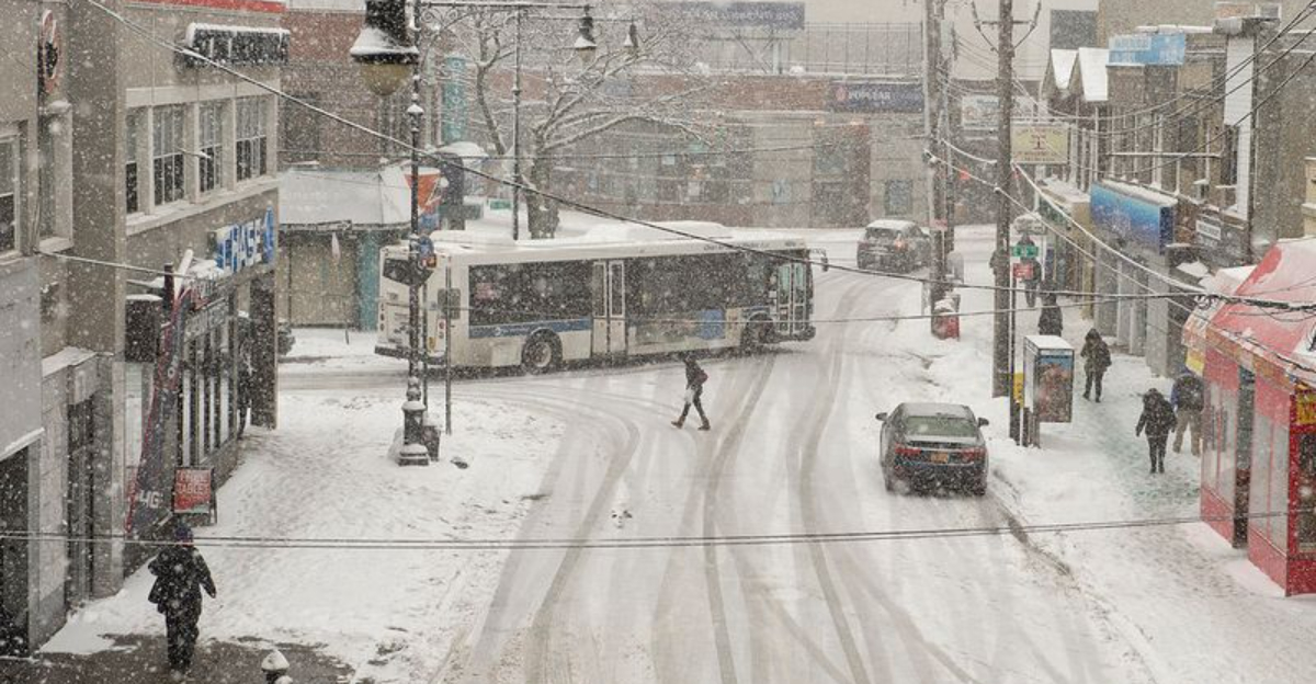
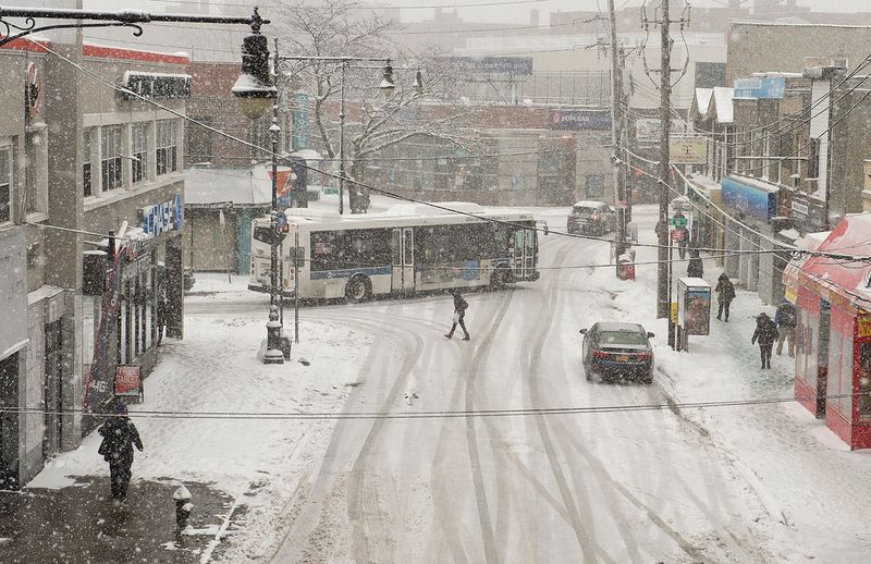
Northeast and New England Snowfall and Travel Hassles

This weekend’s winter storm laid down several inches from New York City through parts of New Jersey and into southern New England, disrupting travel and stacking delays at major airports. After the snow, temperatures plunged, turning moisture into sheets of black ice overnight. You may not see it, but you will feel it when tires or boots hit untreated patches.
In Connecticut and surrounding areas, wind chills have dipped as low as 15 below zero, leading to school delays and extra caution for drivers. Short walks without proper layers become risky, and batteries struggle in the cold. Keep an eye on refreeze cycles as sunshine melts edges by day, then everything locks up again after sunset.
If you must travel, favor main corridors treated by crews, and watch curbs, crosswalks, and metal grates that glaze quickly. For flights, rebook proactively and track airline alerts. Portable chargers, warm gloves, and a scraper will save time and comfort when the mercury nosedives.
Bitter Cold and Widespread Freeze Effects
A broad swath of arctic air has settled over the eastern U.S., pushing wind chills into single digits and teens across the Midwest and Northeast. More than 70 million people remain under cold alerts as the polar surge deepens. Even brief exposure bites, so limit time outside and cover skin when wind picks up.
Farther south, Freeze Warnings reach into the Gulf Coast and southeast Texas where hard freezes are uncommon. Protect pets, plants, and pipes by bringing animals indoors, covering tender vegetation, and insulating outdoor faucets. Dripping interior taps overnight can prevent freezes in marginally insulated homes.
Space heaters demand clear space and supervision, and carbon monoxide alarms need fresh batteries when generators or gas appliances run. Morning frost can turn shaded bridges slick before dawn. Check neighborhood forecasts for hour-by-hour lows, and set reminders to bring coverings back inside after the sun returns.
Hazards and What to Expect This Week
Behind the initial storm, well-below-normal temperatures will linger into early next week, reinforcing snowpack and extending icy conditions. Cold advisories stretch from the Ohio Valley to the northern Gulf Coast, while lake-effect bands continue to pinwheel east of the Great Lakes. If you live downwind, expect localized heavy bursts with quick ramps from flurries to near whiteout.
Snowfall forecasts vary by model, and the biggest totals cluster closer to the storm track. Use official graphics at weather.gov to gauge risk corridors rather than chasing single-number predictions. Timing your errands between bursts can make the difference between a smooth trip and a dicey slide.
Keep vehicles fueled, wiper fluid topped, and phone batteries charged. Sand or kitty litter adds traction if you get stuck. As another shot of cold arrives, monitor alerts, stagger travel, and give road crews space so everyone gets through the week safely.


