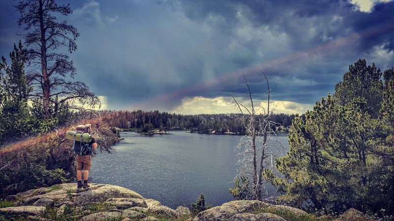
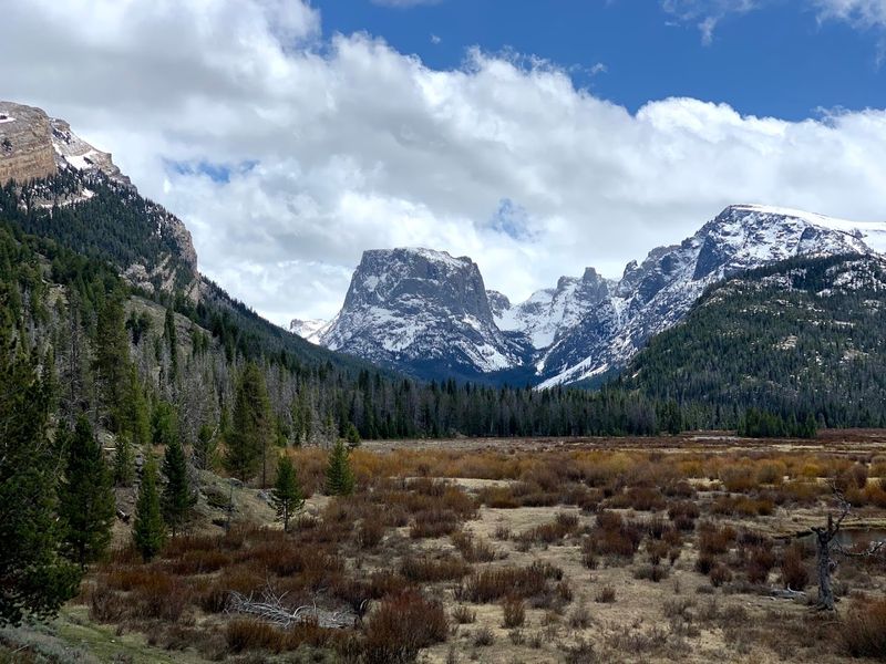
Most travelers driving through Wyoming never stop here, and that is exactly why it stands out. The Wind River Range stretches 100 miles and packs in more than 1,300 lakes, active glaciers, and some of the most demanding and rewarding trails in the West.
While crowds flood Yellowstone and Grand Teton, this range stays quiet. You can hike for days without seeing anyone, fish for trophy trout in high alpine lakes, and camp in areas that feel completely untouched.
The Winds are not just another scenic stop. They offer a level of space, challenge, and solitude that is getting harder to find.
And once you know what is here, it is hard to justify driving past it again.
Where Heaven’s Balcony Begins: Finding the Wind River Range
The Wind River Range sits in Fremont and Sublette counties in western Wyoming, stretching roughly from South Pass in the south to the Gros Ventre Range in the north, with its heart near the zip code Wyoming 82513.
The nearest gateway towns are Pinedale to the west and Lander to the east, both of which offer supplies, gear shops, and friendly locals who are happy to point you toward the trailhead of your dreams.
This range is part of the Greater Yellowstone Ecosystem, yet it receives a fraction of the crowds that flood Yellowstone and Grand Teton each summer.
The range tops out at Gannett Peak, Wyoming’s highest point at 13,809 feet, and the entire area is managed by the Bridger-Teton and Shoshone National Forests, along with the Wind River Indian Reservation on its eastern flank.
Getting here requires a bit of planning, but that extra effort is exactly what keeps this extraordinary landscape feeling wild and uncrowded.
The Geology Behind Those Jaw-Dropping Peaks
Few mountain ranges in North America carry as much geological history as the Winds, and that story is written right across the rock faces you see on every hike.
The core of the range is made up of Precambrian granite and gneiss, some of it dating back nearly three billion years, making it among the oldest exposed rock in the Western Hemisphere.
Glaciers carved the dramatic U-shaped valleys, cirques, and lake basins that define the landscape today, and roughly 40 active glaciers still cling to the high peaks, including Fremont Glacier, one of the largest in the contiguous United States.
That glacial sculpting is why you see those perfect bowl-shaped amphitheaters holding shimmering alpine lakes at nearly every turn.
The sheer variety of rock formations also makes this range a world-class destination for technical climbers, who come from across the globe to test themselves on walls that have stood for billions of years.
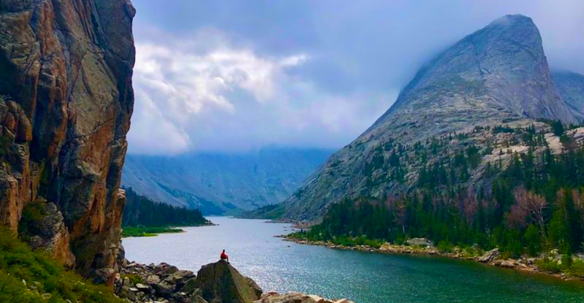
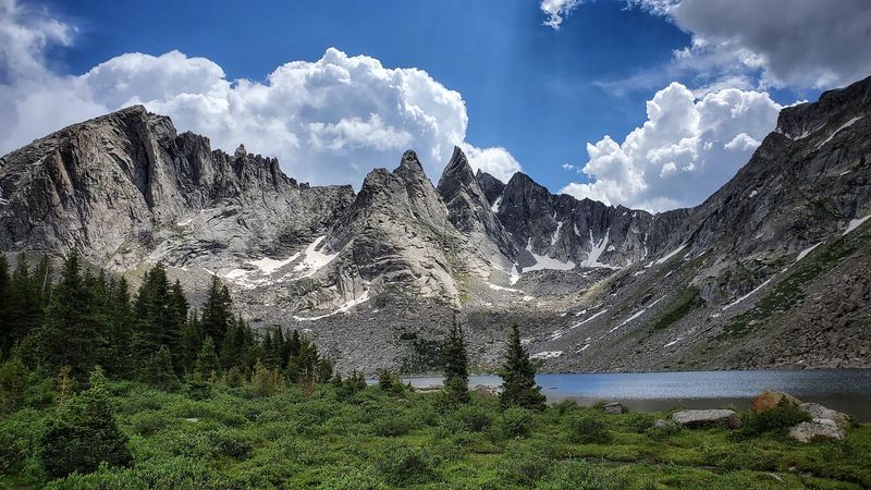
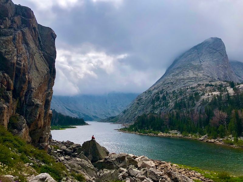
Cirque of the Towers: The Range’s Crown Jewel
Nothing quite prepares you for the moment you crest Jackass Pass and the Cirque of the Towers suddenly fills your entire field of vision.
A semicircle of jagged granite spires rises above a high alpine basin, with towers like Pingora, Wolf’s Head, and Sharks Nose reaching toward the sky in shapes that look almost deliberately dramatic.
The most popular access route starts at the Big Sandy Trailhead, roughly a two-hour drive from Lander via Highway 28 and the Big Sandy Road. Big Sandy Lake is about six miles in and offers designated campsites, making it a perfect base camp.
From there, the push up Jackass Pass adds roughly four more miles of steep, rocky trail, but the payoff at the top is the kind of view that makes your legs forget they were ever tired.
Climbers come here for hundreds of established routes on the granite towers, but even hikers who never touch a rope leave with memories that last a lifetime.
The Crow’s Nest Viewpoint Above Glimpse Lake
High above Fremont Lake and well out of earshot of summer crowds, a rocky perch known as the Crow’s Nest rewards those willing to earn their views the hard way.
This hike is best accessed from a less-traveled trailhead near Pinedale, and the round trip clocks in at roughly 12 miles with a manageable elevation gain of about 500 feet, making it a solid full-day adventure rather than a brutal sufferfest.
The trail winds through groves of aspen trees that turn gold in early autumn, across meadows carpeted with wildflowers in July, and up rocky ridgelines that offer teaser views before the main event.
At the top, Fremont Lake spreads out far below like a blue mirror, and the full sweep of the Wind River Range stretches across the horizon in both directions.
Because this trailhead sees far less traffic than the Big Sandy or Green River Lakes corridors, you have a realistic shot at having those views entirely to yourself on a weekday morning.
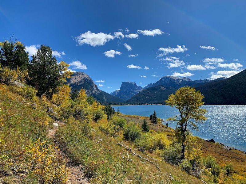
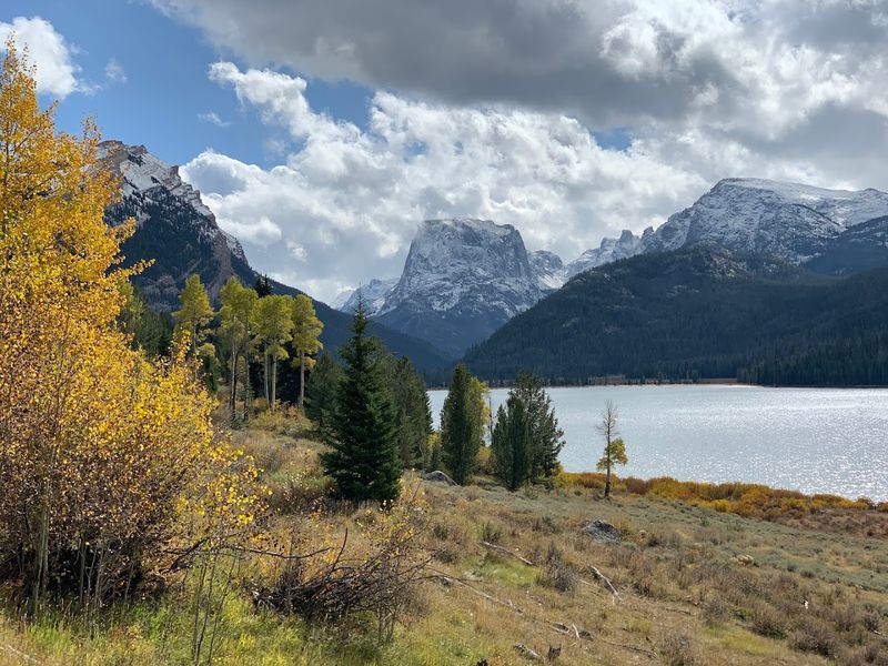
Green River Lakes: The Postcard View You Can Actually Drive To
Not every breathtaking view in the Wind River Range requires a multi-day backpacking permit and a bear canister packed with freeze-dried meals.
Green River Lakes, located at the northern end of the range near Cora, Wyoming, is one of those rare places where a relatively short drive on a maintained dirt road drops you at the edge of something genuinely spectacular.
Squaretop Mountain, with its perfectly flat summit and sheer granite walls, rises directly above the upper lake and reflects in the calm water on still mornings in a way that makes photographers arrive before sunrise and stay long past noon.
A gentle trail follows the lakeshore for several miles, offering constantly shifting angles on the mountain and the surrounding peaks without demanding much elevation gain.
Campsites near the trailhead fill up fast on summer weekends, so arriving midweek or reserving a spot well in advance is the smart move if you want to wake up to that reflection at first light.
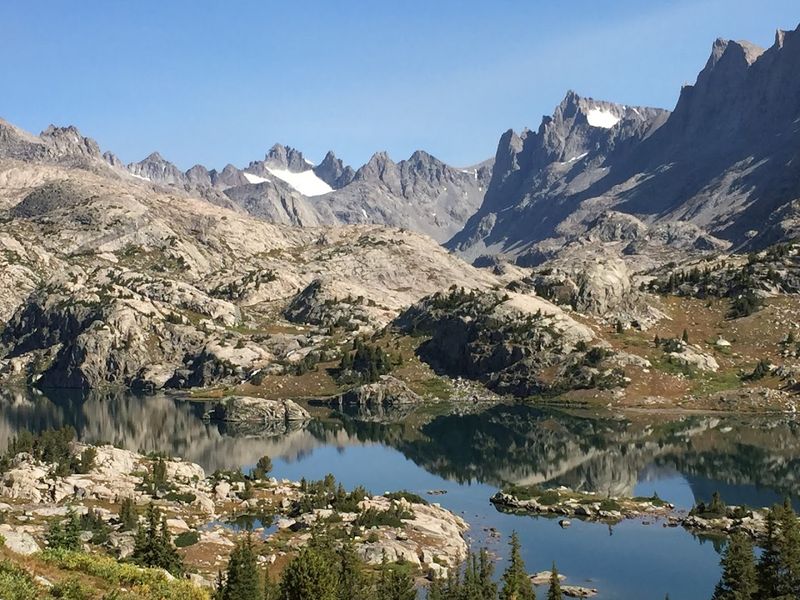
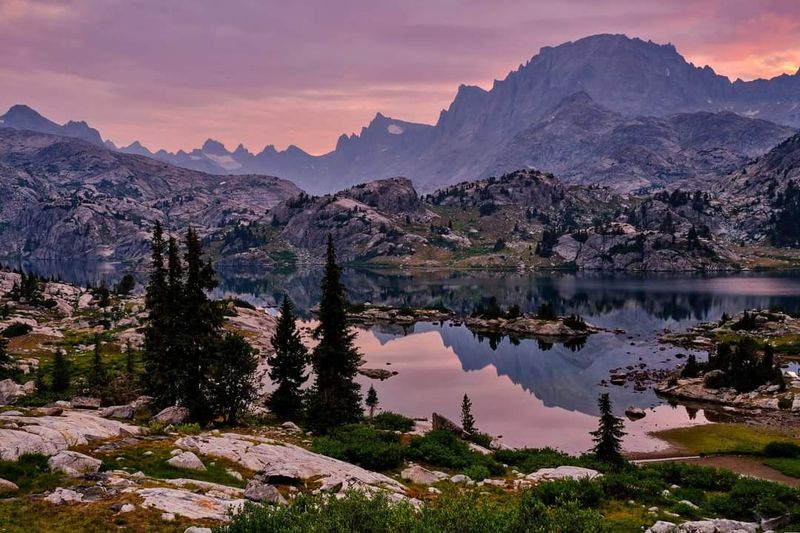
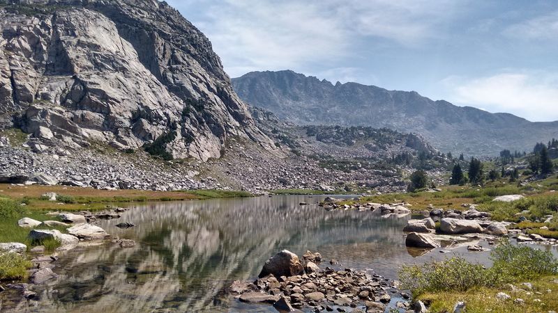
Titcomb Basin and Island Lake: Backpacker’s Paradise
Ask any seasoned backpacker in Wyoming where they would go if they could only pick one destination, and there is a strong chance they say Titcomb Basin without hesitating.
The most common route starts at Elkhart Park Trailhead outside Pinedale and follows the Fremont Trail system through Seneca Lake and Island Lake before climbing into the basin itself, a journey of roughly 16 miles one way.
Island Lake alone is worth the trip, sitting at about 10,500 feet with views of Fremont Peak and the surrounding ridgeline that feel more like a painting than a place you can actually stand in.
Titcomb Basin pushes higher still, ending in a narrow glacially carved valley flanked by some of the range’s most dramatic peaks, with small glaciers visible on the upper slopes even in August.
The fishing here is legendary, with cutthroat trout in nearly every lake, and the solitude, even in peak season, is the kind that reminds you why people fall in love with wild places.
Wildlife You Might Share the Trail With
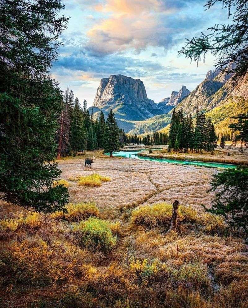
The Wind River Range is not just a landscape to look at from a distance. It is a living, breathing ecosystem where wildlife moves through the same trails and meadows you do.
Pronghorn antelope graze the lower sagebrush flats near the range’s eastern approaches, often visible right from your car window as you drive in from Lander.
Higher up, mule deer and elk pick their way across rocky slopes, while moose wade through the marshy edges of beaver ponds in the valley bottoms.
Grizzly bears are present in parts of the range, particularly in the northern sections, so carrying bear spray and knowing how to use it is not optional here. Black bears also roam throughout the range at various elevations.
Marmots whistle from boulder fields, pikas dart between rocks near the alpine zone, and golden eagles ride thermals above the high ridges.
Seeing a moose knee-deep in a backcountry lake at dawn is the kind of moment that makes you feel genuinely lucky to be there.
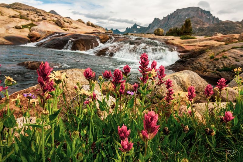
Fishing the Alpine Lakes: Trout Heaven at High Elevation
More than 1,300 lakes dot the Wind River Range, and a remarkable number of them hold fish, making this one of the finest high-altitude fishing destinations in the entire country.
Cutthroat trout are the most common catch, thriving in the cold, clear waters that flow from snowmelt and glacier runoff throughout the summer months.
Brook trout and golden trout also appear in certain lakes, with golden trout found at elevations above 10,000 feet in specific drainages, a target species that dedicated anglers plan entire trips around.
A Wyoming fishing license is required, and regulations vary by location and species, so checking the Wyoming Game and Fish Department rules before your trip saves you from any surprises at the water’s edge.
The fish here are wild, the setting is extraordinary, and there is something deeply satisfying about catching dinner in a lake that most people never knew existed.
Just remember that catch-and-release in certain areas helps preserve the fishery for every angler who follows you in.
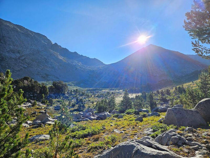
The Best Time to Visit and What the Seasons Actually Look Like
The Wind River Range has a short but spectacular window of accessibility, and timing your visit right makes an enormous difference in what you experience.
The main hiking and backpacking season runs from late June through early September, with July and August offering the most reliable weather and the fullest wildflower bloom in the meadows below treeline.
June can still carry heavy snowpack at high elevation, making some passes difficult or impassable without ice axe experience, but it also brings the most dramatic snowmelt waterfalls and the fewest crowds.
Mosquitoes are a serious presence in June and early July, particularly near lakes and marshy areas. Packing a quality insect repellent and a head net is not overkill.
It is simply smart preparation.
By late August, the bugs thin out considerably, the temperatures cool pleasantly, and the first hints of autumn color begin touching the aspen groves near lower elevations.
Early September can be magical, but afternoon thunderstorms are common throughout summer, so planning to be off exposed ridges by early afternoon is standard practice here.
Gear Up Right: What You Actually Need for This Range
The Wind River Range is not the place to discover that your rain jacket has a leak or that your sleeping bag is not rated low enough for the temperatures you will actually face.
Nights above 10,000 feet can drop below freezing even in July, so a sleeping bag rated to 20 degrees Fahrenheit or lower is the practical choice for most of the range.
A bear canister is required in many areas of the Bridger Wilderness and is strongly recommended everywhere else. It protects both your food and the wildlife that would otherwise be attracted to your campsite.
Trekking poles make a real difference on the rocky, uneven terrain that dominates most routes above treeline, reducing strain on your knees during long descents.
Rain gear that actually works is non-negotiable, since afternoon thunderstorms roll in fast and can turn a pleasant ridge walk into a cold, wet scramble for shelter in under 20 minutes.
A good topographic map and a compass back up your GPS device when battery life or signal becomes an issue deep in the backcountry.
Leave No Trace: Why It Matters More Here Than Almost Anywhere
There is a reason the Wind River Range still feels like one of the last true wild places in the contiguous United States, and that reason is not luck. It is the deliberate care of everyone who visits.
The Bridger Wilderness, which covers much of the western side of the range, sees significant visitor traffic during peak season, and the fragile alpine soils, slow-growing vegetation, and crystal-clear water sources are all vulnerable to careless use.
Camping at least 200 feet from lakes and streams, using a camp stove instead of building fires above treeline, and packing out every piece of trash, including orange peels and apple cores, are the baseline expectations here.
Human waste disposal requires a trowel and a cat hole at least six inches deep and 200 feet from any water source, trail, or campsite. Waste bags are required in some heavily used areas.
The wild character of this range is a shared resource, and every visitor who treats it with care is making a quiet promise to everyone who comes after them.
Why the Wind River Range Stays With You Long After You Leave
Some places are beautiful and forgettable. The Wind River Range is neither.
There is something about the scale of this landscape, the way the peaks stack up behind each other for miles, the way the silence at high elevation feels almost physical, that gets into your thinking and stays there.
People who have backpacked here describe coming home and immediately starting to plan their return trip. It is that kind of place, one that raises the bar for every wild landscape you experience afterward.
The range rewards effort in a way that feels honest and proportional. The harder you work to get somewhere, the more extraordinary it tends to be.
Even a single day hike to Green River Lakes or a weekend at Big Sandy Lake gives you a genuine taste of what makes the Winds so special to the people who know them well.
Whatever brought you to this article, consider it a quiet nudge from a corner of Wyoming that has been waiting patiently for you to show up and see it for yourself.


