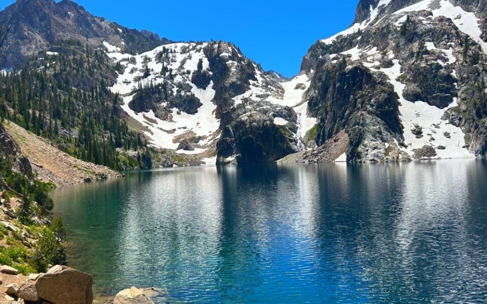
Idaho keeps some of its best scenery behind a trailhead sign and a few thousand feet of climbing. Past the highways and the busy beaches, there are lakes scooped out by glaciers thousands of years ago, still sitting under granite peaks that look like they were cut with a saw.
Many of them stay frozen until early summer, which gives them a short, busy season and a long, quiet rest. Some take a full day of hiking to reach.
Others sit at the end of a gravel road, close enough for a picnic with your shoes still clean. In the pages ahead, you will find exact trail distances, elevation gains, permit rules, and a few spots where campfires are off the table.
You will also learn which lake thaws first, which one has a boat shuttle, and which tiny pond hides a campsite most hikers walk right past. Pack your curiosity, a good map, and maybe some extra snacks.
The mountains are waiting, and they are surprisingly good at keeping secrets.
1. Alice Lake, Stanley, Idaho
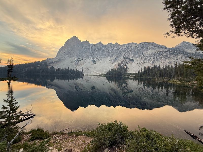
Five creek crossings stand between the trailhead and Alice Lake, and only the last one comes with a bridge. Bring sandals or be ready for soggy socks.
The hike starts at the Tin Cup Trailhead inside the Pettit Lake campground. From there, it is about 11 miles round trip with roughly 1,600 feet of climbing.
Your reward is a 71-acre lake sitting at 8,602 feet. El Capitan rises to 9,901 feet on the east side, joined by a jagged ridgeline people call the Dragon’s Back.
Snow can linger here well into early summer. July through September is the safest window for a clear trail and an ice-free shoreline.
Many backpackers treat Alice Lake as the first big stop on the Alice-Toxaway Loop. That route runs about 19 to 22 miles and gains up to 4,237 feet, so it rewards strong legs and good planning.
A wilderness permit is required, and you can fill one out at the trailhead. Camping is allowed near the lake if you follow wilderness rules and camp well away from the water.
2. Sawtooth Lake, Stanley, Idaho
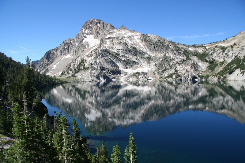
Size matters in the Sawtooths, and this lake wins the contest. At 173 acres, it is the largest alpine lake in the entire range.
Mount Regan steals the show at the southern end, climbing to 10,190 feet. Most photos of this place feature that peak front and center.
The trail begins at Iron Creek Trailhead, about 6.8 miles southwest of Stanley off Highway 21. Expect roughly 10 miles round trip and close to 1,900 feet of elevation gain.
Switchbacks carry you past views of Alpine Lake and Alpine Peak before the big finale. It is a moderate to tough hike, so pace yourself and drink plenty of water.
Summer brings plenty of company on this trail. Arrive early on weekdays if you want a quieter lunch spot along the shore.
Campsites sit near the lake’s outlet. A smaller pond just before the main lake has its own campsite, which makes a calmer overnight option.
Wilderness permits are required, and ice can stick around until early summer.
3. Goat Lake, Stanley, Idaho
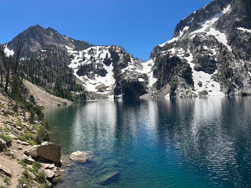
The last half mile is where Goat Lake separates the curious from the committed. Hikers gain about 600 vertical feet over scree, sand, and boulders in that final stretch.
Call it a stairway with no stairs. Good boots and patient footwork matter a lot here.
The full trip runs about 8 to 9 miles round trip from Iron Creek Trailhead, with up to 1,800 feet of climbing. The route mixes the Iron Creek trail, the Alpine Way trail, and an unmaintained path at the end.
Goat Falls tumbles along Goat Creek on the way up, giving you a nice excuse to stop and catch your breath. Nobody needs to know it was a rest break.
The lake sits at 8,220 feet in a glacial basin. Its blue-green color against the light granite is the detail visitors talk about most.
Wilderness permits are available at the trailhead. Summer weekends get busy, so a weekday visit gives you more room on that rocky scramble and at the shoreline.
4. Toxaway Lake, Stanley, Idaho
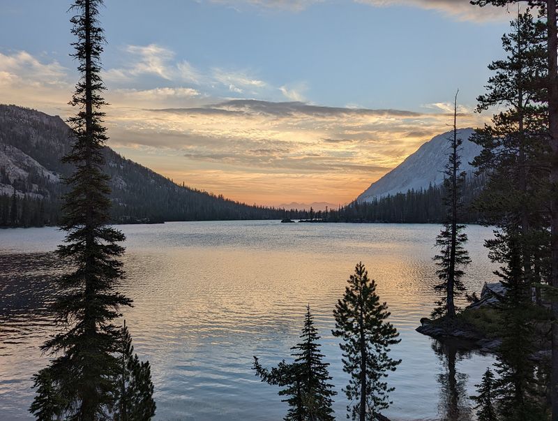
Brook trout were stocked here back in the early 1900s, and anglers still show up hoping for a bite. Fishing is one of the big draws at this roomy Sawtooth lake.
Toxaway is one of the larger lakes in the range, tucked inside a glacier-carved valley. It anchors the Alice-Toxaway Loop, a favorite multi-day backpacking route.
Hikers heading straight here from the Tin Cup Trailhead at Pettit Lake cover about 16 miles round trip. The route crosses a moraine between the Alice and Toxaway drainages and passes Farley Lake on the way.
Another option starts at the Yellowbelly Lake trailhead. It can be shorter, but the road there is rough, so check your vehicle before committing.
The trail is well kept and passes streams and small waterfalls. That variety keeps the miles from feeling repetitive.
Campfires are banned in the Toxaway drainage because of heavy use. Bring a camp stove for cooking, and grab your wilderness permit before heading out.
5. Hell Roaring Lake, Stanley, Idaho
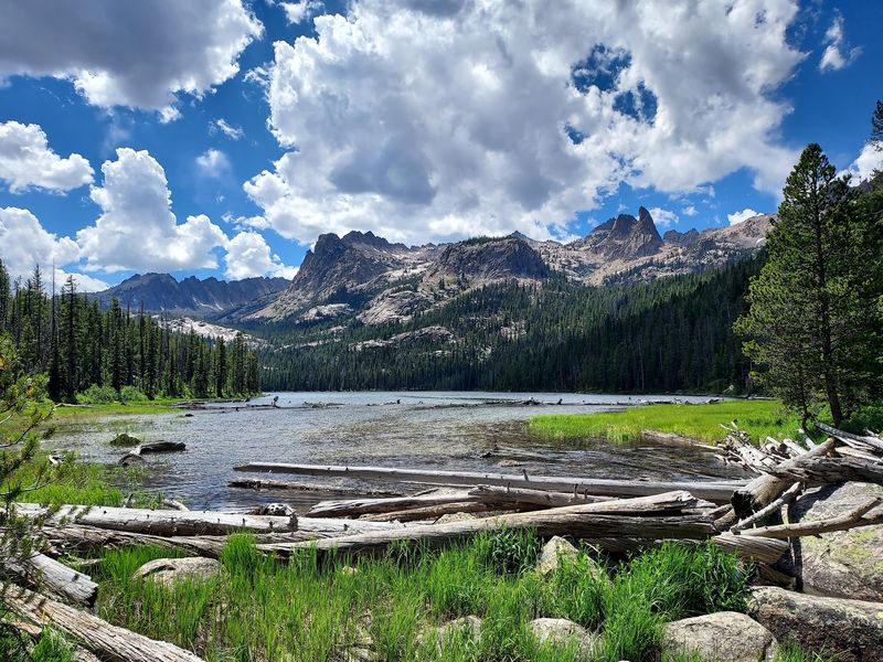
Early birds get the snow-free trail at Hell Roaring Lake. It is often one of the first Sawtooth lakes to melt out each season.
That head start makes it a smart pick for June hikers itching to get into the mountains. Higher lakes may still be locked in ice.
Above the water stands the Finger of Fate, a granite spire reaching 9,780 feet. The name sounds dramatic, and the rock lives up to it.
Two trailheads lead here. The lower one works for regular cars and means a hike of about 5 to 5.6 miles each way with only around 600 feet of gain.
The upper trailhead needs a high-clearance 4WD vehicle for a bumpy 4-mile road. In return, the walk is shorter and easier.
The lake sits at 7,422 feet, and brook trout live in both the lake and Hell Roaring Creek. Campfires are not allowed.
A free wilderness permit is required. Strong hikers can continue upstream to Imogene, Profile, and Mushroom lakes.
6. Alpine Lake, Stanley, Idaho
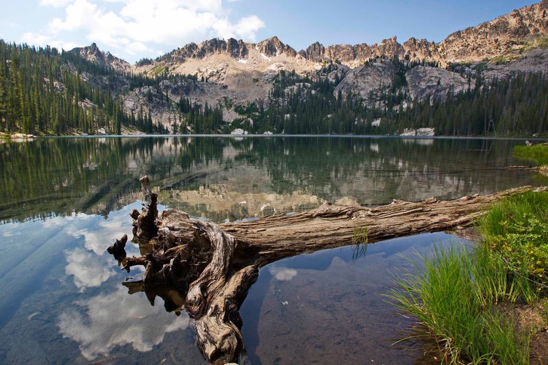
Plenty of hikers rush past this lake on their way to Sawtooth Lake. That is great news for anyone who stops.
Alpine Lake sits in a glacier-carved bowl at 7,828 feet, less than half a mile southwest of its bigger neighbor. Alpine Peak rises close by.
From Iron Creek Trailhead, it is about 3.8 miles one way with up to 1,300 feet of gain. The trail climbs gently along the valley floor, then steepens after a small creek crossing.
Here is the tricky part. The path down to the shore is an unmarked, user-made trail, and it is steep, so watch your footing.
Families and newer hikers often make this their turnaround point. It delivers clear water and mountain views without the extra miles.
Campfires are strictly banned here because of heavy use and limited wood. A small stove handles hot meals just fine.
Wilderness permits are required. Backpackers and day hikers both use this spot, so pack out every scrap you bring in.
7. Upper Palisades Lake, Irwin, Idaho
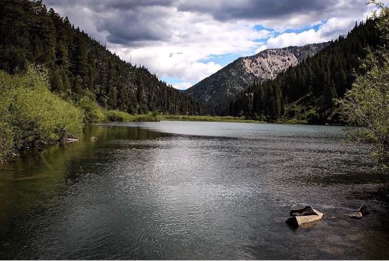
Moose sightings are a real possibility on the way to this eastern Idaho lake. Deer and many bird species also roam the canyon.
Upper Palisades Lake sits in the Caribou-Targhee National Forest, far from the Sawtooth crowds. The out-and-back hike from the Palisades Creek Trailhead runs about 13.9 miles.
Most of the trip follows Palisades Creek and passes Lower Palisades Lake. Then the real climbing starts.
Nearly all the elevation gain packs into the last mile, with switchbacks just below the upper lake. Save some energy for that finish.
Clear days can bring views all the way to the Teton Range. The blue-green water surrounded by steep slopes makes the effort worth it.
Campsites line the trail and the lake area, some with fire pits and vault toilets. Trout fishing is popular too.
Palisades Creek Road is gravel, and high-clearance vehicles are recommended. After heavy rain, 4WD helps, and winter visitors will need snowshoes.
8. Fourth of July Lake, Stanley, Idaho
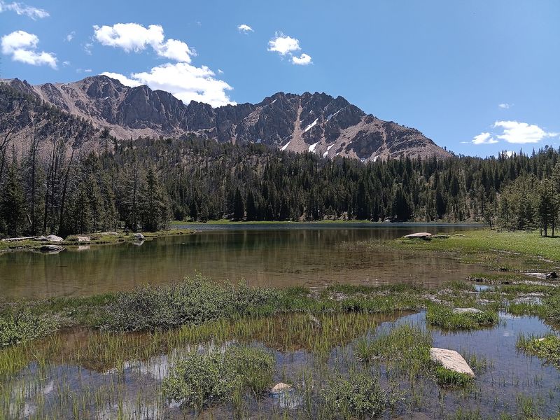
No fireworks are needed to celebrate this one. The White Cloud Mountains put on the show all by themselves.
Fourth of July Lake sits at about 9,380 feet, with Patterson Peak to the west and Fourth of July Peak to the northeast. It feeds Fourth of July Creek.
The shortest approach is a round trip of roughly 3 miles with about 500 feet of gain. That makes it one of the friendliest high-country hikes in the state.
Pine forests and open meadows line the trail. Some exposed stretches offer views toward the Castle Peak area.
Getting to the trailhead is the bumpy part. A rough 10-mile dirt road leads there, so drive slowly and plan extra time.
Weekends draw a crowd of day hikers and backpackers starting longer trips. Arriving on a weekday morning helps.
Dispersed camping is allowed in the backcountry. Fishing is popular, so pack a rod if you have the right license.
9. Washington Lake, Stanley, Idaho
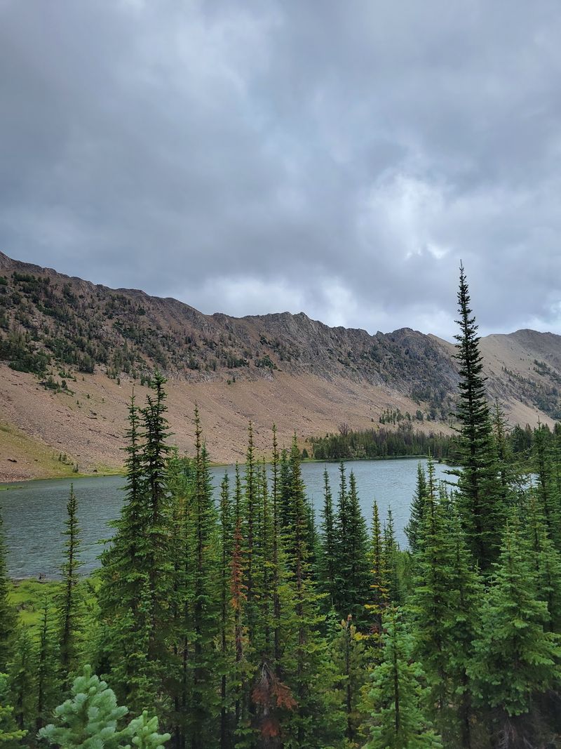
A 2005 forest fire changed the landscape on the way to Washington Lake. Today, small brush and wildflowers are filling in the slopes.
Watching that recovery is part of the hike. It shows how mountain forests rebuild themselves over time.
The trip starts at the Fourth of July Creek Trailhead. After about 2 miles, hikers spot Fourth of July Lake below the Whitecloud Ridge.
From there, the trail heads southeast for another mile over a short pass. Washington Lake comes into view from the top.
The full hike covers around 7 miles with about 1,046 feet of gain. The highest point reaches close to 9,500 feet.
The lake rests at 9,367 feet in its own basin. That protected spot often keeps the water calm.
Backcountry campsites make it easy to stay overnight. Anglers can try for rainbow, cutthroat, and hybrid trout, and explorers can push on to the nearby Chamberlain Lakes.
10. Pettit Lake, Stanley, Idaho
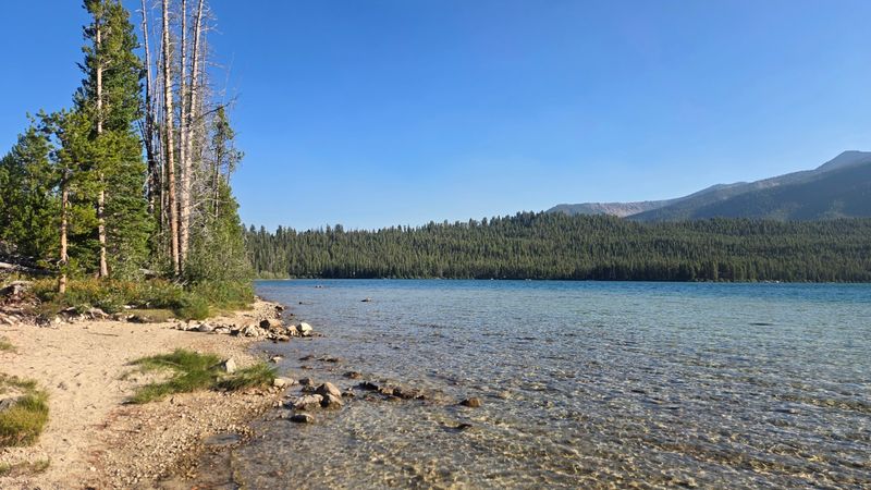
Jet skis are not allowed on Pettit Lake, and that single rule changes everything. Paddlers get the water mostly to themselves.
The lake sits at 7,000 feet, about 17 miles south of Stanley. You reach it on Forest Road 208, a gravel washboard road off Highway 75.
The road can be dusty, but most vehicles handle it fine. Even camping trailers make the trip.
A small campground offers 12 first-come, first-served sites with vault toilets. There is no drinking water, so bring your own supply.
Kayaking, canoeing, swimming, and fishing for trout and whitefish fill most summer days. A day-use picnic area sits right next to the campground.
Hikers know Pettit for another reason. The Tin Cup Trailhead at the north end of the campground leads to Alice Lake, Farley Lake, and the Alice-Toxaway Loop.
Cell service is usually missing here. Download maps ahead of time, and tell someone your plans before you go.
11. Edith Lake, Stanley, Idaho
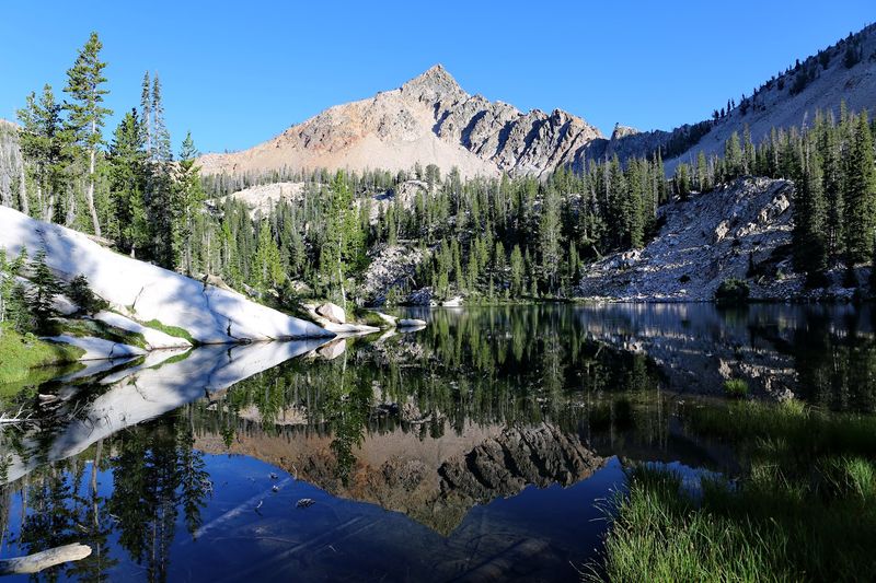
Small lakes in hard-to-reach places tend to stay quiet, and Edith Lake follows that pattern. Few casual hikers make it this far.
The lake sits at 8,660 feet in a small hanging basin above the Yellowbelly Lake drainage. It rests just below Imogene Pass.
One route starts at the Yellowbelly Lake trailhead and runs about 9 miles one way. Another begins at the Pettit Lake Tin Cup Trailhead and covers about 7.3 miles with 1,842 feet of gain.
Either way, you cross polished granite, wooded sections, and stretches of bare bedrock. Watch the trail markers closely on the rock.
Many backpackers add Edith to the Alice-Toxaway-Edith Loop. That trip covers about 21 to 22 miles.
Ice can linger here into early summer, just like at other high lakes. Check recent trail reports before you plan dates.
Wilderness permits are required. For hikers who enjoy earning their views, Edith delivers a peaceful shoreline and a strong sense of distance from the busy trailheads.
12. Little Sawtooth Lake, Stanley, Idaho
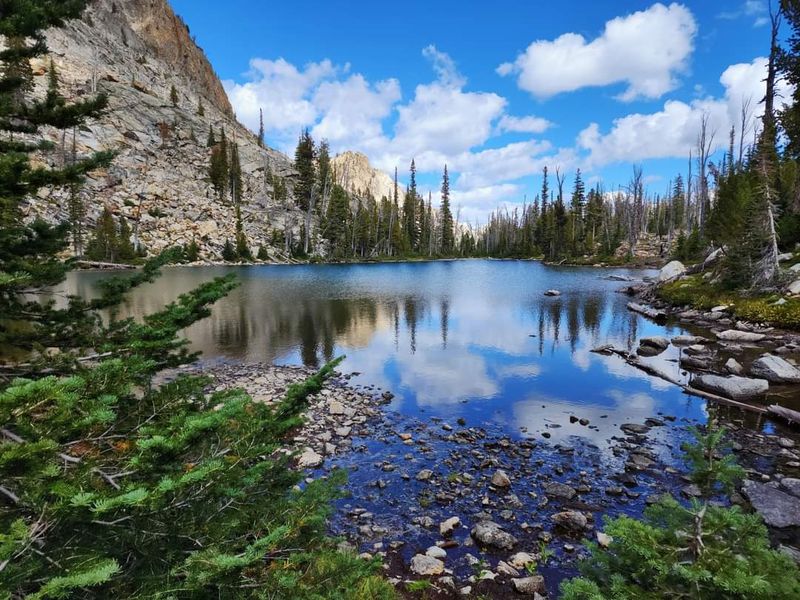
Most people walking past this tiny tarn have their eyes locked on the big lake ahead. Their loss is your quiet campsite.
Little Sawtooth Lake sits on the main trail to Sawtooth Lake. You reach it after a quick 500-foot climb beyond the Alpine Lake turnoff.
It rests below the outlet of Sawtooth Lake, surrounded by rocky high-country terrain. The setting is simple and open.
Here is a fun bonus. Just past this spot, many hikers get their first look at Mount Regan.
The views are not as wide as those at the larger lake. Still, the trade-off is solitude, which is rare on such a busy trail.
At least one campsite sits near the water. Backpackers who want fewer neighbors should consider claiming it early in the afternoon.
The same Iron Creek Trailhead and wilderness permit rules apply here. Treat it as a bonus stop, a snack break, or a quiet base camp for exploring the area.
Share this story