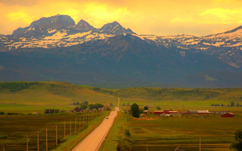
Water pours straight out of canyon walls along one southern Idaho highway. It comes from an underground aquifer, and it shows up in a place that otherwise looks dry.
I love that detail, because it proves a road trip here can surprise you fast.
The surprises keep coming. One route climbs to a summit overlook where jagged peaks fill the horizon.
Another follows a river once called the River of No Return.
Idaho packs a lot of variety into its back roads. You can trace lava fields one day and lakeshores the next.
Pioneer names are still carved into granite on one drive, while another runs past orchards and farm stands.
So which road deserves your next full tank? Grab a camera, check the weather, and plan for a few extra stops.
These routes reward people who take their time.
1. Sawtooth Scenic Byway, Stanley, Idaho
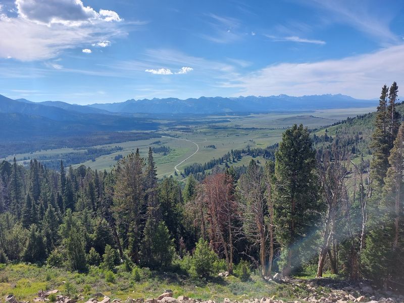
Galena Summit sits at 8,701 feet, and the overlook just below it is where this drive earns its reputation. The jagged Sawtooth Mountains line up across the valley like they posed for the shot.
Highway 75 runs about 116 miles from Shoshone to Stanley. Along the way, you pass through the Wood River Valley, home to Ketchum and Sun Valley, before the road starts climbing.
Save time for Redfish Lake, a short detour south of Stanley. The lake sits right below the peaks, and it’s a favorite spot for swimming, paddling, and picnics in summer.
The Sawtooth National Recreation Area visitor center near Ketchum is a smart stop for maps and trail ideas. Winter can bring snow to the summit, so check road conditions before heading out.
Stanley is tiny, with only a few dozen year-round residents. Fuel up when you can.
Address: Highway 75, Stanley, ID 83278
2. Mesa Falls Scenic Byway, Ashton, Idaho
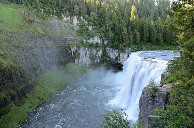
Two waterfalls on one short drive is a pretty good deal for your gas money. This roughly 28-mile route through the Caribou-Targhee National Forest leads to Upper and Lower Mesa Falls on the Henrys Fork of the Snake River.
Upper Mesa Falls drops about 114 feet over rock left behind by ancient volcanic eruptions. A boardwalk and viewing platforms let you get surprisingly close to the spray.
Lower Mesa Falls has its own pullout farther downstream. The view looks down into the canyon, so it feels different from the upper stop.
The historic Big Falls Inn near the upper falls serves as a visitor center in season. Inside, displays explain the area’s geology and history.
Plan your trip between late spring and fall. The road is groomed for snowmobiles in winter, and parts aren’t open to regular cars.
Address: Highway 47, Ashton, ID 83420
3. Payette River Scenic Byway, McCall, Idaho
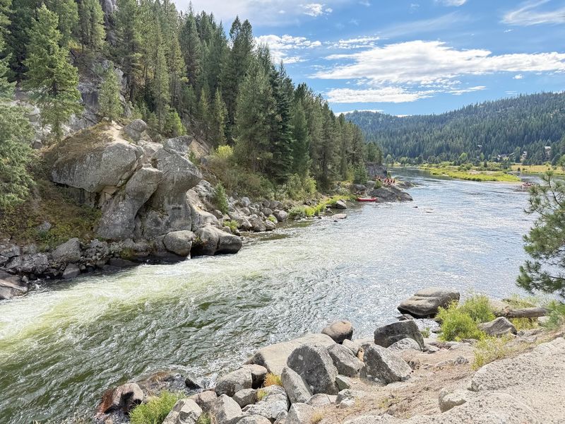
Whitewater rafters know this road well, and it’s easy to see why once the river starts churning beside your car. Highway 55 follows the Payette River north from the Boise area for about 114 miles.
The canyon stretch near Banks and Horseshoe Bend is the dramatic part. Rapids run right alongside the pavement, and several pullouts let you watch boaters tackle them.
Farther north, the canyon opens into wide mountain valleys. Cascade sits beside Lake Cascade, a large reservoir known for fishing and boating.
McCall wraps up the drive on the shore of Payette Lake. You can rent a paddleboard, walk the lakeside downtown, or visit Ponderosa State Park on a nearby peninsula.
Traffic can build on summer weekends, since many Boise residents head north to cool off. Leaving early makes the curvy canyon drive more relaxing.
Address: Highway 55, McCall, ID 83638
4. Teton Scenic Byway, Driggs, Idaho
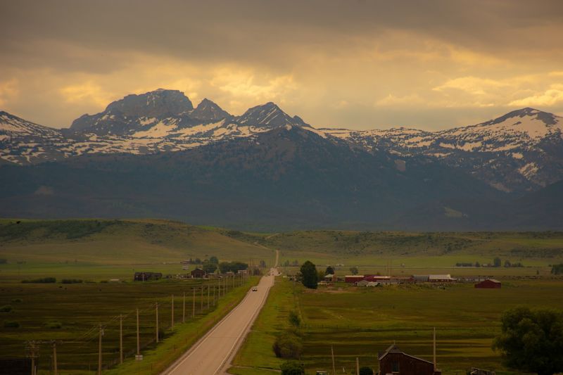
Wyoming tends to hog the credit for the Tetons. From Teton Valley in Idaho, though, you get the quieter western side of the range rising above open farmland.
This byway runs about 68 miles through eastern Idaho, passing fields, ranches, and small towns. The peaks stay in view for long stretches, which makes slow driving feel completely reasonable.
Driggs and Victor are the main stops in the valley. Both have local shops and cafes, and Driggs is the gateway to Grand Targhee Resort just across the state line.
Summer brings hay fields and wildflowers, while fall adds golden aspens on the surrounding slopes. Watch for sandhill cranes in the fields during spring and fall.
Want a closer look at the mountains? Several trailheads on the Idaho side lead into the Jedediah Smith Wilderness.
Address: Highway 33, Driggs, ID 83422
5. Lake Coeur d’Alene Scenic Byway, Harrison, Idaho
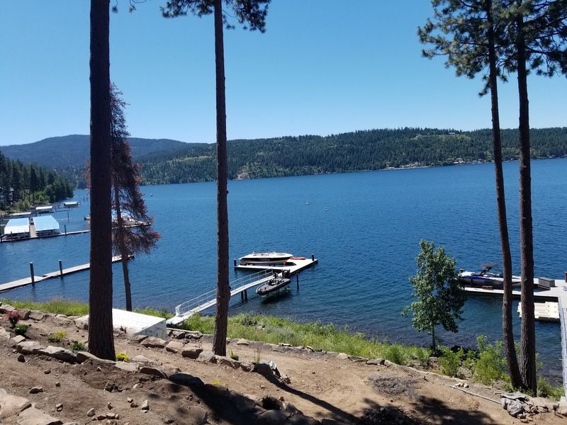
Short drives can still pack a punch, and this one proves it in just 25 miles. Highway 97 hugs the eastern shoreline of Lake Coeur d’Alene, curving past forested hills and quiet bays.
The road links Interstate 90 with Highway 3. That makes it an easy add-on if you’re already passing through northern Idaho.
Bald eagles gather near Wolf Lodge Bay in late fall and winter to feed on spawning kokanee salmon. Many birders time their trip around those weeks.
Harrison sits at the southern end, near where the St. Joe and Coeur d’Alene rivers meet the lake. The small town has a marina and access to the Trail of the Coeur d’Alenes, a paved bike path.
Take the curves slowly. The road is narrow in spots, and the lake views make it tempting to look away from the pavement.
Address: Highway 97, Harrison, ID 83833
6. Salmon River Scenic Byway, Salmon, Idaho
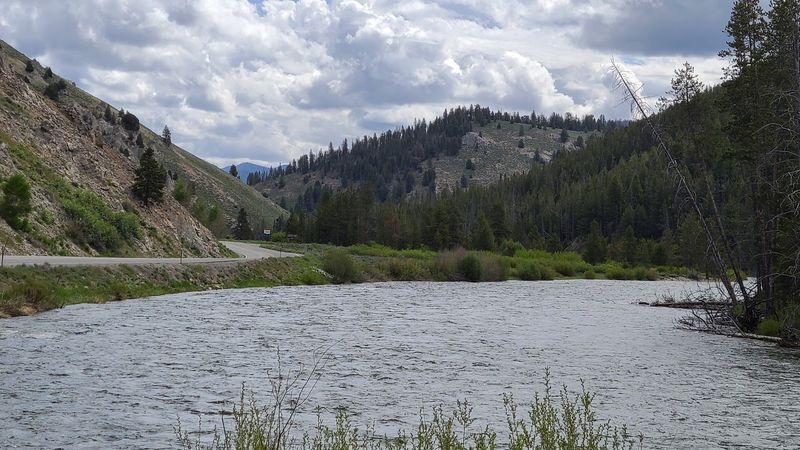
Early boaters could float down the Salmon River but couldn’t easily paddle back up, which earned it the nickname River of No Return. Driving it is much easier, and the road follows it for long stretches.
The byway covers about 163 miles from the Montana border near Lost Trail Pass to Stanley. Along the way, it passes through Salmon and Challis.
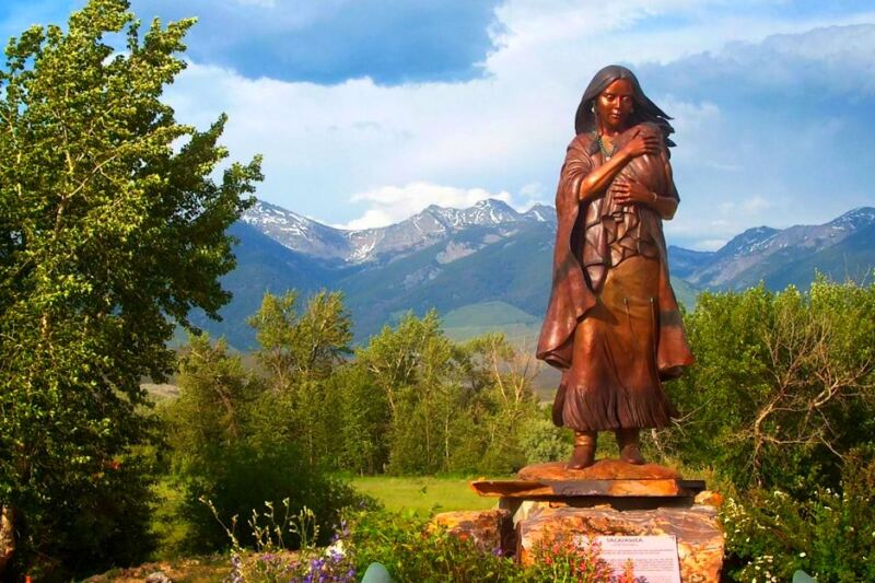
Salmon is home to the Sacajawea Interpretive, Cultural and Educational Center. Sacagawea was born in the Lemhi Valley, and the center shares her story and Lemhi Shoshone history.
South of Challis, the road follows the river through rocky canyons. Watch for bighorn sheep on the slopes.
Old mining remnants pop up in a few areas too. Pack snacks, since services are spread out across this wild stretch.
Address: Highway 93, Salmon, ID 83467
7. Pend Oreille Scenic Byway, Hope, Idaho
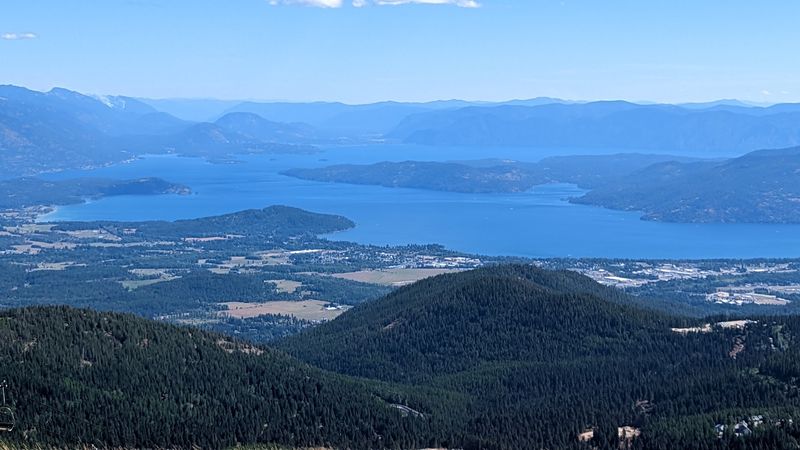
Lake Pend Oreille plunges to about 1,150 feet in places, making it one of the deepest lakes in the country. The U.S.
Navy even uses it for submarine research at a station on its southern end.
This byway follows Highway 200 for about 34 miles along the northern shoreline. It starts near Sandpoint and heads toward the Montana border.
Hope is a small town perched above the water with wide lake views. Nearby, the David Thompson Game Preserve sits on a peninsula, and deer are often spotted along the road.
Clark Fork, farther east, marks the spot where the Clark Fork River enters the lake. Fall brings golden larch trees to the hillsides.
Railroad tracks run near the shoreline too. Don’t be surprised if a long freight train keeps you company.
Address: Highway 200, Hope, ID 83836
8. Ponderosa Pine Scenic Byway, Idaho City, Idaho
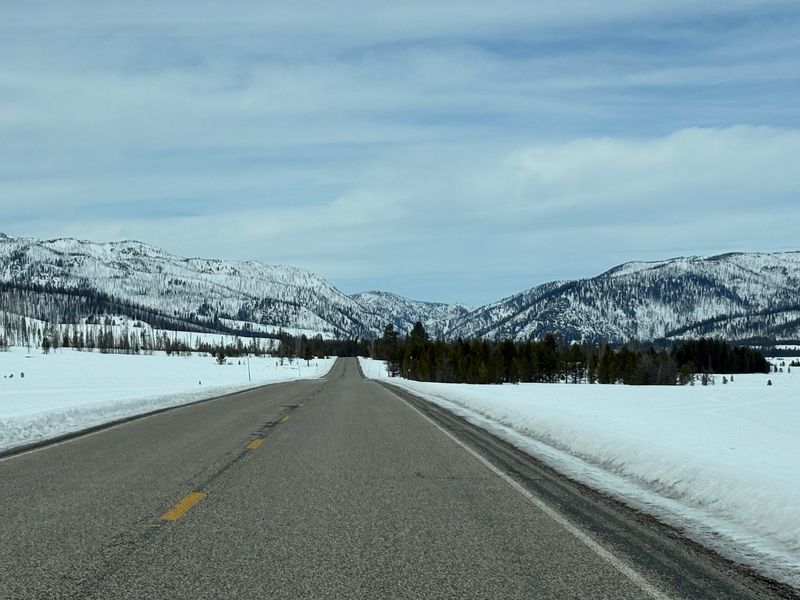
Back in the 1860s gold rush, Idaho City was briefly one of the largest towns in the Pacific Northwest. Today it’s a small stop on Highway 21, but many old buildings still stand.
The byway runs about 131 miles from Boise to Stanley. It passes Idaho City, Lowman, and plenty of tall ponderosa pine forest.
In Idaho City, look for the Boise Basin Museum and the historic Pioneer Cemetery. Walking the boardwalks gives you a quick history lesson.
North of Lowman, the road climbs through the Boise National Forest. Kirkham Hot Springs sits beside the highway, though it’s run as a day-use site with fees.
The final stretch drops into the Sawtooth Valley near Stanley. Heavy snow can close the section near Banner Summit in winter, so check conditions first.
Address: Highway 21, Idaho City, ID 83631
9. Thousand Springs Scenic Byway, Hagerman, Idaho
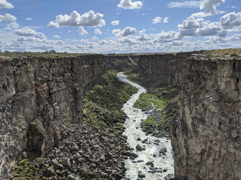
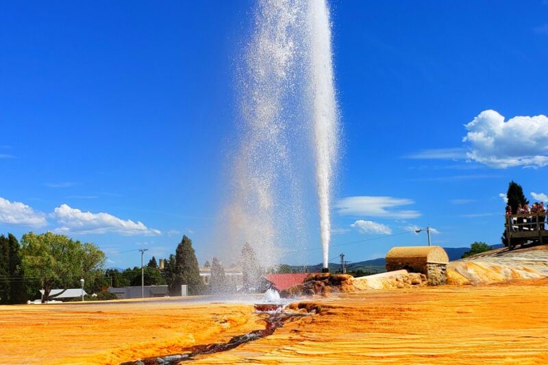
Water gushing from solid rock sounds odd, but it happens here daily. Snowmelt soaks into the Snake River Plain aquifer far away and emerges from the canyon walls around Hagerman.
The byway runs about 65 miles along the Snake River corridor between Bliss and Twin Falls area towns. Pullouts give you views of springs spilling down the basalt cliffs.
Hagerman Fossil Beds National Monument is a major stop nearby. Scientists found many fossils of the Hagerman Horse, an ancient zebra-like animal, and it’s now Idaho’s state fossil.
Thousand Springs State Park has several units worth exploring. Box Canyon and Malad Gorge show off clear water and deep canyon views.
Fish hatcheries in the area depend on that steady spring water. Several welcome visitors, which makes for an easy family detour.
Address: Highway 30, Hagerman, ID 83332
10. Northwest Passage Scenic Byway, Kooskia, Idaho
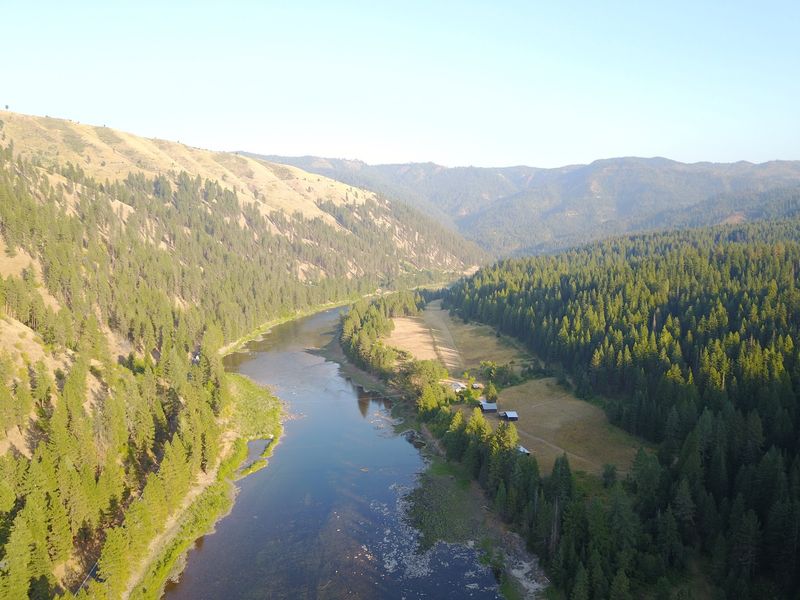
Lewis and Clark struggled across these mountains in 1805, nearly running out of food on the Lolo Trail. You get to follow their general route on smooth pavement with snack options.
The byway uses U.S. Highway 12 and nearby roads beside the Clearwater and Lochsa Rivers.
It crosses lands that are the homeland of the Nez Perce people.
Near Spalding, the Nez Perce National Historical Park visitor center explains tribal history and culture. It’s a strong place to start.
Kooskia sits where the Middle Fork and South Fork of the Clearwater meet. East of town, the road winds through thick forest along the Lochsa.
Services get sparse past Lowell, and there’s a long stretch with few stops. Fill up beforehand and enjoy the river views.
Address: U.S. Highway 12, Kooskia, ID 83539
11. City of Rocks Backcountry Byway, Almo, Idaho
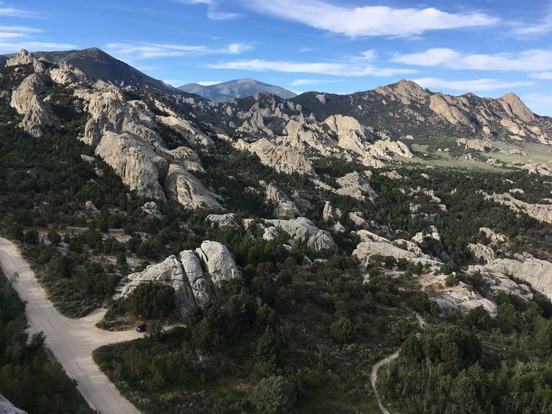
Pioneers on the California Trail painted their names in axle grease on these granite rocks. Some of those signatures are still visible today.
The backcountry byway runs about 49 miles through southern Idaho near the Utah border. Parts are gravel, so drive carefully and check conditions.
City of Rocks National Reserve features granite spires and domes, some estimated at billions of years old. Rock climbers come from far away to scale them.
Look for Camp Rock and Register Rock to see emigrant names. The visitor center in Almo shares maps and trail history.
Nearby Castle Rocks State Park adds more formations and hiking. Both areas offer camping if you want to stay overnight.
Is it remote? Yes, so pack water and gas up before leaving the main highway.
Address: 3010 Elba Almo Road, Almo, ID 83312
12. St. Joe River Scenic Byway, Avery, Idaho
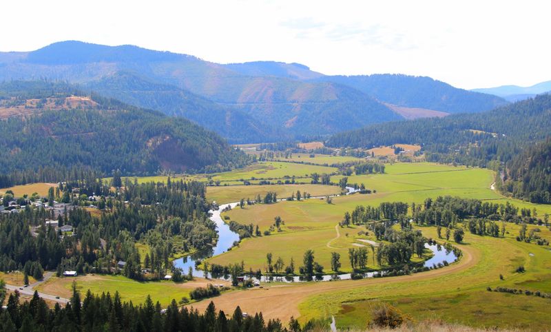
Ospreys build big stick nests on poles along this river road. Keep your eyes up as you drive.
The St. Joe River Scenic Byway follows the river through northern Idaho forest. It heads east from St. Maries toward Avery.
The river is known for clear water and good trout fishing. Rafting is popular on the upper sections during warmer months.
Avery was once a stop on the Milwaukee Road railroad. The old depot still stands, and it now serves as a museum about that railroad history.
Cell service can drop out along the way. Download maps ahead of time so you don’t get stuck.
The drive suits anyone who likes calm roads and wildlife sightings. Eagles and deer often show up too.
Address: Forest Highway 50, Avery, ID 83802
13. Hells Canyon Scenic Byway, Oxbow, Idaho
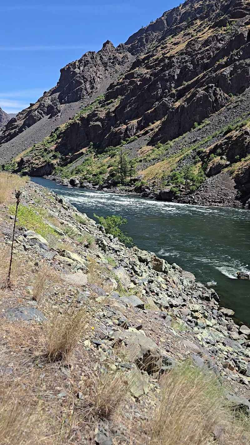
Hells Canyon is deeper than the Grand Canyon, dropping almost 8,000 feet at its deepest point. The Snake River carved it along the Idaho and Oregon border.
From Oxbow, a road follows the river north toward Hells Canyon Dam. The steep slopes rise on both sides as you drive.
At the dam, there’s a visitor center with displays about the canyon. Jet boat tours leave from nearby for trips deeper into the gorge.
The road ends at the dam, so plan to turn around. Bring snacks, since stores are scarce along the way.
Summer gets hot down in the canyon. Spring and fall bring milder temperatures for walking around.
Watch for bighorn sheep and eagles. The rugged terrain gives wildlife plenty of space.
Address: Hells Canyon Road, Oxbow, OR 97840
14. Snake River Canyon Scenic Byway, Caldwell, Idaho
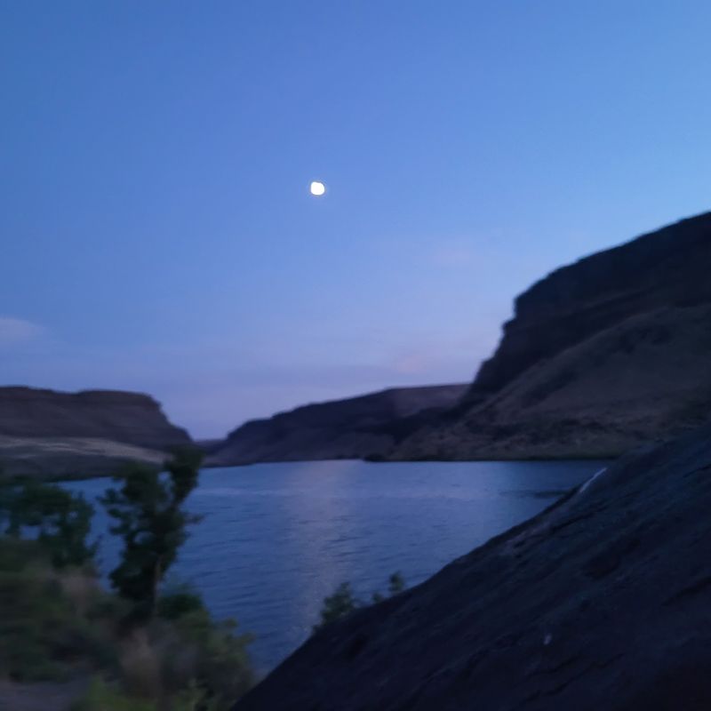
Who says a scenic drive needs mountains? This roughly 70-mile route swaps peaks for orchards, farms, and river views.
The byway winds through southwestern Idaho near Caldwell, Marsing, and the Sunnyslope area. Fruit stands pop up seasonally, offering cherries, peaches, and apples.
Map Rock is a highlight for history lovers. The large boulder has ancient carvings that some believe show the Snake River system.
Celebration Park, Idaho’s first archaeological park, sits nearby. It features petroglyphs and guided programs about early people in the area.
Fall is a great time to visit, with harvest season in full swing. Many farms open for U-pick fruit.
Take back roads slowly and enjoy the quiet. It’s a relaxing contrast to busier mountain routes.
Address: Map Rock Road, Caldwell, ID 83607
Share this story