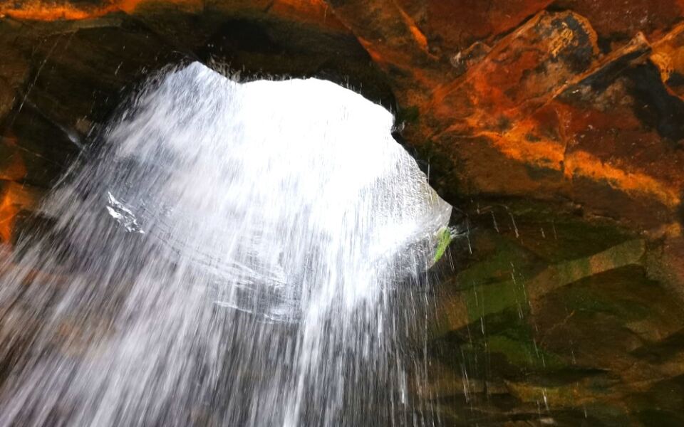
Arkansas has a waterfall that drops through a hole in solid rock. Another plunges roughly 209 feet into a remote hollow, while the state’s highest mountain rises 2,753 feet above sea level.
And those are just three of the natural wonders worth exploring.
Across the state, you’ll find massive limestone bluffs, underground caverns, unusual sandstone formations, and springs powerful enough to feed entire rivers. Some destinations require challenging hikes, but others have roadside overlooks or easy walking trails.
These 15 Arkansas natural wonders offer plenty of reasons to plan a road trip, including a few places that might surprise even longtime residents.
1. Hawksbill Crag (Whitaker Point)
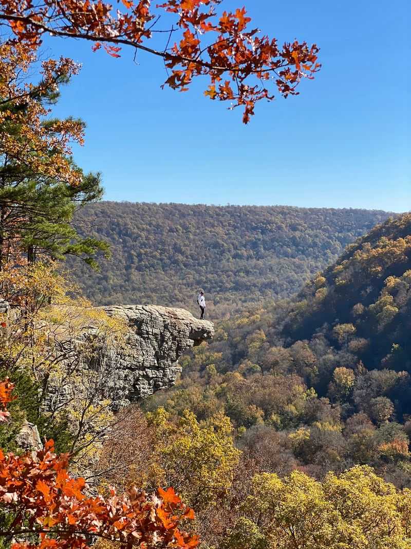
A slim slab of sandstone sticks straight out over a wooded valley, and it may be the most photographed rock in the state. Many people know it as Whitaker Point, and both names point to the same famous ledge.
Getting there takes a round-trip hike of about three miles through the Upper Buffalo Wilderness. The walk out is mostly downhill, so save some energy for the climb back to your car.
Fall is a favorite time to go, when the Ozark hills turn red, orange, and gold. The cliff edges have no railings, so keep kids close and skip the dramatic hops near the drop.
Pack water, wear sturdy shoes, and plan for a rough gravel road leading to the trailhead.
Address: Cave Mountain Road (County Road 5), Ponca, AR 72670
2. Petit Jean State Park
Did you know Arkansas started its state park system right here? Petit Jean became the first state park in Arkansas, and it still makes a strong case for being one of the finest.
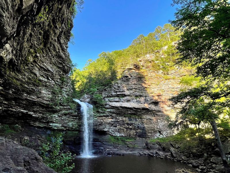
Cedar Falls is the big draw, dropping about 95 feet into a rocky canyon lined with tall sandstone walls. The Cedar Falls Trail heads down to the base, and the climb back up will remind your legs it happened.
Don’t stop at the waterfall, though. The park also has odd rock formations, scenic overlooks, and trails through surprisingly varied ground.
Historic buildings from the Civilian Conservation Corps era add a nice old-time touch. Prefer an easier look at the falls?
Try the Cedar Falls Overlook for a view without the steep hike.
Address: 1285 Petit Jean Mountain Road, Morrilton, AR 72110
3. Blanchard Springs Caverns
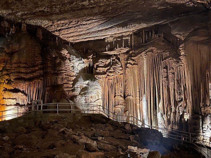
Water is still at work inside this cave, slowly adding to its stone formations drop by drop. That makes Blanchard Springs Caverns a living cave, not a dried-out museum piece.
Guided tours lead through lit passages filled with stalactites, columns, and huge rooms. Rangers explain how these shapes formed over huge stretches of time.
Timing matters a lot here. The caverns have run seasonal tours in 2026, and major renovation work is planned afterward, with reopening expected around 2028.
Check tour availability before you drive out to the mountains. Even if the cave is closed, the nearby spring and recreation area in the Ozark National Forest still make a pleasant stop.
The cave stays cool year-round, so a light jacket is smart when tours are running.
Address: 704 Blanchard Springs Road, Fifty-Six, AR 72533
4. Buffalo National River
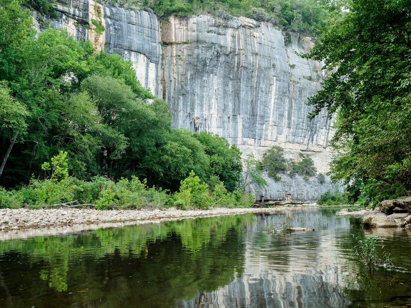
Back in 1972, Congress made the Buffalo the first national river in the United States. That protection kept it free of dams, so it still flows the way nature planned.
The river winds past towering limestone bluffs, some of the tallest in the Ozarks. Paddling beneath them in a canoe or kayak is the classic way to see it.
Water levels change with the seasons. Spring usually brings better floating on the upper river, while summer trips often work best on the lower stretches.
Not into paddling? Plenty of hiking trails, campgrounds, and historic sites line the river too.
Check current conditions with the park service before you go, since rain can raise the water quickly.
Address: 402 N Walnut Street, Suite 136, Harrison, AR 72601
5. Mount Magazine State Park
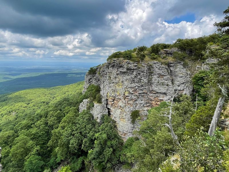
At 2,753 feet, this mountain holds the title of highest point in Arkansas. Bragging rights come free with the view.
Overlooks along the ridge stretch across the Arkansas River Valley and nearby mountains. Fall turns those distant hills into a colorful patchwork worth timing a trip around.
The Signal Hill Trail takes you to the actual summit. It’s a short walk, so even casual hikers can claim they topped the state.
The park lodge sits right on the bluff, giving you a scenic spot to rest. When the wind cooperates, you might also watch hang gliders launch off the mountain.
Temperatures up top often run cooler than in the valley, so bring a layer even in warm months.
Address: 577 Lodge Drive, Paris, AR 72855
6. Hemmed-In Hollow Falls
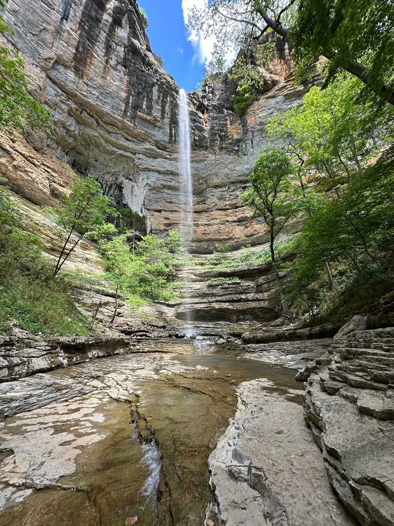
Roughly 209 feet of falling water makes this one of the tallest waterfalls between the Rockies and the Appalachians. It pours off a huge bluff into a hollow surrounded by rock walls.
Here’s the catch: the trail from the Compton trailhead is tough. You head steeply downhill on the way in, which means a long, hard climb on the way out.
Plan for about five miles round trip and several hours. Bring plenty of water and snacks, and start early.
Rain makes a big difference here. Spring usually brings the strongest flow, while dry spells can shrink the falls to a trickle.
Address: Compton Trailhead, County Road 2700, Compton, AR 72624
7. Mammoth Spring State Park
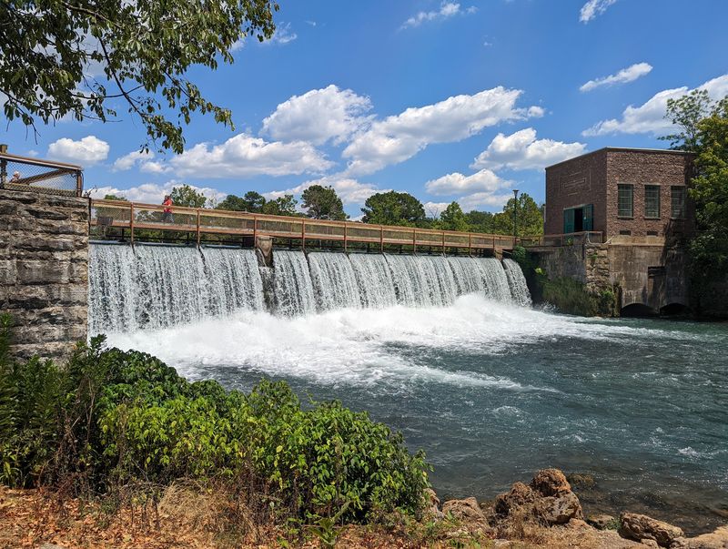
A single spring here pushes out millions of gallons of water every hour. It’s so strong it gives birth to an entire river, the Spring River.
Mammoth Spring is a National Natural Landmark, and you don’t need hiking boots to enjoy it. An easy walking path loops around the clear lake and the rushing spillway below an old dam.
History is part of the visit too. The park includes a restored train depot and reminders of the area’s hydroelectric past.
It’s a relaxed stop for families, older travelers, or anyone needing a break from steep trails. Bring a picnic and enjoy the green lawns near the water.
Address: 17 US Highway 63 North, Mammoth Spring, AR 72554
8. Glory Hole Falls
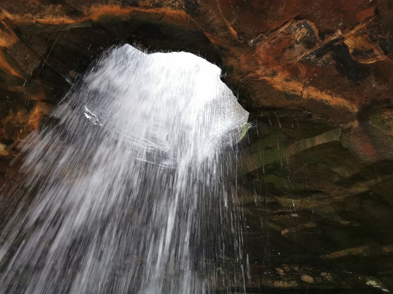
Most waterfalls go over a cliff, but this one drops straight through the roof. Water has worn a round hole through solid rock and now pours into a sheltered grotto below.
The trail is about two miles round trip in the Ozark National Forest. It heads downhill to the falls, so the return walk takes a bit more effort.
After a good rain, the stream punches through the opening with real force. In very cold weather, ice can form around the hole and make it look even stranger.
Dry seasons may leave only a thin flow. Watch your footing on wet rocks, and give yourself time for photos from underneath.
Address: Highway 21, near Fallsville, Ozone, AR 72854
9. Devil’s Den State Park
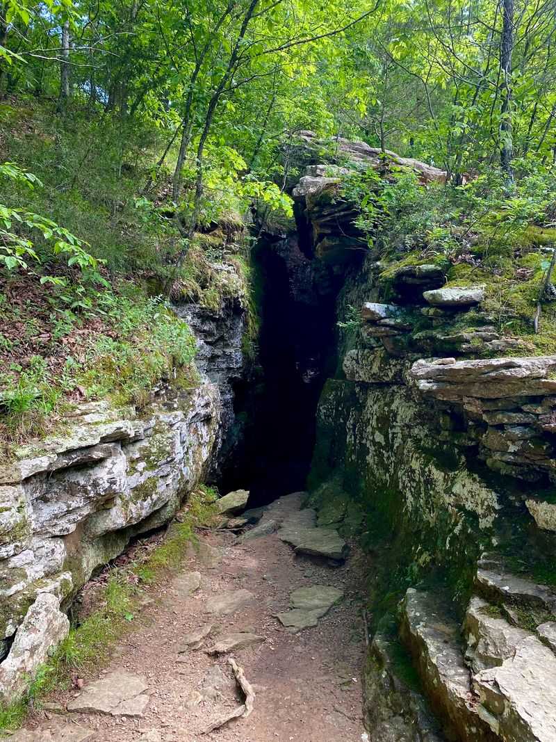
Workers from the Civilian Conservation Corps built stone cabins, bridges, and a dam here back in the 1930s. Many of those structures still stand, giving the park a rugged, handmade look.
The real fun is the geology. Huge sandstone blocks, narrow crevices, and caves fill the valleys of the Boston Mountains.
The Yellow Rock Trail leads to a sandstone overlook with wide views of the forest. It’s a solid hike for families ready for some uphill work.
The Devil’s Den Trail lets you explore cracks and small caves up close. Some caves close seasonally to protect bats, so check postings at the trailheads.
Address: 11333 West Arkansas Highway 74, West Fork, AR 72774
10. Lost Valley Trail
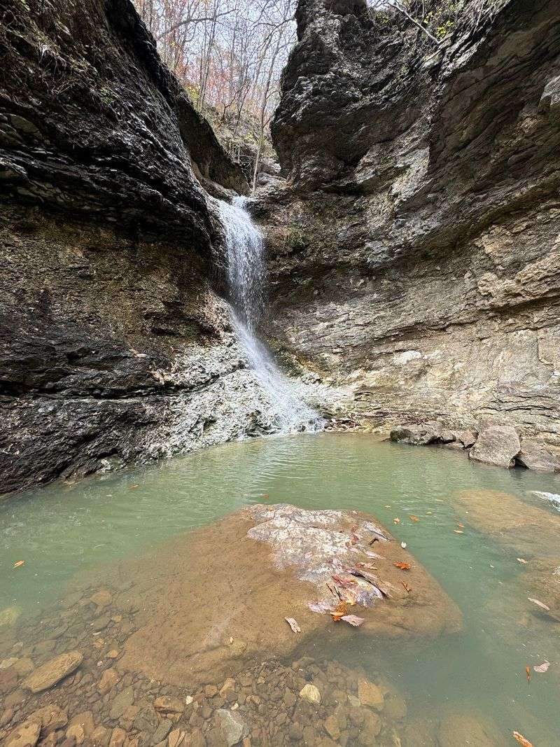
How many trails pack a natural bridge, a giant rock shelter, and a waterfall into one short hike? Lost Valley does it in about 2.5 miles round trip.
The path follows Clark Creek through the woods. Early on, you’ll pass a natural bridge where the creek flows through a rock arch.
Next comes Cob Cave, a huge overhang under a limestone bluff. Then the canyon tightens, and the trail gets rockier near the end.
Eden Falls waits at the top, dropping about 53 feet. Spring and rainy weeks bring the best flow, so time your hike after some rain if you can.
Address: Lost Valley Trailhead, Highway 43, Ponca, AR 72670
11. Lake Ouachita State Park
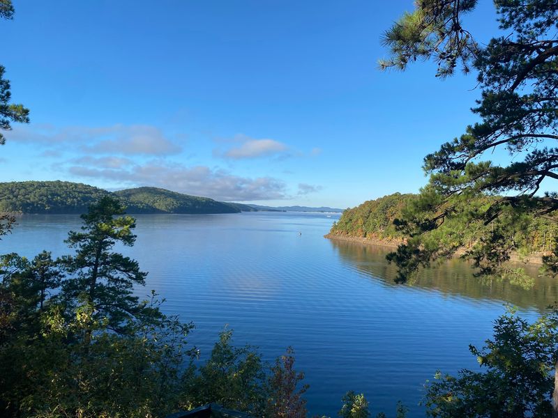
Lake Ouachita is the largest lake located entirely within Arkansas. It’s dotted with dozens of wooded islands, and much of its shoreline stays undeveloped.
The surrounding Ouachita National Forest helps keep it that way. Hills roll right down to the water with very few buildings in sight.
The state park makes a handy home base. You can swim, kayak, fish, or launch a boat, then hike lakeside trails.
Camping spots and cabins let you stay overnight. Early mornings on the water tend to be calm, which is great for paddlers.
Bring sunscreen and plenty of water, since shade can be scarce out on the lake.
Address: 5451 Mountain Pine Road, Mountain Pine, AR 71956
12. Pedestal Rocks Scenic Area
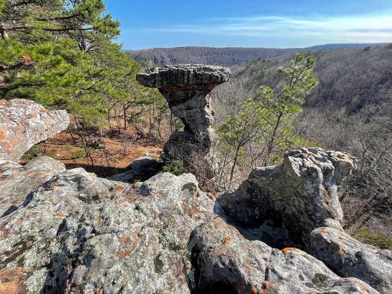
Erosion turned sandstone here into tall columns with wide, rounded tops, kind of like stone mushrooms. They stand along bluffs in the Ozark National Forest.
The Pedestal Rocks Loop is a little over two miles. It leads past the formations and along cliff edges with views over the woods.
Kings Bluff sits on a nearby loop. After rain, a seasonal waterfall spills over its tall rock face.
Combine both loops for a hike of roughly four miles. Watch the edges closely, since the drops are steep and unfenced.
Fall and winter give clearer views once leaves drop, so those seasons work well for photographers.
Address: Highway 16, Witts Springs, AR 72686
13. Arkansas Grand Canyon
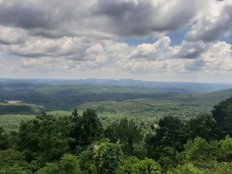
Calling anything a Grand Canyon is a bold move, but this view earns some respect. The valley spreads wide below, ringed by layer after layer of Ozark ridges.
Best of all, no hike is required. The main overlook sits right off Scenic Highway 7, south of Jasper.
Pull over, step out, and enjoy the scenery from the roadside. It’s an easy pick for anyone with limited time or mobility.
Autumn is the showstopper season, when the hills turn orange and red. Clear mornings help too, before haze settles in.
Highway 7 itself is a scenic drive, so build in extra time for stops along the curves.
Address: Arkansas Scenic Highway 7, Jasper, AR 72641
14. Cossatot River State Park-Natural Area
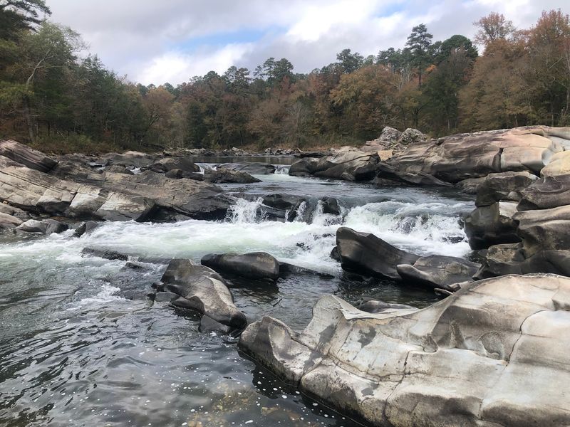
Cossatot Falls isn’t one big drop. It’s a series of ledges and rapids squeezed between giant boulders in the Ouachita Mountains.
Experienced whitewater paddlers seek out this river for its Class IV and Class V rapids when water runs high. Beginners should leave those runs to the pros.
Hikers get great views too. Trails and viewing areas let you watch the rapids safely from shore.
The visitor center near Highway 278 has exhibits about the river and its wildlife. Water levels rise fast after storms, so check conditions before heading to the falls area.
Address: 1980 Highway 278 West, Wickes, AR 71973
15. Kings River Falls Natural Area
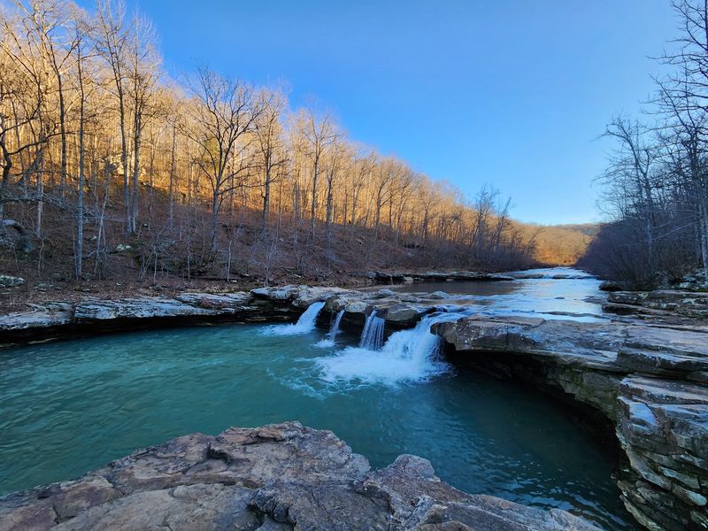
Short and wide beats tall and skinny at this waterfall. Kings River Falls spreads across a rocky ledge on a clear stretch of the Kings River.
The hike is about two miles round trip and mostly flat. It follows the river through the woods, making it friendly for families.
On hot days, the pool below the falls tempts plenty of swimmers. Check water levels first, since currents can turn strong after rain.
The natural area also protects rare plants along the riverbanks. Stay on the trail and pack out trash to help keep it clean.
Spring wildflowers make an early-season visit extra pretty.
Address: County Road 3925, Witter, AR 72776
Share this story