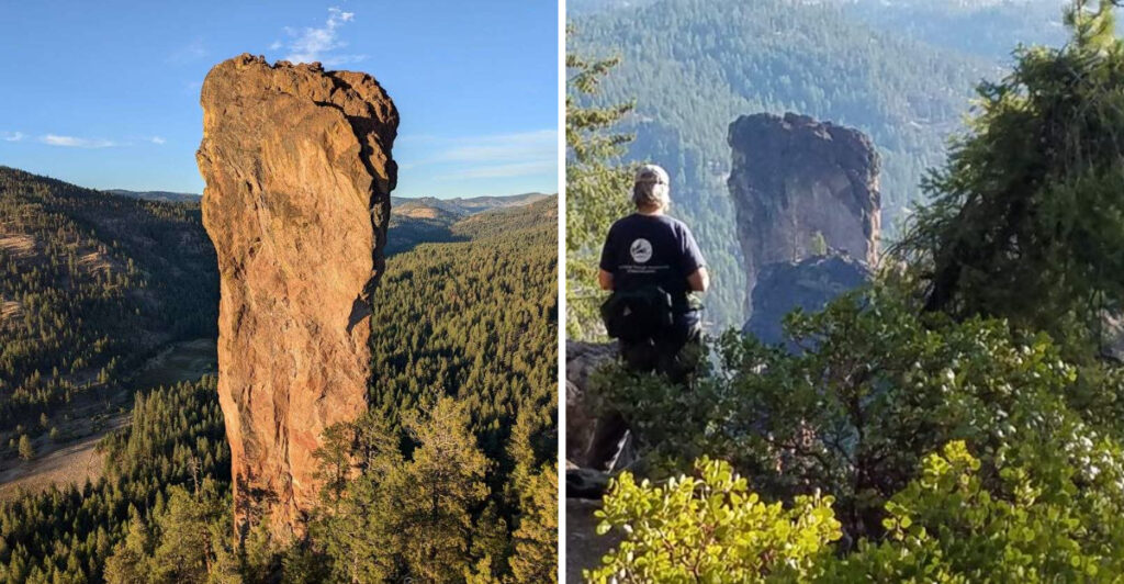
There is a trail in central Oregon that most people have never heard of, and it ends at the base of a volcanic rock tower so tall and so strange-looking that your brain takes a second to accept it as real. The pillar shoots straight up from the forest floor like something out of a science fiction film, except it has been standing there for millions of years.
The hike is only about four miles round trip, the scenery along the way is genuinely beautiful, and the payoff at the end is one of the most dramatic geological sights in the entire Pacific Northwest. Stick with me, because I am going to walk you through everything you need to know before you lace up your boots and head out to see this incredible place for yourself.
Where Exactly You Are Going
The trailhead for Steins Pillar sits in the Ochoco National Forest, not far from the small city of Prineville, Oregon 97754. To get there, you head east out of Prineville on Highway 26, then turn north onto Mill Creek Road, which eventually transitions into a gravel forest road for the last couple of miles before the parking area.
The coordinates place you at roughly 44.3947 degrees north latitude and 120.6239 degrees west longitude, deep in the rolling hills and ponderosa pines of the Ochoco Mountains. This is not a trailhead you stumble upon by accident.
You have to want to be there, and that intentionality is part of what makes the experience feel rewarding before you even take your first step.
The U.S. Forest Service manages the area, and their official page lists the trail under the Ochoco National Forest recreation area.
Cell service is limited out here, so download your maps before you leave town. The drive from Prineville takes roughly 30 to 40 minutes depending on road conditions, and the journey through the high desert landscape is already worth the trip.
The Geological Story Behind the Pillar
Steins Pillar is what geologists call a volcanic plug or erosional remnant, formed from welded tuff, which is essentially compressed volcanic ash that hardened into solid rock over millions of years. The softer rock around it eroded away over time, leaving this massive column standing alone like a sentinel above the trees.
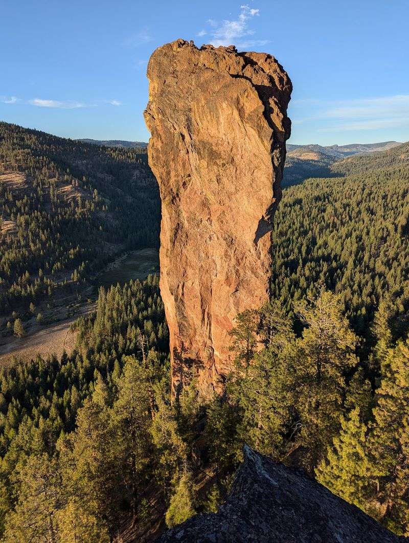
The pillar rises approximately 350 feet from its base, which makes it genuinely staggering to look at when you are standing directly beneath it. At that height, it clears the tops of most of the surrounding ponderosa pines by a significant margin, and the sheer verticality of the thing is almost disorienting in the best possible way.
Geologists estimate the formation dates back tens of millions of years to a period of intense volcanic activity across what is now the Pacific Northwest. The welded tuff composition gives the rock a rough, textured surface that catches light differently depending on the time of day.
Early morning light turns the column a warm amber color, while midday sun bleaches it almost pale gold. Either way, it is a masterclass in what patience and geology can produce together.
What the Trail Itself Is Actually Like
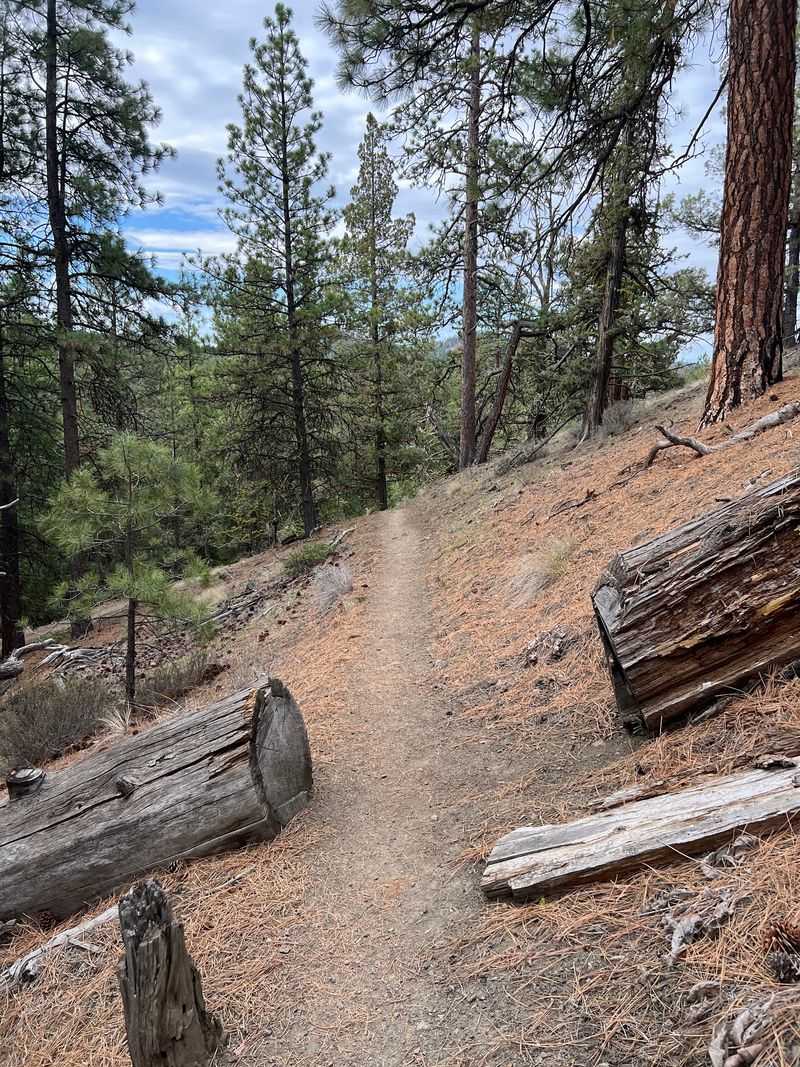
The Steins Pillar Trail is listed as a four-mile out-and-back route, and most hikers with a moderate fitness level find the round trip takes somewhere between one and a half to two and a half hours. The path is well-defined for most of its length, though there are a few sections where the route becomes less obvious, particularly beyond the midpoint viewpoint.
Elevation change is real but manageable. You will notice some solid uphill stretches and a meaningful drop as you descend toward the base of the pillar in the final section.
The terrain shifts from open hillside to shaded forest as you move along, which keeps the visual experience from feeling repetitive.
A small stream crossing near the start of the trail adds a touch of adventure, and a few logs placed across it serve as a natural bridge. The path winds through ponderosa pine, juniper, and patches of native shrubs, and in late spring the wildflowers along the edges are genuinely pretty.
The trail is not stroller-friendly, and anyone with limited mobility should consider stopping at the midpoint viewpoint rather than pushing all the way to the base.
The Midpoint Viewpoint Worth Stopping At

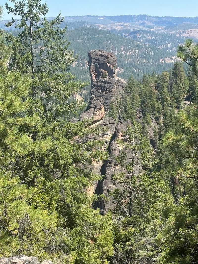
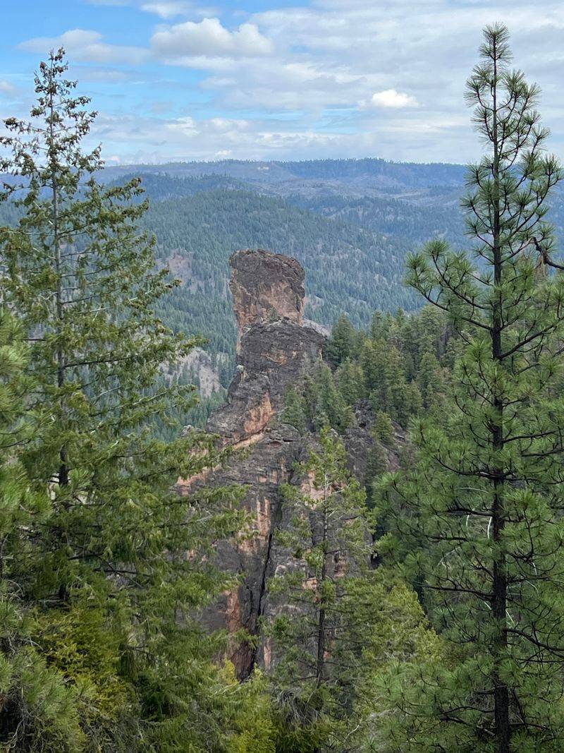
About halfway along the trail, a single sign points toward a viewpoint, and it is absolutely worth pausing here even if you plan to continue all the way to the base. From this elevated spot, you get a clear sightline across the valley to Steins Pillar rising above the treeline, and the scale of the formation really starts to register from this distance.
Some hikers actually prefer this vantage point for photography because you can capture the full height of the pillar against the sky without having to crane your neck upward at a steep angle. The surrounding hills and forest canopy frame the shot naturally, and on a clear day the contrast between the pale rock and the blue Oregon sky is striking.
That said, stopping here and calling it done means missing the most dramatic part of the experience. The closer you get, the more the pillar seems to grow, and standing at its actual base is a completely different sensation from viewing it across the valley.
Both perspectives are genuinely worthwhile, but if your legs are willing, keep going. The final descent to the base is steep but short, and the payoff is significant.
Standing at the Base of the Pillar
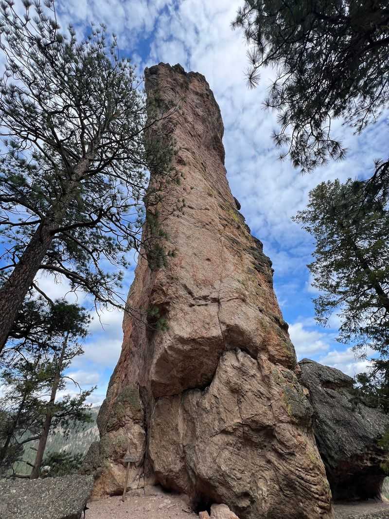
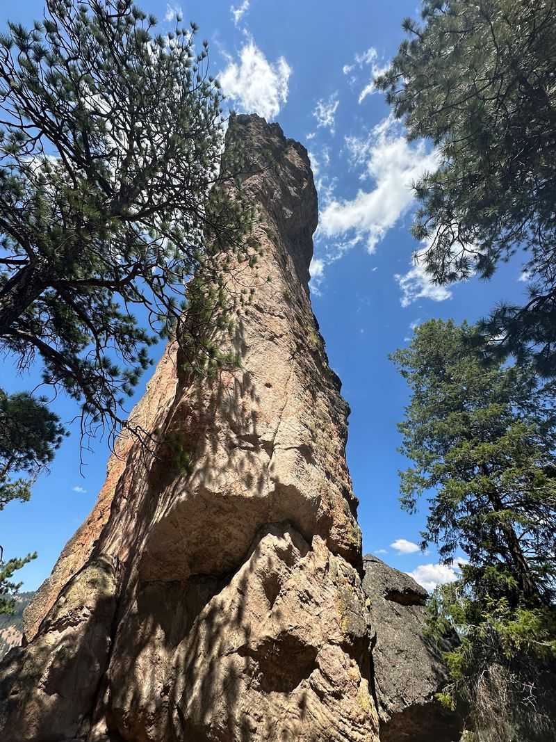
Nothing quite prepares you for the moment you round the last bend in the trail and the full mass of Steins Pillar fills your entire field of vision. The rock face is enormous up close, textured and layered, with the kind of presence that makes you instinctively slow down and go quiet.
It is one of those rare natural features that commands attention without asking for it.
The base area is relatively small and shaded by the pillar itself and surrounding trees, which gives it a cool, sheltered atmosphere even on warm days. Looking straight up from the base, the top of the column seems impossibly far away, and the slight lean of the structure, which is perfectly natural, adds a subtle sense of drama to the view.
Evidence of rock climbing activity is visible on the lower sections of the pillar, including old bolt placements and chalk marks on certain holds. Steins Pillar is a known technical climbing destination, though it is a serious and committing route not suited for beginners.
For most visitors, simply standing at the base and taking in the sheer mass of the thing is more than enough of an adventure to make the whole drive worthwhile.
Rock Climbing on the Pillar
Steins Pillar has a quiet but real reputation in the Pacific Northwest climbing community. The first recorded ascent of the pillar dates back to 1950, and it has drawn technically skilled climbers ever since.
The route to the summit is graded at a serious difficulty level, involving exposed face climbing on welded tuff that requires solid anchor-building skills and comfort with long, committing pitches.
The rock quality on Steins Pillar is generally good, though some sections are more weathered than others and require careful route-finding. The summit itself is small, and the views from the top are reportedly extraordinary, though very few people ever make it up there in any given year.
This is not a sport crag with bolted routes and easy top-roping setups.
For the vast majority of hikers who visit, watching the pillar from the base is the full extent of the experience, and that is perfectly satisfying. But knowing that climbers have stood on top of that narrow summit adds an extra layer of fascination to the whole scene.
The pillar is not just a geological curiosity. It is also a genuine mountaineering objective with a history worth respecting.
Wildlife and Nature Along the Way
The trail to Steins Pillar passes through a varied mix of high desert and montane forest habitat, which supports a surprisingly diverse range of wildlife. Wild turkeys are frequently spotted along the route, often appearing suddenly from the brush and waddling across the path with complete indifference to hikers.
Deer are common too, especially in the early morning and late afternoon hours.
The Ochoco Mountains are also home to mountain lion, black bear, and coyote, though sightings on this particular trail are rare. Still, carrying bear spray is a sensible precaution, and a few hikers have noted seeing large cat tracks in the mud along the lower sections of the trail.
Awareness is always good practice in any backcountry setting.
Bird life along the trail is rich and varied, with several species of woodpecker, nuthatch, and raptor visible depending on the season. The ponderosa pines provide excellent habitat for cavity-nesting birds, and the open hillside sections attract hawks and falcons hunting the slopes.
Wildflowers bloom along the trail edges from late April through early June, adding splashes of yellow, purple, and white to the forest floor and making the spring season a particularly appealing time to visit.
Best Seasons and Weather Conditions
The trail to Steins Pillar is accessible for most of the year, but each season brings a different kind of experience. Summer visits offer warm temperatures, long daylight hours, and dry trail conditions that make the hike comfortable and straightforward.
This is the most popular time of year, though the trailhead never gets truly crowded, and finding a quiet moment at the base of the pillar is usually easy enough.
Autumn is genuinely spectacular in the Ochoco Mountains. The combination of golden light, cooler air, and the changing colors of the understory shrubs creates an atmosphere that feels almost cinematic.
October is a sweet spot for visitors who want good trail conditions without the heat of summer.
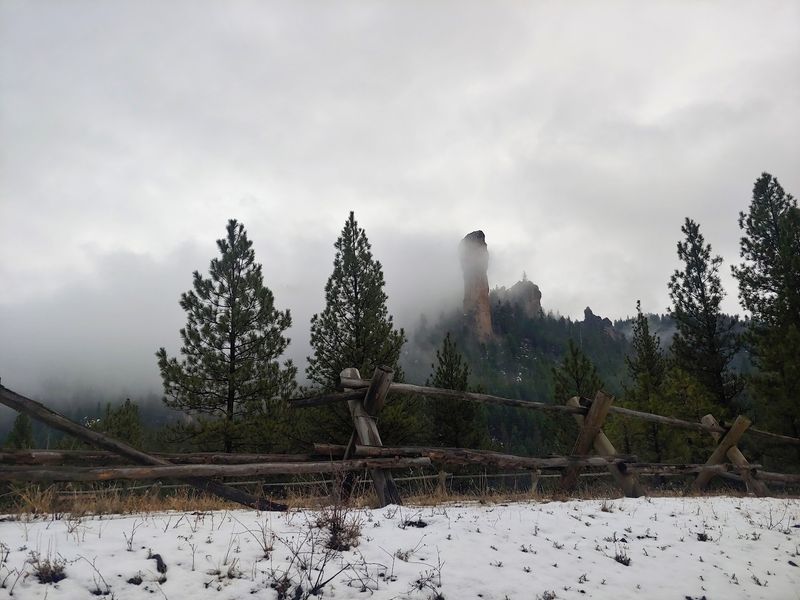
Winter and early spring hiking is possible but requires more preparation. Snow can cover the trail and make route-finding difficult, and the gravel access road can become muddy and slippery.
The mud under melting snow creates genuinely challenging conditions for both vehicles and hikers. That said, a clear winter day with a few inches of snow on the ground transforms the landscape into something quietly beautiful, and the lack of other visitors gives the whole experience an added sense of solitude and discovery.
Getting There and Road Conditions
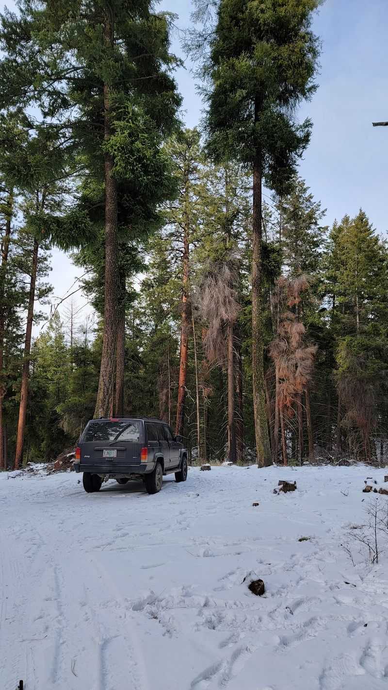
The access road to the Steins Pillar trailhead is one of the most consistently mentioned topics in visitor accounts, and for good reason. The last two miles of the approach involve a gravel road that can be seriously washboarded and rutted, particularly after wet weather or heavy use.
Vehicles with higher ground clearance handle the road noticeably better than low-clearance sedans.
That said, determined visitors in regular passenger cars have made it through without incident, especially when road conditions are dry. The key is going slowly and picking your line carefully through the rougher sections.
A four-wheel-drive vehicle is not strictly necessary under normal dry conditions, but it does make the drive less stressful.
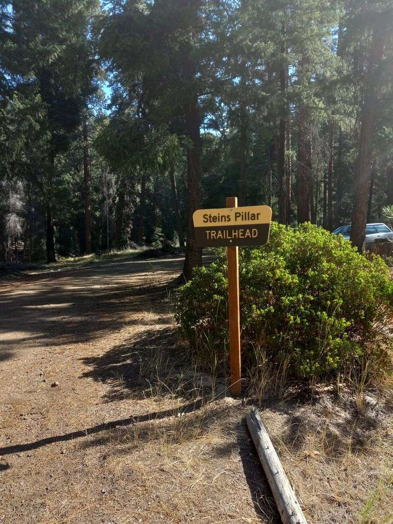
One navigation detail worth knowing: when you use a maps app to get directions to the trailhead, the app may stop you short of the actual parking area. There is a sign on the forest road indicating that the trailhead is still two miles ahead, so trust the sign and keep driving rather than stopping where the app tells you to.
The parking area at the trailhead is a decent size and can accommodate multiple vehicles comfortably, though it fills up faster on summer weekends than you might expect for such a remote location.
Tips for Making the Most of Your Visit
A few practical details can make the difference between a smooth outing and a frustrating one. Download offline maps before leaving Prineville, because cell service disappears well before you reach the trailhead.
The Forest Service website for the Ochoco National Forest has current trail condition updates, and checking it the day before your visit is a habit worth forming.
Wear proper footwear with ankle support and good grip. The trail has enough elevation change and loose sections to make trail runners or hiking boots a smarter choice than casual sneakers.
Trekking poles are helpful on the steeper descent toward the base of the pillar, especially if the ground is wet or icy.
Bring more water than you think you need. The hike is only four miles, but the exposed hillside sections can feel warm on sunny days, and the stream near the trailhead is not treated for drinking.
Starting early in the morning gives you the best light for photography, cooler temperatures for hiking, and the highest chance of having the trail to yourself. The whole experience, from parking lot to pillar and back, is genuinely one of the most satisfying half-day adventures available in central Oregon, and it costs nothing but your time and a tank of gas.
Share this story