Some roads were practically built to be driven slowly, with the windows down and no particular rush to arrive. America’s national parks offer exactly that kind of freedom, with scenic highways crossing volcanic plateaus, mountain passes, red-rock canyons, and wild coastlines.
Whether you have a long weekend or a full month, these 15 parks deliver unforgettable road trip experiences from the moment you pull through the entrance gate.
Yellowstone National Park, Wyoming, Montana, and Idaho
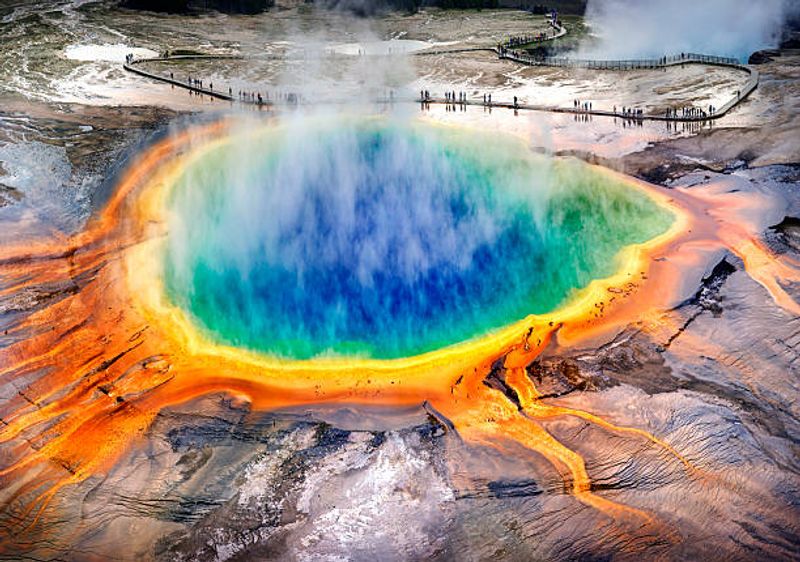
Yellowstone sits on top of one of the world’s largest active volcanoes, and driving through it feels like touring another planet entirely. The road network connects Old Faithful, Grand Prismatic Spring, Mammoth Hot Springs, Yellowstone Lake, Lamar Valley, and the Grand Canyon of the Yellowstone across a massive volcanic landscape.
No other park packs this many jaw-dropping landmarks into a single looping drive.
Old Faithful and the Grand Canyon of the Yellowstone are about 50 miles apart, so distances add up quickly. The park has no public transportation, which means your car is your only real option for getting around.
Most roads close to regular vehicles during winter, so late spring through early fall is the prime season for driving.
Wildlife jams are completely normal here. Bison herds cross roads whenever they feel like it, and wolves and bears regularly stop traffic in Lamar Valley.
Build extra time into your schedule and treat every slowdown as a bonus wildlife-watching opportunity rather than a frustration.
Yosemite National Park, California
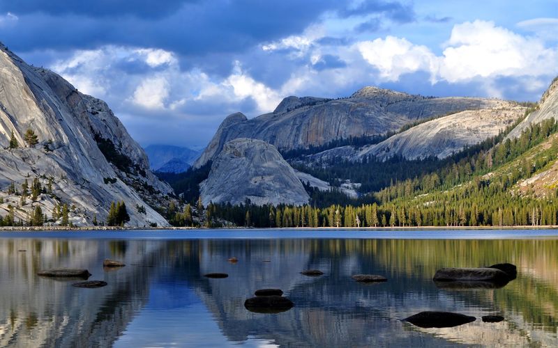
Tioga Road is one of those drives that rewards patience. The 47-mile highway travels through the Sierra Nevada high country, passing granite domes, meadows, forests, and broad mountain viewpoints that most Yosemite visitors never bother to explore.
Snow keeps the road closed until late May or June most years, so timing your visit matters.
When conditions allow, Tioga Road creates a stunning east-west crossing that connects Yosemite Valley with the dramatic scenery along U.S. Highway 395.
That connection makes it possible to combine Yosemite with a longer California or Nevada road trip without backtracking. Tuolumne Meadows, roughly halfway along the route, is a great stopping point for a short walk or a picnic.
Yosemite Valley itself has its own driving loop, though shuttle buses handle most of the valley traffic during peak season. Arriving before 9 a.m. dramatically improves your chances of finding parking near popular spots like Valley View and Tunnel View.
Crowds thin noticeably in September, which many experienced visitors consider the park’s best driving month.
Grand Canyon National Park, Arizona
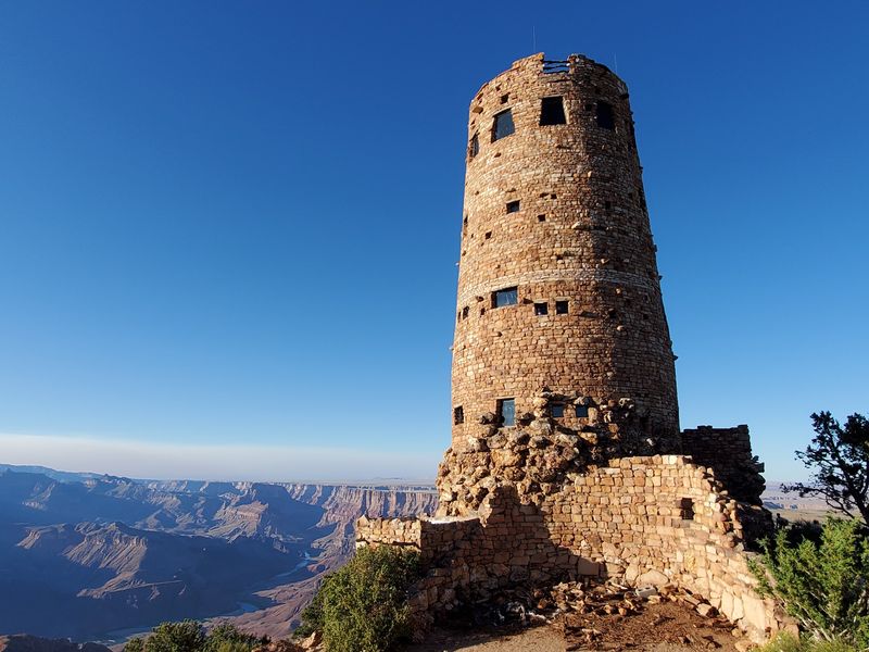
Standing at the edge of the Grand Canyon for the first time, most people go completely quiet. Desert View Drive gives you that moment multiple times across its 23-mile stretch from Grand Canyon Village to the park’s East Entrance.
Each overlook reveals a slightly different angle of the canyon and the Colorado River threading through it far below.
Unlike the western section of the South Rim, which relies heavily on shuttle buses, Desert View Drive stays open to private vehicles year-round unless snow or a temporary hazard forces a closure. Entering from the East Entrance is a smart move because the first viewpoint you hit, near Desert View Watchtower, is one of the most spectacular in the entire park.
Starting there and working westward means the crowds thin as you go.
The historic Watchtower itself is worth a stop. Built in 1932 and designed to resemble ancient Pueblo towers, it offers views that stretch for miles in every direction on a clear day.
Combining Desert View Drive with a night at the South Rim turns a quick visit into a genuinely memorable road trip experience.
Glacier National Park, Montana
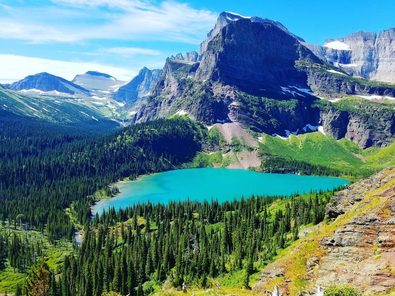
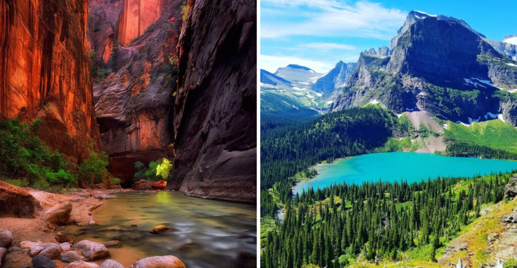
Going-to-the-Sun Road is the kind of drive that makes people pull over every five minutes just to stare. The 50-plus-mile route crosses glacier-carved valleys, dense forests, alpine meadows, and Logan Pass before descending toward Lake McDonald on the western side.
Engineers carved this road into sheer mountain cliffs in the 1920s and 1930s, and it remains an extraordinary achievement.
Snow dictates the timeline here more than any park calendar does. The alpine section often stays closed until late June, and some years push that date even further.
Checking the park’s official website before your trip is genuinely essential, not just a suggestion. Vehicle size restrictions also apply on the narrower alpine sections, so oversized RVs and trailers need to plan accordingly.
Wildlife sightings along Going-to-the-Sun Road are remarkably common. Mountain goats frequently hang out near Logan Pass, and bears are spotted along the road throughout the season.
Arriving at Logan Pass early in the morning gives you the best chance of finding parking and catching golden-hour light on the surrounding peaks. This road earns its reputation every single time.
Grand Teton National Park, Wyoming
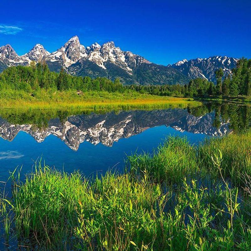
The Teton Range does not gradually appear on the horizon the way most mountain ranges do. It erupts straight up from the flat valley floor with almost no warning, creating one of the most dramatic roadside views in North America.
Turnouts near Snake River Overlook, Oxbow Bend, and Jenny Lake deliver that view from different angles, each one worth stopping for.
Grand Teton’s road network connects wildlife areas, lakeshores, trailheads, and historic ranches, giving drivers plenty of reasons to slow down and step out of the car. The park also connects naturally with Yellowstone just to the north, making a combined Wyoming road trip an obvious choice for anyone who has the time.
Road construction may cause delays in 2026, so checking current conditions before your visit is a smart move.
Moose sightings near Oxbow Bend are almost embarrassingly reliable in the early morning hours. Photographers gather there before sunrise with tripods set up, and even casual visitors regularly spot moose wading through the shallow water.
Sunset over the Tetons from any of the main pullouts along Teton Park Road is the kind of thing that earns its own chapter in a travel journal.
Zion National Park, Utah
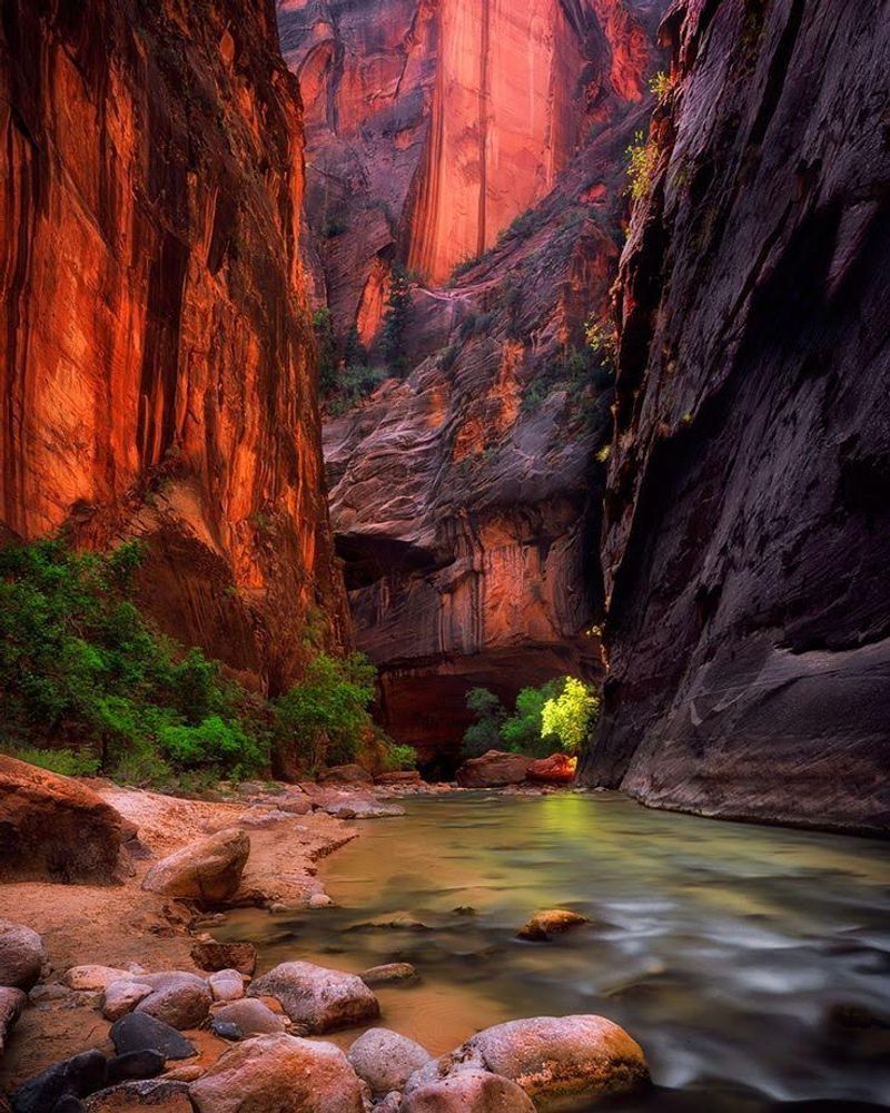
Driving into Zion Canyon feels like entering a world built entirely from shades of red, cream, and salmon pink. The sandstone walls rise hundreds of feet on both sides, and the road winds beneath them in a way that makes you feel genuinely small.
The Zion-Mount Carmel Highway is the main through-route, complete with a historic tunnel that cuts directly through the canyon walls.
Here is the catch that surprises first-time visitors: private vehicles cannot use Zion Canyon Scenic Drive during most of the shuttle season. Buses take over that stretch of road, and honestly, riding the shuttle is a perfectly pleasant experience.
You can still explore other park roads by car, including the full Zion-Mount Carmel crossing, which is a fantastic drive on its own.
Vehicle-size restrictions apply in the tunnel on the Zion-Mount Carmel Highway, and oversized vehicles require an escort and a fee. Rockfall, snow, and seasonal congestion can also affect travel, so checking current conditions before heading out is always a good idea.
Arriving at the park before 8 a.m. during peak season is the single most effective strategy for avoiding the worst of the crowds.
Rocky Mountain National Park, Colorado
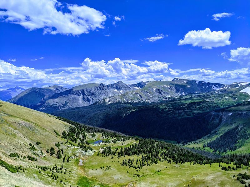
At 12,183 feet above sea level, Trail Ridge Road holds the title of the highest continuous paved road in the United States. That is not just a trivia fact worth mentioning at dinner.
It means the drive literally takes you above the treeline into a wide-open world of alpine tundra where the wind hits differently and the views stretch for what feels like forever.
Eleven miles of the 48-mile highway run completely above the treeline, offering non-stop panoramic mountain scenery. Elk graze near the road with impressive confidence, marmots sun themselves on rocks, and summer wildflowers cover the meadows in bursts of color.
The road connects Estes Park on the east side with Grand Lake on the west, making it a natural anchor for a broader Colorado road trip.
Altitude sickness is a real consideration on Trail Ridge Road, especially for visitors arriving from lower elevations. Drinking extra water, taking it slow, and skipping the run up the trail are all genuinely useful habits here.
The road typically opens in late May and closes in October, though snowstorms can push those dates in either direction without much warning.
Olympic National Park, Washington
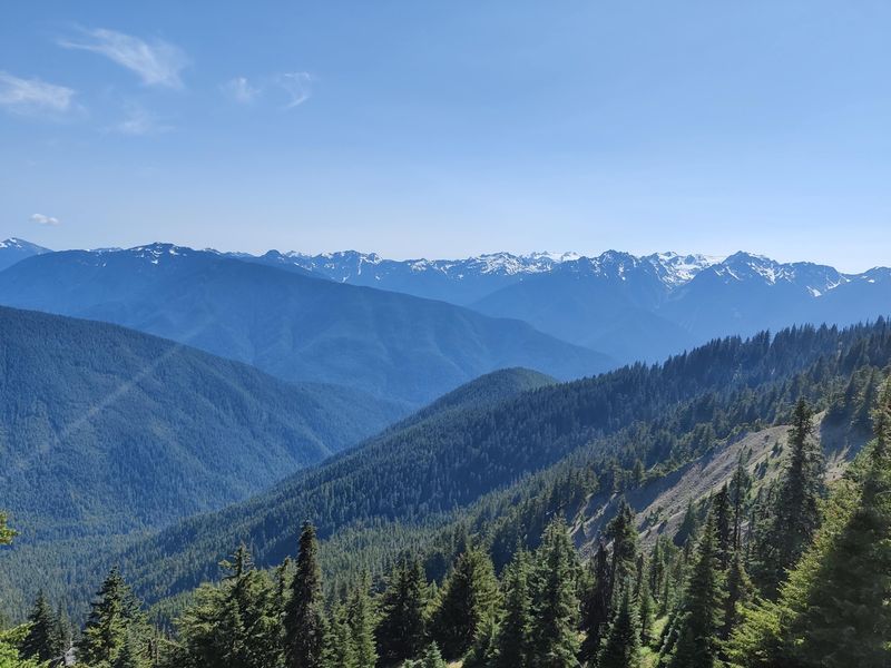
Olympic National Park might be the most geographically diverse park in the entire country, and that variety is exactly what makes it such a rewarding road trip. A loop around the Olympic Peninsula can take you through glacier-covered mountains, old-growth temperate rainforest, freshwater lakes, natural hot springs, and more than 70 miles of wild Pacific coastline.
Very few drives in the world cover that range of environments.
The park has no single road crossing its interior, so visitors travel around the peninsula and take separate access roads into different sections. Hurricane Ridge Road climbs 17 miles from near Port Angeles to one of the park’s most accessible mountain panoramas, with views reaching across the Strait of Juan de Fuca into Canada on clear days.
The Hoh Rain Forest access road offers a completely different but equally stunning experience.
Planning an Olympic Peninsula loop typically takes three to five days to do it justice. Campgrounds fill up fast in summer, so reservations are worth making well in advance.
Rain gear is a sensible packing choice no matter what the forecast says, because the weather in this corner of Washington has its own agenda and rarely asks for permission.
Acadia National Park, Maine
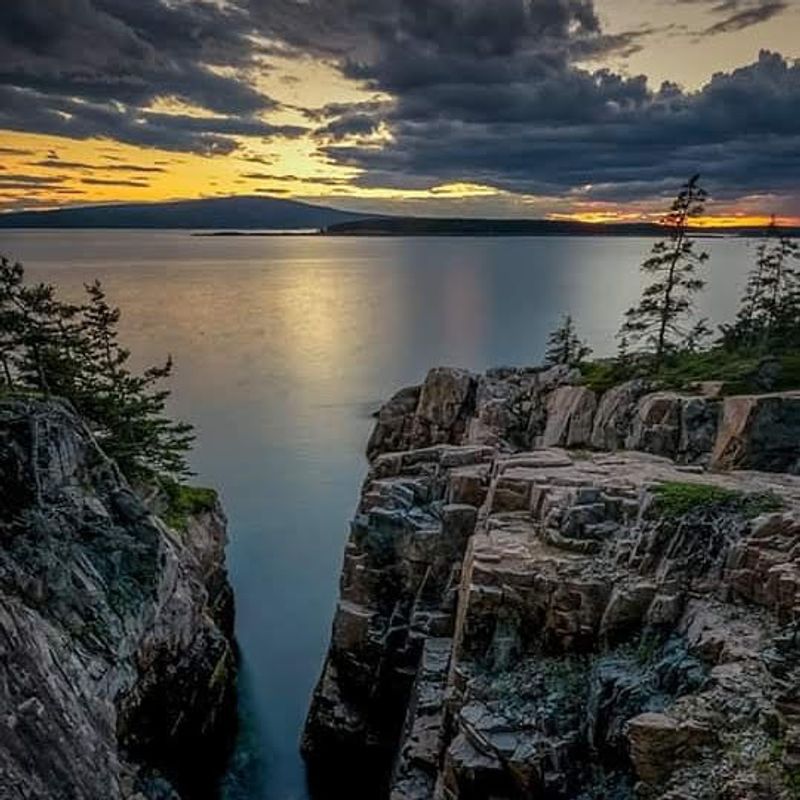
Acadia is proof that a road trip does not need to be epic in length to be epic in experience. The 27-mile Park Loop Road packs rocky Atlantic shoreline, forested hillsides, mountain views, freshwater lakes, and landmarks like Sand Beach, Otter Point, and Jordan Pond into a circuit that can theoretically be driven in under an hour.
In practice, it takes all day because you stop constantly.
Cadillac Mountain is the crown jewel of the loop, and from October through early April it is the first place in the continental United States where sunlight touches the ground each morning. A timed entry reservation is required to drive Cadillac Summit Road between May 20 and October 25, 2026, and those reservations sell out quickly.
Booking as early as possible is strongly recommended for anyone with sunrise ambitions.
The surrounding town of Bar Harbor adds a charming coastal-village dimension to the Acadia road trip experience. Lobster rolls, ice cream, and kayak rentals are all within easy reach of the park entrance.
Acadia is also one of the few national parks where cycling on carriage roads is a genuinely excellent alternative to driving for at least part of the visit.
Great Smoky Mountains National Park, Tennessee and North Carolina
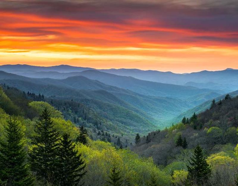
Morning mist sitting in the valleys of the Great Smoky Mountains is one of those sights that explains immediately why this park gets more visitors than any other in the country. Newfound Gap Road crosses 31 miles of that landscape, climbing through changing forest zones from Gatlinburg, Tennessee, to Cherokee, North Carolina.
The highway crosses the state line at Newfound Gap, where a stone overlook marks the ridge.
Historic stonework, overlooks, and trailheads line the route throughout. A side road to Clingmans Dome, the park’s highest point, branches off from Newfound Gap and is worth every minute of the short detour.
Spring wildflower season and fall foliage both transform the drive into something genuinely extraordinary, though both periods also bring heavy traffic.
Unlike most national parks, Great Smoky Mountains charges no entrance fee, which partly explains its popularity. Arriving early in the morning is the most effective way to beat congestion, especially on weekends.
The park also offers access to the Appalachian Trail at multiple points along Newfound Gap Road, giving hikers and drivers alike a reason to get out and stretch their legs somewhere scenic.
Arches National Park, Utah
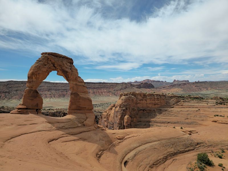
Over 2,000 natural stone arches exist within Arches National Park, which is a number that seems impossible until you are actually driving through it and spotting them everywhere. The main park road leads through areas including The Windows, Delicate Arch Viewpoint, Wolfe Ranch, and Devils Garden, each one offering a different flavor of red-rock weirdness.
Sandstone fins, balanced boulders, and towering pinnacles fill the gaps between arches.
A complete driving tour can technically be finished in about three hours without any long hikes. Realistically, congestion and packed parking lots will stretch that timeline considerably during busy periods.
Arriving before 8 a.m. or after 3 p.m. makes a significant difference in both parking availability and overall enjoyment of the experience.
Arches pairs perfectly with nearby Canyonlands and Dead Horse Point State Park for a multi-day Moab area road trip. The town of Moab sits just outside the park entrance and offers a wide range of food, lodging, and gear options.
Summers are brutally hot in the canyon country, so carrying more water than you think you will need is not overcautious. It is genuinely necessary.
Canyonlands National Park, Utah
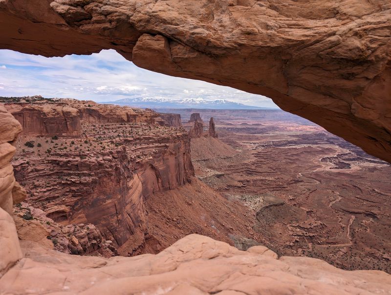
Canyonlands is Arches’ quieter, more remote neighbor, and the Island in the Sky district is the easiest place to start exploring it by car. A 34-mile round-trip paved drive crosses the top of the mesa and reaches a series of overlooks above canyons carved by the Colorado and Green rivers over millions of years.
The scale of the landscape is genuinely hard to process from ground level.
Short trails lead from pullouts toward Mesa Arch, Green River Overlook, Grand View Point, and other elevated viewpoints along the route. Mesa Arch at sunrise is one of the most photographed moments in all of Utah’s canyon country, and for good reason.
The drive itself takes two to three hours with stops, making it a manageable half-day outing that leaves time for Moab or Arches in the afternoon.
The Needles district offers a completely different side of Canyonlands and is best treated as a separate excursion rather than a same-day addition. Roads in the Maze district are primarily unpaved and require a high-clearance four-wheel-drive vehicle.
For a standard road trip without off-road capability, Island in the Sky delivers the full canyon country experience with a well-maintained paved road throughout.
Bryce Canyon National Park, Utah
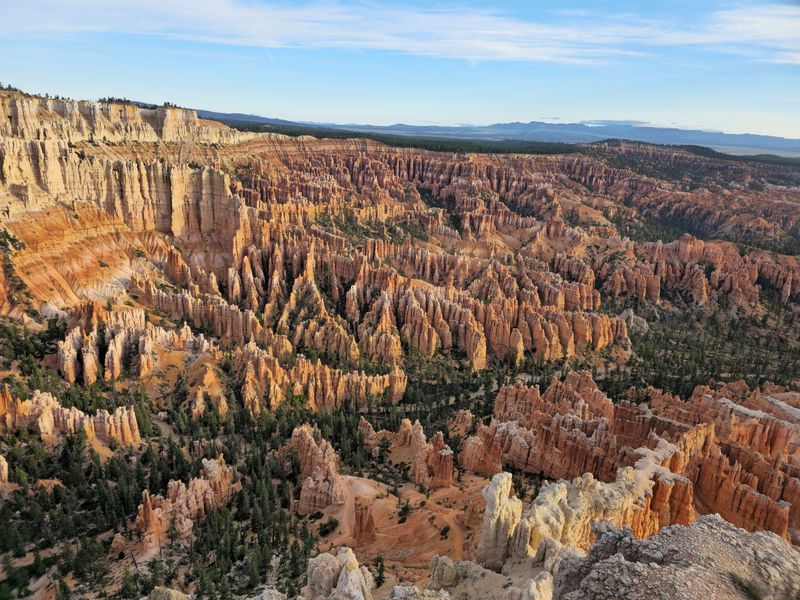
Hoodoos are the main event at Bryce Canyon, and no photograph fully captures how strange and beautiful they look in person. Thousands of these tall, skinny rock spires rise from the canyon floor in shades of orange, red, white, and purple, and the park’s 18-mile main road delivers overlook after overlook into the amphitheaters where they cluster most densely.
Bryce Amphitheater, visible from multiple viewpoints near the entrance, is the showstopper.
The smartest driving strategy is to head straight to Rainbow and Yovimpa Points at the southern end of the road first, then work your way back north, stopping at viewpoints along the way. Pullouts will be on your right side as you return, which makes stopping much easier and safer than pulling across traffic.
This simple trick is worth knowing before you arrive.
Bryce Canyon sits at elevations between 8,000 and 9,100 feet, which keeps temperatures noticeably cooler than nearby Zion or Arches. That makes it a comfortable summer drive when lower-elevation Utah parks are sweltering.
It also fits naturally into a classic Utah national parks road trip that includes Zion, Capitol Reef, Arches, and Canyonlands in one extended loop.
Death Valley National Park, California and Nevada
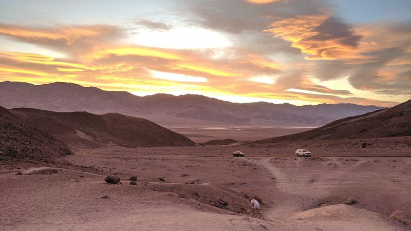
Death Valley holds the record for the hottest air temperature ever reliably recorded on Earth, 134 degrees Fahrenheit in 1913, and driving through it in summer is genuinely risky. Visit between November and April and you get something completely different: a vast, otherworldly landscape of salt flats, sand dunes, colorful badlands, and mountain passes that feels like no other park in the system.
The roads here are as dramatic as any mountain highway.
Badwater Road leads south from the main visitor area to Badwater Basin, the lowest point in North America at 282 feet below sea level. Along the way, Devils Golf Course and the entrance to Artists Drive are both worth stopping for.
Artists Drive is a nine-mile one-way paved loop through volcanic hills painted in shades of green, yellow, purple, and pink by different mineral deposits.
Flash floods can damage or close roads in Death Valley even outside the summer heat season, so checking current road conditions before each day’s drive is essential. Cell service is limited throughout most of the park, so downloading offline maps in advance is a practical habit.
Carrying extra water, extra food, and a full spare tire is standard preparation for any Death Valley road trip.
Joshua Tree National Park, California
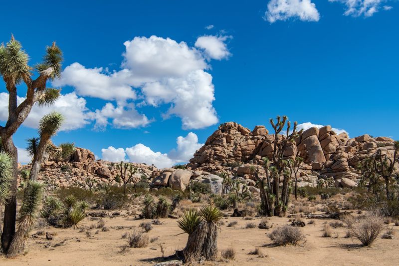
Joshua trees look like something a child drew from memory after being told to sketch a tree but never actually seeing one. They twist and branch in completely unpredictable directions, and driving through dense groves of them on Park Boulevard feels like passing through a surreal art installation that stretches for miles.
Huge granite boulder piles scattered throughout the park add another layer of visual strangeness to the whole experience.
Three separate entrances make it possible to drive through the park rather than backtracking out the same way you came in. That flexibility is one of Joshua Tree’s underrated advantages as a road trip stop.
Short trails and viewpoints along Park Boulevard can easily turn a planned two-hour drive into a full day of exploration without much effort.
One thing every visitor needs to know before arriving: Joshua Tree has no gas stations, restaurants, grocery stores, or hotels inside its boundaries. The park sits in the desert, temperatures can climb dangerously high, and help is not close by if something goes wrong.
Filling up the tank, loading up on food and water, and checking your tires before entering are not optional steps. They are the whole plan.
Share this story