There is a trail in Oregon where the river runs a shade of blue so vivid that your first instinct is to question your own eyes. Two natural hot springs sit along the path, ready to warm your tired legs after miles of hiking through old-growth forest.
The scenery shifts constantly, from thundering waterfalls to glassy pools that reflect the sky like a mirror. This is not a trail that shows off all at once.
It earns your attention mile by mile, rewarding every step with something worth stopping for. The McKenzie River Trail is one of Oregon’s most beloved routes, and once you walk it, you will understand exactly why people keep coming back.
Where the Trail Begins: Location and Access
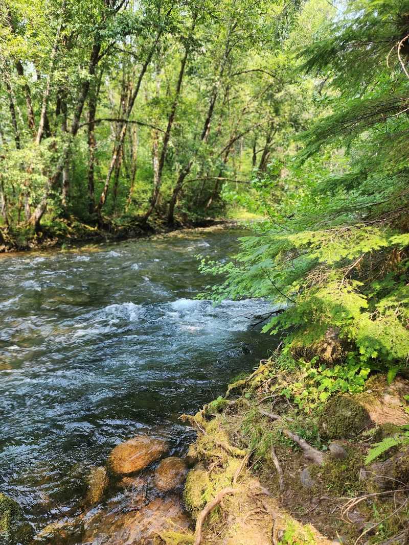
The McKenzie River Trail runs through the Willamette National Forest in Lane County, Oregon, with the postal code 97413 associated with the McKenzie Bridge area nearby.
The trail stretches roughly 26 miles along the McKenzie River, starting near the town of McKenzie Bridge and ending at the Clear Lake trailhead to the north.
Most hikers access the southern trailhead from Highway 126, which cuts through the heart of this forested valley.
The coordinates place the trail at approximately 44.1878, -122.0790, deep in the Cascade Range foothills where cell service is limited, so downloading an offline map before you go is a smart move.
The nearest town with services is McKenzie Bridge, which has a small store and a handful of lodges.
Eugene, Oregon, sits about 50 miles to the west and serves as the closest major city for gas, groceries, and gear.
Parking at the trailheads is free, though a Northwest Forest Pass is required at certain access points, so check the current requirements before your visit to avoid a surprise ticket on your windshield.
The Unreal Blue of the McKenzie River
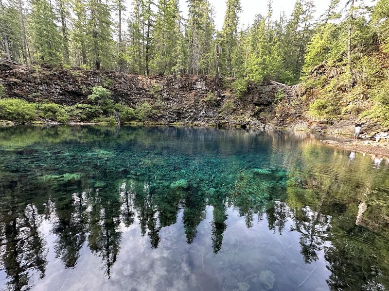
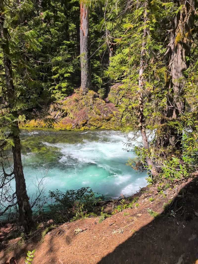
Few things in nature prepare you for the color of the McKenzie River on a clear day.
The water runs a deep, electric blue-green that looks almost computer-generated, and the reason behind it is genuinely fascinating.
The river draws much of its flow from underground springs fed by ancient lava fields, which naturally filter the water to an exceptional level of clarity.
That clarity, combined with the depth of certain pools and the way sunlight angles through the forest canopy, produces a color that sits somewhere between teal and sapphire.
Photographs barely do it justice, and first-time visitors often stop mid-stride just to stare at it for a moment.
The water stays cold year-round, typically hovering between 34 and 50 degrees Fahrenheit depending on the season, which means swimming is more of a brave choice than a casual one.
Still, plenty of hikers dip their feet in at the rocky banks just to say they did it.
The color is most dramatic on sunny mornings when the light hits the surface at a low angle and turns the whole river into something that feels almost too beautiful to be real.
Terwilliger Hot Springs: The First Soak
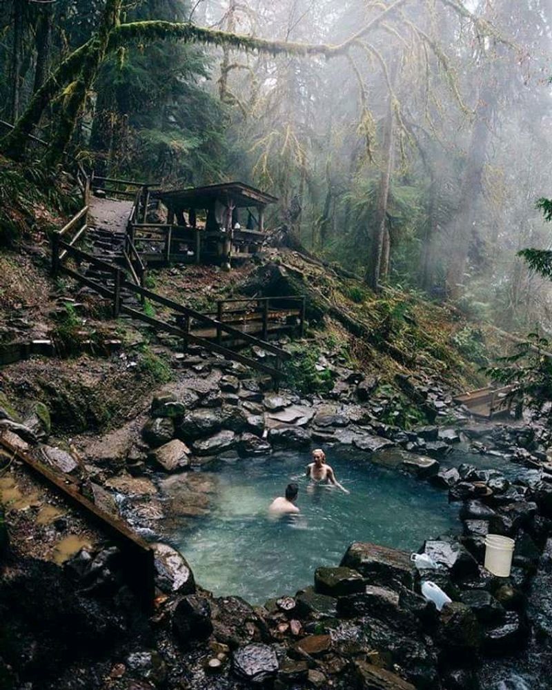
Terwilliger Hot Springs, also known locally as Cougar Hot Springs, is one of two geothermal soaking spots along the McKenzie River corridor, and it has built a devoted following over the decades.
A short hike of about half a mile through a mossy, fern-lined trail leads you to a series of tiered rock pools, each one slightly cooler than the one above it.
The hottest pool sits at around 112 degrees Fahrenheit, which is firmly in the “ease in slowly” category.
The lower pools cool to a more manageable 98 to 104 degrees, making them ideal for a long, relaxed soak after a full day on the trail.
The setting is spectacular, with towering old-growth trees surrounding the pools and the sound of a small creek running nearby.
A day-use fee is required to enter the Cougar Recreation Area, and the parking lot fills up fast on weekends, so arriving early in the morning is strongly recommended.
The springs are managed by the Willamette National Forest, and visitors are asked to follow posted rules to help preserve the natural environment around the pools.
Bigelow Hot Springs: The Hidden Second Soak
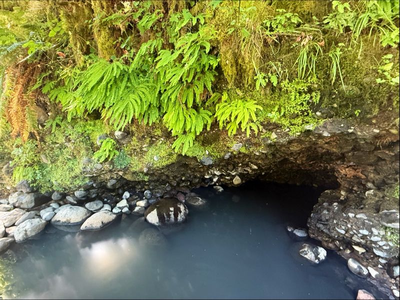
Not everyone knows about the second hot spring tucked along this stretch of the McKenzie River, which is part of what makes it feel like a reward for the more curious hiker.
Bigelow Hot Springs sits right at the edge of the river, and the contrast between the hot spring water and the icy McKenzie is something you can feel on both feet at the same time if you position yourself just right.
The spring seeps out of the riverbank and collects in a small, shallow pool before merging with the cold river current.
There is no formal developed area here, just a natural seep and a small soaking spot that fits a few people comfortably.
The temperature of the water varies with river levels and season, but it typically stays warm enough to be enjoyable even in cooler months.
Access requires a short walk from a pullout along Highway 126, and the spot is easy to miss if you are not looking for it.
Locals tend to treat it as a quieter alternative to Terwilliger, and on weekdays it is often nearly empty, which makes the whole experience feel wonderfully private.
Waterfalls Along the Way
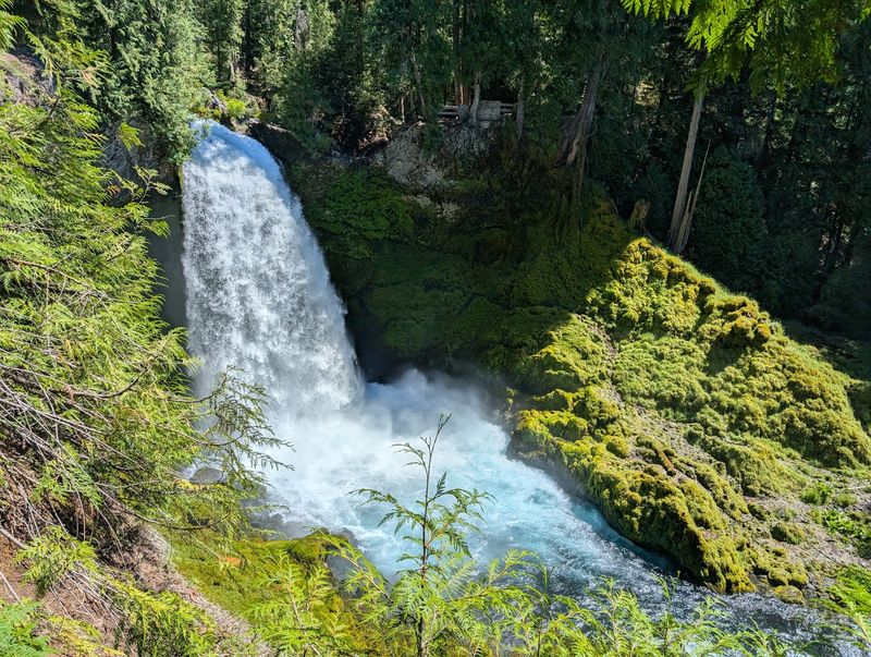
The McKenzie River Trail is not shy about showing off its waterfalls, and two of the most dramatic ones sit close together near the northern end of the trail.
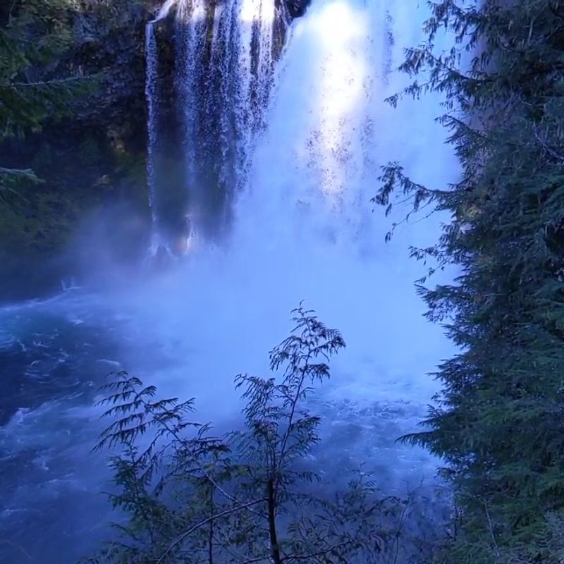
Sahalie Falls drops about 100 feet over a basalt lava ledge, sending a roaring curtain of white water into a churning pool below.
The sound alone is enough to stop you in your tracks, and the mist that drifts up from the base coats everything nearby in a fine cool spray.
Just a short walk downstream, Koosah Falls offers a slightly shorter but equally powerful drop, with the river pushing through a narrow volcanic channel before spreading wide again.
Both falls are accessible via a well-maintained loop trail that most hikers can complete in under an hour.
The viewpoints are close to the water, which makes for dramatic photographs without requiring any technical skill to reach them.
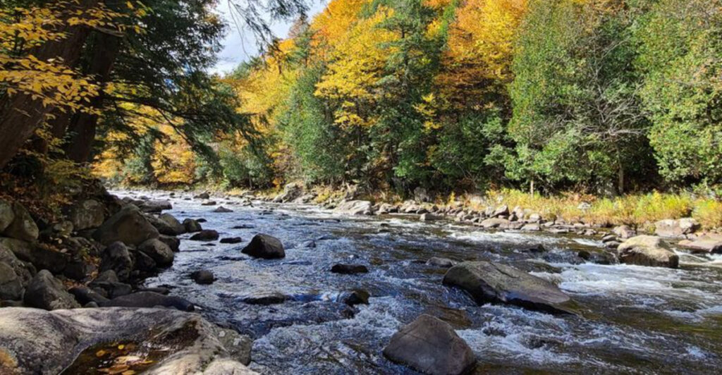
Autumn is a particularly rewarding time to visit, when the surrounding maples and alders turn gold and orange and frame the white water in a way that feels almost theatrical.
Spring snowmelt pushes the flow to its highest and most powerful, which creates a completely different but equally impressive experience.
Clear Lake: Where the River Is Born
At the northern end of the McKenzie River Trail sits one of the most quietly astonishing places in all of Oregon.
Clear Lake formed roughly 3,000 years ago when a lava flow dammed the ancestral river, and the cold spring water that fills it is so clear that you can see submerged ancient trees still standing on the lake bottom.
Those trees have been preserved by the cold, oxygen-poor water for thousands of years, which gives the lake an almost otherworldly quality.
The water temperature stays around 34 degrees Fahrenheit year-round, fed entirely by underground springs that bubble up from the lava fields above.
A rustic resort on the lake’s edge rents rowboats by the hour, and rowing out over the submerged forest is one of those experiences that sticks with you for years.
The trail circles the entire lake in a relatively flat loop of about five miles, making it accessible to hikers of most fitness levels.
The color of the water here rivals anything you will see on the main river corridor, and on calm mornings the surface reflects the surrounding conifers so perfectly that the whole scene looks painted.
Old-Growth Forest and Ancient Lava Fields
One of the things that makes this trail feel unlike most hiking routes is the constant presence of ancient lava beneath your feet.
The entire McKenzie River corridor sits on a vast system of volcanic rock left behind by eruptions thousands of years ago, and in several sections the trail winds directly through fields of jagged, moss-covered basalt.
The contrast between the dark, rough lava and the bright green moss that blankets it creates a visual texture that is genuinely hard to describe.
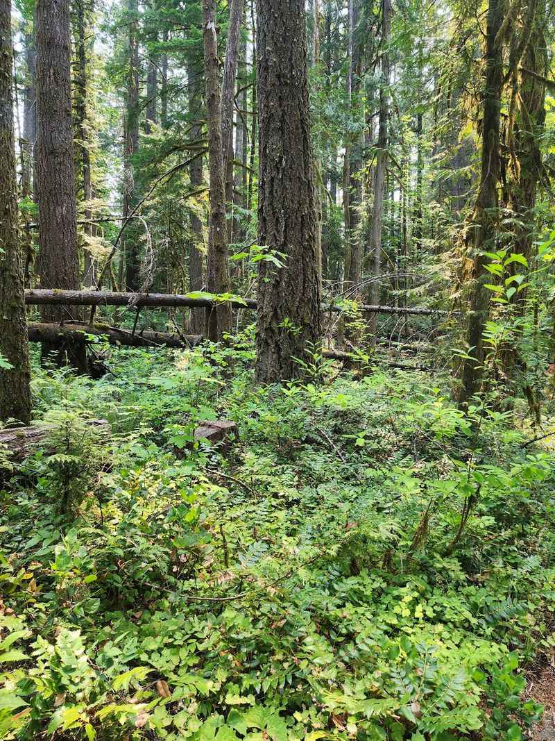
Old-growth Douglas fir trees tower overhead in certain sections, some of them reaching heights of over 200 feet and spanning several centuries of growth.
The forest floor in these older sections is dense with ferns, oxalis, and wildflowers that change with the season.
In spring, trillium blooms appear along the shadier stretches of trail, and by midsummer the whole understory is lush and dripping with green.
Birdwatchers will find plenty to slow them down, as the old-growth sections support species like the pileated woodpecker and the American dipper, which bobs along the river rocks in a way that is almost comedic to watch.
Wildlife You Might Spot on the Trail
The McKenzie River corridor is home to a surprisingly diverse range of wildlife, and paying attention to your surroundings can turn a good hike into a genuinely memorable one.
Black bears live in the area, and while sightings on the trail are not common, they do happen, particularly in late summer when berries ripen along the forest edges.
Carrying bear spray and storing food properly in your pack is standard practice here.
Roosevelt elk are another possibility, especially in the broader valley sections where the forest opens up near the river.
Osprey and bald eagles patrol the river regularly, scanning the clear water for fish with a patience that makes you feel slightly rushed by comparison.
The river itself supports healthy populations of wild trout, and in certain pools you can watch them holding position in the current without any gear at all.
Smaller mammals like river otters, mink, and Douglas squirrels are also present, though they tend to disappear quickly when they notice you.
Staying quiet and moving at a relaxed pace dramatically increases your chances of spotting something worth writing home about on this trail.
Best Times to Visit and Seasonal Conditions
The trail is technically open year-round, but the experience changes dramatically depending on when you show up.
Summer, from late June through September, is the most popular window, offering dry trails, warm air temperatures, and the best conditions for enjoying the hot springs without freezing on the walk back.
Crowds peak on summer weekends, particularly at the hot springs and the waterfall viewpoints, so a weekday visit is worth the scheduling effort.
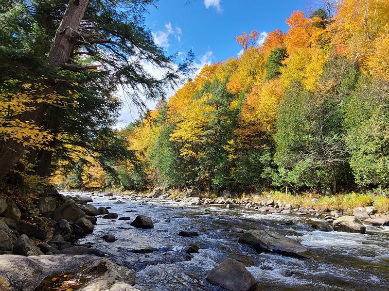
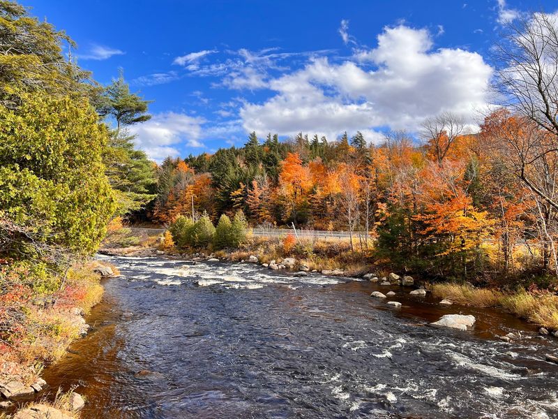
Autumn brings a quieter trail and spectacular color, as the bigleaf maples and vine maples turn gold and orange against the dark green of the conifers.
October is widely considered one of the most beautiful months on the trail, and the cooler temperatures make longer hiking days more comfortable.
Winter brings snow to the higher elevations, and some sections near Clear Lake can become icy and difficult to navigate without traction devices.
Spring is wet and lush, with waterfalls running at full power and wildflowers emerging along the lower sections of trail.
Rain gear and waterproof boots are non-negotiable from November through May, and checking road conditions on Highway 126 before you drive out is always a good idea.
Practical Tips for Planning Your Visit
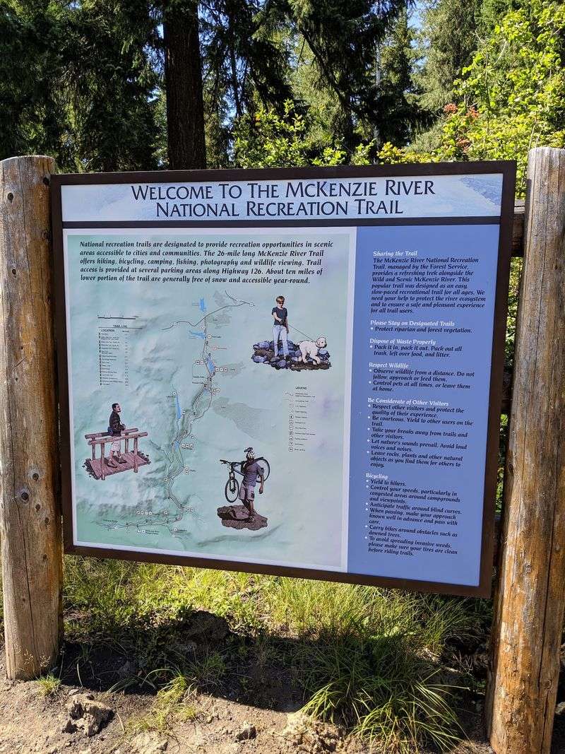
A little planning goes a long way on a trail this popular, and a few specific details can make the difference between a smooth trip and a frustrating one.
A Northwest Forest Pass is required for parking at most of the main trailheads, and it costs around $30 for an annual pass or $5 for a day pass.
America the Beautiful passes, also known as the Interagency Annual Pass, are accepted and cover the parking fee at all federal recreation sites along the corridor.
Cell service is unreliable throughout most of the trail, so downloading the area maps on the AllTrails app or a similar platform before leaving home is a practical step worth taking.
The full 26-mile trail is typically done as a point-to-point route, which requires a car shuttle or a pre-arranged pickup at the far end.
Many visitors choose to hike shorter out-and-back sections instead, targeting specific highlights like the waterfalls, the hot springs, or Clear Lake.
Bringing more water than you think you need is always smart, even though the river is nearby, since drinking directly from any natural water source requires proper filtration.
A light layer and rain jacket are worth packing even on sunny summer mornings, as the forest shade keeps temperatures cooler than expected.
A Trail Worth Every Step
Some trails earn their reputation through sheer drama, and the McKenzie River Trail does exactly that without ever feeling like it is trying too hard.
The combination of volcanic geology, ancient forest, vivid water color, hot springs, and accessible waterfalls puts it in a category that very few trails in the Pacific Northwest can match.
The fact that you can tailor your visit to a two-hour stroll or a multi-day backpacking trip makes it genuinely versatile for different types of hikers.
First-time visitors often find themselves mentally planning a return trip before they even reach the parking lot on the way out.
The trail has a way of getting under your skin, not because it overwhelms you with spectacle, but because it keeps offering quiet, specific details that reward attention.
A reflection in a still pool, a woodpecker working a snag overhead, the warmth of a hot spring after cold miles of trail, these are the things that stay with you.
Oregon has no shortage of beautiful outdoor destinations, but this one sits near the top of the list for a reason.
Give it a full day, bring good boots, and let the river do the rest of the convincing.
Share this story