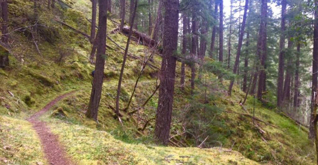
There is a trail in southern Oregon that winds through ancient forests so thick and quiet that you can almost hear the trees breathing. Old-growth Douglas firs tower overhead, the North Umpqua River roars below, and the whole place feels like it belongs to a different century.
I had been hearing about this trail for years before I finally laced up my boots and drove out to see it for myself. What I found was one of the most rewarding hiking experiences in the entire Pacific Northwest, full of waterfalls, hot springs, volcanic geology, and forest corridors that seem to go on forever.
If you love trails that reward curiosity at every turn, keep reading because this one delivers on every promise.
Where the Trail Begins: Location and Access
The North Umpqua Trail System is anchored near the small community of Idleyld Park, Oregon 97447, tucked into the Umpqua National Forest in Douglas County. The trail follows the North Umpqua River corridor for roughly 79 miles in total, but the most celebrated stretch for day hikers and weekend adventurers is the old-growth segment that covers approximately 14.5 miles of pure forest immersion.
Getting there is straightforward if you are coming from Roseburg, Oregon. Take Highway 138 east from Roseburg and follow the river upstream.
Trailheads are scattered along the highway, making it easy to pick up the trail at multiple access points depending on your time and fitness level.
The trail sits at coordinates 43.3382043 latitude and -122.7237939 longitude, placing it deep in the western Cascades. Cell service gets spotty fast, so download an offline map before you go.
Parking at most trailheads is free, though some segments near popular features like Toketee Falls require a Northwest Forest Pass.
Arriving early on weekends helps you snag a spot and enjoy the forest before the crowds filter in.
The Old-Growth Forest That Surrounds You
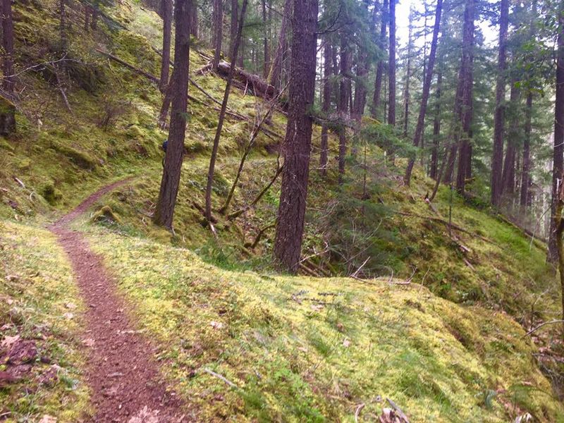
Few trails in the lower 48 states put you inside old-growth forest as completely as this one does. The trees here are not just big.
They are monumental. Douglas firs stretch 200 feet into the sky, their bark deeply furrowed and dark, while western red cedars spread their roots like slow, patient giants along the riverbank.
The forest floor is a carpet of sword ferns, oxalis, and bright green moss that coats every rock and fallen log. Bigleaf maples add splashes of gold and orange in autumn, and in spring the understory fills with trillium and bleeding heart.
The canopy is so dense in places that even on a sunny day, the light filters down in soft, broken beams.
Old-growth ecosystems like this one take hundreds of years to develop, and walking through one feels genuinely different from hiking in younger second-growth forest. The air is cooler, the sounds are softer, and the biodiversity is staggering.
Spotted owls, black bears, and Roosevelt elk all call this forest home, and patient hikers sometimes catch a glimpse of wildlife moving quietly between the trees.
The River That Never Leaves Your Side
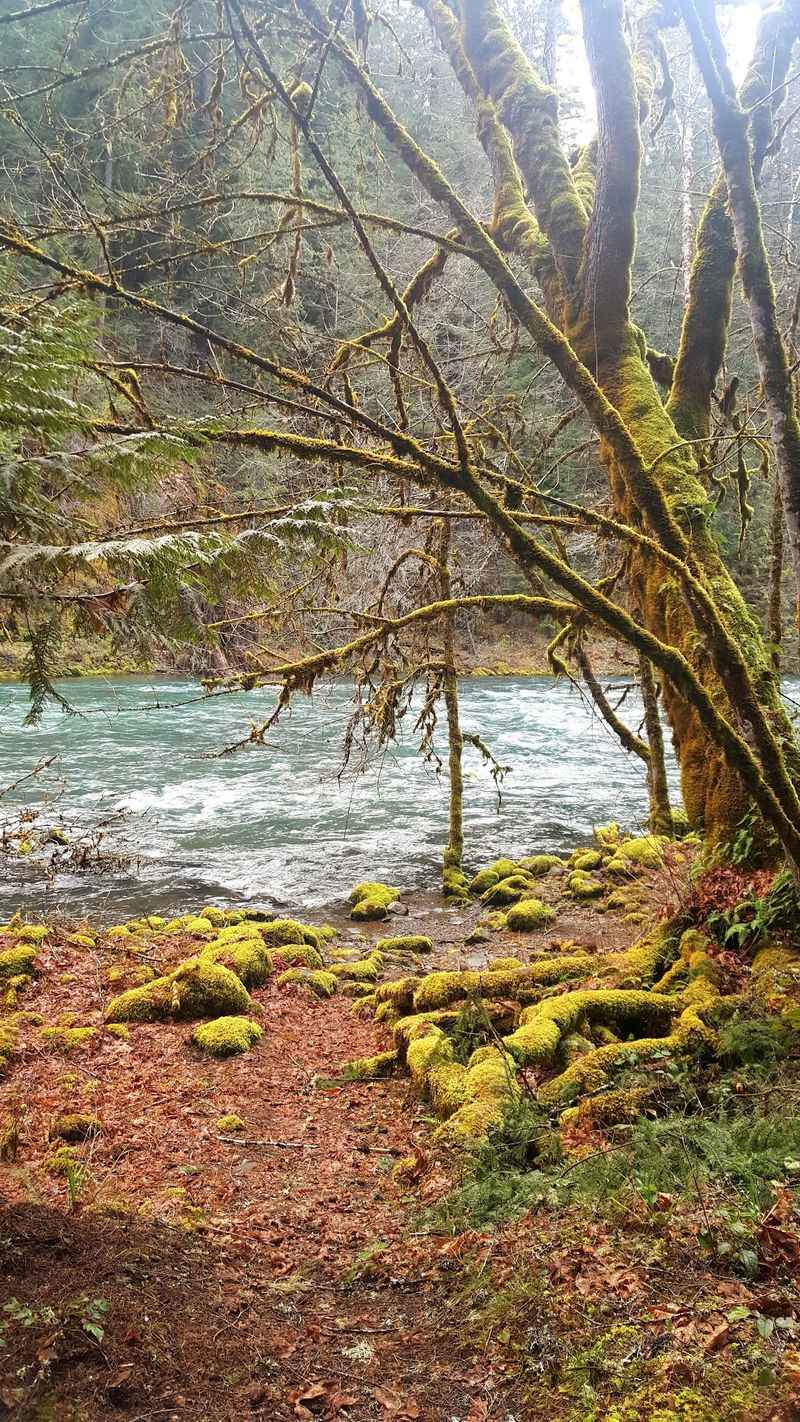
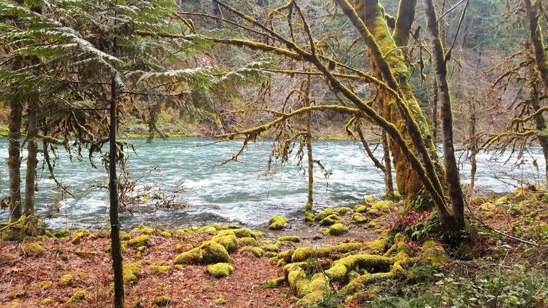
One of the things that makes this trail unlike most long-distance routes is the constant presence of the North Umpqua River. For much of the hike, the trail runs along the canyon wall above the river, and you can hear the water crashing over boulders far below.
Other sections drop right down to the bank, close enough to dip your boots in.
The North Umpqua is classified as a Wild and Scenic River, which means it is legally protected from development and dam construction along its designated stretch. The water runs a striking shade of blue-green, colored by glacial minerals and the clarity of its source.
In summer, the river drops to swimmable levels in some pools, and hikers cool off in the shallows after long miles on the trail.
The sound of the river is a constant companion. It rises to a roar at the narrows and drops to a gentle murmur in the wider pools.
That audio backdrop has a way of pulling your mind into the present moment and making the miles feel shorter than they are.
The river alone is worth the drive.
Toketee Falls: The Trail’s Most Dramatic Stop
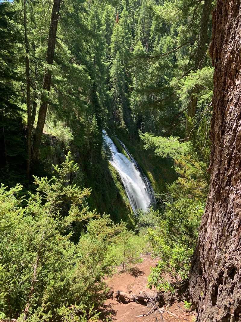
Toketee Falls is the kind of waterfall that stops you mid-sentence. The name comes from the Chinook language and roughly translates to “graceful,” which is an accurate description.
The falls drop in two tiers, first about 28 feet and then another 90 feet, into a deep basalt plunge pool framed by columnar lava walls that look almost architectural.
The short spur trail to the viewpoint is about 0.8 miles round trip from the parking area off Highway 138. Wooden stairs lead down to the viewing platform, which puts you face-to-face with the falls.
The mist reaches the platform on high-flow days, and the roar of the water fills the narrow canyon completely.
Toketee is one of the most photographed waterfalls in Oregon, and it earns that reputation every single time. The basalt columns surrounding the falls formed from ancient lava flows, and the contrast between the dark rock and the white rushing water is genuinely striking.
Plan to spend at least 30 minutes here.
Most people end up staying longer because it is very hard to walk away from a view like that.
Umpqua Hot Springs: A Natural Reward
A few miles east of Toketee Falls, the North Umpqua Trail leads to one of Oregon’s most beloved natural thermal features. Umpqua Hot Springs sits on a hillside above the river, where geothermally heated water seeps out of the ground and fills a series of small rock pools.
The temperature in each pool varies depending on how close it is to the source, ranging from very warm to genuinely hot.
Getting there requires a short but steep hike of about half a mile from the nearest trailhead. The path is well-worn but can be slippery when wet, so sturdy footwear is a good idea even if you plan to soak.
Arriving early in the morning on weekdays is the best strategy for a quieter experience, since the springs attract a steady crowd in summer.
The setting is hard to beat. The pools perch above the river with a forested hillside rising behind them, and on clear mornings the steam drifts up through the tree canopy in wispy columns.
As one visitor noted, the walk to the springs is not easy for everyone, but those who make the effort consistently say it is one of the highlights of the entire trail.
The Dread and Terror Segment
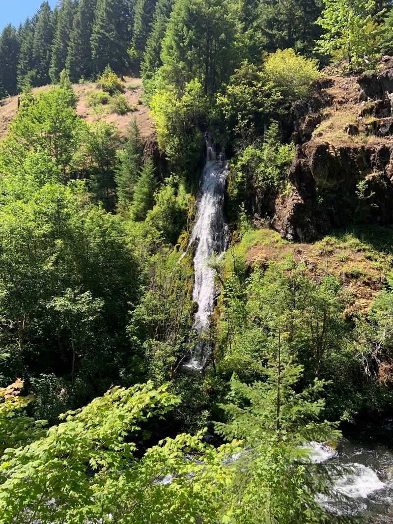
The trail segment known as Dread and Terror has a name that is both dramatic and surprisingly accurate. This stretch of the North Umpqua Trail runs through one of the wilder, less-maintained sections of the corridor and leads to the spectacular Lemolo Falls, a wide curtain of water that crashes into a steep basalt gorge.
The segment earned its nickname for a reason. The terrain is rugged, the trail is narrow in places, and downed trees occasionally block the path after winter storms.
Hikers who tackled this section during a particularly uncleared summer reported climbing over, under, and around more than a hundred fallen trees in a single outing. That kind of obstacle course is not typical, but it does happen.
Before heading into Dread and Terror, calling the Umpqua National Forest ranger station to check current trail conditions is genuinely smart advice. The forest service updates conditions regularly, and a quick phone call can save you a very long, very frustrating day.
That said, when the trail is clear, this segment rewards hikers with some of the most dramatic scenery on the entire route, and Lemolo Falls alone makes the effort worthwhile.
Wildlife and Ecology Along the Corridor
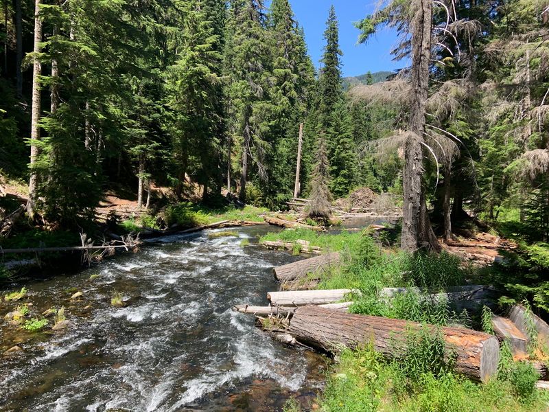
The North Umpqua corridor is a living classroom in Pacific Northwest ecology. The combination of old-growth forest, a free-flowing river, and volcanic terrain creates habitat for an extraordinary range of species.
Roosevelt elk are the most iconic residents, and their tracks are visible in the muddy sections of the trail year-round.
Black bears move through the corridor regularly, feeding on berries and salmon during the fall run. The North Umpqua is one of the few rivers in Oregon that still supports wild summer steelhead, and watching the fish hold in the current of a clear pool is one of those trail-side moments that stays with you.
Bald eagles and osprey patrol the river from above.
During the wet season, ticks are active throughout the forest, especially in brushy sections of the trail. Wearing long pants, using insect repellent on exposed skin, and checking yourself and your dog thoroughly after each hike are basic precautions that make a real difference.
Dogs should be treated with tick prevention products before entering the trail, as the dense vegetation provides excellent tick habitat from late winter through early summer.
Trail Running and Mountain Biking Potential
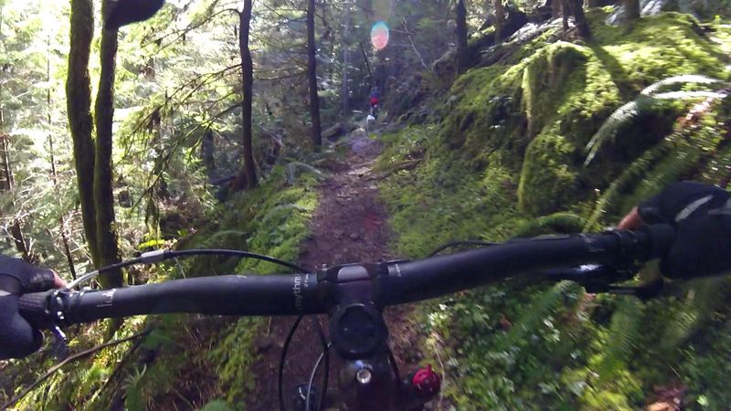
The North Umpqua Trail is not just for hikers. The corridor is divided into segments that serve different user groups, and several sections are open to mountain bikers and trail runners, making it one of the most versatile multi-use trail systems in the Pacific Northwest.
Trail runners especially love the consistent grade of many segments and the soft, forgiving forest floor.
The roughly 80-mile total length of the system means that serious athletes can string together multi-day running or riding adventures, camping at designated sites along the way. The terrain shifts enough between segments to keep things interesting, with river-level stretches alternating with ridge-top sections that open up views of the surrounding Cascade peaks.
Mountain bikers should check which segments allow bikes before heading out, since some sections near sensitive habitat or steep terrain are hiker-only. The Tioga and Panther segments are popular with riders for their flowing single-track character.
Whether you are covering miles on foot or wheels, the trail rewards a steady pace and an eye for detail.
The forest has a way of revealing something new around every bend, and that sense of discovery is what keeps people coming back season after season.
Volcanic Geology Beneath Your Feet
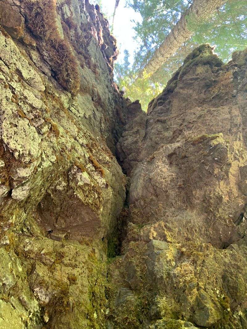
The landscape of the North Umpqua corridor is shaped by volcanic forces that go back millions of years. The Cascade Range is a chain of active and dormant volcanoes, and the rock beneath the trail tells that story in vivid detail.
Columnar basalt formations appear at multiple points along the river, most dramatically at Toketee Falls and in the walls of the Lemolo gorge.
These hexagonal basalt columns formed when ancient lava flows cooled slowly and contracted, cracking into geometric shapes that look almost too precise to be natural. The same process that created the Devils Postpile in California and the Giant’s Causeway in Ireland also sculpted the canyon walls of the North Umpqua.
Walking past them is a reminder that Oregon’s landscape is still geologically young and active.
The volcanic soil also explains the extraordinary fertility of the forest. Mineral-rich substrate supports the massive trees and lush understory that define the old-growth ecosystem here.
The hot springs are another direct expression of the geothermal energy still moving beneath the surface.
Every feature of this trail, from the waterfalls to the thermal pools to the towering firs, connects back to the volcanic foundation that built this landscape.
Planning Your Visit: Practical Tips for the Trail
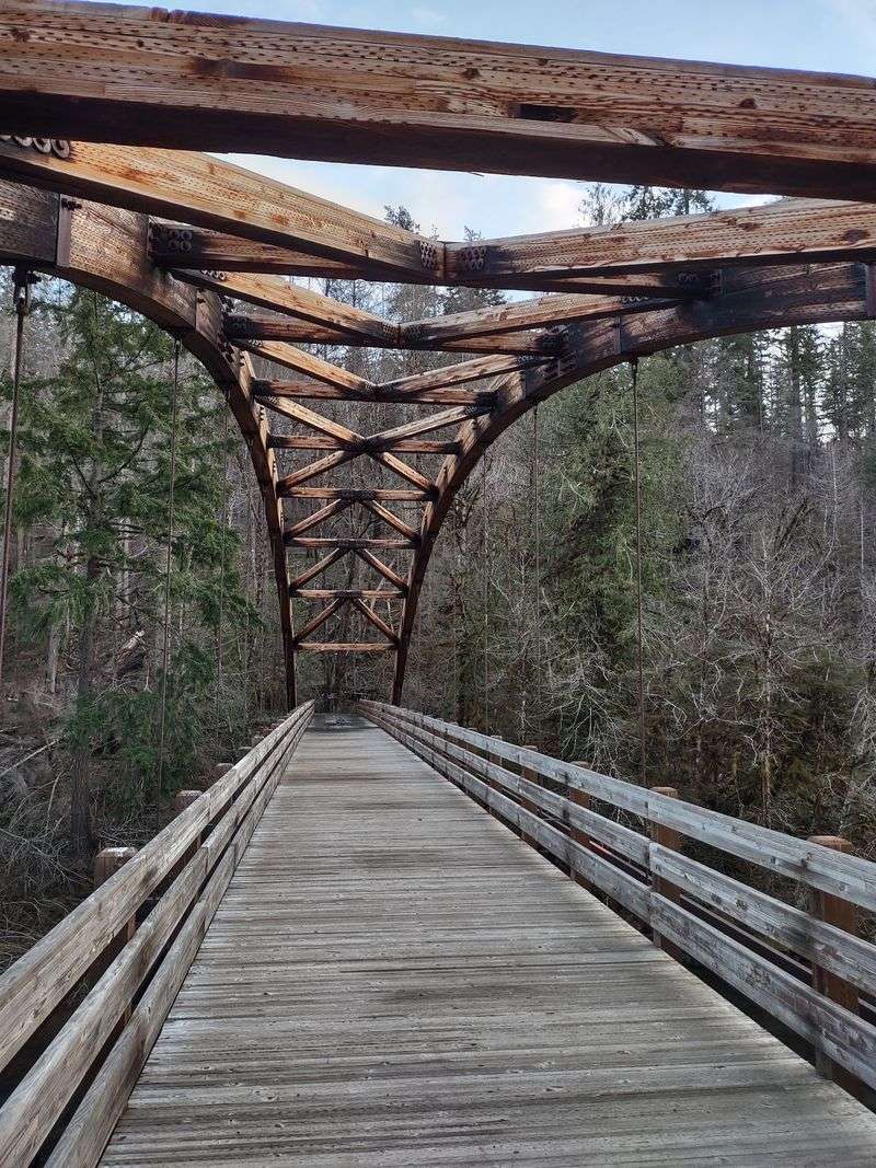
A trail system this large rewards a little planning before you show up. The best seasons to visit are late spring through early fall, roughly May through October.
Snow can linger on higher segments into June, and winter rain makes some trail sections muddy and difficult. Summer brings the most reliable conditions, though it also brings the most visitors.
Camping is available at several campgrounds along Highway 138, including Susan Creek, Horseshoe Bend, and Toketee Lake. Spending a week camped along the river and hiking a different segment each day is genuinely the best way to experience the full range of what the trail offers.
Day hikers can cover the most scenic segments, including the stretch near Toketee Falls and the hot springs, in a single long day.
Carry more water than you think you need, since the trail can be warm and exposed in summer despite the forest cover. A lightweight first-aid kit, a paper map as backup, and layers for the cool mornings are sensible additions to any pack.
The ranger district office for Umpqua National Forest can provide current conditions, permit information, and campsite availability, and reaching out before your trip is always time well spent.
Share this story