Oregon has a way of making you feel like your camera is lying to you. Some places look spectacular in photos, but standing there in person is a completely different experience.
The scale, the sounds, the colors, and the strange feeling that you’ve wandered into a different world altogether are things no screen can fully capture. These 10 Oregon spots are proof that some places you simply have to visit yourself.
Painted Hills – Near Mitchell
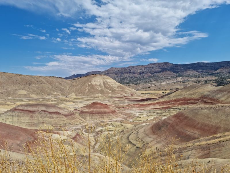
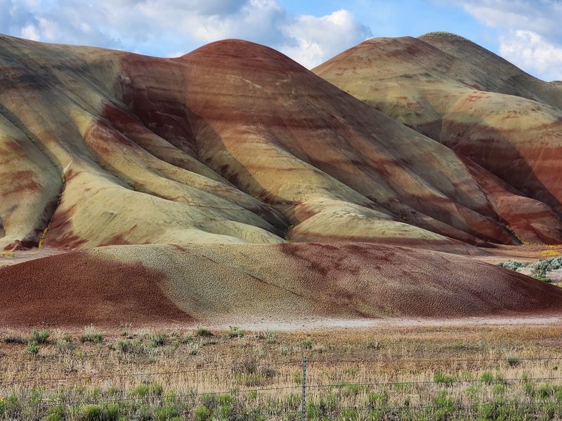
Stand in front of the Painted Hills for the first time and you’ll immediately wonder if someone touched up the colors. They didn’t.
Part of John Day Fossil Beds National Monument, these rolling formations are striped with bands of red, gold, black, and yellow earth that shift character as the light moves across them throughout the day.
Each color band tells a chapter of geological history stretching back millions of years. Late afternoon light tends to be the most dramatic, deepening reds and warming the golden layers into something almost unreal.
Photographs catch the palette but miss the way shadows sculpt the ridges into shapes that seem too smooth to be natural.
Short, accessible trails offer multiple viewpoints without requiring a serious hike. Moisture also affects the colors, making wet conditions surprisingly worth showing up for.
What really sticks with visitors, though, is the sudden realization that those decorative-looking stripes are actually ancient environmental records preserved in the earth. That detail makes the whole place feel considerably stranger than it already looks.
Crater Lake National Park
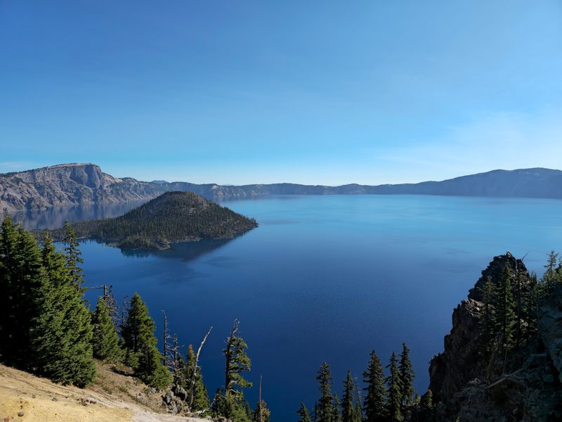
Nobody warns you quite enough about that blue. You’ve seen the photos, you’ve nodded politely at them, and then you walk up to the rim of Crater Lake and genuinely reconsider everything you thought you understood about the color blue.
It’s the kind of shade that makes you check whether someone installed a filter over your eyes.
The lake formed roughly 7,700 years ago when a massive volcanic eruption caused Mount Mazama to collapse inward. Centuries of rain and snowmelt filled the resulting caldera, creating a lake that reaches 1,943 feet deep, the deepest in the United States.
The National Park Service also describes it as one of the clearest lakes anywhere in the world, which explains the color.
Photographs communicate the hue reasonably well. They completely fail to communicate the scale.
Standing along the rim, you realize the cliffs drop sharply toward a lake stretching more than five miles across, with Wizard Island rising from the enormous blue expanse far below. On calm days the surface can look less like water and more like a painting someone left unfinished because they couldn’t improve it.
Thor’s Well – Cape Perpetua
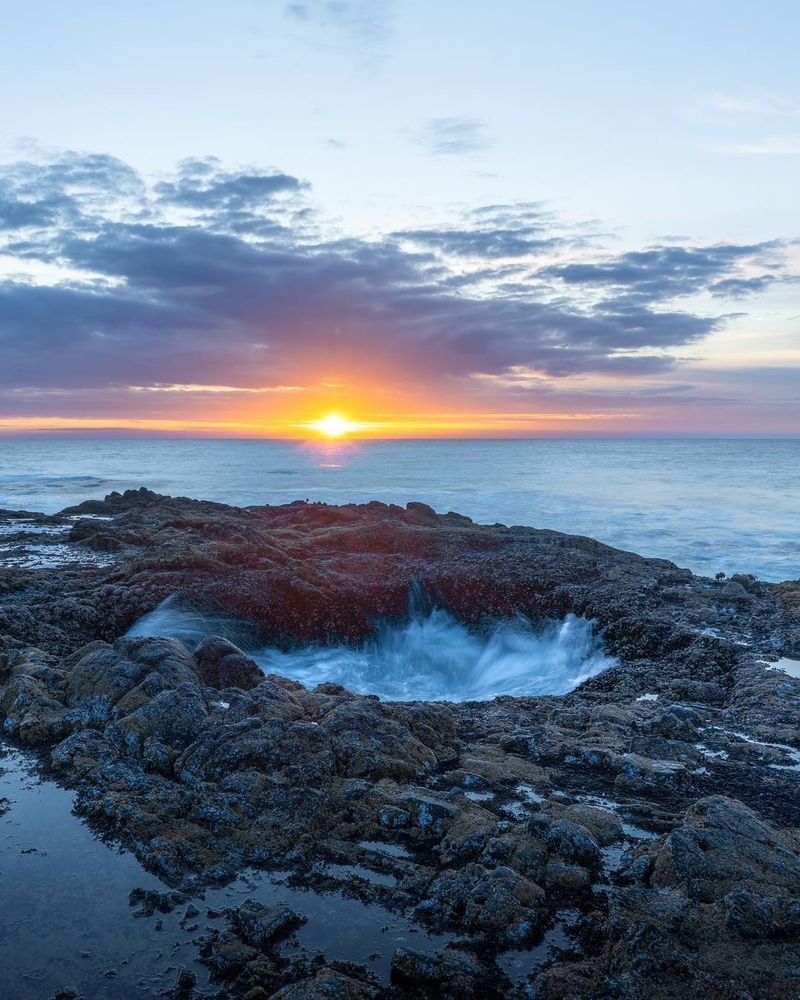
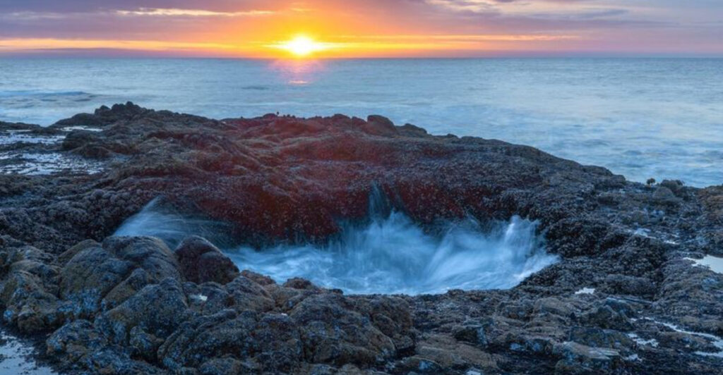
Thor’s Well looks like the ocean found a drain and decided to use it. Tucked along the rocky coastline near Yachats at Cape Perpetua, this roughly 20-foot basalt opening creates a continuous spectacle as waves surge across surrounding rock, rush into the hole, and appear to disappear entirely into the earth beneath.
It isn’t actually bottomless. The dramatic effect comes from the timing and force of incoming waves, which becomes particularly intense around higher tides.
Photographs typically freeze one spectacular moment, showing spray erupting from the opening or water cascading back down into the dark interior.
Being there is a completely different experience. The Pacific is constantly moving, crashing against basalt, retreating, and surging again while wind and salt spray fill the air around you.
The sound alone is worth the trip. Visitors should stay on designated safe areas rather than chasing a better angle, because wet basalt is genuinely slippery and coastal waves along this exposed stretch can arrive without warning.
The well earns its dramatic name. Standing nearby while it does its thing, you’ll understand why no photograph has fully captured it yet.
Tamolitch Blue Pool – McKenzie River
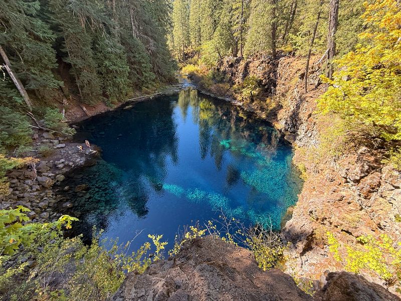
The first time hikers round the final bend and see Tamolitch Blue Pool, a few of them actually stop walking to stare. The color is that disorienting.
Turquoise water sits in a bowl of dark volcanic rock with a clarity so extreme that judging the actual depth by looking at it becomes genuinely difficult.
The pool forms where the McKenzie River reemerges after traveling underground through an ancient lava field. That underground journey filters the water to an almost absurd degree, producing the color and clarity that make every photograph of this place look heavily edited, even when it isn’t.
The roughly four-mile round trip hike follows a beautiful stretch of the McKenzie River Trail through old-growth forest.
Here’s the detail that catches most visitors off guard: the water is extremely cold. The underground lava field keeps temperatures low regardless of air temperature above ground.
Admiring the color from the rocky shore is the move here, and honestly the view is better from dry ground anyway. The trailhead gets busy during spring and summer, so an early start pays off.
Let the photos fool your friends back home. You’ll know what it actually felt like to stand there.
Oregon Caves National Monument and Preserve
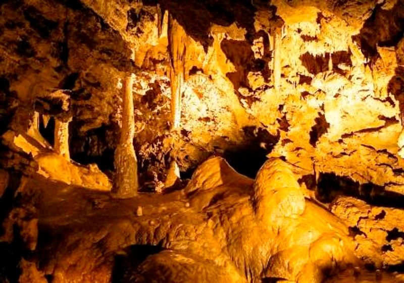
Walking into Oregon Caves feels less like entering a geological feature and more like the mountain quietly decided to swallow you. Deep in the Siskiyou Mountains, acidic water worked its way through marble over millions of years, carving the twisting chambers and passages now protected as Oregon Caves National Monument and Preserve.
The National Park Service calls them the Marble Halls of Oregon, which is not an overstatement.
Photographs show formations and narrow corridors well enough. What they cannot reproduce is the full sensory shift of entering the mountain.
Light fades. Temperature drops noticeably.
The walls close in on either side as the sounds of the outside world disappear completely. Each chamber feels dramatically removed from the Siskiyou forest you were just walking through.
Guided tours take visitors through the underground landscape rather than leaving them to peer through an entrance from outside. The guided format matters here because the cave system is complex, and the formations are best understood with context.
Oregon Caves also happens to sit in a remarkably beautiful corner of southwestern Oregon, making the drive through the Siskiyou Mountains part of the experience. Above ground you get old-growth forest.
Below it, you get something else entirely.
Alvord Desert – Southeastern Oregon
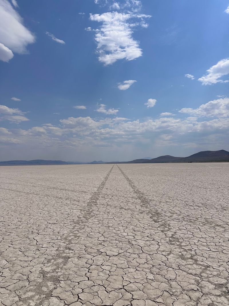
Most of Oregon prepares you for trees. The Alvord Desert prepares you for nothing, which is exactly the point.
Stretching across the eastern rain shadow of Steens Mountain in the state’s remote southeastern corner, this enormous flat playa offers a landscape so stripped down and minimal that it can feel almost confrontational in its emptiness.
Ground. Mountain.
Sky. That’s the whole composition.
Without a person or vehicle for scale, photographs of the Alvord tend to look flat and unremarkable. Stand on the playa yourself and the scale suddenly becomes the entire experience.
The horizon sits impossibly far away in every direction, and the silence has a physical quality that’s hard to describe to anyone who hasn’t felt it.
Nearby Alvord Hot Springs adds a surreal bonus to the trip, offering simple soaking pools with Steens Mountain looming overhead. Getting here requires commitment.
Southeastern Oregon is genuinely remote, with long stretches between fuel stops and few services. Bring water, check road conditions before heading out, and plan for weather that can change quickly.
The reward is one of the most otherworldly landscapes in the continental United States, experienced by far fewer people than the Oregon coast or Crater Lake.
Blue Basin – John Day Fossil Beds
If the Painted Hills look like another planet, Blue Basin belongs to a completely different solar system. Located in the Sheep Rock Unit of John Day Fossil Beds National Monument, the landscape fills a canyon with blue-green formations that seem particularly bizarre against the dry, golden tones of Oregon’s high desert interior.
The color combination reads as wrong in the best possible way.
The Island in Time Trail winds directly into the basin, eventually surrounding hikers with the formations on multiple sides. Travel Oregon describes the short route as putting visitors right in the middle of the greatest concentration of those blue-green shapes.
That enclosed feeling is something a photograph taken from the trailhead simply cannot replicate.
The color is only part of what makes Blue Basin worth the trip. This is serious fossil country.
The John Day Fossil Beds preserve an extraordinary record of prehistoric life and shifting ecosystems spanning tens of millions of years, and the canyon walls hold evidence of creatures that walked Oregon long before Oregon looked anything like it does today. Walking between those strange blue formations while sitting with that timescale makes the whole place feel genuinely humbling.
A camera captures the shapes. Being there captures the feeling.
Sea Lion Caves – Near Florence
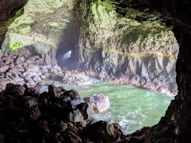
Nobody mentions the smell in the brochure. Sea Lion Caves, located along Highway 101 north of Florence, offers access to a genuinely enormous coastal cavern connected directly to the Pacific Ocean.
Visitors descend into the cave and look out across a rocky chamber where wild Steller sea lions may be gathered in varying numbers on any given day.
The experience is sensory in a way that no photograph has ever successfully communicated. There’s the sheer scale of the cavern itself, which is larger than most visitors expect.
There’s the constant sound of waves moving through the rock. There’s the barking and growling of sea lions bouncing off stone walls.
And then there’s that smell, which is authentic and memorable and absolutely not going on anyone’s Instagram caption.
The animals are wild rather than captive, meaning their presence and location vary with the season and their own preferences. That unpredictability is actually part of what separates this from an aquarium visit.
You’re stepping into their space rather than observing them in yours. Peak sea lion numbers tend to occur during fall and winter months.
The elevator ride down into the cliff adds its own slightly absurd charm to the whole experience.
Proxy Falls – Three Sisters Wilderness
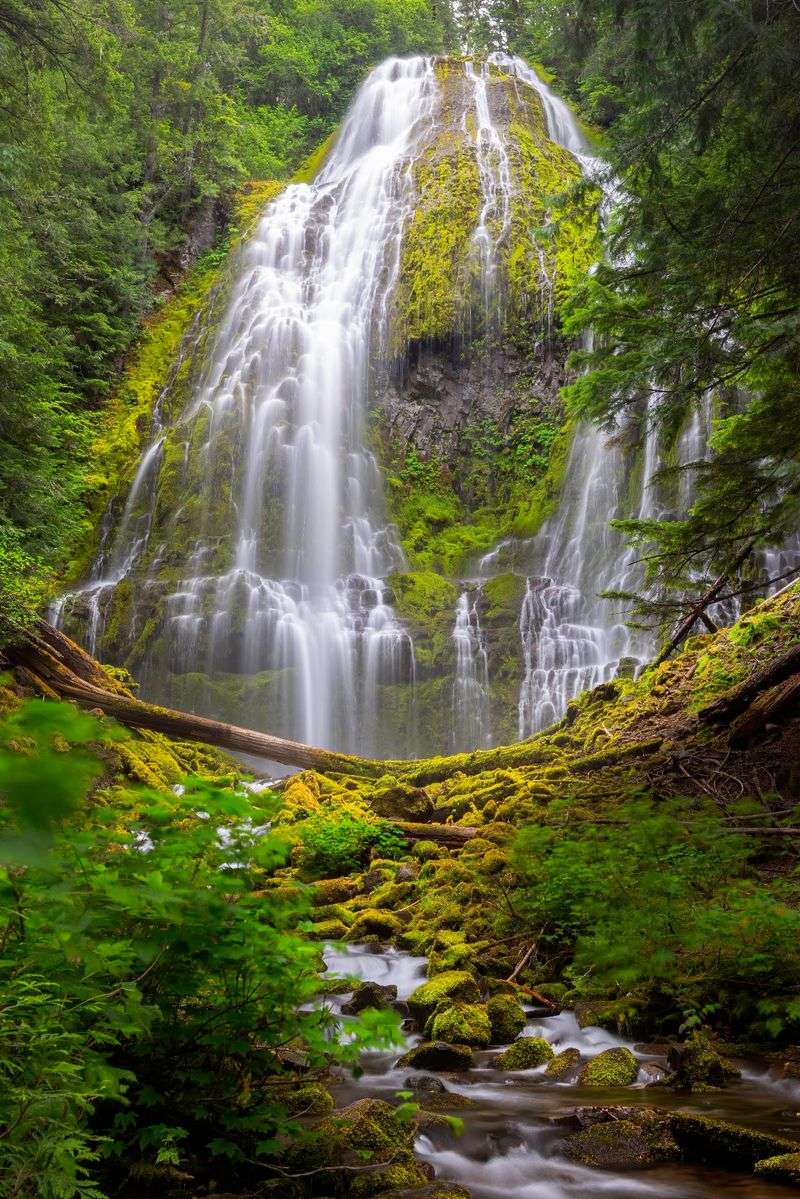
Proxy Falls looks like a waterfall designed by someone who found regular waterfalls too straightforward. Rather than dropping as one clean column, the water spreads across a wide face of dark volcanic rock covered in thick moss and vegetation, separating into dozens of delicate streams before collecting at the base.
The result is lush in a way that borders on theatrical.
A photograph captures the pattern of those streams reasonably well. Standing beneath the forest canopy adds everything the photograph leaves out: cold air carrying mist, the sound of water multiplied across the rock face, and an overwhelming density of green surrounding the falls on every side.
The scale of the basalt wall also reads differently in person than it does on a screen.
The falls sit along the McKenzie Pass corridor in the Three Sisters Wilderness, making the drive itself worth attention. This is deep Cascade country shaped by volcanic activity and blanketed in old-growth forest.
When the seasonal highway is accessible, combining Proxy Falls with other McKenzie Pass highlights, including the remarkable Dee Wright Observatory and the lava fields surrounding it, can produce one of Oregon’s most satisfying day trips. The falls are the dramatic centerpiece, but the setting earns equal credit.
Fort Rock – Central Oregon
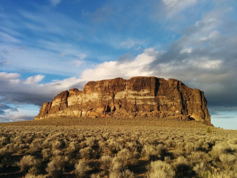
Driving through miles of Central Oregon sagebrush flats and suddenly spotting Fort Rock on the horizon produces a specific kind of double-take. The formation rises from the desert like a gigantic broken ring of stone walls, looking convincingly like a fortress built by someone with access to truly impressive materials and no interest in subtlety whatsoever.
Geologically, Fort Rock is the eroded remnant of a volcanic tuff ring formed when rising magma interacted explosively with water in an ancient lake that no longer exists. The surrounding lake has been gone for thousands of years.
The rock walls remain, rising roughly 200 feet from the desert floor and enclosing a flat interior that visitors can walk into directly.
That walk inside is the key move. From the highway, Fort Rock reads as an interesting object on the horizon.
From the interior, looking up at the curved walls against an enormous Central Oregon sky, the scale becomes something your body understands rather than just your eyes. The surrounding emptiness amplifies every dimension.
No competing skyline, no dense forest, just volcanic rock standing above the sagebrush under a sky that seems wider here than anywhere else in the state. Put the camera down for at least five minutes.
The place rewards it.
Share this story