There is a spot on the Oregon coast where the Pacific Ocean stretches out so far in every direction that you genuinely forget the rest of the world exists for a moment. Eight hundred feet above the water, standing at a stone shelter built decades ago, the horizon feels almost personal.
The trail through old-growth spruce forest is the kind of hike that rewards every step with something new, whether it is a wildflower tucked between mossy roots or a sudden gap in the trees revealing the ocean below. This article walks you through everything worth knowing about Cape Perpetua Overlook, from its history and trails to practical tips that will make your visit smooth and memorable.
Where Exactly You Are Going
The address that gets you there is Cape Perpetua Lookout, Yachats, OR 97498, sitting at the edge of the Siuslaw National Forest along Highway 101 South near mile marker 166.9.
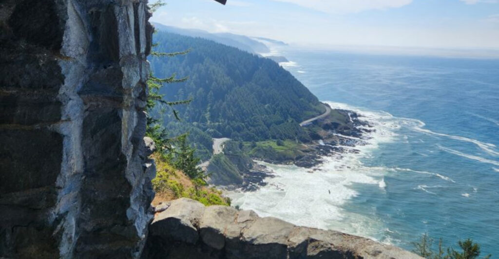
The overlook perches at 802 feet above sea level, which makes it one of the highest accessible coastal viewpoints in Oregon. From the stone shelter at the top, you can look south along a dramatic stretch of rugged coastline and scan northward toward Yachats and beyond.
The site is open 24 hours a day, every day of the week, so early risers and sunset chasers both have a fair shot at the view. A day-use fee of five dollars per vehicle applies, and you can pay at automated machines on-site, through Recreation.gov, or with an America the Beautiful Pass.
Getting here requires a two-mile drive up a winding road from Highway 101, turning at the sign for the Cape Perpetua Campground and heading uphill to the summit parking area. Keep your eyes open because the signage can be easy to miss when driving north.
The History Behind the Stone Shelter
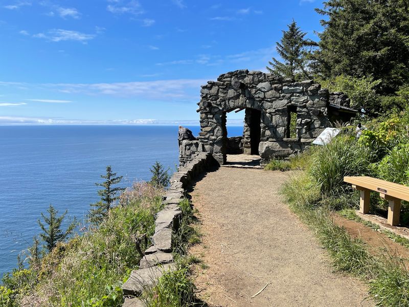
The stone structure greeting you at the top of Cape Perpetua is not just a scenic prop. It was built in the mid-1930s by the Civilian Conservation Corps, a federal work program created during the Great Depression to put young men to work on public lands across the country.
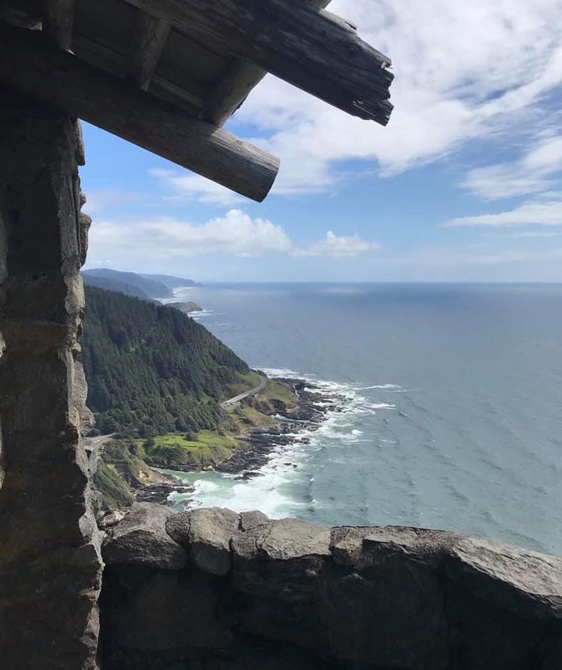
The CCC constructed the shelter using local stone, and the craftsmanship has held up remarkably well for nearly ninety years. The West Shelter, as it is formally known, sits right at the overlook and frames the ocean view in a way that feels almost theatrical.
Knowing the history adds a different layer to the experience. The workers who built this shelter had no guarantee of what their future held, yet they created something that millions of people have enjoyed long after their time.
The structure is a quiet reminder that public lands carry stories worth paying attention to.
The Cape Perpetua area was designated a scenic area by the U.S. Forest Service, and the CCC’s contributions here were part of a broader effort to make the Oregon coast accessible to everyday visitors for generations to come.
Two Ways to Reach the Top
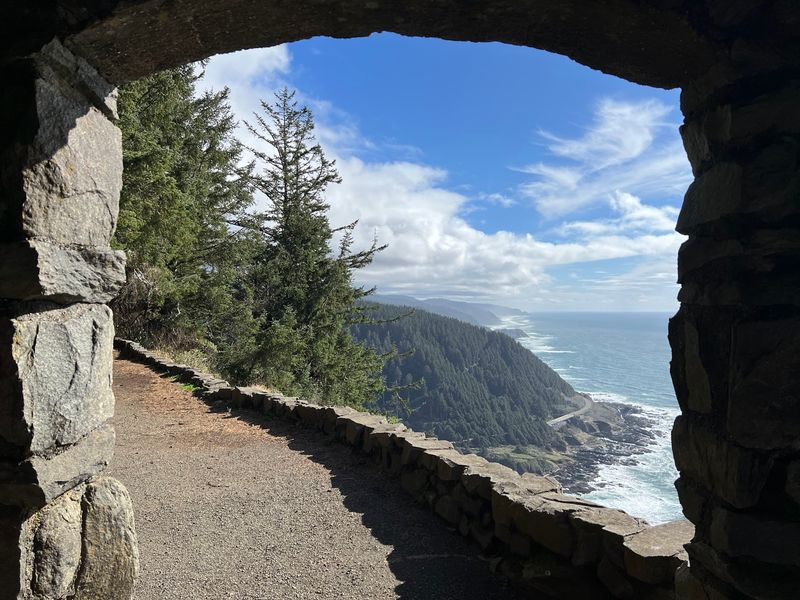
Not everyone arrives at the overlook the same way, and that is part of what makes this place work for such a wide range of visitors. The most rewarding option for active travelers is the St. Perpetua Trail, a 2.8-mile round-trip route that climbs roughly 700 feet through old-growth forest using a series of switchbacks.
The trail is in good condition and follows a fairly consistent grade, so while the climb is real, it is manageable for most reasonably fit hikers. The payoff comes in the final stretch, where the trees thin out and the Pacific Ocean suddenly fills the view ahead of you.
The second option is simply driving. A two-mile road leads from Highway 101 directly to the summit parking area, where a short, mostly flat walk brings you to the stone shelter and the overlook.
This route works well for families with young children, older visitors, or anyone who wants the view without the full workout.
Both approaches have genuine merit. Hikers get the forest experience and the earned satisfaction of the climb, while drivers get the same ocean panorama with far less effort.
There is no wrong choice here.
The Whispering Spruce Trail
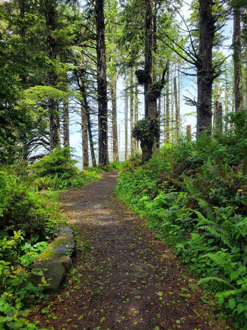
For visitors who drive to the summit, the Whispering Spruce Trail is the short connector path that leads from the parking area to the stone shelter overlook. It is easy, mostly level, and well-groomed underfoot, making it accessible for a broad range of visitors including those who are not looking for a serious workout.
The trail winds through a canopy of Sitka spruce trees that are old enough to feel genuinely ancient. The branches carry thick coats of moss, and the air has that particular cool dampness that only exists deep inside a coastal forest.
Even on a busy day, the trees absorb enough sound to make the walk feel surprisingly quiet.
Wildflowers appear along the path depending on the season, with vibrant pink foxgloves and small white blooms adding color to the otherwise green-dominated scenery. The forest floor is soft and lush, with ferns filling in the spaces between the tree roots.
The trail is short enough that even hesitant hikers finish it without complaint, and it delivers you directly to one of the most photographed views on the entire Oregon coast. The walk itself earns its place as a highlight rather than just a means of getting somewhere.
What You See From 802 Feet Up
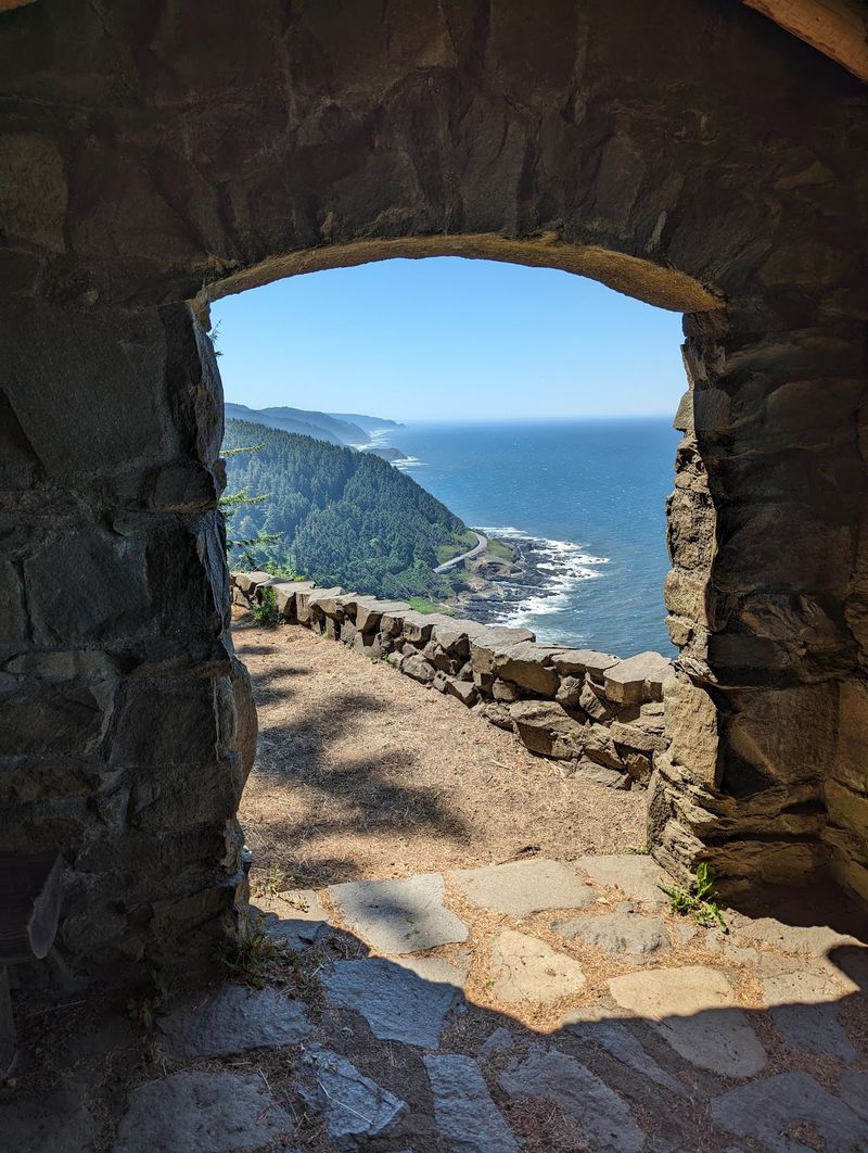
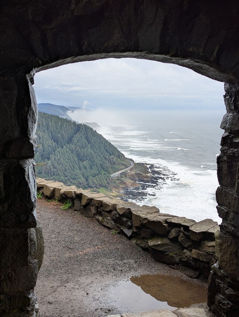
The view from the stone shelter at Cape Perpetua Overlook is the kind that makes people go quiet for a minute before they reach for their cameras. The Pacific Ocean spreads out from directly below all the way to the horizon, and on a clear day the coastline curves away in both directions for a remarkable distance.
Looking south, the rugged volcanic rock coastline comes into sharp focus, with the ocean crashing against dark formations far below. On a clear day you can pick out Thor’s Well and Cooks Chasm, two dramatic geological features that are visible from this elevation.
Devils Churn is also in the sightline, adding to the sense of scale.
To the north, the view extends toward Yachats and the broader central Oregon coast, though some tree coverage does soften that angle slightly. The elevation of 802 feet means weather plays a real role in what you actually see on any given day.
Fog and mist roll in frequently, and rather than ruining the experience, they add a moody, layered quality to the landscape that clear days cannot replicate. Either version of this view is worth the trip, just in very different ways.
Geological Features Visible From the Overlook
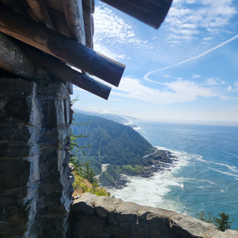
One of the quietly thrilling aspects of standing at the Cape Perpetua Overlook is being able to look straight down at some of the Oregon coast’s most dramatic natural features. Thor’s Well, Cooks Chasm, and Devils Churn are all within the sightline from the stone shelter, and seeing them from 800 feet up gives them a completely different context than standing at their edges.
Thor’s Well is a natural rock formation that appears to drain the ocean endlessly, creating a swirling, churning spectacle especially during high tide and rough surf. From above, it looks like a dark puncture in the volcanic rock shelf, with white water rushing in and out around it.
Cooks Chasm is a long, narrow inlet carved by centuries of wave action, and the force of the water rushing through it during storms is visible even from the overlook. Devils Churn operates similarly, funneling waves into a confined channel with enough energy to send spray high into the air.
These features formed from ancient lava flows that reached the coastline and were then shaped over thousands of years by the relentless Pacific. The overlook gives you the rare perspective of seeing the full coastal geology laid out like a map below your feet.
Wildlife and Nature Along the Way
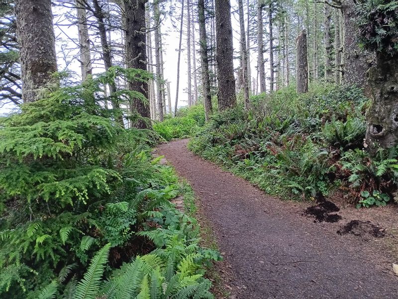
The Cape Perpetua area is not just about the views from the top. The forest and coastline surrounding the overlook support a genuinely rich variety of wildlife, and paying attention to what is around you on the trail adds a whole extra dimension to the experience.
Gray whales migrate along this stretch of the Oregon coast during spring and fall, and the elevation of the overlook makes it a solid spot for watching them spout and surface far below. Binoculars are worth bringing if whale watching is on your list, since the distance is real even from 800 feet up.
Birdwatchers show up regularly at the parking area and along the trail, drawn by the mix of coastal and forest species that overlap in this zone. The spruce forest supports songbirds, woodpeckers, and various raptors, while the coastline below attracts shorebirds and seabirds that are visible from the overlook on calm days.
The wildflowers along the St. Perpetua Trail and Whispering Spruce Trail are worth slowing down for as well, particularly in late spring and early summer when foxgloves and other coastal blooms are at their peak. The forest floor feels genuinely alive at that time of year.
Best Times to Visit and What to Expect
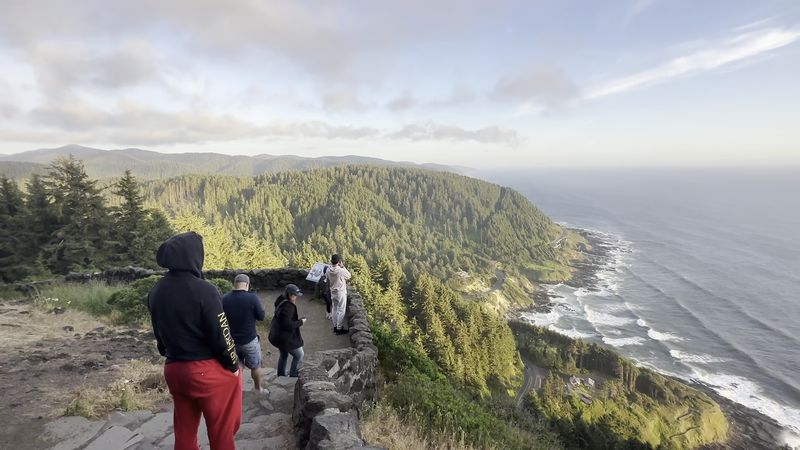
Timing your visit to Cape Perpetua Overlook takes a little strategy, especially during the summer months when the Oregon coast draws visitors from across the country. The parking area at the summit is not large, and on busy weekends it fills up faster than most people expect.
Arriving before 9 a.m. gives you a strong advantage. The lot is typically far less crowded in the early morning, the light is softer and better for photography, and the coastal air carries a cool freshness that makes the walk to the overlook feel genuinely invigorating.
By mid-morning on a sunny summer day, the lot can be nearly full.
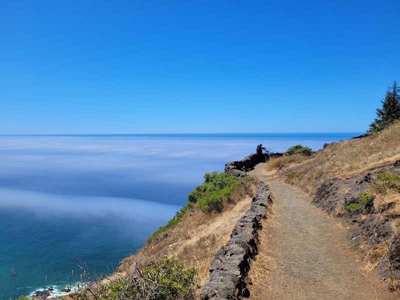
Fog is common along this section of the Oregon coast, particularly in the morning during summer months. Rather than treating fog as a reason to skip the visit, consider it part of the experience.
The misty, layered views from the stone shelter have their own character, and the forest feels especially atmospheric when clouds drift through the treetops.
Fall and spring offer a good balance of manageable crowds and decent weather, with the added bonus of whale migration season in both spring and fall bringing extra wildlife activity to the area. Winter visits are quiet and dramatic, though the road conditions deserve extra attention.
Practical Tips for a Smooth Visit
A few simple preparations make the difference between a smooth visit and a frustrating one at Cape Perpetua Overlook. The day-use fee is five dollars per vehicle, and payment options include the automated machines at the site, Recreation.gov for a digital pass, or existing passes like the America the Beautiful Pass and the Oregon Pacific Coast Passport.
The Oregon Pacific Coast Passport costs thirty-five dollars annually or ten dollars for a five-day window, which makes it worthwhile if you are planning multiple stops along Highway 101. The America the Beautiful Pass covers entry at federal sites nationwide, so it covers Cape Perpetua as part of the Siuslaw National Forest.
Footwear matters more than people expect. Even during dry stretches, parts of the trail retain moisture and can be slippery, so proper hiking shoes or trail runners are a better choice than sandals or casual sneakers.
Carrying water is also recommended, especially if you are taking the St. Perpetua Trail up from the visitor center.
A vault toilet is available at the overlook parking area, and there are picnic tables nearby for anyone who wants to eat with a view. The visitor center at the base of the road is worth a stop for trail maps and information about the area’s natural history.
Connecting to the Broader Cape Perpetua Trail Network
Cape Perpetua Overlook is the headline attraction in the area, but the surrounding trail network offers considerably more for hikers who want to extend their time here. The Cape Perpetua Scenic Area contains multiple routes that connect forests, coastline, and creek corridors into a genuinely varied trail system.
Amanda’s Trail runs approximately 2.9 miles one way from the Cape Perpetua area toward Yachats, following the coastline and offering a completely different perspective than the overlook hike. The route is named for a young Alsea woman from the 1860s, and interpretive signs along the way share the history of the Indigenous peoples connected to this land.
The Giant Spruce Trail is another popular option, a relatively flat one-mile round-trip path that leads through old-growth forest to a massive 500-year-old Sitka spruce tree near Cape Creek. The sheer size of that tree puts the age and scale of this forest into sharp perspective.
Combining two or three of these trails into a single visit turns Cape Perpetua from a quick overlook stop into a full half-day or even full-day outing. The trail signs throughout the area are clear and well-maintained, so navigation is straightforward even without a dedicated GPS device.
Share this story