Oregon’s most famous trails have a way of filling up fast, especially on summer weekends when the parking lots turn into a game of musical chairs. The good news is that the state is massive, full of hidden corners where you can actually hear yourself think.
Whether you want coastal cliffs, forest lakes, volcanic rock formations, or quiet meadows, there is a trail out there with your name on it and nobody else’s. These 10 under-the-radar hikes prove that skipping the crowds does not mean settling for second best.
Silent Creek Trail – Near Diamond Lake
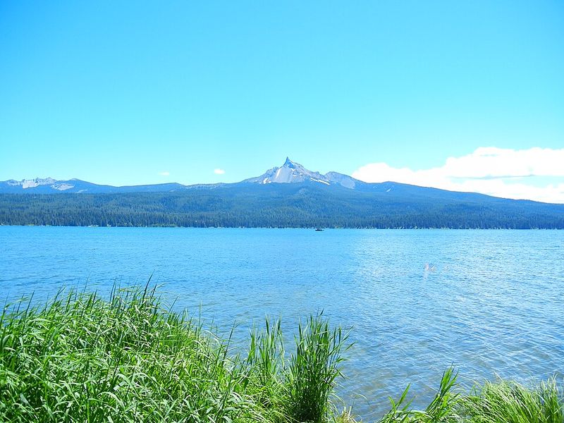
Quiet is not always easy to find near popular recreation areas, but Silent Creek Trail earns its name without any effort. This easy out-and-back hike near Diamond Lake covers about 2 miles with a barely noticeable 85 feet of elevation gain.
You follow a clear, gently moving stream through high-elevation forest, and the whole experience feels more like a nature walk than a workout.
Wildflowers pop up along the creek banks depending on the season, and one stretch of the trail opens up to a view of the sharp, distinctive peak of Mount Thielsen. Oregon Hikers currently rates the route as not crowded, calling it a peaceful alternative to Diamond Lake’s busier spots.
This trail is a great reminder that solitude does not always require a brutal climb or a two-hour drive into the middle of nowhere. Families with younger kids will appreciate the gentle terrain, and anyone who just wants to breathe fresh mountain air without bumping elbows will feel right at home.
Sometimes the best hike is the one nobody else thought to take that day.
Steins Pillar Trail – Ochoco National Forest
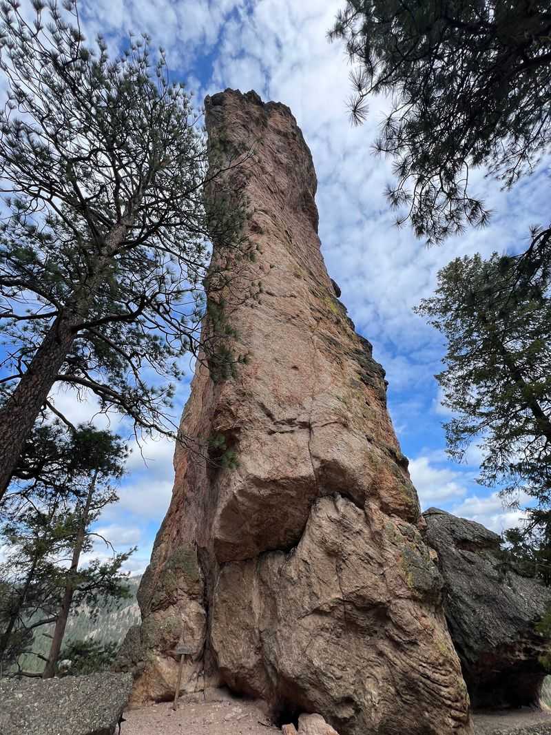
Standing beneath a 350-foot volcanic monolith has a way of making your problems feel pretty small. Steins Pillar, tucked inside Ochoco National Forest east of Prineville, is one of Central Oregon’s most jaw-dropping geological features and one of its least visited.
Travel Oregon specifically recommends it as a quieter alternative to the extremely popular Smith Rock State Park.
The round-trip trail runs about 4 miles through ponderosa pine forest and open wildflower meadows before delivering you to the base of the pillar. The rock grows more impressive with every step closer, and by the time you are standing under it, the comparison to Smith Rock feels almost unfair.
You still get strange volcanic scenery and wide Central Oregon skies, but without the crowd that tends to gather at more famous spots. The trail has a moderate feel without being punishing, making it accessible to most hikers with a bit of experience.
Pack a lunch, find a shady spot near the base, and take your time. Ochoco National Forest rewards hikers who wander off the well-worn path, and Steins Pillar is one of its best arguments for doing exactly that.
Siltcoos Lake Loop – Near Florence
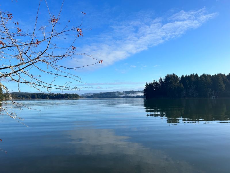
Thousands of cars roll down Highway 101 past Florence every single day, and most of their drivers have no idea a lake is hiding just off the road. Siltcoos Lake Loop is one of the Oregon Coast’s best-kept secrets, a 4.3-mile lollipop route that passes through dense coastal forest before arriving at a calm, secluded lakeshore with a handful of backcountry campsites.
Oregon Hikers rates this trail as easy and, more importantly, not crowded. The route gains about 605 feet total, which keeps things interesting without making anyone miserable.
It can be hiked year-round, which is a big bonus when summer crowds take over the coast’s famous viewpoints and beaches.
There is something satisfying about turning inland while everyone else keeps driving toward the dunes. The forest along this route has that deep, mossy, coastal richness that feels completely different from Cascade hiking.
Birds are active, the light filters through the canopy in interesting ways, and the lake feels like a reward you actually earned. If you are already making a trip to the Florence area, adding this loop to your itinerary takes almost no extra effort and pays off immediately.
Blacklock Point – Near Floras Lake
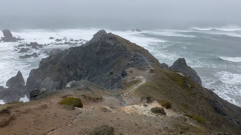
The Southern Oregon Coast gets wilder the farther you travel from the major beach towns, and Blacklock Point sits at the far end of that wildness. Starting near Floras Lake, this route moves through coastal forest, crosses open beach sections, and eventually reaches clifftop viewpoints with stunning views of natural arches, sea stacks, and open Pacific water.
Oregon Hikers calls the surrounding area one of Oregon’s most unheralded state parks.
A few things keep this trail from getting overrun, and they are worth knowing before you go. Route-finding requires attention since signs are not posted every few hundred yards.
Seasonal puddles can be significant after rain, and the beach section is not safe when high tide pushes waves directly against the cliffs. These are not dealbreakers, but they do require preparation.
Prepared hikers who check tide charts and wear waterproof boots will find something increasingly rare on the Oregon Coast: genuine space. No shoulder-to-shoulder viewpoints, no backup at scenic overlooks, just wind, waves, and rock formations that look like they belong in a nature documentary.
The trail rewards effort with scenery that feels completely unfiltered. Bring a map, check conditions, and enjoy having one of Oregon’s best coastal views almost entirely to yourself.
Bald Butte – Near Hood River
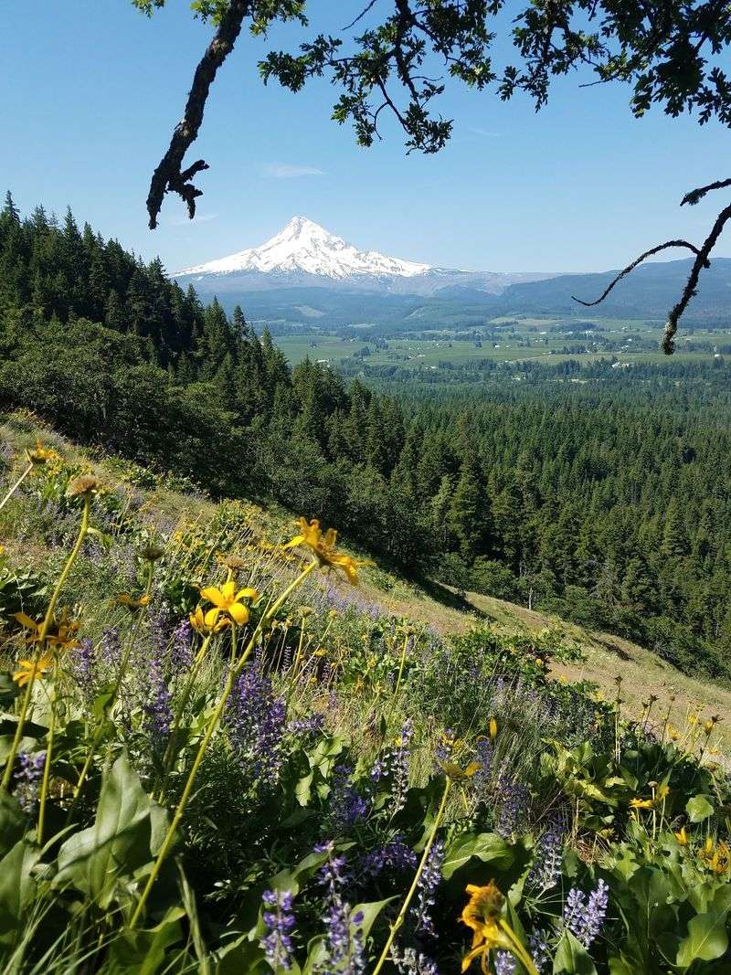
Mount Hood’s most famous trails are gorgeous, crowded, and sometimes require a permit just to park your car. Bald Butte, beginning from the Oak Ridge Trailhead near Hood River, offers a different deal: a real workout, a real view, and a real chance of having the ridge mostly to yourself.
Oregon Hikers measures the round trip at about 8.2 miles with 2,465 feet of elevation gain and rates it not crowded.
That elevation gain is doing a lot of heavy lifting in the crowd-control department. The climb moves through mixed forest and open meadows before reaching Surveyors Ridge and continuing to the former lookout site at the summit.
The variety of terrain keeps the ascent from feeling like a slog, which is a welcome detail when your legs are asking hard questions.
From the top, the Hood River Valley spreads out below in a way that feels genuinely earned. On clear days, the Cascades line up impressively across the horizon.
This is the kind of hike that reminds you why you lace up boots in the first place: not for a parking lot selfie, but for the view you worked to reach. Hood River’s famous wineries are a reasonable post-hike reward.
Golden and Silver Falls – Near Coos Bay
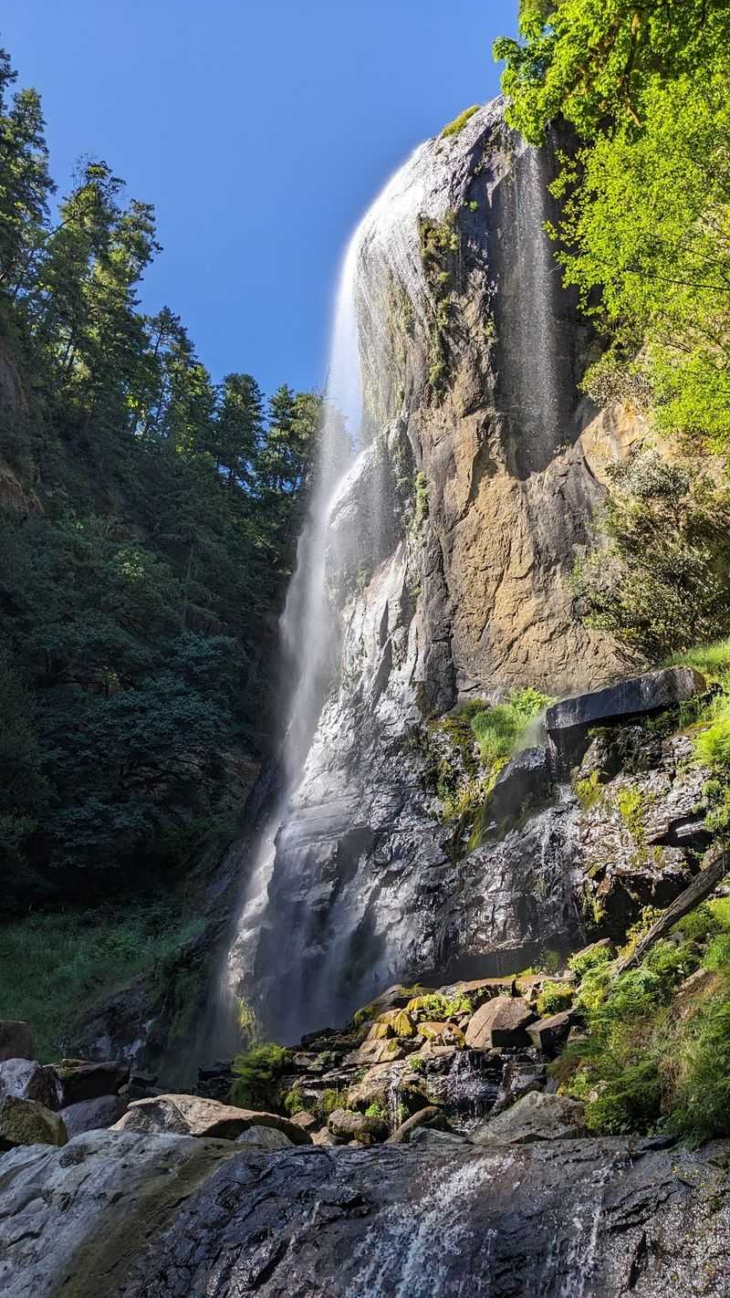
Oregon already has a famous Silver Falls, and that one gets plenty of attention. This Silver Falls, paired with its neighbor Golden Falls deep in the Coast Range east of Coos Bay, is a completely different story.
Getting here requires about 23 miles of driving east from Coos Bay on roads that discourage casual drop-ins, and that effort is rewarded with two of the tallest waterfalls in the entire Oregon Coast Range.
Silver Falls drops roughly 259 feet, while Golden Falls tumbles about 254 feet, making them the second- and third-tallest in the Coast Range according to Oregon Hikers. The trail connecting them is not crowded, and the forest surrounding both falls is the kind of dense, old-growth coastal richness that makes you want to slow down and look at everything twice.
The history adds an extra layer of interest. Part of today’s trail follows a route that was blasted through rock and turned into a wagon road back in 1901, and an automobile stage later used the same precarious path in the early 20th century.
You are walking on ground with a real story. Two enormous waterfalls, centuries-old forest, and a piece of Oregon history, all without fighting for a parking spot.
Threemile Lake South Trail – Oregon Dunes
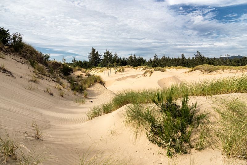
Most people who visit the Oregon Dunes come for the sand, the ATVs, and the ocean views. Threemile Lake South Trail is hiding in plain sight among all of that, and according to Oregon Hikers, it is way off the radar for most visitors.
The route is only about 1.8 miles round trip with 275 feet of climbing, making it one of the more approachable hikes on this entire list.
The trail moves through coastal forest before opening up at a secluded beach along Threemile Lake, a freshwater dune lake that can actually get warm enough for swimming during summer. That combination of forest walking and lakeside arrival is genuinely satisfying for such a short hike.
Oregon Hikers rates it not crowded, which is a remarkable thing to say about anything in the Oregon Dunes.
There is one catch worth mentioning upfront. Access via Sparrow Park Road involves significant potholes that can be rough on smaller vehicles.
Think of those potholes as a natural filter keeping the crowds away. Drivers with higher clearance vehicles will have no trouble, and the payoff at the lake is well worth the bumpy approach.
Bring a towel in summer. The swimming is a bonus you will not find at most dunes trailheads.
Marys Peak East Ridge Trail – Near Corvallis
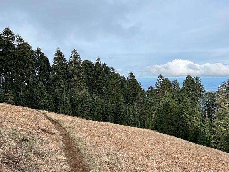
Marys Peak is not exactly a secret. At 4,097 feet, it is the tallest point in Oregon’s Coast Range, and plenty of people know how to drive toward the top.
The secret is the East Ridge Trail from Conner’s Camp, a route that earns the summit through forest rather than a parking lot, and one that Oregon Hikers currently rates as not crowded except at the summit itself.
Starting in Douglas-fir and western hemlock, the trail climbs into higher-elevation stands of noble and silver fir before breaking into the open meadows near the top. The forest transition alone is worth the hike.
Each zone feels distinct, and the canopy shifts noticeably as elevation increases. By the time you reach the summit meadows, you have actually experienced the mountain rather than just arrived at it.
On a clear day, the view stretches across an impressive lineup of Cascade peaks, from Mount Jefferson to the Three Sisters. You will likely share the summit with people who drove up, but the trail itself stays quiet.
That is a reasonable trade: solitude for most of the hike, then a shared payoff at the top. Descend back into the quiet forest when the summit gets busy.
The trees down there do not care how many followers you have.
North Island to Arch Rock – Samuel H. Boardman Corridor
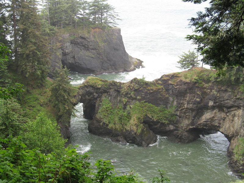
Samuel H. Boardman State Scenic Corridor is one of Oregon’s most spectacular stretches of coastline, and its highway pullouts can get busy on nice days.
What most visitors do not realize is that longer trails connect those viewpoints, and walking them feels like entering a completely different world. The North Island to Arch Rock section of the Oregon Coast Trail is rated not crowded by Oregon Hikers, which is almost hard to believe given the scenery.
A one-way version of this route covers roughly 5.6 miles through a mix of natural arches, sea stacks, coves, cliffs, forest, and secluded beaches. The trail drops into gullies and climbs back out repeatedly, including one section that descends all the way to China Beach before hauling back up toward the headlands.
It is not a stroll, and that is exactly the point.
The physical effort creates real separation from the highway crowd. Every mile walked adds more breathing room, and the Southern Oregon Coast reveals itself slowly in a way that a five-minute pullout stop never could.
Arrange a car shuttle if possible, or plan to retrace your steps. Either way, the experience of being fully immersed in Boardman’s coastline rather than just glancing at it from a parking area is worth every climb.
Enchanted Valley Trail – Oregon Coast
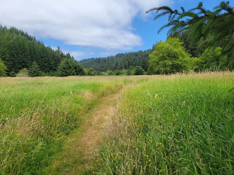
A trail called Enchanted Valley sounds like it should be overrun with tour groups and souvenir stands. Somehow, this one stays quiet.
The coastal Enchanted Valley Trail is a 3.5-mile out-and-back route with only about 80 feet of elevation gain, following an old roadbed through alder forest before opening into meadow country that feels genuinely removed from the rest of the world.
Oregon Hikers lists it as family-friendly and usable year-round, two qualities that are harder to find than they should be on the Oregon Coast. The gentle grade makes it accessible for kids, older hikers, or anyone who wants to move at a slower pace without feeling like they are missing out.
Not every hike needs to leave your legs sore to count as worthwhile.
This trail makes its case for a different kind of hiking goal: showing up, slowing down, and paying attention to what is actually around you. Birds are active along the alder corridor.
The meadow at the end has an open, unhurried quality that invites you to stay longer than planned. No summit, no waterfall, no dramatic viewpoint.
Just a quiet walk through a place that most people have not found yet. That is the whole appeal, and it is more than enough.
Share this story