Arkansas’ Buffalo National River stretches 135 miles through the Ozark Mountains, carving its way past limestone bluffs, forested valleys, and old homesteads that have stood for generations. It was the first river in the United States to receive national river status, back in 1972, which means no dams, no diversions, and no development cluttering its banks.
That kind of protection is rare, and the result is one of the most scenic and accessible wild river corridors in the entire country. From dramatic bluff overlooks to century-old general stores, the Buffalo National River corridor packs more variety into 135 miles than most states manage in their entire highway systems.
Here are 13 stops worth building a trip around.
1. Lost Valley Trailhead, Kingston, Arkansas
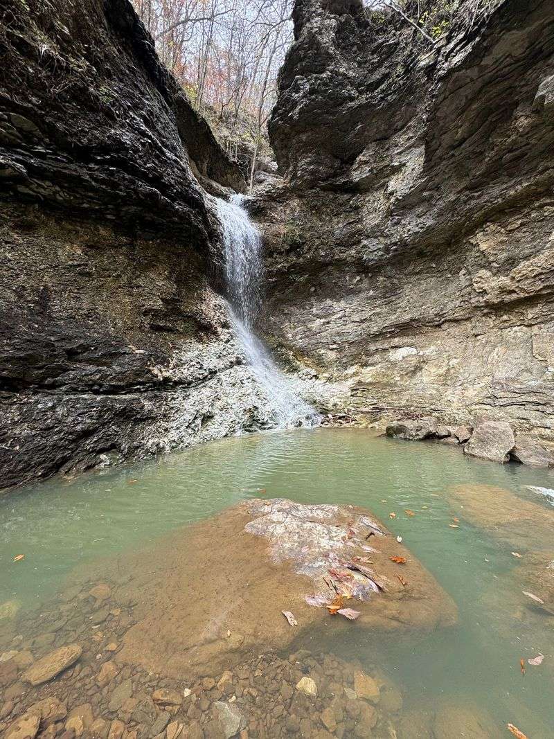
A natural bridge, multiple cave entrances, and a waterfall tucked inside a narrow Ozark canyon make Lost Valley one of the most feature-packed short hikes in the entire national river corridor.
The trail runs about two miles round trip, making it manageable for most visitors, including families with older kids. The National Park Service uses it for educational programs focused on how water shapes and reshapes the surrounding limestone landscape over time.
Hundreds of visitors have left reviews praising the variety of geological features packed into such a compact route, giving it a 4.8 rating that holds up year after year. Arrive early on weekends to secure parking, since the trailhead fills up quickly.
The cave at the end of the trail requires a short crawl, so bring a headlamp and prepare for a bit of an adventure.
2. Boxley Valley Historic District, Ponca, Arkansas
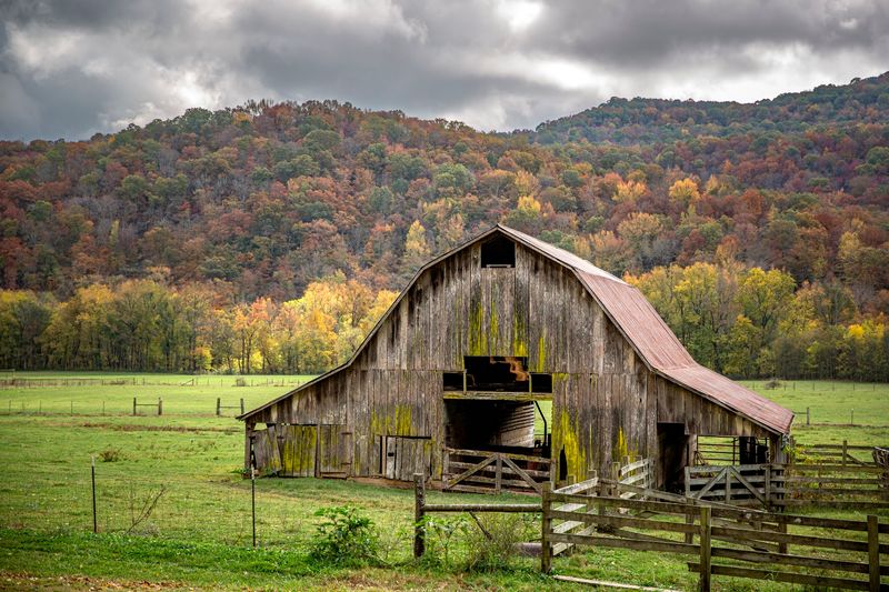
One of the most quietly impressive landscapes along the entire upper Buffalo corridor, Boxley Valley preserves a stretch of farm country that has been continuously worked since the mid-1800s.
Descendants of the original homesteading families still operate farms here today, which gives the valley a living-history quality that most historic districts can only approximate. The area features rolling fields, forested slopes, old barns, a schoolhouse, and community buildings scattered across the landscape.
Boxley Valley also holds the distinction of supporting Arkansas’s largest elk herd, and the animals are regularly spotted grazing in the open fields at dawn and dusk. Pulling over along the road at either end of the day practically guarantees a wildlife sighting.
It is the kind of place that rewards patience and a willingness to simply sit still for a few minutes.
3. AGFC Ponca Nature Center, Ponca, Arkansas
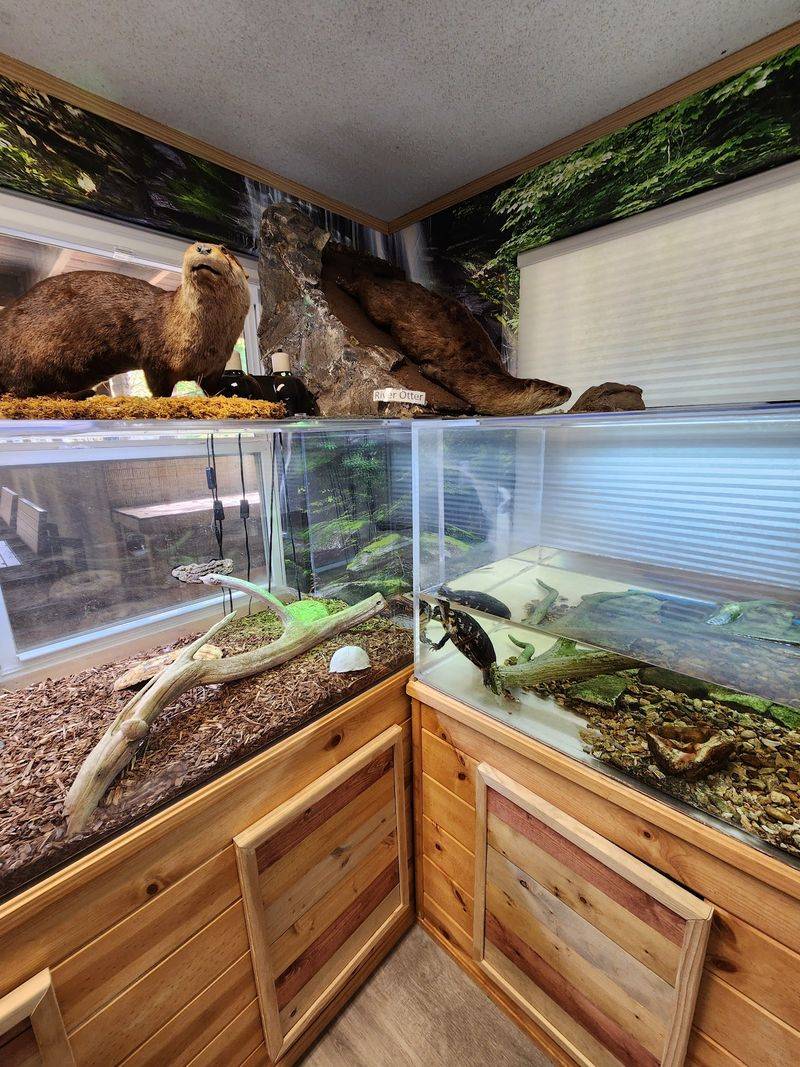
Before heading into the backcountry around Ponca, a stop at the Arkansas Game and Fish Commission’s nature center pays off in a big way, especially for anyone traveling with curious kids.
The center features exhibits focused on Arkansas elk, native wildlife, and the broader ecology of the Ozark Mountains. Rangers and staff can answer questions about current trail conditions, wildlife activity, and what to expect in the surrounding landscape, which is genuinely useful information before a hike.
Its location directly on Highway 43 makes it an easy and low-effort addition to any upper-river itinerary. The programming here is designed to be accessible rather than academic, so visitors of all ages tend to leave with a clearer picture of what makes this corner of Arkansas so ecologically distinct.
Budget about 30 to 45 minutes for a thorough visit.
4. Ponca Low-Water Bridge, Ponca, Arkansas
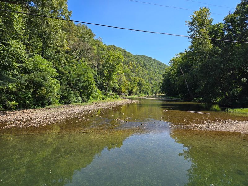
There is something almost deceptively simple about the Ponca Low-Water Bridge, a modest concrete crossing that has become one of the most photographed spots on the upper Buffalo River.
Forested ridges rise on both sides of the water, and the river itself spreads out wide and clear below the crossing, creating a scene that looks like it belongs on a postcard. The bridge also serves as a popular put-in point for floaters heading downstream toward Kyle’s Landing, one of the most scenic paddling stretches in the entire park.
River levels here can shift quickly after rainfall, so anyone planning to float should check current conditions before launching. More than 150 visitor reviews confirm that the bridge draws crowds even from people who have no plans to get on the water at all.
Sometimes the best stops are the ones that require absolutely nothing from you except showing up.
5. Steel Creek Campground, Jasper, Arkansas
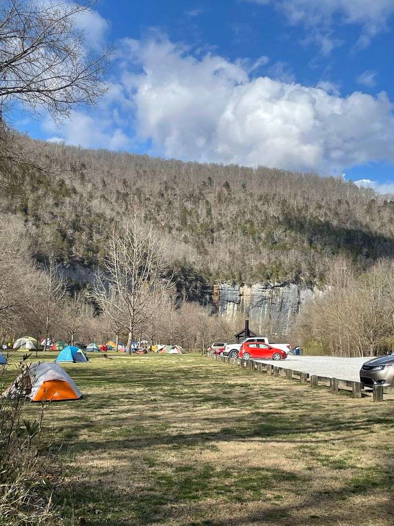
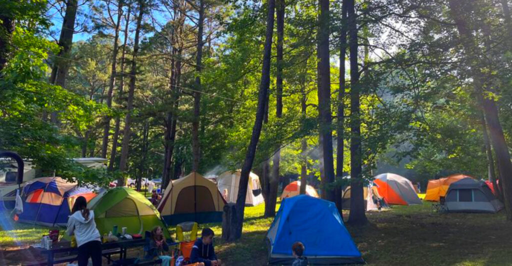
About three miles east of Ponca, Steel Creek Campground delivers a Buffalo River scene that manages to be both dramatic and approachable, with towering bluffs, river access, and a forest setting all packed into one compact area.
The campground offers 26 tent-only sites and 13 additional sites designed specifically for campers with horses or stock animals, which is a relatively rare amenity in the national river system. Flush restrooms and potable water are available seasonally, generally from mid-March through mid-November, while vault toilets remain accessible year-round.
All sites require reservations during peak season, but camping is free outside that window, which makes it an appealing option for budget-minded travelers. Beyond camping, the area draws visitors for canoeing, kayaking, swimming, and stargazing.
Even a brief stop to walk the riverbank gives a strong sense of why this stretch of the upper Buffalo is so consistently praised by visitors.
6. Big Bluff/Goat Trail, Compton, Arkansas
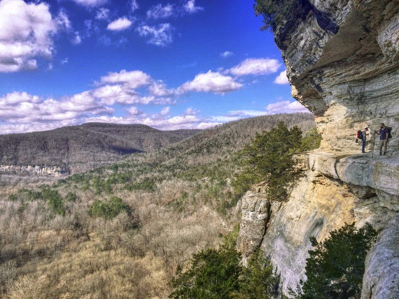
At roughly 350 to 550 feet above the Buffalo River, the Goat Trail section of the Big Bluff route offers one of the most vertigo-inducing perspectives in the entire Ozarks, and that is absolutely a selling point for the right kind of hiker.
The National Park Service is upfront about the risks here: the narrow trail hugs the edge of a sheer cliff, and this area consistently ranks among the most frequent locations for search-and-rescue incidents in the park. The round trip runs approximately six miles from the Centerpoint Trailhead, with significant elevation changes of 1,100 to 1,400 feet throughout.
Experienced hikers who come prepared with proper footwear, plenty of water, and a clear understanding of the terrain consistently describe the panoramic river-country views as worth every demanding step. This trail is not appropriate for casual day hikers or anyone uncomfortable with exposed heights.
Go in, know your limits, and plan accordingly.
7. Hemmed-In Hollow Falls, Compton, Arkansas
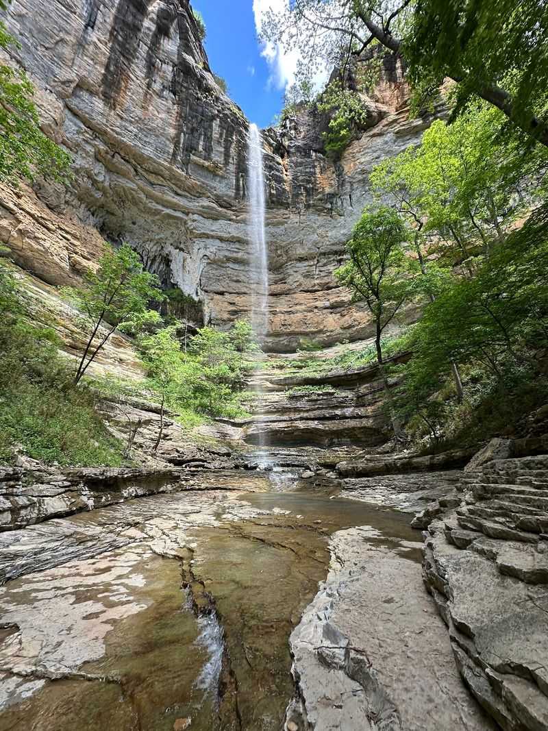
Recognized as the tallest waterfall between the Rocky Mountains and the Appalachians, Hemmed-In Hollow Falls drops approximately 204 to 210 feet over a rugged bluff wall deep inside the Ponca Wilderness.
Getting there is a genuine commitment: the route from Compton Trailhead involves a steep descent of nearly 1,400 feet over 2.5 miles, and the full round trip of about 5.5 to 5.7 miles typically takes between four and six hours. The National Park Service identifies this area as one of the most demanding in the entire park for search-and-rescue operations, which gives a clear sense of what the terrain requires.
The falls flow with the most impressive volume after significant rainfall, so timing matters. Anyone planning this hike should carry ample water, wear sturdy footwear, and start early in the day.
The payoff at the end of that descent is a waterfall that genuinely earns every superlative thrown at it.
8. Kyles Landing Campground, Jasper, Arkansas
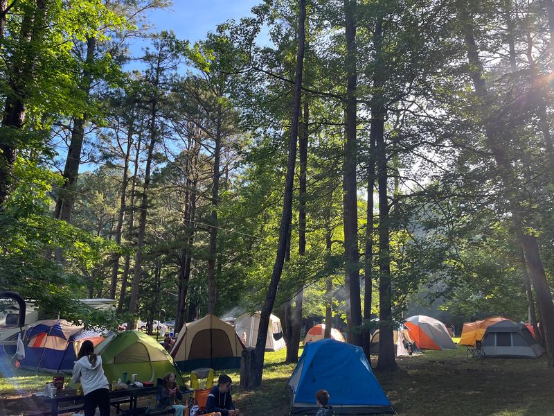
Kyles Landing sits at the downstream end of the most celebrated paddling stretch on the Buffalo River, the Ponca-to-Kyle’s Landing run, which means the campground has a built-in reputation as a destination in its own right.
The setup here is deliberately basic: tent sites come with a picnic table, fire grate, and lantern pole, and the surrounding landscape of bluffs, forest, and river does the decorating. Drinking water faucets and pit toilets are available year-round, while flush toilet facilities operate seasonally and close during winter months.
Hundreds of positive visitor reviews consistently highlight the campground’s rugged setting and proximity to both trails and the river as the main draws. The lack of electrical hookups or premium amenities is the point rather than a drawback for most people who choose to stay here.
A night at Kyles Landing is a genuine backcountry experience without requiring a multi-day backpacking permit.
9. Arkansas Grand Canyon, Jasper, Arkansas
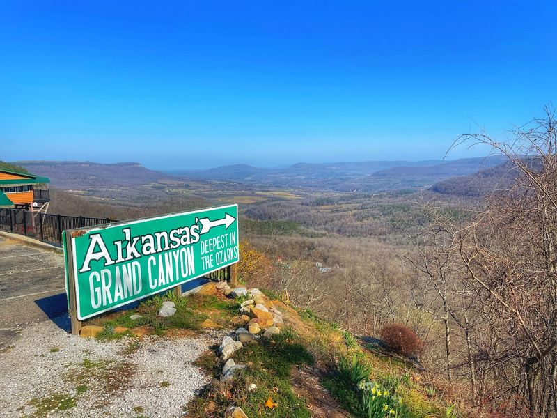
The nickname is bold, but the view from this Highway 7 overlook near Jasper backs it up with a sweeping panorama of folded Ozark ridges that stretch out in every direction with the Buffalo River winding up to 1,400 feet below.
This is a roadside stop in the best possible sense: you pull over, walk a short distance to the overlook, and the landscape does all the work. More than 1,500 visitor reviews confirm that it ranks among the most popular scenic stops in the entire Buffalo River region, and the numbers spike noticeably during fall foliage season when the ridge colors are at their peak.
There are no trails required and no gear needed, which makes it an ideal addition to a driving itinerary. The overlook is accessible from the highway without a long approach, so even travelers on a tight schedule can work it into the day without sacrificing much time.
10. Ozark Cafe, Jasper, Arkansas
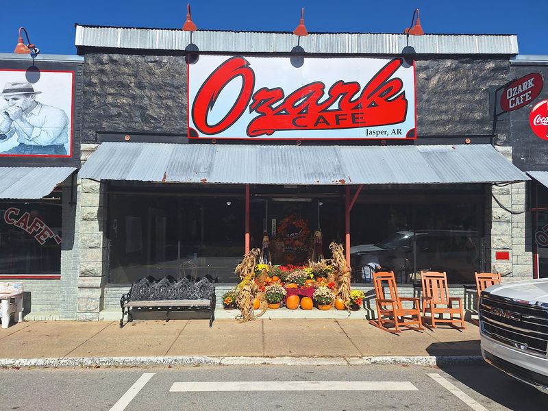
Established in 1909, the Ozark Cafe holds the distinction of being one of Arkansas’s oldest continuously operating restaurants, which means it was feeding Ozark travelers long before Buffalo National River even existed as a designation.
The menu leans into classic American diner territory, with burgers, chicken fried steak, breakfast plates, and chocolate biscuits with gravy all making regular appearances. The cafe is particularly well known for its milkshakes, and the peanut butter malt has developed a following that extends well beyond the local regulars.
New York Magazine’s Grub Street has listed it among top foodie destinations, which is a genuinely surprising accolade for a tiny diner off a courthouse square in a town of a few hundred people. Daily operating hours and thousands of visitor reviews make it one of the most reliable meal stops in the entire corridor.
After a long day on the river, reliable and delicious is exactly what you want.
11. Tyler Bend Visitor Center, St. Joe, Arkansas
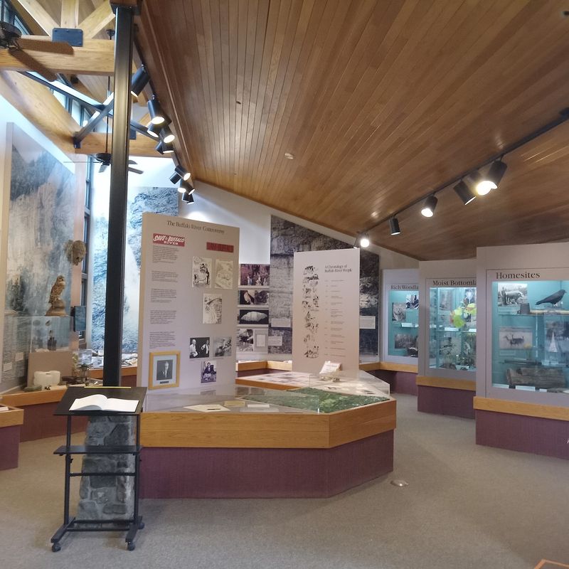
Tyler Bend Visitor Center serves as the primary information hub for the entire Buffalo National River, and it earns that role with a thorough set of interpretive exhibits covering the river’s history, its transformation into a national park in 1972, and the region’s native plants and animals.
The center includes a theater, a bookstore, and a gift shop, giving visitors a well-rounded introduction to the corridor before heading out to explore. It is open year-round, which sets it apart from many seasonal facilities in the area.
Trails and direct river access are available in the surrounding Tyler Bend area, and the nearby Collier Homestead adds a tangible historical dimension to the visit. The homestead showcases a restored 1930s Ozark dwelling that gives a concrete sense of what daily life looked like for families who once carved out a living in this rugged valley.
Budget at least an hour here before hitting the trails.
12. Gilbert General Store, Gilbert, Arkansas
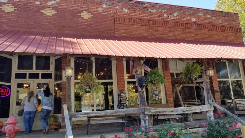
Gilbert, Arkansas has a population that hovers around 30 people, which makes the fact that its general store is listed on the National Register of Historic Places feel like exactly the kind of quirky detail this town deserves.
Originally opened in 1901 as Mays Store, the Gilbert General Store continues to sell camping supplies, groceries, fishing licenses, and souvenirs. It also houses Buffalo Camping and Canoeing, which offers canoe, kayak, and raft rentals with shuttle service, making it a one-stop logistics center for anyone planning a river float.
The adjacent Ben’s Place serves food and hosts live music seasonally, adding a social dimension to what might otherwise be a quick errand stop. Gilbert also holds the distinction of being Arkansas’s first Dark Sky Lighting Compliant City within the Buffalo National River’s International Dark Sky Park, making it an exceptional base for nighttime stargazing.
Small town, big credentials.
13. Indian Rockhouse Trail, Yellville, Arkansas
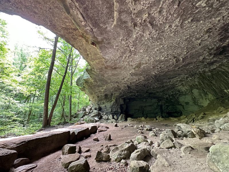
Human beings have been finding shelter under the massive limestone overhang at Indian Rockhouse for roughly 9,000 years, which puts most modern visitor centers in a rather humbling historical context.
Carnegie Institute excavations conducted in the 1930s uncovered stone tools, basketry, and food remains at the site, and the bluff shelter now features a natural skylight and an underground creek that add genuine geological drama to an already historically rich location. The 3.5-mile loop trail is rated moderately strenuous, with steep inclines, uneven terrain, and rocky footing throughout.
Along the way, hikers pass a sinkhole, a waterfall, a mine prospect, Panther Creek, sculpted bedrock, and a quarry, which means the trail delivers far more variety than its modest length suggests. As a final stop on a Buffalo River road trip, Indian Rockhouse ties together the geology, history, and rugged terrain that define this entire corridor in one well-constructed loop.
Share this story