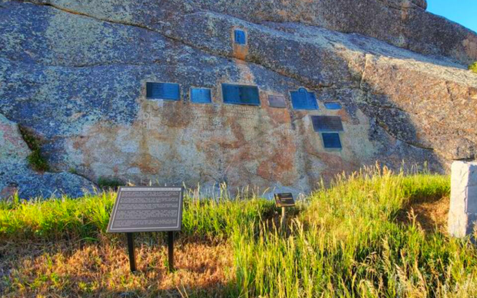
America did not expand west in a single dramatic rush. It happened trail by trail, fort by fort, mining camp by mining camp, over several decades of movement that changed the continent forever.
Wagon wheels cut grooves into solid rock. Travelers scratched their names into cliff faces.
Railroad crews drove spikes across deserts while treaty negotiators redrew boundaries that Indigenous nations had lived within for generations. The story of westward expansion is complicated, layered, and still surprisingly visible if you know where to look.
From a Missouri town that served as the launchpad for three major trails to a reconstructed California fort that stood at the center of the Gold Rush, the landmarks on this list hold real pieces of that history. Some offer sweeping views.
Others offer something far more striking: the chance to stand exactly where history unfolded and feel just how enormous that journey really was.
1. National Frontier Trails Museum, Independence, Missouri
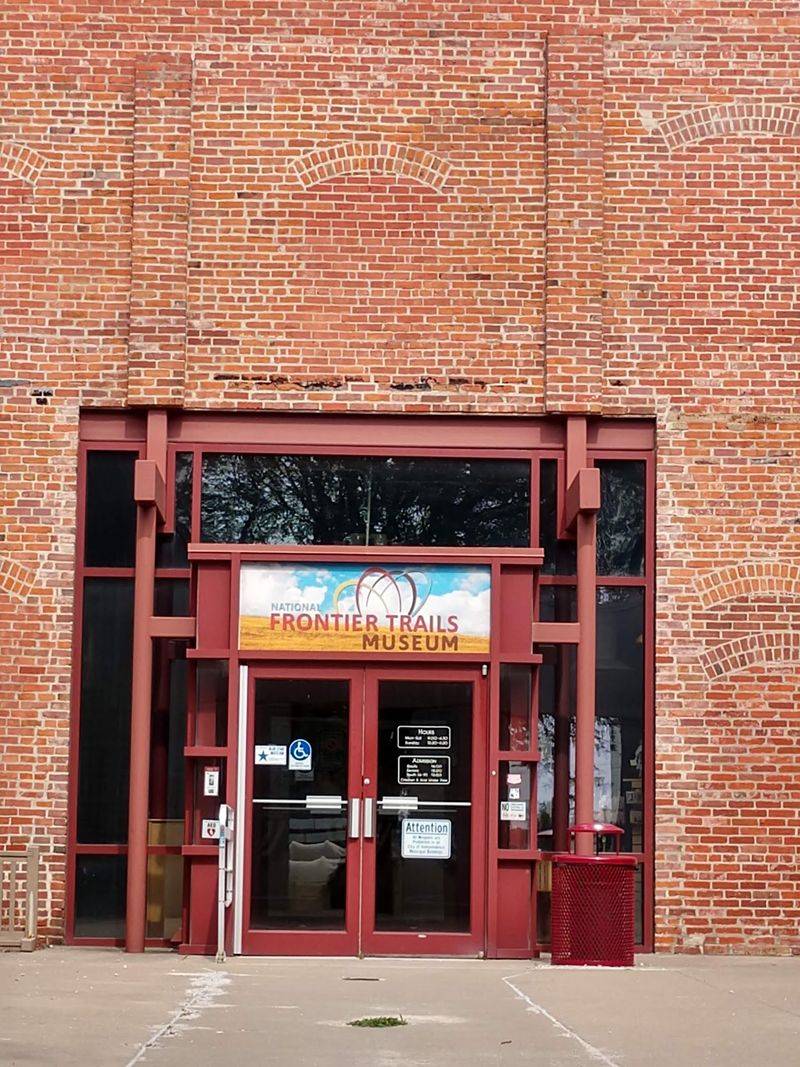
Before a single wagon wheel rolled westward, someone had to decide where the journey would begin, and for thousands of emigrants, that place was Independence, Missouri. Known as the Queen City of the Trails, Independence served as the primary departure point for the Santa Fe, California, and Oregon Trails during the mid-1800s.
The National Frontier Trails Museum is the only institution in the country dedicated entirely to all three of those routes. Its collection includes authentic covered wagons, trail artifacts, and original diaries and letters written by people who actually made the journey.
One of its most valuable resources is the Merrill J. Mattes Research Library, which holds over 2,600 first-person trail accounts.
Outside the museum, visible swales in the earth still mark where wagon traffic once passed. An award-winning introductory film sets the stage before visitors explore the exhibits, making this a genuinely strong starting point for anyone tracing the history of westward expansion.
2. Chimney Rock National Historic Site, Bayard, Nebraska
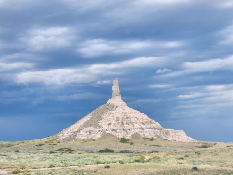
No other geological formation appears more often in Oregon Trail diaries than this one. Chimney Rock rises more than 300 feet above the North Platte River valley, its narrow spire perched atop a cone-shaped mound that was visible to travelers from miles away across the open Nebraska plains.
For emigrants who had spent weeks crossing what felt like an endless stretch of grass, spotting Chimney Rock meant real progress. It marked the point where the flat prairie began giving way to something more dramatic, and trail travelers knew the Rocky Mountains were getting closer.
Although erosion has reduced its height since the 1840s, the formation still appears remarkably similar to sketches made by emigrants more than 175 years ago. The Ethel and Christopher J.
Abbot Visitor Center houses exhibits about pioneer migration, and the rock’s distinctive silhouette even earned a spot on the 2006 Nebraska State Quarter, which says a great deal about its lasting cultural footprint.
3. Scotts Bluff National Monument, Gering, Nebraska
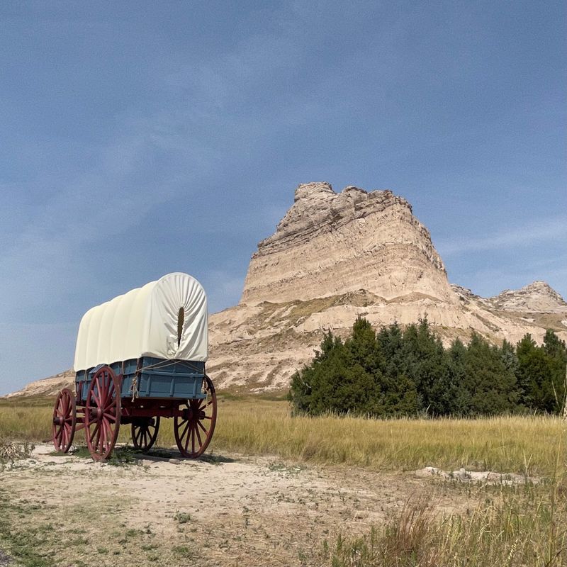
Rising roughly 800 feet above the North Platte River, Scotts Bluff is the kind of landmark that makes you stop and recalibrate your sense of scale. Native Americans had used it as a navigational reference for centuries before emigrants on the Oregon, California, and Mormon Pioneer Trails began passing through the same corridor.
Early travelers had to detour through Robidoux Pass to the south, adding extra miles to an already exhausting journey. Around 1851, Mitchell Pass opened through the bluffs directly, saving roughly 15 miles and quickly becoming the preferred route.
Wagon ruts worn into the landscape by that concentrated traffic are still visible today.
Visitors can drive to the summit, hike the 1.6-mile Saddle Rock Trail, or walk the paved Oregon Trail Pathway near the visitor center. On a clear day, the view from the top stretches nearly 100 miles west toward Laramie Peak, giving a genuine sense of how far these travelers still had to go.
4. Fort Laramie National Historic Site, Fort Laramie, Wyoming
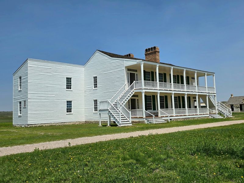
Originally a private fur trading post established in 1834, Fort Laramie grew into one of the most consequential sites along the entire length of the western emigrant trails. Travelers on the Oregon, California, and Mormon routes stopped here for supplies, repairs, and rest before pushing toward the Rocky Mountains.
When the U.S. Army purchased the fort in 1849, its role shifted.
It became a military installation deeply tied to Plains Indian relations, hosting the Horse Creek Treaty of 1851 and the Fort Laramie Treaty of 1868. Both treaties attempted to define territorial boundaries, and both were ultimately undermined as settler encroachment continued.
The fort also served as a Pony Express station and a transcontinental telegraph hub. Decommissioned in 1889 and preserved as a National Historic Site in 1960, it now contains over 22 restored structures.
Living history programs during summer months bring costumed interpreters into the buildings, adding a layer of immediacy to a site with a genuinely complicated legacy.
5. Guernsey Ruts, Guernsey, Wyoming
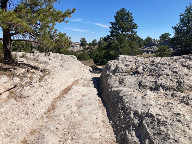
Somewhere between a geology lesson and a gut-punch of historical reality, the Guernsey Ruts are among the most remarkable physical traces left by westward migration anywhere along the Oregon Trail. Near Guernsey, Wyoming, a sandstone ridge forced wagon trains away from the North Platte River, funneling thousands of travelers through the same narrow crossing.
The result is astonishing. Repeated passage between 1841 and 1869 wore grooves two to six feet deep into the solid rock, with some sections reaching waist-to-shoulder depth.
These are not reconstructed or reinforced. They are the actual path, carved by actual wagons and the animals pulling them.
Declared a National Historic Landmark in 1966, the site is now maintained by the National Park Service and Wyoming State Parks. Visitors can walk directly along the ruts and observe the depth up close, which turns an abstract number like “hundreds of thousands of emigrants” into something you can actually measure with your own eyes.
6. Independence Rock State Historic Site, Alcova, Wyoming
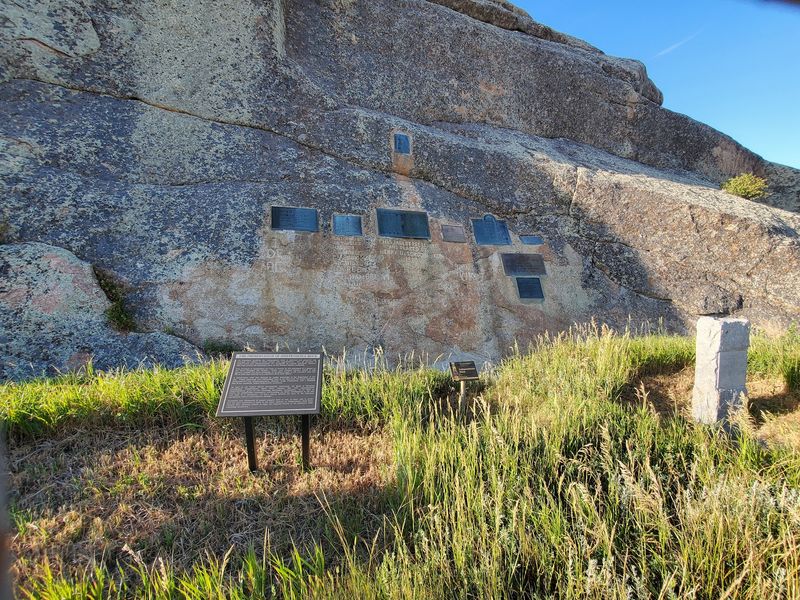
Fur trappers reportedly celebrated the Fourth of July here in 1830, which is how this massive granite dome beside the Sweetwater River got its name. For the thousands of emigrants who followed on the Oregon, California, Mormon, and Pony Express trails, reaching Independence Rock by July 4th was more than a milestone.
It was a deadline.
Arriving by that date meant travelers were on track to cross the mountains before winter. Arriving late meant real danger.
Father Pierre-Jean De Smet dubbed it the “Register of the Desert” in 1840, and the name fits perfectly. Pioneers carved their names, dates, and messages into the hard granite surface, turning the rock into an enormous outdoor record of human passage.
Today, visitors can walk a footpath around the base, read interpretive exhibits about trail history, and observe visible wagon swales in the surrounding ground. Hiking on the rock itself is permitted, though the earliest inscriptions are fragile.
Designated a National Historic Landmark in 1961, this site rewards a slow, attentive visit.
7. Fort Bridger State Historic Site, Fort Bridger, Wyoming
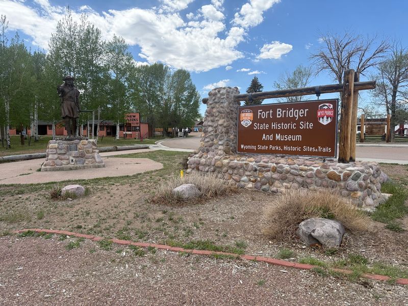
Mountain man Jim Bridger and his partner Louis Vasquez built this trading post in 1843 at a spot so strategically placed that nearly every major overland route eventually passed through it. The Oregon, California, Mormon, and Cherokee Trails, the Pony Express route, and later the Lincoln Highway all ran through this corridor in southwestern Wyoming.
The fort’s ownership changed hands dramatically over the decades. Mormon traders took it over in 1855, then burned the wooden portions during the Utah War of 1857 to prevent U.S.
Army use. The Army rebuilt it and garrisoned the site as a military installation until 1890.
The fort also hosted the 1868 Treaty of Fort Bridger, signed with the Shoshone and Bannock nations.
Now preserved as a state historic site, the 37-acre property contains 27 historic structures and four replica buildings. A reconstructed trading post, museum exhibits inside the 1888 stone barracks, and living history demonstrations make it possible to trace several distinct chapters of frontier history in a single afternoon visit.
8. South Pass City State Historic Site, South Pass City, Wyoming
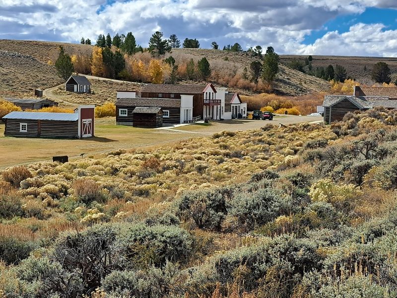
Gold has a way of turning empty wilderness into a boomtown almost overnight, and South Pass City proved that point with remarkable speed. After the discovery of the Carissa Lode in 1867, this remote Wyoming location swelled to nearly 3,000 residents by 1868 and counted over 300 buildings within its limits.
The Carissa Mine produced an estimated $7 million in gold during its peak years. When the easily accessible surface deposits ran out, deep hard-rock mining became far more difficult and expensive, and the population drained away just as fast as it had arrived.
Wyoming purchased the core of the town in the 1960s and restored it into the state historic site visitors see today.
More than two dozen historic structures remain, along with a restored Carissa Mine and Mill where visitors can try gold panning. South Pass City also carries a notable political distinction: Wyoming became the first territory in the world to grant women the right to vote in 1869, partly due to the influence of legislators connected to this community.
9. This Is The Place Heritage Park, Salt Lake City, Utah
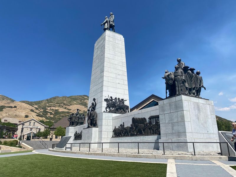
At the mouth of Emigration Canyon, with the Wasatch Mountains forming a dramatic backdrop, this 450-acre park marks the spot where Brigham Young and the first Mormon pioneer company arrived in the Salt Lake Valley in July 1847. Young reportedly surveyed the valley and declared it the right place, ending a 1,300-mile journey undertaken in search of religious freedom.
The 60-foot “This Is The Place Monument” features bronze figures of Young and other early church leaders. The park, however, covers a much broader historical canvas than pioneer settlement alone.
A Native American Village within the grounds explores the traditions of Utah’s first residents through displays, craft demonstrations, and exhibits developed in consultation with local tribal representatives.
The Heritage Village uses reconstructed 19th-century buildings and costumed interpreters to portray daily pioneer life. Monuments added in 2022 honor the first Black pioneers, including enslaved individuals who traveled with the Latter-day Saints, expanding the park’s narrative to reflect the full range of people whose experiences shaped early Utah history.
10. Golden Spike National Historical Park, Corinne, Utah
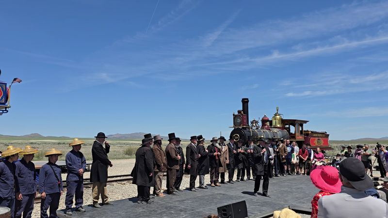
On May 10, 1869, two railroad crews met at Promontory Summit in Utah and drove the final spike connecting the Central Pacific and Union Pacific railroads into a continuous transcontinental line. What had taken wagon travelers four to six months could now be accomplished in roughly a week.
The entire calculus of westward migration changed that afternoon.
Golden Spike National Historical Park preserves the landscape around that meeting point. The park’s most popular feature is its pair of fully operational, life-size replica locomotives: the Central Pacific’s Jupiter and the Union Pacific’s No. 119, both delivered to the site in 1979.
Reenactments of the Last Spike Ceremony draw visitors who want to see the moment recreated in real scale.
The park also addresses the human labor that made the railroad possible. Over 12,000 Chinese immigrant workers built the Central Pacific’s portion of the line, often under dangerous conditions and for lower pay than their counterparts.
Visitors can walk portions of the original railroad grade and explore the historic site through auto tours and interpretive exhibits.
11. National Historic Oregon Trail Interpretive Center, Baker City, Oregon
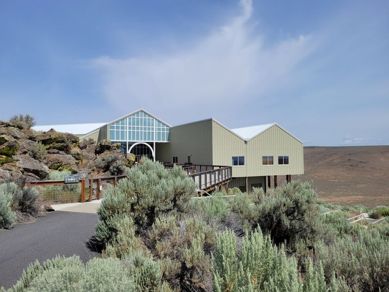
Perched on Flagstaff Hill above the Baker Valley, this interpretive center occupies a landscape that Oregon Trail emigrants crossed during the later stages of their journey. After months of travel across plains and mountain ranges, reaching this part of eastern Oregon meant the end was finally within reach, though still not easy.
The 23,000-square-foot center uses interactive exhibits, life-size dioramas, and historical displays to explore daily trail life, the roles of mountain men and guides, transportation methods, and the complex relationships between emigrants and the Native American communities whose territories the trails crossed. The outdoor component is equally strong.
Four miles of interpretive hiking trails lead to scenic viewpoints and sections of original wagon ruts still visible in the hillside. A wagon encampment area hosts living history demonstrations, and a replica gold stamp mill adds context about the mining activity that drew many settlers into the region.
The Leo Adler Theater screens films and hosts presentations that put the full scope of the overland journey into clear perspective.
12. End of the Oregon Trail Interpretive Center, Oregon City, Oregon
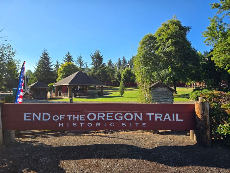
After roughly 2,000 miles of overland travel, Oregon City was where the journey officially ended for hundreds of thousands of emigrants who made the crossing between 1843 and 1869. The interpretive center at this site takes that arrival seriously, exploring not just the emigrant experience but also the histories of Indigenous peoples who had lived in the Willamette Valley long before the first wagon arrived.
Visitors can watch two notable films: “Oregon’s First Peoples,” developed in collaboration with the Confederated Tribes of the Grand Ronde, and “Bound for Oregon,” which draws directly from pioneer diary entries. Both offer perspectives that a purely emigrant-focused narrative would miss.
Interactive exhibits let visitors pack a replica wagon, try on period clothing, make butter, and dip candles, giving younger visitors a concrete sense of what daily life on the trail actually required. Outdoor spaces include a heritage garden, historic markers, and a mini Oregon Trail replica featuring key landmarks.
The center also highlights the experiences of African American emigrants, ensuring that the full story of who made this journey gets told.
13. Sutter’s Fort State Historic Park, Sacramento, California
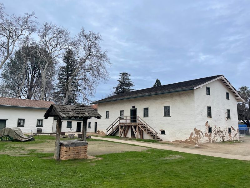
Swiss immigrant John Sutter established his agricultural settlement, New Helvetia, in California’s Central Valley in 1839, and construction of the adobe fort began in 1841. It became the first non-Indigenous settlement in the region and quickly developed into a critical waystation for travelers arriving via the California Trail, offering supplies and temporary shelter to exhausted emigrants.
Everything changed in 1848 when gold was discovered at Sutter’s Mill, roughly 50 miles away. The fort was quickly overwhelmed and then largely abandoned as workers and settlers rushed toward the goldfields.
Sutter’s own agricultural empire collapsed under the pressure, even as the city of Sacramento rapidly expanded around the original fort site.
The history of the fort is also directly tied to the displacement and exploitation of Indigenous peoples whose labor was essential to its early operation. California State Parks is actively working to present that history more honestly.
Today, the reconstructed adobe fort stands in midtown Sacramento with the central building original to the 1840s, offering self-guided tours through rooms that connect agriculture, migration, commerce, and the transformative chaos of the Gold Rush.
Share this story