Somewhere in the mountains of North Carolina, a road quietly crosses a state line and keeps climbing until the trees thin out and the sky opens wide. The Cherohala Skyway is 43 miles of federally designated scenic byway that connects Robbinsville, North Carolina, with Tellico Plains, Tennessee, and it has a way of making a Tuesday feel like a gift.
No app required, no subscription needed, just a full tank of gas, a packed lunch, and a willingness to pull over whenever something beautiful appears around the next curve.
The 43 miles run from North Carolina into Tennessee
Calling the Cherohala Skyway a North Carolina drive is a little like calling a sandwich just bread. Technically true in part, but missing the whole picture.
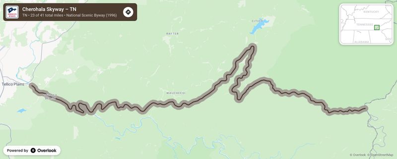
America’s Byways program designates the full 43-mile corridor as a National Scenic Byway, and that corridor crosses two states: North Carolina and Tennessee.
Here is how the geography actually works. Travelers heading west from Robbinsville, North Carolina, follow NC 143 roughly 12 miles to Santeetlah Gap, where the Skyway itself begins.
The North Carolina Scenic Byways guide puts the North Carolina portion of the Skyway at approximately 17.8 miles, running from Santeetlah Gap to the Tennessee state line. The remaining miles continue through Tennessee as State Route 165, eventually descending into Tellico Plains.
That cross-state detail matters for planning. Services, road-condition systems, and some recreation areas shift depending on which side of the line you are on.
Recreation.gov’s Cherohala Skyway gateway treats the whole route as one unified destination, which it is, but smart travelers keep a mental note of where North Carolina ends and Tennessee begins.
As for the meditation-app comparison in the article’s title, treat that as a playful way of saying the road earns your full attention. No study has compared a scenic drive on this highway with a guided breathing session, and the Skyway is not a clinical treatment for anything.
What it genuinely offers is a scenic destination designed for lingering, with overlooks, forest access, and long stretches free of strip malls, advertisements, and the usual noise of daily life.
Why the route rewards an unhurried schedule
Most roads exist to move people from one place to another as efficiently as possible. The Cherohala Skyway was built with a different purpose in mind.
Designated as part of America’s Byways network, it was planned as a scenic destination rather than a commuter corridor, and that intention shows in every mile.
Overlooks appear at intervals along the route, each one offering a different angle on the surrounding ridgelines and valleys. Picnic areas give travelers a reason to cut the engine, stretch their legs, and sit with a sandwich while the wind moves through the treetops.
The U.S. Forest Service’s Cherohala Skyway destination page highlights mountain vistas, high-elevation balds, the Tellico River, and nearby recreation access as the route’s signature draws.
Limited commercial development along the core stretch means fewer distractions and more room to notice what the landscape is actually doing.
Spending time in natural settings may help some people feel less stressed or more at ease, and that is a reasonable thing to expect from a few hours on this road. A systematic review of nature-exposure studies found that time in natural environments may reduce perceived stress for some individuals, though the studies examined varied widely in setting, duration, and design.
None of them tested this particular highway, and none compared scenic driving with a meditation app.
A separate review of nature-exposure therapies found generally positive associations with mood and stress measures but also noted that driving requires sustained attention, which is a different mental state from walking quietly through a forest or sitting beside a stream. The honest takeaway is that the Skyway can feel restorative for many travelers, especially those who build in time to stop, walk, and breathe rather than treating the mileage as a checklist to finish.
High ridges and forested slopes create the visual payoff
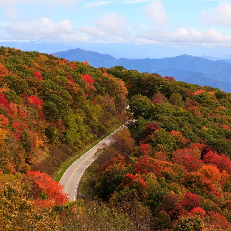
Elevation changes everything about how a road feels. Below 3,000 feet, the Cherohala Skyway moves through dense hardwood forest where sunlight filters through a canopy of oak, maple, and tulip poplar.
As the road climbs, the trees shorten and thin, the air cools noticeably, and the world starts to open up in ways that feel almost theatrical.
The North Carolina Scenic Byways guide identifies Hooper’s Bald at approximately 5,429 feet, making it one of the notable high-elevation landmarks along the North Carolina section of the route. At that height, the ridgeline opens into grassy balds where the sky fills the entire frame and the nearest visible mountain might be 30 or 40 miles away on a clear day.
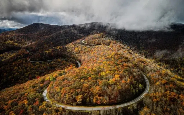
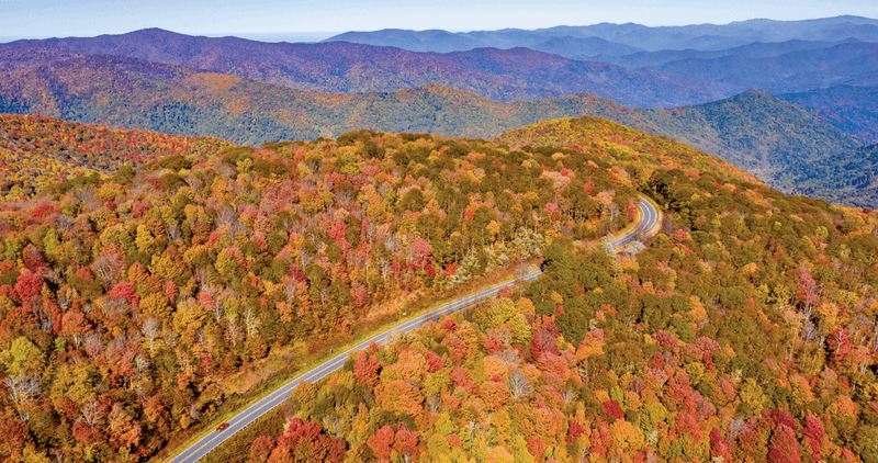
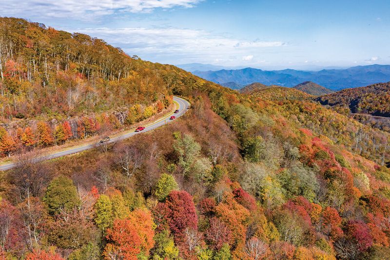
The route passes through the Nantahala National Forest on the North Carolina side and the Cherokee National Forest as it continues into Tennessee. The Forest Service describes the Skyway’s scenery as a combination of high-elevation balds, forested slopes, and long-distance mountain vistas that shift with the seasons, from spring wildflowers and fresh green canopy to the layered reds and golds of October.
Clear panoramas are weather-dependent, and that is worth saying plainly. Fog rolls in quickly at higher elevations, and a morning that looks promising in Robbinsville can turn gray and misty by the time a driver reaches the ridgeline.
Rain and low clouds can reduce visibility at overlooks to a few hundred feet. That unpredictability is part of mountain travel, not a flaw in the road, and it makes the clear days feel genuinely earned.
Short hikes turn a drive into an outing
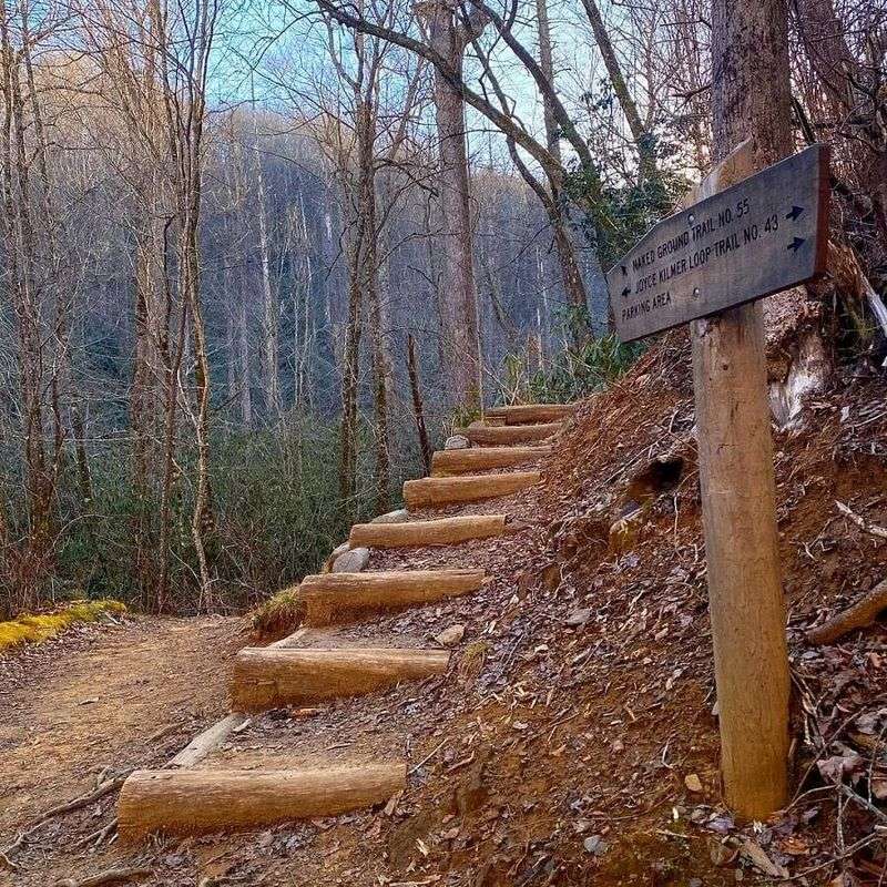
Pulling off the road and actually walking somewhere changes the experience in ways that no overlook quite replicates. Two short-hike options near the high-elevation section of the Skyway, Huckleberry Knob and Hooper Bald, give travelers a reason to leave the car behind and spend some time on foot.
Visit Smokies describes both as accessible short hikes near the Skyway’s highest elevations, though exact trail distances, surface conditions, and difficulty ratings can vary by source and by season. Verify current trail conditions before you go rather than assuming a description from one site matches what you will find on the ground.
Joyce Kilmer Memorial Forest is a different kind of stop entirely, and it deserves its own paragraph. Located near the North Carolina end of the route as a separate side trip rather than a roadside viewpoint, the forest requires leaving the main road and committing to a walk.
The Forest Service describes a two-mile figure-eight trail through old-growth forest, with a lower loop of approximately 1.25 miles and an upper loop of about 0.75 miles. The trees here are genuinely staggering, tulip poplars and hemlocks that can exceed 100 feet in height and several feet in diameter.
The trailhead has parking, picnic tables, and a flush toilet, which makes it a practical stop for families or anyone who needs a break from the car. Overnight parking and camping at the memorial forest are not permitted, so plan accordingly.
The Forest Service advises visitors to stay on designated trails, remain alert for older branches and trees overhead, and avoid the area during windy or icy conditions.
Forest Service recreation pages can give you updated information on access, but check them close to your travel date. A temporary closure in 2025 affected the Joyce Kilmer and Jenkins Meadow trailheads for road and parking lot repairs, a reminder that even beloved spots can go offline without much warning.
Fuel up before the remote central stretch
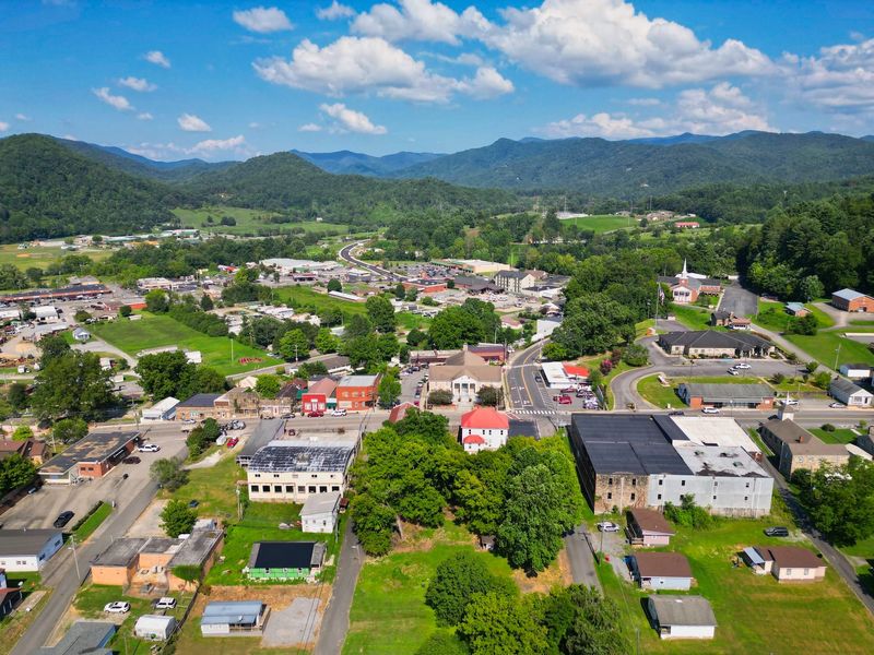
Romanticizing the remote stretch of the Skyway is easy until your fuel gauge dips below a quarter tank and you realize the next gas station is a long way back. Visit Smokies is direct on this point: there are no gas stations or restaurants along the core Skyway route.
That is not a minor inconvenience. It is the kind of detail that can turn a relaxed afternoon into a stressful one if you are not prepared.
Fill the tank in Robbinsville before heading out on NC 143. Pack food and water for the drive, including enough for a proper picnic at one of the overlooks or designated rest areas along the route.
Recreation.gov’s Cherohala Skyway page describes the area as a destination for outdoor recreation and scenic exploration, not a commercial corridor with roadside amenities.
Cell service along the Skyway can be unreliable, and that is worth knowing before you depend on a navigation app or plan to stream music through the ridgeline sections. The North Carolina Scenic Byways guide frames the route as a scenic experience rather than a commuter road, which is another way of saying that convenience infrastructure is minimal by design.
Building flexibility into the itinerary makes the whole trip better. If you treat the 43 miles as a timed race to complete before dinner, the overlooks start to feel like interruptions rather than the point of the journey.
Budget at least half a day, and more if you plan to walk the Joyce Kilmer trail or linger at the higher elevation stops. The miles go slowly in the best possible way when you stop trying to rush them.
Prepare for mountain conditions and drive defensively
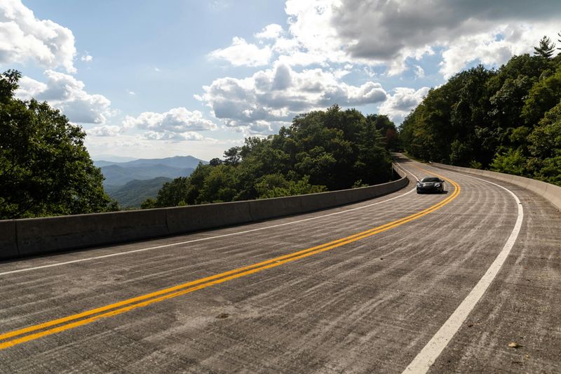
Beautiful roads can lull drivers into a false sense of ease, and the Cherohala Skyway is beautiful enough to be genuinely distracting. Keeping attention on the road rather than the view is not optional advice; it is the thing that makes the view worth having next time.
A Federal Highway Administration road safety audit of the North Carolina Skyway section describes a two-lane road with a 45-mph posted speed limit, long stretches without intersections or driveways, and road characteristics that change noticeably near Robbinsville. Curves, grade changes, and the possibility of pedestrians and bicyclists sharing the road all require consistent attention.
Stopping to photograph a view is perfectly reasonable. Stopping in a travel lane, around a blind curve, or on a narrow shoulder where other drivers cannot see you is not.
Use designated overlooks and legal pull-offs, pull fully clear of the travel lane, and let the car come to a complete stop before reaching for a camera or phone. The overlooks exist precisely so that travelers can enjoy the scenery without creating a hazard.
The North Carolina Scenic Byways guide states clearly that tractor-trailer trucks are prohibited on the Skyway section and that the route is not recommended for recreational vehicles or buses. If you are driving a large camper or towing a sizable trailer, this is a road to skip or research carefully before committing to it.
Weather is worth treating as a variable rather than a given. At elevations above 5,000 feet, conditions can shift from sunny and calm to foggy and windy in less time than it takes to drive from one overlook to the next.
Carrying a light jacket or extra layer is a practical precaution regardless of what the forecast shows at lower elevations. Check conditions before you leave, and build enough flexibility into the schedule that turning around or waiting out a weather window feels like a reasonable option rather than a defeat.
North Carolina’s 511 system provides current road condition information for the North Carolina portion of the route.
Check access before you leave
An open road does not automatically mean an open trailhead. The main Cherohala Skyway route and the individual recreation areas, forest roads, and side trips along it can have very different statuses on any given day.
Storms, maintenance work, and seasonal repairs can close a parking area or trailhead without affecting the scenic drive itself, and the reverse is also true.
North Carolina’s 511 system is the right place to check road conditions and closures for the North Carolina portion of the Skyway before departure. For current status on the Tennessee section, check Tennessee’s official transportation resources directly, since conditions on each side of the state line are managed independently.
For recreation areas and trails, go to the Forest Service directly. A 2025 closure of the Joyce Kilmer and Jenkins Meadow trailheads for road and parking lot repairs illustrated how quickly access can change at a beloved spot.
The main scenic road remained usable, but travelers who had planned to walk the old-growth trail that day arrived to find the trailhead closed.
The Forest Service’s Joyce Kilmer guide is a useful reference for trail layout and general site information, but for current access status, check the Nantahala National Forest news and alerts page as close to your travel date as possible. Picnic areas and forest roads near the Skyway can also close temporarily, so a quick check before leaving home is far easier than a long drive to a locked gate.
Let the Skyway slow the day down
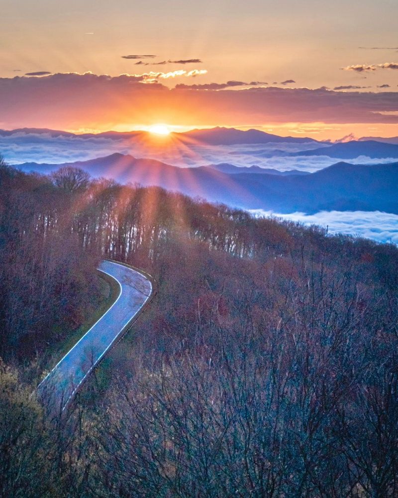
No road fixes everything, and the Cherohala Skyway does not promise to. What it offers is something more modest and more honest: 43 miles of federally designated scenic byway through two national forests, across a state line, and up into elevations where the air smells different and the horizon stretches farther than it does anywhere near a highway interchange.
Treating the route as a flexible North Carolina-Tennessee outing, rather than a strict mileage target, changes the whole experience. Pack food and water, fill the tank in Robbinsville, check conditions before leaving, and leave room in the schedule for a picnic, a short walk, and a few extra minutes at an overlook that turns out to be better than expected.
The Forest Service describes the Skyway’s draws as mountain vistas, high-elevation balds, and nearby recreation, and those are the things worth building time around.
The Skyway will not rewrite your nervous system or compete with a certified wellness program. But on a good day, with the right weather and a willingness to let the landscape set the pace, it has a way of making the rest of the week feel a little more manageable.
That might be the best thing a mountain road can honestly offer.
Share this story