Most people assume you need a long road trip to find real nature. The truth is, some of the most jaw-dropping landscapes in the country are sitting just outside city limits, waiting for anyone willing to make a short drive.
From canyon walls and river gorges to ancient forests and wetland trails, these spots offer the kind of scenery that makes you forget you were stuck in traffic an hour ago. This list covers 14 natural attractions that are genuinely close to major cities, each one offering something different enough to be worth a dedicated visit.
Griffith Park, Los Angeles, California

At over 4,300 acres, Griffith Park is one of the largest urban parks in the United States, and it sits right inside Los Angeles city limits. That alone makes it worth knowing about, especially when most people associate LA with freeways and concrete.
The park has more than 50 miles of trails ranging from flat paved paths to steep dirt climbs. The hike to the Griffith Observatory is one of the most popular routes, offering wide views of the city, the Hollywood Sign, and the surrounding hills on clear days.
Beyond hiking, the park includes the Los Angeles Zoo, the Autry Museum of the American West, pony rides, a golf course, and the Greek Theatre for outdoor concerts. There is no general admission fee to enter the park itself.
Parking is available at multiple lots throughout the property, though weekends can fill up early.
Red Rock Canyon National Conservation Area, Las Vegas, Nevada
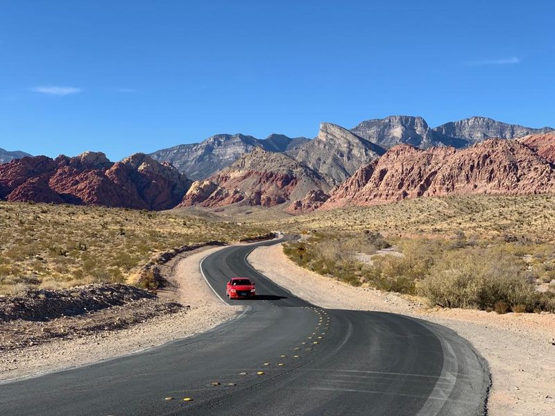
About 17 miles west of the Las Vegas Strip, the landscape shifts from neon signs to 3,000-foot sandstone cliffs in a way that genuinely catches first-time visitors off guard. Red Rock Canyon covers roughly 195,000 acres managed by the Bureau of Land Management.
The 13-mile scenic drive loops through the conservation area and gives drivers access to pullouts, trailheads, and overlooks without requiring any serious hiking. For those who want to get out of the car, trails range from the easy Calico Tanks route to more technical climbs used by experienced rock climbers.
Timed entry reservations are required for the scenic drive from late fall through spring due to high visitor volume. The visitor center is open daily and includes exhibits on the geology and wildlife of the Mojave Desert.
Entry fees apply per vehicle, and the pass is valid for seven consecutive days.
Mount Tamalpais State Park, San Francisco Bay Area, California
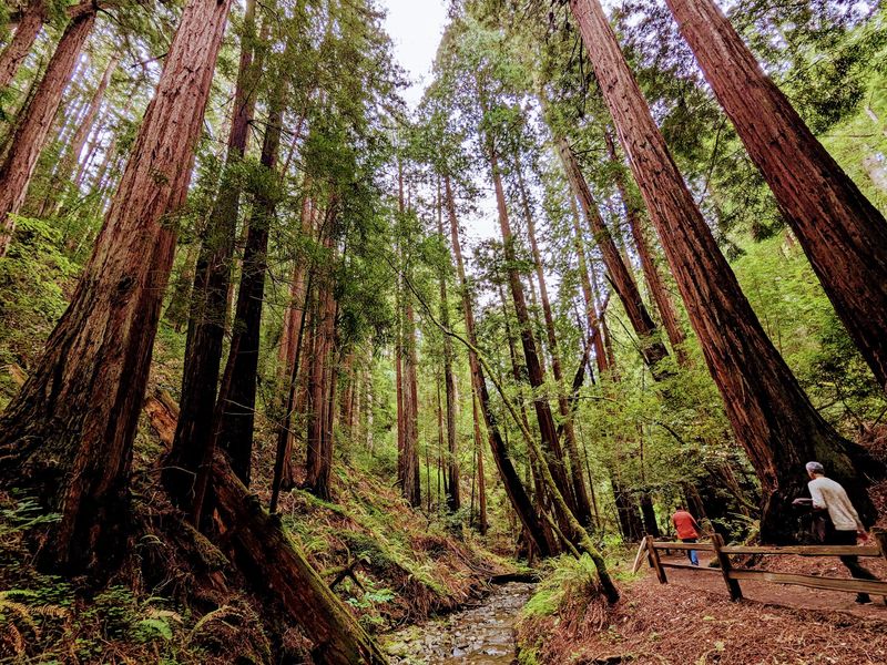
Mount Tamalpais rises to about 2,571 feet in Marin County, just north of San Francisco, and on clear days the views from the summit stretch across the Bay, the Pacific Ocean, and the Sierra Nevada in the distance. Getting there takes less than an hour from the city.
The park has over 60 miles of trails covering grasslands, chaparral, and old-growth redwood groves. The Steep Ravine Trail is one of the most scenic routes, descending through dense redwoods along Webb Creek before reaching the coast.
Mountain biking is also popular here, as the mountain is often credited as one of the birthplaces of the sport.
The Mountain Theater, a stone amphitheater built into the hillside, hosts outdoor performances in spring and summer. Parking at popular trailheads fills early on weekends.
A day-use fee applies at most entry points, and the park is open year-round.
McDowell Sonoran Preserve, Scottsdale, Arizona
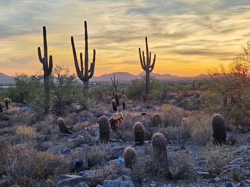
Scottsdale made a serious commitment to open space when it set aside over 30,000 acres for the McDowell Sonoran Preserve, making it one of the largest urban preserves in the country. The Sonoran Desert landscape here is genuinely striking, especially in spring when wildflowers fill the desert floor.
The preserve has more than 225 miles of trails for hiking, mountain biking, and horseback riding. The Tom’s Thumb Trail is one of the most recognized routes, climbing through granite boulders to a distinctive rock formation with sweeping valley views.
The Gateway Loop Trail near the main visitor center is a good option for first-time visitors looking for a manageable distance with solid scenery.
The Scottsdale Trailhead on Legacy Boulevard includes a staffed visitor center, restrooms, and ample parking. Trail access is free.
Summer heat in this region is serious, so early morning starts are strongly recommended from May through September.
Great Falls Park, Washington D.C. Area, Virginia
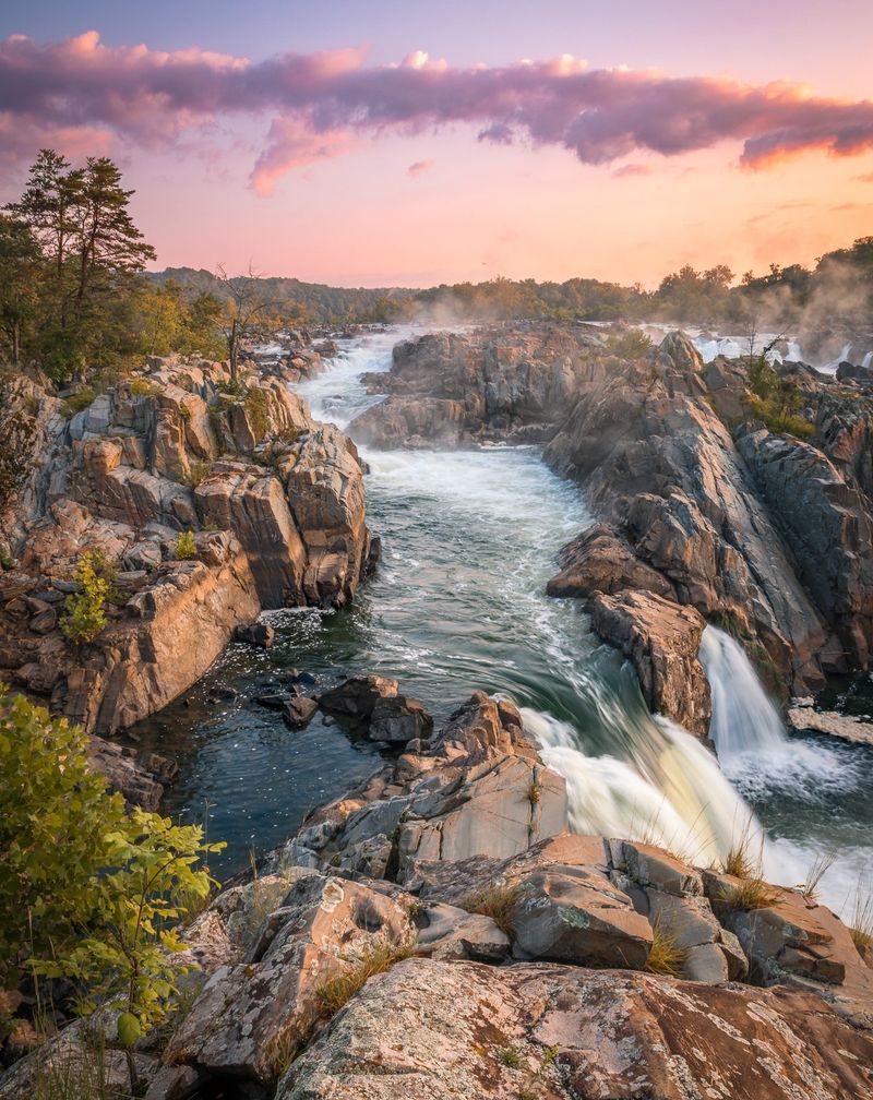
Fifteen miles from the center of Washington D.C., the Potomac River drops roughly 76 feet over a series of jagged rocks, creating one of the most powerful river scenes on the East Coast. Great Falls Park sits on the Virginia side of those falls and draws visitors year-round.
Three overlooks give different perspectives of the falls, and the views are genuinely dramatic regardless of the season. The River Trail follows the Gorge downstream through rocky terrain with views into the canyon below.
The Old Carriage Road Trail offers a flatter option through forest and along the historic Chesapeake and Ohio Canal corridor.
The park is managed by the National Park Service, and the entrance fee covers both the Virginia and Maryland sides of the falls area. Parking lots fill fast on weekends, especially in spring and fall.
Swimming and wading are prohibited due to strong currents that make the water far more dangerous than it appears from the overlooks.
Chattahoochee River National Recreation Area, Atlanta, Georgia
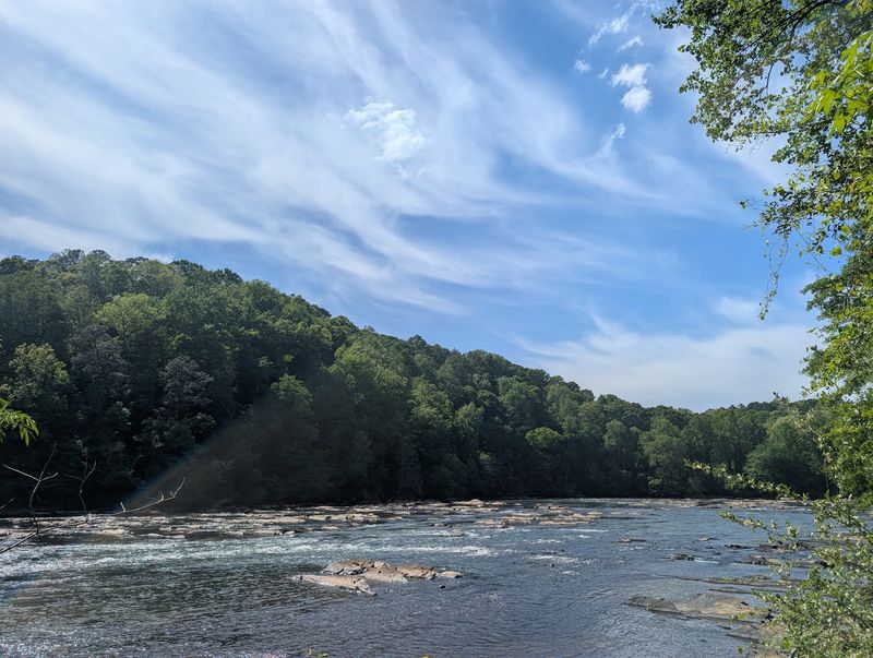
The Chattahoochee River runs right through the northern edge of metro Atlanta, and the national recreation area that follows it covers 48 miles of riverbank across multiple access points. For a city known for sprawl and traffic, this stretch of protected river corridor is a genuine surprise.
The recreation area is broken into 16 separate land units, each with its own parking, trails, and character. Johnson Ferry, Island Ford, and Paces Mill are among the most visited sections.
Trails range from short riverside walks to longer routes connecting multiple units through hardwood forest.
Fishing is popular along the river, and a Georgia fishing license is required for anglers 16 and older. Tubing and kayaking are also common recreational activities here during warmer months, with several outfitters operating near the park.
The National Park Service manages the area, and a daily vehicle fee or annual America the Beautiful pass covers entry at most units.
Cuyahoga Valley National Park, Cleveland, Ohio
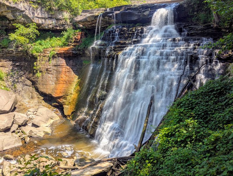
Sitting between Cleveland and Akron, Cuyahoga Valley National Park covers about 33,000 acres and is one of the most visited national parks in the country, though it rarely gets the same attention as parks out west. The fact that it sits inside a major metro corridor makes that visitor count even more impressive.
The Ohio and Erie Canal Towpath Trail runs 20 miles through the park and is popular with cyclists, joggers, and walkers. Brandywine Falls is one of the park’s most recognizable features, a 65-foot waterfall accessible via a short boardwalk trail.
The Cuyahoga Valley Scenic Railroad still runs excursion trips through the park on select days, offering a different way to see the valley.
Entry to the park is free. The park includes historic farms, wetlands, forests, and the restored canal corridor.
Fall foliage season draws significant crowds, so arriving early on weekends in October is a practical approach.
Starved Rock State Park, Chicago Area, Illinois
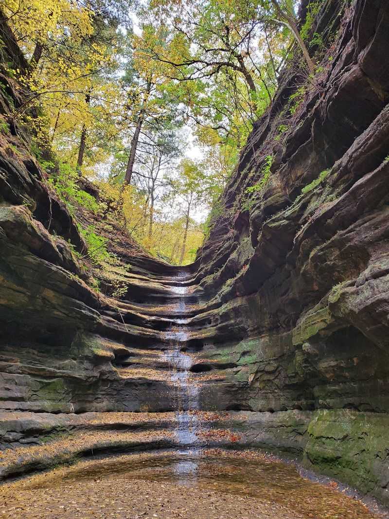
About 90 miles southwest of Chicago, Starved Rock State Park packs an unusual amount of geological drama into a relatively small footprint. The park is built around 18 canyons carved from St. Peter Sandstone by glacial meltwater thousands of years ago, and some of those canyon walls rise over 100 feet.
Waterfalls flow through the canyons during spring snowmelt and after heavy rain, making those seasons especially popular for photography and hiking. In winter, the falls freeze into dramatic ice formations that draw visitors specifically for that effect.
The park has about 13 miles of trails, with canyon overlooks and river views along the Illinois River as highlights.
The lodge inside the park dates to the 1930s and was built by the Civilian Conservation Corps. It offers dining and lodging, which makes a weekend stay possible without leaving the grounds.
Trail conditions can be slippery after rain or snow, so appropriate footwear is worth planning ahead.
Middlesex Fells Reservation, Boston Area, Massachusetts
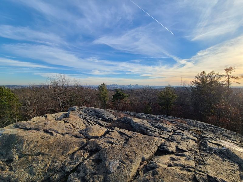
Just four miles north of Boston, Middlesex Fells Reservation covers about 2,575 acres of forested hills, rocky ridges, and three reservoirs. The name comes from an Old English word meaning open pasture land, though the landscape today is almost entirely wooded and rugged.
The reservation has over 100 miles of trails ranging from paved paths around the reservoirs to rocky scrambles along the ridge lines. The Skyline Trail is the most well-known route, covering about 7 miles across the western and eastern sections and passing several granite outcrops with views over the surrounding suburbs and Boston skyline.
Mountain biking is permitted on designated trails, and the reservation is open year-round. The area is managed by the Massachusetts Department of Conservation and Recreation, and there is no general admission fee.
Wildlife in the reservation includes white-tailed deer, wild turkeys, and a variety of migratory bird species that make it a solid destination for casual birdwatchers.
Discovery Park, Seattle, Washington
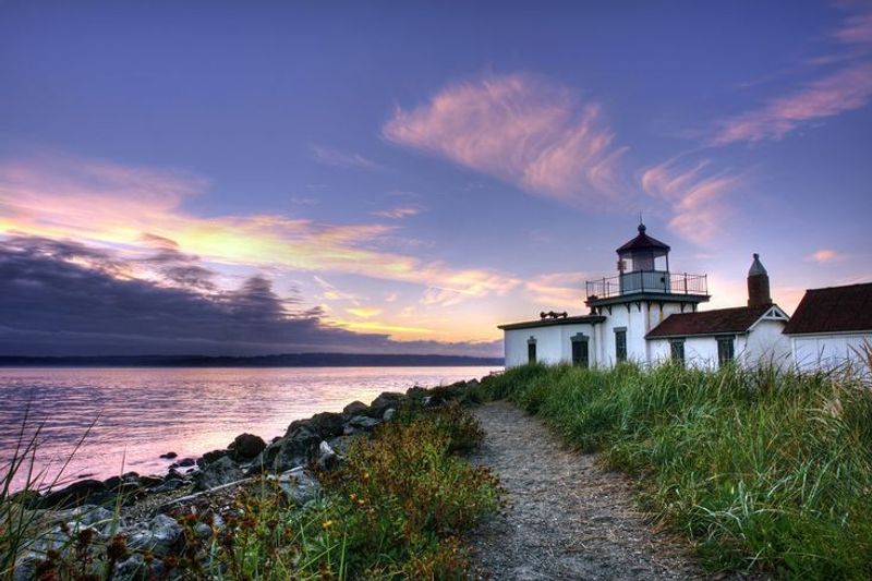
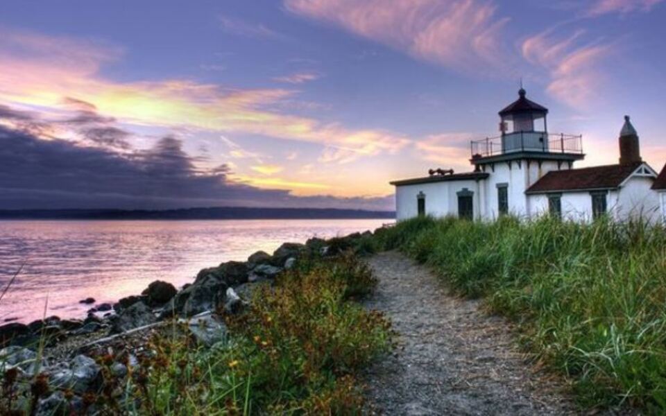
Discovery Park occupies 534 acres on a bluff overlooking Puget Sound in the Magnolia neighborhood of Seattle, making it the city’s largest park by a significant margin. The West Point Lighthouse, built in 1881, still stands at the park’s northwestern tip and remains one of the most photographed spots in the city.
The park has about 12 miles of trails covering meadows, forest, sand dunes, and bluff edges. On clear days, views from the bluff include the Olympic Mountains to the west and the Cascade Range to the east.
The North Beach Trail leads down from the bluffs to a stretch of public shoreline along Puget Sound.
Discovery Park is open daily from 6 a.m. to 11 p.m. There is no general admission fee.
The visitor center near the main entrance provides trail maps and information about the park’s natural and cultural history, including its former life as Fort Lawton, a military installation that operated for decades before the land was converted to parkland.
Barton Creek Greenbelt, Austin, Texas
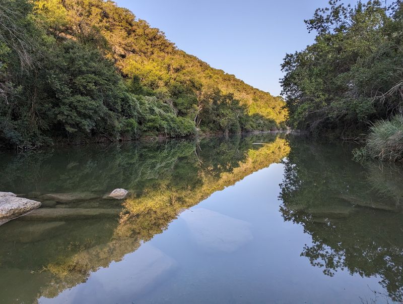
Austin’s Barton Creek Greenbelt stretches about 12 miles through the limestone hills just southwest of downtown, and during the summer it functions as the city’s unofficial outdoor gathering place. The creek carves through the Edwards Plateau, creating natural swimming holes, cliff jumping spots, and shaded canyon trails that offer real relief from the Texas heat.
The greenbelt has multiple access points, with Barton Springs Road, Spyglass Drive, and Loop 360 being the most commonly used entry points. Trail conditions change significantly with rainfall.
After dry spells, some swimming holes shrink considerably, while heavy rain can close the greenbelt entirely due to flash flood risk.
Rock climbing is also popular here, with established routes along the limestone walls near several trailheads. The greenbelt is free to access and managed by the City of Austin Parks and Recreation Department.
Dogs are allowed on trails but must be leashed, and the area can get crowded on summer weekends from mid-morning onward.
Shark Valley, Miami Area, Florida
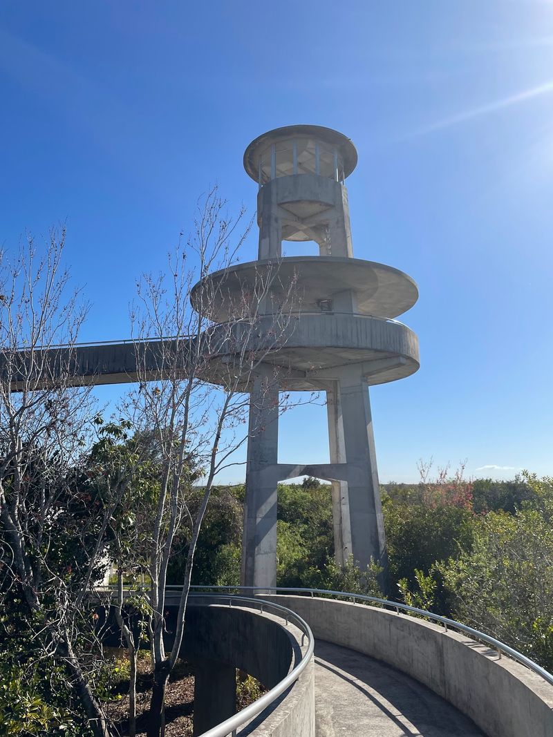
Shark Valley sits at the northern edge of Everglades National Park, about 35 miles west of downtown Miami, and it offers one of the most accessible windows into the Everglades ecosystem anywhere along the park’s boundary. The main feature is a 15-mile paved loop trail that cuts through open sawgrass marsh with minimal shade.
Alligators are routinely seen resting on or beside the trail, sometimes close enough to require visitors to give them space by walking around. The wildlife viewing here is reliable and requires no special equipment or backcountry experience.
A 65-foot observation tower at the midpoint of the loop provides elevated views across the flat marsh landscape.
Tram tours run daily and cover the full loop for visitors who prefer not to bike or walk the distance. Bicycle rentals are available at the visitor center.
Entry fees apply per vehicle or per person arriving by bicycle or on foot. The park recommends visiting early morning to avoid midday heat and to see the most wildlife activity.
Forest Park, Portland, Oregon
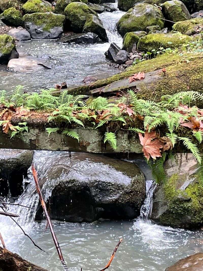
Forest Park in Portland covers over 5,100 acres and holds the distinction of being one of the largest urban forests in the United States. The park runs along the Tualatin Mountains northwest of downtown Portland, and the tree canopy inside it feels far removed from the city below.
The Wildwood Trail is the park’s backbone, running about 30 miles from end to end through Douglas fir, western red cedar, and bigleaf maple forest. Dozens of connector trails branch off from Wildwood, making it easy to build loops of almost any length.
Trail runners and hikers use the park heavily on weekends, but the sheer size means it rarely feels overcrowded on most routes.
Forest Park is free to access and open year-round. Trailheads are accessible from multiple neighborhoods including Thurman Street and NW 53rd Avenue.
The park has no facilities like restrooms or visitor centers at most entry points, so planning ahead is helpful for longer outings.
Patapsco Valley State Park, Baltimore Area, Maryland
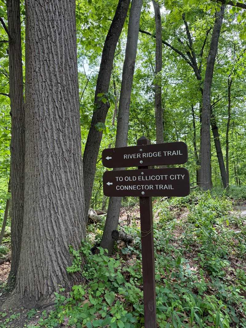
Patapsco Valley State Park follows the Patapsco River for about 32 miles through the valleys west of Baltimore, covering over 16,000 acres across multiple developed areas. The park has been around since 1907, making it one of Maryland’s oldest state parks, and the landscape reflects both natural recovery and human history layered over more than a century.
The park includes historic iron and stone bridges, remnants of 19th-century mill towns, and the ruins of structures that were part of early industrial development along the river. Hiking trails connect these historic features with forested ridges, river access points, and open meadows.
The Orange Grove and Hilton areas are among the most heavily used sections.
Camping, fishing, and picnicking are all available within the park. A daily vehicle fee applies at staffed areas.
The river corridor attracts migratory songbirds in spring, making it a worthwhile stop for birdwatchers during April and May. Trail conditions after rain can be muddy in low-lying sections near the river.
Share this story