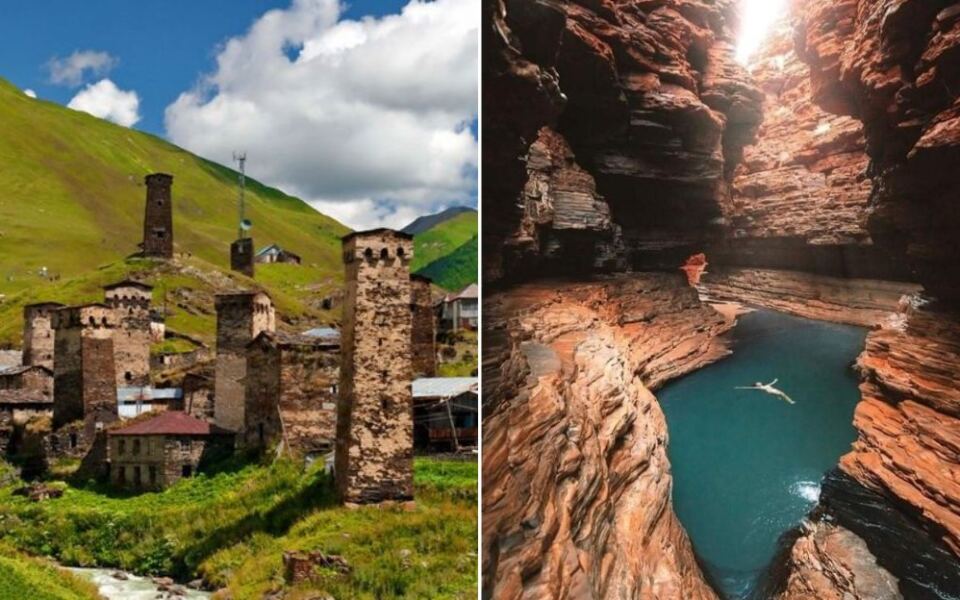
Most travel lists point you toward the same crowded spots everyone already knows. But the world is full of places that quietly deliver something far more memorable, where the landscapes are wilder, the history runs deeper, and the crowds are almost nonexistent.
If you are already thinking about where to go in 2027, this list is worth saving. These 15 destinations span remote deserts, ancient ruins, volcanic islands, and old-growth forests, and every single one of them is the kind of place that makes you feel like you actually discovered something worth talking about.
Bisti De Na Zin Wilderness Area, Farmington, New Mexico
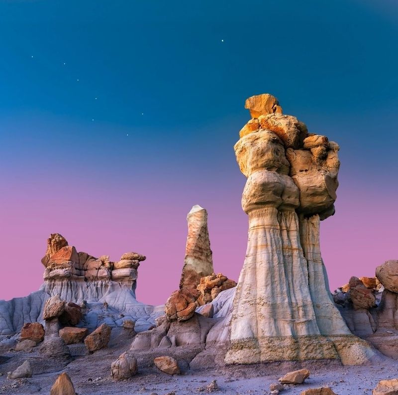
Few places in the American Southwest look as genuinely alien as the Bisti De Na Zin Wilderness. The landscape is a maze of crumbling hoodoos, layered sedimentary rock, scattered petrified wood, and formations that seem to belong on another planet entirely.
There are no marked trails, no paved roads leading in, and no developed facilities waiting at the trailhead. That is precisely what makes it worth the effort.
You navigate by instinct and landmarks, which means every visit feels like genuine exploration.
The BLM confirms the wilderness is open year round, so early spring and late fall tend to offer the most comfortable temperatures for hiking. The area sits near Farmington, making it a manageable day trip from town.
Bring more water than you think you need, wear sturdy footwear, and download an offline map before you leave the car. Sunrise and sunset light make the formations look extraordinary.
Great Basin National Park, Baker, Nevada
Nevada gets a lot of attention for Las Vegas, but Great Basin National Park is a completely different kind of Nevada experience. Sitting near the Utah border in a remote stretch of the state, this park climbs from desert scrub to alpine peaks above 13,000 feet.
The ancient bristlecone pines here are among the oldest living organisms on Earth, with some individuals exceeding 4,000 years in age. Lehman Caves offers ranger-led tours through a surprisingly ornate marble cavern system.
The hiking trails range from short walks to full summit climbs up Wheeler Peak.
What really draws serious visitors is the night sky. Great Basin consistently ranks as one of the darkest locations in the continental United States, making it a prime spot for stargazing.
The park is open year round, though winter brings significant snow to higher elevations. Baker, the nearest town, is small but friendly.
Chaco Culture National Historical Park, Nageezi, New Mexico
Getting to Chaco requires commitment. The last stretch of road is unpaved, rough, and slow, and that is not an accident.
The remoteness is part of what has preserved this place so well for so long.
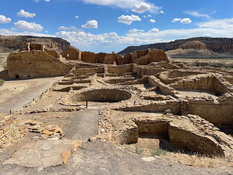
Chaco Culture National Historical Park protects some of the most significant ancestral Puebloan structures ever built in North America. Pueblo Bonito alone contained hundreds of rooms and rose several stories high, constructed with remarkable precision using sandstone blocks and wooden beams hauled from forests miles away.
Archaeological sites and trails operate on seasonal daily hours, so checking the National Park Service website before visiting is a smart move. The park also sits in a dark sky zone, making evenings here genuinely special during ranger-led astronomy programs offered on selected dates.
Plan to spend at least a full day. Bringing your own food, water, and a full tank of fuel before heading in is not optional, it is essential.
Makoshika State Park, Glendive, Montana
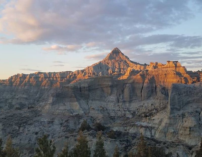
Montana’s largest state park does not get nearly the attention it deserves. Makoshika sits just outside Glendive in the eastern part of the state, a region most road trippers skip entirely in their rush to reach Glacier or Yellowstone.
The badlands here are genuinely impressive, with eroded ridges, layered formations, and canyon views that stretch for miles. The park has also produced significant paleontological finds, including Triceratops and Tyrannosaurus rex fossils, and the visitor center displays some of what has been recovered from the surrounding terrain.
Hiking trails range from short paved loops to longer backcountry routes, and the scenic drive through the park gives a solid overview without requiring a long walk. Campsites are available for those who want to stay overnight and catch the landscape at golden hour.
The park and campground remain open throughout the year, making late spring and early fall particularly pleasant times to visit.
Caddo Lake State Park, Karnack, Texas
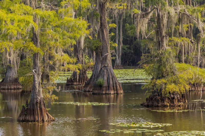
Caddo Lake does not look like Texas. The bald cypress trees rise straight out of dark water, their trunks draped in Spanish moss, creating a bayou environment that feels more like Louisiana than the Lone Star State.
Caddo Lake is one of the few naturally formed lakes in Texas, and its maze of waterways, sloughs, and open water areas makes it one of the most ecologically rich places in the region. Paddling here is a genuinely different experience, quiet, slow, and full of wildlife sightings including herons, egrets, turtles, and alligators.
The state park at Karnack offers camping, hiking trails, and canoe rentals, making it accessible even if you arrive without your own gear. The park is open daily, though individual facilities can occasionally close due to water levels or weather conditions, so checking ahead is a good habit.
Weekday visits tend to be noticeably quieter than weekends.
Valley of the Gods, Mexican Hat, Utah
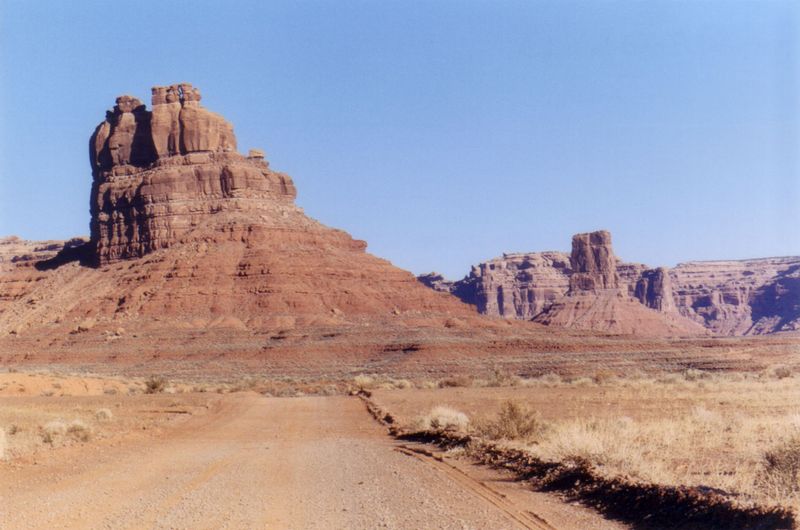
Valley of the Gods sits in the shadow of Monument Valley’s fame, which is exactly why it still feels raw and uncrowded. The sandstone formations here are just as dramatic, rising hundreds of feet from the desert floor in shapes that earned them names like Sitting Hen Butte and Seven Sailors.
The 17-mile unpaved loop road winds directly through the formations, making it drivable in a high-clearance vehicle when conditions allow. The BLM maintains visitor information for the area, and road conditions depend on recent weather, so checking before heading out is worth the two minutes it takes.
There are no entrance fees, no visitor center, and no crowds competing for the best angles. Dispersed camping is permitted in the area, meaning you can spend the night under a sky full of stars with sandstone towers silhouetted around you.
Sunrise and sunset are the two times of day when the light on these formations becomes genuinely hard to describe.
Guadalupe Mountains National Park, Salt Flat, Texas
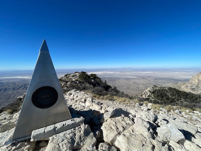
Guadalupe Mountains National Park holds the highest point in Texas, Guadalupe Peak at 8,749 feet, yet it remains one of the least visited national parks in the country. That gap between quality and attendance is hard to explain, but easy to enjoy if you make the trip.
The park protects a fossilized reef from an ancient sea, and the exposed rock tells a geological story spanning hundreds of millions of years. Hiking trails range from the popular Guadalupe Peak summit trail to canyon walks through the Chihuahuan Desert, with diverse plant and animal life throughout.
Fall is an especially good time to visit because the canyon maples in McKittrick Canyon turn brilliant shades of orange and red, creating color rarely associated with west Texas. The park is open year round with no seasonal road closures, and the remote location near Salt Flat means very little light pollution at night.
Backcountry camping is available with a free permit.
Lassen Volcanic National Park, Mineral, California
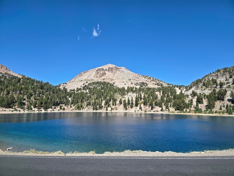
California has plenty of national parks competing for attention, but Lassen Volcanic quietly offers something most of them cannot: active hydrothermal features sitting alongside mountain lakes, volcanic craters, and old-growth forest, all in one compact park.
Bumpass Hell is the largest hydrothermal area in the park and one of the most accessible, reached by a boardwalk trail that keeps visitors safely above the boiling mud pots and steam vents below. Lassen Peak itself is a hike that rewards those who make the climb with sweeping views across northern California.
The park is open 24 hours a day throughout the year, though snow closes the main road through the park for a significant portion of winter and spring. Summer and early fall offer the best access to the full range of trails and features.
Crowds here are noticeably lighter than at Yosemite or Sequoia, making it a genuinely comfortable summer park visit without the reservation stress.
Cumberland Island National Seashore, St. Marys, Georgia
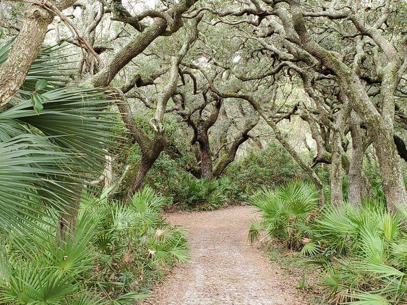
Cumberland Island is the kind of place that requires a little planning to reach, and that barrier is exactly what keeps it so beautifully undisturbed. The only way to get there without a private boat is the passenger ferry from St. Marys, which operates on a seasonal schedule with limited daily capacity.
Once on the island, the experience is unlike anything else on the Georgia coast. Wild horses roam freely through maritime forests and along the beach, largely indifferent to visitors.
The ruins of Dungeness, a Carnegie family estate, sit open to the sky and surrounded by palmettos. Miles of undeveloped beach stretch in both directions.
Camping is available for those who want to stay overnight, which is when the island really shows its character. No cars, no stores, no streetlights.
Reservations for the ferry and campsites fill up quickly, especially in spring and fall, so booking well in advance is genuinely important for a 2027 visit.
Congaree National Park, Hopkins, South Carolina
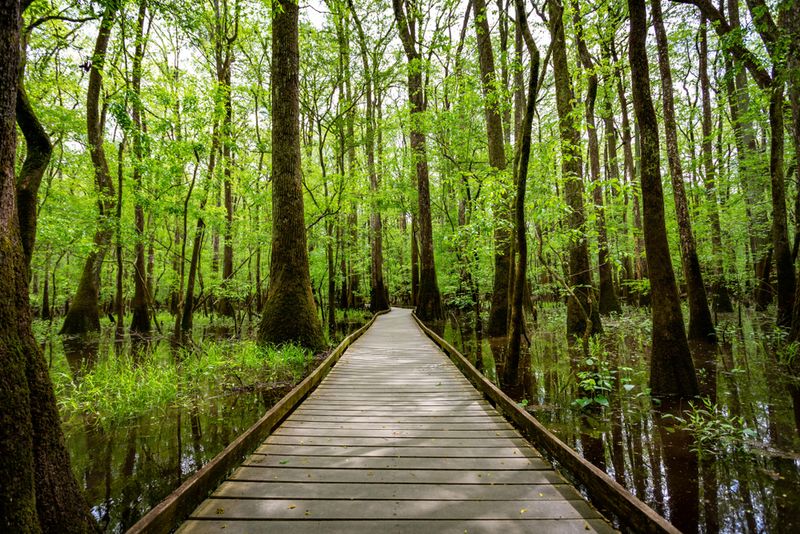
Congaree does not look like what most people picture when they think of South Carolina. The park protects one of the last significant old-growth bottomland hardwood forests in the southeastern United States, and the trees here are genuinely enormous.
The park holds champion trees in multiple species, with loblolly pines, bald cypresses, and water tupelos reaching heights that rival the tall timber of the Pacific Northwest. The elevated boardwalk loop makes the forest accessible even when the floodplain floor is underwater, which happens regularly and is actually part of what keeps the ecosystem so healthy.
Congaree is also recognized as an International Biosphere Reserve and a Ramsar Wetland of International Importance. Park roads, trails, parking areas, and campgrounds are generally accessible throughout the year.
Firefly season in late May and early June draws visitors for a spectacular natural light display when synchronous fireflies flash in coordinated patterns across the forest floor after dark.
North Cascades National Park, Marblemount, Washington
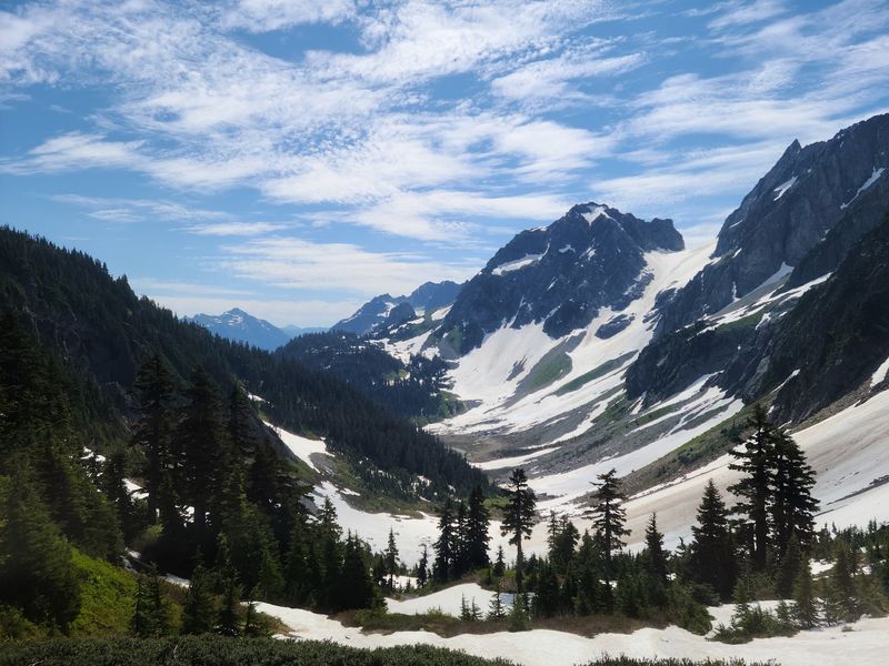
North Cascades is often called the American Alps, and the comparison earns its credibility quickly once you see the jagged ridgelines and glaciated peaks rising above the Skagit Valley. This park contains more glaciers than any other area in the contiguous United States outside Alaska.
Diablo Lake sits near the North Cascades Highway and is famous for its vivid turquoise color, which comes from glacial rock flour suspended in the water. The overlook above the lake is one of the most photographed spots in Washington state.
Hiking options range from short lake-access trails to multi-day backcountry routes through remote wilderness.
Visitor facilities operate seasonally, and travelers should check road and trail conditions before visiting since the North Cascades Highway closes in winter. The park sees far fewer visitors annually than Olympic or Mount Rainier, making it a more spacious experience for those willing to make the drive to Marblemount.
Shoulder seasons offer particularly striking scenery.
Old Town of Kuldiga, Kuldiga, Latvia
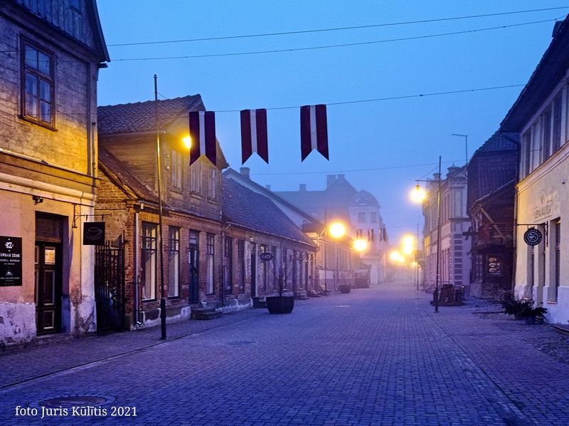
Kuldiga is the kind of European town that stops you mid-walk. The cobblestone streets, pastel-colored wooden buildings, and riverside setting give it a preserved quality that feels rare even by Baltic standards.
The Venta Rapid, a wide natural waterfall on the Venta River, is one of the broadest waterfalls in Europe. Each spring, vimba fish leap upstream over the falls in a migration that locals have watched for generations.
The brick bridge crossing the river nearby is the longest surviving old brick bridge in Latvia and adds to the town’s architectural character.
Kuldiga’s historic center was inscribed as a UNESCO World Heritage Site, recognizing its exceptional state of preservation. New tourism experiences are being developed in connection with the Liepaja 2027 European Capital of Culture program, making 2027 a particularly good year to visit this part of western Latvia.
The town is small, walkable, and genuinely undervisited by international travelers.
Ushguli, Svaneti, Georgia
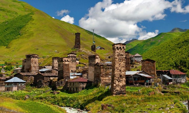
Ushguli sits at roughly 2,200 meters above sea level in the Svaneti region of Georgia, making it one of the highest continuously inhabited settlements in Europe. The stone defensive towers that define the skyline here were built centuries ago and have never been demolished or replaced.
The village is part of the Upper Svaneti UNESCO World Heritage Site, recognized for its extraordinary collection of medieval towers, frescoed churches, and traditional architecture. The surrounding peaks, including Shkhara at over 5,000 meters, form one of the most dramatic mountain backdrops anywhere in the Caucasus.
Access from Mestia, the nearest larger town, involves a mountain road that can be difficult or temporarily impassable depending on snow and seasonal conditions. Summer and early fall offer the most reliable travel windows.
The remoteness is real, infrastructure is basic, and that authenticity is precisely the point. Ushguli rewards travelers who are comfortable with unpredictability and genuinely curious about places that have changed very slowly over time.
Karijini National Park, Pilbara, Australia
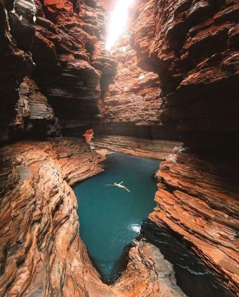
The Pilbara region of Western Australia is not on most international itineraries, but Karijini National Park makes a compelling case for changing that. The gorges here cut deep into ancient banded iron formations, exposing rock that is among the oldest exposed geology on Earth.
Handrail Pool, Fern Pool, and Circular Pool are among the swimming holes tucked inside the gorges, reached by scrambles and climbs that make the reward feel genuinely earned. The contrast between the deep red canyon walls and the clear water at the bottom is visually striking in a way that photographs struggle to fully capture.
Major visitor facilities and access roads have recently been upgraded, and the park remains open while further improvements continue. The best visiting months are typically April through October, when temperatures are manageable and gorge access is at its most reliable.
Eco-retreat accommodation within the park provides a comfortable base without requiring a long daily drive from town.
Flores Island, Azores, Portugal
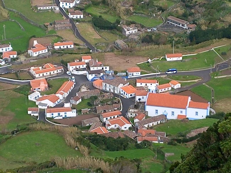
Flores is the westernmost island of the Azores and, by extension, one of the westernmost points of Europe. The island is small, intensely green, and packed with natural features that would each be a headline attraction somewhere less concentrated.
Crater lakes sit inside ancient calderas, waterfalls drop from basalt cliffs directly into the sea, and natural lava pools along the coastline serve as swimming areas when Atlantic swells allow. The interior is crisscrossed with hiking trails that pass through hydrangea-lined roads and fog-draped highlands.
Flores sees far fewer visitors than Sao Miguel or Terceira, which means trails are quieter and the pace of life in the island’s small villages moves at its own unhurried rhythm. Official Azores tourism listings confirm a range of accommodations, hiking routes, diving experiences, canyoning, and other visitor activities on the island.
Inter-island flights from other Azores islands make Flores reachable, though schedules are limited and advance booking for 2027 travel is strongly recommended.
Share this story