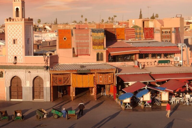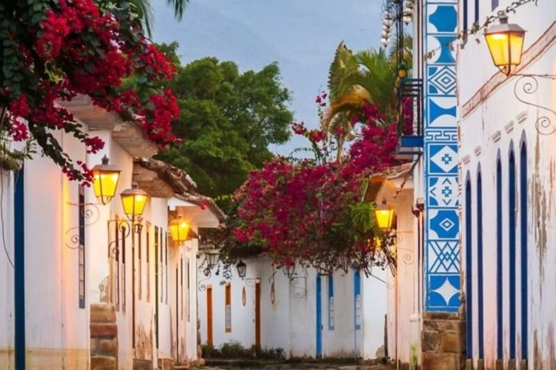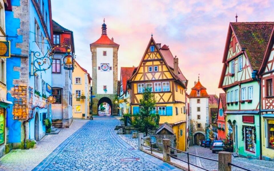
Some towns were designed long before cars existed, and walking through them feels like the whole point of being there. From cobblestone medieval lanes in Europe to car-free islands in the American Midwest, these places reward slow movement in a way that driving simply cannot.
Parking once and spending an entire trip on foot is not just possible here, it is practically encouraged. Whether you love history, waterfront views, mountain scenery, or just a great cup of coffee around the corner, these 15 small towns prove that the best way to see a place is on your own two feet.
Zermatt, Switzerland
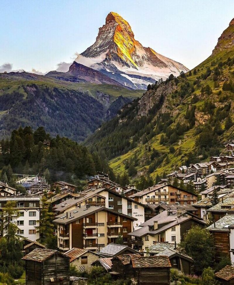
No car keys needed here. Zermatt is officially car-free, and visitors must leave their vehicles in Täsch, about five kilometers down the valley, before boarding a train into the village.
That single rule completely changes the atmosphere from the moment you arrive.
Walking along Bahnhofstrasse feels like strolling through a living postcard. Hotels, restaurants, bakeries, and mountain gear shops line the path, while the older quarter preserves wooden buildings that are nearly 500 years old.
The Matterhorn looms above everything at 14,692 feet, visible from almost every corner of town.
Zermatt sits at roughly 5,315 feet above sea level, so the air is crisp and the light is sharp. Mountain railways and lifts connect the village to an enormous network of Alpine trails, extending the pedestrian experience well beyond the town center.
You really do not need a car to have a full adventure here.
Mackinac Island, Michigan
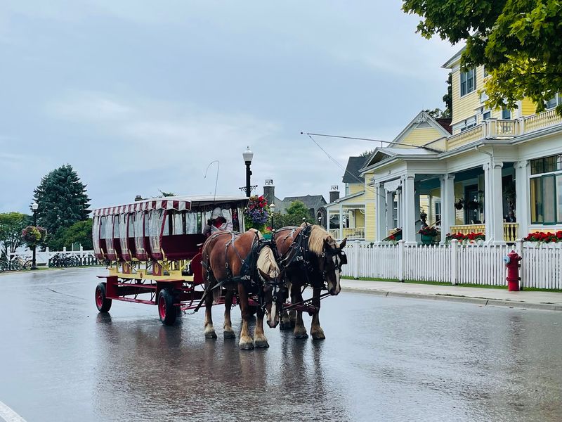
Back in 1898, Mackinac Island banned automobiles partly because the new horseless carriages were spooking the horses. Over a century later, that old-fashioned decision turned the island into one of the most refreshingly car-free destinations in the United States.
Covering only about 3.8 square miles, the island keeps most of its restaurants, hotels, shops, and historic attractions clustered near the ferry docks. Getting around means walking, cycling, or hopping into a horse-drawn carriage, which somehow never gets old.
The clip-clop of hooves on pavement becomes the town’s unofficial soundtrack.
Beyond the downtown strip, Mackinac Island State Park covers more than 80 percent of the island and offers over 70 miles of trails. Even M-185, the 8.2-mile road circling the shoreline, bans regular motor vehicles, making it one of the rare highways in America where pedestrians actually have the right of way.
Fudge shops and all, this island earns its legendary status.
Giethoorn, Netherlands
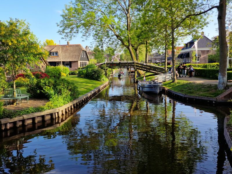
Giethoorn is the kind of place that makes you wonder why every town was not built this way. The historic core replaces roads with canals and footpaths, connecting thatched farmhouses through a series of small arched bridges.
It looks like a fairy tale, and walking through it feels like one too.
The Binnenpad, the central footpath running alongside the main canal, passes gardens, cafes, small museums, and historic homes at a pace that feels genuinely unhurried. Quieter paths branch off into the surrounding village, rewarding anyone willing to wander away from the main route.
Electric whisper boats glide silently past, but the pedestrian view is honestly better.
Giethoorn’s unusual layout grew from centuries of peat extraction and water management, a practical history that accidentally produced one of Europe’s most charming streetscapes. Cars can reach the outer edges of the settlement, but visitors park at the perimeter and continue on foot or by boat.
The village did not plan to be beautiful. It just happened that way.
Rothenburg ob der Tauber, Germany
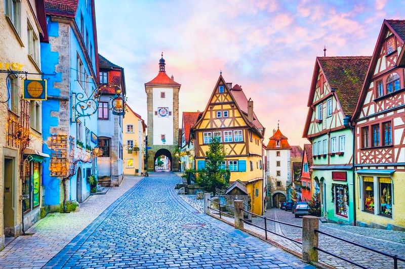
Rothenburg ob der Tauber had its walking infrastructure sorted out centuries before the first automobile rolled off an assembly line. The entire medieval old town is enclosed by intact fortifications, and visitors can walk about four kilometers of city wall on the Rothenburger Turmweg, passing towers, gates, and sweeping views over tiled rooftops and the Tauber Valley below.
Inside the walls, everything connects naturally. Narrow streets link Marktplatz, centuries-old churches, half-timbered houses, and small squares in a layout that practically designs its own walking route.
The town’s tourism office offers self-guided itineraries through the fortifications and heritage sites for visitors who want a bit of structure to their wandering.
The medieval street plan was never designed for cars, and that shows. Distances between major sights are short enough that rushing feels almost rude.
Rothenburg rewards the kind of slow, curious walking where you stop to admire a doorway or peer down an alley simply because it looks interesting. That is exactly what the town was built for.
San Gimignano, Italy
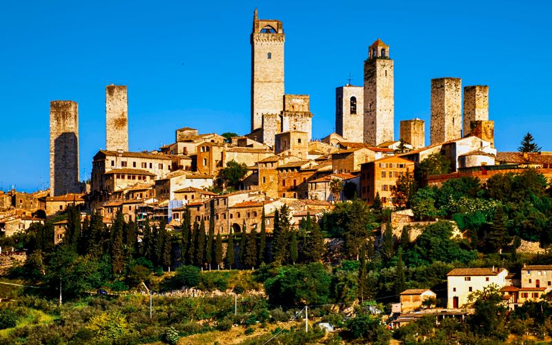
Thirteen medieval towers rising from a Tuscan hilltop make San Gimignano unmistakable from miles away. Up close, the town is even better, a compact fortified center packed with alleys, piazzas, churches, and gelato shops that all sit within comfortable walking distance of each other.
The natural walking route connects Piazza della Cisterna, Piazza del Duomo, the Collegiate Church, and Torre Grossa, the tallest publicly accessible tower, in a loop that takes under an hour at a casual pace. Italy’s national tourism site specifically recommends experiencing San Gimignano by wandering its lanes, which is genuinely good advice.
The steeper sections remind you that medieval builders cared more about defense than accessibility.
Those elevation changes also reward the effort with panoramic views over vineyards, olive groves, and the rolling Tuscan countryside. San Gimignano sits between Florence and Siena, making it a natural stop for travelers already in the region.
The UNESCO-listed center is compact enough that driving within it would add almost nothing, even on the rare stretches where a car could technically fit.
Cesky Krumlov, Czech Republic
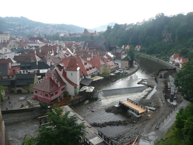
Geography did most of the planning in Cesky Krumlov. The historic center sits inside a tight loop of the Vltava River, naturally limiting the space available and keeping everything close together.
Narrow lanes connect the central square, bridges, riverside paths, and the enormous castle complex above town in a layout that simply makes more sense on foot than in any vehicle.
Short distances here produce dramatic shifts in perspective. Castle towers appear suddenly above rooftops, lanes open onto river views without warning, and bridges connect districts that otherwise feel entirely separate.
VisitCzechia recommends discovering the center by strolling through it, noting the satisfying mix of Gothic, Renaissance, and Baroque architecture along the way.
The castle, the Latran district, Svornosti Square, riverside gardens, cafes, and small museums all fit naturally into a single walking day. The medieval street pattern predates automobiles by many centuries, and the town shows no particular interest in accommodating them.
Cesky Krumlov is one of those places where slowing down is not a suggestion. The streets themselves insist on it.
Lucca, Italy
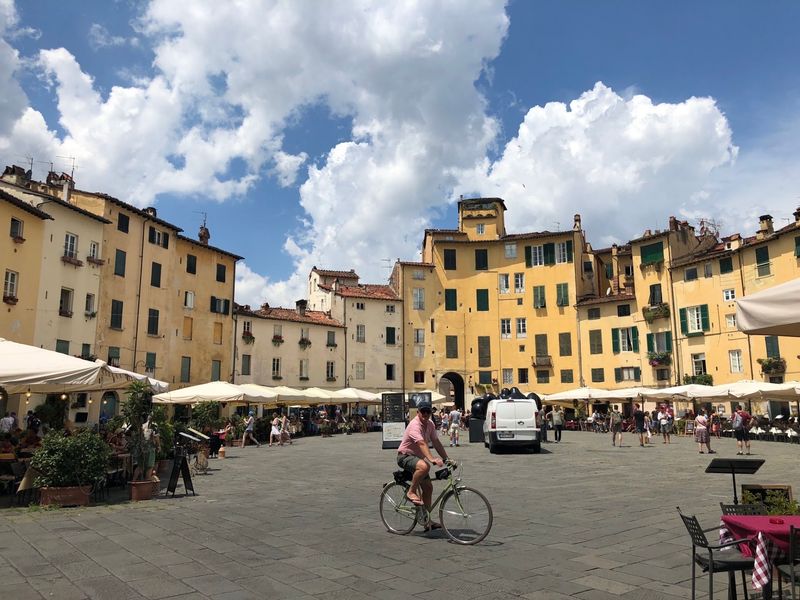
Lucca pulled off something remarkable with its old defensive walls. Instead of tearing them down when they became militarily useless, the city transformed the entire 4.2-kilometer circuit into a broad, tree-lined public promenade.
Today it serves as an elevated urban park used for walking, jogging, cycling, and everyday socializing above the historic rooftops.
Below the walls, Lucca’s compact historic center connects its best sights in a way that feels almost effortless on foot. Piazza dell’Anfiteatro, San Martino Cathedral, Via Fillungo, Torre Guinigi, and Piazza San Michele are all within a short walk of each other.
The oval shape of the Anfiteatro piazza, built over a Roman amphitheater, is one of those details you only fully appreciate while standing in it.
The walls themselves are Lucca’s most distinctive walking feature, offering a continuous loop with views over the old city on one side and gardens and neighborhoods on the other. Few towns demonstrate more clearly how former military infrastructure can become beloved public space centuries later.
Lucca makes the case quietly, without making a fuss about it.
Hallstatt, Austria
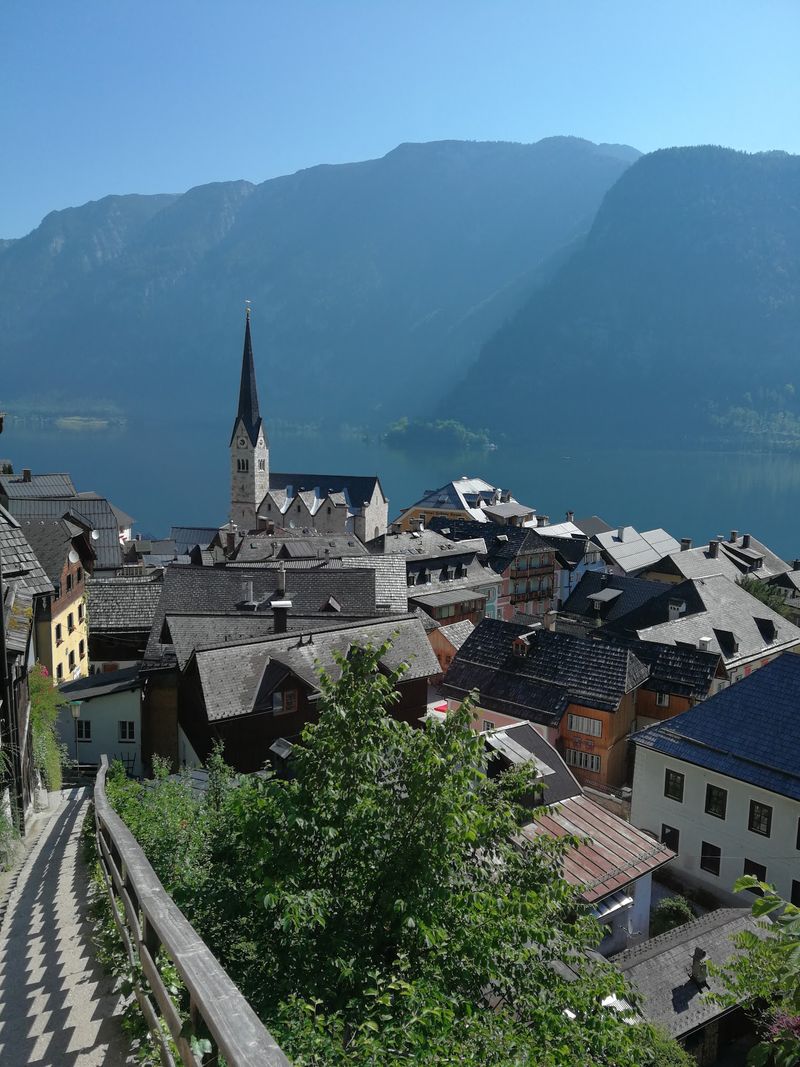
Hallstatt occupies one of the most dramatically cramped locations of any town on this list. The historic settlement squeezes into a narrow strip between steep Alpine slopes and Lake Hallstatt, leaving almost no room for roads and plenty of reason to explore on foot.
The scenery is so striking that the village has become one of the most photographed places in all of Europe.
The lakeside center links the market square, churches, waterfront viewpoints, traditional wooden houses, and boat landings within a very short distance. Walking routes then climb steeply into the surrounding terrain, connecting the village to the historic salt landscape that earned the area its UNESCO designation.
Hallstatt Tourism lists a 2.4-kilometer route from the Salzberg area into town for visitors wanting a structured introduction.
Salt mining here dates back to the first millennium B.C., making this one of the oldest continuously inhabited settlements in the Alps. The vertical geography, with its stairways and elevation changes, makes Hallstatt more physically demanding than its compact size suggests.
That same terrain is also exactly what makes the village feel so impossibly dramatic from every angle.
Telluride, Colorado
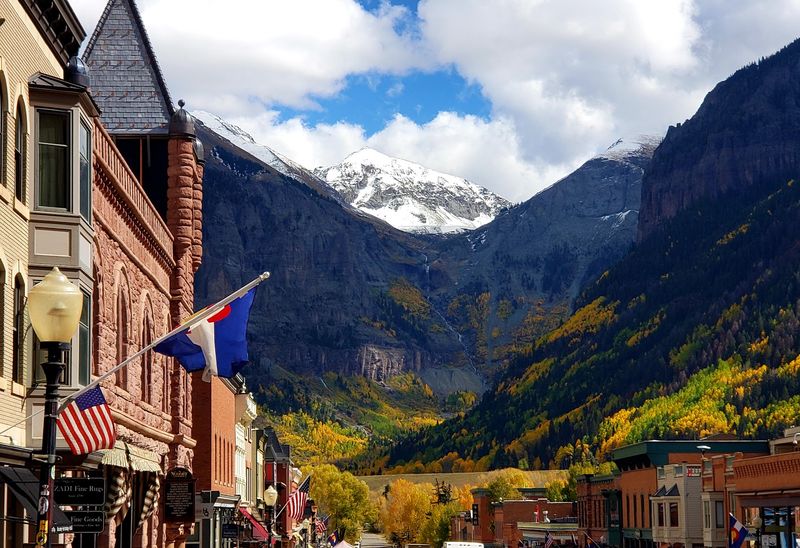
Telluride sits at the end of a box canyon with no way out except back the way you came, and that geographical quirk turned out to be excellent news for pedestrians. Colorado Avenue forms the backbone of a compact downtown where trailheads, restaurants, shops, historic buildings, and festival venues all sit within easy walking distance of each other.
What sets Telluride apart from most mountain towns is its free gondola, which connects Telluride and Mountain Village in about 12 minutes and runs for long daily hours during the main seasons. That single cable car essentially doubles the walkable area without requiring anyone to touch a steering wheel.
The free Galloping Goose shuttle adds stops every few blocks for those who want to rest their legs between errands.
Festivals draw huge crowds to this small town throughout the year, covering everything from film and bluegrass to yoga and mushrooms, yes, mushrooms. During busy periods, combining walking with the gondola and shuttle is genuinely more practical than moving a car repeatedly around town.
Telluride proves that mountain towns can be built for people, not just parking lots.
Carmel-by-the-Sea, California
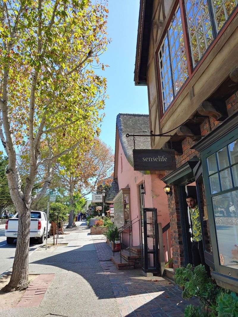
Carmel-by-the-Sea packs a remarkable amount into roughly one square mile. The official tourism organization promotes the village specifically as a place where restaurants, wine tasting rooms, boutiques, galleries, inns, and a white-sand beach are all within walking distance, and that description is not an exaggeration.
Ocean Avenue forms the main spine, descending gently from the commercial center toward Carmel Beach, while small passageways and landscaped courtyards branch off the obvious route and reward anyone curious enough to explore them. Art lovers get a particularly good deal here because galleries are densely clustered throughout the village, turning a simple walk into an informal gallery tour.
The main caveat is a practical one: reaching the beach involves a downhill walk and therefore an uphill return trip, which feels more noticeable after a long lunch. Big Sur, Point Lobos, and the wider Monterey Peninsula still require a car for proper exploration.
But central Carmel itself is one of California’s strongest park-once destinations, the kind of place where you genuinely forget you drove here at all.
Galena, Illinois
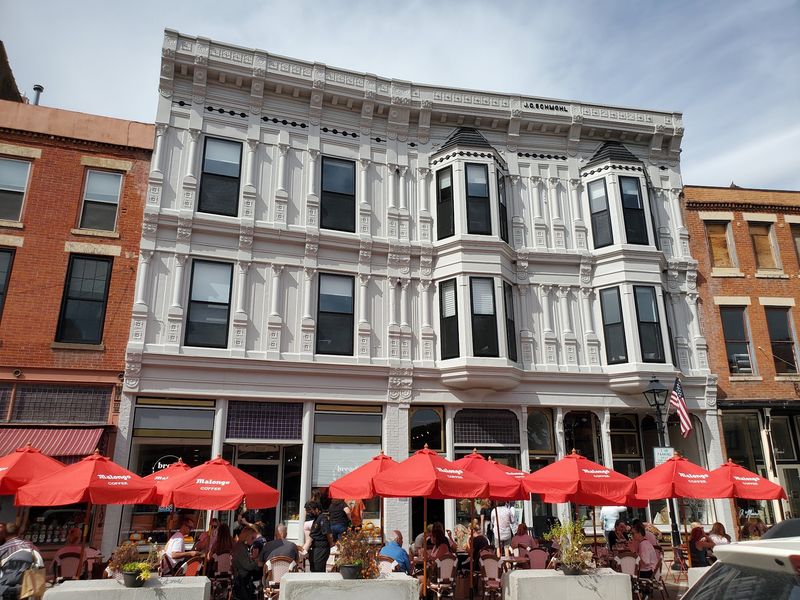
Galena’s Main Street is the kind of place where an afternoon walk turns into a full day without anyone noticing. The local tourism organization counts more than 125 shops and restaurants along the historic commercial district, with galleries, candy stores, wine tasting rooms, boutiques, and restaurants occupying buildings that date mostly from the 19th century.
That density makes walking the obvious choice. Driving from shop to shop would mean finding new parking repeatedly, which defeats the whole purpose of visiting a place this compact.
The preserved architecture also gives travelers a reason to move slowly, looking up at cornices and facades rather than treating the street purely as a route between destinations.
Galena is hillier than most people expect from an Illinois town, and streets climbing away from Main can be genuinely strenuous. Within the main commercial district, though, the layout works beautifully for a full day of browsing, eating, and sightseeing without returning to the car.
Ulysses S. Grant lived here before the Civil War, and his home is a short walk from downtown, adding a slice of American history to the shopping and dining.
Beaufort, South Carolina
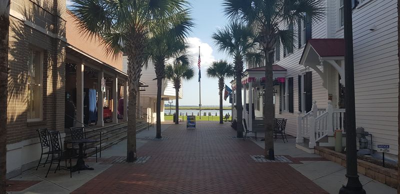
Spanish moss hangs from live oaks above streets lined with antebellum homes, and the Beaufort River glints at the end of nearly every block. Founded in 1711, Beaufort holds one of the best-preserved collections of pre-Civil War architecture in the American South, and the official tourism guide specifically describes the historic district as walkable, which turns out to be an understatement.
From Bay Street, visitors move easily toward Henry C. Chambers Waterfront Park and the riverfront, then continue into residential neighborhoods where the shade from old trees makes even summer afternoons bearable.
The town’s scale means that architecture, water views, restaurants, and local history overlap continuously rather than appearing as separate attractions spread across a sprawling map.
Beaufort has appeared in so many films and television productions that locals have mostly stopped keeping count. That cinematic quality comes through on foot in a way that a car window simply cannot capture.
A vehicle becomes useful for reaching Hunting Island State Park or other Sea Islands nearby, but central Beaufort rewards leaving it parked for as long as possible.
Bar Harbor, Maine
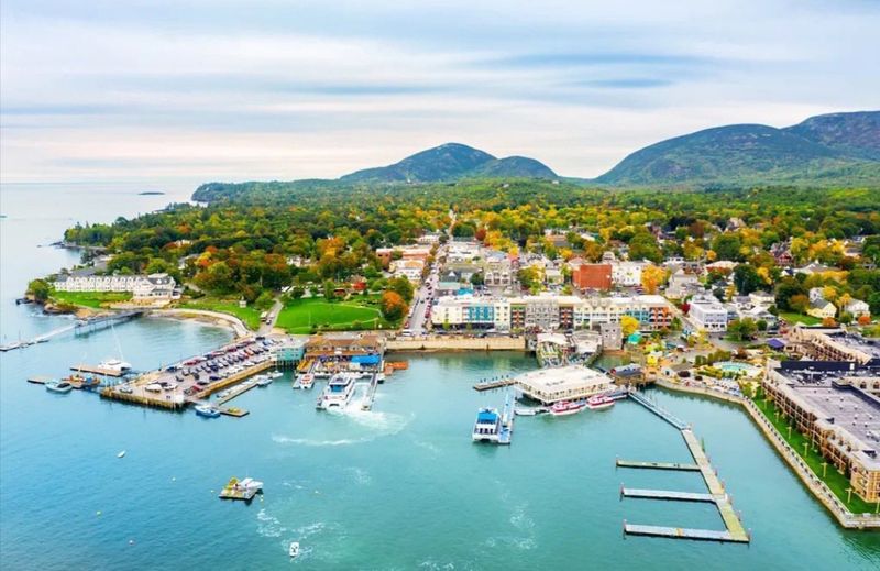
Bar Harbor’s own tourism organization tells visitors to leave the vehicle behind, describing the town as best experienced on foot, which is refreshingly honest advice from a place that could just as easily encourage people to drive everywhere. Downtown streets connect restaurants, shops, the Village Green, and harborfront areas within a compact and genuinely pleasant walking zone.
The Shore Path adds a scenic waterfront option, following the rocky coastline with views of Frenchman Bay. Seasonal Island Explorer buses provide fare-free transportation to Acadia National Park and other parts of Mount Desert Island, making it realistic to explore well beyond the downtown core without touching a steering wheel.
Bar Harbor has also formalized its pedestrian history through the Museum in the Streets program. Dozens of interpretive panels are installed throughout downtown and surrounding neighborhoods, creating self-guided walking routes that cover the town’s development, notable residents, historic fires, and its long relationship with Acadia.
That combination of compact town center, free regional transit, and built-in storytelling makes Bar Harbor especially useful during crowded fall foliage season, when Acadia parking can become a genuine headache.
Eureka Springs, Arkansas
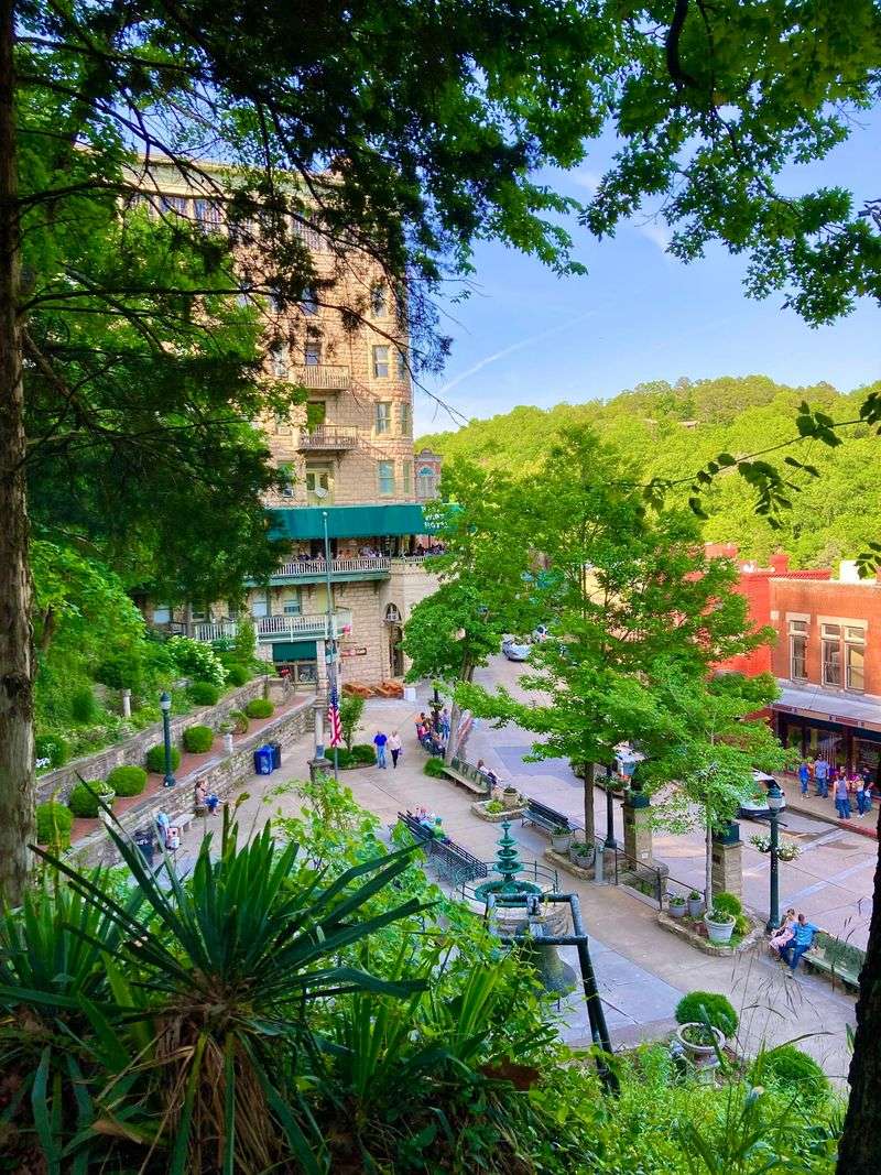
Eureka Springs threw the conventional street grid out the window and built itself around Ozark topography instead. Streets curve around hills, stairways connect different elevations, and historic buildings often appear stacked directly above one another.
The result is a downtown that feels genuinely unlike anywhere else in the American South, and navigating it on foot is the only way to fully appreciate the layout.
Spring Street and the streets surrounding Basin Spring Park concentrate most of the galleries, restaurants, shops, historic springs, and architectural landmarks within a walkable area. The unusual terrain also produced multi-level buildings where the ground floor on one street sits several stories above the street on the other side of the block.
That kind of architectural quirk only makes sense once you are standing in it.
The climbs can be tiring, particularly on warmer days, but the town’s trolley system covers longer and steeper connections for visitors who need a break from the hills. Combining walking with the trolley is more practical than repeatedly moving a car through streets that were never designed to accommodate modern traffic volumes.
Eureka Springs rewards curiosity, especially for travelers willing to follow a staircase just to see where it leads.
Colonia del Sacramento, Uruguay
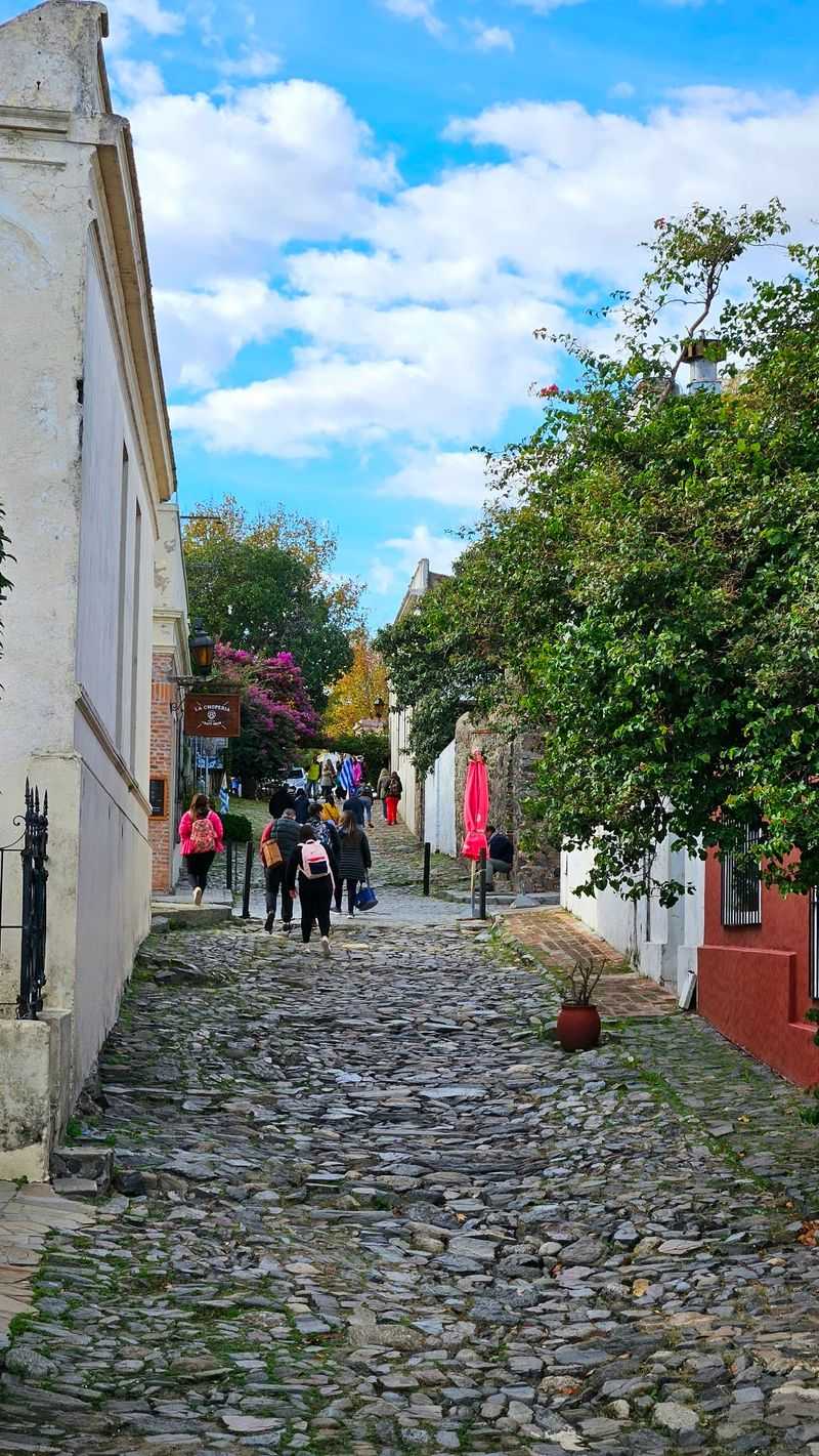
Colonia del Sacramento was founded by the Portuguese in 1680, and its irregular colonial street pattern has never been particularly interested in accommodating cars. The old district is a UNESCO World Heritage Site that preserves cobblestone streets, sections of the historic wall and drawbridge, 18th-century buildings, small museums, craft shops, and a 19th-century lighthouse within a remarkably tight area.
Calle de los Suspiros is the most photographed lane, its uneven cobblestones and low colonial walls giving it a quietly cinematic quality. Plaza Mayor sits only steps from several major historic sites, making it easy to cover the highlights of the quarter in a single morning.
The riverfront adds another natural walking route, especially appealing around sunset over the Rio de la Plata.
Colonia is also unusually convenient for international visitors. Ferries connect it with Buenos Aires in roughly an hour, allowing travelers to arrive without a car and continue exploring almost entirely on foot from the moment they step off the boat.
For a town this small and this old, it handles visitors with surprising grace, rewarding slow walkers far more generously than anyone in a hurry.
Share this story