Arkansas has a river that almost disappeared behind dams. Instead, it became America’s first national river in 1972, protecting 135 miles of free-flowing water through the Ozark Mountains.
Today, Buffalo National River offers towering limestone bluffs, waterfalls, historic mining sites, and opportunities to spot wild elk in Boxley Valley. Visitors can explore the area by canoe, kayak, or hiking trail, with several campgrounds along the river.
Some of the most interesting places aren’t visible from the road. A narrow trail leads across a massive bluff, waterfalls hide inside caves and remote hollows, and the remains of an old zinc mining town tell another part of the river’s story.
Meet the River That Started It All
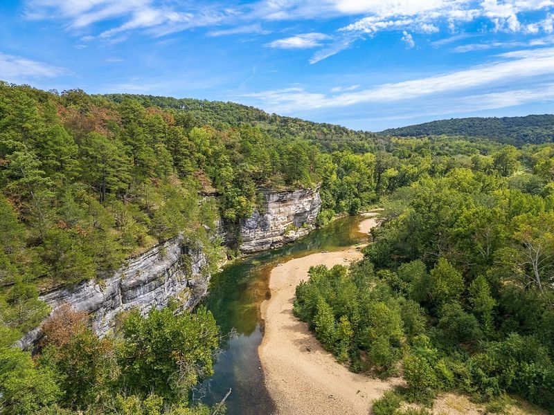
Plenty of rivers run through Arkansas, but only one carries a title no other American river held before it. In 1972, Congress set aside the Buffalo as the first national river in the country, and the National Park Service still cares for it today.
The park stretches across the northern Arkansas Ozarks, roughly between the towns of Ponca, Jasper, and Yellville. It follows about 135 miles of free-flowing water, which means no dams block its path from the high hills to the White River.
The park is long and narrow, shaped by the river itself. That design matters, because it keeps the focus on the water, the bluffs, and the forest instead of on buildings or busy roads.
I like that the main attraction here is simply a river allowed to be a river. It rises after rain, drops in dry summers, and changes its mood with the seasons.
That changing personality shapes nearly every trip. Before you plan anything, it helps to understand the cliffs that make this river look so dramatic, and the people who once fought hard to protect them.
The Dam Fight That Saved a Wild River
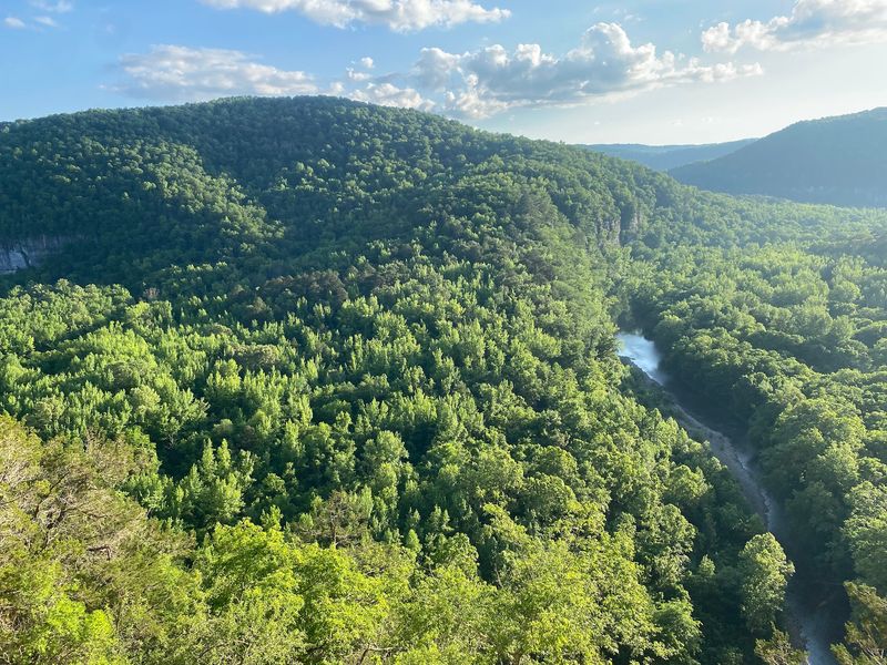
A few decades ago, this valley came close to becoming a lake. During the 1950s and 1960s, the U.S.
Army Corps of Engineers proposed dams that would have flooded long stretches of the Buffalo.
Local residents, conservation groups, and outdoor lovers pushed back. Among the well-known voices was Dr. Neil Compton, a physician from Bentonville who helped lead the Ozark Society.
Their campaign drew national attention. Supreme Court Justice William O.
Douglas even came to float the river, and photographs of its bluffs helped convince people far from Arkansas that it deserved protection.
Then, in 1972, President Richard Nixon signed the law creating Buffalo National River. It was a big win for a small group of determined people.
I find this history easy to appreciate when you look at the water today. The gravel bars, the swimming holes, and the quiet bends all exist because someone said no to a reservoir.
Knowing the story adds weight to a simple paddle trip. And the stars of that original campaign, the bluffs, still rise over the river exactly where they stood back then.
Bluffs Taller Than Anything in the Ozarks
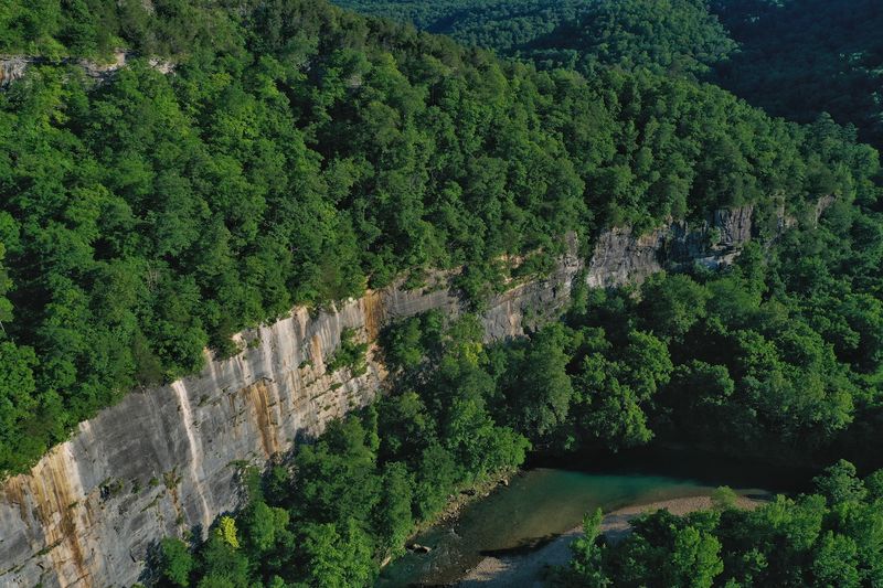
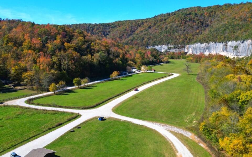
Some cliffs along the Buffalo stand hundreds of feet high. Big Bluff, near the Steel Creek area, rises about 550 feet and is often called the tallest sheer bluff between the Rocky Mountains and the Appalachians.
The rock walls are made of limestone, sandstone, and dolomite. Over long stretches of time, water carved through these layers, leaving streaks of gray, tan, and rusty orange.
From a canoe, you look straight up at them. From the top, along trails like the Centerpoint Trail and the narrow Goat Trail, you look straight down at paddlers who seem very small.
The Goat Trail follows a skinny ledge across Big Bluff, so it calls for steady feet and careful steps. It isn’t a casual stroll for young kids or anyone nervous about heights.
Steel Creek also offers a classic view of Roark Bluff from the campground and river access. You can enjoy it without much hiking at all.
Those massive walls hold another secret. Water seeps through them and spills over ledges, which brings us to the waterfalls hiding all over the park.
Waterfalls Hiding in Side Canyons
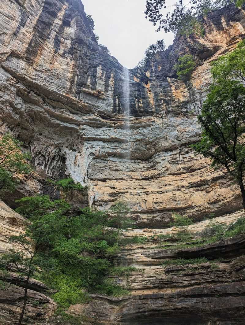
Rainy weeks change everything here. After a good soaking, small creeks pour off ledges and fill hollows with waterfalls that might be trickles in August.
The Lost Valley Trail near Ponca is a favorite for good reason. It’s about two miles out and back and leads past a natural bridge, a large bluff shelter, and Eden Falls, which drops in tiers down a rocky slope.
Hikers who bring a flashlight can peek into Eden Falls Cave, where a waterfall flows inside. The rocks get slick, so good shoes matter more than a fancy camera.
Hemmed-In Hollow is a much tougher hike. Its waterfall is often listed as one of the tallest between the Rockies and the Appalachians, but the trail down is steep and the climb back out is serious work.
Timing is the trick. Spring usually brings the strongest flow, while late summer can leave some falls looking pretty quiet.
Here’s my plan if I had one day: Lost Valley in the morning, when the light is soft. Then I’d head out to look for the park’s biggest wildlife, which shows up near Boxley Valley.
Elk Grazing in Boxley Valley
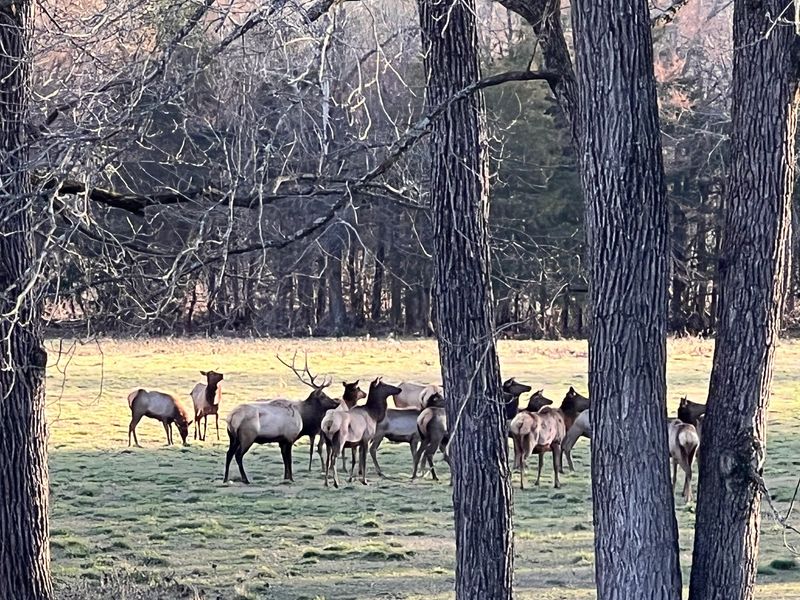
Elk once vanished from Arkansas entirely. Between 1981 and 1985, the state worked with partners to release elk from Colorado and Nebraska along the Buffalo River, and the herd took hold.
Today, Boxley Valley near Ponca is the easiest place to spot them. The open fields along Highway 43 and Highway 21 give these big animals room to graze.
Early morning and evening are usually your best chances. Many people simply pull off safely, stay in their car, and wait for the herd to wander out of the trees.
Fall adds sound to the scene. That’s when bull elk bugle, a high, squealing call that carries across the valley.
Please keep your distance. Elk are wild and powerful, and bulls can get grumpy during the fall season, so binoculars or a zoom lens beat walking closer.
Boxley Valley is also a historic district, with old homes, barns, and farm fields that are still privately owned in many cases. Stay on public roads and respect the property.
Once the elk wander off, the river itself is calling. Getting on the water takes a little planning, though.
Floating the Buffalo, Section by Section
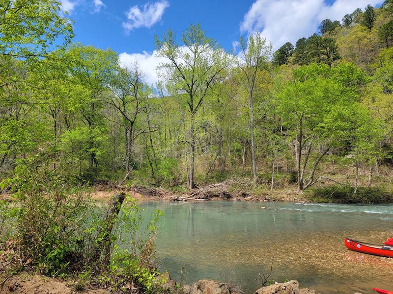
Ask anyone why they come here, and paddling usually tops the list. Canoes, kayaks, and inner tubes all show up on the Buffalo, depending on the season and the water level.
The river is usually split into three parts. The upper river, around Ponca and Steel Creek, has the tallest bluffs and the liveliest water, but it often runs too low by early summer.
The middle river, near Tyler Bend and Woolum, offers longer floats and steady scenery. The lower river, near Buffalo Point and Rush, tends to hold water later in the year and passes through wilderness areas.
Several licensed outfitters rent boats and run shuttles. That service is handy, since a one-way float means your car is miles away at the end.
Gentle riffles and calm pools make many sections friendly for beginners. Still, conditions change after storms, so checking the park’s water level information before you go is smart.
I’d always pack more water and sunscreen than seems necessary. A few miles on the river can feel longer than the map suggests, especially when you keep stopping at gravel bars to look around.
Gravel Bar Nights and Riverside Campgrounds
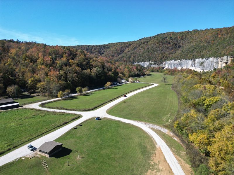
Few campsites feel as simple as a gravel bar beside clear water. Along the Buffalo, paddlers on longer trips often pitch tents right on these rocky banks.
For something more organized, the park runs campgrounds at places like Steel Creek, Kyles Landing, Ozark, Tyler Bend, and Buffalo Point. Each has its own feel, from horse-friendly Steel Creek to roomy Tyler Bend.
Buffalo Point also has rustic cabins, which are a nice choice for anyone who prefers a real bed. Reservations for popular sites and cabins can fill up during busy months.
Night skies here are another treat. In 2019, the park earned recognition as an International Dark Sky Park, so stars stand out clearly on clear nights away from town lights.
A quick word about rising water: rivers can climb fast after heavy rain upstream. Camping high on a gravel bar, and watching the weather, keeps a trip relaxed instead of stressful.
Kyles Landing has a famously steep, rough road down to it. Small cars and trailers may struggle, which is a good reminder that getting around this park takes some thought.
Ghost Towns and Old Ozark Homesteads
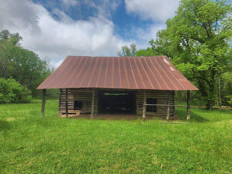
Long before canoes filled the river, families farmed and mined these hills. Their traces still stand in places like Rush, a zinc mining town on the lower river.
Rush boomed in the late 1800s and early 1900s, especially during World War I demand for zinc. When prices fell, people left, and today a short trail passes old stone buildings and mine areas.
Please admire the mine openings from outside. They’re closed for safety and to protect bats that live in the park.
Farther upstream, the Collier Homestead near Tyler Bend shows a small log cabin from homesteading days. A short walk leads to it, and it’s an easy stop for families.
Boxley Valley adds old churches and farm buildings, while Erbie has more historic structures near the middle of the upper river.
I like these stops because they slow a trip down. The river feels wild now, but people once raised crops, sent kids to school, and made hard livings right here.
Those stories fit nicely between hikes, which is good, because the park’s trail system covers a lot of ground.
Trails That Go Far Beyond the Riverbank
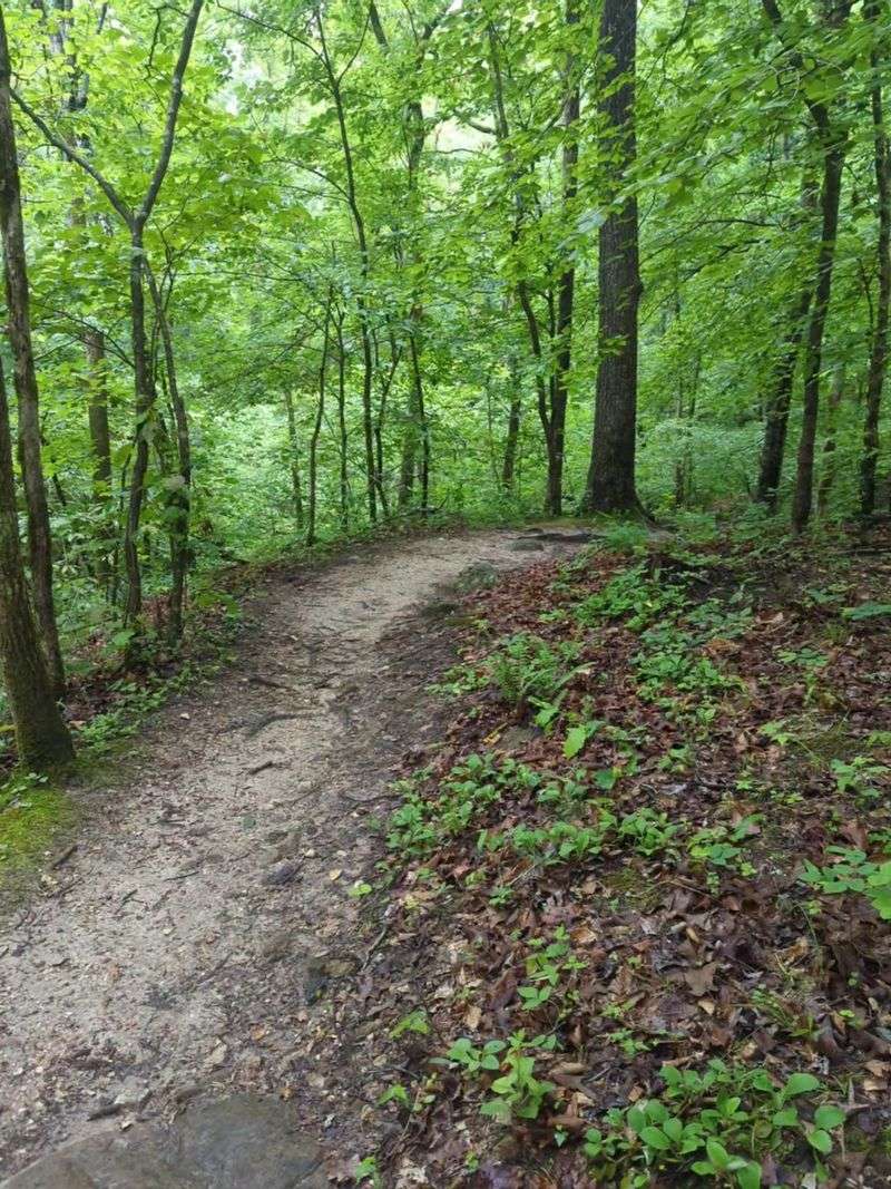
More than 100 miles of maintained trails wind through the park. That surprises people who think of the Buffalo only as a paddling spot.
The long Buffalo River Trail follows much of the upper and middle river. Backpackers can walk it in sections, camping in the woods along the way.
Shorter options suit casual walkers. At Buffalo Point, the Indian Rockhouse Trail leads to a huge rock shelter, a sinkhole, and small waterfalls on a loop of roughly three miles.
Tyler Bend has easy paths near the visitor center, while the Ozark Highlands Trail connects into the area for hikers chasing serious mileage.
A real practical tip: ticks and chiggers are common in warm months. Insect repellent, long socks, and a quick check after your hike can save a lot of itching later.
Poison ivy grows here too, so learning its three-leaf pattern is handy. Summer heat can be strong as well, and shade disappears fast on open ridges.
Those warm-weather challenges point to a bigger question. When is the right time to visit this river at all?
Picking the Right Season for Your Trip
Spring is when the upper Buffalo comes alive. Rain fills the river, waterfalls run strong, and dogwoods and redbuds brighten the hillsides.
Summer brings warm swimming holes and busier weekends. By then, the upper river often runs low, so many paddlers shift down to the middle and lower sections.
Dry spells can be serious. In a drought, even popular stretches may get too shallow to float, so a picnic and a swim might replace your canoe plans.
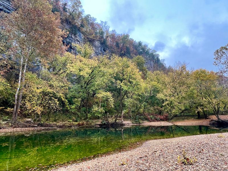
Fall paints the bluffs with orange, red, and gold leaves. It’s also elk bugling season in Boxley Valley, and cooler air makes hiking more pleasant.
Winter is quiet and chilly. Leafless trees open up views of bluffs and rock formations that summer greenery hides.
Cell service is spotty across much of the park, so download maps ahead of time. Gas stations and stores sit in small towns like Jasper, Ponca, and Yellville, not inside the park.
Every season shows a different side of the same river. Pick yours based on what you want most, rushing water, fall color, elk, or solitude.
Share this story