Thousands of drivers on Interstate 84 cross a 250-foot-deep canyon every day, and plenty of them never realize it is down there. Right below the freeway, a river squeezes through a narrow slot of dark volcanic rock and drops into a churning pool.
That pool carries a name worthy of a pirate legend. Nearby, a pedestrian bridge lets you stand directly above a waterfall and stare straight down into the gorge.
I like places that hide in plain sight, and this one does it better than most in Idaho. It takes only a few minutes to leave the highway, yet the view feels far removed from traffic.
The canyon also tells a story written by ancient lava and melting mountain snow. Some of its water seems to appear out of solid rock.
A Deep Canyon Hiding Under the Interstate
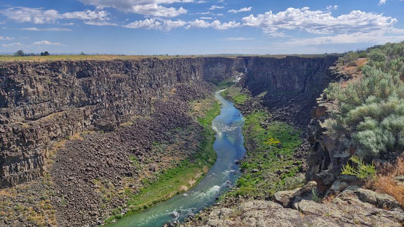
Few state parks sit this close to a major highway. Malad Gorge, part of Thousand Springs State Park, is found at 2314 S Ritchie Road in Hagerman, Idaho, just a short hop off Interstate 84.
The gorge drops about 250 feet into dark volcanic rock. The Malad River runs along the bottom, cutting a path through layers of old lava.
From the freeway, most travelers see only a quick flash of the canyon before it disappears behind them.
Thousand Springs State Park is actually made up of several separate units spread around the Hagerman Valley. Malad Gorge is one of them, and it focuses on canyon views, short walks, and a scenic loop road.
It operates as a day-use park, so plan for a daytime stop rather than an overnight stay.
I find it fun that such a dramatic landscape sits right next to a busy road. You can hear the traffic at times, yet the canyon still feels wild and quiet in its own way.
The first thing most people head for is a narrow bridge, and it sits right over the most famous spot in the park.
Standing Above the Devil’s Washbowl
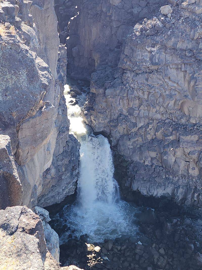
Here’s a waterfall with a name that sounds like trouble. The Devil’s Washbowl is where the Malad River pours roughly 60 feet into a swirling pool inside a tight section of the gorge.
That pool really does churn like a giant basin. The water foams and spins as it hits the bottom, then rushes on through the narrow rock walls.
It’s the first numbered stop on the park’s self-guided route, so it makes a natural starting point.
Sunlight can make photos tricky here. Morning sun sometimes shines straight into your view, so afternoon or early evening light often works better for pictures.
Water levels change through the year, too. Spring usually brings stronger flows from melting snow, while late summer can look calmer.
Each season shows a different side of the falls, which gives you a good excuse to come back.
My advice is simple. Bring a camera, but also take a few minutes to just watch the water move.
To get the closest look, though, you need to cross something that makes some visitors a little nervous.
A Footbridge Over the Falls
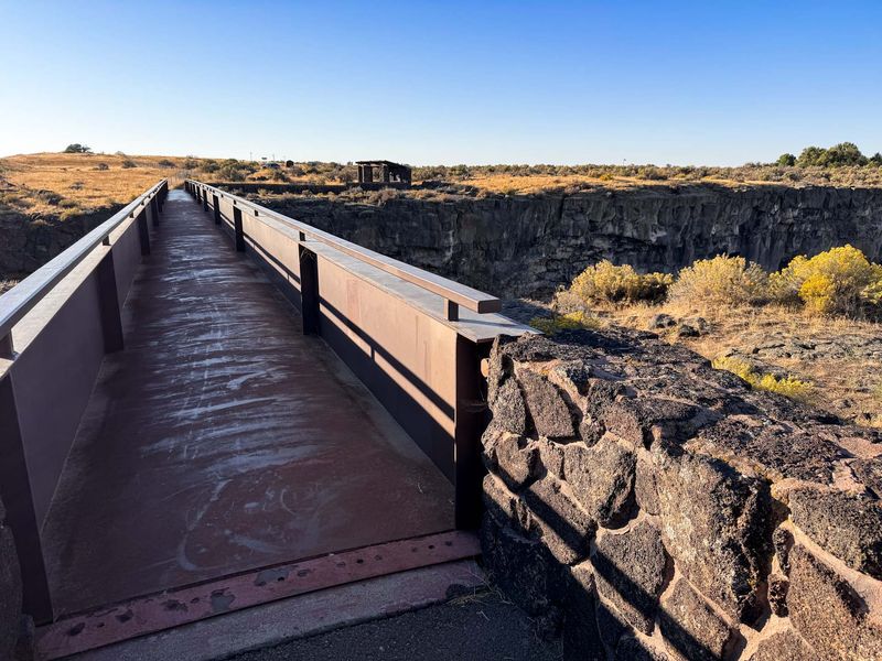
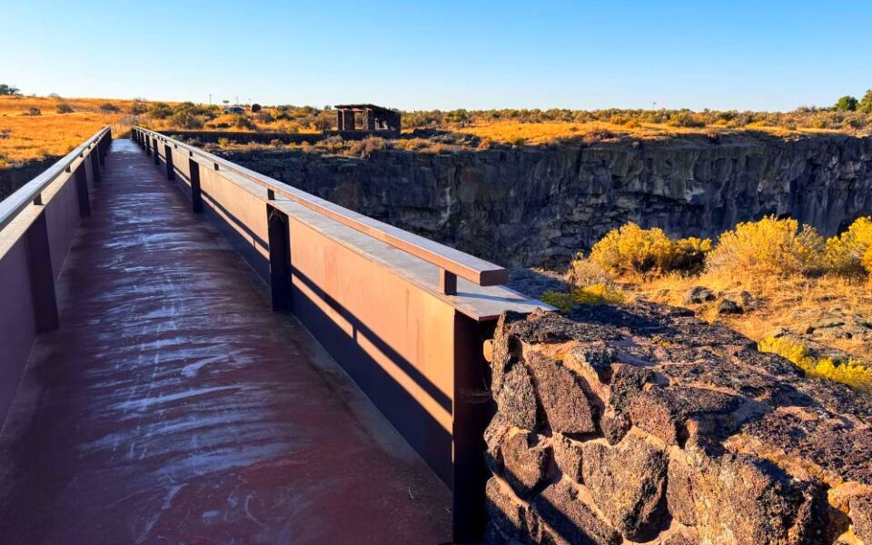
Heights not your thing? Hold that thought, because the pedestrian bridge at Malad Gorge puts the waterfall directly under your feet.
A short walk from the parking area leads to the bridge, which spans the narrow canyon. From the middle, you can look straight down into the gorge and see the river crashing below.
It’s one of the few places where a waterfall view comes from directly above.
The walk itself is easy. A paved path leads to the bridge, making it friendly for most people who can manage a gentle stroll.
Once you cross, a trail continues along the rim. Walking a little farther gives you a wider angle of the gorge and the falls.
That extra stretch is worth adding if your legs and schedule allow.
Keep children close at all times. Viewing areas sit right at the canyon edge, and the drop is serious.
The bridge is also visible from eastbound Interstate 84 if you know where to glance. Once you have stood on it, you’ll probably spot it on every future drive past.
Five Stops on One Scenic Loop
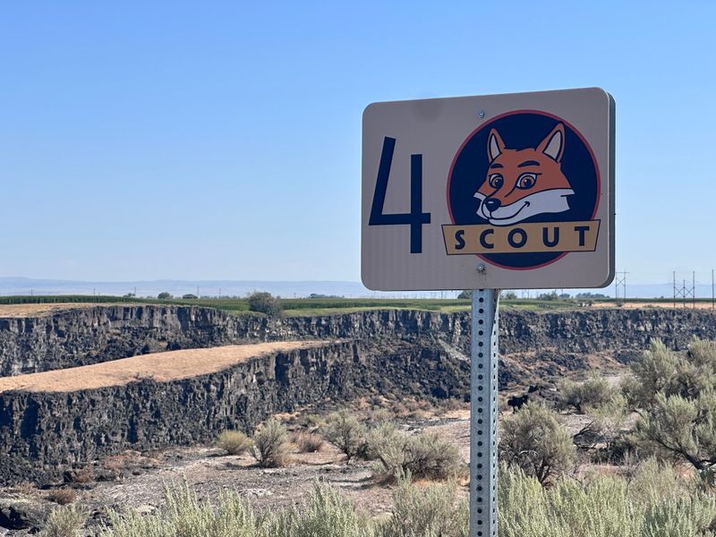
Think of the park as a treasure map with five pins. A scenic road loops through Malad Gorge, and numbered roadside markers point you to five viewpoints.
A pamphlet with a map is often handed out at the entrance. It explains what you’ll see at each stop, which turns a quick drive into a mini guided tour.
Interpretive signs along the way add even more background.
The first stop is the Devil’s Washbowl. The second offers a wide overlook of the gorge and its waterfall.
A third shows the Malad River dam, while a fourth highlights canyon rock formations and a rare native plant.
The final stop takes you to Woody’s Cove, which has its own story to tell.
The road is easy to drive, and even larger vehicles can manage it. That makes it handy for road-trippers pulling trailers.
You can visit every stop or pick just the ones that interest you most.
I’d suggest doing the whole loop in order. Each viewpoint builds on the last, and the canyon slowly reveals how it was shaped.
Woody’s Cove and Water From the Walls
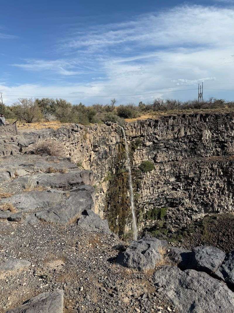
Woody’s Cove is the spot that best explains the title of this article. Water here appears to spill out of the canyon wall itself.
The Hagerman Valley sits near the edge of the Snake River Plain Aquifer, a huge underground water supply. Water soaks into porous volcanic rock far upstream, then travels underground and bursts out of canyon walls as springs.
That’s how the Thousand Springs area earned its name.
At Woody’s Cove, a large waterfall once flowed over the rim. Today, you’ll usually see a smaller fall, but the scene still shows how water shaped this canyon.
Wind can be strong at this stop. On gusty days, the falling water sometimes blows sideways or even upward, which is a strange and memorable sight.
Bring a jacket if the forecast looks breezy, and hold onto your hat. Some longtime visitors even joke about bringing paper airplanes to test the updrafts.
Springs like this one connect to an even bigger story about how the whole gorge was formed in the first place.
Lava, Floods, and Melting Snow
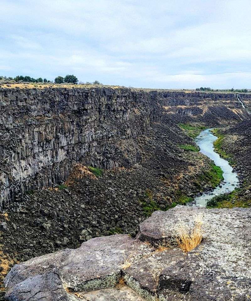
Long before any highway existed, molten rock covered this part of southern Idaho. Layer after layer of lava cooled into the dark basalt you see in the canyon walls.
Over time, water went to work. Snowmelt from distant mountains fed rivers and springs that slowly carved into the rock.
The Malad River cut the gorge deeper, creating the steep cliffs visible today.
Look closely at the walls. Basalt often breaks into blocky, step-like shapes, and those patterns show up clearly along the canyon.
One of the loop stops points out this structure specifically.
The canyon is fairly short, but its depth is impressive. Standing at the rim, you can see how much rock the water removed.
I enjoy places where geology feels easy to understand. Here, you don’t need a science degree to picture lava flowing and rivers cutting through it.
Interpretive signs help fill in the details. They’re worth a quick read at each stop, especially if you’re traveling with curious kids who like asking how things got this way.
Shady Picnic Spot After the Views
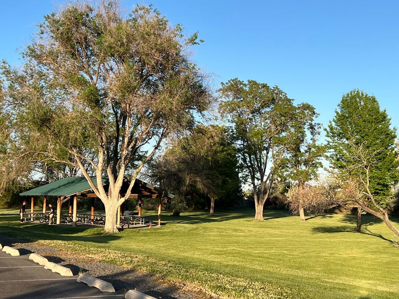
After a few rounds of staring into a canyon, lunch sounds pretty good. Malad Gorge has a large picnic area shaded by tall trees, which feels welcome on hot summer days.
Southern Idaho can get warm, and shade isn’t always easy to find in this high desert landscape. These trees make the picnic grounds a comfortable place to rest.
Restrooms are available in the park, though facilities can occasionally be closed. A playground nearby gives younger travelers a chance to burn off energy after the drive.
Packing your own food is the way to go. The park focuses on outdoor recreation rather than dining, so bring snacks, sandwiches, and plenty of water.
I like the idea of splitting a visit into two halves. Explore the viewpoints first, then settle in at a shady table and rest your feet.
Parking is easy to find, and the picnic area stays close to the main attractions. If you’re on a long road trip, this spot makes a much nicer break than a crowded gas station.
Wildlife Along the Rim
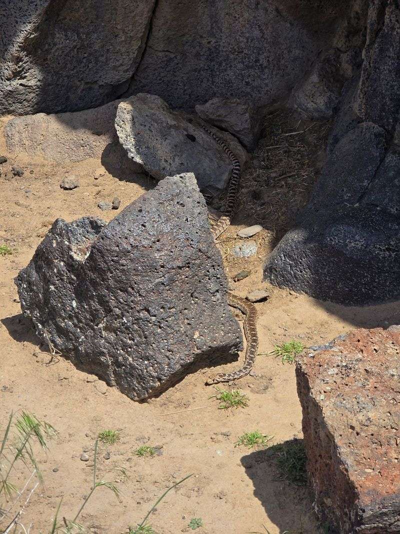
Keep an eye on the rocks near your feet. Small lizards often dart across the warm basalt along the canyon rim.
Look up, too. Birds such as pigeons glide through the gorge, using the cliffs for shelter.
The canyon walls offer nooks and ledges that make good resting spots.
The surrounding area also includes ranch land, and horses can sometimes be seen near the park roads. It’s a reminder that this canyon sits in the middle of working farm country.
Plant life adds to the scene. The fourth stop on the loop points out a rare native plant that grows in this area, so slow down and look for it.
Wildlife sightings are never guaranteed, of course. Animals keep their own schedules, and quiet visitors usually see more.
A pair of binoculars can make a big difference here. They let you scan cliff ledges and the river below without leaning over any edges.
Spotting critters also gives kids something fun to do between viewpoints, which might keep the backseat questions to a minimum.
Why Spring Changes Everything
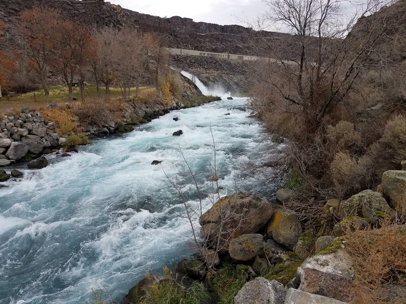
Timing matters more here than at many parks. Water levels in the Malad River rise and fall through the year, and the falls change along with them.
Spring often brings the strongest flows. Melting snow feeds the river, and the Devil’s Washbowl can roar with extra power.
Many visitors plan their trips for this season to see the falls at their fullest.
Summer offers longer days and warm weather. The water may calm down, but the shady picnic area becomes even more appealing.
Fall can still surprise you. In some years, the gorge carries plenty of water well into September.
Light is another factor. Afternoon and evening sun tends to make the canyon glow and keeps glare out of your eyes at the main falls.
Wind can pick up at any time of year, especially at the far end of the loop. A light layer is smart even on sunny days.
No matter when you go, checking the park’s current conditions before leaving is a wise move.
Know Before You Pull Off I-84
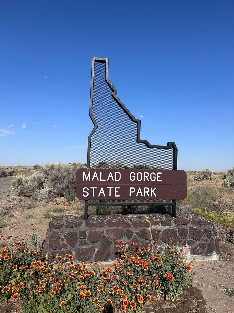
Getting here is refreshingly simple. The park sits near Interstate 84, and the turnoff is only a few minutes from the highway near Hagerman.
Like most Idaho state parks, Malad Gorge charges a daily vehicle entry fee. That day pass also covers other Idaho state parks for the same day, so it pairs nicely with nearby units of Thousand Springs.
When no staff member is at the gate, a self-pay station is available, so carrying a little cash helps.
Friendly staff sometimes greet visitors at the entrance and hand out maps. They can answer questions and help you plan which stops to visit.
Google lists daily hours starting in the morning and ending in the evening, but checking the official Idaho Parks and Recreation website is the safest way to confirm.
A car is the easiest way to explore, since the viewpoints are spread along the loop road.
Finally, remember those cliff edges. Hold small hands, stay behind barriers, and enjoy the view from solid ground.
A canyon this pretty deserves your full attention, not a risky selfie.
Share this story