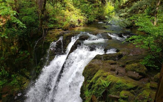
I only pulled off the road because I wanted a quiet walk, and I expected a trickle of water and maybe a bench. Instead I found mossy stairs, rushing creeks, and one waterfall after another tucked into a green Oregon canyon.
The whole loop felt like a secret the forest had been saving for whoever bothered to look. If you love places that tourists drive right past, this one belongs on your list.
A Linn County Canyon Hiding in Plain Sight
Tucked into the foothills east of Lebanon, McDowell Creek Falls County Park sits at 43170 McDowell Creek Dr. It is run by Linn County Parks, and from the road you would never guess what waits below the trees.
Step onto the trail and the Willamette Valley farmland disappears fast. Moss, ferns, and tall firs close in, and the sound of falling water takes over.
One visitor who found it by scanning a map for new hikes called it a true hidden gem, and that feels exactly right.
The park is built around a loop trail that links several waterfalls, wooden bridges, and stone stairways. You can stroll a few minutes to a nearby cascade or commit to the full circuit.
Either way, it rewards Oregonians who like trading highway noise for creek song without driving half a day to get it.
Rain, Moss, and the Seasons of the Creek
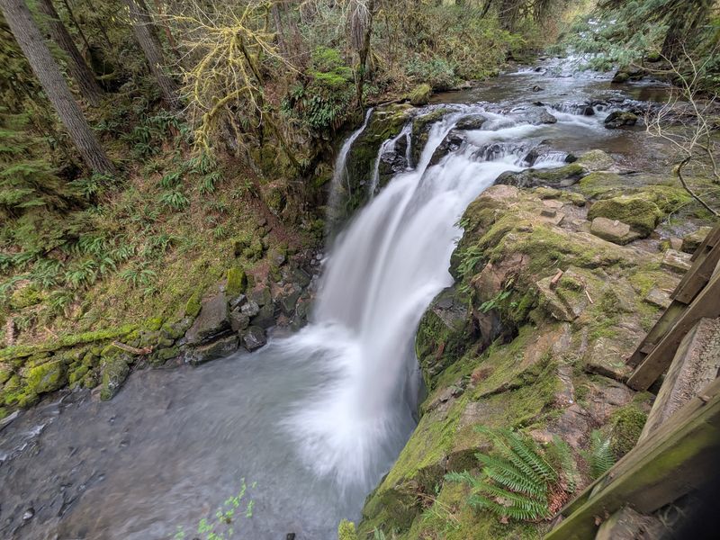
Rain is the secret engine behind this place. Regulars say the falls run strongest from early fall through mid spring, when Oregon’s wet months keep McDowell Creek swollen and loud.
Summer tells a different story. Some longtime visitors mention that recent hot summers shrank the falls noticeably, though they still found them worth seeing.
The upside of warm months is that the creek becomes a playground, and some folks even hike up the streambed after finishing the trail.
Spring may be the sweetest balance. Hikers have spotted bleeding hearts in bloom and salmonberries lining the path, with mud underfoot as the price of admission.
Winter brings more mud and fewer people, which suits anyone chasing solitude. Pick your season based on what matters most to you: roaring water, wildflowers, or a cool dip on a hot afternoon.
Royal Terrace Falls, the Triple-Decker Star
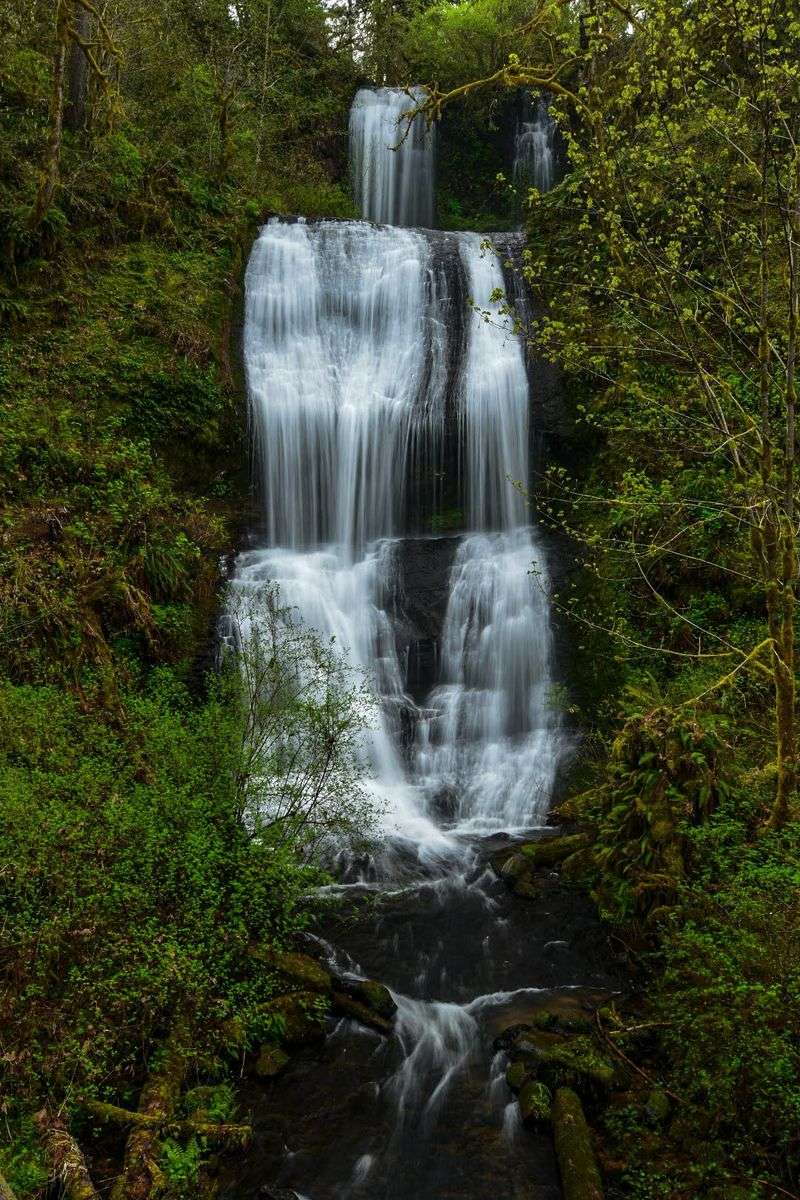
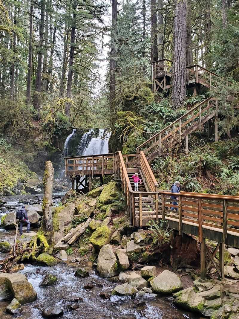
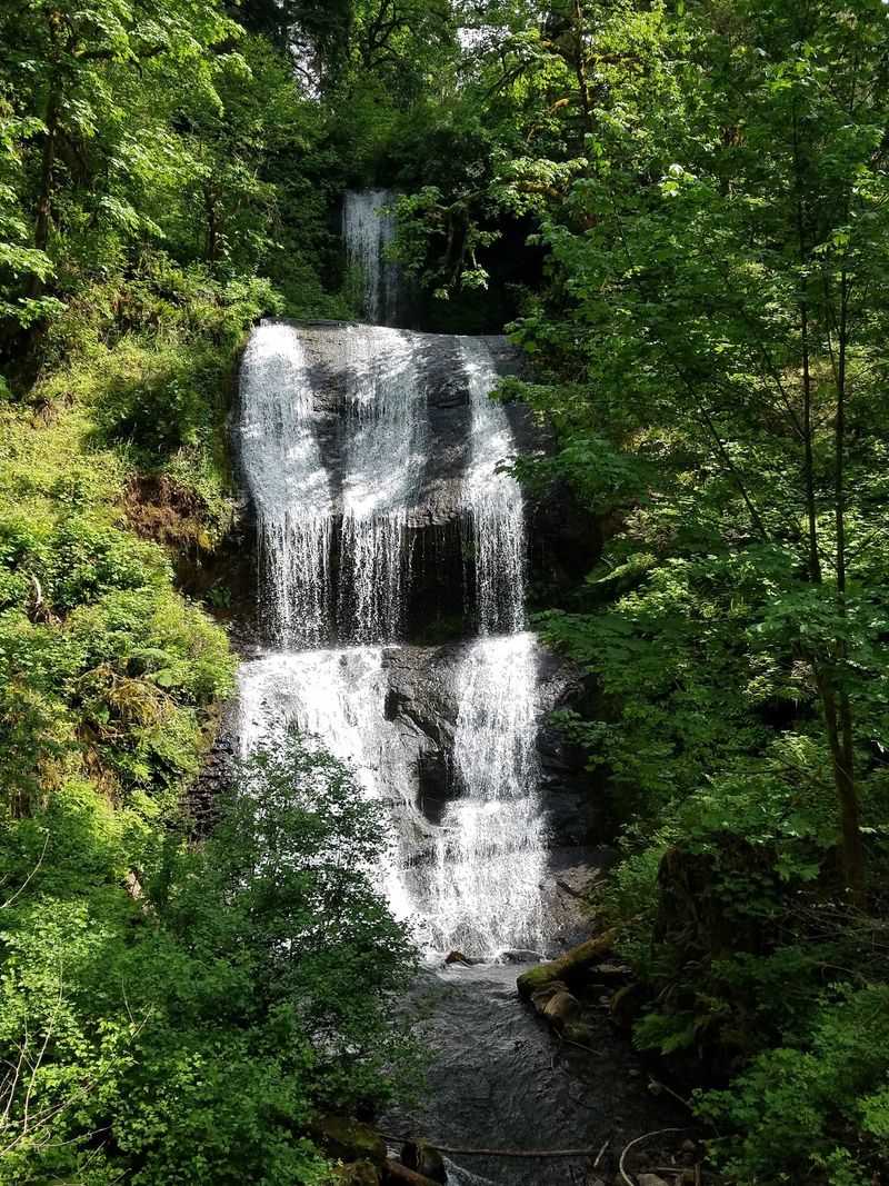
Picture water stepping down a cliff like a grand staircase built for giants. Royal Terrace Falls drops in three distinct tiers, and more than one hiker admits it turned out taller than they expected.
The best angles change as you move. Several visitors say the lower bridge offers the finest view, framing the whole cascade from below.
Climb the stairs beside it and you gain a new respect for its height as you look out from near the top.
If you have the legs for it, keep going to the upper viewpoint. One returning hiker, back after decades away, praised the view from above the triple falls as a highlight of the day.
Morning light filtering through the trees makes the white water glow against dark basalt and green moss, so bring a camera and plan a few extra minutes here.
Lower McDowell and the Double Drop
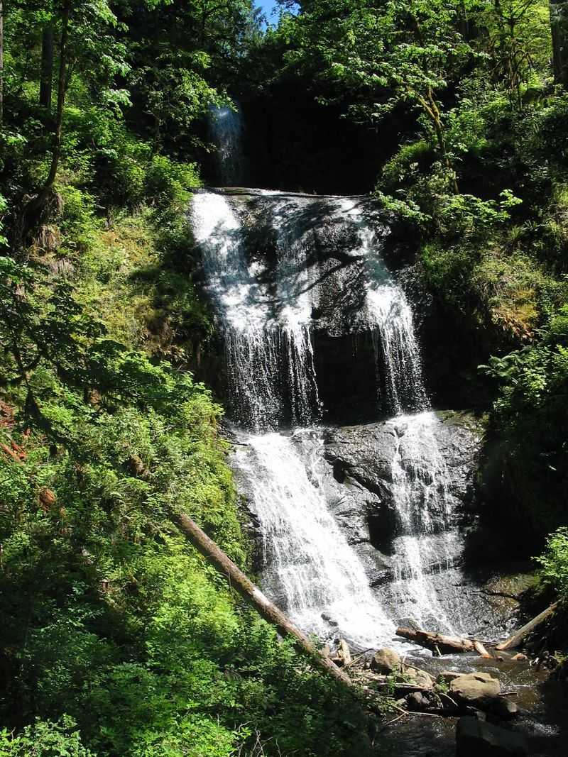
Head right from the lower parking area and follow the trail far enough, and you will catch both levels of Lower McDowell Falls. Hikers say it is worth walking that extra stretch rather than stopping at the first glimpse.
Here the creek splits its energy into a two-step drop, spilling into a clear pool that invites you closer. On warm days people wade in, and one visitor noted the water felt mild, neither warm nor cold.
Another described getting wet under the falls as downright magical.
A friendly word of caution comes straight from regulars, though. The pool below the double waterfall is only about four to five feet deep, so jumping is a bad idea.
Ease in slowly, wear sturdy water shoes or sneakers, and watch your footing on slick rock. A calm swim here beats any crowded lake day.
Stone Stairs That Earn Every View
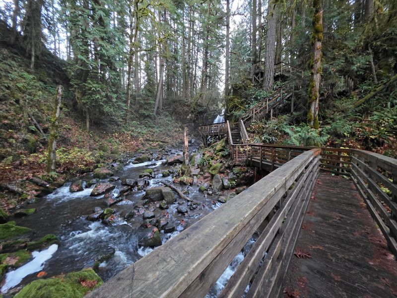
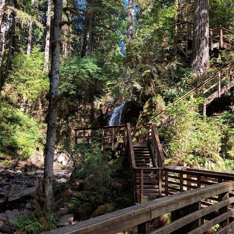
Nobody warns you enough about the stairs, so consider this your heads-up. One hiker compared a section to climbing about thirty flights straight up, and others call them steep, uneven, and a real workout.
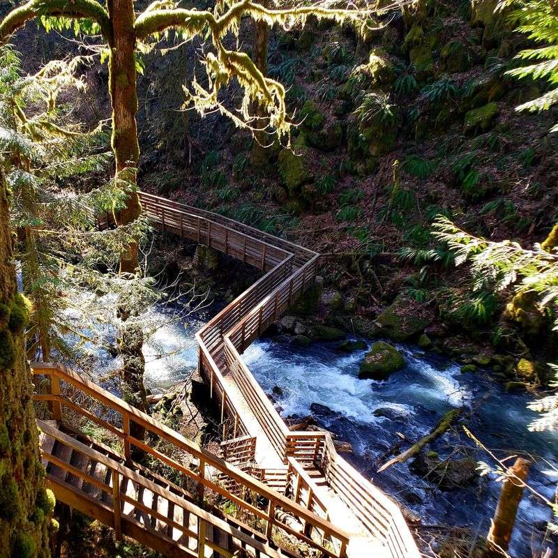
After rain the stone steps turn slick, and a few wooden ones are loose or worn, so test each step before trusting your full weight. Handrails help a lot, and several visitors swear by bringing a walking stick for balance.
Direction matters too. Many regulars recommend going counterclockwise, and one noted that climbing up the wet staircase felt safer than heading down.
Still, people manage it in all sorts of ways, including one parent who carried a toddler on their shoulders. Take breaks, soak in the views between breaths, and remember that the effort is exactly what keeps this canyon feeling wild.
Loop Distance, Time, and Trail Tips
Short on time? Good news.
Hikers describe the full loop as roughly two to three miles, and one couple finished it in about forty minutes going counterclockwise from the top lot.
Linger longer and you might stretch it to ninety minutes, especially with photo stops. Along the way you will pass up to four waterfalls, a few bridges, and plenty of picnic spots.
Trails are generally well kept and clearly defined, which also protects the plants growing beside them.
Navigation gets mixed marks, though. Some visitors found signage helpful, while others felt confused about which trail they were on.
Cell service is minimal to nonexistent, so download an offline map before you leave home. Pack water if you plan the full circle, and expect a couple of muddy patches that waterproof boots handle easily, though sneakers can work in drier weather.
Families, Dogs, and Banana Slugs
Kids giggling, dogs sniffing every fern, and maybe a bright yellow Pacific banana slug inching across the path. That is the scene many hikers describe on a typical outing here.
Dogs are welcome, and visitors say they seem to be everywhere. Families love the mix of options, since some trails are easy strolls while others test your legs.
One hiker called it a perfect spot to bring out-of-town guests to show off the area.
Picnic tables are scattered around, so packing a lunch turns a quick hike into a lazy afternoon. The forest itself sets the mood, lush and quiet in a way that feels almost enchanted.
Several people used that very idea, saying the hike simply feels magical. For little ones, a short walk to the nearest falls may be all the adventure they need.
Hours, Parking, and Beating the Crowds
Gates open daily from 7 am to 8 pm, giving you plenty of daylight to plan around. For current details, Linn County Parks can be reached at 541-967-3917.
Parking is where strategy pays off. The park has several lots, and since the trail loops, you can see every waterfall no matter where you start.
Many hikers favor parking lot number three, while others like the bottom lot and walking up. Bathrooms, clean pit toilets stocked with paper, sit at the main entrance lot only.
Weekends fill up quickly. One Saturday visitor found it packed at 11 am but mostly empty by 2:30, suggesting mid-afternoon as the sweet spot.
Weekday evenings can feel almost private, with one hiker meeting just a handful of people. Come early, come late, or come on a rainy weekday for that locals-only calm.
A Quiet Keeper for Your Oregon List
Some places shout for attention, and some wait patiently for you to find them. McDowell Creek Falls is firmly the second kind.
You get waterfalls you can walk right up to, a loop short enough for a lunch break, and stairs challenging enough to make you feel you earned the view. Visitors keep saying the same thing in different words: they wish they had come sooner, and they plan to return.
Is it flawless? Not quite.
Mud, slick steps, and patchy trail markings come with the territory. Yet those small quirks are part of why it still feels like a local secret rather than a crowded attraction.
Grab sturdy shoes, a water bottle, and an offline map, then head toward Lebanon on a gray Oregon morning. Chances are you will leave already planning your next visit.
Share this story