Some drives in Georgia stick with you long after the tires stop rolling, and one crossing along the coast does exactly that. Rising high above a wide river, this towering structure makes plenty of drivers grip the wheel a little tighter and quietly slide toward the middle lane.
It carries traffic, sure, but it also draws people who come just to watch it, walk it, and photograph it. There is history tangled in its cables and a hidden park tucked beneath it.
Curious what makes this coastal giant such a big deal? Keep reading, because the story is taller than you might expect.
A Coastal Giant Rising Over the Brunswick River
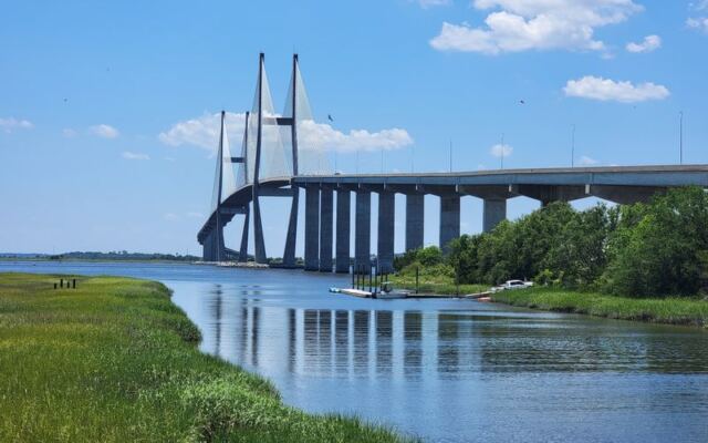
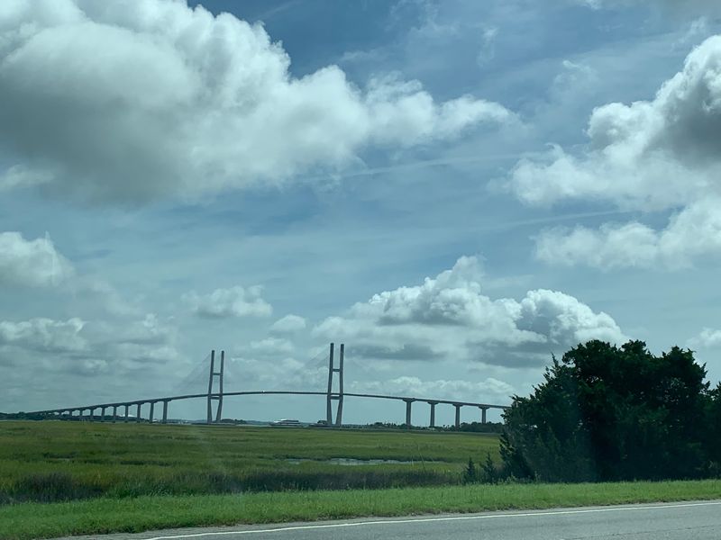
Along the Georgia coast in Brunswick, GA 31520, the Sidney Lanier Bridge stretches nearly 7,780 feet across the Brunswick River. It carries four lanes of US-17 and stands as the tallest cable-stayed bridge in the state.
Reaching 486 feet at the top of its central towers, the structure towers above an otherwise flat landscape. That height alone turns an ordinary commute into something people talk about long after they cross.
Open around the clock, seven days a week, it welcomes both drivers and folks who simply want a closer look. The bridge connects the mainland to nearby island getaways, making it a natural gateway for coastal travelers.
Locals hold it dear, and newcomers tend to slow down for a second glance. It is both a working roadway and a landmark that quietly steals the show.
Named for a Southern Poet
Behind the towering cables sits a name with deep literary roots. The bridge honors Sidney Lanier, a Georgia poet who lived from 1842 to 1881 and was celebrated across the South for his verse.
Giving a modern engineering feat a poet’s name feels like a fitting nod to the region’s storytelling spirit. It ties steel and concrete to something older and more human.
Lanier’s connection to the Georgia coast makes the tribute feel earned rather than random. His words once described the marshes and waters that the bridge now soars above.
That blend of art and infrastructure gives the crossing an extra layer of meaning. Drivers may not think about poetry as they climb the slope, yet the name quietly links them to a chapter of the state’s cultural history every single time they pass.
The Engineering Story Behind the Cables
Completed in 2003, the current span replaced an older, smaller bridge that once crossed the same water. The newer version towers over where the previous crossing stood, dwarfing the memory of its predecessor.
Regulars describe it as a genuine engineering marvel. Its main span reaches 1,250 feet, and the clearance beneath allows a generous 185 feet for vessels passing below.
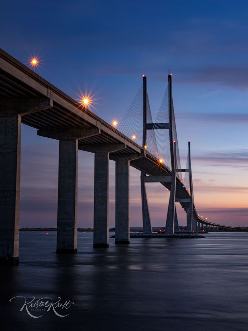
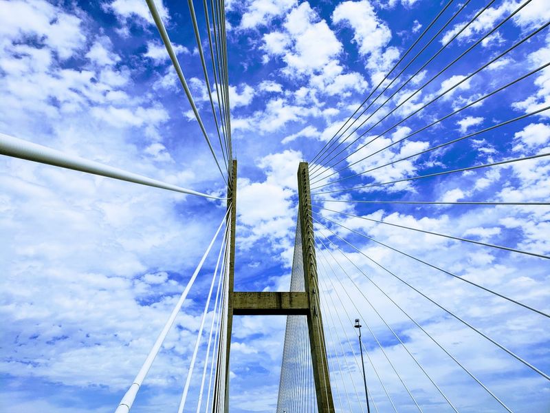
The cable-stayed design gives the structure its signature look, with straight pilings rather than the diamond shapes seen on some other famous bridges. Those cables fan outward and catch the eye from a distance.
Four lanes of traffic move steadily across the top, carrying cars over the river with room to spare. For anyone drawn to how big things get built, the bridge offers a real-life lesson in modern design worth studying up close.
Why Drivers Cling to the Middle Lane
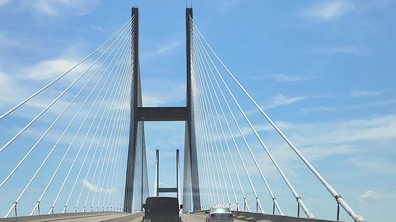
Height has a way of testing nerves, and this crossing is no exception. Plenty of drivers admit they steer toward the middle lane the moment the road starts climbing skyward.
The sides feature low concrete barriers rather than tall guardrails, which can make the drop feel closer than some people would like. That open feeling is exactly why the center lane becomes so popular.
Some folks compare the sensation to feeling as if they could drive right off the edge, so they hug the middle for peace of mind. It is a common, understandable reaction to all that altitude.
Even so, the roadway is wide and considered safe by those who cross it often. First-timers may grip the wheel, yet most come away calling the experience thrilling rather than frightening once solid ground returns.
The Hidden Park Tucked Underneath
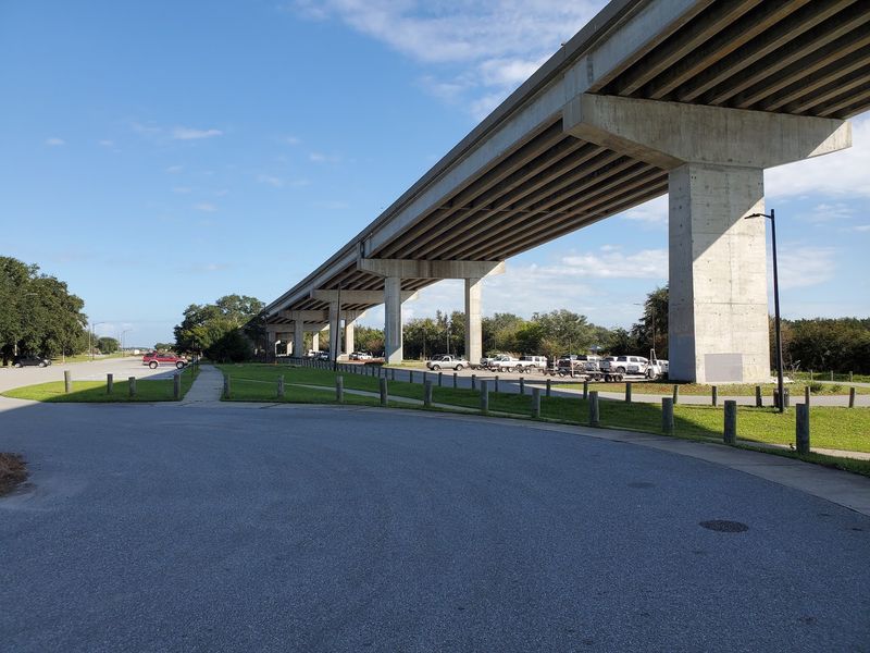
Not everyone realizes there is a quiet spot hiding right below all that steel. On the north end, near the Brunswick side, a little park sits tucked beneath the towering span.
Getting there is simpler than it sounds. Drive north across the bridge, take the first left afterward, and loop back toward the riverside directly under the structure.
The area offers picnic tables and grills, making it an easy place to pause and enjoy the waterfront. Families spread out here for a relaxed afternoon away from the traffic overhead.
A boat ramp and a walk-out pier round out the setting, giving anglers and photographers a reason to linger. Looking up at the bridge from below offers a completely different angle than crossing it, and that surprise view is part of what makes the little park so worthwhile.
A Favorite Spot for Photographers
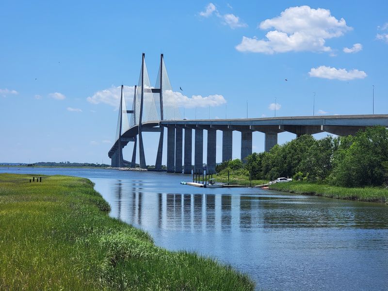
Cameras come out constantly wherever this bridge enters the frame. Its dramatic cables and soaring towers make it a magnet for anyone who loves a striking shot.
Photography ranks among the most mentioned reasons people stop by. The park underneath offers a prime vantage point, and nearby Jekyll Island delivers postcard-worthy views from across the water.
Drivers heading across even catch the cables sweeping past their windows, so having a camera ready pays off. Cargo ships gliding beneath the span add an extra element that photographers love to capture.
Morning light and clear coastal skies help the white structure pop against its surroundings. Whether framed from below, from the roadway, or from a distant island shore, the bridge rarely disappoints.
It has quietly become one of the most photographed landmarks along this stretch of the Georgia coast.
Walking and Running the Span
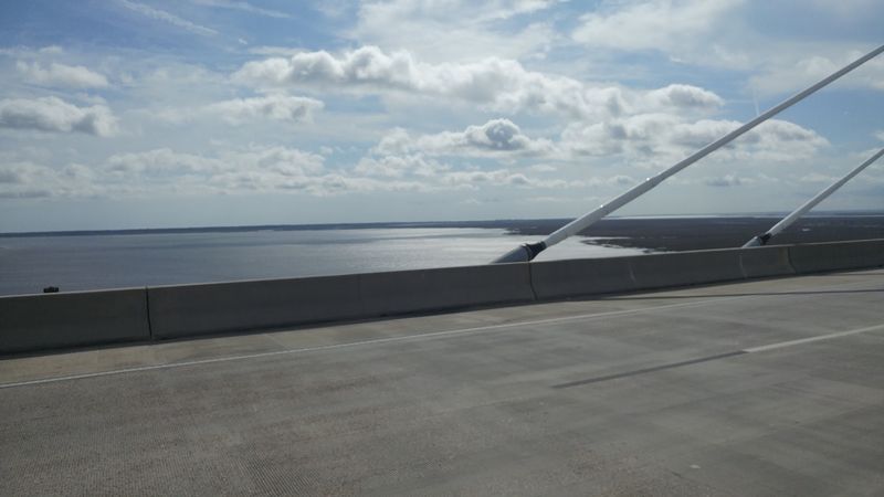
Foot traffic is welcome here, and that surprises a lot of first-timers. People are free to get out and walk or run the bridge whenever they like.
Covering the length from one end to the other and back adds up to roughly a 5k, making it a natural challenge for anyone chasing steps. Walkers, joggers, and cyclists all share the route.
There is enough room along the edge that pedestrians stay comfortably clear of passing cars. That extra space eases the nerves of anyone worried about traffic.
Windy days can make the walk feel more intense, since the height amplifies every gust. Regulars mention that crossing on breezy afternoons takes a little extra grit.
Still, the reward is a sweeping view over the river that few gym workouts can match, all while getting a genuine dose of exercise.
Gateway to the Golden Isles
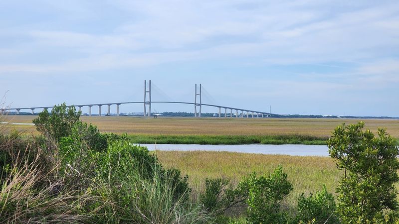
Beyond its own appeal, the bridge serves as a doorway to some of Georgia’s most beloved coastal escapes. A peaceful morning drive across it leads travelers toward East Coast island beaches.
Jekyll Island, Saint Simons Island, and Cumberland Island all sit within reach of this crossing. The span connects the mainland to a region packed with history and natural wonders.
Many people spot the bridge again and again while traveling the area, and seeing it never seems to lose its charm. It marks the transition from everyday roads to vacation territory.
Cargo ships passing beneath hint at the busy waterway it protects and links. That mix of working port and tourist route gives the area a lively, layered feel.
For road trippers exploring the Golden Isles, the bridge becomes both the journey and a memorable stop worth savoring along the way.
Planning Your Visit
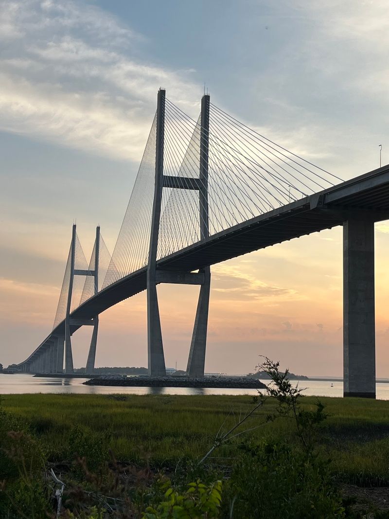
Good news for spontaneous travelers: the bridge is open 24 hours a day, every day of the week. There are no tickets, no set hours, and no crowds to fight through.
Parking areas sit nearby, giving you space to leave the car and explore the local landscape on foot. The hidden riverside park on the Brunswick side makes a convenient base for pictures and picnics.
Windy conditions can make walking feel bolder, so a calmer day may suit those who prefer steady footing. Families should keep younger children close, since the height and open barriers call for a little extra care.
Held in high regard by locals and travelers alike, this towering crossing rewards anyone willing to slow down and look up. Come for the drive, stay for the view, and let the coast do the rest.
Share this story