New Zealand’s South Island packs more dramatic scenery into one stretch of land than most countries manage across their entire territory. From glacier-carved fiords to turquoise lakes, wild coastlines to ancient rainforests, the variety here is genuinely hard to match.
The challenge is not finding something worth seeing but deciding where to start. This list covers 15 natural attractions spread across the island, each one offering something distinct enough to shape an entire itinerary around rather than just filling a spare afternoon.
Milford Sound / Piopiotahi, Fiordland
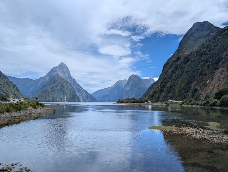
Mitre Peak rising straight from dark water is one of those views that stops people mid-sentence. Milford Sound is the kind of place that earns its reputation without needing any exaggeration, and the sheer scale of the cliffs surrounding the fiord only becomes clear once you are actually on the water.
Boat cruises are the most popular way to experience the fiord, but kayaking and scenic flights offer genuinely different perspectives on the same landscape. Lady Bowen Falls and Stirling Falls flow year-round, though they become especially powerful after the region’s heavy rainfall.
Bottlenose dolphins, fur seals, and Fiordland crested penguins can all be found in the wider area. The drive from Te Anau through Fiordland National Park is spectacular on its own.
Always check road and weather conditions before heading in, since Fiordland weather can shift quickly and significantly.
Aoraki / Mount Cook National Park, Canterbury
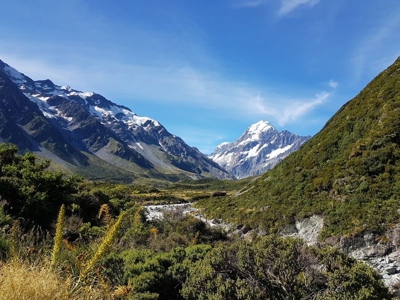
At 3,724 metres, Aoraki is the highest point in New Zealand, and standing anywhere in this national park makes that fact feel completely believable. The scale of the alpine landscape here is hard to absorb from a single viewpoint, which is part of why visitors tend to stay longer than planned.
Mountaineering experience is not required to appreciate what the park offers. A network of day walks crosses the valley floor and reaches viewpoints with unobstructed views of glaciers and peaks.
Scenic flights and guided glacier experiences add another layer for those who want to get closer to the ice.
The park is part of the Te Wahipounamu South West New Zealand World Heritage Area, a designation that reflects just how significant this landscape is on a global scale. Spring and summer are particularly popular for walking, though visitors arrive throughout the year for the dramatic scenery and dark sky stargazing.
Abel Tasman National Park, Nelson Tasman
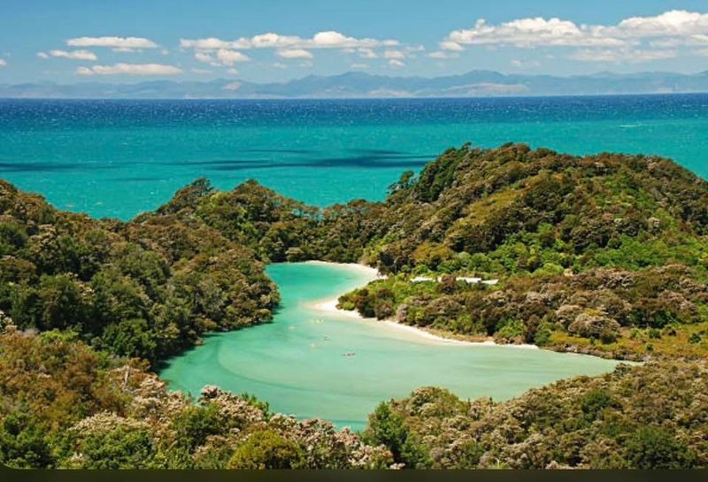
Golden beaches, granite headlands, and sheltered coves are not what most people picture when they think of New Zealand’s national parks, which is exactly what makes Abel Tasman worth seeking out. This coastal park in the Nelson Tasman region offers a noticeably different experience from the alpine and fiord landscapes that dominate the South Island’s reputation.
The Abel Tasman Coast Track takes three to five days to complete in full, but the park’s water taxi network means shorter visits are genuinely practical. Travelers can combine a half-day hike with a beach stop and a water taxi back without feeling like they missed the point.
Sea kayaking is another strong option, particularly for reaching coves that the main track bypasses. The comparatively mild coastal climate makes this an approachable destination across multiple seasons.
For travelers wanting to mix hiking, paddling, and swimming in a single trip, Abel Tasman handles all three comfortably.
Patea Doubtful Sound, Fiordland
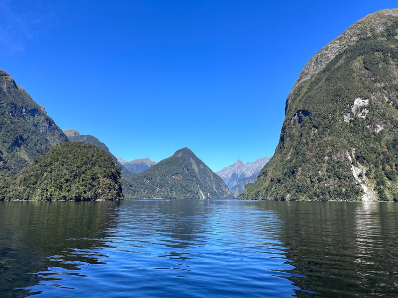
Getting to Doubtful Sound requires more effort than most South Island attractions, and that effort is a large part of what makes it worthwhile. Unlike Milford Sound, which is accessible by road, reaching Doubtful Sound involves a boat crossing of Lake Manapouri followed by a road transfer over Wilmot Pass before the fiord even comes into view.
That layered journey filters out casual visitors and creates a noticeably quieter atmosphere on the water. The fiord itself is one of the longest and deepest in Fiordland, surrounded by steep mountain walls, dense rainforest, and waterfalls that appear after rain.
Bottlenose dolphins and Fiordland crested penguins have been recorded in the region. Cruises focus on the landscape and the surrounding wilderness rather than rushing between highlights.
For travelers who have already experienced Milford Sound, Doubtful offers a genuinely different perspective on what Fiordland looks and feels like when the crowds thin out.
Lake Tekapo / Takapo, Canterbury
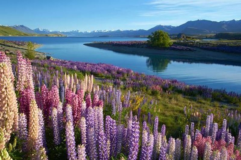
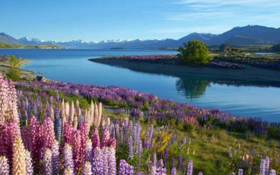
That intense turquoise color is not a photography trick. Lake Tekapo’s distinctive hue comes from fine glacial rock flour suspended in the water, and it genuinely looks that vivid on a clear day.
The Southern Alps rising behind the lake add a backdrop that photographers return to repeatedly across every season.
After sunset, the area earns an entirely different kind of attention. The Mackenzie Basin sits within a region recognized internationally for its dark skies, making stargazing one of the most compelling reasons to spend a night here rather than just passing through.
During spring, lupins appear around parts of the basin, adding splashes of color to the shoreline. Nearby Lake Pukaki and Aoraki / Mount Cook are close enough to combine into a multi-day loop through the Mackenzie region.
Tekapo rewards visitors who slow down and stay, rather than those who stop briefly for a photograph and move on.
Franz Josef Glacier / Ka Roimata o Hine Hukatere, West Coast
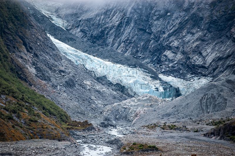
Few landscapes on the West Coast make the South Island’s dramatic geography as obvious as Franz Josef. Alpine ice, ancient rainforest, braided rivers, and steep mountain peaks exist within a surprisingly compact area, creating a combination that feels almost unlikely until you see it in person.
The current public walking route leads through rainforest to a designated viewing area overlooking the glacier valley. Because the glacier has retreated significantly, visitors can no longer approach its face from the valley floor.
The Department of Conservation actively warns travelers not to cross barriers or venture beyond marked zones, as the valley is geologically active.
Helicopter flights and guided glacier experiences operate commercially in the region for those wanting a closer look. The site can be temporarily affected by flooding or rockfall, so checking current conditions before arrival is genuinely important rather than optional.
Despite these restrictions, Franz Josef remains one of the West Coast’s most visited natural landmarks.
Fox Glacier / Te Moeka o Tuawe, West Coast
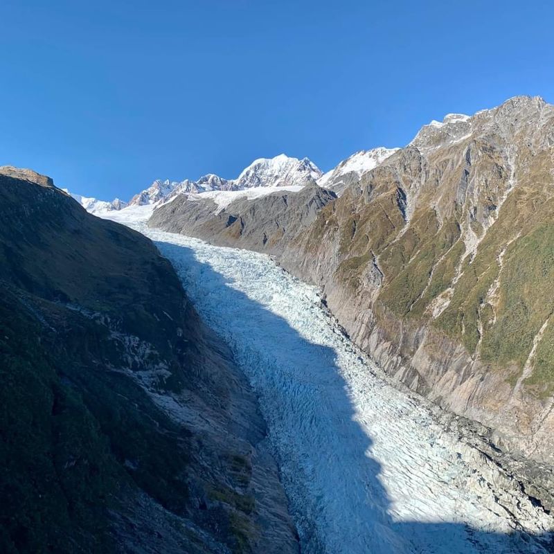
South of Franz Josef, another glacier descends from the Southern Alps through Westland Tai Poutini National Park, and the surrounding valley tells its own geological story. Fox Glacier / Te Moeka o Tuawe sits within a landscape shaped by centuries of ice movement, and evidence of that process is visible in the valley floor long before the glacier itself comes into view.
The Fox Glacier South Side Walkway and Cycleway follows the Fox River through ancient podocarp rainforest and across terrain carved by earlier glacial activity. A designated viewpoint provides distant views of the glacier face from a safe distance.
The valley remains geologically active and can be affected by flooding, river surges, and rockfall, so visitors must respect all barriers and closures. Those restrictions do not reduce the experience.
Watching a landscape that continues to change noticeably from year to year is a different kind of natural encounter, one that few other places in the country can offer.
Pancake Rocks and Blowholes, Punakaiki
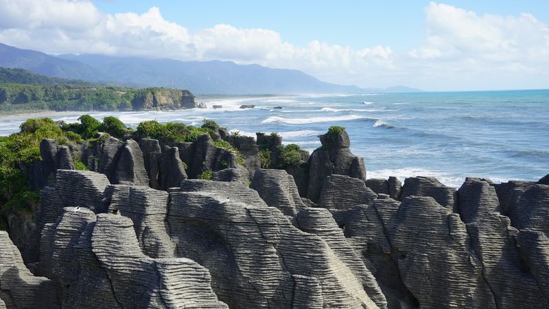
The limestone formations at Punakaiki look exactly like what their name suggests: thick layers of rock stacked in horizontal bands along the edge of the Tasman Sea. The geological process that created them involved alternating layers of soft and hard material compressing over millions of years, eventually producing those distinctive ridged columns.
A developed walking circuit leads visitors through the limestone landscape and past viewpoints overlooking surge pools and blowholes. When large ocean swells arrive, water forces through gaps in the rock with considerable power, making timing your visit around tidal conditions a practical consideration.
In 2026, the Department of Conservation completed additional walking connections and a nature walk as part of the wider Dolomite Point redevelopment, improving access and the overall visitor experience. The combination of limestone formations, coastal rainforest, and rough Tasman coastline makes Punakaiki a stop that justifies slowing down rather than treating it as a quick roadside break.
Arthur’s Pass National Park, Canterbury and West Coast
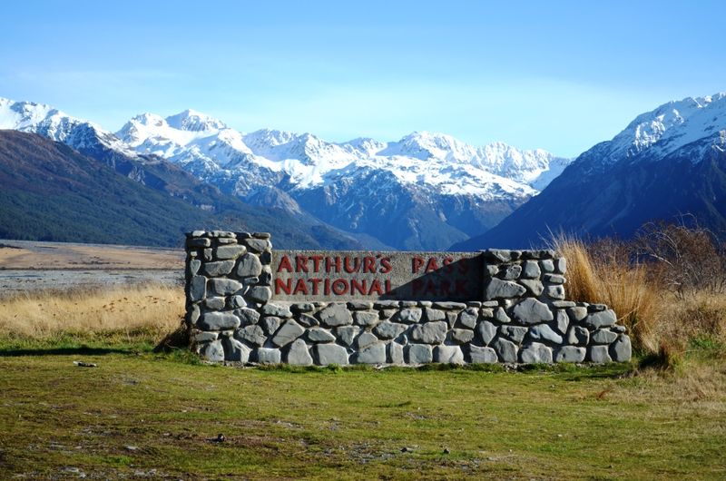
State Highway 73 crosses the Southern Alps through Arthur’s Pass National Park, which means some of the most dramatic mountain scenery on the South Island is accessible without leaving the road. The park sits directly across the spine of the Alps, creating a landscape that shifts noticeably between the wet western slopes and the drier eastern side.
Short walks begin close to Arthur’s Pass village. The Devils Punchbowl Walking Track climbs through native beech forest to a viewpoint near a 131-metre waterfall, making it one of the more rewarding short options in the park without requiring a full day.
Kea are a genuine highlight here. These native alpine parrots are curious, intelligent, and regularly spotted around the village and trailheads.
Mountain conditions can change rapidly, so the Department of Conservation recommends checking weather and track information before heading into the backcountry. For a scenic road crossing with real hiking options, Arthur’s Pass delivers consistently.
Blue Pools, Mount Aspiring National Park
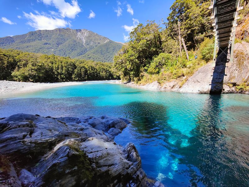
Glacier-fed rivers in the South Island can produce water colors that seem almost artificial, and the Blue Pools near Makarora are one of the clearest examples of that phenomenon. Snowmelt from the Southern Alps feeds the Makarora River, and under the right conditions the water takes on a blue-green clarity that is easy to understand why people stop specifically for this spot.
The Blue Pools Track passes through native silver beech forest before crossing swing bridges above the river and pools. Dry conditions produce the most vivid colors, while heavy rain can temporarily cloud the water brown.
The track itself is accessible without bookings, though visitors should bring insect repellent since sandflies are persistent in this part of the island.
The pools sit close to State Highway 6, making them a practical stop on any drive between Wanaka and the West Coast. The short walk through beech forest adds genuine value beyond what you see from the bridge.
Mount Aspiring National Park, Otago
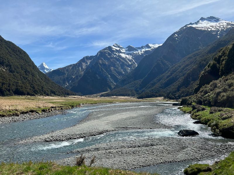
West of Wanaka, the landscape opens into one of the largest and most varied wilderness areas on the South Island. Mount Aspiring National Park covers glaciated mountains, deep river valleys, alpine meadows, beech forests, and waterfalls across a World Heritage landscape that connects with Fiordland to the south.
The park offers a wide range of experiences depending on how much time and fitness a traveler brings. The Makarora area provides accessible trails through silver beech valleys with mountain views, while the Matukituki Valley near Wanaka opens routes that experienced hikers use as gateways to more demanding terrain.
Multi-day backcountry routes exist for those prepared for remote travel, but shorter walks and scenic excursions make the park approachable for visitors with limited time. Weather and river conditions matter significantly in this part of the South Island.
Checking Department of Conservation information before entering remote sections is strongly recommended for any trip beyond the established day walk network.
Kaikoura Peninsula, Canterbury
Mountains rising almost directly behind a working coastal town with fur seals on the rocks and whales in the water offshore is not a combination you find in many places. Kaikoura makes that combination look completely natural, and the Kaikoura Peninsula Walkway gives visitors a straightforward way to experience it on foot.
The full walkway takes roughly three hours to complete, though shorter sections are available for those with less time. Clifftop paths provide views across tidal platforms toward the Seaward Kaikoura Range, while seals and seabirds are regularly spotted along the rocky coastline below.
The wider Kaikoura area is well established as one of New Zealand’s most productive marine wildlife destinations, with whale watching and dolphin encounters operating commercially offshore. Visitors should stay at least 20 metres from seals and remain on formed tracks near exposed cliff edges.
For travelers driving between Christchurch and the northern South Island, Kaikoura rewards a proper stop rather than a quick fuel break.
Moeraki Boulders / Kaihinaki, Otago
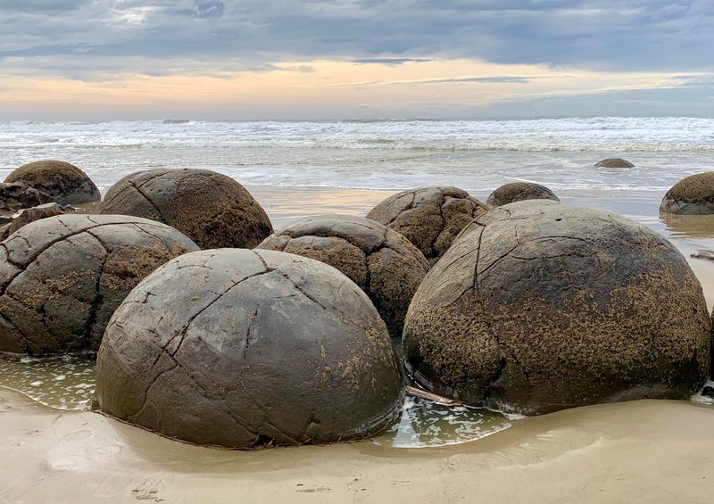
Large, almost perfectly round boulders scattered across a beach would look like a deliberate installation if they appeared anywhere else. At Koekohe Beach on the Otago coast, they are entirely natural, and geologists have a clear explanation for how they formed over millions of years.
The Moeraki Boulders are concretions, meaning they developed as minerals gradually accumulated around a central point within the surrounding mudstone. As coastal erosion wears away the cliffs, the boulders are slowly revealed.
Some have cracked open, exposing patterned interiors that make the internal structure visible and easy to understand.
Visitors can reach the beach from the Moeraki Boulders Scenic Reserve car park or via an access point near the local cafe. The Department of Conservation advises watching for changing tides and rogue waves, since the coastline is exposed.
The site sits close to State Highway 1, making it a natural addition to any journey between Dunedin and Oamaru.
Lake Wanaka, Otago
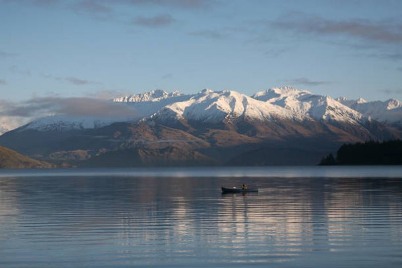
Lake Wanaka stretches roughly 45 kilometres through a broad alpine basin, and the surrounding mountains make it feel like the lake was placed there deliberately for maximum effect. The town of Wanaka sits at the southern end, giving visitors a practical base with easy access to both the water and the mountains beyond.
Kayaking, sailing, and cruising are all available on the lake, while walking and cycling tracks follow the shoreline and climb into the hills above town. More ambitious hikers use Wanaka as a starting point for routes leading into Mount Aspiring National Park, including trails with wide views across the lake and Southern Alps.
The region changes character noticeably across seasons. Summer brings water activities and hiking, autumn turns the surrounding vegetation into warm gold and orange tones, and winter draws skiers to nearby slopes.
Wanaka works well as a base for multi-day exploration rather than a single-afternoon stop, and the lake itself rewards time spent on or beside the water.
Marlborough Sounds, Marlborough
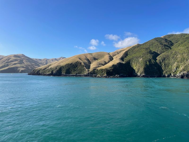
At the northern tip of the South Island, the landscape shifts completely from the alpine drama of the interior to something altogether quieter. The Marlborough Sounds were formed when ancient river valleys were gradually flooded by the Pacific Ocean, creating an intricate maze of sheltered bays, forested ridges, islands, and narrow waterways that reward slow exploration.
Queen Charlotte, Kenepuru, and Pelorus Sounds form the core of the region. Kayaking and boat trips allow visitors to reach secluded bays that road access cannot touch, while the Queen Charlotte Track follows forested ridgelines above the water with views across multiple sounds.
Several islands within the region are protected wildlife sanctuaries, and dolphins, fur seals, penguins, and native birds can be encountered throughout the wider area. Picton serves as the main gateway and is well set up for travelers heading out onto the water.
For anyone arriving on the Interislander ferry from Wellington, the Sounds begin before the boat even docks.
Share this story