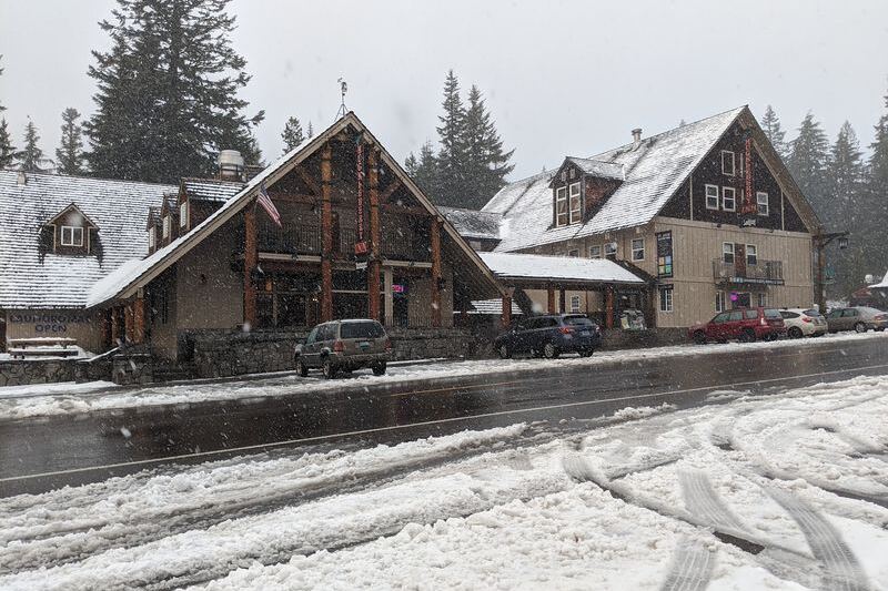
Some of the best days in Oregon start with a wrong turn, a half-empty gas tank, and a road you have never heard of. Around the next bend, a lake glows impossibly blue, or a gravel lane opens onto a canyon so deep your stomach drops, and suddenly the trip becomes a story you tell for years.
Fall is the last chance to chase these views, because snow soon locks the high passes and gates swing shut until summer. Pack some snacks, fill the thermos, and get ready to find the routes most tourists miss.
1. McKenzie Pass-Santiam Pass Scenic Byway, Oregon, Sisters
Picture driving across the surface of the moon, then glancing up to find six Cascade peaks staring back at you. Highway 242 over McKenzie Pass, just west of Sisters, delivers exactly that strange double feeling.
Black lava stretches for miles, jagged and silent, with twisted pines poking through wherever they can.
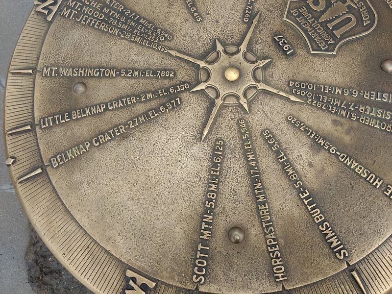
The star stop is the Dee Wright Observatory, a squat stone lookout built by the Civilian Conservation Corps in 1935 from the very lava around it. Peek through its little window slots and each one frames a different summit, from Mount Jefferson to the Three Sisters.
Timing matters here more than almost anywhere else in Oregon. Snow usually shuts the pass sometime in November, and it often stays gated until early summer.
The road is narrow and twisty, with a length limit that keeps big RVs away, so weekday afternoons can feel wonderfully empty.
Grab a warm cinnamon roll in Sisters before you climb.
2. Crater Lake Rim Drive, Oregon, Crater Lake National Park
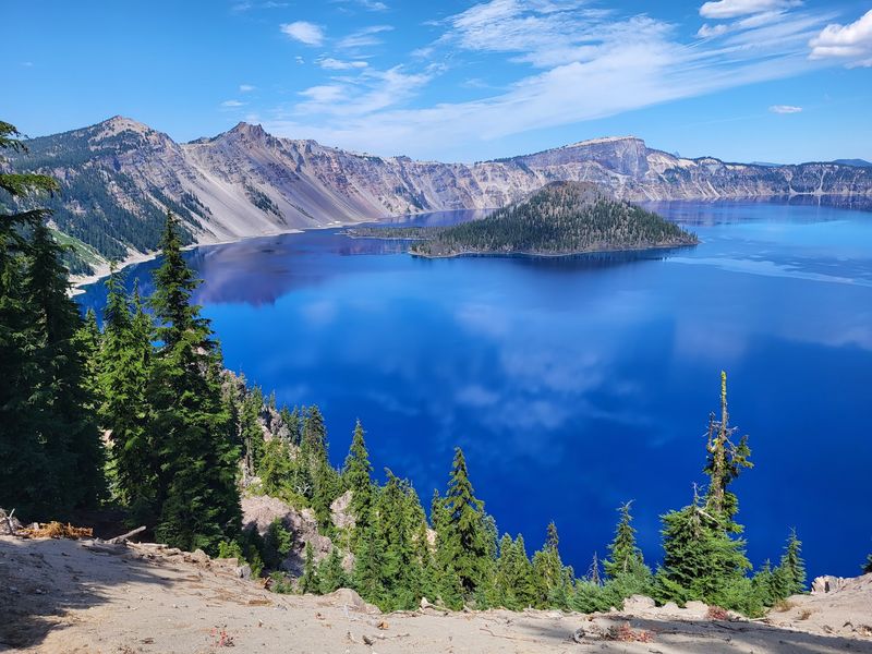
Nothing prepares you for that first blue. You crest the rim, the trees part, and the water below looks almost too saturated to be real, like someone turned the color dial all the way up.
Crater Lake formed roughly 7,700 years ago when Mount Mazama collapsed, and at 1,943 feet it holds the title of deepest lake in the United States. The 33-mile Rim Drive circles the whole caldera, with more than 30 pullouts.
Favorites include Watchman Overlook for sunset and the Pinnacles spur on the quieter east side, where spires of old volcanic ash rise like stone candles.
Here is the catch. The park gets some of the heaviest snowfall in the country, and most of Rim Drive typically closes by early November, sometimes sooner.
Fall visits reward you with thin crowds, crisp air, and a lake so calm it mirrors Wizard Island perfectly. Pack layers, because the rim runs cold even on sunny October days.
3. Steens Mountain Loop, Oregon, Frenchglen
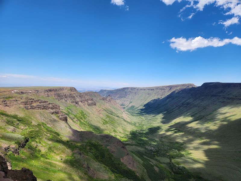
Oregon’s highest road does not sit in the Cascades at all. It climbs Steens Mountain in the far southeast corner of the state, starting from the tiny outpost of Frenchglen, and tops out near 9,700 feet at the East Rim viewpoint.
From up there, the Alvord Desert spreads out a mile below like a pale, cracked tabletop. Along the 52-mile gravel loop, you will peer into Kiger Gorge, a glacier-carved U so perfect it looks drawn with a compass.
Wild horses sometimes roam the lower slopes, and aspens flare gold in early fall.
Honestly, few Oregonians ever make this trip, which is exactly the appeal. Upper gates usually open around July and close once snow arrives, often by late October or November.
Bring a full tank, a spare tire, and plenty of water, since services are scarce.
Afterward, the Frenchglen Hotel’s hearty family-style dinners feel like a well-earned reward.
4. Cascade Lakes Scenic Byway, Oregon, Bend
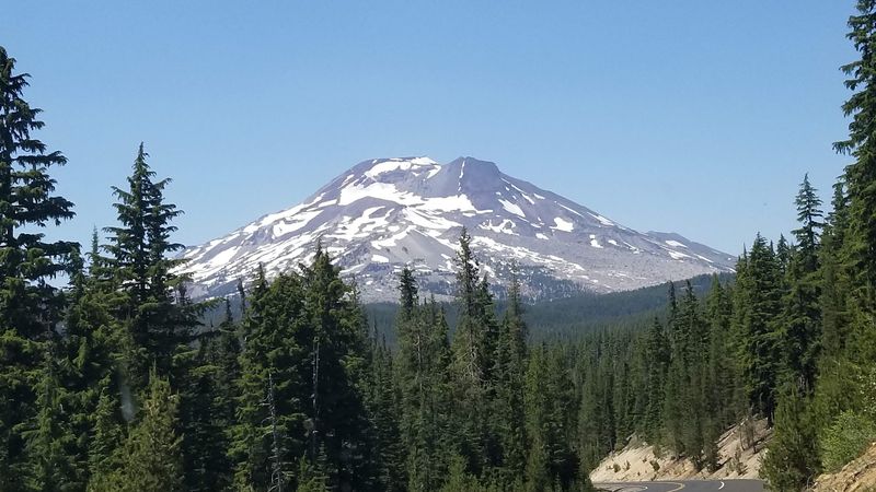
Lake hopping is the whole point of Highway 46, a 66-mile ribbon that leaves Bend and winds past more than a dozen alpine lakes. Each one has its own mood, so the fun comes from comparing them.
Think of it as a tasting menu for mountain water.
Sparks Lake is the photographer’s darling, shallow and scattered with lava islands, with South Sister and Broken Top reflecting in the still morning water. Todd Lake requires a short walk, which weeds out most of the traffic.
Farther south, Elk Lake and Lava Lake feel sleepy and old-fashioned, the kind of places where a picnic table and a thermos of cocoa make a perfect lunch.
Fun fact: Apollo astronauts trained on the lava fields around Bend in the 1960s. Snow typically closes the byway past Mount Bachelor from mid-November until late spring.
Go in October for frosty mornings, empty trailheads, and aspens glowing along the shorelines.
5. Wallowa Mountain Loop, Oregon, Joseph
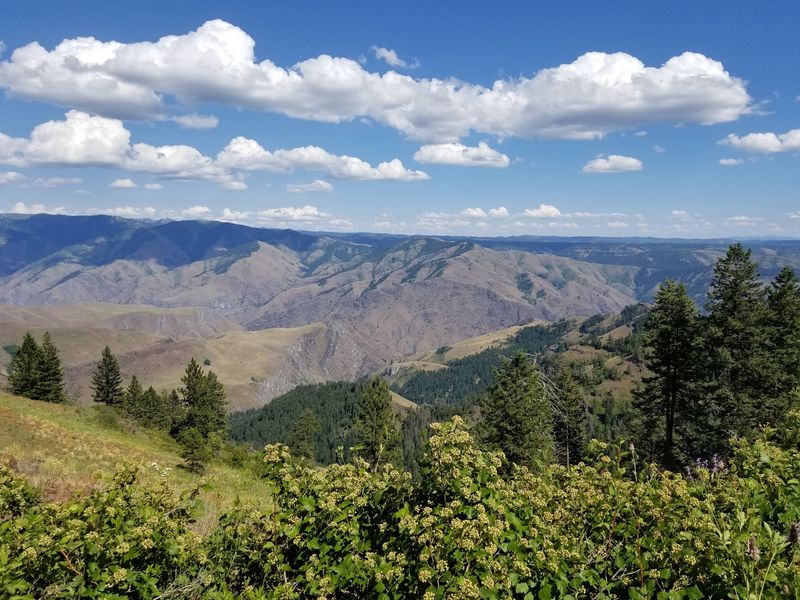
Few people realize that North America’s deepest river gorge sits in Oregon’s northeast corner. Hells Canyon plunges nearly 8,000 feet at its deepest point, deeper than the Grand Canyon, and the Wallowa Mountain Loop is your paved backdoor to its rim.
The route, Forest Road 39, runs about 54 miles from Joseph to Halfway through thick forest and quiet meadows. Take the short spur to Hells Canyon Overlook, where layered ridges fade into blue haze and Idaho’s Seven Devils peaks line the horizon.
Fall paints the tamaracks a buttery gold that looks almost lit from within.
Joseph itself is a charming little art town full of bronze sculptures, and a warm breakfast there sets you up nicely. The loop is not plowed, so it usually closes with the first heavy snow and stays shut until spring.
October gives you color without the summer campers.
6. Elkhorn Scenic Byway, Oregon, Baker City
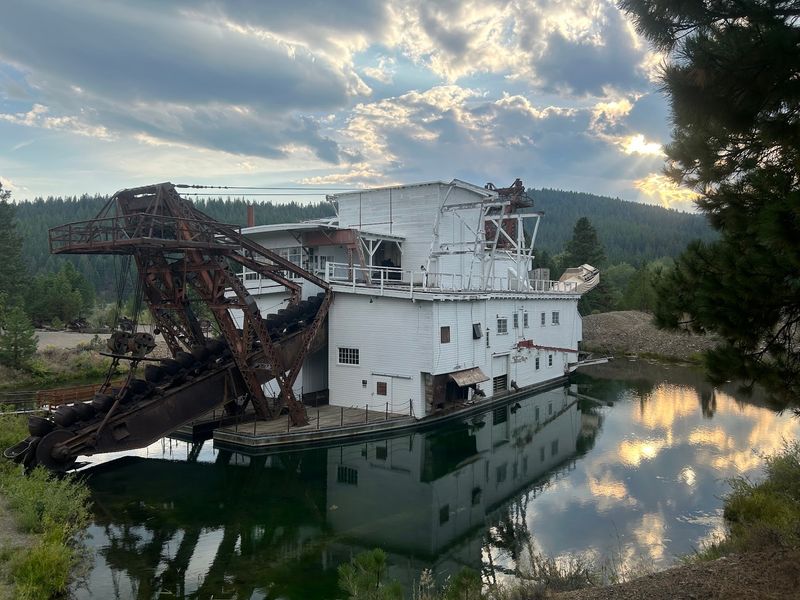
Gold rush history and golden larches share the spotlight on this 106-mile loop out of Baker City. Start early, because there is a lot to see and the fall light fades fast in the Blue Mountains.
Locals simply call it tamarack season.
Head west toward Sumpter, where a massive 1930s gold dredge still rests in the pond it dug, now a state heritage site you can walk through. A few miles on, the near-empty mining town of Granite claims a population you can count on your fingers.
Then the road climbs past Anthony Lakes, where granite peaks tower over glassy water at over 7,000 feet.
What makes October special is the western larch, a rare conifer that drops its needles each fall. Before they go, whole hillsides glow like pumpkin pie.
Snow can close the high section near Anthony Lakes by late fall, so check conditions before you roll out.
7. Historic Columbia River Highway, Oregon, Corbett
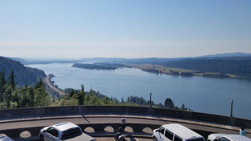
Back in 1922, engineers finished something the country had never seen: a road designed purely for beauty. The Historic Columbia River Highway was the first planned scenic highway in the United States, and its mossy stone guardrails still curve gracefully along the gorge east of Portland.
Vista House at Crown Point, perched 733 feet above the river, makes a dramatic first stop near Corbett. From there, waterfalls arrive one after another: Latourell, Wahkeena, and the famous 620-foot Multnomah Falls.
Bigleaf maples turn the whole corridor yellow and orange in late October.
Here is the insider move. Skip summer weekends and aim for a weekday morning in fall, when mist hangs in the trees and parking lots sit half full.
Winter ice storms occasionally close the old road, so autumn really is the sweet spot for the drive.
During busy months, a timed entry permit may be required near Multnomah Falls, so check ahead.
8. Rogue-Umpqua Scenic Byway, Oregon, Roseburg
Waterfall lovers, this one is for you. The Rogue-Umpqua Scenic Byway stretches about 172 miles from Roseburg to Gold Hill, following two wild rivers through the southern Cascades.
Along Highway 138, the North Umpqua runs clear and emerald, beloved by fly anglers. Toketee Falls is the showstopper, a two-tiered cascade pouring over columns of dark basalt at the end of a short, rooty trail.
Nearby Watson Falls drops 293 feet, among the tallest in southern Oregon.
Farther south, the road swings past the Rogue River Gorge, where the water squeezes through a narrow lava channel with a roar you feel in your chest. Fall adds vine maples flickering scarlet against dark evergreens.
Beckie’s Cafe in Union Creek serves homemade pie worth the stop.
Higher stretches near Diamond Lake get serious snow, so go before Thanksgiving for dry trails and quiet pullouts.
9. Three Capes Scenic Route, Oregon, Tillamook
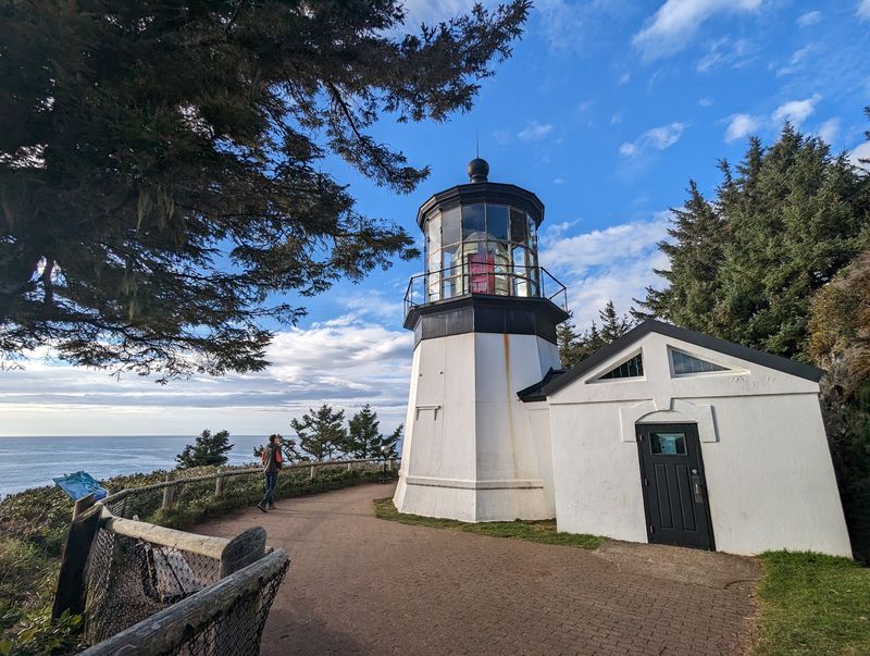
Think of the Three Capes Scenic Route as the Oregon coast’s greatest hits album, minus the Highway 101 traffic. The 40-mile loop west of Tillamook links Cape Meares, Cape Lookout, and Cape Kiwanda, each with a totally different personality.
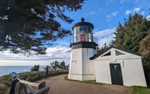
Cape Meares hides a stubby little lighthouse, only 38 feet tall, plus the Octopus Tree, a Sitka spruce with limbs that sprawl sideways like tentacles. Cape Lookout offers a forested trail that pushes 2.5 miles out over the Pacific.
Down in Pacific City, Cape Kiwanda’s giant sand dune lets you scramble up for sweeping ocean views as dory boats launch from the beach.
Unlike mountain passes, this route never truly shuts for winter, but fall offers a sweet window before the heavy storms roll in. Calm autumn days bring clear views, and by December, gray whales begin passing offshore.
Warm up afterward with a bowl of clam chowder by the water.
Share this story