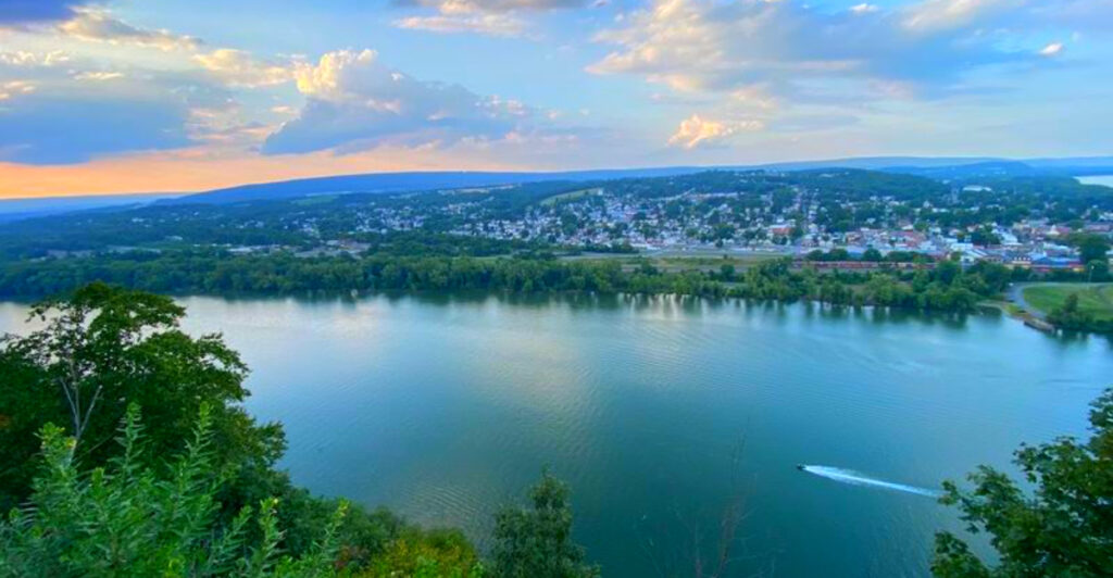
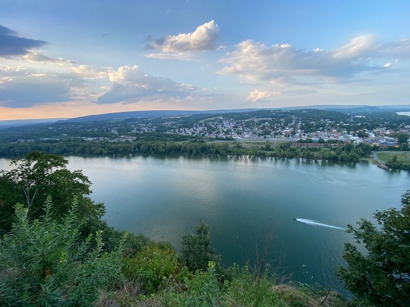
High above the Susquehanna River in central Pennsylvania, one scenic overlook offers a panoramic view unlike any other in the state. Visitors come to watch the North Branch and West Branch of the Susquehanna River merge hundreds of feet below, admire sweeping valley vistas, explore wooded hiking trails, and experience one of Pennsylvania’s most dramatic natural landscapes, but many leave just as captivated by the rich history tied to this remarkable bluff. It’s the kind of place where every visit rewards you with breathtaking scenery and a deeper appreciation for the Susquehanna Valley.
The experience extends far beyond the overlook itself. Historic stories dating back to Chief Shikellamy, peaceful forest trails, picnic areas, seasonal views of Lake Augusta, opportunities to spot peregrine falcons, and one of Pennsylvania’s most impressive free scenic overlooks make this an unforgettable destination for nature lovers and history enthusiasts alike. Whether you’re planning a road trip through central Pennsylvania or searching for one of the state’s finest viewpoints, it’s easy to understand why generations of visitors have been drawn to this remarkable hilltop.
Here’s why the Shikellamy State Park Overlook has become one of Pennsylvania’s most spectacular scenic destinations and one of the very best places to experience the beauty of the Susquehanna River Valley.
Where Exactly You Will Find This Overlook
The address that gets you closest to the overlook experience is Shikellamy State Park Road, Selinsgrove, PA 17870, though the park’s main administrative office is listed at 401 Bridge Avenue, Sunbury, PA 17801.
The Overlook Section sits on the western shore of the Susquehanna River in Union Township, Union County, Pennsylvania, just outside of Selinsgrove. GPS coordinates of approximately 40.87924, -76.80382 will point you directly to the overlook parking area, which is helpful since cell service along the access road can be spotty.
The road up the hill is narrow and steep, so drivers of large vehicles should take their time and watch for oncoming traffic. Once you reach the top, three separate parking lots spread across the overlook area, making it easy to find a spot even on a busy weekend afternoon. The phone number for the park office is +1 570-988-5557 if you need to call ahead for any reason.
The Story Behind the Name on the Sign

Long before a single parking lot or trail marker existed here, this prominent bluff above the Susquehanna River was already a place of considerable human significance. The park takes its name from Chief Shikellamy, an Oneida chief and diplomat who served as an emissary for the Iroquois Confederacy during the 18th century.
His role was essentially that of a bridge builder between Indigenous nations and colonial Pennsylvania leaders, and he reportedly resided near this very bluff. The name Shikellamy is often translated as “our enlightener,” a title that speaks to the respect he commanded across cultural lines.
The confluence below was not just a scenic backdrop but a genuine crossroads of Indigenous paths and canoe routes, and the nearby area known as Shamokin, now modern-day Sunbury, was once a significant Indigenous settlement. Understanding that history while standing at the overlook adds a layer of meaning that the view alone cannot fully provide. The land itself carries the weight of centuries.
A Hilltop With a Surprisingly Dramatic Past
The bluff above the river, historically referred to as Blue Hill, has attracted human ambition for well over a century before the state park ever opened. Back in the 1840s, a man named John Mason built an unusual viewing tower that extended right out from the edge of the cliff, giving brave visitors a suspended view over the river far below. That tower was destroyed in 1864.
Then, in 1890, construction began on the grand Hotel Shikellamy, a full summer resort perched dramatically on the clifftop. The hotel opened in 1891 and came equipped with a ballroom and a bowling alley, drawing guests who wanted to combine leisure with one of the finest river views in the state.
Tragically, the entire structure burned down in 1898 and was never rebuilt. The Overlook Section of Shikellamy State Park officially opened to the public in 1960, giving everyone access to the same dramatic vantage point that once hosted paying resort guests. History here has a flair for the theatrical.
What the Confluence Actually Looks Like From Up Here
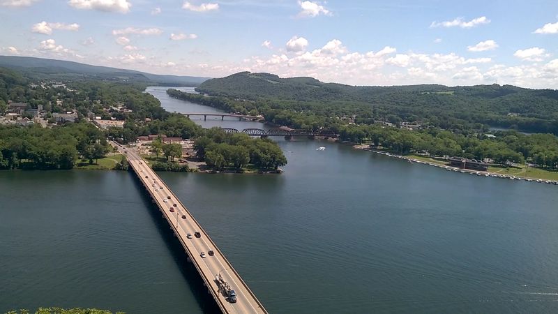
Most river confluences are things you read about on a map rather than actually see with your own eyes, but this one is different. From the overlook, standing 360 feet above the water, the meeting point of the West Branch and the North Branch of the Susquehanna River is genuinely visible as a distinct line where two different-colored waters press against each other.
The West Branch typically runs a cleaner blue, while the North Branch often carries a darker, brownish tint, and where they meet, the contrast holds for a surprisingly long stretch before the two finally blend together. The towns of Sunbury and Northumberland frame either side of the river below, and Packers Island sits quietly in the middle of it all.
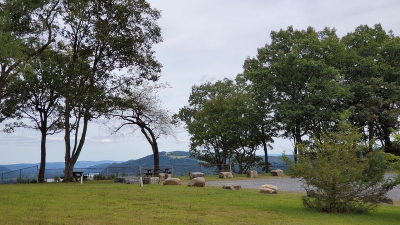
Three separate viewpoints are spaced along the overlook area, each offering a slightly different angle on the same spectacular scene. On a clear day, the panorama stretches far enough that you almost feel like you are looking at a painted landscape rather than a real one.
The Inflatable Dam That Creates a Seasonal Lake
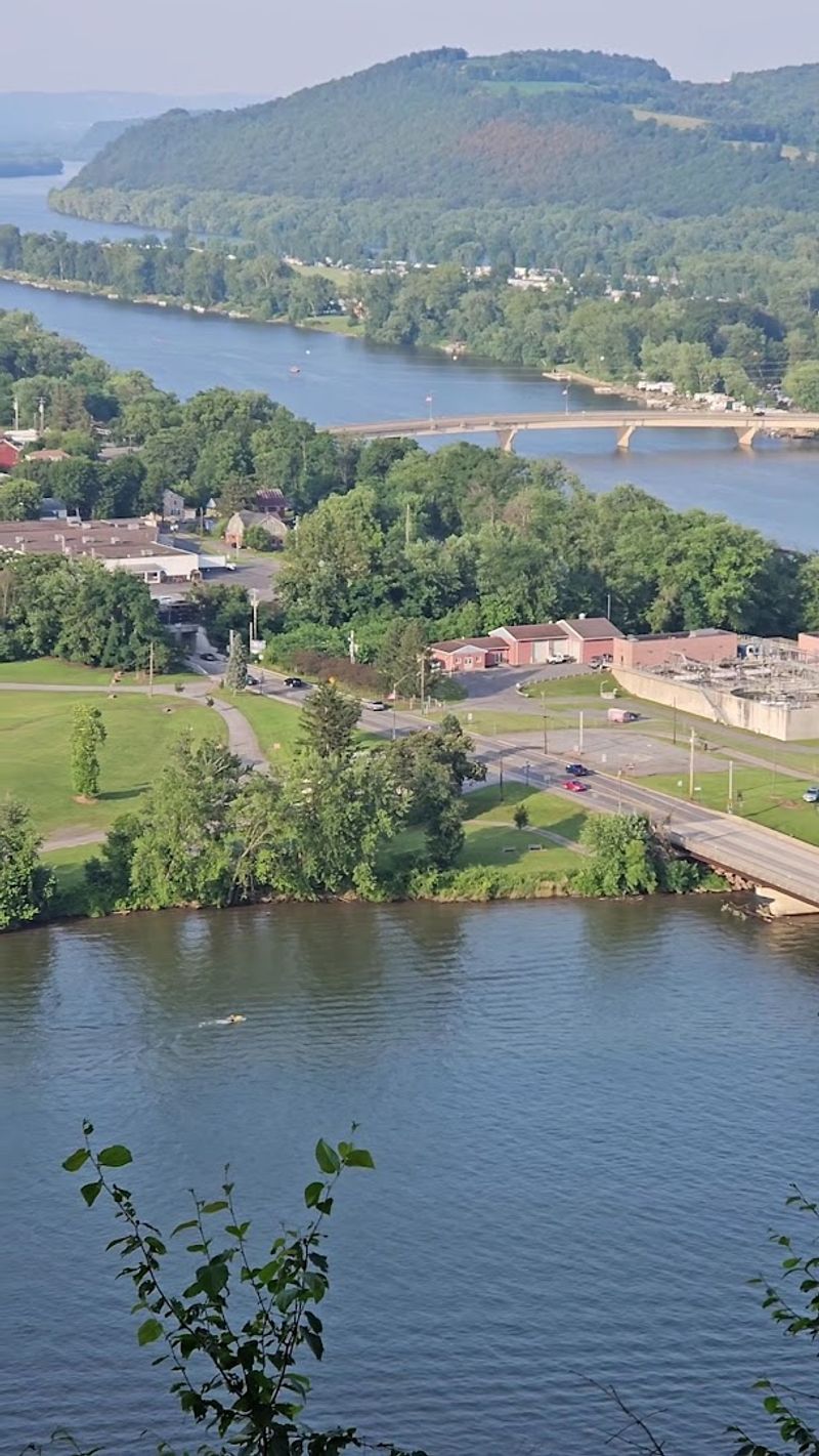
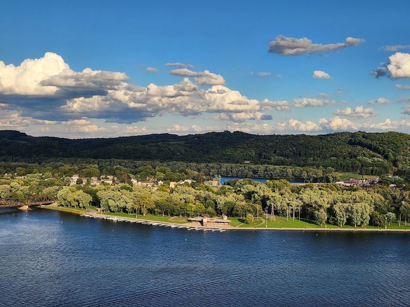
One of the more unexpected facts about this stretch of the Susquehanna River is that the broad, lake-like body of water you see below the overlook during warmer months is not natural. Lake Augusta is created seasonally by the Adam T. Bower Memorial Dam, which holds the remarkable distinction of being reportedly the world’s longest inflatable dam.
When inflated in spring and deflated in late fall, the dam transforms a wide section of the river into a recreational waterway that supports boating, fishing for bass and walleye, and even university rowing competitions. The history behind it connects to an older log dam that was swept away by ice in 1904, and the current inflatable structure essentially revived a long tradition of water use on this part of the river.
From the overlook, watching boats cut across the glittering surface of Lake Augusta adds a lively, almost festive quality to the view. The contrast between the moving river downstream and the calm lake upstream is one of those small details that makes the scene genuinely interesting to study.
Hiking Trails That Actually Reward the Effort
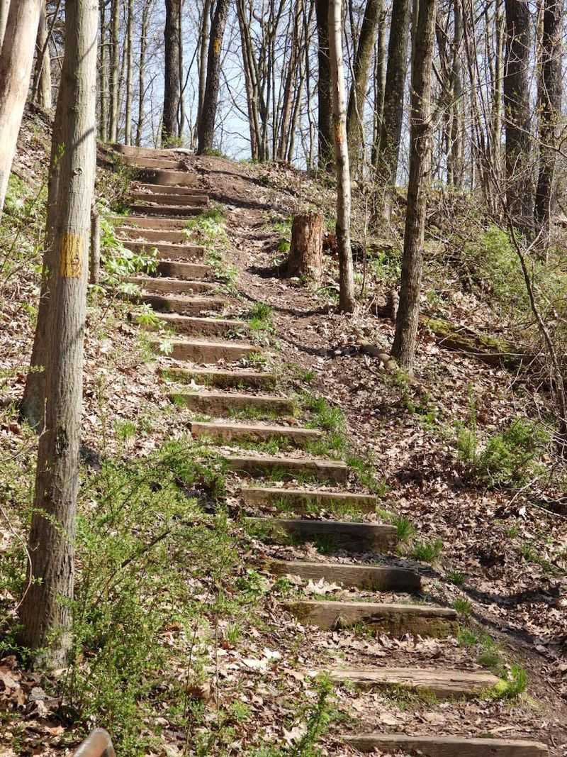
The overlook gets most of the attention, but the trail system here deserves credit on its own terms. The park offers approximately 1.7 miles of hiking trails, with the Deer Trail standing out as the most rewarding option for those who want a real walk rather than just a parking-lot view.
The Deer Trail runs about 1.1 miles as a loop along the cliff’s edge and includes some genuinely steep sections with stairs cut into the hillside, so comfortable footwear matters. The Oak Ridge Trail and Dry Hollow Trail provide a smoother, more gradual loop for visitors who prefer an easier pace, and a one-mile nature trail winds through the forested interior for a quieter, more immersive experience.
Trail blazes are generally easy to follow, though the signage at intersections can be a little ambiguous, so grabbing a map from the information board at the top of the hill before heading out is a smart move. The reward at the end of any route is always the same breathtaking river view waiting at the overlook.
Picnic Spots, Pavilions, and a Playground Worth Knowing About
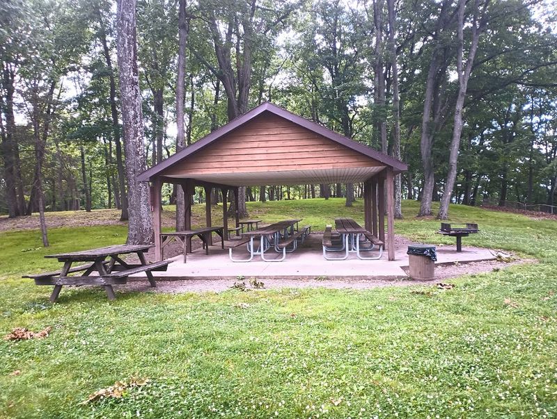
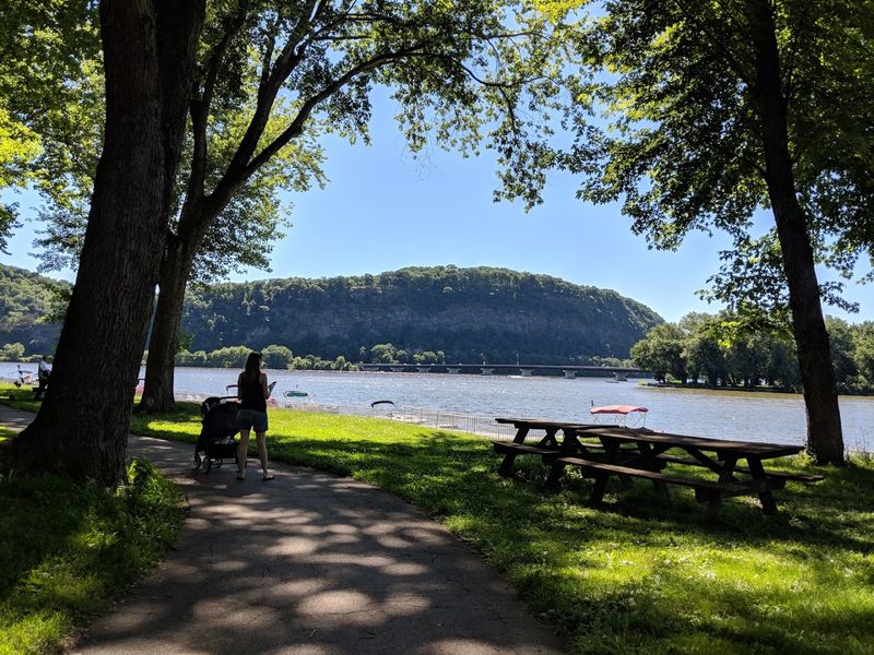
This is not a park where you drive up, snap a few photos, and leave within ten minutes, even though plenty of people do exactly that. The overlook section is genuinely set up for a full day out, with picnic tables scattered across the grounds, multiple pavilions available for larger groups, and a playground that gives younger visitors something to do between trail walks and view-gazing.
Pavilion number five, located in the middle parking lot area, is particularly well-positioned, with tables that look directly out toward the river so that even lunch feels like a scenic event. Pavilions can be reserved in advance for gatherings or used on a first-come, first-served basis when not booked.
Clean restrooms are available at the overlook section, which is a detail that matters more than people admit when planning a day trip with kids or older family members. Grilling areas round out the amenities, making a proper outdoor cookout a realistic option. The whole setup feels genuinely welcoming rather than just functional.
The Best Times to Visit and What to Expect Each Season
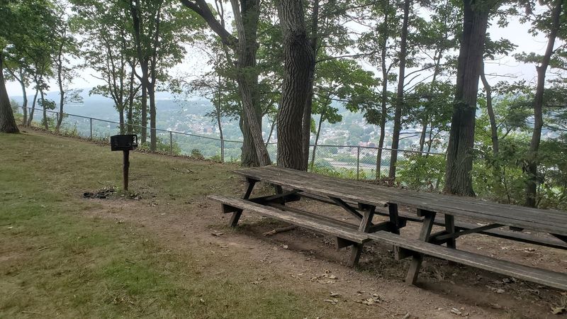
Timing your visit to this overlook makes a real difference in what you experience. The park is open from sunrise to sunset year-round, but the access road to the Overlook Section closes during winter, generally from December through March, because the steep incline becomes unsafe in icy conditions.
Spring brings the inflation of the Adam T. Bower Memorial Dam, which fills Lake Augusta and transforms the river view into something almost Mediterranean in its breadth and calm. Summer is the busiest season, with boats on the water, rowing teams training below, and families filling the picnic pavilions on weekends.
Autumn is arguably the most visually dramatic time to visit, as the hardwood forest surrounding the overlook turns a rich combination of gold, orange, and red that frames the river panorama in a way that photographs almost embarrassingly well. The park hours run from 8 AM to 7 PM daily during the open season, and there is no entrance fee at any time of year.
Practical Tips That Will Make Your Visit Smoother
A few practical details can save you some frustration before you even arrive. The access road to the overlook is narrow, and while passenger cars handle it without issue, large campers or vehicles towing wide trailers will have a genuinely difficult time navigating the tight passage, especially when meeting oncoming traffic.
Cell phone service along the road and throughout much of the park is unreliable, so downloading maps or saving the GPS coordinates before you leave home is a genuinely good idea rather than just a suggestion. The coordinates 40.87924, -76.80382 will get you directly to the overlook area.
There is no entrance or day-use fee, which makes this one of the more generous state park experiences in Pennsylvania. Dogs are welcome but must be kept on a leash at all times. Restrooms are available on-site, and if you plan to reserve a pavilion for a group event, calling the park office at +1 570-988-5557 ahead of time will ensure you get the spot you want.
The River Towns Visible From the Overlook
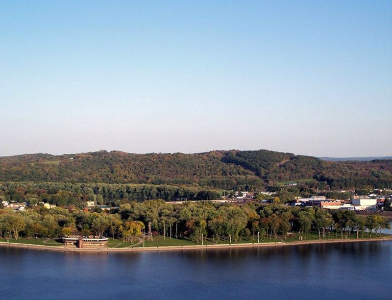
Part of what makes this overlook so compelling is that the view is not just water and sky. The towns of Sunbury and Northumberland sit directly below on opposite banks of the Susquehanna, their streets and rooftops clearly visible from 360 feet up, giving the panorama a lived-in quality that purely natural landscapes sometimes lack.
Sunbury, on the eastern bank, has its own deep historical roots, occupying land once known as Shamokin, a significant Indigenous settlement before European colonization reshaped the region. Fort Augusta, a British colonial fort, was later built there, cementing the area’s role as a strategic point along the river.
Packers Island, resting in the middle of the river between the two towns, adds a quiet, green focal point to the scene below. Watching the activity on the water between the two riverbanks, from fishing boats to rowing crews, while standing on a bluff that has overlooked this same stretch of river for centuries, gives the whole experience a quietly powerful sense of continuity.
Why This Overlook Deserves a Spot on Your Pennsylvania List
Some places earn their reputation through marketing, and others earn it simply by being exactly what they promise. This overlook falls firmly into the second category, consistently rated 4.7 out of 5 stars across more than 1,100 visitor reviews, not because of any grand amenities, but because the view genuinely delivers something memorable.
The combination of natural spectacle, layered history, accessible trails, and zero entrance fee makes it an unusually strong value for a day trip from anywhere in central Pennsylvania. Whether you come for the peregrine falcons, the confluence, the hiking, or just a quiet picnic with a remarkable backdrop, the overlook gives you something real to take home.
Nearby accommodations in Sunbury, Northumberland, and Selinsgrove make it easy to extend the trip into a full weekend if the region pulls you in, which it has a habit of doing. The Susquehanna Valley has been drawing people to this exact spot for centuries, and after one visit, it becomes fairly obvious why that tradition has never stopped.
Share this story