You do not need a difficult climb to get one of the biggest views in Pennsylvania. Barbour Rock Trail reaches an overlook roughly 850 feet above Pine Creek after an easy walk through Tioga State Forest.
The main route is about 1.3 miles round trip on a wide crushed-stone path designed to accommodate walkers, wheelchairs, and strollers. Most visitors can complete the outing in under an hour, even with time to stop at the overlook.
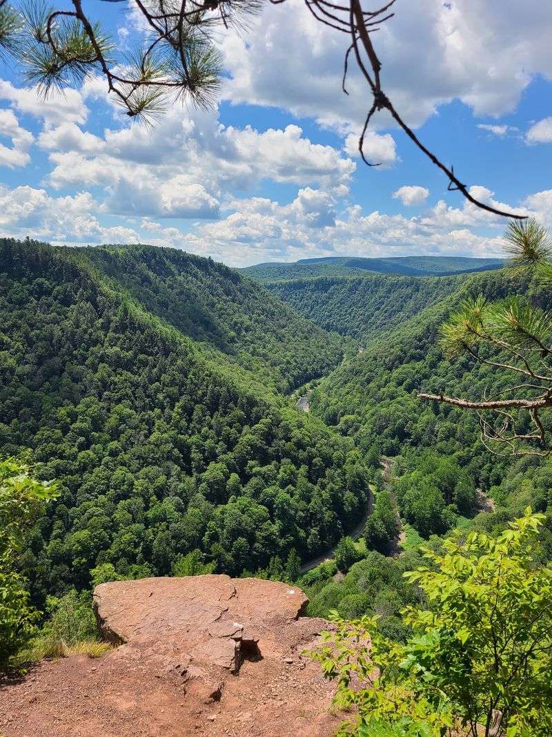
At the end, the trees open to a sweeping view across Pine Creek Gorge, better known as the Grand Canyon of Pennsylvania. The overlook faces east, making it especially appealing around sunrise, while fall turns the surrounding forest red, orange, and yellow.
One navigation detail is important before you leave. Some map apps can send drivers toward a rough road into the gorge, so knowing the correct approach can save you an unnecessary detour.
A Canyon View Hiding in Tioga County
The mystery spot is the Barbour Rock Trail Overlook, near Wellsboro, Tioga County, Pennsylvania. The trailhead sits along Colton Road in the Tioga State Forest, about three miles south of Route 6, just west of Ansonia.
The Google Maps address reads Barbour Rock Trail, Wellsboro, PA 16901, United States.
The trail leads to a rim view over Pine Creek Gorge, which people love to call the Grand Canyon of Pennsylvania. I found the parking area on the right side of the road, a large gravel lot with space for many cars.
The trail itself starts across the road.
Plan on a short outing. The main path is wide, crushed stone, and the walk to the rim runs about seven tenths of a mile one way.
Most people finish the round trip in under an hour, even with plenty of photo stops.
I liked how simple the whole setup felt. No permits, no steep scrambles, and no gear beyond decent shoes.
Even a quick stop on a road trip fits the schedule.
Before the view, though, there is a name to explain, and the story behind it goes back to the logging days.
The Logger Behind the Name
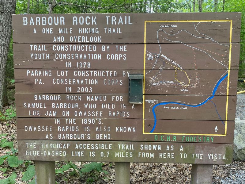
Barbour Rock carries the name of Samuel Barbour, a logger from the 1890s. He worked the log drives on Pine Creek, when thousands of logs floated downstream to the mills.
A log jam at the Owassee Rapids, below the overlook, ended his working days there.
Those rapids are sometimes called Barbour’s Bend. When the wind is calm, you can sometimes hear the water from the rim.
It adds a quiet bit of history to the soundtrack.
The trail itself is newer. The Youth Conservation Corps built it in 1978, and young workers shaped a path that now serves hikers of all ages.
I find that a nice link between old labor and new fun.
Standing at the rail, I tried to picture the gorge as a busy timber highway. Today it is green, calm, and mostly quiet, with the creek moving lazily.
Next, let me tell you how this giant canyon got carved in the first place, because the answer involves a glacier and a very large lake.
Meet the Grand Canyon of Pennsylvania
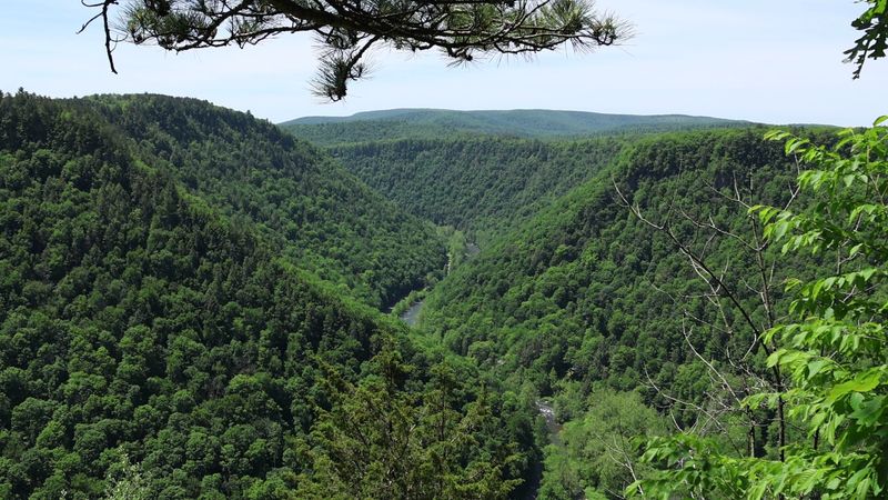
Forty-seven miles. That is how long Pine Creek Gorge stretches across north-central Pennsylvania.
The creek cut it into the Allegheny Plateau, and the result looks like a big green crease in the land.
The deepest spot reaches about 1,450 feet near Waterville. Near Barbour Rock, the canyon drops more than 800 feet, and the rim-to-rim span can reach roughly 4,000 feet.
Those numbers feel real once you stand at the edge.
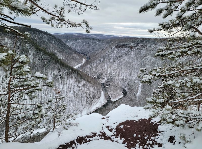
From the overlook, I counted ridge after ridge of trees fading into the haze. Pine Creek curls along the bottom like a ribbon.
It looks small from up here, which is part of the charm.
The nickname Grand Canyon of Pennsylvania fits well. It is not the size of the famous one in Arizona, but it has a similar feeling of space.
The forest makes it softer, and there is no desert dust.
Of course, a canyon this big did not appear overnight, and the real origin story is stranger than most people expect.
How Ice and Meltwater Carved the Gorge
About 20,000 years ago, Pine Creek flowed toward the northeast. Then the Laurentide Continental Glacier began to melt back.
It left a huge pile of rock, soil, and debris that blocked the creek like a plug.
Water backed up behind that blockage, and a large lake formed near where Ansonia sits today. Eventually the lake overflowed.
The rushing meltwater turned south and sliced into the rock.
That fast flow did the heavy lifting. Over a long time, steady erosion kept deepening the channel.
The layers of rock you see in the canyon walls are the result.
I like thinking about this while looking down from the rail. The calm creek below once had a powerful older sibling made of meltwater.
It reshaped the land long before anyone built a trail.
Now that you know the backstory, let me describe the easiest way to reach the view, a path built for wheels as well as feet.
The Wide Path Built for Wheels
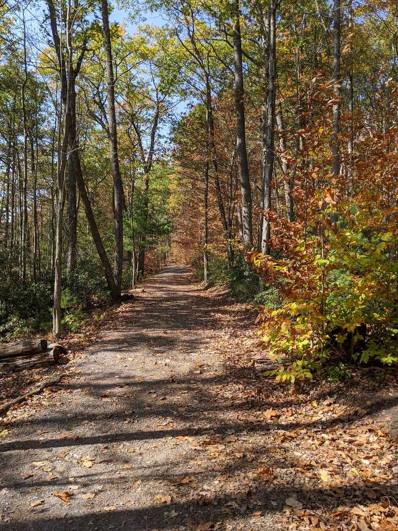
Strollers love this trail. The main path is wide crushed stone, built to be friendly to wheelchairs and baby carts.
I saw families rolling along without any trouble.
The out-and-back route runs about 0.7 miles each way, or 1.3 miles round trip. The average grade is around 3 percent, with a few stretches reaching 6 percent.
That means a gentle rise, not a workout.
Wheelchair users should know that pneumatic tires handle the stone better than solid rubber ones. Motorized wheelchairs are allowed on the trail.
A bit of gravel can feel bumpy, so go slowly.
The path is well marked with blue blazes, so getting lost is nearly impossible. Benches appear near the end for a rest.
Dogs on leashes are welcome, and mine would have loved all the smells.
If you want a bit more adventure, the same trail system has a rougher option, and it comes with a clever shortcut.
A Dirt Loop and Longer Wanders
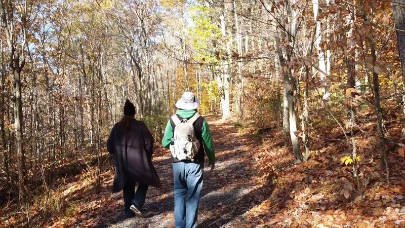
Choose your own route. A narrower yellow-blazed dirt trail runs beside the wide blue one, and it makes a shortcut of about 0.4 miles to the overlook.
Together, the two paths make a loop of roughly one mile.
The dirt route is rated moderate, with about 216 feet of elevation gain. Footing is less steady, and roots and rocks come into play.
A tree blocked part of it on my visit, but it was easy to scoot around.
Hikers who want more can join the West Rim Trail or the Bear Run Trail. Those links allow longer outings of just under three miles.
The extra distance brings new angles on the forest.
I walked out on the wide path and returned on the dirt one. That gave me both views of the woods, smooth and rugged.
It took about thirty minutes of steady walking.
The full loop is not wheelchair friendly, but the main view is not missed by taking the easy route. Now for the moment everyone came for.
The Moment the Trees Part
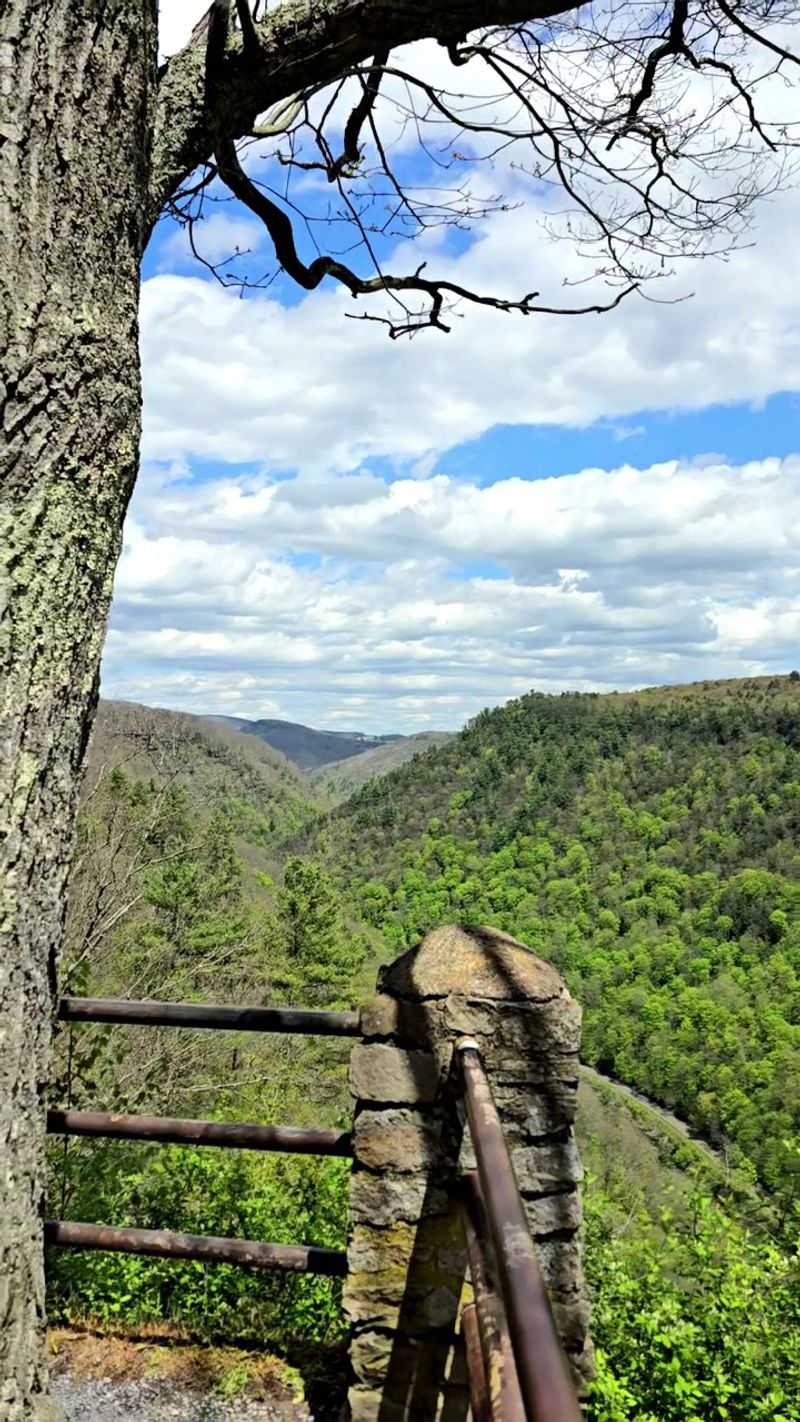
Then the forest opens, and the ground gives way to sky. The overlook is small, with a wooden railing and a bench.
The view reaches eastward and sweeps about 180 degrees along the gorge.
Pine Creek lies roughly 850 feet below. It shimmers like a long ribbon on the canyon floor.
On the far side, you can spot the Pine Creek Rail Trail, and sometimes cyclists crawling along it like tiny dots.
I stayed longer than planned. Birds drifted at eye level, and the wind carried a faint whisper of rapids.
Photos are good here, but the real view is better.
Care matters at this spot. Other unofficial viewpoints along the rim have no fence, and the cliffs are steep.
Keep children close and pets on a short leash.
Loose gravel near the rocks can slip under shoes. Stay behind the railing and enjoy the panorama safely.
The next section tells you when to come for the most color.
Fall Colors and Sunrise Glow
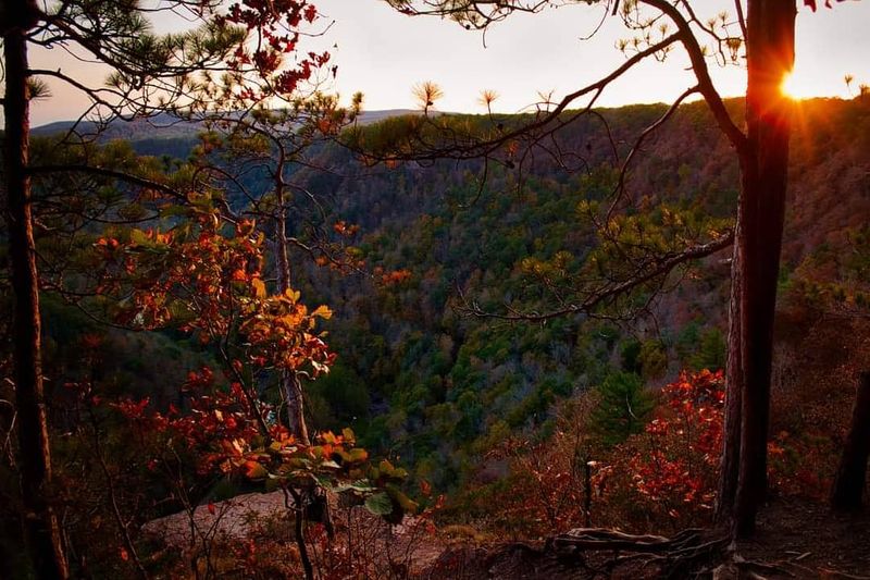
Timing changes everything. Late September through mid-October is the star season.
The gorge fills with yellow, orange, red, and purple, with pockets of evergreen to add contrast.
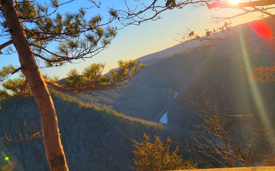
Early risers get a special treat. The overlook faces east, so it is one of the best places in the Pennsylvania Grand Canyon for sunrise.
I would bring a thermos of cocoa and arrive before the light turns gold.
Spring and summer bring lush green leaves and cooler shade on the trail. Mountain laurel blooms add soft pink and white to the path.
Even a November visit can offer clear views once the leaves drop.
Winter needs planning. Colton Road is not maintained in cold months, so driving can be limited by snow or ice.
Check conditions before you set out.
Fall weekends get busier, though this overlook tends to be quieter than other canyon views. A weekday morning is the sweet spot.
Along the way, the forest itself has a few surprises.
Woods Full of Quiet Residents
Tall oaks and maples shade the path, and the second-growth forest feels calm and cool. Mountain laurel, the Pennsylvania state flower, grows beside the trail.
When it blooms, the whole walk looks dusted with petals.
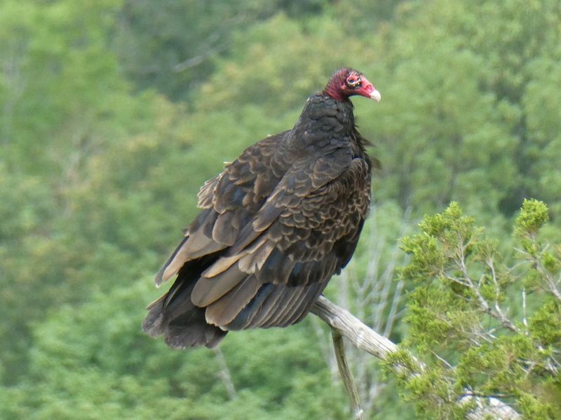
Small wildlife shows up often. I spotted gray squirrels, chipmunks, and signs of wild turkeys.
Birders will enjoy the songs drifting through the canopy.
Quiet pays off here. Stop for a minute, and the forest seems to turn up its volume.
Leaves rustle, branches creak, and sometimes the far-off rapids murmur.
Tiny flies can buzz around your face in warm months, so a hat helps. Bug spray is a smart add-on.
It made my trip much happier.
The walk is short, but the woods reward slow steps. Bring a pair of binoculars if you have them.
Beyond the viewpoint, there is plenty more to do in this corner of the state.
More Ways to Play Nearby
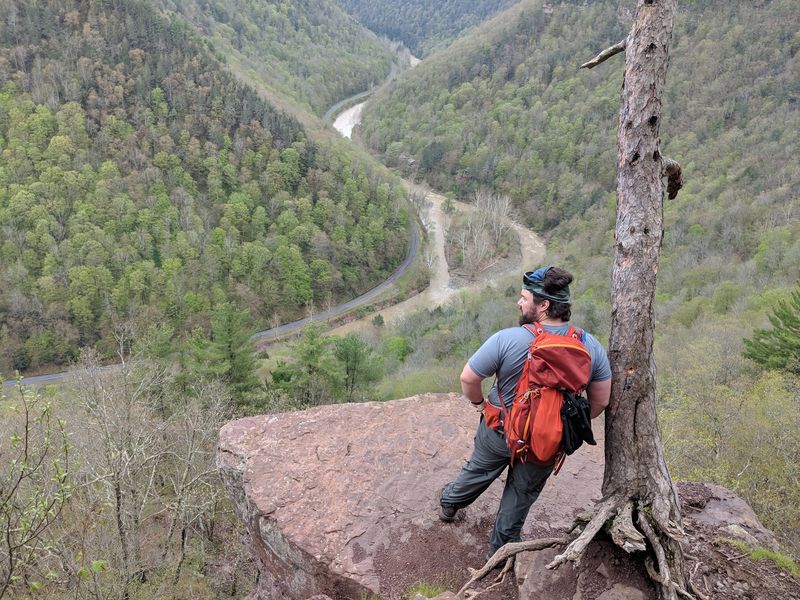
One overlook can start a whole day. The West Rim Trail runs along the canyon edge, so hikers can stretch the outing.
Photographers can chase light and seasonal color along the way.
Down below, the Pine Creek Rail Trail is a favorite for biking, running, and walking beside the water. You can see it from the overlook, which makes planning feel like a map come to life.
It gives a very different view of the same gorge.
Chimney Hollow Falls is another nearby feature for people who like a bit of exploring. Birdwatching in the Tioga State Forest adds a calm option.
Pack a snack and take your time.
The town of Wellsboro is close too, and it is a charming place for a break after the hike. A stroll through its streets makes a nice ending.
Local shops and cafes are easy to find.
Before you go, though, there are a few practical details that will keep the trip smooth.
Smart Tips and a Wrong Turn to Skip
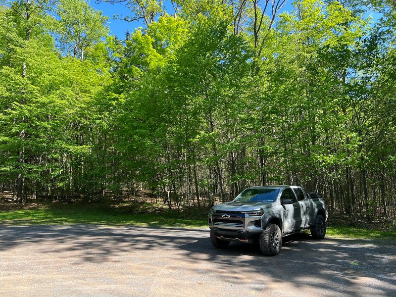
Parking is simple. A large gravel lot sits at the trailhead on Colton Road, with handicap accessible spaces.
The trail picks up across the road.
Here is the big warning. Some map apps send drivers onto Owassee Road, a narrow, rocky dirt road that drops into the gorge.
Stay on Colton Road, and continue south until you see the gravel lot on the right.
No modern restrooms stand at the trailhead. Accessible facilities are at the snowmobile lot across from Wilson Maintenance Headquarters and at Colton Point State Park.
Plan a stop beforehand.
Wear sturdy shoes, especially for the dirt sections. Leashed dogs are welcome, and owners should carry out waste.
Keep little ones close near the cliffs.
Colton Road is not maintained in winter, so check conditions first. A bit of prep makes the easy trail even easier.
One last detail changes what you will see on the skyline.
The Lone Pine That Left the Skyline
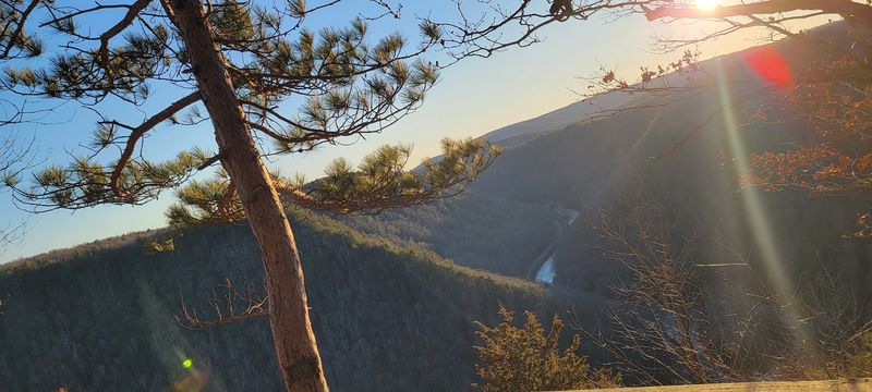
For years, a single pine stood at the rim like a lookout. Photographers loved it, and many visitors posed beside it.
People called it the Lone Pine.
The tree died a year before spring 2022 and then fell from its perch. It is no longer there.
Returning hikers may notice the empty spot right away.
I never saw it in person, but the missing landmark gives the overlook a touch of storytelling. Old photos show how much the rim has changed.
The change feels gentle, not sad.
The view itself stays just as striking. Layers of forest still fade into the distance, and Pine Creek still glitters below.
The canyon does not need one tree to impress.
So pack a snack, lace up, and roll or stroll to the rail. The easiest trail in the gorge may give you the best photo of the year.
Share this story