There is a trail in Illinois where history is not behind glass in a museum but right under your boots. The Illinois and Michigan Canal State Trail stretches across the northern Illinois landscape, following a waterway that once powered the growth of an entire region.
You can walk or ride past stone locks built by immigrant laborers, peek inside a restored locktender’s house, and stand beside a massive earthwork that still impresses anyone who sees it. This trail is a rare mix of outdoor adventure and living history, and every mile has something worth stopping for.
The Trail’s Address and Starting Point in Morris
The official address for the Illinois and Michigan Canal State Trail is 401 Ottawa St, Morris, IL 60450, right in Grundy County in northern Illinois. Morris serves as one of the most popular starting points for the trail, and Gebhard Woods State Park nearby gives visitors a shaded, welcoming place to park and prepare for the journey ahead.
The trail is managed by the Illinois Department of Natural Resources, and you can reach them at +1 815-942-0796 or visit the official site at dnr.illinois.gov. The trail runs roughly 61 miles total, connecting the Chicago metropolitan area to the Illinois River Valley near LaSalle and Peru.
Most of the surface is crushed limestone, which is firm enough for road bikes and comfortable for hikers. The section east of Morris toward William G.
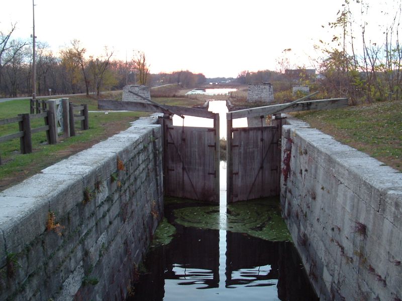
Stratton State Park is particularly scenic, with a full canal channel and lush tree cover framing the path on both sides throughout the season.
The Historic Canal Itself
Completed in 1848, the Illinois and Michigan Canal was a massive engineering achievement that connected the Great Lakes to the Illinois River and, by extension, to the Mississippi River system. Before railroads took over, this 96-mile waterway was the main artery for moving grain, lumber, and goods across the Midwest.
Mule-drawn boats traveled the canal at a slow but steady pace, guided along the towpath that is now the trail you walk or ride today. The canal was dug largely by Irish and German immigrants who worked under grueling conditions for modest pay.
Their labor shaped a corridor that fueled the rapid growth of Chicago itself.
Near Morris and heading east, the canal still holds water in stretches, giving the trail a mirror-like companion on one side. The reflection of old trees in the still water on a calm morning is one of those quiet rewards that makes the whole trip feel worthwhile and deeply connected to the land.
The Old Stone Locks Along the Route
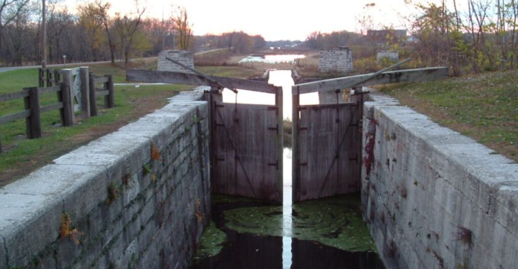
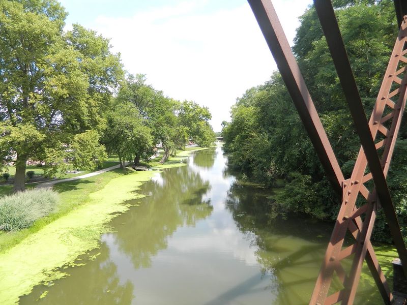
One of the most tangible pieces of history along the trail is the collection of old stone locks scattered at intervals along the canal corridor. These locks were built to raise and lower canal boats as the land elevation changed between Chicago and the Illinois River Valley, a total elevation drop of about 140 feet.
Each lock was constructed from locally quarried limestone, and the craftsmanship is still visible today even after more than 170 years. The stones are fitted tightly together, and the basic form of the lock chambers remains intact at several locations.
Standing beside one and thinking about the boats that passed through is a surprisingly moving experience.
There were originally 15 locks along the canal’s length, and several of them are accessible directly from the trail. Some are just stone walls half-hidden by vegetation, while others are more clearly preserved.
Either way, each one is a quiet monument to the era when water transportation ruled the American interior and these structures were as vital as a modern highway interchange.
The Restored Locktender’s House
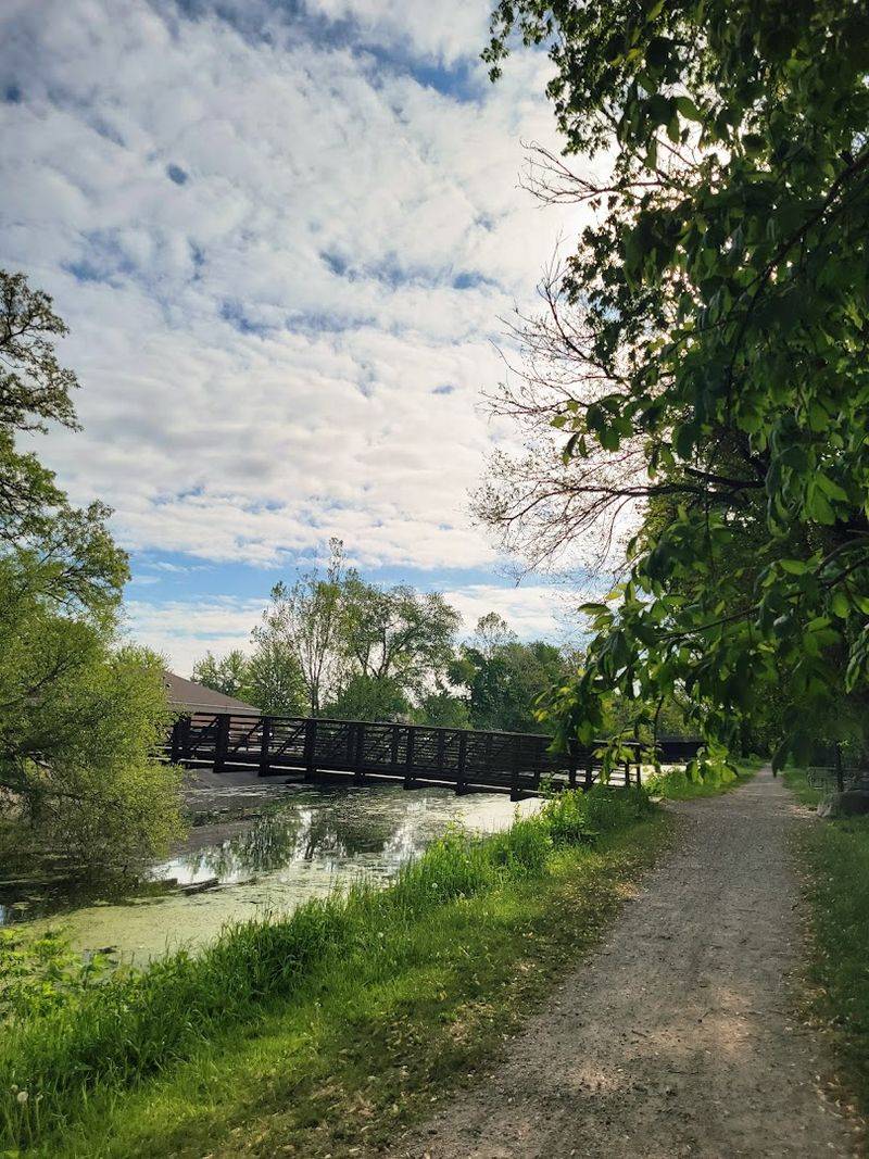
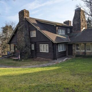
Every lock along the canal needed a person to operate it, and that person, the locktender, lived on site in a small house provided by the canal authority. One of these houses has been carefully restored and is open for visitors to explore, offering a window into everyday life along the canal in the mid-1800s.
The restored locktender’s house is a modest structure by any standard, but its simplicity is exactly what makes it so fascinating. Inside, period furnishings and interpretive displays show how a locktender and their family actually lived, worked, and spent their days beside the busy waterway.
It was a job that ran around the clock during the navigation season, which lasted from spring thaw to autumn freeze.
The house sits close to the trail, so you can walk right up to it without any detour. Visiting it transforms an otherwise physical outdoor experience into something more personal and human.
You leave with a real sense of the people who built and maintained this canal, not just the engineering but the daily human effort behind every boat that passed through.
The Giant Earthwork: The Canal’s Embankment and Aqueduct
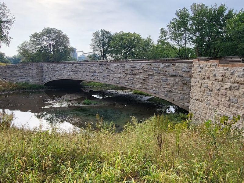
Among the most striking engineering features along the trail is a massive earthwork embankment that carries the canal over lower terrain. To keep the water level consistent, canal engineers had to build up sections of earth to enormous heights, creating berms that still loom impressively over the surrounding landscape today.
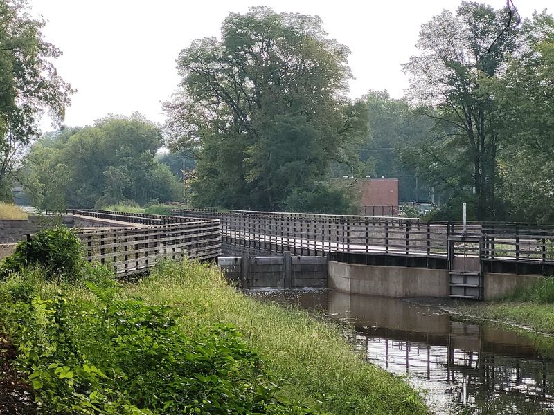
Related to this earthwork is the recently restored aqueduct over Nettle Creek, located just 0.2 miles east of Gebhard Woods State Park in Morris. The aqueduct carries the canal channel itself over the creek below, which means the water flows over more water.
This kind of layered engineering was a genuine feat for the 1840s and required careful planning and skilled labor to execute properly.
The aqueduct was out of service for years after a failure in 2013, but it has since been repaired and is now fully passable for trail users. Riding or walking across it gives you a direct sense of the scale and ambition of the original builders.
The earthwork and aqueduct together are the kind of structures that make you stop and genuinely appreciate what people accomplished with hand tools and determination.
Trail Surface and Conditions for Hikers and Cyclists
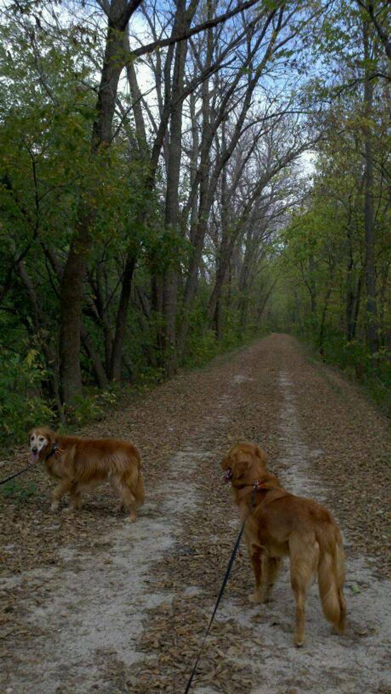
The trail surface varies noticeably depending on which section you are traveling. The most well-maintained stretches feature a packed crushed limestone surface that is smooth enough for road bikes and comfortable for long hikes.
Between Channahon and McKinley Woods, the trail is widely considered the best-maintained and most enjoyable segment of the entire route.
West of Morris toward Ottawa, conditions can be rougher. Some sections have reverted to narrow dirt tracks, and there have been stretches torn up by construction with limited signage to guide visitors around the disruption.
A mountain bike handles these rougher sections better than a road or hybrid bike, and trail shoes grip the uneven ground more reliably than casual sneakers.
Trail conditions also vary by season. Spring can bring soft or muddy surfaces after rain, while late fall offers clear sightlines through the bare trees to the river and canal below.
The Illinois DNR updates trail conditions periodically, so checking the official website before a long-distance ride is a practical step that can save you from an unpleasant surprise halfway through your trip.
Wildlife and Natural Scenery Along the Corridor
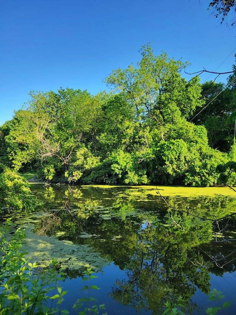
The canal corridor has become a surprisingly rich wildlife habitat over the more than 150 years since the waterway was in active commercial use. The water, wetlands, and mature tree canopy attract a wide range of birds, making this trail a quiet favorite among birdwatchers who come specifically for the herons, egrets, kingfishers, and warblers that frequent the banks.
White-tailed deer are common sightings, especially in the early morning or near dusk. Turtles sun themselves on logs in the canal sections that still hold water, and the occasional mink or muskrat can be spotted moving through the reeds.
The trail passes through a mix of open meadow and dense woodland, which creates natural variety that keeps the scenery from feeling repetitive over a long ride or hike.
The canal itself, where it holds water, supports aquatic life as well, and fishing is permitted at several access points along the route. The combination of accessible wildlife, calm water, and wooded paths gives the trail a peaceful, almost unhurried quality that sets it apart from more developed recreational paths in the Chicago metro area nearby.
Fishing Opportunities Along the Canal
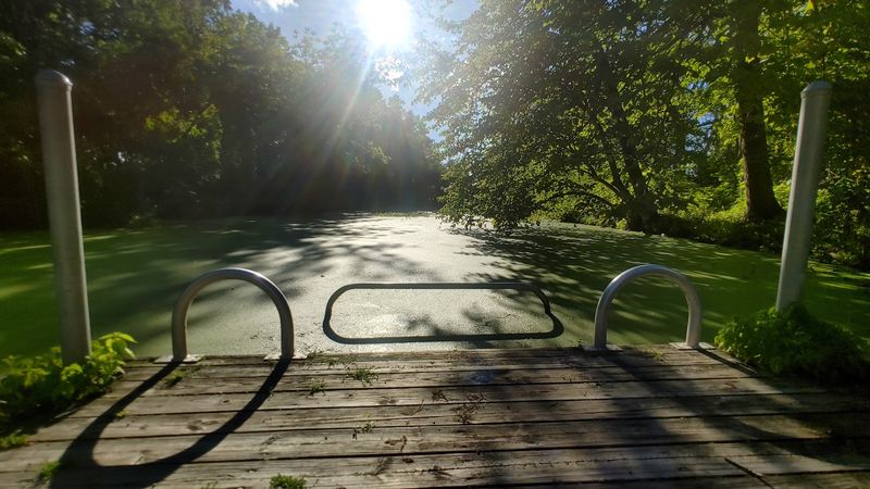
Fishing along the Illinois and Michigan Canal State Trail is one of those low-key pleasures that does not always make it into the trail’s main promotional material, but it is genuinely worth mentioning. The canal sections that hold water support populations of bass, bluegill, catfish, and carp, and the calm, flat water makes for easy casting without the need for a boat.
Access points for fishing are spread along the trail, and many of them are reachable directly from the path without any extra hiking. The shaded banks and quiet atmosphere make it a relaxing way to spend a few hours, especially on a weekday when the trail is less crowded.
Families with kids find it particularly approachable since the water is calm and the banks are generally flat and easy to manage.
An Illinois fishing license is required for anyone 16 and older, and the standard state regulations apply throughout the canal corridor. The combination of a long, scenic trail and productive fishing spots makes this one of the more versatile outdoor destinations in the region, appealing to people who want more than just a walk or a bike ride.
The Trail’s Connection to Illinois History and Chicago’s Growth
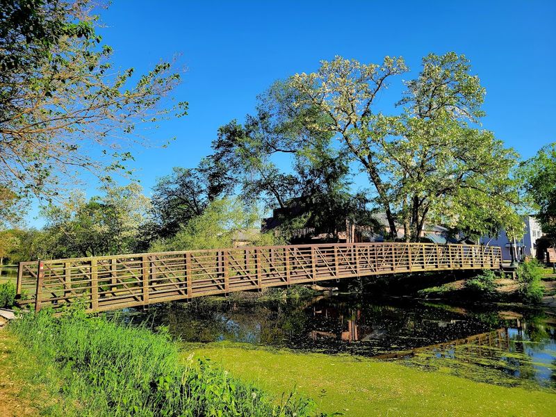
Few trails in the Midwest carry as much historical weight as this one. The Illinois and Michigan Canal was directly responsible for connecting the Great Lakes to the Gulf of Mexico via inland waterways, and that connection transformed Chicago from a small settlement into a booming commercial hub almost overnight after the canal opened in 1848.
The canal made it possible to ship grain from Illinois farms to eastern markets and to bring manufactured goods back west. The economic ripple effects were enormous and long-lasting.
Towns like Morris, Seneca, Ottawa, and LaSalle grew up along the canal corridor specifically because of the commerce it generated, and many of their historic downtown buildings date from that era of canal-driven prosperity.
Congress designated the canal corridor as a National Heritage Corridor in 1984, recognizing its outsized role in American transportation and economic history. The trail today is the most direct way to experience that legacy in person.
Every lock, every stone wall, and every section of towpath is a physical record of a chapter in American history that shaped the entire interior of the continent in ways that are still felt today.
Gebhard Woods State Park as a Trail Hub
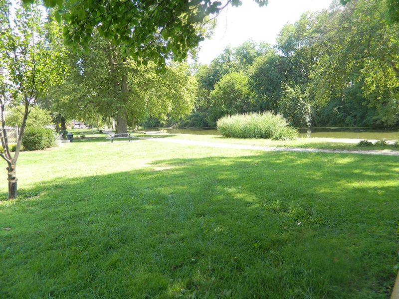
Gebhard Woods State Park in Morris functions as one of the most convenient and pleasant hubs for accessing the Illinois and Michigan Canal State Trail. The park sits right along the canal corridor and offers parking, restrooms, picnic shelters, and a campground, making it a practical base for both day trips and overnight stays.
The park itself is worth a visit on its own terms. A small creek runs through it, and the mature tree canopy creates a cool, shaded environment that is especially welcome on hot summer days.
The picnic areas fill up on weekends but tend to be quieter midweek, which is the better time to visit if you prefer a more relaxed atmosphere.
One practical note: mosquitoes can be a genuine issue at Gebhard Woods, particularly in summer after wet weather. Bringing insect repellent is not optional here, it is necessary.
Despite that seasonal nuisance, the park remains one of the most accessible and well-equipped entry points to the trail, and its proximity to the restored Nettle Creek aqueduct makes it the natural first stop for anyone new to the canal trail experience.
Best Sections to Visit and Practical Tips
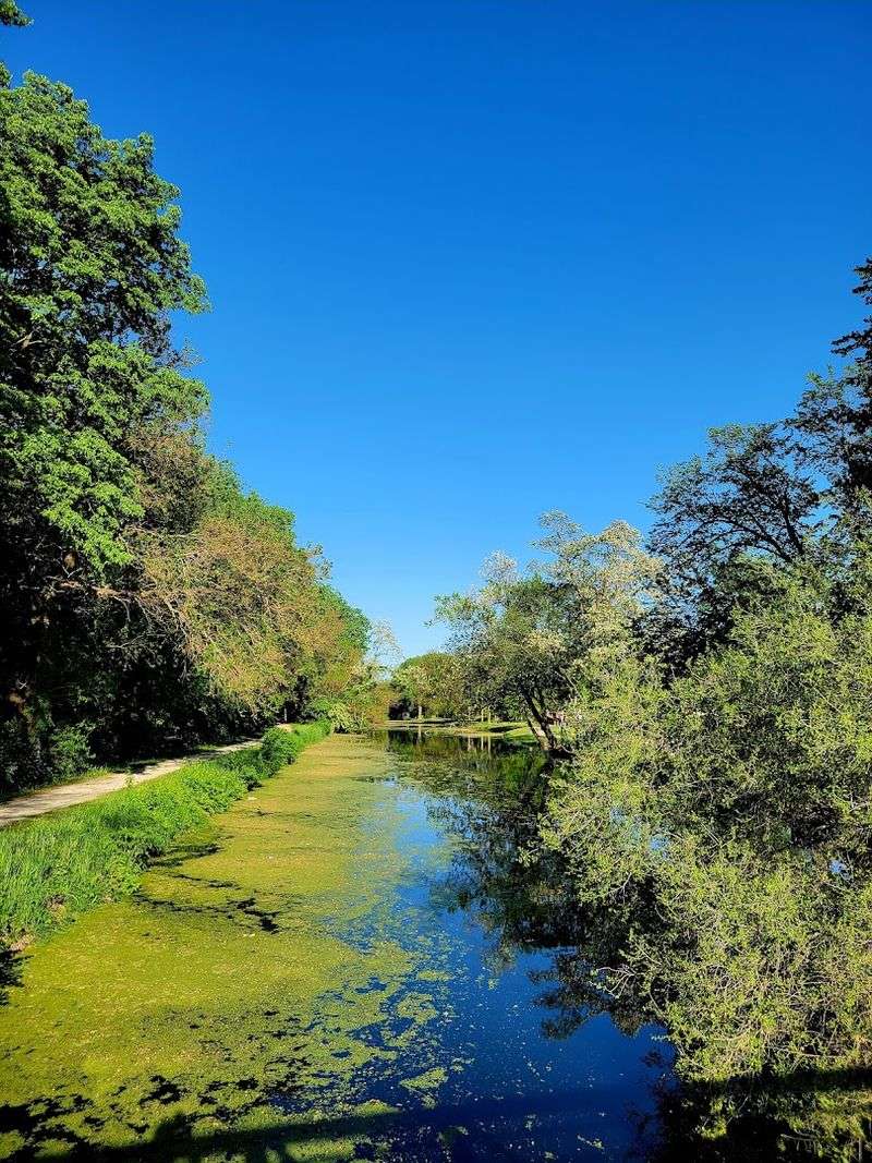
The stretch between Channahon and McKinley Woods is consistently praised as the most scenic and well-maintained section of the entire trail. The canal holds water here, the path is in good shape, and the tree cover is dense enough to make it feel like a true nature corridor rather than a converted industrial route.
East of Morris toward William G. Stratton State Park is another strong section, with a full canal channel and relatively smooth surface.
West of Morris toward Ottawa can be more challenging, with rougher trail surfaces, limited signage, and occasional construction disruptions. Checking current trail conditions through the Illinois DNR website before heading out is genuinely useful, not just a formality.
The trail is open year-round, and each season offers something different. Spring brings wildflowers and returning birds.
Summer is lush but buggy. Fall delivers stunning foliage and clear views through the bare trees.
Winter, for those willing to layer up, offers a stark and quiet beauty that most visitors never see. Whatever season you choose, bringing water, a trail map, and solid footwear will make the experience far more enjoyable from start to finish.
The Trail as a Living Outdoor Classroom
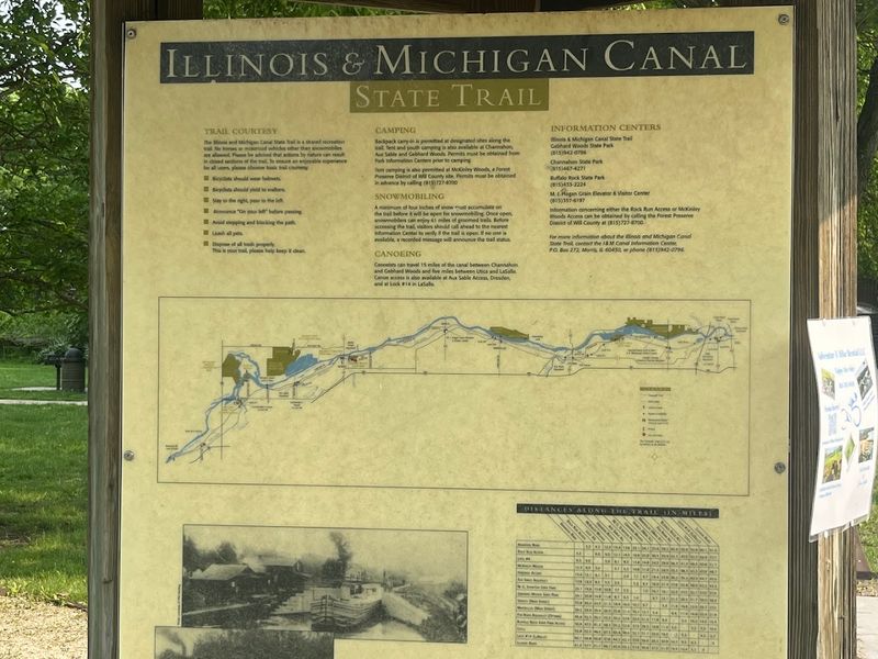
The Illinois and Michigan Canal State Trail is not just a recreational path. It functions as one of the most accessible outdoor history classrooms in the entire state.
The combination of intact infrastructure, interpretive signage, and the sheer scale of the canal corridor makes it an ideal setting for learning about 19th-century engineering, labor history, and economic geography.
Several historic displays are positioned along the trail at key points, offering context for the locks, aqueducts, and earthworks that visitors pass. These signs are well-designed and genuinely informative without being overwhelming.
They give enough background to make the structures meaningful without turning the hike into a lecture.
School groups, scout troops, and family visitors all benefit from the trail’s layered approach to history. You can experience it purely as a physical outdoor activity, or you can slow down and engage with the historical narrative embedded in every stone and earthen berm along the route.
The trail rewards curiosity at every level, and the fact that it is free and open to the public makes it one of the most democratically accessible history experiences in northern Illinois.
Share this story