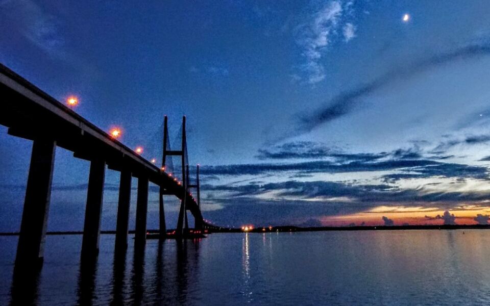
Most drivers on the Georgia coast expect flat marsh, slow rivers, and long, easy stretches of road. Then the highway starts to climb, and a pair of giant towers appears out of nowhere.
Within seconds, the car is rising far above the water, with cables fanning past the windows. This one crossing turns a quick coastal drive into a trip worth talking about, and there is a hidden park waiting below it too.
Where US-17 Climbs Over the Brunswick River
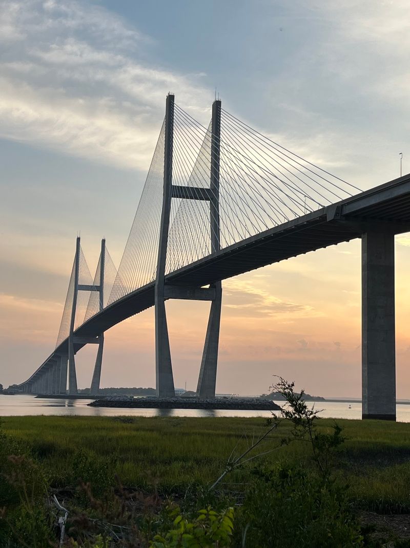
Flat land makes a tall bridge look even taller, and coastal Georgia has plenty of flat land. That is exactly why the Sidney Lanier Bridge stands out so sharply against the sky.
The bridge sits in Brunswick, GA 31520, United States, carrying four lanes of US-17 over the Brunswick River. It links the city side of Brunswick to the route heading toward Jekyll Island and the nearby beaches.
Plenty of travelers spot it while cruising along I-95 and assume it belongs to the interstate. It does not.
The I-95 bridge is a different crossing, and this one serves the coastal highway that runs closer to the water.
Around it, the landscape is mostly marsh, river, and low shoreline. Nothing nearby competes with its height, so the towers become a landmark from miles away.
Once the road starts its climb, it becomes clear this is no ordinary commute.
A Name Borrowed From a Poet
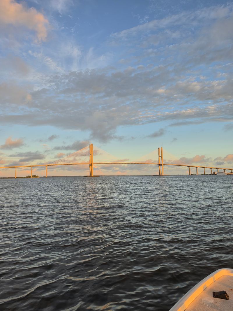
Bridges usually get named after engineers or politicians. This one honors a writer.
Sidney Lanier lived from 1842 to 1881 and became one of the best-known poets of the American South. His name now rides above the Brunswick River on one of the most recognizable structures in the state.
The choice makes sense for the area. Lanier had strong ties to coastal Georgia, and the wide marshes around Brunswick have long been linked with his writing.
Naming a bridge after him keeps that literary history in front of thousands of drivers every day.
Most people crossing probably never stop to think about the name on the sign. Still, it adds a quiet layer of meaning to a structure that is mostly famous for its size.
Not bad for a poet: a monument made of concrete and steel cables, open to the public every hour of every day.
The Older Bridge That Came Before
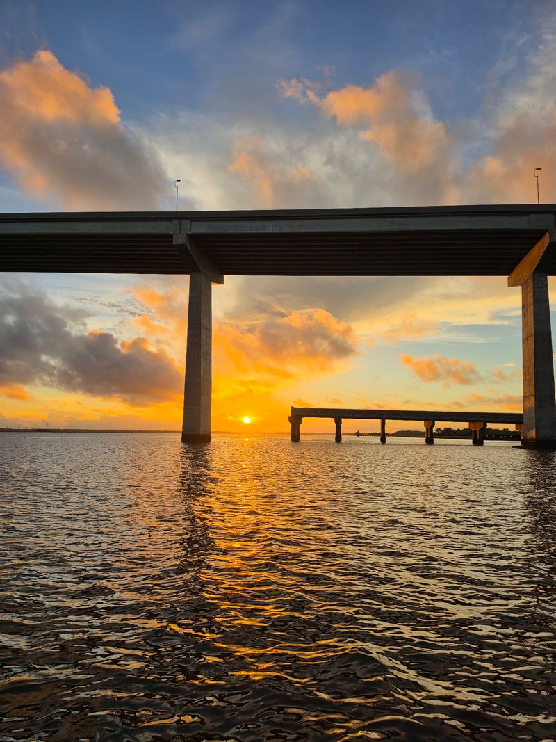
Long before the towers went up, a smaller bridge handled the job. The original Sidney Lanier Bridge opened on June 22, 1956.
That earlier crossing sat much lower over the water. Large ships moving in and out of the port had to pass close to it, and that created problems over the years.
The old bridge was struck by ships on two separate occasions. The first was in November 1972, and the second came in May 1987, when a Polish freighter hit the structure.
Those incidents helped show why a taller crossing made sense for a busy shipping channel. A higher bridge would let vessels pass underneath with room to spare.
Longtime locals still remember the smaller bridge sitting beside the new one during construction. The new towers rose high above it, and the old crossing looked tiny by comparison.
The replacement was finished in 2003.
Numbers Worth Bragging About
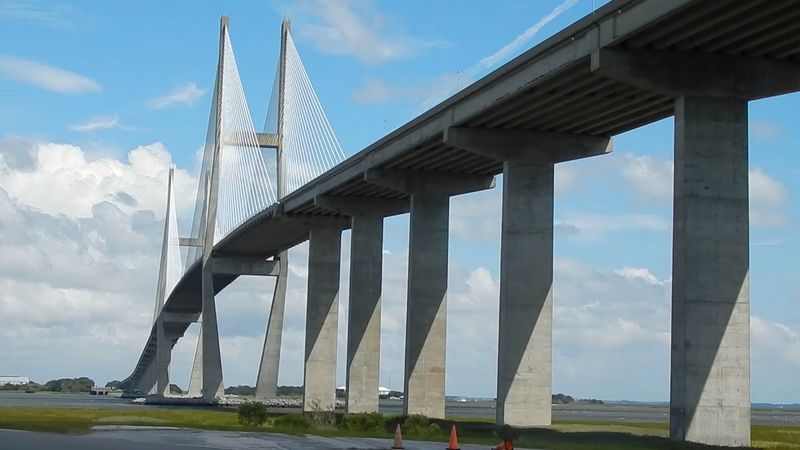
Here is a quick stat sheet for anyone who loves big figures. The bridge stretches about 7,780 feet from end to end, which is close to a mile and a half.
Its towers reach roughly 480 to 486 feet into the air. That height makes it the tallest cable-stayed bridge in Georgia, and it is often called the longest-spanning bridge in the state.
The main span between the towers measures 1,250 feet. Below it, ships get about 185 feet of clearance over the water.
That clearance is the real reason for all the height. Big cargo vessels need space, and this design gives them plenty.
Fans of other Southern bridges sometimes compare it to Charleston’s Arthur Ravenel Jr. Bridge. The difference shows in the towers.
Charleston uses a diamond shape, while the Brunswick towers rise straight up.
Straight, tall, and simple turns out to be a winning look.
Cables Fanning Past the Windshield
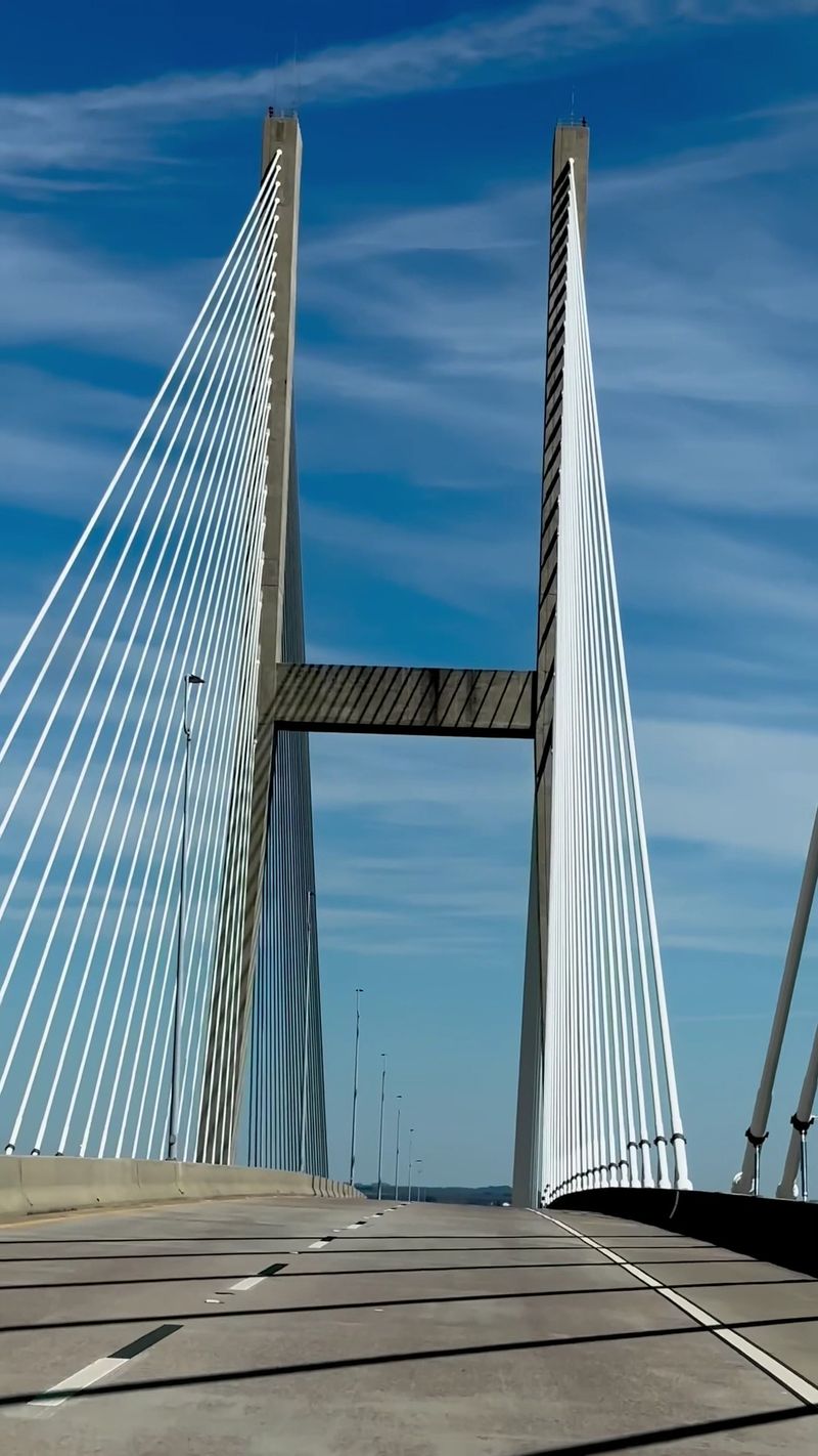
Passengers, get the camera ready early. The cables arrive fast once the car reaches the upper part of the span.
Photography comes up again and again when people talk about this crossing. The fanned cables create strong lines that look great in pictures, especially with the towers rising in the center of the frame.
Drivers should leave the photos to someone else, of course. The road climbs steeply, and focus belongs on the lanes.
From the top, the view opens up across the river, the marsh, and the surrounding coast. On a clear day, the flat landscape seems to stretch forever.
Photographers also like shooting the bridge from a distance. It shows up nicely in pictures taken from Jekyll Island, where the towers rise above the shoreline.
Every angle offers something different, so it pays to try a few. One crossing rarely produces just one good shot.
Cargo Ships Sliding Underneath
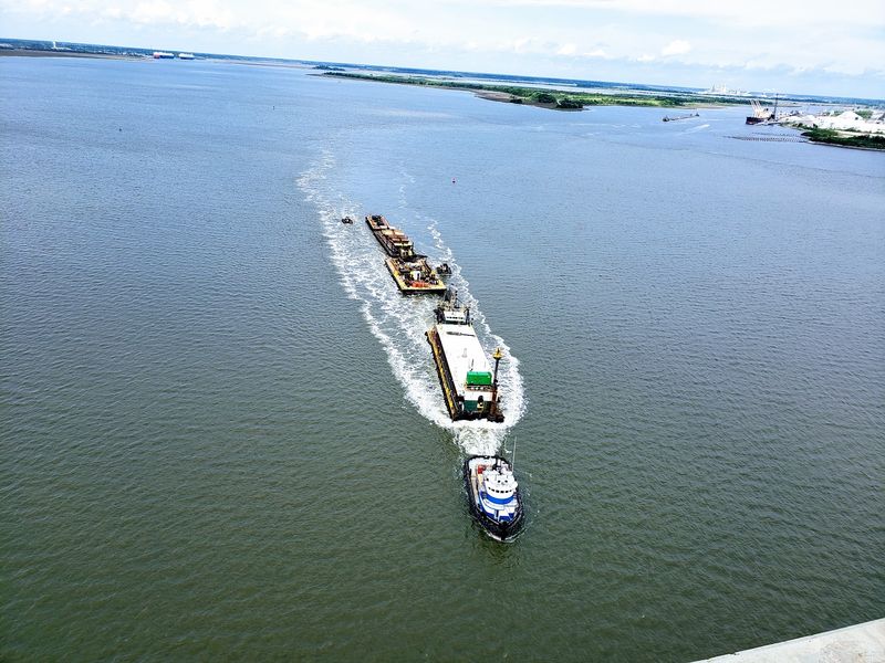
Timing can turn a normal crossing into a small show. Every so often, a large cargo ship moves along the river right below the deck.
The Brunswick River is a working waterway, and big vessels travel through it to reach the port. With 185 feet of clearance, they pass under the bridge without trouble.
Catching one from the top of the span is a lucky moment. The ship looks surprisingly small from that height, which says a lot about how tall the bridge really is.
From the park at the north end, the same ships look much larger. Watching one glide under the span from ground level gives a better idea of the scale.
Nobody can promise a ship will show up on a given day. Still, keeping an eye on the water during any crossing is a smart habit.
Luck favors the patient here.
A Hidden Park on the North End
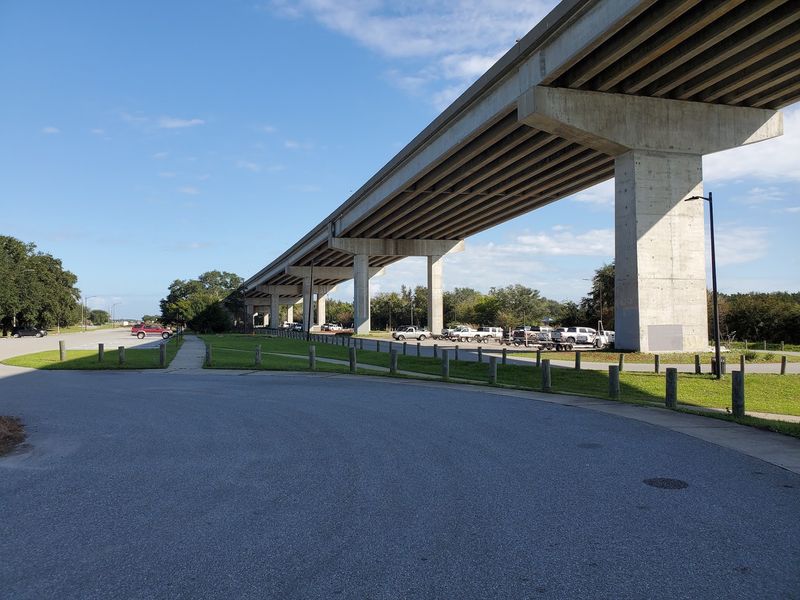
Some of the best views of the bridge come from directly underneath it. Tucked below the north end, on the Brunswick city side, sits a small park that many travelers drive right past.
It has picnic tables and grills, which make it an easy stop for a packed lunch. There is also a boat ramp and a walk-out pier that works well for fishing and photos.
Finding it takes one simple move. Heading north, turn left at the first opportunity after the bridge, then drive back toward the riverside under the span.
From here, the towers and cables rise straight overhead. It is one of the most popular photo spots in the area, and it gives a calm break from the highway.
Locals know about it. Many out-of-towners do not.
Consider this the insider tip of the whole trip.
Walking, Running, and Biking the Span
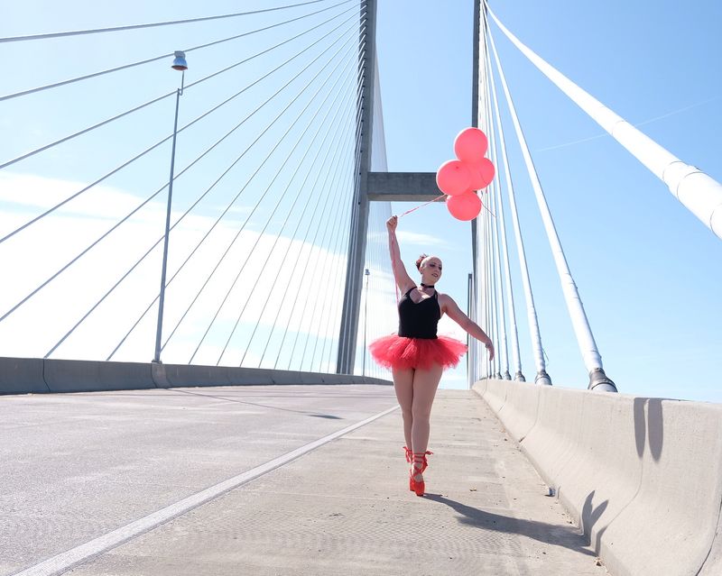
Cars are not the only way across. People regularly walk, run, and bike over the bridge, and doing so is allowed at any time.
Here is a handy number for fitness fans. Going from one end to the other and back adds up to roughly a 5k.
That distance comes with a serious hill in the middle. The climb to the top of the span gives legs a real workout, especially on the way up.
There is plenty of room along the side, so walkers are not squeezed right next to passing traffic. The bridge also tends not to feel crowded, which helps.
At the top, the payoff is a wide view of the river and coast that drivers only see for a few seconds. On foot, there is time to take it all in.
Few workouts come with scenery quite like this one.
Height, Wind, and a Few Butterflies
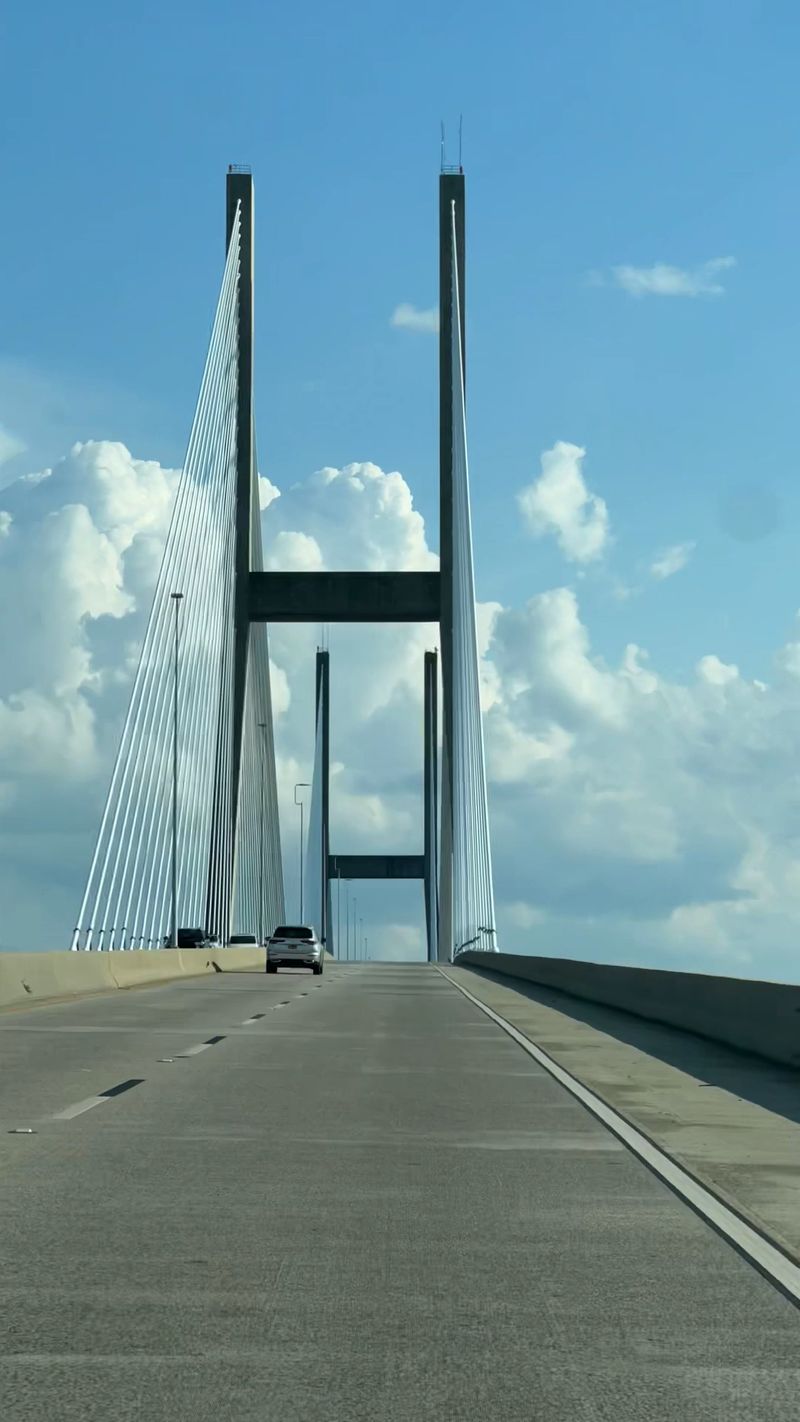
Fair warning for anyone who dislikes heights. This bridge gets your attention.
The climb is steep, and the top sits far above the water. Some drivers say it feels intimidating the first time, and many prefer to stay in the middle lane on the way over.
Wind is another factor. Breezy days are common on the coast, and walking the span during strong gusts can feel unsettling.
The sides use concrete barriers rather than tall guardrails. That keeps the view wide open, though it also makes the height very noticeable.
On the plus side, the deck is wide and the lanes feel roomy. Plenty of nervous first-timers end up enjoying it once they reach the other side.
Families walking across should keep children close and supervised. For everyone else, a few butterflies are simply part of the fun.
Gateway to the Golden Isles
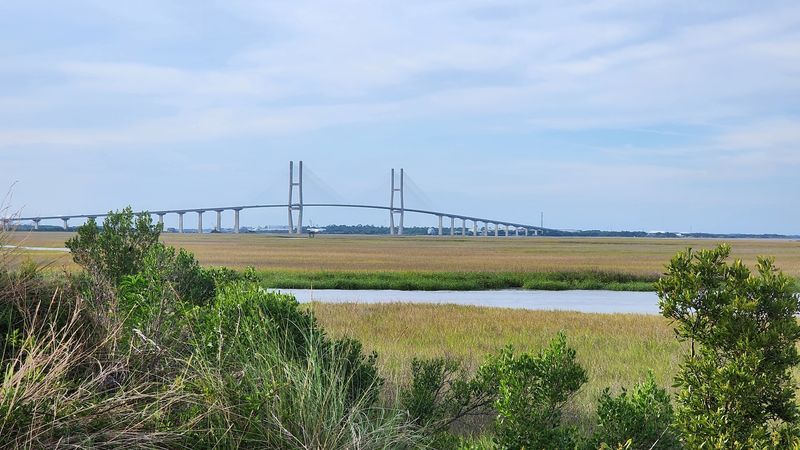
Half the joy of this crossing is where it leads. The bridge forms part of a route that heads toward Jekyll Island and its beaches.
Many people use it as the scenic start to a beach day. An early morning drive over the span can feel peaceful, with the road quiet and the coast spreading out ahead.
The wider region offers plenty more to explore. Jekyll Island, St. Simons Island, and Cumberland Island all sit along this stretch of coast, each with its own mix of history and nature.
Without the bridge, getting between Brunswick and Jekyll would take a lot more effort. One playful way to put it: the bridge saves everyone from swimming across.
For regular visitors, spotting the towers often signals that vacation has officially begun.
Few road trip landmarks deliver that kind of welcome.
Planning Notes Before the Climb
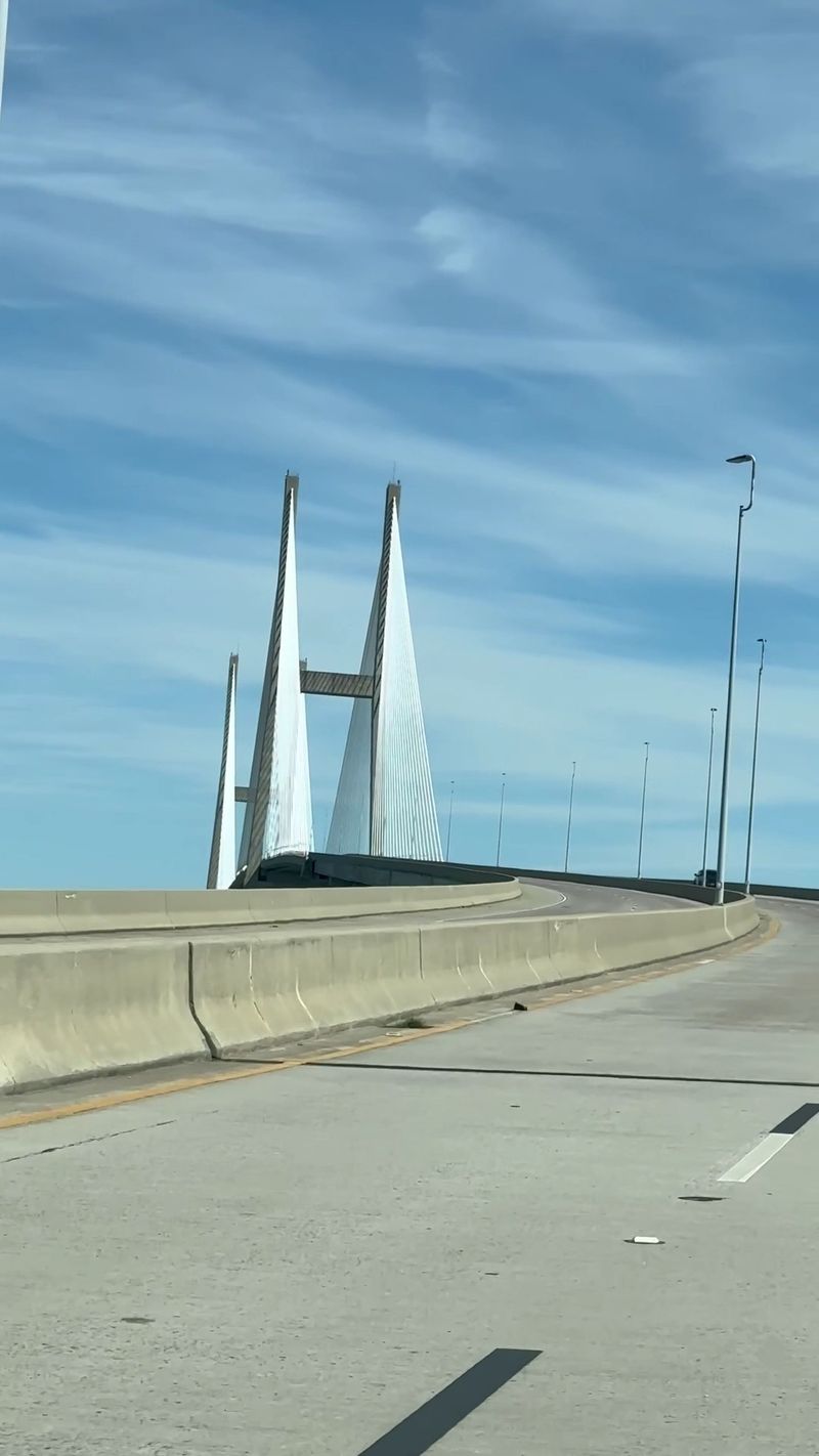
Good news for night owls and early risers. The bridge is open 24 hours a day, every day of the week.
Getting there is simple. Follow US-17 through Brunswick, and the towers will be impossible to miss.
One thing to know ahead of time is that there is no pull-off area on the span itself. Drivers cannot stop at the top to enjoy the view, so plan photos for passengers or for the ground.
Parking is available in nearby areas for anyone who wants to explore the landscape or set out on foot. The park under the north end is a handy base for pictures, picnics, and fishing.
Checking the weather before a walk is wise, since wind can pick up quickly at that height.
A little planning turns a quick crossing into a relaxed half-day outing.
Worth the Detour, Every Time
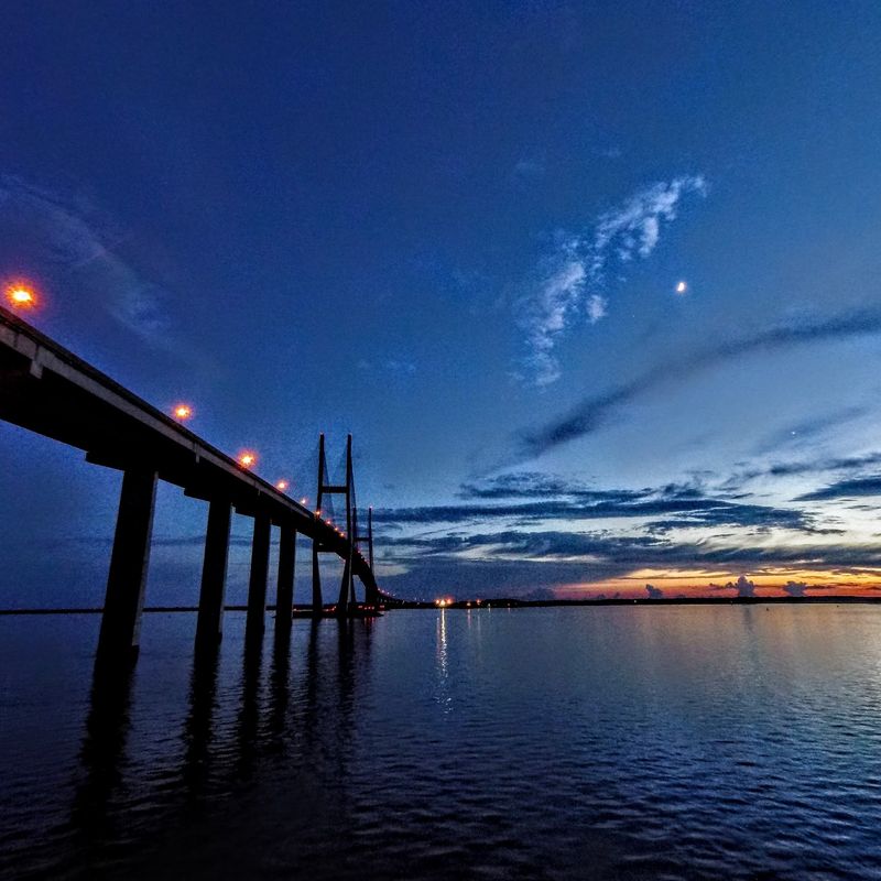
Not every bridge earns a spot on a travel list. This one does.
It blends serious engineering with real everyday use, carrying traffic over a busy shipping river while giving everyone a free lift high above the coast. The history adds depth, and the poet behind the name adds a touch of character.
Drivers get a memorable climb. Walkers and runners get a challenging 5k with a view.
Photographers get cables, towers, and passing ships to work with.
Then there is the small park underneath, which turns the bridge into a place to linger rather than just pass through.
Locals clearly love it, and many visitors feel a little spark of excitement each time the towers come into view.
Next time a trip heads toward the Georgia coast, leave a few extra minutes for this giant. The view from the top is worth the climb.
Share this story