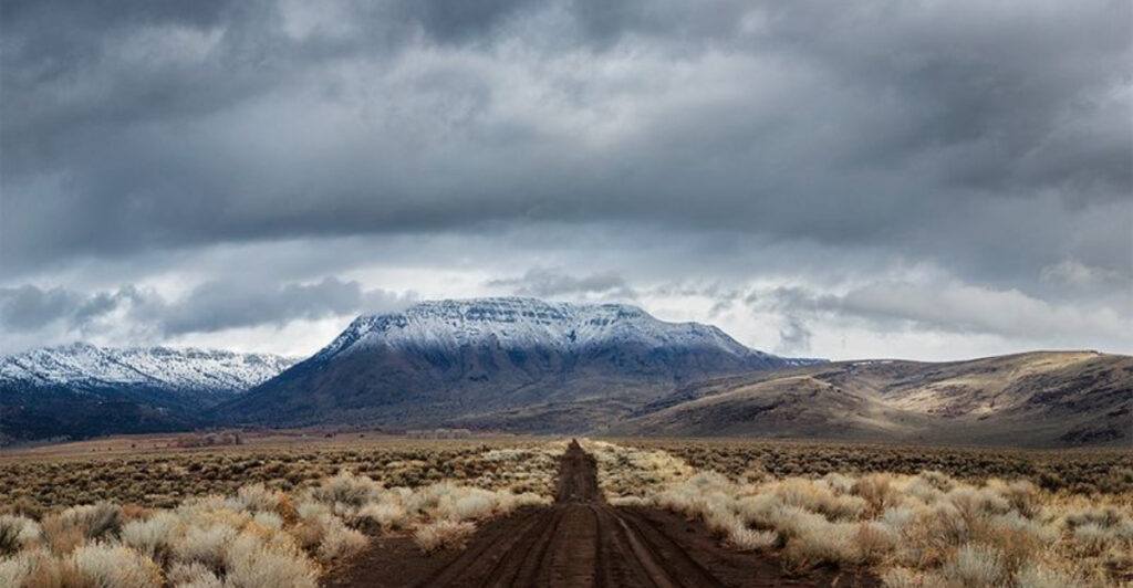
There is a road in southeastern Oregon that climbs through sagebrush, crosses into subalpine meadows, and eventually puts you at nearly 9,733 feet above sea level, all without leaving your car. The landscape shifts so dramatically along the way that you genuinely start to wonder if you have crossed into a different country.
Wild horses roam freely nearby, ancient glaciers carved enormous canyons into the earth, and the Alvord Desert stretches out below like a cracked, sun-baked painting. This is not your average mountain drive, and once you have made the trip, very few other roads will ever feel quite the same again.
Where the Journey Begins: Frenchglen and the Loop Road
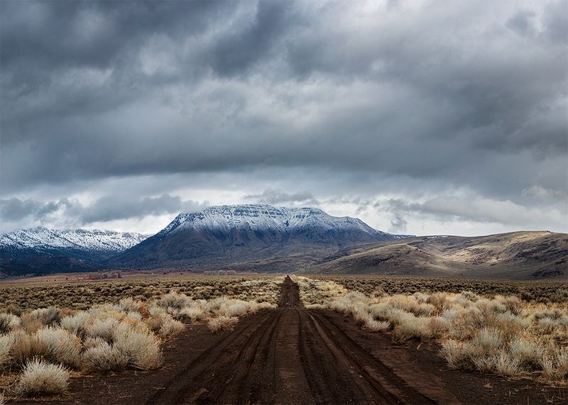
The tiny town of Frenchglen, Oregon, sitting about 60 miles south of Burns on Highway 205, is where most people start the Steens Mountain Loop Road adventure. The official address falls within Oregon 97721, and the trailhead community feels like something out of an old Western film set, with its handful of buildings and wide open silence all around.
The Steens Mountain Loop Road is a 52-mile dirt route that climbs from the sagebrush flats up to an elevation near 9,700 feet, making it the highest driveable road in the entire state of Oregon. That is not a small claim for a mostly unpaved path.
The road is washboard gravel for much of its length, so a high-clearance vehicle is strongly recommended, though passenger cars have made the trip successfully. Plan for the road to be rough in spots, take your time on the curves, and bring plenty of water.
The loop typically opens around July 4th and closes when the first snow arrives in October, so the window for visiting is shorter than you might expect.
The Geology Behind the Giant: A Fault-Block Mountain Unlike Any Other
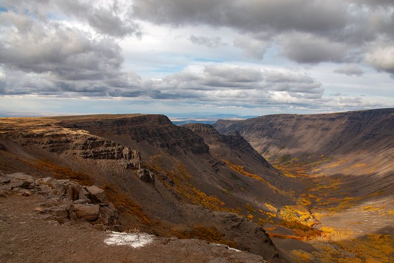
Steens Mountain is not just a big hill with a scenic road running over it. It is the largest fault-block mountain in North America, stretching roughly 50 miles in length, and it rises so steeply on its eastern side that it drops over a vertical mile to the floor of the Alvord Desert below.
A fault-block mountain forms when massive sections of the earth’s crust shift and tilt along geological fault lines over millions of years. The result at Steens is a gradual western slope that eases you into the landscape and an eastern face that drops away like a table edge, creating one of the most dramatic geological contrasts you will find anywhere in the American West.
Glaciers once carved deeply into this mountain, shaping the enormous U-shaped canyons that now define its character. Those ancient rivers of ice left behind gorges hundreds of feet deep, alpine lakes, and boulder-strewn basins that feel completely out of place in the surrounding high desert.
The mountain sits within Harney County in the southeastern corner of Oregon, a region that most travelers simply pass through without realizing what they are missing.
Four Gorges That Will Stop You in Your Tracks
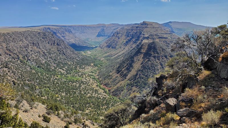
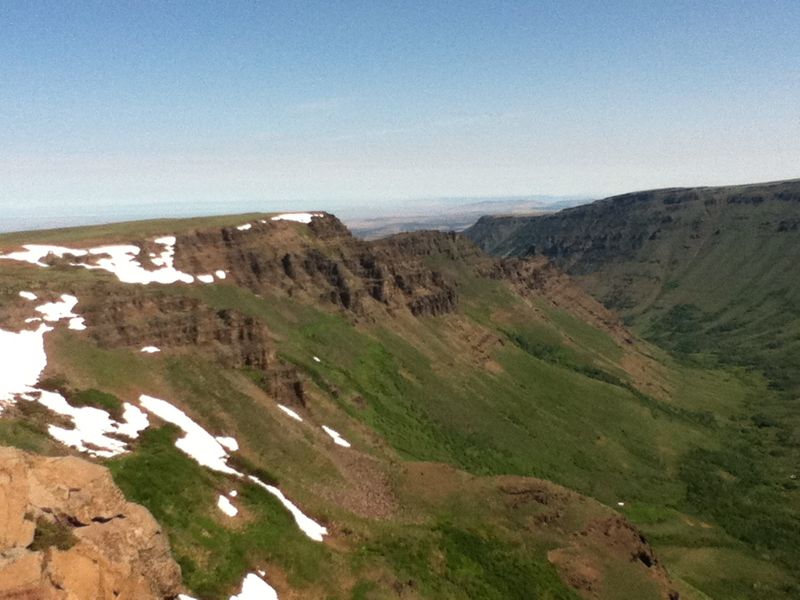
Kiger Gorge is the showstopper of the four major gorges along the Steens Mountain Loop, and the moment you reach its overlook, you will understand why people drive hours just to stand at its edge. The canyon is a classic U-shape carved by glaciers, with walls that drop hundreds of feet and a wide flat floor stretching out below like a green carpet laid across the earth.
Big Indian Gorge and Little Blitzen Gorge offer similarly dramatic views, each with its own distinct character. Big Indian Gorge is popular with backpackers who want to explore the wilderness on foot, while Little Blitzen follows the course of the Blitzen River along the southern side of the loop road.
Wildhorse Gorge leads down toward Wildhorse Lake, one of the most rewarding destinations on the entire mountain. The four gorges together tell the full story of how glaciers once shaped this landscape over thousands of years, leaving behind a terrain that looks nothing like the flat desert floor just a few miles away.
Each overlook along the loop is clearly signed, so you will not accidentally drive past any of them.
Wild Horses of the High Desert
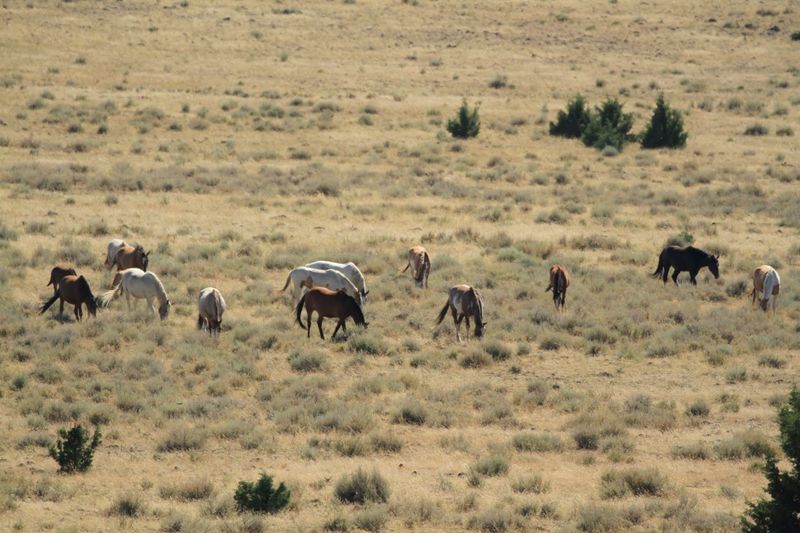
Few things make a road trip feel more cinematic than rounding a corner and spotting a herd of wild horses standing on a ridge against a wide blue sky. At Steens Mountain, that experience is genuinely possible, and the south end of the mountain is especially known for frequent sightings.
The horses in this area are true wild mustangs, not domestic animals that have wandered off a ranch. They roam freely across the open range land, and the Kiger Gorge area is home to the famous Kiger Mustang herd, a group recognized for its distinctive dun coloring and Spanish-type conformation that traces back centuries.
Bringing a camera with a decent zoom lens is a smart move, since the horses can sometimes be at a distance. Early morning tends to be the best time to spot them, when the light is softer and the animals are more active near the road.
Open range cattle also share the land, so keep that in mind while driving. Seeing a bobcat is rarer, but visitors have reported those sightings too, which makes every slow drive along the gravel road feel like a small wildlife lottery worth playing.
The East Rim Overlook and the Alvord Desert View
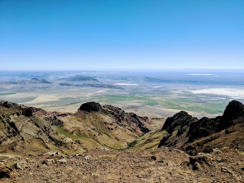
Standing at the East Rim overlook on a clear day is one of those travel moments that genuinely earns the word unforgettable. From this point, the mountain drops over a vertical mile straight down to the Alvord Desert playa, a flat white expanse that looks almost like a frozen lake from this height.
The Alvord Desert is an ancient dry lakebed, and from the East Rim, its scale becomes fully clear in a way that no photograph can fully communicate. The contrast between the rocky, green-tinged summit area and the pale, cracked desert floor thousands of feet below is striking enough to make you stop mid-sentence and just stare.
On days when clouds or fog roll in, the view can disappear entirely, which is a real possibility even in summer. Checking weather conditions before heading up is always a good idea.
The East Rim is one of four major viewpoints along the loop, and it consistently ranks among the most dramatic. A short walk from the parking area gives you the clearest sightlines, and the information kiosks near the summit area provide helpful context about what you are actually looking at down below.
Reaching the Summit at 9,733 Feet
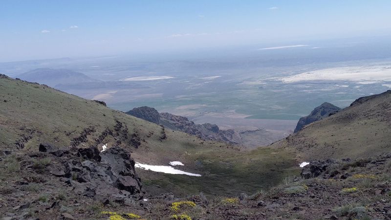
The summit of Steens Mountain sits at 9,733 feet above sea level, and getting there requires only a short walk of just under half a mile from the upper parking area. The trail is rocky and gains elevation quickly, so it is not the right choice for very young children or anyone uncomfortable with steep, uneven ground.
At the top, the views stretch for hundreds of miles in every direction on a clear day. A short path leads up toward the cell towers, and from that vantage point, the valley below and the Alvord Desert spread out in a full panoramic sweep that rewards every step of the climb.
There are no restrooms at the summit, so plan accordingly before you head up. Information kiosks near the top provide background on the geology, ecology, and history of the area.
Temperatures at the summit can run 20 to 30 degrees cooler than in the valley below, which is actually a relief during the heat of a July afternoon when the desert floor is baking in triple-digit temperatures. Bringing a light jacket, even in midsummer, is a practical habit that most first-time visitors learn the slightly chilly way.
Wildhorse Lake: A Hidden Alpine Reward
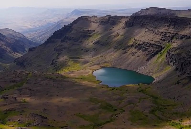
Most people who drive the Steens Mountain Loop do not expect to find an alpine lake waiting for them near the summit, which makes Wildhorse Lake one of the more pleasant surprises the mountain has to offer. The lake sits in a wide open basin below the summit, accessible by a trail that drops 1,100 feet over about 1.2 miles of zigzagging descent down a jagged rock face.
The hike down is steep and requires careful footing, but the payoff is a small sandy beach at the edge of a pristine mountain lake surrounded by wildflowers and open sky. The round trip covers roughly 2.4 miles, and the climb back up will remind your legs that this is serious terrain.
Backcountry camping is allowed near the lake, though campfires are not permitted, so bringing a portable stove is necessary for anyone planning an overnight stay. The area is true alpine backcountry, with no tree cover and full exposure to whatever weather the mountain decides to serve up.
Conditions can shift quickly at this elevation, and afternoon thunderstorms are not uncommon in summer, so starting the hike early in the day is the smarter approach.
Campgrounds Along the Loop: Sleeping Under a Sky Full of Stars
Southeastern Oregon is one of the darkest regions in the continental United States when it comes to light pollution, and the campgrounds scattered along the Steens Mountain Loop take full advantage of that fact. Several campgrounds sit at different elevations along the route, each offering a slightly different experience depending on how high up the mountain you want to sleep.
Page Springs, Fish Lake, Jackman Park, and South Steens are the main campground options, and they range from basic sites with vault toilets to areas with more limited facilities. Reservations are recommended during peak summer months, especially for weekends and holiday periods, since the mountain draws more visitors than its remote location might suggest.
The nights at higher elevations get genuinely cold even in July, so sleeping bags rated for lower temperatures make a real difference. Waking up at a Steens Mountain campground means opening your tent to views of open sagebrush, distant ridgelines, and sometimes the sound of wind cutting across the plateau.
High clearance vehicles handle the campground access roads more comfortably, though most sites are reachable by careful passenger car drivers who take the washboard sections slowly and do not rush the process.
Tips for Planning Your Steens Mountain Trip
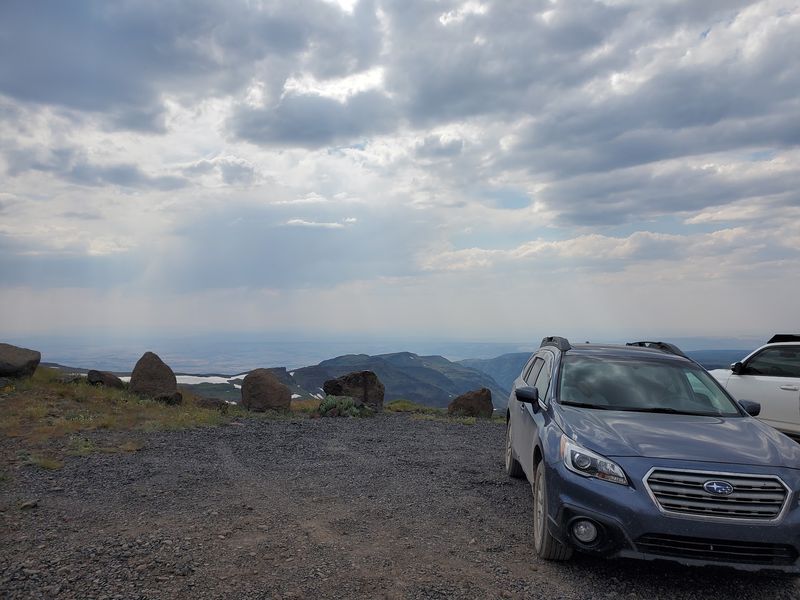
A successful Steens Mountain trip comes down to timing and preparation. The loop road is only open from roughly early July through October, and the exact dates shift each year depending on snowpack.
Calling the Bureau of Land Management office in Burns, Oregon before heading out is a reliable way to confirm current road conditions and any closures caused by landslides or weather damage.
High clearance vehicles handle the washboard gravel road most comfortably, but the road has been traveled by regular passenger cars driven carefully. A thorough car wash after the trip is basically non-negotiable, since the fine dust and gravel work their way into every corner of the vehicle.
Fuel up before leaving Frenchglen, because there are no gas stations on the mountain.
Bringing more water than you think you need is always the right call in the high desert. Cell service is essentially nonexistent once you leave the valley, so downloading offline maps before departure is genuinely useful.
The Frenchglen Hotel, a small historic inn operated as an Oregon State Heritage Site, serves as a comfortable base for visitors who prefer a bed over a tent, and it books up quickly during summer weekends.
Share this story