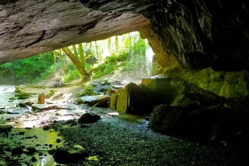
Waterfalls are only part of what makes McIntyre Wild Area worth exploring. This remote section of Loyalsock State Forest in Lycoming County also preserves traces of old logging routes and the remains of a former coal-mining community.
The roughly 7,500-acre wild area near Ralston and Roaring Branch is deliberately undeveloped. Instead of visitor centers and heavily maintained attractions, you will find rugged routes, streams, waterfalls, overlooks, and historical remnants scattered through the forest.
That combination makes McIntyre much more than another Pennsylvania hiking destination. Exploring it can mean following a waterfall-filled ravine one moment and encountering evidence of the region’s logging or mining past the next. the patient.
It spans roughly 7,500 acres within the Loyalsock State Forest, open every day of the year, and reachable by phone at +1 570-946-4049. What you will find here is not polished or packaged for tourists.
It is raw, dramatic, and quietly extraordinary, and the next few sections will show you exactly why.
Where the Wild Area Begins: Location and First Impressions
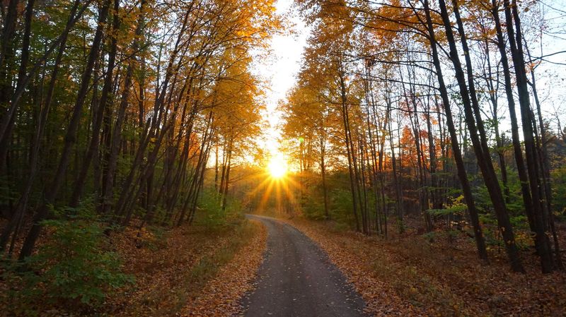
The moment you leave the pavement and feel the gravel crunch beneath your tires, you know you have arrived somewhere genuinely different. McIntyre Wild Area is located near Roaring Branch, PA 17765, within the Loyalsock State Forest in Lycoming County, Pennsylvania.
Access typically runs along Rock Run Road off Route 14, a route that immediately signals you are leaving ordinary life behind.
There is no grand welcome sign, no ranger booth, no gift shop. Just trees pressing in close on both sides, and the distant sound of rushing water.
The area sits at roughly 2,000 feet in elevation across much of its plateau, which means the air carries a crispness that feels cleaner than anything you find at lower altitudes.
Parking areas are basic and informal, coordinates like 41.533518, -76.894311 near Hounds Run Falls serving as reliable waypoints for first-timers. A high-clearance vehicle is strongly recommended for reaching the upper areas of the wild area, particularly along McIntyre Road.
More Than a Dozen Cascades: The Waterfall Collection That Draws Adventurers
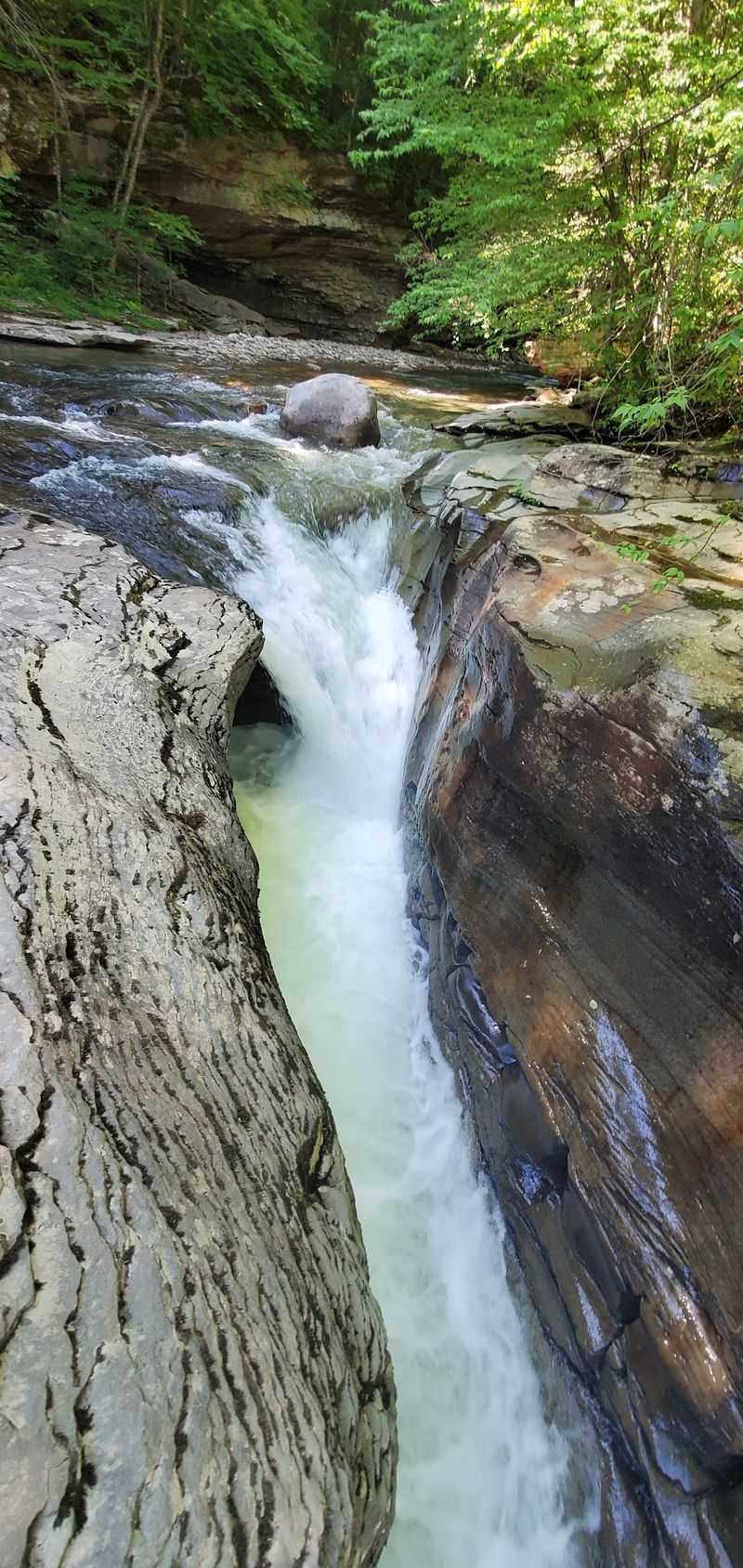
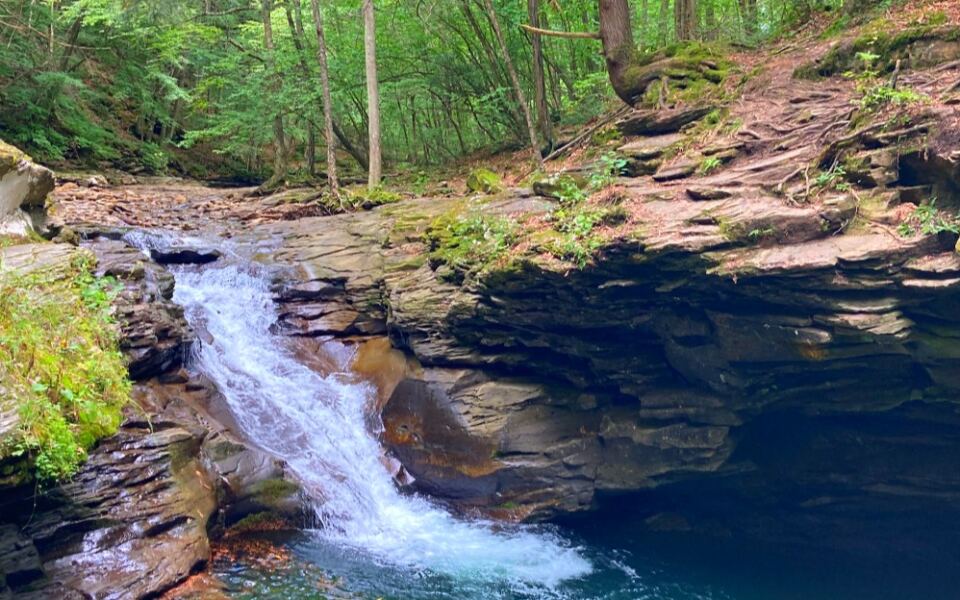
Few places in Pennsylvania pack this many waterfalls into a single wild area, and the McIntyre collection is genuinely impressive. Over a dozen distinct cascades are scattered across the landscape, each one shaped differently by the rock it tumbles over and the stream that feeds it.
Dutchman’s Run claims the title of tallest waterfall in the entire wild area, a fact that becomes especially dramatic in winter when its face freezes into towering columns of ice. Abbott Run offers a quieter, more secluded experience, with falls that reward hikers willing to push a little further into the forest.
The real showstopper, though, is Miners Run, where six separate waterfalls are packed into a 0.6-mile corridor of steep ravine and giant boulders. Hiking the Miners Run loop feels like flipping through a gallery, each new cascade arriving before you have fully processed the last one.
The surrounding rock formations add a sculptural quality that photographs simply cannot capture completely.
Rock Run: Pennsylvania’s Most Scenic Stream in Three Acts
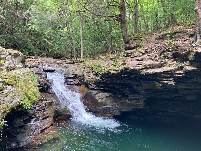
Rock Run has earned its reputation as one of Pennsylvania’s most beautiful streams, and spending even an hour along its banks makes the case without any argument. The water runs clear over layered bedrock, carving pools and channels that feel almost architectural in their precision.
Three named waterfalls punctuate the run: Upper, Middle, and Lower Rock Run Falls. Upper Rock Run Falls, at roughly 10 feet, doubles as the most popular swimming hole on the entire route, and on warm summer weekends the pool below it hums with activity.
Middle Rock Run Falls, a slightly shorter drop at 7 to 8 feet, is a photographer’s favorite thanks to the varied rock textures surrounding it.
Lower Rock Run Falls demands a bit more effort to reach, requiring some off-trail navigation through cliffs and underbrush, but the relative solitude at the base makes that extra effort worthwhile. Wading directly up the stream bed during low water levels is one of the most intimate ways to experience Rock Run’s raw character.
Logging Grades and Splash Dams: The Industrial Ghosts Beneath Your Boots
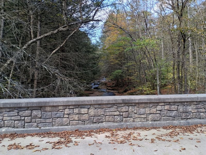
Every trail you walk in the McIntyre Wild Area carries a story older than the trees currently shading it. Between 1913 and 1919, the eastern portion of the McIntyre plateau was heavily logged, with vast quantities of timber hauled out via a sophisticated network of logging railroad grades that still crisscross the landscape today.
These old grades are not marked on most maps, but they are unmistakable once you know what to look for: long, level stretches cutting through otherwise steep terrain, lined on both sides by the massive decaying stumps of trees felled more than a century ago. On Hounds Run, a well-preserved splash dam remains as one of the most tangible relics of this era.
Splash dams were engineering solutions of their time, built to hold water and then release it suddenly, sending logs downstream to distant sawmills in a controlled rush. Seeing that silent stone structure now, with ferns growing from its cracks and the stream quietly bypassing it, offers a powerful contrast between industrial ambition and natural patience.
The Ghost Town Nobody Talks About: McIntyre’s Abandoned Mining Village
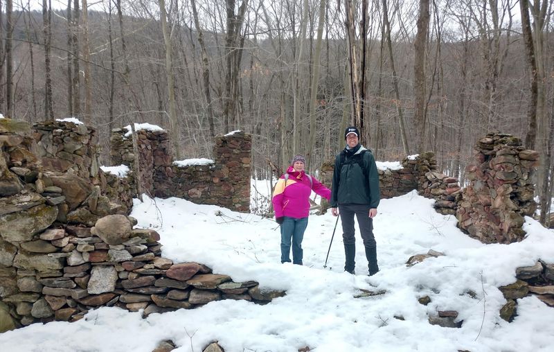
Hidden beneath the canopy of the wild area lies one of Pennsylvania’s most overlooked historical sites: the ghost town of McIntyre, a once-thriving coal mining village that housed up to 1,500 residents at its peak. At its height, the community boasted around 300 homes, a church, a school, and all the infrastructure of a functioning town built on the promise of coal.
Operations began in earnest in 1870, directed by Jervis Langdon, who happened to be Mark Twain’s father-in-law, a connection that adds an unexpected literary footnote to this remote corner of Lycoming County. By around 1900, the town was largely abandoned, its population gone and its buildings left to the slow work of weather and roots.
Today, careful exploration reveals stone foundations, spoil hills formed from excavated mining debris, fragments of old rail lines, and a small cemetery that stands as the most poignant reminder of the community that once called this mountain home. Mining activity continued sporadically into the 1930s, but the forest has been steadily reclaiming the site ever since.
The Inclined Plane That Carried Coal Down a Mountain
Getting coal off a mountaintop in the 1870s required creative engineering, and the solution at McIntyre was both ambitious and remarkable for its time. Jervis Langdon oversaw the construction of a steep, 2,300-foot-long inclined plane rail system designed to ferry loaded coal cars from the high elevation mines down to the main rail line running alongside Lycoming Creek far below.
The system worked through a counterbalance principle, where descending loaded cars helped pull empty cars back up the slope, reducing the energy required to operate the whole mechanism. For a mountain operation in rural Pennsylvania more than 150 years ago, this represented a genuine feat of industrial ingenuity.
Very little of the tramway survives in any obvious form today, but the slope itself is still visible to those who know where to look, and the faint depressions in the earth hint at where the rails once ran. Standing at the top and imagining coal cars rattling down that grade toward the valley below is one of those moments where history stops being abstract and becomes almost tangible.
Band Rock Vista: A View That Earns Every Step to Reach It
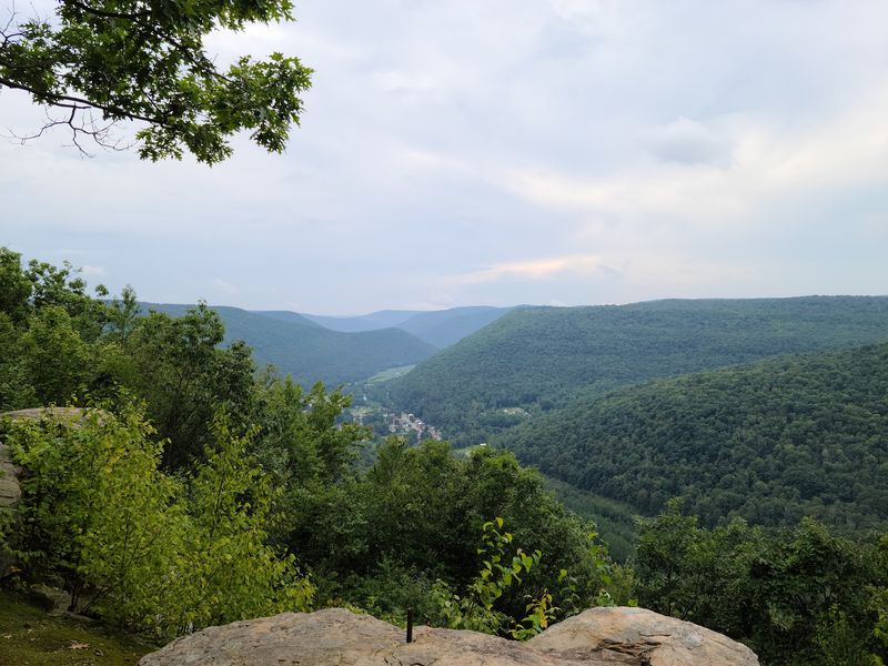
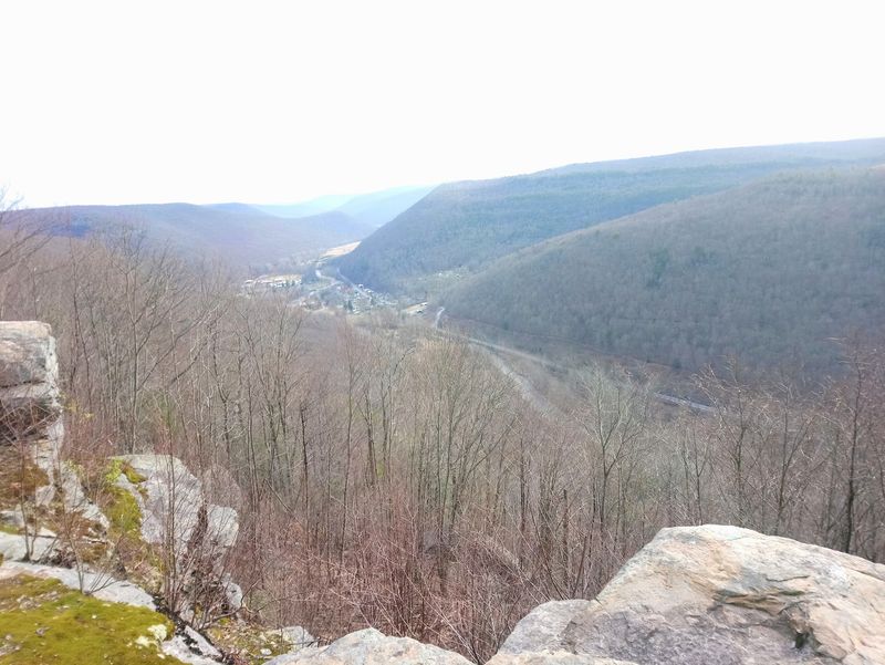
Band Rock Vista is one of those viewpoints that makes you stop mid-sentence and just stare. Perched high above the Lycoming Creek Valley, the overlook delivers a sweeping 180-degree panorama that includes the community of Ralston sitting more than 900 feet below, the winding ribbon of Lycoming Creek, and miles of unbroken forest rolling toward the horizon.
The name carries a charming local legend suggesting that a band once performed here during the heyday of the McIntyre mining town, their music drifting down into the valley. Whether or not that story holds up historically, the setting certainly feels dramatic enough to inspire a performance.
Reaching Band Rock Vista requires navigating the notoriously rough McIntyre Road, a stretch that genuinely demands a high-clearance vehicle and some patience with bumps and ruts. The effort filters out casual visitors, which means the overlook often feels like a private discovery.
McIntyre Vista, another nearby overlook, offers a similar perspective and is worth adding to the same outing for a fuller sense of the landscape’s scale.
Trails That Were Never Really Trails: Hiking Through a Living History Map
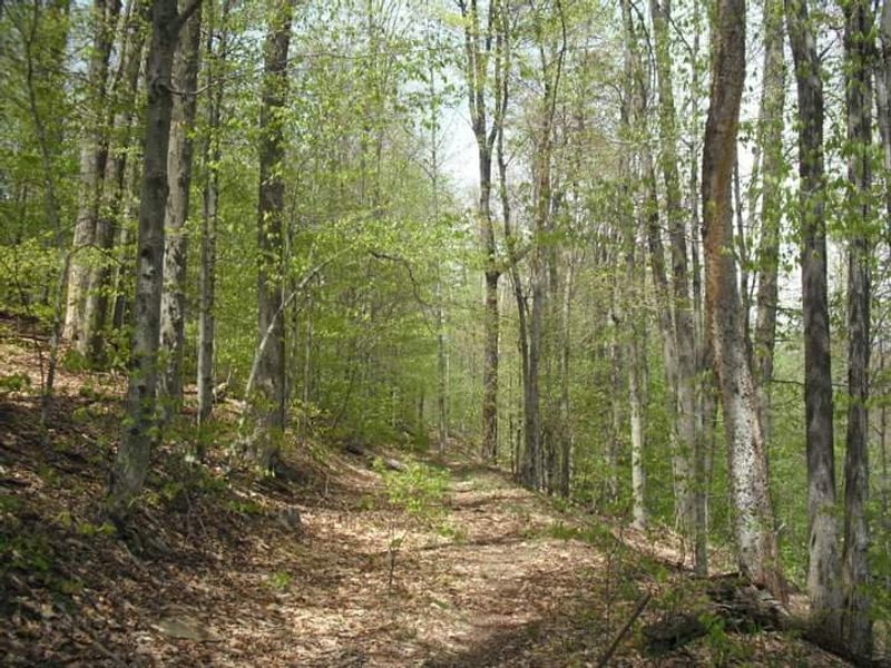
Formal trail infrastructure in the McIntyre Wild Area is minimal by design, and that is precisely what makes hiking here feel so different from a typical state park experience. Most of the navigable routes follow old logging railroad grades and informal paths worn down by decades of foot traffic from hunters, anglers, and adventurous hikers.
The Miners Run Trail stands out as one of the most rewarding unofficial routes, threading through the ravine where six waterfalls appear in quick succession. The terrain along stream corridors is steep and sometimes slippery, demanding solid footing and genuine attention to where you place each step.
For those who want a longer, more structured challenge, the Old Loggers Path, a demanding 27-mile backpacking trail, passes through this area, connecting the wild area to a broader network of historic routes across the Loyalsock State Forest. Completing even a section of it means walking paths where steam locomotives once hauled timber, a detail that adds real weight to every mile covered.
Wildlife Encounters: Black Bears, Barred Owls, and Rare Flora

The McIntyre Wild Area is not just a landscape; it is an active, functioning ecosystem where wildlife encounters are a routine part of any visit. The mixed northern hardwood forest that blankets the plateau provides layered habitat for an impressive variety of species, from the smallest songbirds to the largest predators the region supports.
Black bears are a genuine presence here, not a rumor or a rarity. The population is healthy, and while encounters are typically brief and uneventful when proper awareness is maintained, their presence is a constant reminder that this is a wild place operating on its own terms.
Coyotes, bobcats, white-tailed deer, porcupines, and the occasional fisher round out the mammal list.
Bird life is equally rich, with barred owls, turkeys, and grouse among the most frequently spotted species. The wild area also supports some notably rare plant species, with careful observers occasionally finding botanical surprises that even experienced naturalists rarely encounter elsewhere in the region.
Early morning visits maximize the chances of meaningful wildlife sightings.
Swimming Holes and Summer Thrills Along Rock Run Road
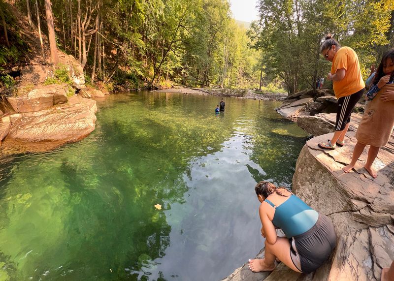
When summer heat settles into the valleys of Lycoming County, the swimming holes along Rock Run Road become some of the most appealing destinations in all of northern Pennsylvania. The water runs cold and clear even in July, fed by shaded streams that never fully warm up regardless of how hot the air temperature climbs.
Upper Rock Run Falls is the most popular spot, where a natural pool collects beneath the cascade and the surrounding rock ledges offer jumping points for those with enough confidence to use them. Rock Run Valley in particular has developed a reputation for cliff jumping, with drops that range from manageable to genuinely thrilling depending on which ledge you choose.
Primitive campsites with fire pits are available further along Rock Run Road within the broader Loyalsock State Forest area, making an overnight stay possible for those who want to catch the swimming holes at dawn before the crowds arrive. No bathroom facilities exist on-site, so planning ahead is a practical necessity rather than a suggestion.
Practical Wisdom for First-Time Visitors: What to Know Before You Go
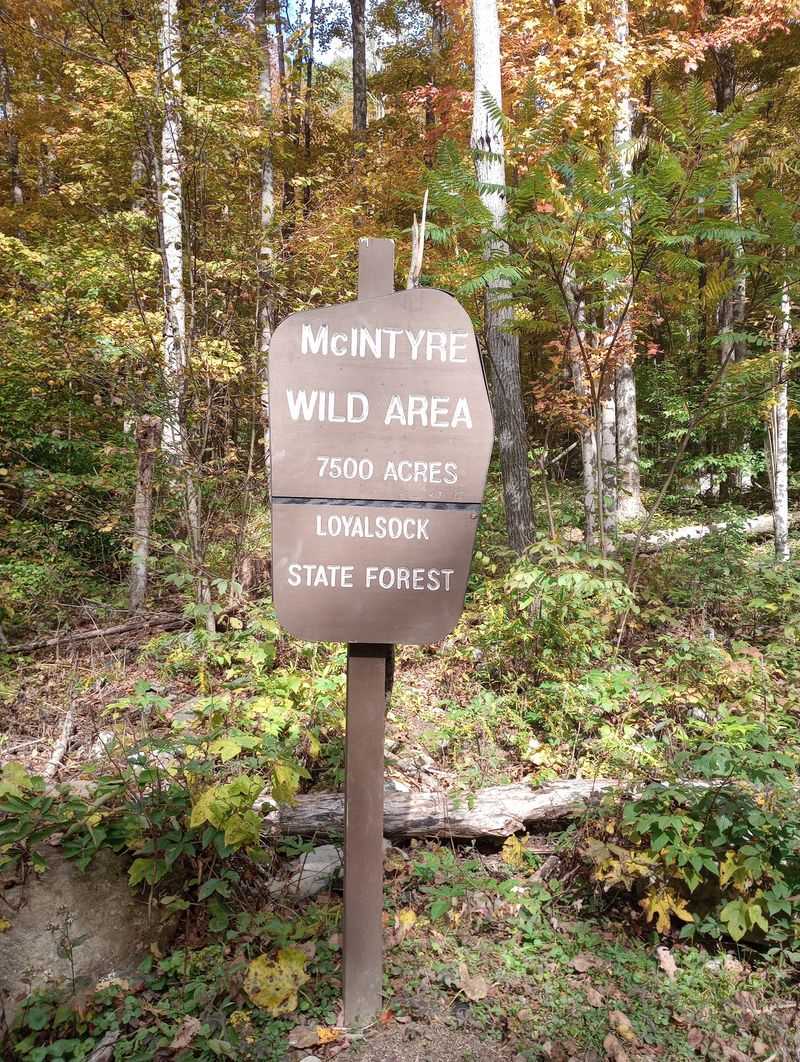
Arriving at the McIntyre Wild Area without preparation is the fastest way to turn an adventure into a frustration. The area is open 24 hours a day, every day of the year, but that accessibility comes with a clear expectation: you are responsible for yourself out here.
No restrooms, no ranger stations, no cell service in many parts of the plateau.
Sturdy hiking boots are non-negotiable given the rocky, uneven terrain along stream corridors and steep ravine walls. Bug spray and long sleeves make a meaningful difference during warmer months, when the overgrown sections of trail can be genuinely uncomfortable without protection.
Weather can shift quickly at elevation, so checking forecasts before leaving home is a practical habit worth building.
A high-clearance vehicle is strongly advised for accessing McIntyre Road and the upper areas of the wild area, and four-wheel drive becomes genuinely useful in wet or wintry conditions. One warning deserves special emphasis: do not enter any mine openings you encounter, as the historical shafts and tunnels are structurally unpredictable and pose serious risks to anyone who ventures inside.
Share this story