A brick-lined cave sits right beside a Tennessee hiking trail, and nobody seems totally sure what it was. Some hikers guess it was an old coke furnace.
Others just call it creepy and keep walking.
That mystery is only one stop. The path follows a rushing creek past mine entrances, crumbling stone remnants, and an old reservoir.
Then it climbs toward a waterfall that pours over a rocky ledge.
I like how the whole trip feels like a history lesson hiding inside a nature walk. Every bend seems to hand you a new clue about the people who worked these hills long ago.
And the best part? Getting in is free.
So why does a place this good still feel like a secret the mountains are keeping?
A Free Wilderness Hiding Near Dayton
Laurel Snow State Natural Area sits just outside Dayton, Tennessee, on the edge of the Cumberland Plateau. It’s a nature preserve managed by the state, and it costs nothing to enter.
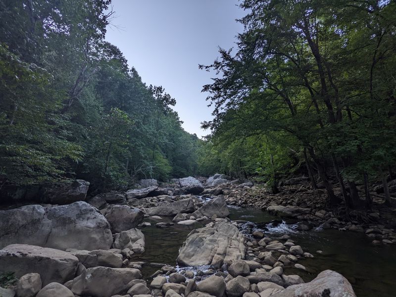
The heart of the place is a trail that runs alongside Richland Creek. Along the way, hikers pass mining ruins, wooden bridges, boulders, and swimming holes.
Two waterfalls anchor the far ends of the trail system. Laurel Falls and Snow Falls give the area its name, which makes the title easy to remember.
There’s also a scenic overlook called Buzzard Point. Part of the Cumberland Trail passes right through the area too, linking it to a much longer route.
What makes this preserve stand out is how much it packs into one hike. You get history, water, rock, and views without needing a ticket or a guided tour.
Plenty of Tennessee spots offer one or two of those things. Very few stack all of them along a single creek, which is why this one deserves a spot on your weekend list.
Coal, Iron, and Coke in the Hills
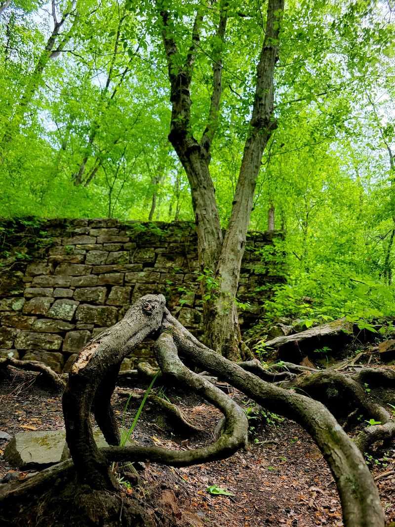
Long before hikers arrived, this valley was a working landscape. Iron, coal, and coke mining once shaped the land along Richland Creek.
Today, the trail follows the path of that old industry. Structural remnants still sit in the woods, and a few signs along the way share stories about the past.
Coke, by the way, isn’t the soda. It’s a fuel made by heating coal, and it was used in iron production during that era.
After the mining days ended, the site was abandoned. Later it became protected land, giving the forest a chance to reclaim the stone walls and openings left behind.
The creek also served another job. At one time it supplied water for the town of Dayton, and you can still spot the old reservoir along the trail.
Knowing this history changes the hike completely. Those piles of shaped stone stop looking random and start looking like clues from a busy chapter in Tennessee life.
The Mine Entrance and the Mysterious Brick Cave
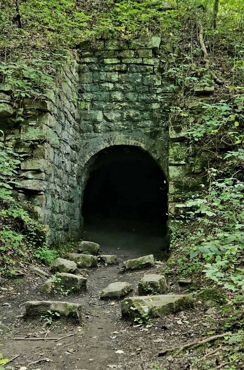
Early on the trail, a dark opening appears in the hillside. It’s an old mineshaft, and hikers often describe it with one word: creepy.
Some folks peek inside. Many simply snap a photo and keep moving, which seems like a perfectly reasonable choice.
Nearby sits a cave with a brick-lined entrance. Some hikers think it may have been an old coke furnace, though the exact story isn’t always clear on site.
Curious explorers should know that a strong flashlight matters here. A weak phone light won’t reveal much in the darkness beyond the entrance.
There’s also a tunnel along the route that hikers call a highlight. It adds one more piece to the puzzle of how the old mining operation worked.
Local legend even claims the area is haunted by the spirits of former miners. Whether you believe that or not, standing at these openings gives you a real sense of how hard that work must have been.
It’s a quiet, thoughtful moment before the trail turns scenic.
Richland Creek Steals the Show Early
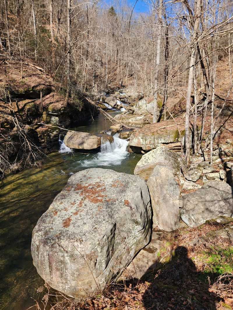
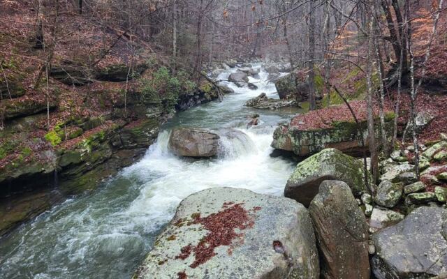
Rushing water follows you for most of the hike. Richland Creek runs parallel to the trail, tumbling over rocks and spilling into small falls.
Around nearly every bend, there’s another water feature. Little cascades, deep pools, and smooth stone shelves keep showing up when you least expect them.
That’s why so many hikers take their sweet time. Some say they enjoyed the creek so much they almost didn’t care about reaching the main waterfall.
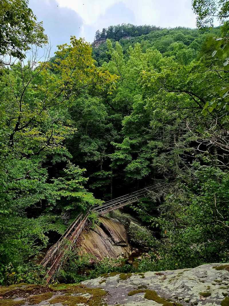
Wooden bridges carry you across the water at several points. They make great photo spots and give you a fresh angle on the creek below.
The first mile or two stays fairly easy. That makes the creek section a solid choice for families or anyone who wants beauty without a tough climb.
Even if you only walk a short distance, you’ll still see plenty. Big rocks, clear water, and a canopy of trees make the opening stretch feel like a reward all on its own.
Honestly, some trails make you earn every view, but this one starts handing them out right away.
Swimming Holes Worth Packing a Towel For
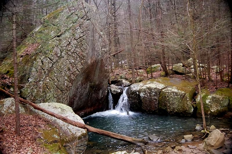
Hot day, cool creek, giant rocks to sprawl on. That combination explains why the swimming holes here get so much attention.
Several pools sit along the first leg of the trail. They’re spread out, so you can often find a spot with some breathing room.
Big boulders line the edges of many pools. They’re perfect for drying off, eating a snack, or just soaking up sunshine between dips.
Hikers also mention a twin waterfall with a swimming hole farther along. Reaching it takes a bit more effort, but that tends to keep it quieter.
A little caution goes a long way here. Venomous snakes can show up near the water’s edge in warmer months, so watch where you step and sit.
Poison ivy also grows in spots, so long socks or careful footwork help. Remember this is wild land, not a park with swingsets or lifeguards.
Pack water shoes, a towel, and a trash bag, and you’ll be ready for an easy, refreshing break.
Laurel Falls Waits at the End of the Climb
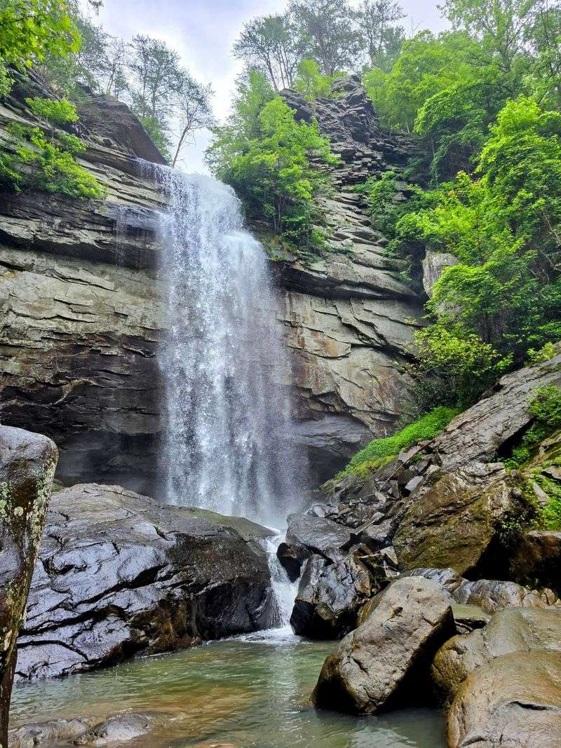
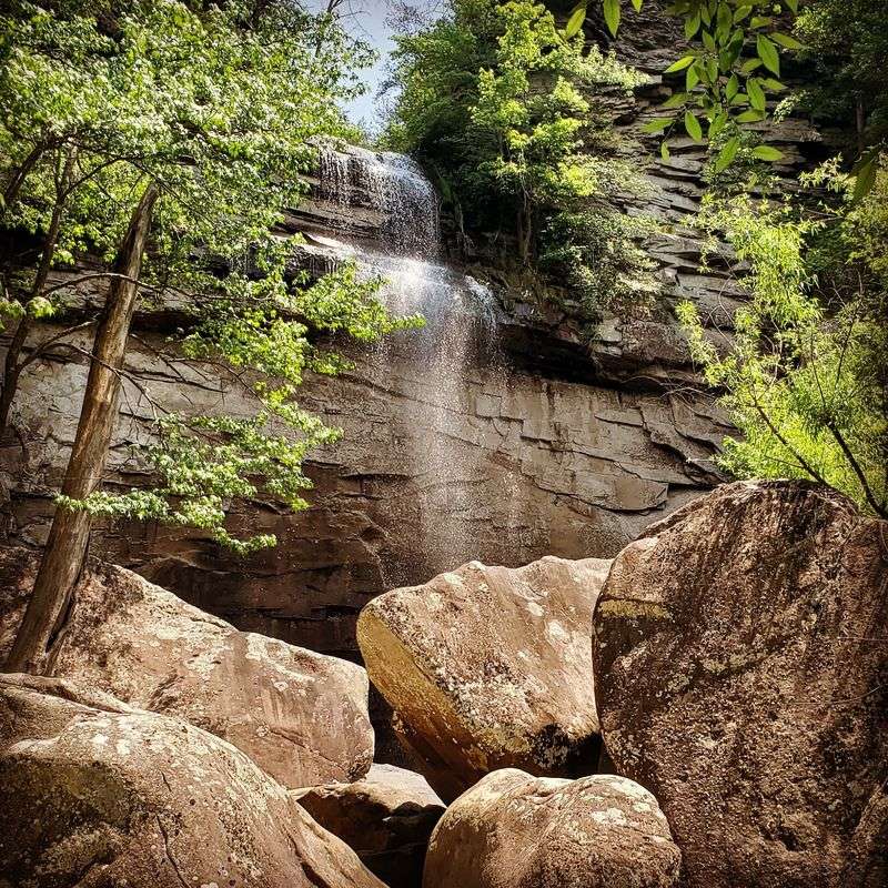
Here’s the payoff most hikers chase. Laurel Falls pours over a rocky ledge deep in the gorge, and after heavy rain it truly roars.
The round trip runs about six miles. After crossing a big bridge, the trail shifts from easy to a moderate climb with rockier footing.
Watch closely near the end. When it seems like the trail stops, look for small arrows scratched on white markers and climb over the rocks to continue.
Many hikers say that last scramble is absolutely worth it. Some report the trip taking around an hour and a half going in, with a quicker return.
Timing matters for the show. Visits right after rain bring dramatic flow, while dry autumn weeks can leave the falls looking thin.
Adventurous hikers can even reach the top and stand beneath the falls. That takes serious boulder climbing, though, since the main trail only leads to the base.
Either way, standing in that spray after the climb feels like a well-earned high five from Tennessee.
Snow Falls and the Buzzard Point View
Turn left instead of right at the trail junction. That choice sends you toward Snow Falls, the second waterfall in the preserve.
Hikers note you can reach Snow Falls without crossing the river. There’s also an old dam in that area, adding another touch of history to the scenery.
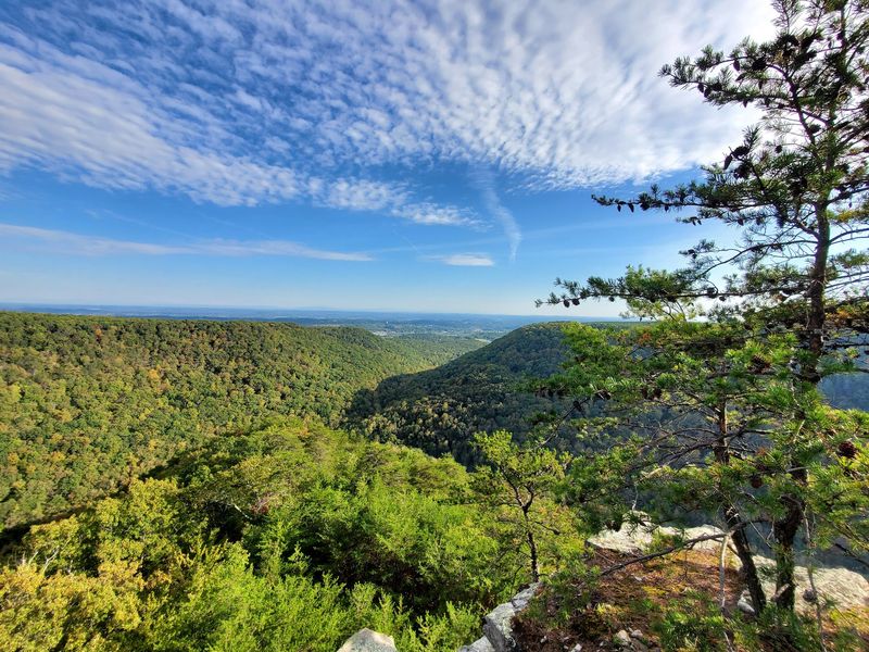
Buzzard Point offers a completely different kind of reward. This overlook gives wide views across the forested gorge after a steady climb.
Two wooden bridges sit along the way at Buzzard Point. They add character to a section that feels more rugged than the creekside stroll.
The climb out of the creek watershed onto the crest is challenging. Once you’re up top, though, the walking becomes much more relaxed.
Some hikers bring lunch and eat at the overlook on clear days. It’s a smart move, since the view makes even a squished sandwich taste better.
Combining both falls and Buzzard Point makes a full day, so start early if you want to see everything.
Boulders That Draw Climbers From Far and Wide
Spot someone hauling a giant folded mat? They’re probably a boulderer, and this preserve is a popular place for them.
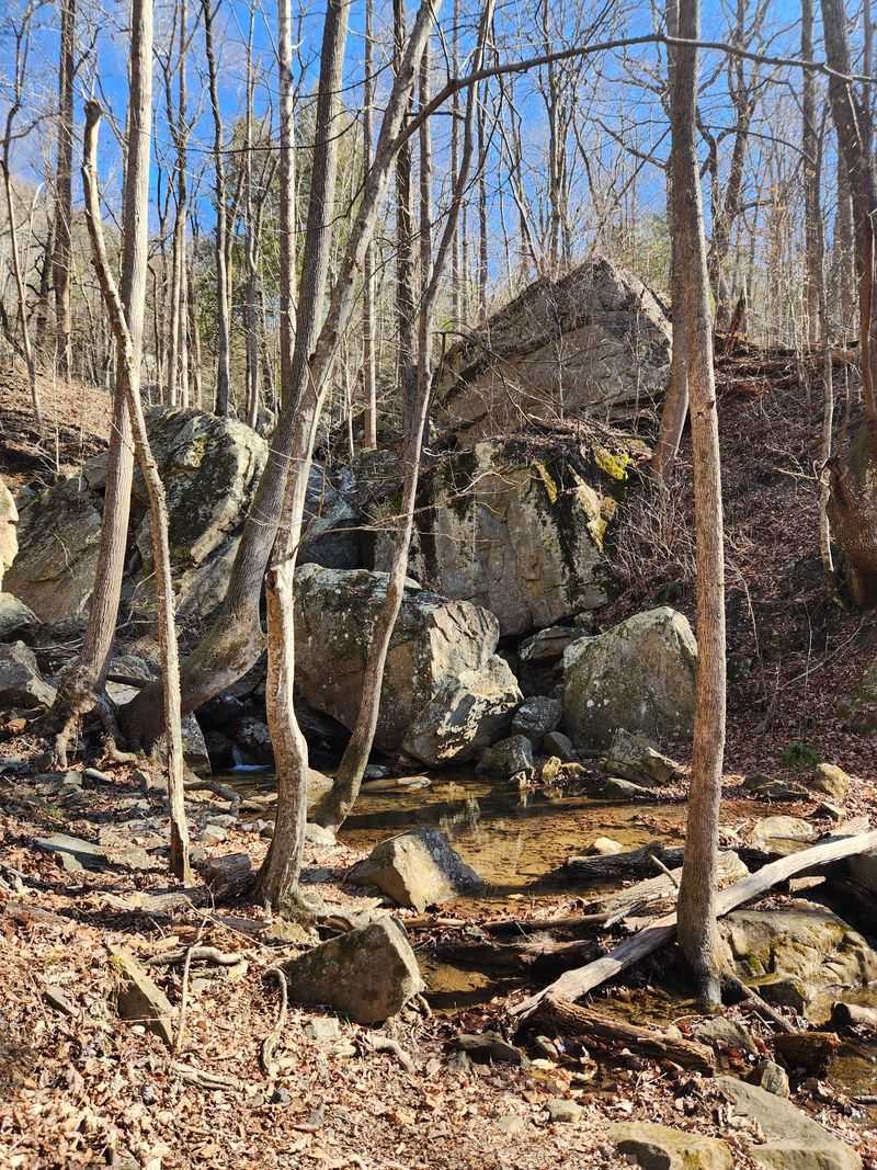
Massive rocks are scattered throughout the creek valley. Climbers tackle routes ranging from very easy to extremely advanced, roughly V0 through V14.
That wide range means beginners and experts can share the same woods. Some climbers believe even harder problems could still be waiting here.
Not into climbing? The boulders still shape the whole experience.
They create the pools, the dramatic creek scenery, and plenty of fun scrambling spots.
Families with kids often enjoy simply hopping across smaller rocks. Just keep an eye on footing, since wet stone can turn slick fast.
The rocky trail itself demands attention too. Large flat stones, loose rocks, and roots appear often, so ankle-supporting boots make a big difference.
In fall, leaf litter can hide loose rock and make the walk slower. Treat the terrain with respect, and the boulders become one of the most memorable parts of Laurel Snow.
Who Will Love a Day on These Trails
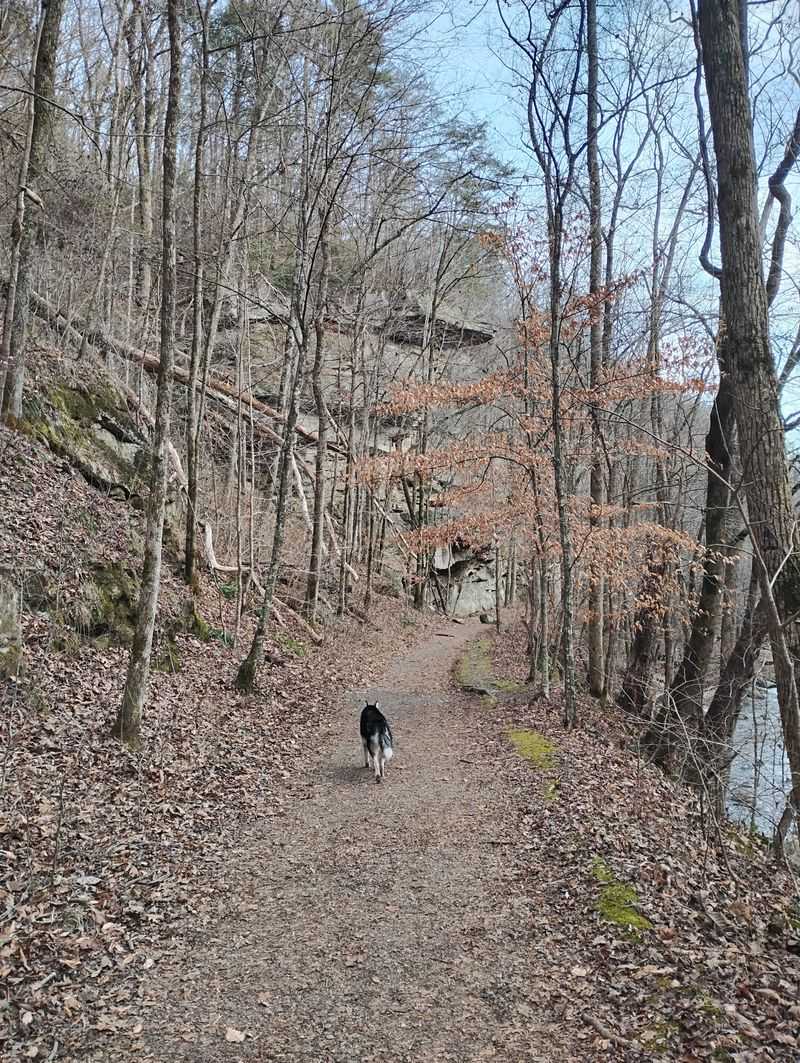
Dog owners, take note. Laurel Snow is dog friendly, and pups seem to love the creek and easy opening miles.
Families with little ones can stick to the gentler first stretch. Hiking to the bridge before Laurel Falls and picnicking by the creek makes a lovely shorter outing.
Serious hikers have plenty to chew on too. Longer routes, steeper climbs, and a section of the Cumberland Trail offer real challenge.
History fans get mine openings, ruins, and an old reservoir. Photographers get waterfalls, bridges, and boulders around nearly every turn.
Crowds can gather near the trailhead on busy days. Hikers say the trail usually thins out as you push toward Laurel Falls, giving you more solitude.
Pet owners should always carry bags and pack out waste. Keeping the trails clean helps protect this special place for everyone who comes next.
This is nature in its raw form, so come prepared, move slowly, and leave it better than you found it.
Parking, Hours, and Campsites Before You Go
Parking is the big puzzle here. The lot fills quickly, especially on weekends, so aim to arrive before 10 a.m.
Some hikers have had to turn back without a spot. Having a backup plan nearby is smart if you’re arriving later in the day.
The address is 1098 Pockett Wilderness Rd #100, Dayton, TN 37321. Laurel Snow is open daily from 8 a.m. to 5 p.m., and entry is free.
The access road can be rough, with potholes and a narrow stretch. Any road-worthy vehicle can handle it if you take it slow.
Camping is available too. There are three designated campsites that can be reserved through the state park system, and hikers describe them as big and private.
Trail markings can be confusing in spots, so download a map beforehand. Note there’s no parking on Route 30 where the Cumberland Trail section ends.
Bring water, bug spray, and sturdy shoes, especially in hot, humid Tennessee summers.
A Creekside Trek That Earns Its Reputation
So, is it worth the early alarm? For anyone who loves water, history, and a bit of adventure, the answer leans strongly toward yes.
Laurel Snow State Natural Area manages to feel both wild and welcoming. You can stroll an easy creekside mile or push all the way to a roaring waterfall.
The mining remnants give the hike a story. The pools and boulders give it fun, and the falls give it a grand finale.
It’s also proof that Tennessee doesn’t need famous names to impress. A free preserve near Dayton delivers scenery that rivals far busier destinations.
Go after a good rain if waterfalls are your priority. Go in summer if swimming holes sound better, and bring patience for parking either way.
Every return trip seems to reveal something new, whether it’s a twin waterfall or a hidden overlook. That kind of variety keeps hikers coming back season after season.
Pack your boots, grab a friend, and let Richland Creek lead the way.
Share this story