Some places look like a quick roadside stop, and then they quietly take your breath away. That is exactly what happens at a reddish cone of cinders rising out of a black lava field in Central Oregon.
You pull off the highway expecting a short stretch break and end up walking the rim of a real volcano with snowy peaks all around you. If you love finding the Oregon spots most travelers zoom right past, this one belongs on your list.
A Cinder Cone South of Bend
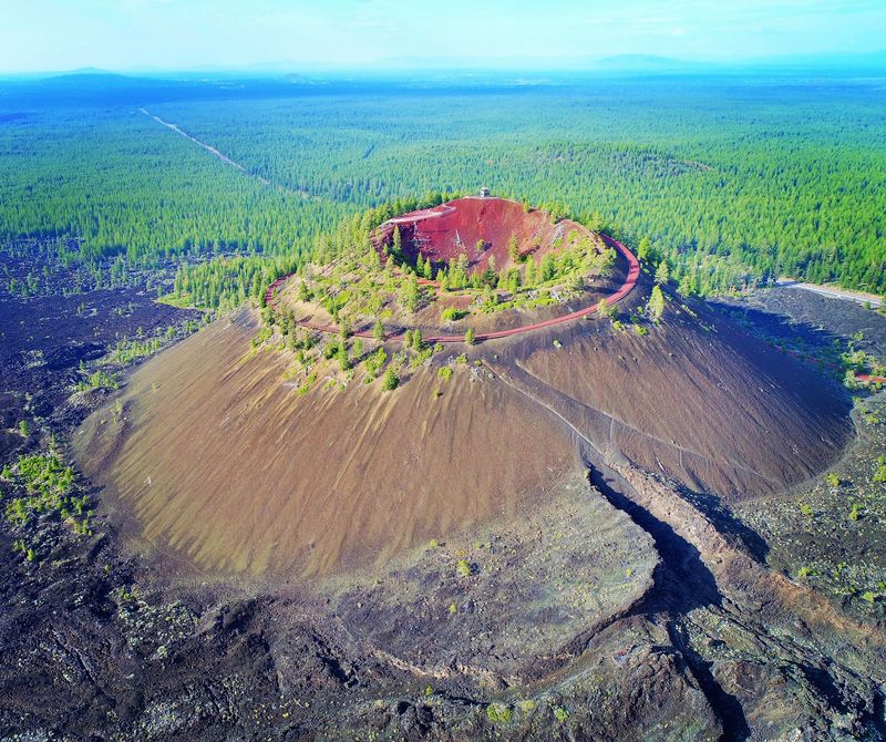
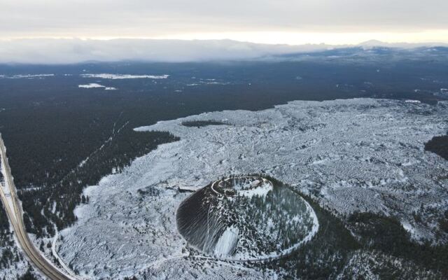
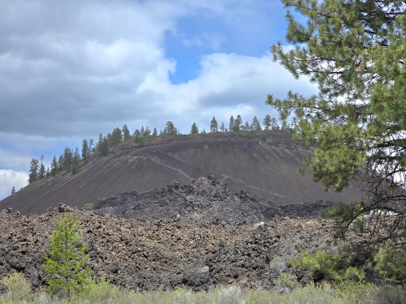
Picture a perfectly shaped hill of red and black cinders popping up beside Highway 97, just a short drive south of Bend. That is Lava Butte, a symmetrical volcanic cinder cone sitting inside the Deschutes National Forest.
Plenty of drivers glance at it and keep going. Visitors who stop often call it one of those out-of-the-way places you could easily miss, yet it turns out to be completely worth the detour.
The butte is part of the larger Newberry Volcano story, and a visitor center at its base helps you understand what you are seeing. From there, a seasonal shuttle, a paved road, and your own two legs can all carry you toward the summit.
Think of it as a pocket-sized volcano adventure. It is easy enough for a morning outing, but it leaves you feeling like you stepped onto another world.
Newberry Volcano’s Fiery Backstory
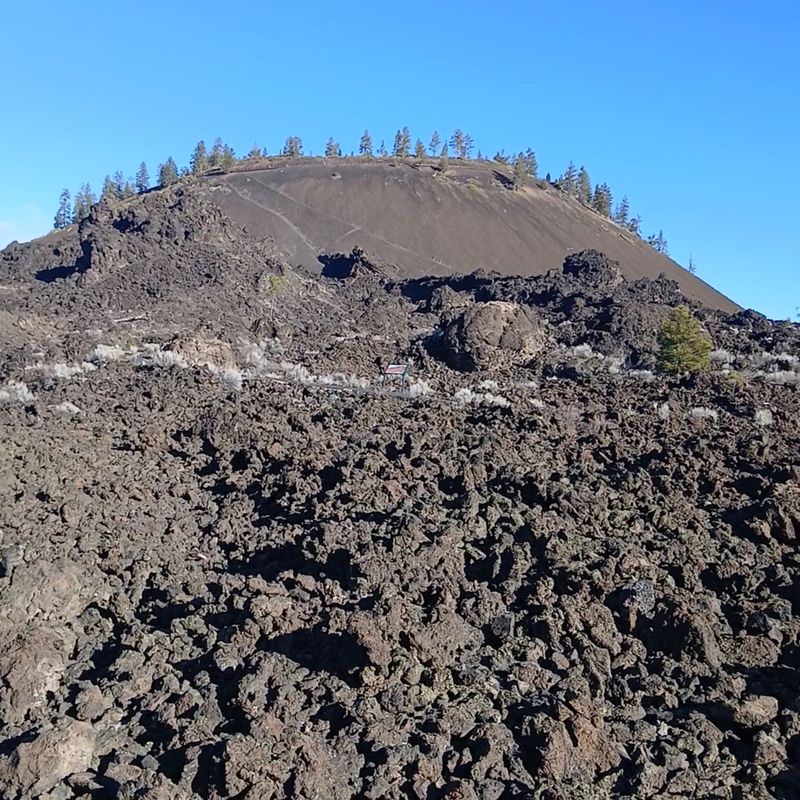
Long before any highway curved past, molten rock was pouring across this land. Lava Butte grew as a vent on the flanks of the much bigger Newberry Volcano, spilling lava that hardened into the rough black fields you still see today.
Families say the area is a wonderful spot to learn about Newberry’s history. The museum at the visitor center earns real praise, with exhibits that make the geology feel exciting instead of dry.
Here is a fun way to think about it. Every chunk of dark stone underfoot was once glowing hot, flowing like slow syrup across the high desert.
Knowledgeable rangers are on hand both in the museum and up on the summit. Ask them anything, and they will happily explain how the cone formed and how far the lava traveled before it cooled.
Black Rock That Looks Like Another Planet
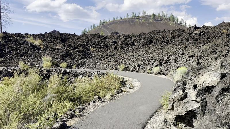
Step out of the car and the ground suddenly looks alien. Jagged black lava rock stretches in every direction, broken into sharp ridges and tumbled boulders.
One visitor described it as feeling like a distant galaxy, and honestly, that fits. A smooth paved path even matches the dark volcanic stone, so the whole scene looks carefully painted in shades of charcoal.
Trails near the base wind right through this rocky landscape, including the Trail of the Molten Land. These loops are free of the shuttle fee and give you a close look at how the flow buckled and cracked as it cooled.
A quick word of caution for parents. The lava is sharp and can scrape little hands, so keep young explorers on the trail and close by.
Riding the Shuttle to the Summit
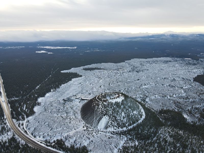
Not every summit requires sore legs. During the busy season, a shuttle bus carries visitors from the visitor center up the spiraling road to the top of the butte.
Riders say the buses run roughly every 15 minutes, so waiting is rarely a chore. One family mentioned their toddler had an absolute blast on the short ride, which makes it a fun little adventure all by itself.
Ticket prices have shifted over the years, with visitors reporting fares from $3 up to around $5 per person, and one group paying $10 for their party. Check the current price before you go.
A popular trick is riding up and walking back down. That way you save your energy for the rim, then soak up the views slowly on the descent toward the parking area.
The Steep Hike Up the Road
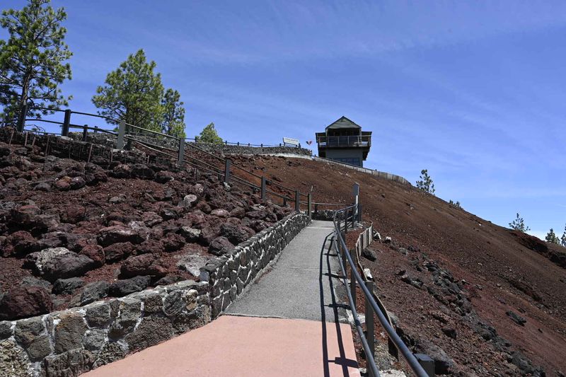
Feeling ambitious? When the road is closed to cars, hikers can walk the paved route all the way up.
Visitors who have done it call the climb short but steep, around a mile and a half if you start at the very bottom. One parent cheerfully called it a real burner on the legs, especially while carrying a kiddo.
Families with small children report it took them a little over an hour at a relaxed pace. The good news is that the views keep improving with every switchback, which makes the effort feel well spent.
Cyclists tackle it too, though you will need stamina. One rider found an e-bike made the climb a breeze.
Whatever you choose, bring plenty of water. Summer days here can get quite hot, and there is very little shade on the cinder slopes.
Walking the Crater Rim
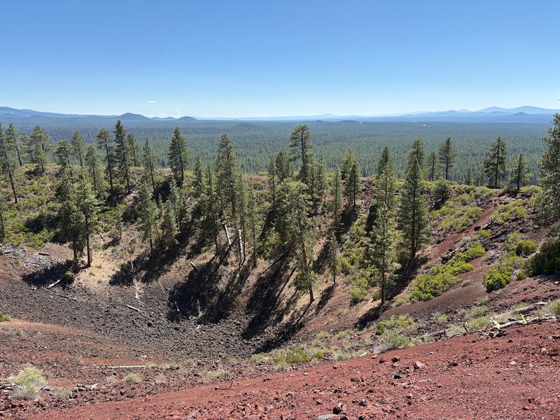
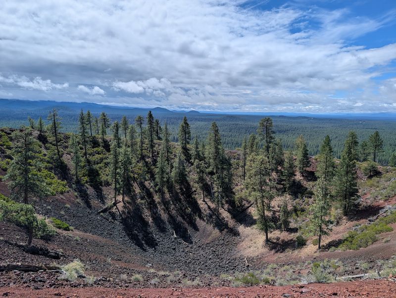
Up top, the real magic begins. A trail about a quarter mile long loops around the rim of the crater, letting you stroll along the edge of an actual volcano.
Visitors love this part most. Walking the ridge feels thrilling, with the bowl of the crater on one side and sweeping country spreading out on the other.
The red-orange cinders create a striking foreground for photos. Against blue sky and distant peaks, the colors almost look too bold to be real.
Plan on roughly 45 minutes to see everything at the summit, according to people who have taken their time. That gives you room to pause, read the signs, and chat with the ranger stationed up there.
Kids especially enjoy the crunchy red dirt underfoot. Expect a few happy detours as they inspect every interesting pebble.
Fire Lookout on the Peak
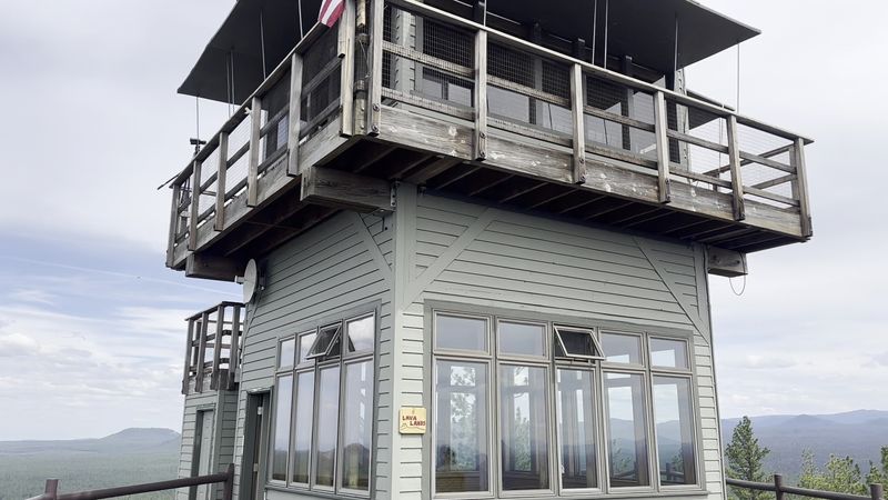
Perched on the summit sits something you rarely get to see in action. Lava Butte has an active fire lookout, staffed by someone scanning the forest for smoke.
Visitors say spotting the lookout is one of the coolest parts of the trip. It is a real working post, not just a museum piece, which gives the summit a sense of purpose.
The upper level is for staff only, so you cannot climb inside. Still, standing at the base of the tower offers a wonderful panoramic view.
Think about the job for a second. Someone spends long days up here watching miles of pine forest, ready to call in the first wisp of smoke.
Friendly rangers nearby often share how the lookout works. Their stories add a human touch to a landscape shaped by fire long ago.
Panoramas of the Cascade Peaks
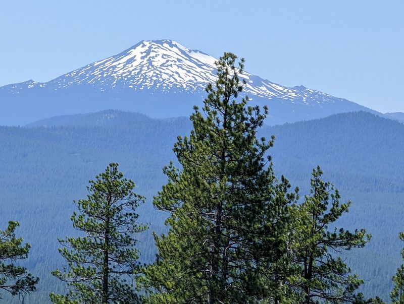
Turn in a slow circle and count the mountains. From the top of Lava Butte, snowcapped Cascade peaks line the horizon like a lineup of old friends.
Visitors name Mount Bachelor, the Three Sisters, Broken Top, and Mount Jefferson among the highlights. Some call these the best views of all the mountains in the area.
Look down and the scene changes completely. The black lava field spreads out below, and you can trace how far the flow traveled, along with smaller volcanic bumps scattered nearby.
One visitor summed it up nicely, saying you could see for days. Weather plays a role, so a clear morning gives you the sharpest views.
This is the moment people talk about later. You feel very small next to all that volcanic history, and somehow that feels wonderful.
Families, Hikers, and a Note on Dogs
Good news for parents. Lava Butte works for nearly every age, from toddlers riding the shuttle to grandparents enjoying the summit views.
Families describe it as an easy one to two hour excursion. Little ones tend to love the red dirt, the shuttle ride, and the strange black rocks most of all.
Locals also enjoy it as a short walk with classic Bend scenery. It suits anyone wanting a big payoff without an all-day commitment.
Now, a serious tip about pets. One visitor strongly warns against bringing dogs, since the sharp cinders are made of glassy material that can hurt their paws.
Leave your furry buddy at home or with a friend for this outing. Your pup will thank you, and you can focus fully on exploring.
Fees, Seasons, and Getting There
Planning ahead makes this trip smooth. Visitors report a $5 day parking fee, plus a separate shuttle ticket if you ride to the top.
During peak season, cars are not allowed up the summit road, so the shuttle or your feet are your options. After the busy months end, some visitors have driven their own vehicles right to the top.
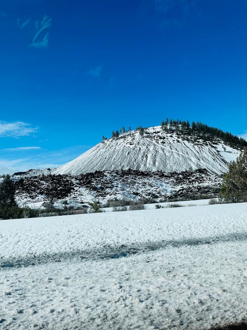
Winter is a different story. Snow can close the road entirely, and one traveler had to turn back in early February, so check conditions first.
Restrooms and plenty of parking sit at the visitor center, but there are none at the summit. Staff from the Deschutes National Forest keep the area clean and well maintained.
Bike lovers, take note. A well-marked trail leads from the lower lot toward the Deschutes River and nearby falls.
Why the Detour Pays Off
So, is it worth pulling off Highway 97? Nearly everyone who stops seems to say yes, with plenty calling it worth both the time and the money.
Few places pack this much into a short visit. You get a working fire lookout, a crater rim walk, alien lava fields, and a mountain lineup that feels almost unfair.
Timing helps. Shoulder seasons, when crowds thin and the road may open, can feel especially relaxed and peaceful.
Bring water, wear sturdy shoes, and leave the dog at home. Then pick your adventure, whether that means shuttle, hike, bike, or a mix of all three.
You will likely leave a little windblown and very impressed. And next time a friend asks for a hidden Central Oregon gem, you will know exactly where to send them.
Share this story