Europe is packed with gorgeous cities, charming squares, and historic streets that seem made for strolling. But not every popular destination is as foot-friendly as it looks on a postcard.
Some cities spread across vast distances, hide their best attractions behind steep hills, or send pedestrians on exhausting detours through traffic-heavy roads. Whether you are planning your next trip or just curious about urban geography, knowing which cities challenge walkers the most can seriously change how you plan your itinerary.
Lisbon, Portugal
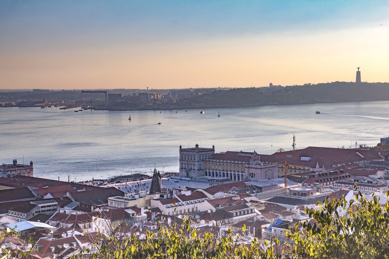
Lisbon holds the unfortunate crown of being the least walkable city in Preply’s tourism-focused study, requiring roughly 15 miles and an estimated 31,500 steps to connect its five major attractions. And that number does not even count the hills, which are legendary for a reason.
Alfama’s winding alleys, Bairro Alto’s steep climbs, and the long haul out to Belem add up fast.
The city is not without genuinely pleasant walking zones. Praca do Comercio, Rua Augusta, and stretches along the waterfront are comfortable and scenic.
The problem kicks in the moment travelers try to link these areas into one continuous route.
Narrow sidewalks, sun-baked stone paving, and summer heat turn what looks manageable on a map into something that wears you out by noon. Thankfully, Lisbon’s trams, funiculars, metro, and elevators exist precisely for moments like these.
Smart visitors mix walking with transit and save their energy for the views that actually deserve the climb.
Zagreb, Croatia
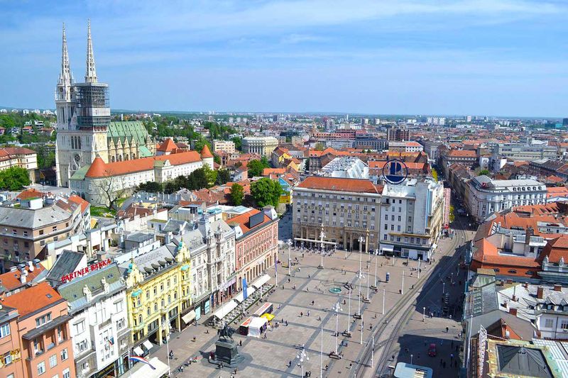
Zagreb surprised a lot of travelers when it landed near the bottom of Preply’s walkability rankings, with roughly 11.8 miles separating its five key attractions. The city has a charming pedestrian core, but that core is only a fraction of the full picture.
Step outside the historic center and the distances grow quickly.
Upper Town and the area around Ban Jelacic Square are genuinely enjoyable on foot, with pleasant cafes, galleries, and cobblestone lanes to explore. The trouble begins when your itinerary stretches south of the railway tracks or out toward larger parks and museums scattered across residential neighborhoods.
Zagreb rewards visitors who treat it as a collection of walkable pockets rather than one giant pedestrian loop. Trams are frequent, affordable, and cover a solid chunk of the city.
Staying close to the central square keeps the old town accessible, while a tram ride handles the heavier lifting. Once you accept that transit is part of the experience here, Zagreb becomes considerably more enjoyable and far less tiring to explore.
Hamburg, Germany
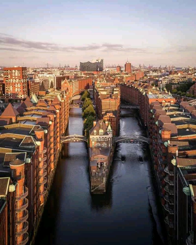
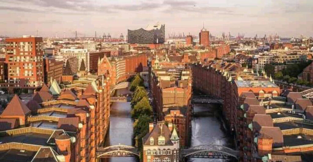
Hamburg is Germany’s second-largest city, and it shows. Preply’s study found that connecting its five major attractions requires around 10.1 miles of walking, a figure that reflects just how spread out this port city really is.
The harbor, lakes, canals, and railway infrastructure slice the city into sections that do not flow naturally from one to the next.
Speicherstadt is one of the most atmospheric walking areas in all of northern Europe, with its red-brick warehouses reflecting off quiet canals. The path along the Alster lakes is equally lovely.
The challenge is that these highlights are not neighbors; they sit at opposite ends of a sprawling urban layout.
Trying to link the Elbphilharmonie, St. Pauli, the city center, and outlying attractions on foot alone can eat up an entire day before you have seen half of what Hamburg offers. The U-Bahn, S-Bahn, buses, and harbor ferries are not backup options here; they are essential tools.
Treat the transit network as part of sightseeing and Hamburg becomes a genuinely rewarding city to explore.
Munich, Germany
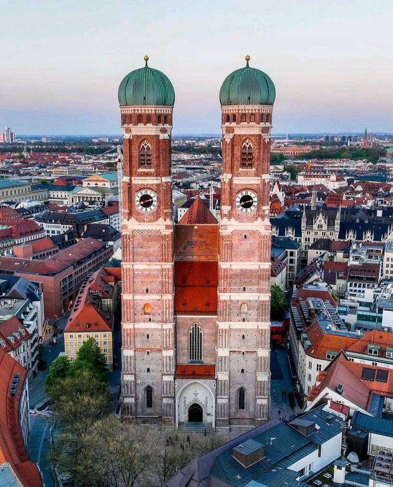
Munich is a city that looks great on paper for walkers, with a car-free old town, excellent public transit, and well-maintained streets. Yet Preply’s methodology told a different story, placing it among the five lowest-ranked cities when measuring the walking route between its top tourist attractions, clocking in at roughly 16 kilometers with over three hours of estimated walking time.
The contradiction makes sense once you understand what is being measured. Marienplatz and the surrounding old town are genuinely easy to explore on foot, with broad pedestrian zones and plenty of street life.
The problem is that Munich’s most famous attractions are not all neighbors. Nymphenburg Palace sits well to the west, Olympiapark is to the north, and museums spread across the English Garden area add further distance.
Everyday walkability for residents is a different matter entirely, and Munich scores well in those broader studies. For tourists building an ambitious itinerary across multiple landmarks, the U-Bahn and trams are indispensable.
Plan your days by district and let public transit bridge the gaps, and Munich becomes one of the most comfortable cities in Europe to visit.
Oslo, Norway
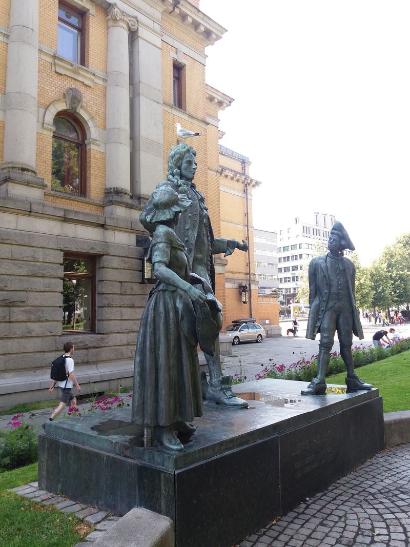
Rounding out Preply’s five lowest-ranked cities, Oslo proves that stunning scenery and walkability do not always go hand in hand. The Norwegian capital wraps itself around a fjord and stretches outward into forested hills, islands, and redeveloped waterfront zones that are visually spectacular but not exactly clustered together for convenient sightseeing.
Karl Johans gate, the Opera House, and the central harbor area are perfectly pleasant to explore on foot. Once your list includes Bygdoy peninsula with its open-air museums, or cultural sites farther north, the distances become a genuine workout.
Winter adds another layer of difficulty that no map can fully convey.
Ice-covered sidewalks, early darkness, and bitter cold can transform a manageable walk into something genuinely uncomfortable. Oslo’s metro, trams, buses, and ferries are woven so naturally into daily life that locals barely think twice about using them.
Visitors should follow that lead. The ferry to Bygdoy, for instance, is not just practical; it offers a lovely view of the fjord as a bonus.
Oslo is best explored with a transit card in your pocket and good waterproof boots on your feet.
Istanbul, Turkiye
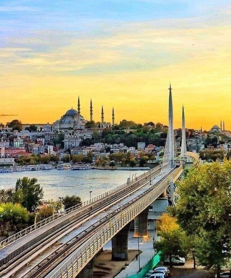
Trying to walk across Istanbul in a single day is an ambition that the city will cheerfully defeat. Spanning two continents, divided by the Bosphorus, and carved up by steep hills, major highways, and centuries of irregular urban growth, Istanbul operates on a scale that makes most European capitals feel compact by comparison.
The metropolitan area is simply enormous.
Sultanahmet is the exception to the rule. The Hagia Sophia, Blue Mosque, Topkapi Palace, and the Grand Bazaar sit close enough together that exploring them on foot is not only possible but genuinely enjoyable.
Cross into Galata or head toward Taksim Square, however, and the inclines and crowds become a factor.
Reaching Besiktas, Kadikoey, or neighborhoods farther along the Bosphorus requires ferries, metro lines, trams, or buses. Crowded sidewalks, aggressive traffic, and the occasional dead-end street add to the challenge.
The good news is that Istanbul’s public transportation is frequent and affordable, and the ferries offer some of the best city views you will find anywhere. Think of each neighborhood as its own adventure and use transit to travel between them.
Edinburgh, Scotland
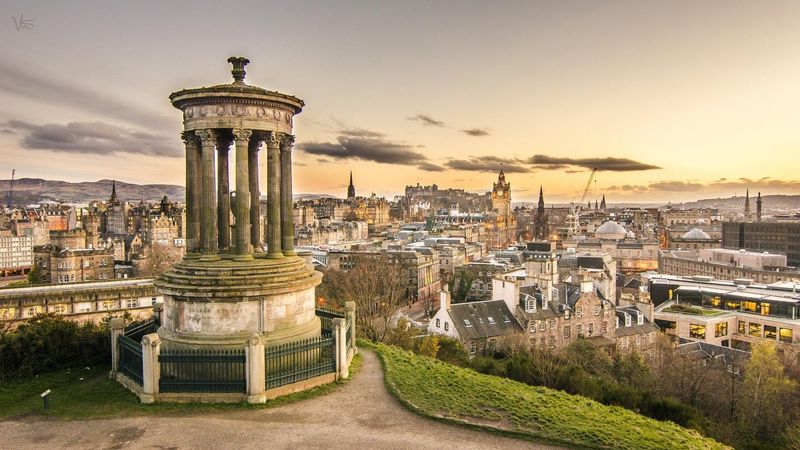
At first glance, Edinburgh seems like a walker’s paradise. The historic center is compact, the Royal Mile is famous worldwide, and the skyline dominated by a castle on volcanic rock looks like something out of a fantasy novel.
Look a little closer, though, and the terrain starts to reveal its personality: dramatic, beautiful, and absolutely relentless on the legs.
Cobblestones, steep stairways called closes, sharp elevation changes between the Old Town and New Town, and the sheer vertical effort required to reach places like Calton Hill or Arthur’s Seat can catch visitors off guard. A route that looks short on a map may involve a significant climb or a long flight of stone steps with no alternative.
For travelers with limited mobility or joint issues, Edinburgh requires careful planning and a willingness to use taxis or buses for certain stretches. The city also rewards those who slow down and explore one area at a time rather than rushing between landmarks.
Rain and wind, which are frequent guests here, add another reason to pace yourself. Edinburgh is spectacular, but it asks something physical of everyone who visits.
Belgrade, Serbia
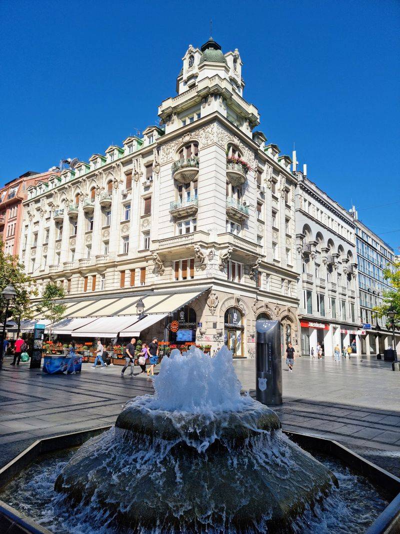
Belgrade has a magnetic energy that draws travelers in, and the pedestrian stretch of Knez Mihailova Street leading up to Kalemegdan Fortress is one of the liveliest walking corridors in the Balkans. Spend a morning there and you might assume the whole city is this easy to navigate.
Venture beyond that central strip and the picture changes considerably.
Wide roads built for vehicles rather than pedestrians, uneven pavement, parked cars blocking sidewalks, and construction zones scattered across various neighborhoods make extended walking less comfortable than it sounds. Reaching Zemun, New Belgrade’s riverfront, or districts away from the center involves crossing busy traffic arteries that are not always pedestrian-friendly.
Trams, buses, and taxis fill the gaps efficiently and cheaply. The smartest approach is to anchor your day in one neighborhood at a time, exploring it thoroughly on foot before hopping on transit to the next.
Belgrade’s food scene, nightlife, and fortress views make every neighborhood worth visiting; you just do not need to walk between all of them. Comfortable shoes and a transit app on your phone are your two best travel companions in this city.
Warsaw, Poland
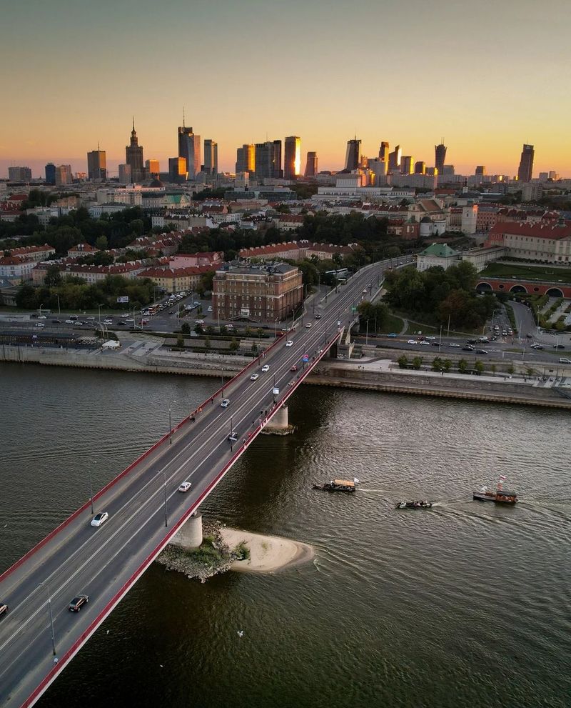
Warsaw’s story is unlike any other city on this list. Virtually destroyed during World War II and rebuilt from scratch in the postwar decades, the city was redesigned around wide boulevards, large open spaces, and efficient vehicle movement rather than compact pedestrian networks.
The result is a modern capital that functions well but can feel spread out and impersonal between its highlights.
The reconstructed Old Town is genuinely charming and pedestrian-friendly, a UNESCO-listed testament to extraordinary historical preservation. Step outside that bubble and the scale shifts dramatically.
Museums, memorials, parks, and cultural sites are scattered across a large footprint, often separated by multi-lane roads that require long detours to cross safely.
Warsaw’s metro system, trams, and buses cover the city well and make the distances very manageable. Travelers who combine transit between districts with walking within each neighborhood will have a much richer experience than those who try to cover everything on foot.
The city rewards curiosity and patience in equal measure. Once you accept its layout and work with it rather than against it, Warsaw reveals a surprisingly vibrant and layered character that goes well beyond the Old Town square.
Patras, Greece
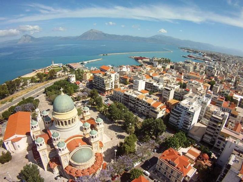
Patras does not get the same tourist spotlight as Athens or Santorini, but Greece’s third-largest city presents a genuinely tricky walking environment for visitors. Stretched along the Gulf of Patras and rising steeply inland at the same time, the city’s layout means that getting from the waterfront to the upper neighborhoods involves a serious elevation gain.
Your calves will notice.
The central shopping streets and the waterfront promenade are flat and comfortable enough for a leisurely stroll. Push farther toward the upper city, the medieval castle, or attractions positioned on the hillside, and the inclines become a real commitment.
Summer heat in this part of Greece amplifies everything, turning a moderate walk into an energy-draining effort before you have reached your destination.
Local buses and taxis handle the steeper stretches efficiently, and the suburban railway connects Patras to surrounding areas. Organizing your sightseeing by elevation zone makes a lot of sense here: explore the waterfront in the morning when it is cooler, then use transport to reach the upper city rather than climbing in the midday sun.
Sturdy shoes, plenty of water, and a flexible schedule will serve you far better than stubbornness on these streets.
Share this story