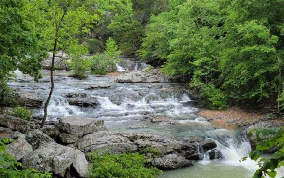
Arkansas is home to some seriously underrated waterfalls, and the best part is that most of them do not require a full day of hiking to reach. Whether you have a free afternoon or a few hours between stops on a road trip, the state’s short waterfall trails deliver big rewards.
From a waterfall that drops through a hole in the rock to a staircase of cascades tucked inside a national forest, the variety here is genuinely surprising. Spring and periods after heavy rain tend to bring the most dramatic water flow, but many of these trails are worth visiting year-round.
Good footwear is a recurring theme across this list, since wet rocks and creek crossings show up more often than not. Read on to find 11 Arkansas waterfall trails that clock in under 3 miles, each with its own character and its own reason to make the trip.
1. Glory Hole Falls Trail, Ozone, Arkansas
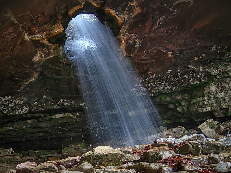
Geology does some wild things in Arkansas, but Glory Hole Falls might be the most dramatic example of all. Dismal Creek has spent centuries carving a circular opening directly through an overhanging bluff, so the water does not fall over the edge like a normal waterfall.
It pours straight through the hole and drops 31 feet into the grotto below.
The trail is about 2 miles round-trip and rated moderate, with nearly 500 feet of elevation gain that makes the return hike noticeably harder than the walk in. The path starts on an old ATV road and passes through the Dismal Creek Special Interest Area, which is known for its botanical variety and wildflowers.
After reaching the falls, visitors can explore the grotto and large boulders scattered around the base. Spring visits after rainfall offer the most impressive flow, and during sustained cold winters, the falls have been known to freeze into a striking ice column.
2. Cedar Falls Trail, Morrilton, Arkansas
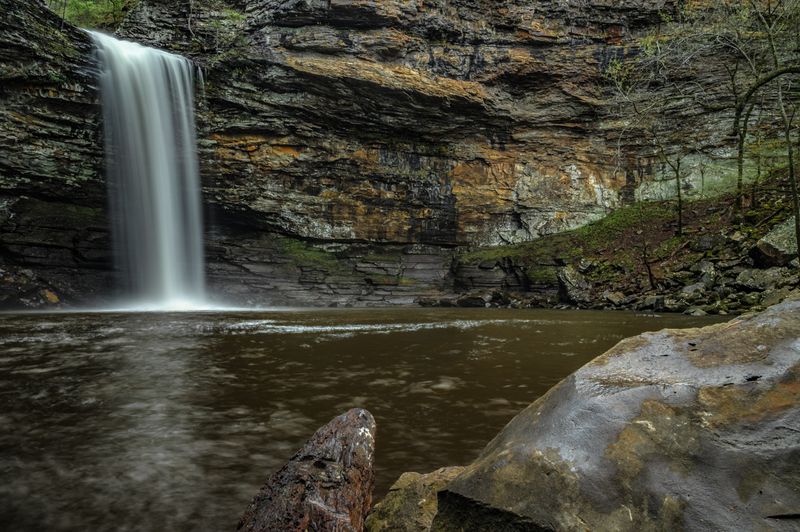
Petit Jean State Park has a lot going for it, but Cedar Falls is the clear headline act. The waterfall drops roughly 95 feet into a wide grotto carved from the canyon wall, and it flows consistently enough to be worth a visit across most of the year.
Getting there involves a roughly 2-mile round-trip trail that begins near Mather Lodge. The route descends more than 200 feet early on, which feels easy on the way down and considerably less easy on the way back.
After a narrow bridge crossing over Cedar Creek, the path leads directly to the falls.
Hikers who prefer not to tackle the descent can use an accessible boardwalk that leads to an overlook above the falls. The rocky sections and steep stretches mean sturdy footwear is a practical requirement, not just a suggestion.
Allow a couple of hours and keep in mind that cell service inside the park tends to be unreliable.
3. Falls Branch Trail, Hot Springs, Arkansas
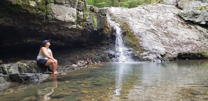
Lake Catherine State Park keeps a low profile compared to some of Arkansas’s bigger park destinations, but its Falls Branch Trail earns a spot on this list without much argument. The loop runs roughly 1.6 to 2.3 miles through a mix of pine and hardwood forest in the Ouachita Mountain landscape, crossing Little Canyon Creek several times along the way.
The destination is Falls Creek Falls, a 10-foot seasonal waterfall with a pool at the base that occasionally doubles as a swimming spot. Water flow depends heavily on rainfall, so timing a visit after a wet stretch will make a noticeable difference in what you see.
The trail is generally considered family-friendly, with moderate elevation changes around 180 to 316 feet and some footbridge crossings to help with the creek sections. Views of Lake Catherine appear from certain points on the route.
Bug repellent is worth packing during warmer months, and sturdy shoes are a good idea given the potentially slippery rocks near the falls.
4. Sweden Creek Falls Trail, Kingston, Arkansas
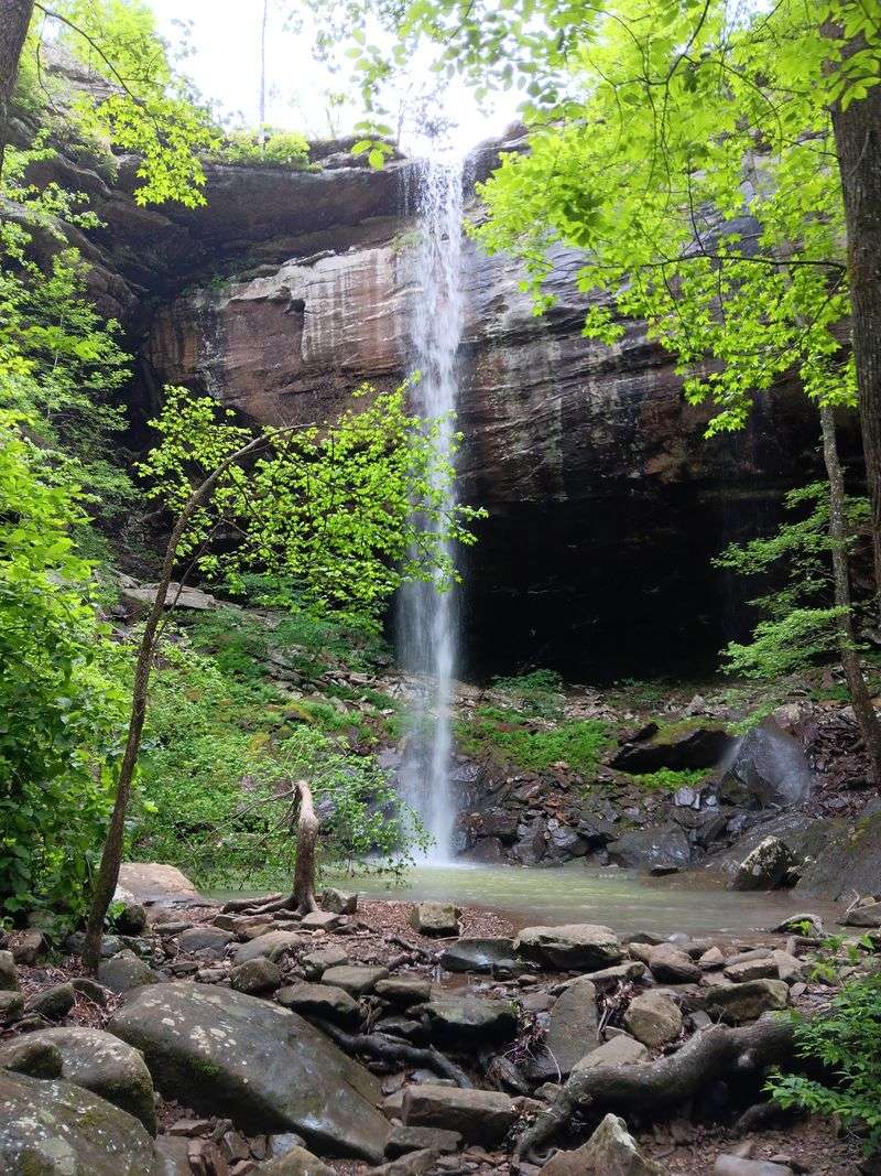
Eighty-one feet of waterfall for only 1.5 miles of hiking is a trade that most people would take without hesitation. Sweden Creek Falls sits inside the Sweden Creek Falls Natural Area in the Boston Mountains, and its height makes it one of Arkansas’s tallest waterfalls reachable by a short trail.
The path starts as an old jeep road, passes historical remnants including an abandoned house and outbuilding, and then transitions into a rockier section along towering bluffs. Grottos and rock formations appear along the way, and hikers can actually move behind the curtain of the falls without getting wet when conditions are right.
The natural area supports dry glades, woodlands, and rare plant species, including the small-headed pipewort found on sandstone glades. The initial downhill stretch means the return involves an uphill push that can catch visitors off guard.
Dogs are welcome on this trail, though the rough gravel road to the parking area and the lack of restroom facilities are worth knowing before you go.
5. Pack Rat Falls Trail, Hagarville, Arkansas
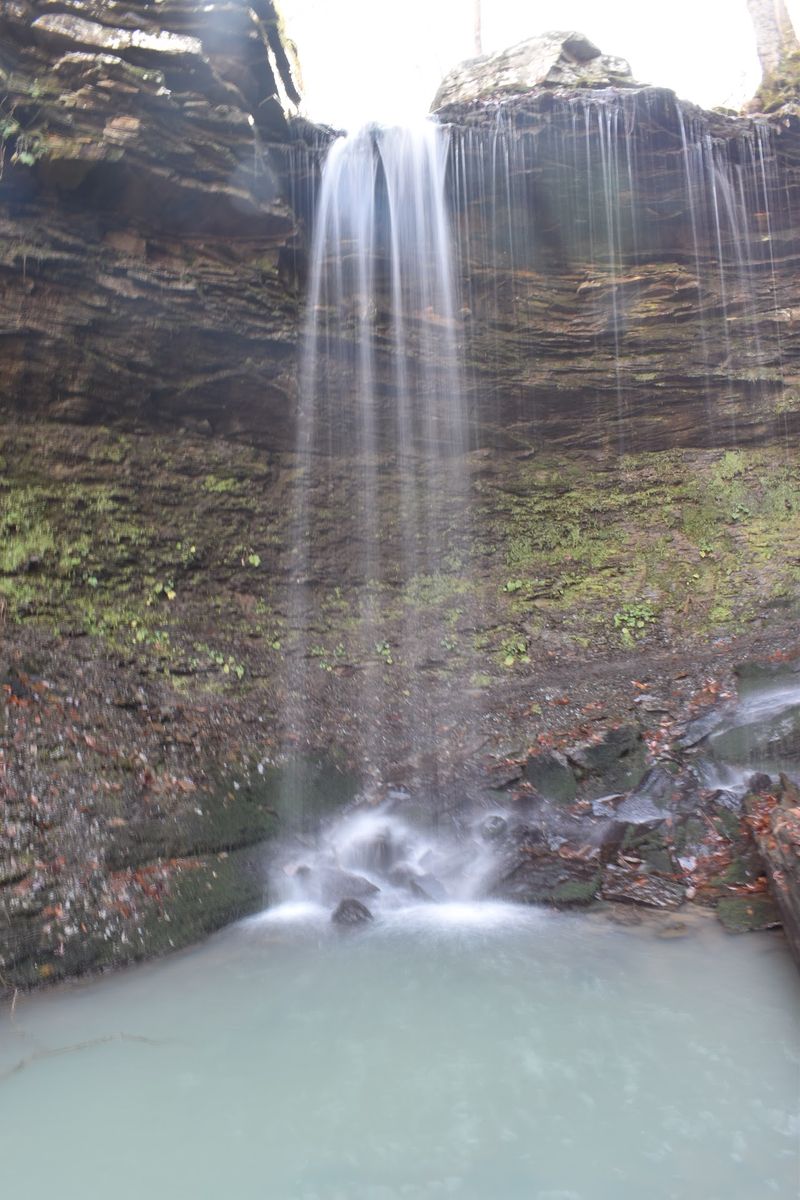
Half a mile sounds like barely a warm-up, but the route to Pack Rat Falls earns its moderate rating through sheer terrain. There is no formal trail here.
Hikers follow a rocky creek bed from near Haw Creek Falls Recreation Area, which means rock hopping, careful foot placement, and a real chance of slipping if footwear is not up to the task.
The payoff is a 24-foot waterfall dropping into a mossy grotto inside a secluded canyon setting. When recent rain has filled the drainage, the falls can split into two distinct streams, which adds a different dimension to the view.
The dense forest along the creek keeps the whole area feeling tucked away from the rest of the world.
Visitors can access the route from the back of Haw Creek Falls Campground, often near campsites 6 or 7. Upper Pack Rat Falls sits upstream for those willing to scramble further.
Combining this stop with Haw Creek Falls and Pam’s Grotto nearby makes for a full day of waterfall exploration in one area.
6. Long Pool Falls Trail, Dover, Arkansas
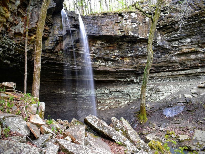
Most visitors heading to Long Pool Recreation Area have the swimming hole on their minds, and that is fair. But about 1 to 2 miles away by trail, a 44-foot waterfall sits inside a small box canyon that most day-trippers never find.
The route involves rocky creek bed sections and some scrambling, which gives it a backcountry character that the modest mileage does not immediately suggest. A smaller 8-foot cascade downstream from the main falls sometimes gets mistaken for the primary destination by first-time visitors, so keep moving until the canyon walls close in around you.
The trail begins from the Loop B camping area and is not always clearly marked, so a downloaded map is a practical precaution given the poor cell service in the area. Spring and winter months tend to bring the strongest water flow.
The recreation area has restrooms and picnic facilities, and the paved access roads make it reachable for most vehicles.
7. High Bank Twin Falls Trail, Pettigrew, Arkansas
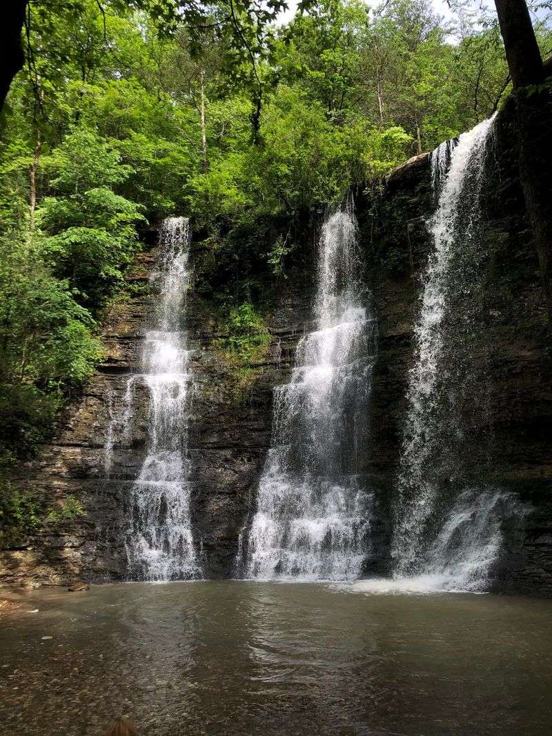
A 71-foot double waterfall reached by roughly half a mile of hiking near the Mulberry River is the kind of discovery that makes people feel like they have found something the rest of the world missed. High Bank Twin Falls sits in the Ozark National Forest near Pettigrew, and despite being close to the highway, the falls are not visible from the road.
The approach follows a rocky creek bed from the High Bank Canoe Access, involving some rock hopping and scrambling depending on water levels. The falls hit an outcropping midway down the bluff before pooling at the base, which creates an interesting two-stage visual effect.
During periods of especially heavy rainfall, a third waterfall can appear alongside the main two.
Smaller cascades and distinctive rock formations appear along the creek before the main falls come into view. Spring is the best season for dramatic flow, though the falls are worth visiting whenever recent rain has topped up the drainage.
This spot tends to stay quiet even on weekends.
8. Six Finger Falls Trail, Pelsor, Arkansas
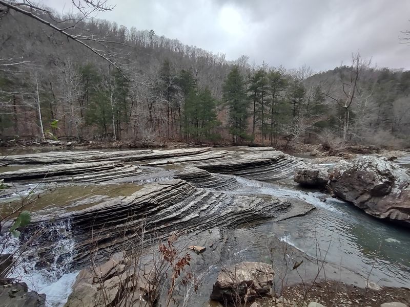
Not every waterfall needs to be tall to stop you in your tracks. Six Finger Falls on Falling Water Creek stands only 6 to 10 feet high, but its width stretches up to 100 feet across, with the water dividing into multiple parallel cascades over a broad rock ledge that gives the formation its name.
The trail is remarkably short, often just 50 to 100 yards from the parking area, and the falls are actually visible from Falling Water Road itself. That accessibility makes it one of the easiest waterfall stops in the entire Ozarks, suitable for just about any fitness level.
The unique shape of the falls is the result of differential erosion, where water carved parallel grooves through softer rock layers while harder ridges remained to form the finger-like divisions. Low water levels give visitors a chance to walk among the rock formations and examine the geology up close.
Nearby Fuzzy Butt Falls and Falling Water Falls can round out a full day of waterfall stops in this exceptionally scenic area.
9. Little Missouri Falls Trail, Langley, Arkansas
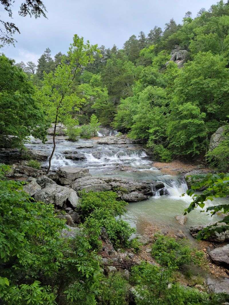
Most waterfalls on this list involve a single dramatic plunge, but Little Missouri Falls takes a completely different approach. Water tumbles down a staircase of natural rock shelves, passing through several small pools before gathering in a larger swimming hole at the bottom.
It is a different kind of impressive.
The walk from the parking area is only about 0.25 to 0.3 miles, making this one of the most accessible destinations in the Ouachita National Forest. A developed day-use area with picnic facilities sits nearby, and the broader Little Missouri Trail connects from the same location for those who want to keep hiking.
The surrounding geology features sandstone, shale, and novaculite formations that give the landscape a distinctive look. Spring visits after rain bring the most vibrant flow and the best swimming conditions when temperatures cooperate.
Cell service is essentially unavailable at this location, so downloading maps and directions before leaving town is a genuinely useful habit to build before this trip.
10. Tanyard Creek Nature Trail, Bella Vista, Arkansas
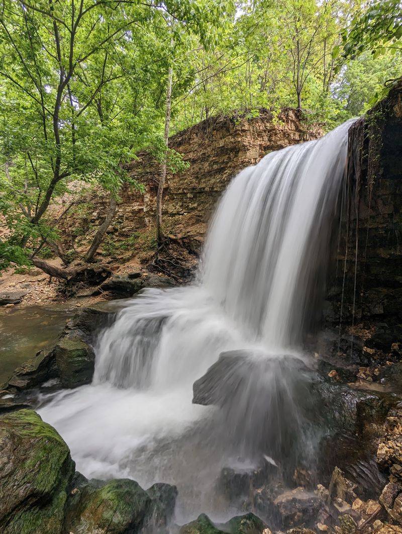
Bella Vista is not the first place most people think of when planning an Arkansas waterfall hike, but Tanyard Creek Nature Trail makes a convincing case for reconsideration. The main loop runs roughly 2.2 miles through a semi-urban natural area, which means the trailhead is close to town without the trail feeling like it.
The route starts on a 0.3-mile paved section before transitioning to a natural surface that follows Tanyard and Sunshine creeks. Bridges, bluffs, and informative signs about local flora appear along the way, and the trail was built and is maintained by community volunteers.
The highlight is a tiered waterfall created by the Lake Windsor Dam spillway, which becomes noticeably more dramatic during heavy rainfall. The creek itself runs clear and supports fish, crawdads, and snails, and boulders along the banks contain fossils worth examining.
Spring and fall offer particularly comfortable conditions for the walk. This trail works well for families and beginners who want real scenery without a demanding hike.
11. Waterfall/Gum Springs Trail, Dardanelle, Arkansas
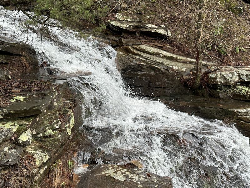
Quarter-mile trails are usually the kind of thing people knock out before breakfast. The Waterfall/Gum Springs Trail at Mount Nebo State Park is classified as strenuous, which should immediately recalibrate expectations for anyone planning a casual stroll.
The Civilian Conservation Corps built this route in the 1930s using hand labor and mules, installing steep switchbacks and massive stone steps, some weighing up to 500 pounds. That history is visible in every deliberate placement of rock along the descent.
The seasonal waterfall, also known as Nebo Falls, drops approximately 32 to 40 feet and is most impressive after heavy rain.
Beyond the falls, the trail passes Gum Springs, which historically supplied water to the town of Dardanelle, with old water pipes still partially visible in the area. The route connects to the Rim Trail, which provides wide views of the Arkansas River Valley and Lake Dardanelle.
The return climb back up the stone steps is the part visitors remember most, so saving energy for it is a practical plan.
Share this story