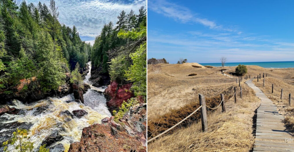
Wisconsin has a surprising range of wild landscapes packed into one state. From roaring waterfalls in the north to towering quartzite bluffs and miles of Great Lakes shoreline, the state parks here offer far more than a simple walk in the woods.
Whether you are planning a weekend road trip or looking for a new day hike, this list covers eleven parks that each bring something genuinely different to the table. Some are well known, some require a ferry ride to reach, and a few will completely change how you think about Wisconsin’s outdoors.
Copper Falls State Park, Mellen
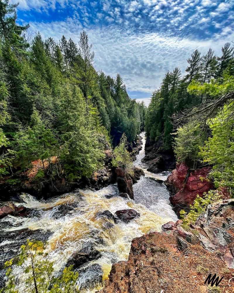
Few places in northern Wisconsin pack this much geology into a single short hike. Copper Falls State Park sits near Mellen and features deep river gorges carved through ancient volcanic rock, giving the landscape an almost prehistoric feel.
The 1.7-mile Doughboys Nature Trail is the park’s main route, looping through the heart of the property along the Bad River and Tyler Forks.
Along the way, hikers get views of Copper Falls, Brownstone Falls and several smaller cascades tucked between walls of dark rock. Mature hardwoods, old-growth hemlocks, white cedar and pine line the trail throughout.
Stone and log structures built by the Civilian Conservation Corps in the 1930s add a quiet historical layer to the whole experience.
Beyond the waterfall corridor, Loon Lake offers a spot to swim, fish or simply sit and decompress. The park is open year-round, though trail conditions and services shift with the seasons.
Pattison State Park, Superior
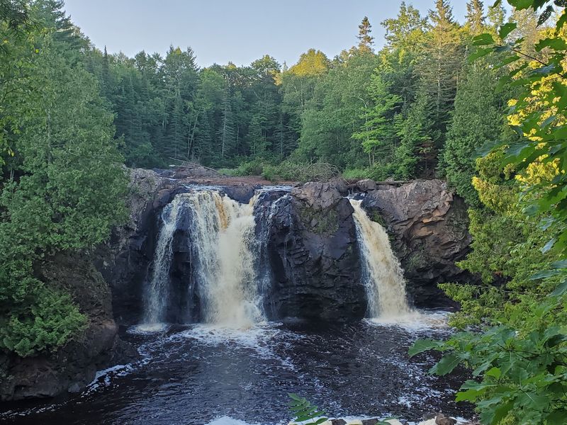
At 165 feet, Big Manitou Falls is Wisconsin’s tallest waterfall and one of the tallest waterfalls east of the Rocky Mountains. That alone puts Pattison State Park in a category of its own.
The falls drop along the Black River in a powerful rush that is visible from wooded overlook paths near the trailhead.
What makes Pattison especially interesting is that it offers a second waterfall experience on the same property. Little Manitou Falls stands 31 feet tall and sits within easy walking distance, giving visitors two distinct cascades without needing to drive anywhere else.
The trails connecting them wind through forest and wetland sections of the Black River corridor.
Interfalls Lake adds a beach and swimming area to round out the visit. Camping and picnicking are also available throughout the park.
Pattison is open year-round from 6 a.m. to 11 p.m., making it a flexible destination across multiple seasons.
Amnicon Falls State Park, South Range
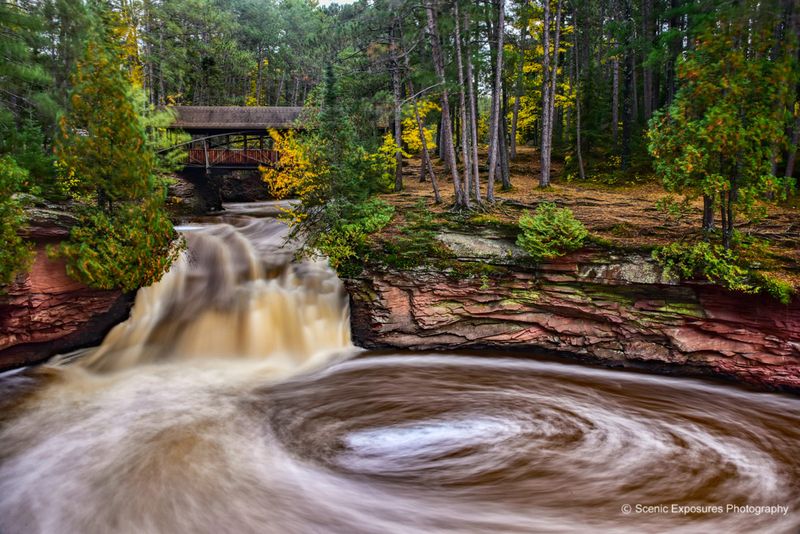
Rather than one big dramatic drop, Amnicon Falls State Park is built around a series of waterfalls and rapids that keep revealing themselves as you follow the river. The Amnicon River tumbles across rock formations shaped in part by the Douglas Fault, creating multiple distinct viewpoints along approximately two miles of trail.
One of the most recognizable features here is the covered footbridge near the falls. It frames the river in a way that feels classic and unhurried, especially during the fall color season when the surrounding trees turn gold and red.
The trail system is compact enough that most visitors can see the main waterfall areas without committing to a full-day outing.
Picnic areas and a campground give visitors good reasons to linger past the afternoon. This park is a solid choice for families or anyone who wants a genuine waterfall experience without a strenuous hike.
It is open year-round from 6 a.m. to 11 p.m.
Willow River State Park, Hudson
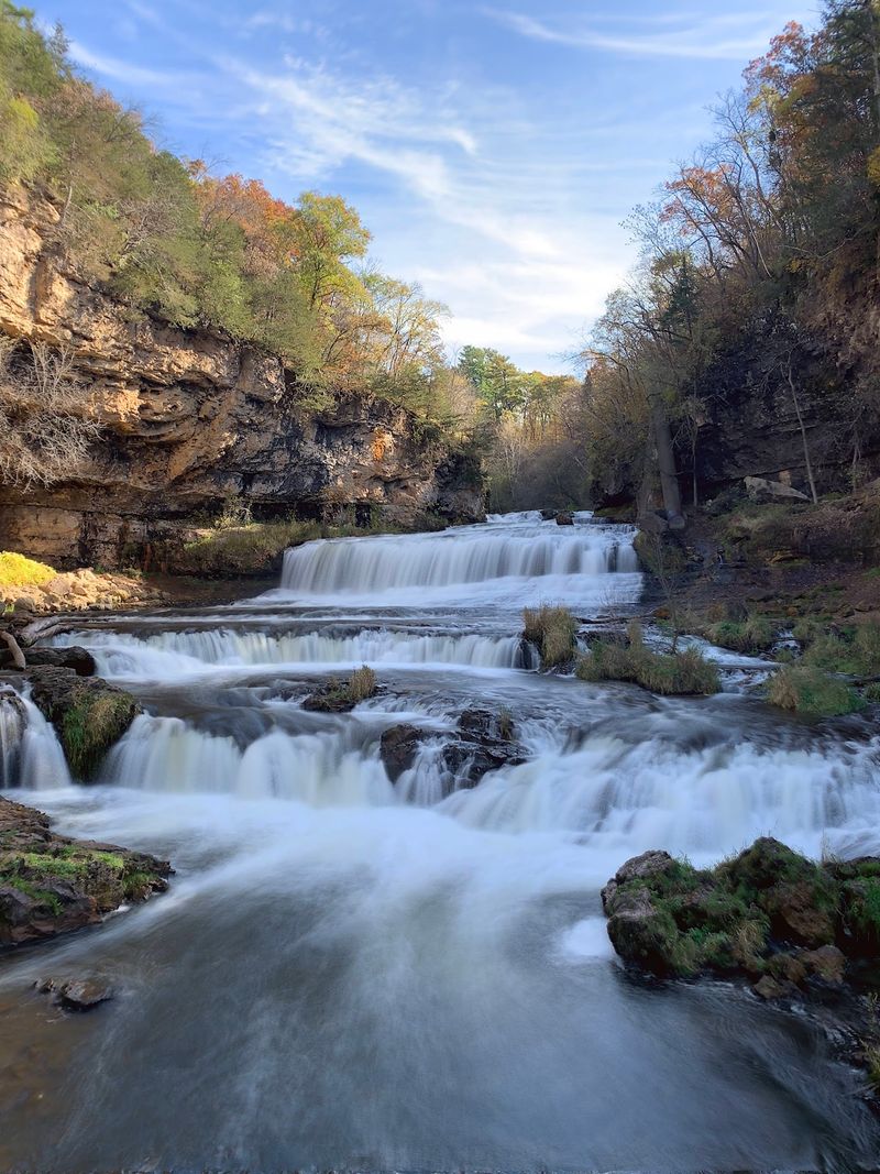
Willow River State Park sits just east of Hudson near the Wisconsin-Minnesota border, and it is the kind of place that surprises visitors who expected something small and flat. The park covers approximately 2,800 acres of rolling countryside, prairie remnants and forest, with Willow Falls as the centerpiece attraction.
The falls flow across broad rock ledges inside the Willow River Gorge. Trails descend from higher ground toward the waterfall, offering changing views of the gorge walls along the descent.
Some paths are relatively easy, while the approaches near the gorge include steeper slopes and stairs worth planning for.
Little Falls Lake adds another waterside area within the park, with potential for swimming, paddling and fishing depending on current seasonal conditions. Lakeside picnic areas, campgrounds and a nature center make this a convenient full-day destination.
If you are coming from the Twin Cities metro area, the drive is short enough to make this a realistic morning trip.
Devil’s Lake State Park, Baraboo
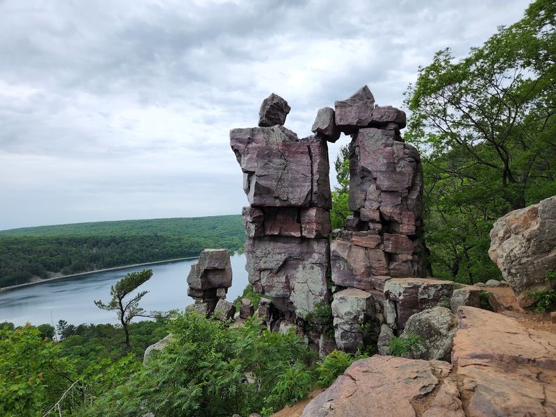
Devil’s Lake State Park is probably Wisconsin’s most recognized state park, and the landscape earns that reputation. A clear glacial lake sits at the center of the property, framed on both sides by quartzite bluffs that rise dramatically above the water.
The visual contrast between the calm lake surface and the exposed rocky ridges is striking at almost any time of year.
The park has approximately 29 miles of trails covering a wide range of difficulty levels. Easy paved paths run near the lakeshore, while more demanding routes climb toward the East Bluff and West Bluff overlooks.
Up top, exposed rock ledges and open formations deliver broad views across the lake and the surrounding Baraboo Hills.
Popularity is a real factor here. Wisconsin DNR notes that parking can fill before 9 a.m. on busy weekends from May through October, and park access may be temporarily restricted during peak congestion.
Arriving early is not optional, it is essential for a smooth visit.
Interstate State Park, St. Croix Falls
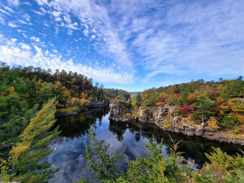
Established in 1900, Interstate State Park holds the distinction of being Wisconsin’s oldest state park. It sits along the St. Croix National Scenic Riverway near St. Croix Falls, where steep rock walls form the dramatic Dalles of the St. Croix.
The river corridor here has a rugged, canyon-like quality that feels unexpected this far south of Wisconsin’s northern highlands.
The park is especially known for its glacial potholes, cylindrical formations carved into the rock by swirling water and sediment during the retreat of ancient glaciers. These features make Interstate a notable stop along Wisconsin’s Ice Age Trail and a useful destination for anyone interested in how the landscape was shaped thousands of years ago.
Trails lead to river overlooks, forested ridges and the Ice Age Interpretive Center, which provides context for the geology on display. The park is open year-round from 6 a.m. to 11 p.m., though interpretive center hours and seasonal services vary.
Combining a bluff hike with a stop at the center makes for a well-rounded visit.
Peninsula State Park, Fish Creek
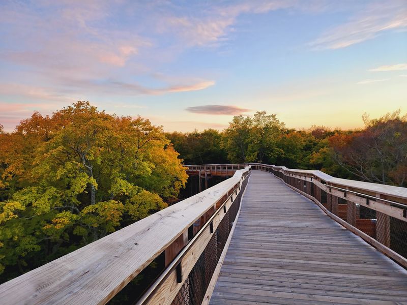
Peninsula State Park protects eight miles of Green Bay shoreline along the Door Peninsula, and the bluffs here are part of something much larger. They form a section of the Niagara Escarpment, the same long bedrock ridge that continues northeast all the way toward Niagara Falls.
That geological connection gives the park a regional significance that goes beyond its already impressive scenery.
About 20 miles of trails cross the park, ranging from gentle shoreline walks to elevated routes with open views. Sven’s Bluff and Eagle Panorama are among the popular overlook spots.
Eagle Tower rises above Eagle Bluff and can be reached by stairs or an 850-foot accessible canopy walk, offering panoramic views of nearby islands and the Upper Michigan shoreline.
The park also includes beaches, a lighthouse, bicycle trails, scenic roads and numerous campsites. Sunset views along Green Bay are a reliable draw during warmer months.
This is one of Door County’s most visited destinations, so arriving with a plan helps.
High Cliff State Park, Sherwood
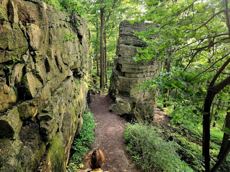
High Cliff State Park is the only state-owned recreational property located directly on Lake Winnebago, Wisconsin’s largest inland lake. That position alone makes it stand out from most other parks on this list.
The park sits above the eastern shoreline and takes its name from the limestone cliffs of the Niagara Escarpment running along its western edge.
Trails climb through forested sections of the escarpment and open up toward overlooks above the lake. The mix of limestone formations, wooded slopes and wide water views creates a setting that feels distinctly different from the northern waterfall parks or the Door Peninsula’s shoreline.
A 12-foot statue of Ho-Chunk leader Red Bird stands on a large granite rock overlooking the lake, adding a meaningful cultural presence to the landscape.
The park also features effigy mounds, a marina and picnic areas. For travelers based in the Fox Valley or greater Milwaukee area, High Cliff offers bluff hiking and lakeshore scenery without a long drive north.
Big Bay State Park, La Pointe
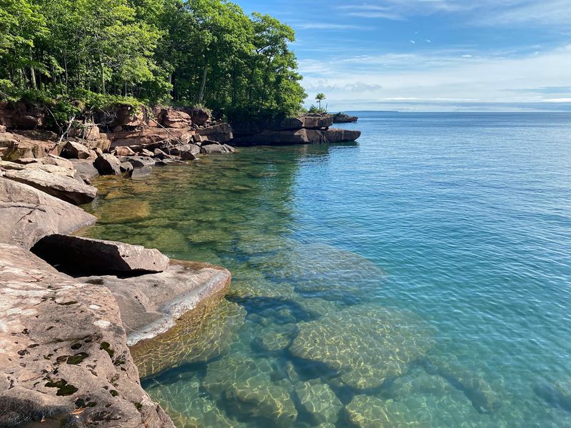
Getting to Big Bay State Park is part of the experience. The park occupies the eastern side of Madeline Island, the largest island in the Apostle Islands archipelago.
Reaching it requires taking a ferry from Bayfield to the island and then traveling across Madeline Island to the park entrance. Ferry schedules can be affected by ice and seasonal conditions, so checking ahead before the trip is important.
Once inside, the park delivers four miles of Lake Superior shoreline marked by sandstone bluffs, sandy beaches and northern forest. A mile-long boardwalk provides an accessible route through portions of the landscape.
Additional trails move through bogs, barrier beaches, boreal forest and old-growth hemlock stands, covering a range of northern Wisconsin environments in a relatively compact area.
The sandy swimming beach offers a quieter and more sheltered contrast to the rugged bluff sections. Camping is available for visitors who want more than a single afternoon beside Lake Superior.
This is a genuinely remote park worth the extra logistics.
Kohler-Andrae State Park, Sheboygan
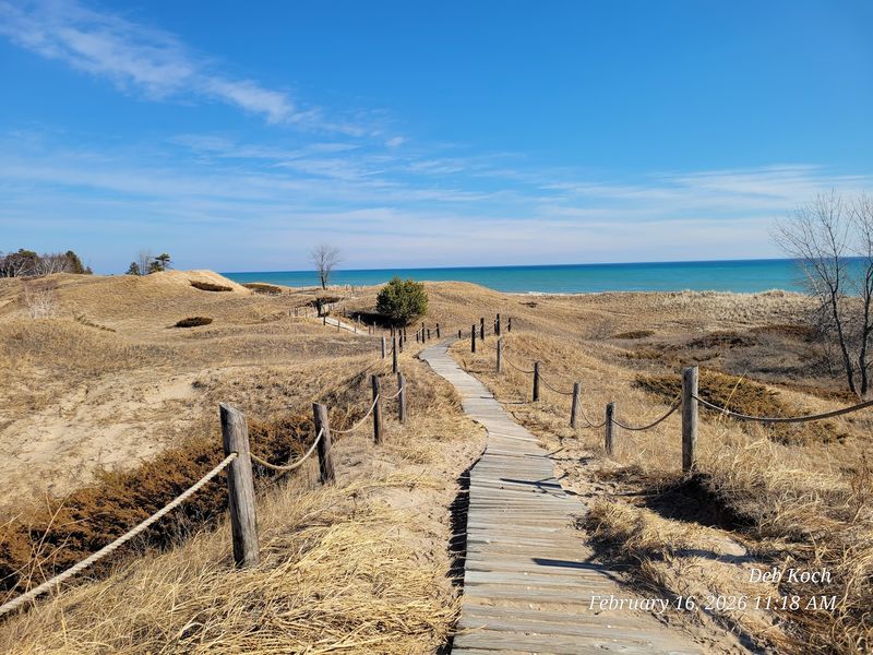
Kohler-Andrae State Park protects one of the few remaining natural stretches of Lake Michigan shoreline in southeastern Wisconsin. The landscape here feels coastal in a way that catches many first-time visitors off guard.
Tall sand dunes rise above broad beaches, with pine trees and wetlands filling in the areas behind the dune line.
Boardwalk-style trails take visitors through the dune system in a way that limits erosion and protects the fragile plant communities holding the dunes in place. Walking these routes gives a clear sense of how dynamic and changeable a dune landscape actually is.
The open views across Lake Michigan add to the feeling of being somewhere genuinely different from the rest of the region.
Visitors come for wildlife observation, beach walks, camping and sunrise views over the water. Lake Michigan can stay cold well into summer, and conditions on the water change quickly, so checking local beach information before swimming is always smart.
The park remains a reliable destination for peaceful shoreline time in southeastern Wisconsin.
Rock Island State Park, Washington Island
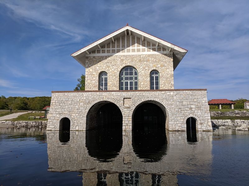
Rock Island State Park sits at the very tip of Door County and requires two ferry rides to reach. First, travelers cross from the Door Peninsula to Washington Island.
From there, a passenger ferry from Jackson Harbor carries visitors to Rock Island itself. Personal vehicles are not allowed on the island, which keeps the whole place quiet and largely free of the crowds that affect more accessible parks.
The island has hiking trails, sandy beaches and miles of largely undeveloped shoreline to explore at a slow pace. Pottawatomie Lighthouse is one of the standout landmarks, and the park also includes distinctive stone buildings connected to inventor Chester Thordarson, who once owned the island and left behind an unusual architectural legacy.
Camping here is rustic, with walk-in sites rather than drive-up spots. Drinking water and restrooms are available seasonally, but there is no full camp store on the island.
Planning carefully around ferry schedules and weather is essential. The limited access is exactly what gives Rock Island its rare, unhurried character.
Share this story