Arkansas has a way of making you forget that highways, grocery stores, and cell towers even exist. The Ozark region, in particular, is packed with places that look and feel like the rest of the world simply forgot to show up. Rocky bluffs hang over rivers that have been flowing since long before anyone thought to name them, and trails wind into hollows so quiet you can hear your own thoughts again. This list covers 13 destinations spread across the Arkansas Ozarks, from towering waterfalls and underground cave systems to mountain summits and folk culture preserved in living detail.
Whether you are planning a weekend backpacking trip or just a long afternoon drive with a good pair of boots, these spots deliver the kind of scenery that makes you want to put your phone face-down and actually look around.
1. Steel Creek Campground, Jasper, Arkansas
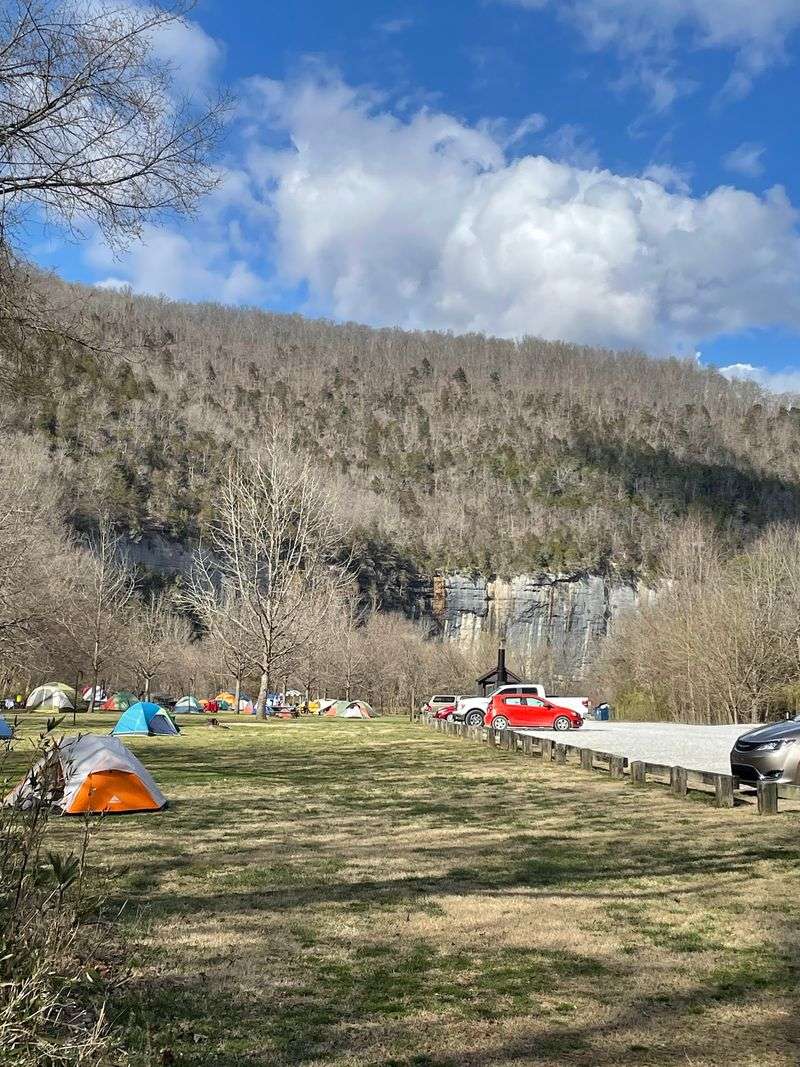
Roark Bluff rises dramatically behind Steel Creek Campground, and that backdrop alone is worth the drive on the steep, winding access road that keeps RVs out of the picture entirely. The National Park Service operates this riverside site about three miles east of Ponca, and it shows in the careful, low-impact setup.
Twenty-six tent-only sites and 13 equestrian sites are available by reservation, bookable up to six months in advance. Flush restrooms and potable water run from mid-March to mid-November, with vault toilets available during the off-season when camping becomes free of charge.
The Buffalo River Trail cuts directly through the campground, and Lost Valley is close by for day hikes. Deer and elk are spotted here regularly, making early mornings particularly rewarding for anyone who wakes up before the rest of the camp stirs.
2. Lost Valley Trailhead, Kingston, Arkansas
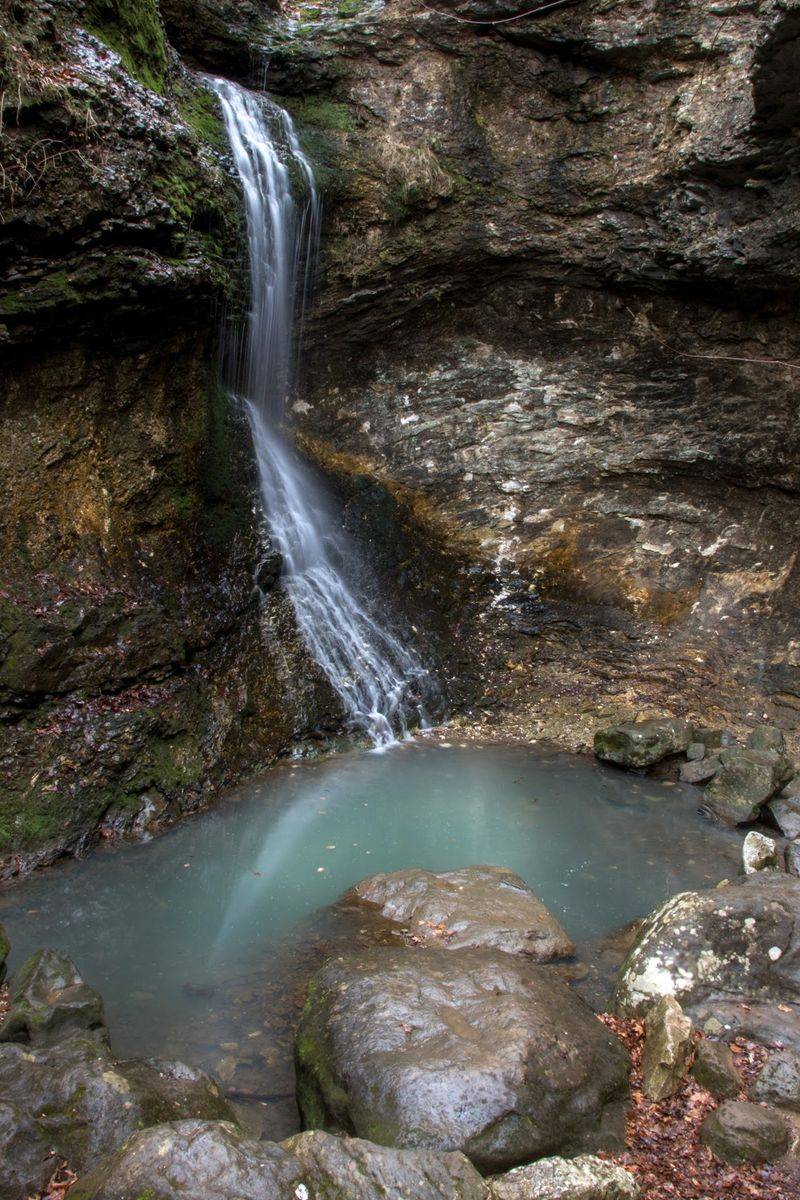
Clark Creek does most of the storytelling along this trail, carving its way through limestone and leaving behind a Natural Bridge, a cavernous bluff shelter, and a 53-foot waterfall called Eden Falls, all within about 2.5 miles of walking.
The first half mile is flat and accessible, following the creek through groves of American beech trees before the terrain shifts and the trail gets noticeably steeper and more rugged. Adventurous hikers who push past Eden Falls can enter the cave behind it, where a 25- to 35-foot interior waterfall waits roughly 200 feet inside, requiring a flashlight and some careful footing.
Lost Valley is a day-use-only destination, and dogs are not allowed on the trail except for documented service animals. Slippery rocks near the falls deserve real respect, as the area sees frequent search and rescue activity.
3. Blanchard Springs Caverns, Fifty-Six, Arkansas
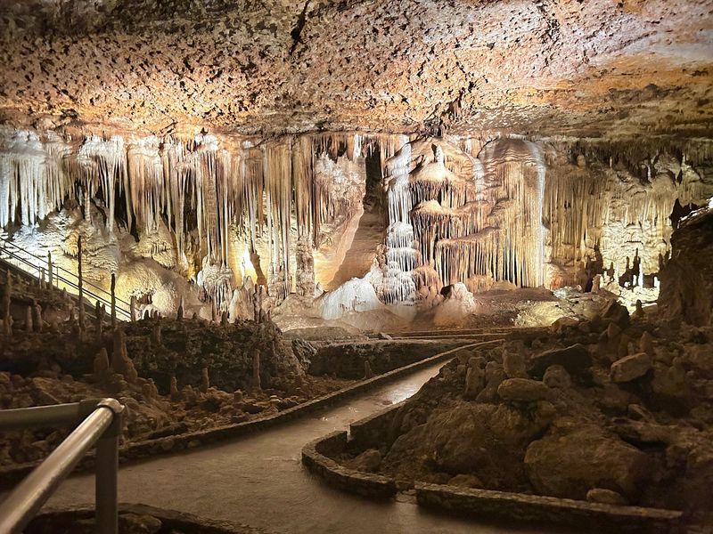
Going underground is a perfectly reasonable response to Arkansas summer heat, and Blanchard Springs Caverns gives you a very good reason to do it. This living cave system in the Ozark National Forest is the only federally owned tourist cave outside the National Park System, and it stretches more than eight miles through ancient limestone.
The Dripstone Tour covers about half a mile on a wheelchair-accessible path past towering columns and delicate soda straws. The Discovery Trail goes considerably deeper, logging 1.2 miles and nearly 700 steps for visitors ready to work a little harder for their geology.
A Wild Cave Tour is offered for those who want to crawl through red clay and experience the cave in its undeveloped state. Above ground, a spring feeds Mirror Lake, a trout pond surrounded by national forest land that keeps the whole outing feeling refreshingly far from the nearest traffic light.
4. Pedestal Rocks Scenic Area, Witts Springs, Arkansas
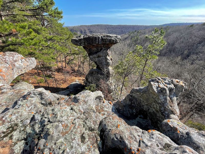
Millions of years of erosion produced something genuinely strange at this corner of the Ozark National Forest near Witts Springs. The sandstone here has been shaped into pedestal formations, narrow at the base and wider at the top, giving them the appearance of oversized stone mushrooms scattered across the forest floor.
Two loop trails start from the same trailhead. The Pedestal Rocks Loop runs 2.2 to 2.4 miles past the signature formations, natural bridges, and scenic overlooks, while the Kings Bluff Loop at 1.7 to 1.8 miles leads to a broad flat ledge above a deep valley.
When rainfall has been generous, Kings Bluff Falls drops 114 feet over that ledge, making it one of the tallest waterfalls in the Ozarks. Both trails are rated easy to moderate, though sections get steep and muddy, so sturdy shoes are a practical choice rather than an optional one.
5. Whitaker Point, Kingston, Arkansas
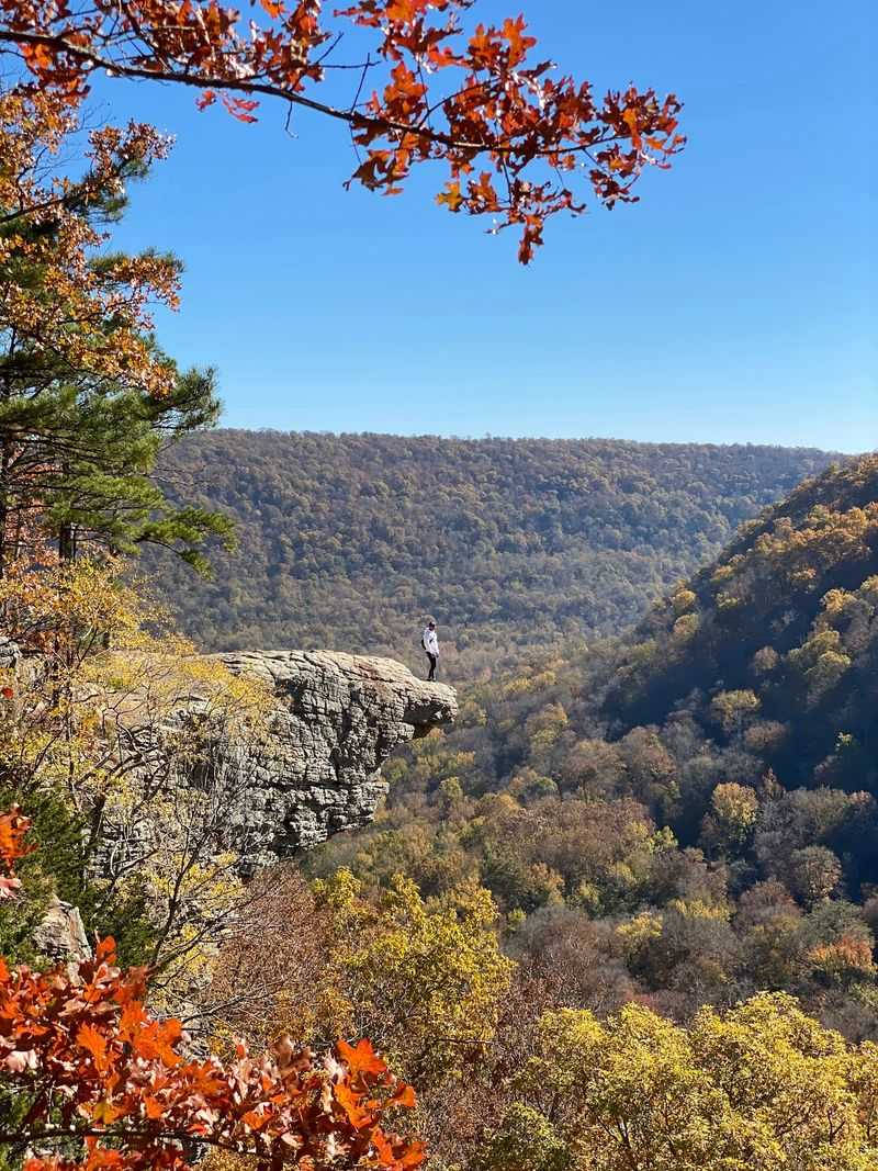
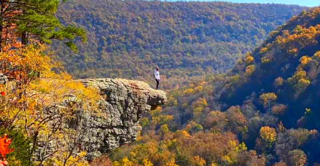
Few overlooks in the entire state earn as many photographs as Hawksbill Crag, the rocky ledge most people know as Whitaker Point. The formation juts out above a sweeping stretch of forested valley in the Upper Buffalo Wilderness, and the drop on all sides is enough to make your stomach do a quick reality check.
The trail is a 2.7- to 3-mile out-and-back route starting on County Road 5, an unpaved and winding road that keeps casual visitors to a minimum. Elevation gain runs about 321 to 413 feet, mostly downhill on the way in and uphill on the way out.
Arriving early on a weekday is a smart move, since parking is limited and the crag draws steady crowds on sunny weekends. Dogs are welcome on a leash, but drone flights are not permitted here.
6. Sams Throne, Mount Judea, Arkansas
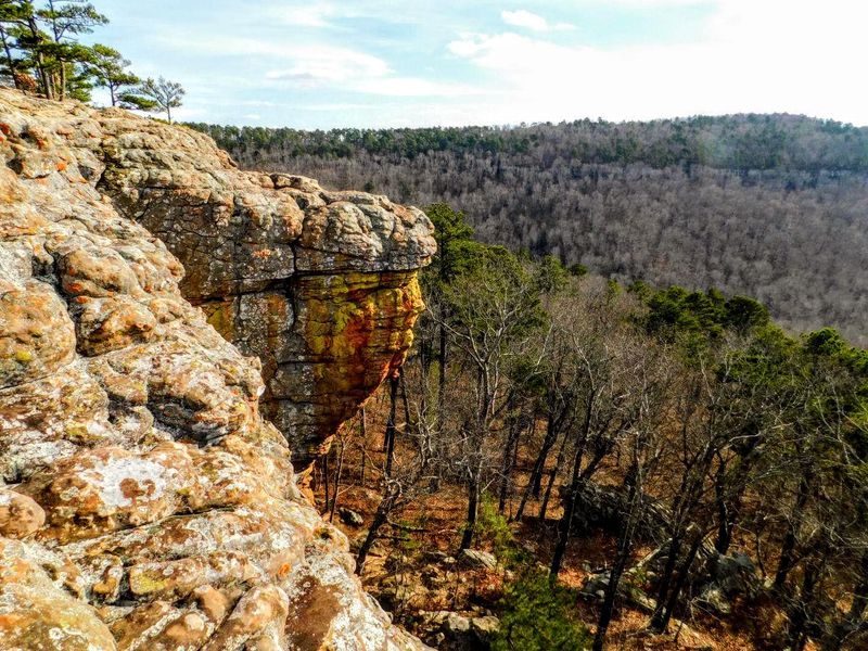
Named after a local legend named Sam Davis, this sandstone outcrop in the Ozark-St. Francis National Forest has enough personality to justify the name. The formation rises well above the surrounding forest and delivers broad views across the Big Creek valley that feel genuinely earned once you are standing on the edge.
Rock climbers know this place well, with over 100 named routes on Atoka sandstone caprock ranging from beginner-friendly to seriously technical. Hikers who have no interest in vertical pursuits can still enjoy the main loop trail, which runs 2.5 to 3.9 miles through bluff-line terrain with glimpses of caves, springs, and seasonal wildflowers along the way.
Primitive campsites are available, and a vault toilet sits near the parking area. The access road via Highway 123 is steep and unsuitable for RVs or trailers, which keeps the crowd size manageable and the atmosphere refreshingly unhurried.
7. Hemmed-In Hollow Falls, Compton, Arkansas
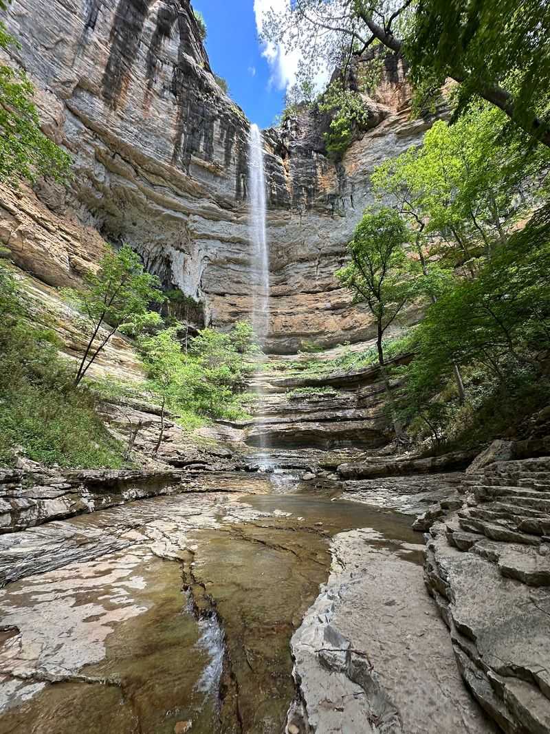
At 204 to 210 feet, Hemmed-In Hollow Falls holds the title of tallest waterfall between the Rocky Mountains and the Appalachians, which is a fact worth pausing on before you start the hike in. The falls drop into a narrow box canyon enclosed on three sides by towering bluffs, creating one of the most secluded pockets of scenery in the entire Buffalo National River wilderness.
Getting there from the Compton Trailhead means covering roughly 5.1 to 6 miles round trip with an elevation change of 1,180 to 1,400 feet. The descent is mostly manageable, but the climb back out is notoriously steep and demands a realistic time estimate of four to six hours for the full outing.
The Compton Trailhead has limited parking and no restroom facilities, so planning ahead matters. Dogs are not permitted on this trail, and the waterfall’s flow peaks in late winter and early spring following significant rainfall.
8. Kings River Falls Natural Area, Witter, Arkansas
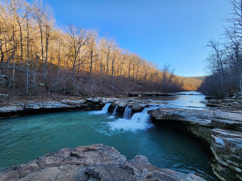
A shelf waterfall six to ten feet tall might not sound dramatic on paper, but Kings River Falls spreads across a broad rock ledge and feeds one of the most inviting swimming holes in the Arkansas Ozarks. The Kings River maintains a reliable flow through most of the year, making the falls consistently photogenic regardless of the season.
The trail to reach them is a 1.5- to 2-mile out-and-back route through mixed hardwood forest, following Mitchell Creek before paralleling the river itself. Small caves and grottos appear along the way, giving curious hikers a few extra reasons to slow down and look around.
No restrooms or cell service are available at the trailhead, and access requires navigating dirt and gravel roads. Dogs are welcome on leash, and the natural area designation means the local plants and wildlife receive strong protection from visitor impact.
9. Gunner Pool Recreation Area, Fifty-Six, Arkansas
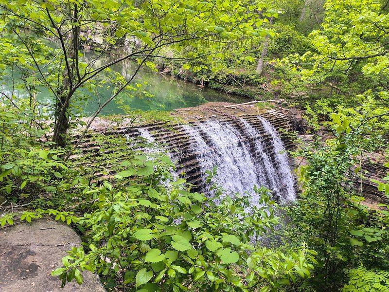
The Civilian Conservation Corps built the stone dam at Gunner Pool back in the 1930s, and the swimming hole it created has been drawing visitors ever since. The water takes on a distinctive blue-green color from dissolved limestone and minerals, making it look almost tropical despite being firmly planted in the Arkansas Ozarks.
Twenty-seven campsites are available on a first-come, first-served basis year-round, with no electrical or water hookups at individual sites. Central water spigots operate seasonally from April to November, and vault toilets serve the campground throughout the year.
Access comes via a three-mile gravel road that is steep, winding, and genuinely unsuitable for large RVs or trailers. Cell service is essentially nonexistent here, which, depending on your perspective, is either a minor inconvenience or the whole point of the visit. The Sylamore Hiking Trail connects directly from the campground into a broader trail network.
10. Withrow Springs State Park, Huntsville, Arkansas
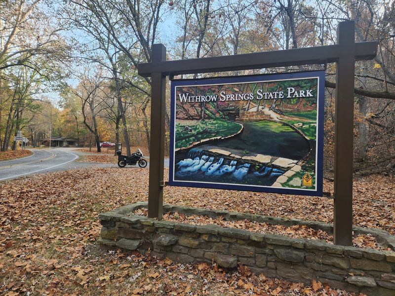
The spring that gives this park its name does something unusual: it emerges from a cave at the base of a limestone bluff, flows into a pond, and then spills over a ledge before joining War Eagle Creek. That sequence of water features, all within a compact 786-acre park near Huntsville, gives the place a layered natural character that rewards slow exploration.
Twenty-nine Class AAA RV sites with full hookups and ten walk-in tent sites make up the campground, all supported by modern bathhouses. Over three miles of hiking trails cover creek-side paths, bluff overlooks, and an old roadway converted to a forest trail.
War Eagle Creek is a Class I paddling stream with seasonal canoe and kayak rentals available through the park. Fishing draws visitors to both the creek and a small pond stocked with rainbow trout, and the park’s varied habitat supports deer, wild turkeys, foxes, and river otters.
11. Lake Fort Smith State Park, Mountainburg, Arkansas
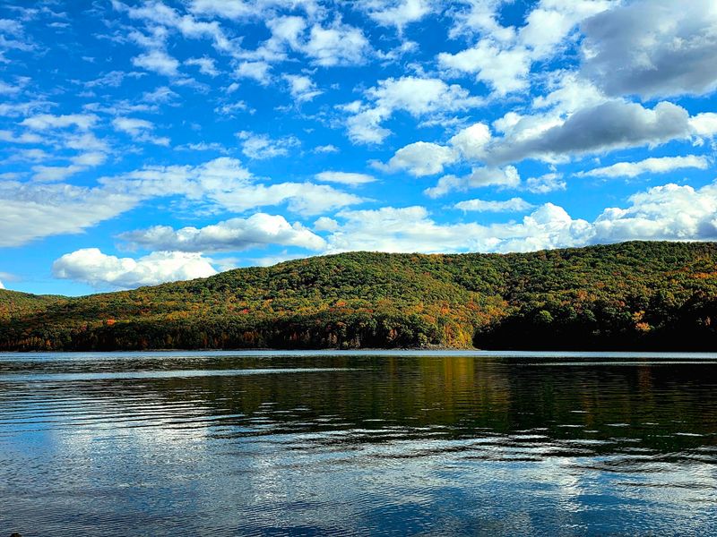
Sitting at the western edge of the Ozark National Forest near Mountainburg, Lake Fort Smith State Park has an interesting backstory: it began as a Fort Smith city park in the 1930s, closed in 2002 for a major dam expansion, and reopened in 2008 at an entirely new location on the enlarged 1,400-acre lake.
The park serves as the western terminus of the Ozark Highlands Trail, a 165-mile National Recreation Trail that cuts through some of the most rugged and scenic terrain in the region. Ten rental cabins, including dog-friendly and barrier-free options, offer full kitchens and private decks for visitors who prefer a roof overhead.
Twenty Class AAA campsites with full hookups and ten Class B sites with water and electric round out the lodging options. Kayaking, canoeing, fishing, and mountain biking are all available within the park, and a visitor center provides trail maps and lake views in equal measure.
12. Devil’s Den State Park, West Fork, Arkansas
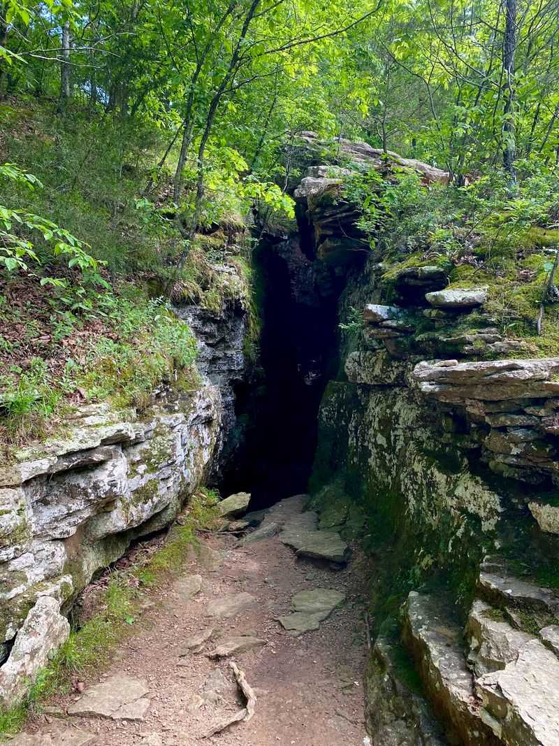
Devil’s Den earned its name honestly. The park contains the largest sandstone crevice area in the United States, with roughly 60 crevice caves formed when massive sandstone blocks fractured and slid into the valley thousands of years ago. The 550-foot Devil’s Den Cave is the centerpiece of a landscape so geologically unusual that it holds a spot on the Arkansas Natural Heritage Commission’s Registry of Natural Areas.
The Civilian Conservation Corps developed the park beginning in 1933, and their stonework, including original cabins and a dam forming 8-acre Lake Devil, still stands as some of the most intact CCC construction in the country. About 64 miles of trails accommodate hikers, mountain bikers, and equestrians across a 2,200-acre landscape in the Lee Creek Valley.
Seventeen full-service cabins with kitchens and fireplaces, nine camper cabins, and over 140 campsites provide plenty of overnight options. Northwest Arkansas cities are not far away, but the narrow valley swallows that fact quickly.
13. Mount Magazine State Park, Paris, Arkansas
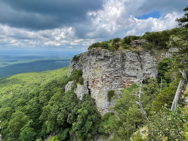
Arkansas tops out at 2,753 feet, and that high point belongs to Mount Magazine, a flat-topped mesa near Paris that rises well above the surrounding landscape of the Ozark-St. Francis National Forests. The views from the bluff edges stretch across the Petit Jean River Valley and Blue Mountain Lake, covering enough ground to make the drive feel immediately worthwhile.
Over 14 miles of trails handle hiking, mountain biking, and technical rock climbing on sandstone bluffs, while designated hang gliding launch areas attract a more aeronautically inclined crowd. Wildlife watchers can search for rare species including the rufous-crowned sparrow and the Magazine Mountain shagreen snail, a threatened land snail found nowhere else on earth.
The Lodge at Mount Magazine offers 60 guest rooms, a restaurant with panoramic views, and an indoor swimming pool. Thirteen fully equipped cabins with fireplaces and private decks round out the lodging options for those who want to spend more than a single afternoon on top of Arkansas.
Share this story