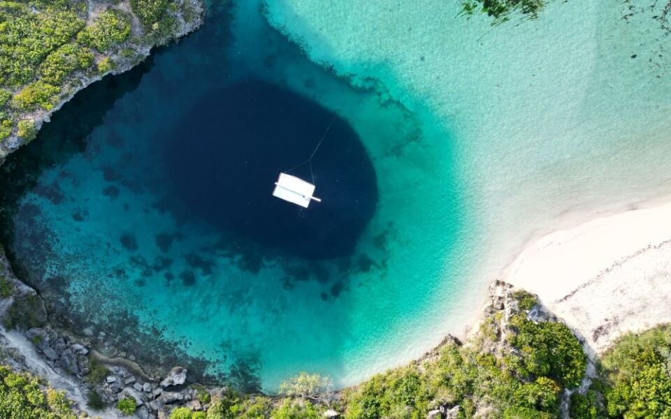
Some holes in the ground are tiny drilled shafts, while others are giant pits you can spot from space. Some are caves that twist down through whole mountains, and others are sinkholes where the ground simply gave way.
Each one tells a story about rock, water, and human curiosity. Here are thirteen of the most amazing descents on the planet, and they are not ranked like a race, since each is measured in its own way.
Kola Superdeep Borehole, Russia
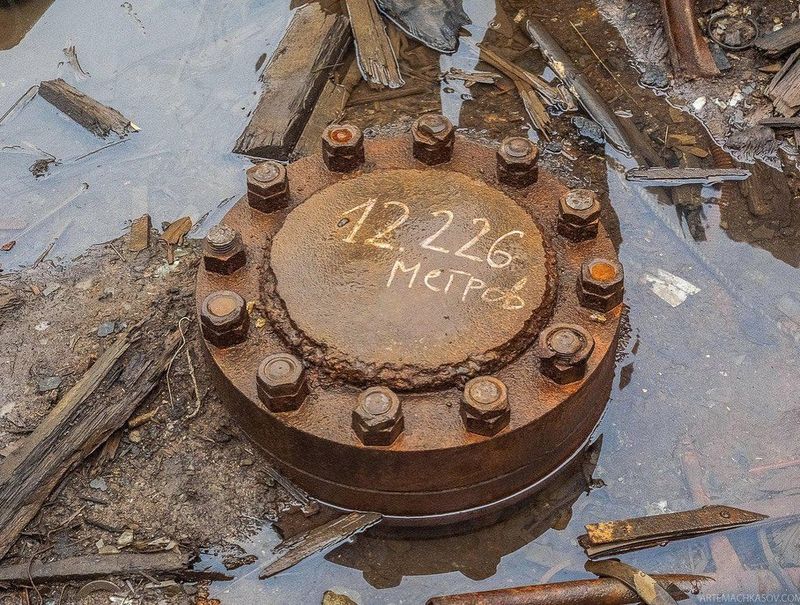
Nine inches wide and 7.6 miles deep. That is the strange shape of the Kola Superdeep Borehole, the deepest hole humans have ever drilled, reaching 12,262 meters on Russia’s Kola Peninsula.
Soviet scientists started drilling in 1970. They wanted to study the continental crust directly instead of guessing from seismic readings.
It was a bold plan, and it paid off with surprises.
The drill never came close to the mantle. Still, it cut through rocks more than 2.5 billion years old.
Scientists also found fractures and fluids at depths where nobody expected them.
Then came the heat. Temperatures near the bottom topped 200 degrees Celsius, much hotter than predicted.
Drilling tools struggled in that oven, and further progress became extremely hard.
Today the site is quiet. A metal cap covers the opening, and the wind howls across the peninsula.
Beneath that small lid lies a record that has stood for decades, a narrow slice of Earth’s deep past that people actually touched.
German Continental Deep Drilling Borehole, Germany
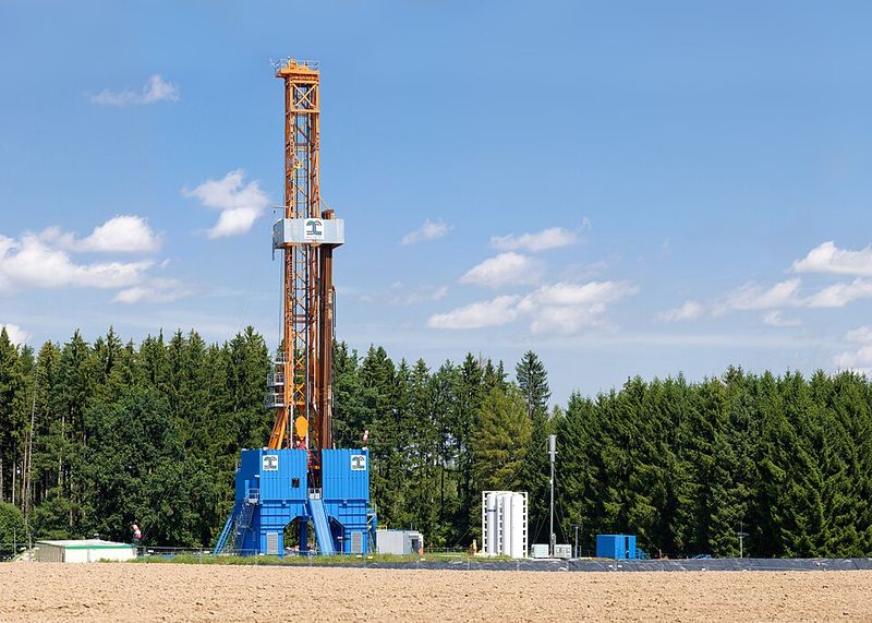
Bavaria hides a tower that looks like a rocket gantry but points the other way. Near Windischeschenbach, German scientists drilled into the crust through the KTB program.
The team first drilled a pilot hole of 4,000 meters. Then they started a much deeper main borehole.
After 1,468 days of work, that second shaft hit 9,101 meters in October 1994.
Researchers used the hole as a giant laboratory. They studied crustal stress, fluids, rock types, and how seismic readings match what is really down there.
Guesses finally met real samples.
The bottom was hot, with temperatures around 265 degrees Celsius. That heat shows how quickly Earth warms as you go down.
When the project ended, the huge drilling tower stayed. It now stands beside a geoscience center, where visitors can learn how the experiment worked.
A machine built for digging became a classroom, and it is pretty cool to see.
Mponeng Gold Mine, South Africa
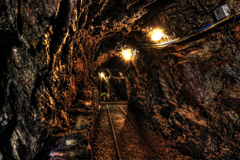
Imagine a commute that starts with an elevator ride measured in kilometers. At Mponeng, workers travel through several stages of shafts to reach rock far below the surface.
A technical report from AngloGold Ashanti described mine development reaching 3,841 meters below mine datum. Plans at the time called for going even deeper than four kilometers.
The mine sits west of Johannesburg. It started producing in the 1980s under its older name, Western Deep Levels.
Here is the catch. Rock gets hotter with depth, so cooling and ventilation are not luxuries.
They keep people alive and machines running.
Moving workers, air, and equipment through multiple stages takes serious planning. Scientific boreholes may go deeper, but they only send instruments down.
Mponeng sends people, and that is a whole different challenge.
Going deep, it turns out, is less about digging and more about building a safe little world inside the rock, where heat, pressure, and distance never stop pushing back.
Veryovkina Cave, Georgia
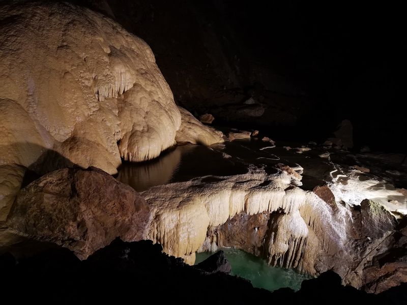
Twelve days. That is how long the record-setting 2018 expedition spent in Veryovkina Cave, reaching 2,212 meters (7,257 feet) below the entrance.
The feat earned a Guinness World Record for the deepest known cave. The cave sits in the Arabika Massif of the Gagra range in the Caucasus.
Nothing here was drilled. Cavers must climb down on ropes through shafts, passages, chambers, and streams.
Every meter is earned by muscle and patience.
The team also collected samples of tiny animals adapted to life in total darkness. These creatures survive where sunlight never arrives, which makes them a treasure for scientists.
Only a handful of caves come anywhere near two kilometers of vertical depth. Veryovkina shows what happens when groundwater spends ages dissolving limestone.
Slowly, it carves a hidden drainage system inside a mountain, and brave explorers finally get to follow the water’s path.
Krubera Cave, Georgia
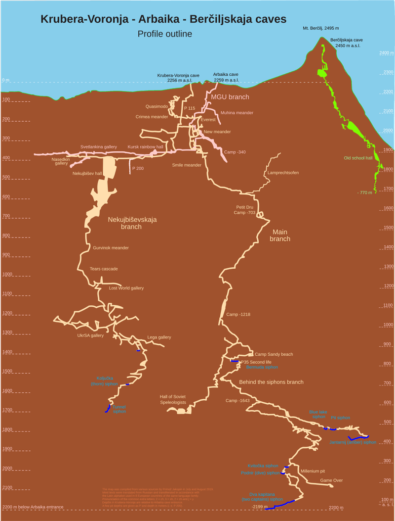
Silver medal in the cave depth race, but a gold medal for legend. Krubera Cave once held the title of deepest known cave before Veryovkina passed it.
Explorers documented a depth of 2,197 meters. That made it only the second cave system known to go beyond two kilometers straight down.
Odd twist: it sits in the same Arabika Massif as Veryovkina. That is no accident.
Thick limestone, heavy rain, melting snow, and big changes in elevation let water carve extremely deep tunnels. The Caucasus turned out to be perfect karst country.
Exploring Krubera took repeated expeditions. Teams set up underground camps, used technical diving, and slowly found passages leading farther down.
Cave records work differently from mountain heights. Reaching the bottom can mean days of climbing, crawling, rope work, and wading through water.
It is hardly a simple elevator drop, and that effort is part of why the number matters so much.
Bingham Canyon Mine, Utah
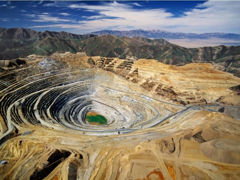
Picture a mountain turned inside out. That is how Bingham Canyon Mine looks from above, with giant stepped terraces circling down into the earth.
The Utah copper mine is more than 4 kilometers across and roughly 1.2 kilometers deep. Guinness has recognized it as the world’s deepest open-pit mine.
Large-scale production began in the early 20th century. Generations of digging carved the layered steps visible today.
Size brings trouble. In April 2013, about 65 to 70 million cubic meters of rock and debris slid down one wall.
The landslide was big enough to show up on seismic instruments.
Rio Tinto still runs the mine. It also offers a seasonal visitor experience at an overlook, so people can stand on the rim and stare into the pit.
Seeing it in person is a humbling moment. Trucks that look enormous up close shrink to toys at the bottom.
Xiaozhai Tiankeng, China
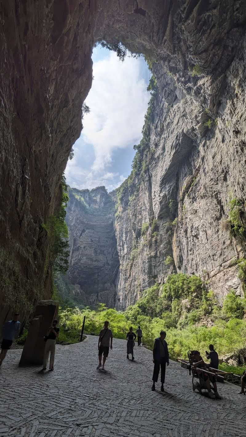
“Heavenly pit” is what the Chinese word tiankeng roughly means, and Xiaozhai earns the name. UNESCO documents a maximum depth of about 662 meters.
The opening is roughly 537 to 626 meters across. At the bottom, an underground river passes through.
Tiankengs are giant, steep-walled karst depressions. They appear when huge underground chambers or rivers become exposed to the surface.
Xiaozhai has a two-level design. The upper elliptical depression is around 320 meters deep.
Below it, a lower shaft drops another 342 meters or so.
Standing at the rim, a visitor feels the ground simply vanish. Mist can drift across the opening, and the far wall looks almost unreal.
The size is hard to grasp. The void is comparable in height to some of the tallest skyscrapers on Earth.
Water and limestone, given enough time, can build something that large without any tools at all.
Dashiwei Tiankeng, China
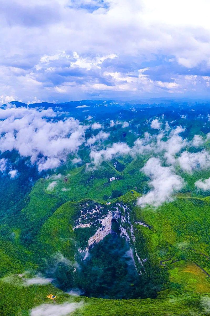
Sixteen years into the new century, a team strapped on harnesses and rappelled about 600 meters into Dashiwei. That 2016 expedition is described in a UNESCO account.
Dashiwei sits in Guangxi, in a part of China packed with giant sinkholes. The country has an exceptional share of them.
UNESCO notes that roughly 300 tiankengs have now been identified. Clusters like this make southern China a dream destination for geologists.
These pits are more than bare holes. Steep walls can cut off forests and living communities from the world above.
Inside, scientists hunt for rare plants, animals, and microbes.
That isolation creates tiny habitats with their own weather and wildlife. A pit that looks empty from the rim can be crowded with life below.
Dashiwei also reminds us that a hole is sometimes just an entrance. Underneath may lie a larger system shaped by rivers and millions of years of dissolving limestone.
Mir Diamond Mine, Russia
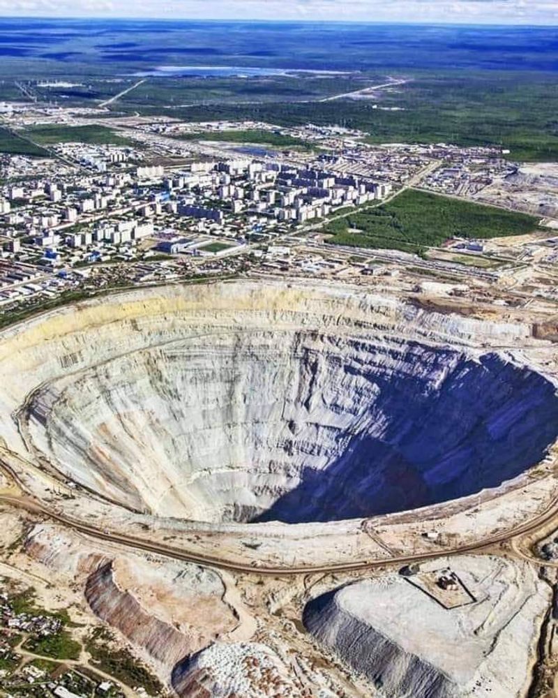
Siberian winter, frozen ground, and a pit so big that helicopters once had to be careful near it. The Mir mine at Mirny is among the most dramatic mining scars anywhere.
ALROSA records the former open pit at 525 meters deep. Open-pit mining ran from 1959 until 2001, then work moved underground.
The target was a kimberlite pipe, a narrow volcanic channel holding diamonds. It was part of a huge Soviet push to build a homegrown diamond industry in Yakutia.
Digging gradually made a giant circular pit. The city of Mirny grew up around it to support the workers.
Engineers faced harsh problems. Brutal cold and permanently frozen ground made every task harder.
Surface mining has ended, but the empty pit still stands. It shows just how much rock had to be removed to follow one slim pipe toward valuable stones far below.
Berkeley Pit, Montana
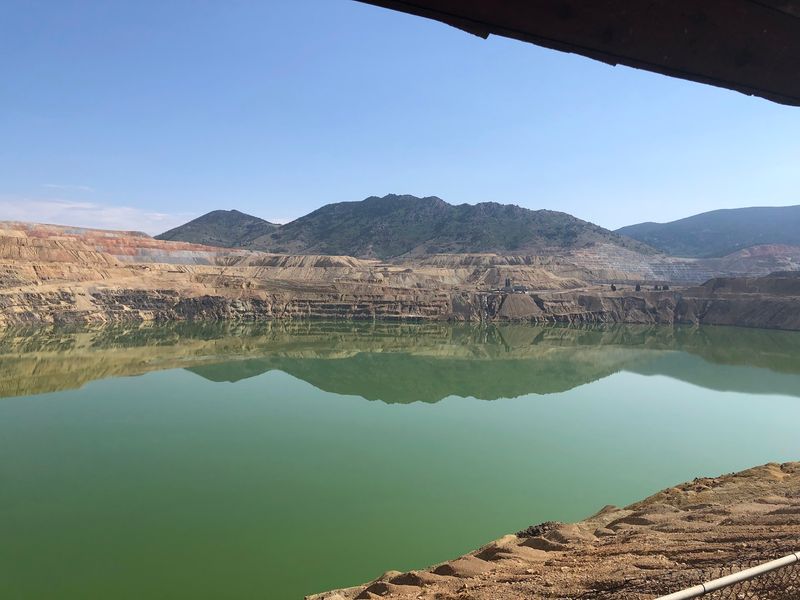
Here is a lake that no fish would choose. Berkeley Pit in Butte, Montana, is filled with acidic, metal-rich water.
It began as an open-pit copper mine in 1955. The U.S.
Environmental Protection Agency describes it as about 1,600 feet, or roughly 488 meters, deep.
Mining stopped in 1982. After that, groundwater started flooding the abandoned pit.
The water is highly acidic and salty. It forms when water meets exposed mineral-rich rock and pulls out metals and other contaminants.
Today the pit is one of the best-known mining cleanup challenges in the country. The EPA runs monitoring and water treatment, and bird-protection efforts help keep wildlife safe.
The lesson is a bit sobering. Digging a deep hole is only chapter one.
When the machines go quiet, geology and groundwater keep working on the empty space, sometimes for generations.
Kimberley Big Hole, South Africa
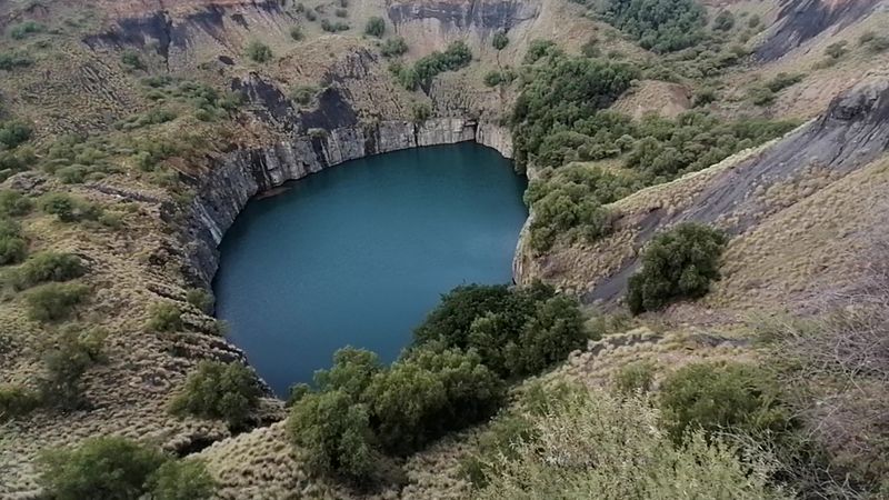
Thousands of prospectors, picks, and shovels. That was the recipe for the Big Hole at Kimberley, born in South Africa’s diamond rush of the late 19th century.
South African Tourism gives the pit a depth of about 225 meters. It covers 17 hectares and has a perimeter of roughly 1.6 kilometers.
Mining here ended in 1914, after the lower parts flooded. Water now fills the bottom of the huge cavity.
Many people call it the world’s largest hand-dug excavation. That title reflects the massive human labor of the early diamond fields, even though later industrial mining also shaped the site.
A hill once stood where the pit is now. Diggers carried it away piece by piece as they chased sparkling stones.
Visitors today can walk a museum and step onto a viewing platform. Looking down, it is easy to picture the wild rush that created this giant bowl.
Dean’s Blue Hole, The Bahamas
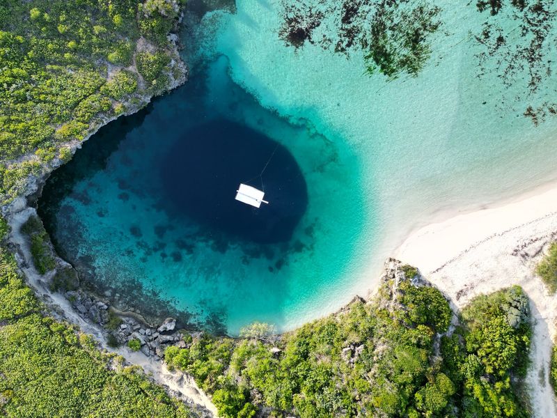
From the beach, it looks like a dark puddle in a turquoise sea. Then you learn that Dean’s Blue Hole plunges about 663 feet, or 202 meters.
The Bahamas tourism authority calls it one of the deepest blue holes in the world. It is also a magnet for freedivers.
Blue holes are flooded karst cavities. They formed when limestone land was exposed during low sea levels, then drowned as the oceans rose.
Dean’s has a fairly narrow opening near shore. Below the surface, it widens a lot, like a giant underwater bottle.
That shape and the calm water around it have made it famous for deep freediving. Athletes come from all over to test their limits on a single breath.
Beauty can hide risk, though. Extreme-depth diving takes serious training, so casual swimmers should stay near the surface and simply enjoy the glowing color.
Great Blue Hole, Belize
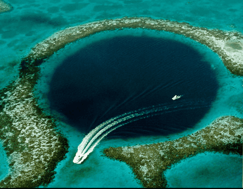
Seen from a plane, it looks like the sea has a giant dark eye. Belize’s Great Blue Hole sits in Lighthouse Reef Atoll and forms an almost perfect circle.
Belize’s tourism authority measures it at roughly 1,000 feet, or 300 meters, across. It is more than 400 feet, or 120 meters, deep.
The story began on dry land. During the Ice Age, sea levels were much lower, and the site was a limestone cave.
As the oceans rose, the cave flooded. Parts of its roof collapsed, leaving the giant marine sinkhole we see now.
Divers who descend find steep walls and ancient stalactites. Those formations grew in open air long ago, which is strong proof of how much the environment has changed.
The Blue Hole is protected inside the UNESCO-listed Belize Barrier Reef Reserve System. It is a fitting finale for a list of holes, since this one is also a time machine.
Share this story