Montana is famous for wide-open spaces and dramatic scenery, but you do not need to log ten miles to earn a view worth remembering. Some of the state’s most striking destinations sit just a short walk from the trailhead, packed with history, geology, and cultural stories that stretch back centuries.
From sacred Blackfeet landmarks to ancient cedar groves and caves covered in 2,000-year-old rock art, these trails punch well above their weight. Whether you have an hour or an afternoon, each of these 13 hikes delivers a payoff that feels completely out of proportion to the distance traveled.
1. Ousel Falls Trail, Big Sky, Montana
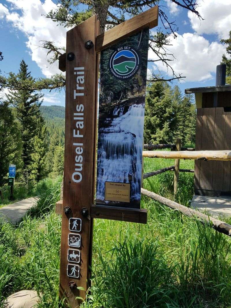
The Gallatin Canyon has been a travel corridor for thousands of years. Blackfeet, Nez Perce, Crow, and Shoshone peoples established camps along the Gallatin River long before Meriwether Lewis and William Clark named it in 1805, honoring Secretary of Treasury Albert Gallatin.
Homesteading arrived in the late 1890s, and Augustus Franklin Crail built Big Sky’s first ranch in 1901. That property eventually became the site of the Big Sky Golf Course, with its historic buildings now listed on the National Register of Historic Places.
The Ousel Falls Park itself is a product of community effort. The Big Sky Community Organization acquired and developed it in 2003.
The waterfall’s name comes from the American Dipper, a small dark bird known for bobbing at the water’s edge, a fitting mascot for a trail built on neighborly determination.
2. Trail of the Cedars, West Glacier, Montana
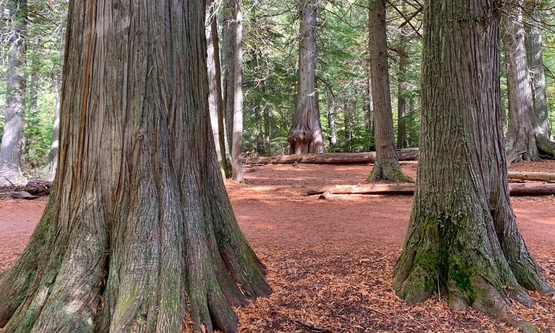
Some of the western red cedars along this 0.9-mile loop are over 500 years old, with a few potentially nearing 1,000 years. That means certain trees were already mature when Columbus was still crossing the Atlantic.
The Kootenai people harvested cedar bark here for baskets and shaped its wood into canoes, recognizing the material value of this forest long before it became a national park attraction. The grove forms part of a rare temperate interior rainforest ecosystem, a striking outlier in a state better known for dry plains and high alpine terrain.
The trail holds a notable place in park history as one of Glacier’s earliest handicap-accessible routes. Boardwalk sections were repaved in 2015 using polymer pavement to meet federal accessibility standards, reflecting how the park has worked to open its best scenery to the widest possible audience.
3. Kootenai Falls and Suspension Bridge Trail, Libby, Montana
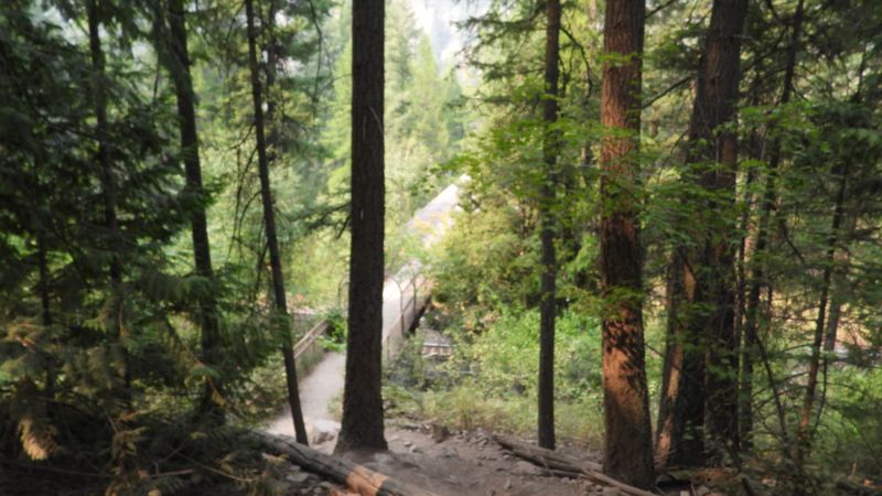
For the Kootenai Tribe, these falls are considered the center of the world, a sacred site used for spiritual practice for centuries before European contact. Canadian explorer David Thompson followed Kootenai-built cairns to portage around the falls in the early 1800s, relying entirely on indigenous knowledge to navigate the river.
The original suspension bridge was built in 1937 by the Civilian Conservation Corps to give Forest Service firefighters a way across the river. A flood in 1948 took out that wooden structure, and it was rebuilt in the 1950s with concrete towers, a design that has survived largely because the Libby Dam, completed in 1975, now controls water levels downstream.
Hollywood discovered the falls in the 1990s. The site served as a filming location for the 1994 thriller “The River Wild” and again for the 2015 epic “The Revenant,” adding a pop culture chapter to an already rich history.
4. Drinking Horse Mountain Trail, Bozeman, Montana
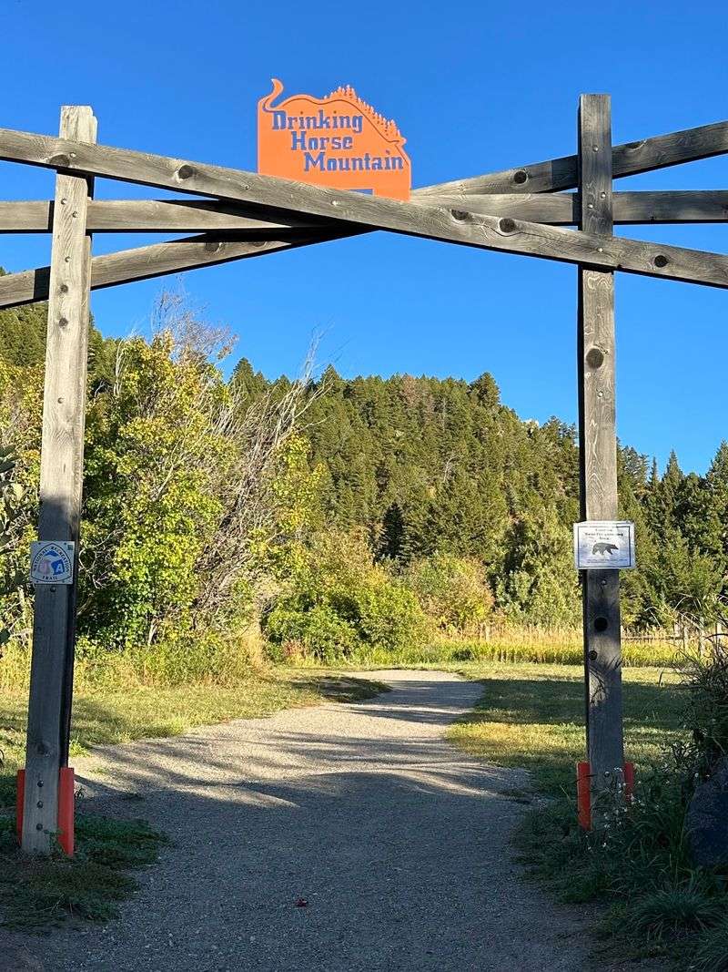
This 2.1-mile loop outside Bozeman did not exist until 2009, making it one of the newer entries on this list. Its creation was the result of an eight-year campaign by the Gallatin Valley Land Trust and local partners who worked through permitting, funding, and construction to make it happen.
The mountain’s name comes from a simple visual trick. When seen from Bridger Canyon Road, the hill’s silhouette looks remarkably like a horse bending down to drink from Bridger Creek below.
The land was privately owned before being donated to the U.S. Fish and Wildlife Service for permanent public use.
A standout feature along the route is the Kevin Mundy Memorial Bridge, a covered wooden structure spanning Bridger Creek. It was dedicated to a beloved Bridger Bowl ski patroller and was intentionally designed with seating so it could serve as an outdoor classroom for visiting school groups.
5. Palisade Falls Trail, Livingston, Montana
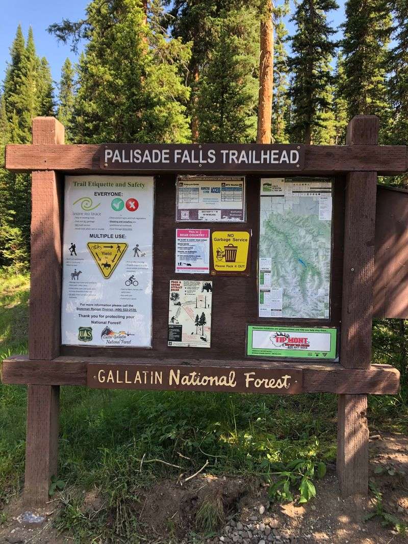
Not every trail needs a complicated backstory to justify the trip. Palisade Falls makes its case with pure geology: an 80-foot column of water dropping straight down a sheer rock wall that was shaped by forces active long before humans arrived in the region.
The trail itself is largely paved, a deliberate design choice that reflects a modern commitment to accessible outdoor recreation. That accessibility has made it one of the most visited short hikes near Bozeman, drawing visitors who might not otherwise attempt a mountain trail.
The Hyalite Recreation Area surrounding the falls has been a recreational anchor for the Gallatin Valley for decades. The cool, wooded setting along the approach provides a reliable escape from summer heat, and the waterfall’s sheer scale consistently surprises first-time visitors who underestimate what half a mile of walking can deliver.
6. Ross Creek Cedars Nature Trail, Heron, Montana
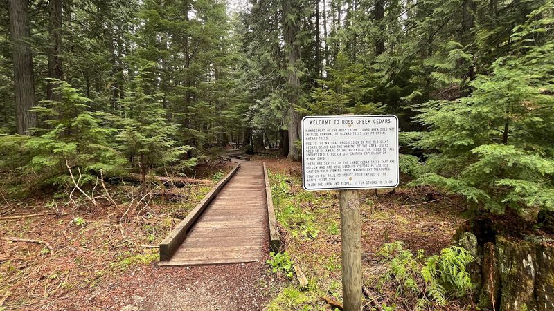
Some trees in this 100-acre grove are estimated to be 1,000 years old, which means they were already centuries old when the first European explorers reached North America. The U.S.
Forest Service officially designated this a Scenic Area in 1959, but the Kootenai, Salish, and Pend d’Oreilles peoples had been harvesting bark and wood from these cedars for nearly 8,000 years before that.
The grove thrives in a low-elevation, damp microclimate that creates conditions more typical of the Pacific Northwest than inland Montana. That ecological quirk is precisely why the trees reached such extraordinary dimensions, with trunks that take multiple adults to encircle.
The preservation of this grove in the mid-20th century was driven partly by local loggers who recognized its irreplaceable value. Ross Creek itself was named after two brothers who prospected for gold and silver in the area during the 1930s, a brief but colorful chapter in the forest’s longer story.
7. Hidden Lake Overlook Trail, West Glacier, Montana
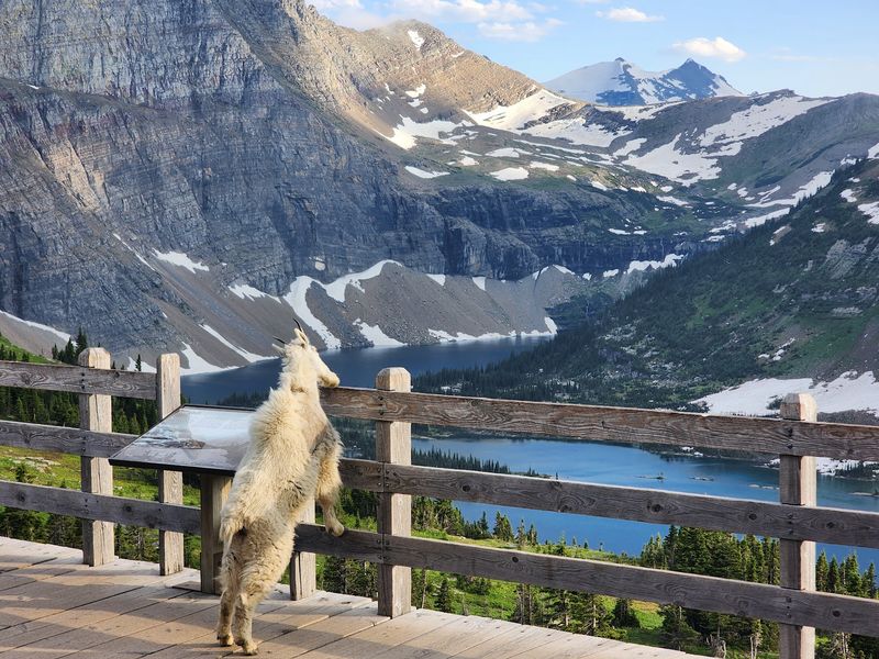
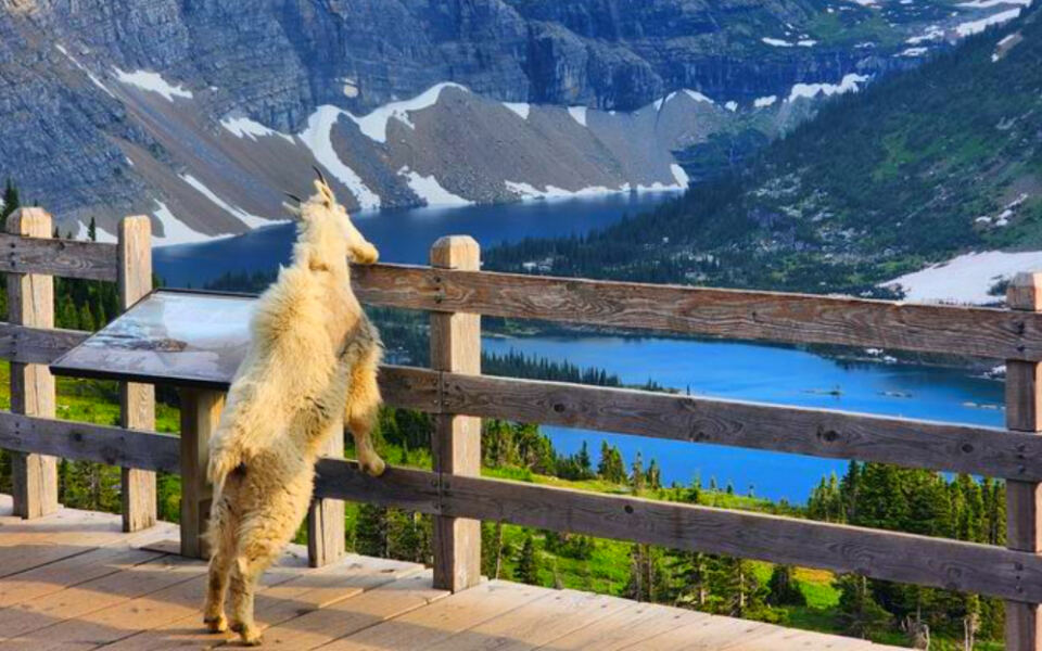
Logan Pass carries a history as layered as its geology. Long before tourists lined up at the visitor center, Native American tribes navigated this rugged corridor through the Rockies, relying on snowshoes and ropes where horses could not go.
The pass was named for Major William R. Logan, Glacier National Park’s first superintendent, who helped build the ranger force between 1910 and 1912.
The real game-changer arrived in 1932 with the completion of Going-to-the-Sun Road, an engineering project that made Logan Pass accessible to ordinary travelers for the first time.
A lesser-known fact is that the Great Northern Railway built a 16-mile trail through this area between 1917 and 1918 to connect its network of backcountry chalets. That route faded from public memory by the 1960s, with its western section absorbed into the Highline Trail.
8. Running Eagle Falls Nature Trail, East Glacier Park, Montana
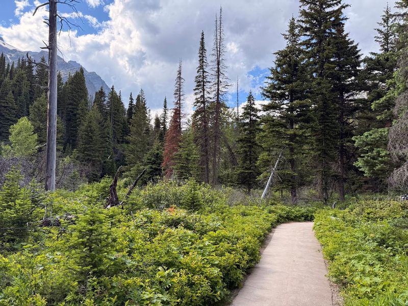
Pi’tamaka, whose name translates to Running Eagle, was a 19th-century Blackfeet woman who mastered hunting and combat skills traditionally held by men. She rescued her father under enemy fire, earned the right to sing the Victory Song, and was ultimately granted the male warrior name Running Eagle, an honor with almost no precedent in Blackfeet history.
Near these falls, she completed a vision quest that confirmed her warrior path and included a vow never to marry. The Two Medicine Valley where the falls sit ranks as the second most sacred site within Glacier National Park for the Blackfeet Nation, behind only Chief Mountain.
The waterfall itself earns the nickname Trick Falls because its appearance changes with water levels. In spring, water pours over an upper ledge.
Later in the season, it seems to emerge directly from an opening in the rock face, a geological quirk that still surprises visitors who have read about it in advance.
9. Pictograph Cave State Park Trail, Billings, Montana
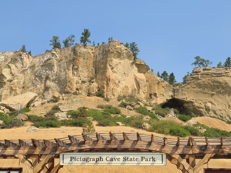
More than 100 pictographs cover the walls of these three sandstone caves, with the oldest confirmed image, a drawing of a turtle, dating back over 2,100 years. More recent paintings, some only around 200 years old, depict rifles and horses, documenting the moment European trade goods entered the cultural vocabulary of the region’s inhabitants.
Archaeological excavations funded by the Works Progress Administration between 1937 and 1941 recovered over 30,000 artifacts from the site. Among them were seashell beads acquired from Pacific Coast tribes and harpoon points associated with Arctic cultures, evidence of trade networks spanning thousands of miles.
Public interest during those Depression-era digs was intense enough that a small museum was built on-site to handle more than 10,000 visitors. Today the site is a National Historic Landmark, and binoculars remain the best tool for spotting the surviving pictographs on the cave walls from the trail below.
10. Cap Rock Nature Trail, Glendive, Montana
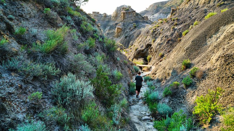
Makoshika State Park covers more acres than any other state park in Montana, and the Cap Rock Nature Trail condenses its most dramatic features into a single one-mile loop. Rills, pinnacles, balanced caprocks, and a natural bridge appear along the route, offering a concentrated lesson in what millions of years of erosion can accomplish.
Glendive itself emerged in 1881 as a Northern Pacific Railway division point, serving as a hub for ranching, agriculture, and steamboat traffic on the Yellowstone River. The name likely derives from a Scottish rendering of words meaning valley and steep riverbank, a description that still fits the terrain.
In 1855, Irish sportsman Sir George Gore reportedly named Glendive Creek during a hunting expedition in which he claimed thousands of bison and elk. The region also experienced a short-lived oil boom in the early 1950s.
The badlands, however, outlasted every economic chapter the area has seen.
11. Natural Bridge Falls Trails, Big Timber, Montana
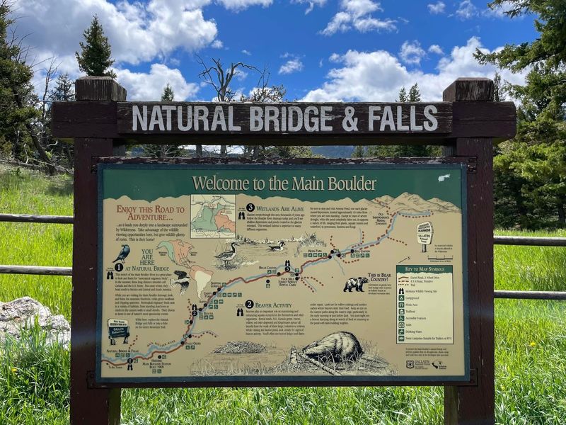
William Clark recorded the confluence of the Boulder River and Big Timber Creek with the Yellowstone during his 1806 return journey, calling it Rivers Across in his journal and naming the creek after the unusually large cottonwood trees at its mouth. That observation stuck, and the name Big Timber eventually transferred to the town that grew up nearby.
The settlement began in 1882 as Dornix, a Gaelic word for smooth flat stones, established around a planned Northern Pacific Railroad stop. When the railroad pushed further west, Dornix pivoted to become a timber depot, floating logs down the Boulder River to supply the expanding rail network before being relocated and renamed.
By the 1890s, Big Timber had become the largest wool-shipping point in the United States, a distinction remarkable enough that Montana’s first woolen mill opened there in 1901. The namesake natural bridge collapsed in 1988, but the geological drama of the Boulder River carving through its rocky chasm remains fully intact.
12. Tower Rock State Park Trail, Cascade, Montana
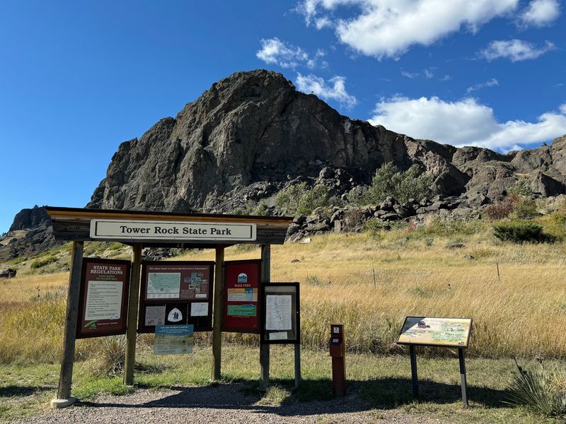
On July 16, 1805, Captain Meriwether Lewis documented this 424-foot volcanic formation in his journal, calling it the tower. From its base, he observed what he described as immense herds of buffalo and noted an Indian road running nearby, recording in a single entry both the landscape’s abundance and its established human pathways.
For the Piegan Blackfeet and other tribes, Tower Rock marked the boundary between the Great Plains and the Rocky Mountains, functioning as a landmark on the Old North Trail, one of the oldest travel routes in the Western Hemisphere. The rock signaled entry into prime bison hunting territory and held deep spiritual significance as a waypoint.
Despite railroad construction and highway development in the surrounding area during the late 19th and early 20th centuries, Tower Rock remained largely untouched. It was added to the National Register of Historic Places in 2002 and became an official state park in 2004, preserving both its geology and its layered human history.
13. Four Dances Recreation Area Trails, Billings, Montana
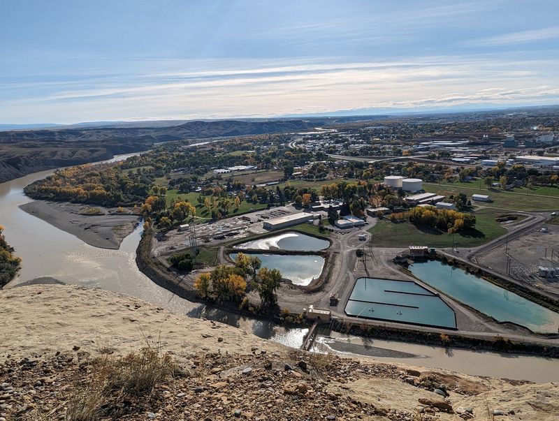
Chief Four Dances of the Crow Nation, known in the Apsáalooke language as Annishi Shopash, used this plateau as a sacred fasting and vision quest site during the 1830s, a decade marked by the height of the Rocky Mountain fur trade and intense conflict among plains tribes. His spiritual practice here shaped his identity as a religious and military leader.
The site was formally protected in 1999 through a partnership among local landowners, the Yellowstone River Parks Association, and the Bureau of Land Management. It is designated both a Special Recreation Management Area and an Area of Critical Environmental Concern, a dual status that reflects the weight of its cultural and ecological significance.
An old cabin on the property adds a literary dimension to the site’s history. The structure was once used by Will James, a celebrated Western artist and writer whose illustrated books about cowboy life reached wide audiences in the early 20th century.
The cabin was restored in 2015, anchoring Four Dances in both indigenous heritage and frontier cultural memory.
Share this story