Long before maps existed, glaciers were busy doing some of the most dramatic landscaping the planet has ever seen. Over thousands of years, massive rivers of ice carved out valleys, sculpted mountain peaks, and left behind sparkling lakes that still take your breath away today. The result is a collection of travel regions so spectacular that they almost seem too dramatic to be real. From the jagged granite towers of Patagonia to the deep fjords of Scandinavia, these destinations carry the fingerprints of ancient ice ages in every cliff face and turquoise lake.
This article takes you through 13 of the most extraordinary glacially shaped regions on Earth, covering what makes each one unique, what visitors can actually do there, and why each landscape still feels like an open-air geology lesson that happens to be jaw-droppingly beautiful. Pack your curiosity and comfortable shoes.
1. Glacier National Park, West Glacier, Montana, USA
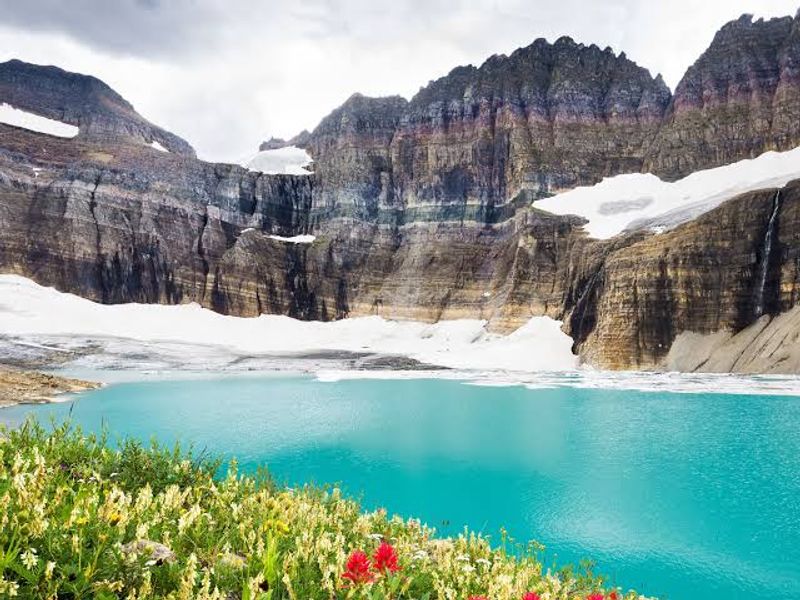
Ancient ice left its signature all over this Montana masterpiece, and the results are nothing short of geological theater. During the Pleistocene Ice Age, massive glaciers repeatedly advanced and retreated, carving out U-shaped valleys, bowl-like cirques, and razor-sharp ridges called aretes across what is now one of North America’s most celebrated national parks.
The park still hosts around 25 active glaciers, though they are noticeably smaller than they once were. Jackson Glacier is visible directly from an overlook on the famous Going-to-the-Sun Road, making it one of the most accessible glacier views in the country. That scenic highway alone is worth the trip, cutting through terrain that feels almost too dramatic to be real.
The turquoise color of the park’s lakes comes from glacial rock flour suspended in the water. Hiking the Grinnell Glacier Trail rewards visitors with alpine meadows and close-up views of glacial moraines that tell the story of the ice age in vivid, unmistakable detail.
2. Yosemite Valley, Yosemite National Park, California, USA
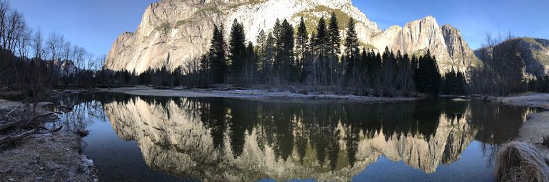
Granite cliffs that rise nearly a mile straight up from the valley floor are a hard thing to argue with, and Yosemite Valley makes that point spectacularly well. Glaciers repeatedly swept through this area during the Ice Age, transforming what was once a V-shaped river canyon into the broad, flat-bottomed valley visitors walk through today.
El Capitan and Half Dome are the park’s most recognizable landmarks, both shaped by glacial erosion that stripped away surrounding rock and left these harder formations standing tall. The valley floor sits at roughly 4,000 feet elevation, while the surrounding cliffs soar to nearly 8,000 feet, creating a sense of scale that photographs consistently fail to capture.
Tunnel View is the classic arrival point for first-timers, offering a sweeping look at the valley’s full layout from a single roadside pullout. Spring brings powerful waterfalls fed by snowmelt, making that season particularly popular with photographers and hikers looking to cover serious ground.
3. Norwegian Fjords, Geiranger, Møre og Romsdal, Norway
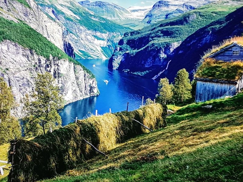
Few geological processes have produced scenery as dramatic as the Norwegian fjords, where ancient glaciers carved valleys so deep that the sea rushed in to fill them. Geirangerfjord stretches roughly 15 kilometers inland from the coast, flanked by cliffs that rise hundreds of meters above the water and dotted with waterfalls that tumble straight into the fjord below.
The Seven Sisters waterfall is one of the most photographed features along the route, a series of seven distinct streams dropping side by side down a sheer rock face. Tiny abandoned farms cling to seemingly impossible ledges high above the water, remnants of communities that once farmed these steep glacially shaped slopes by hand.
Boat cruises offer the most complete view of the fjord’s scale and geology, passing features that are simply invisible from the road above. The nearby Dalsnibba mountain viewpoint sits at 1,500 meters elevation and gives visitors a bird’s-eye perspective of the entire glacially carved system below.
4. Icefields Parkway, Banff, Alberta, Canada
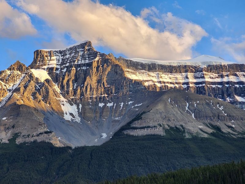
Canada saved some of its best geology for one very long road. The Icefields Parkway runs 232 kilometers between Banff and Jasper, passing through a continuous procession of glacially shaped peaks, ancient icefields, and lakes colored in shades of turquoise that seem almost digitally enhanced.
The Columbia Icefield is the parkway’s centerpiece, a vast expanse of ancient ice that feeds several major glaciers, including the Athabasca Glacier, which visitors can walk onto via guided tours. Peyto Lake and Moraine Lake are two of the most photographed stops, each sitting in valleys carved by glaciers during the last Ice Age and still fed by glacial meltwater today.
Wildlife sightings along the parkway are common, with elk, bighorn sheep, and black bears frequently spotted near the road. The route works equally well as a day drive or a multi-day journey with overnight stops at lodges and campgrounds built right into the glacial landscape.
5. Aoraki Mount Cook National Park, Canterbury, New Zealand
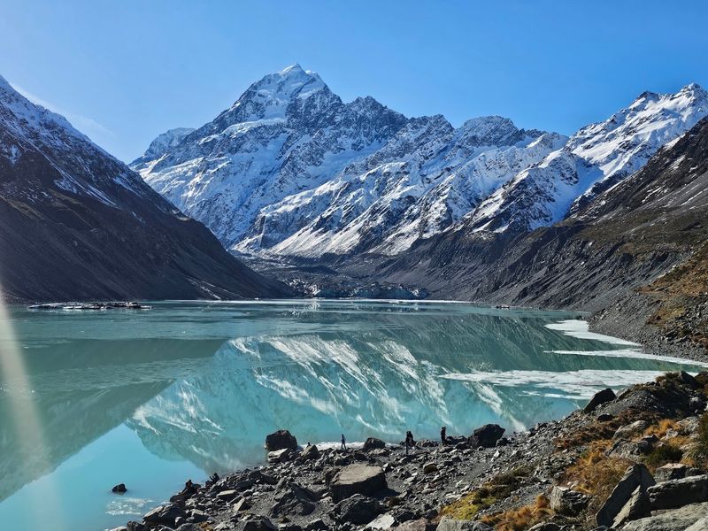
New Zealand’s tallest mountain at 3,724 meters, Aoraki Mount Cook has been shaped by glaciers for millennia and still hosts several active ones within the park boundaries today. The Tasman Glacier, the country’s longest at roughly 24 kilometers, flows down from the Southern Alps and terminates in a glacial lake littered with floating ice chunks.
Boat tours on Tasman Glacier Lake give visitors a close-up look at the glacier’s terminal face and the icebergs it regularly produces. The surrounding valleys display classic glacial landforms including lateral and terminal moraines that show exactly where the ice once extended during colder periods.
The Hooker Valley Track is the park’s most popular hike, a relatively flat trail that passes two swing bridges and three glacial lakes before arriving at a view of Mount Cook’s southern face. Scenic flights over the snowfields and glaciers are available from the village airstrip and provide an entirely different perspective on the scale of the ice above.
6. Torres del Paine National Park, Magallanes Region, Chile
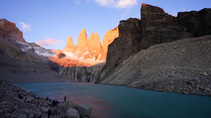
At the far end of South America, glaciers have been sculpting Patagonia for so long that the results look almost deliberate. The three iconic granite towers that give the park its name were exposed by glacial erosion that stripped away softer surrounding rock over millions of years, leaving these dramatic spires standing against the Patagonian sky.
Grey Glacier is one of the park’s most accessible active glaciers, reachable by boat across Lake Grey or via a multi-day hiking route. It calves icebergs regularly into the lake, creating a constantly changing shoreline that looks different on every visit. The glacier’s surface is riddled with crevasses and covered in blue-tinted ice that becomes more vivid on overcast days.
The W Trek and the full Circuit are the park’s two main hiking routes, covering distances between 70 and 130 kilometers through valleys carved by glacial action over thousands of years. Visitor numbers have grown significantly, so booking accommodation and permits well in advance is now essential for anyone planning a trip.
7. Vatnajökull National Park, Iceland
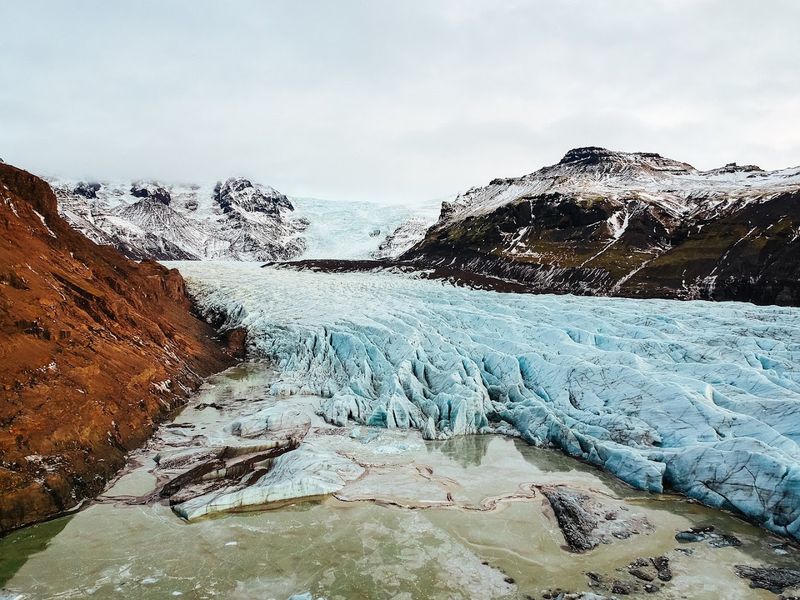
Europe’s largest glacier by volume covers roughly 8 percent of Iceland’s total land area, and the national park built around it is correspondingly enormous. Vatnajökull sits atop several active volcanoes, creating a geological situation where lava and ice interact in ways that have produced some of Iceland’s most dramatic landscapes over thousands of years.
The glacier has carved deep valleys across southeastern Iceland and feeds rivers that spread across black sand plains called sandurs, formed when glacial floods deposit sediment across flat lowland areas. Jokulsarlon glacial lagoon is the park’s most visited feature, a lake filled with floating icebergs that calve from the glacier’s edge and drift slowly toward the sea.
Ice cave tours inside the glacier run from November through March, when the ice is stable enough for guided groups to enter. Crystal Cave and the Sapphire Ice Cave are among the most popular options, accessible from the town of Jokulsarlon. The surrounding volcanic highlands add an extra layer of geological interest to an already extraordinary destination.
8. Swiss Alps, Zermatt, Valais, Switzerland
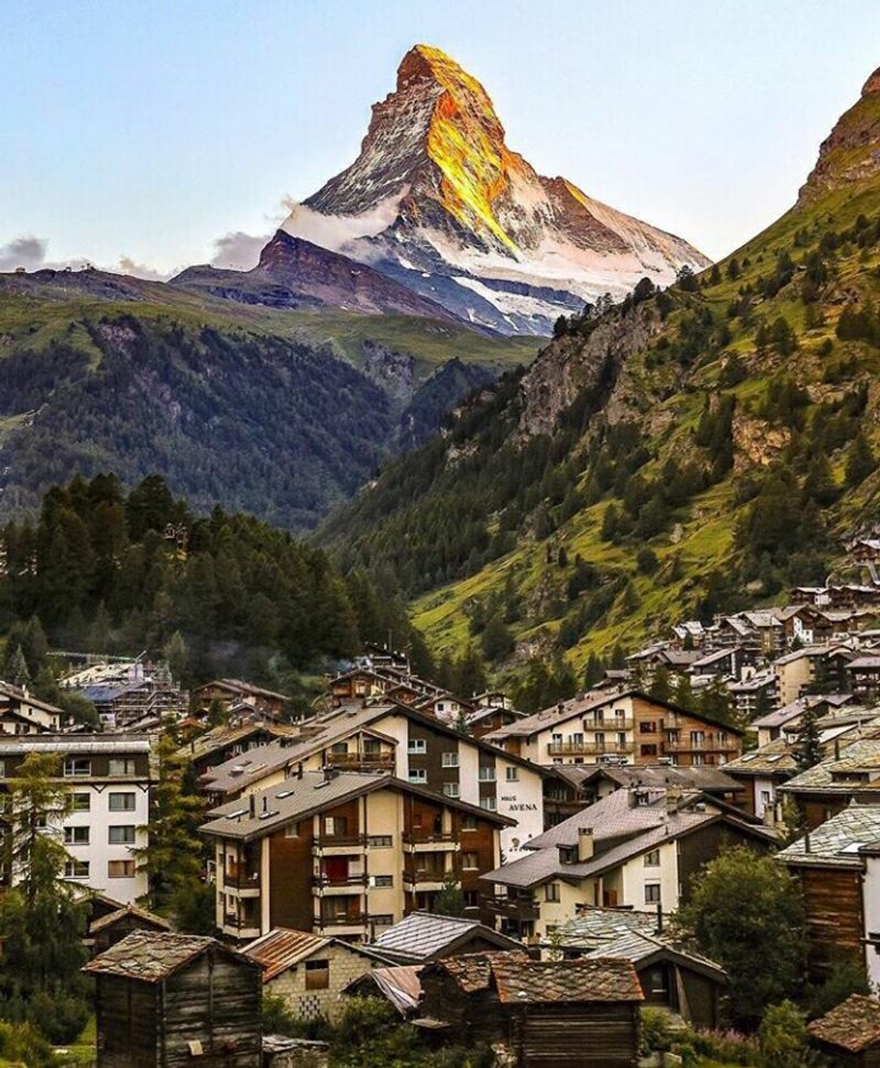
The Matterhorn is arguably the world’s most recognized mountain, and it owes its distinctive pyramid shape almost entirely to glacial erosion. Four glaciers carved away at the mountain from different sides simultaneously, leaving behind the sharp, angular peak that has appeared on everything from chocolate wrappers to geography textbooks for over a century.
The region around Zermatt contains more than 30 glaciers, including the Gorner Glacier, which is easily viewed from the Gornergrat railway that climbs to 3,089 meters above the village. The Gorner Glacier has retreated significantly over the past century, and information boards along the trail mark exactly where the ice stood in different decades.
Zermatt itself is a car-free village, meaning visitors arrive by train and get around on foot or by electric vehicle. The surrounding alpine landscape includes glacially carved valleys, moraines, and high-altitude lakes that reward both serious hikers and visitors happy to explore by cable car and mountain railway.
9. Fiordland National Park, Southland, New Zealand
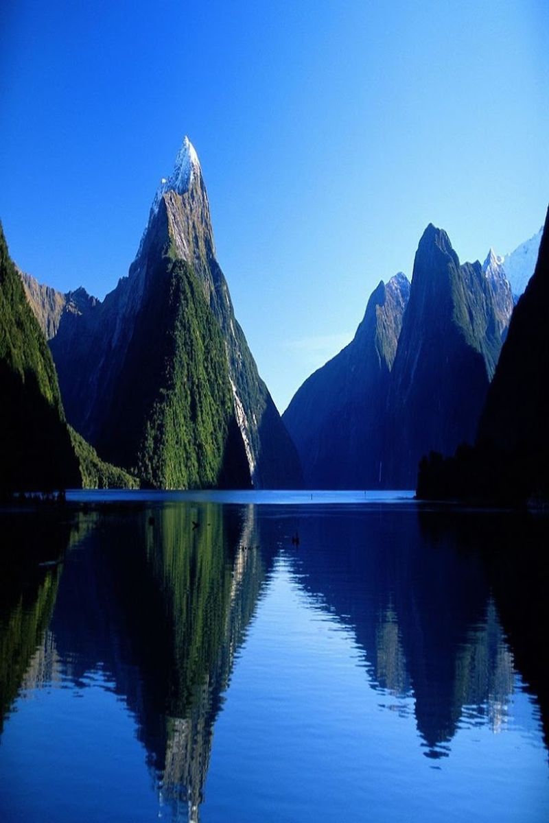
New Zealand’s largest national park covers 1.2 million hectares of some of the most glacially carved terrain on the planet, and most of it remains completely roadless. The fjords that define the park’s western edge were carved by glaciers during multiple ice ages, cutting valleys so deep that seawater now fills them to depths of over 400 meters in places.
Milford Sound is the park’s most visited attraction, accessible via a single winding road through a mountain tunnel. Boat cruises on the sound pass beneath waterfalls that drop directly off glacier-polished cliff faces and offer close-up views of fur seals resting on rocky outcrops. Doubtful Sound, three times longer than Milford, requires a boat crossing and a bus journey to reach, which keeps visitor numbers lower and the scenery more undisturbed.
The Milford Track is one of New Zealand’s most famous multi-day hikes, covering 53 kilometers through glacially shaped valleys and over a mountain pass. Booking spots on the track requires advance planning, as daily numbers are strictly limited by the Department of Conservation.
10. Kenai Fjords National Park, Seward, Alaska, USA
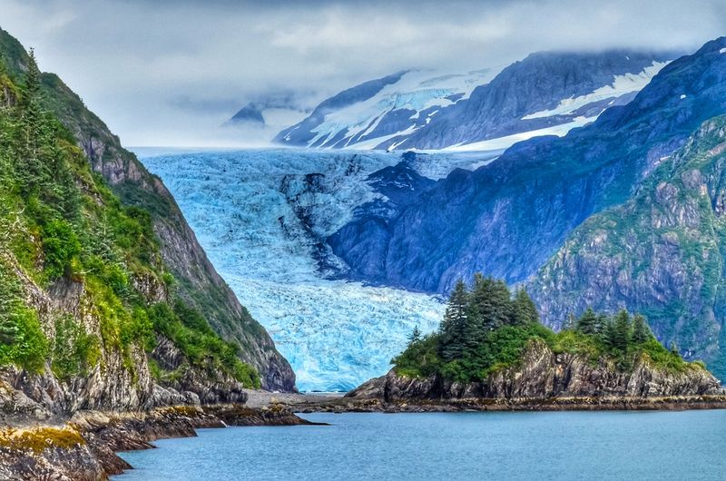
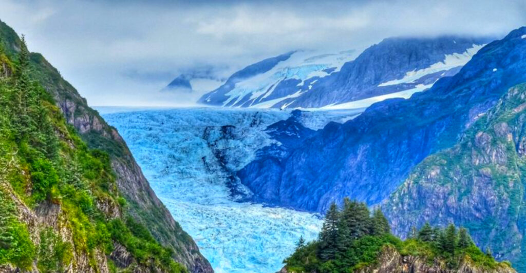
Most national parks preserve landscapes that glaciers shaped in the past, but Kenai Fjords offers something rarer: a front-row seat to glacial sculpting still happening right now. The Harding Icefield, one of the largest in the United States, feeds more than 40 glaciers that continue to carve the surrounding mountains and coastline in real time.
Exit Glacier is the most accessible part of the park, reachable by road from the town of Seward. A network of trails leads from the valley floor up through different vegetation zones to the edge of the icefield itself, passing marker posts that show where the glacier stood in previous decades. The retreat is measurable and visible, making it one of the most concrete illustrations of long-term glacial change available to everyday visitors.
Boat tours from Seward are the best way to experience the park’s marine fjords, where tidewater glaciers meet the sea and wildlife including orcas, sea otters, and puffins gather in large numbers. Day trips typically last six to eight hours and cover a significant stretch of the park’s fjord coastline.
11. Jostedalsbreen National Park, Vestland, Norway
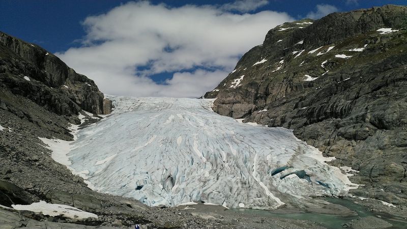
Mainland Europe’s largest glacier sits in a corner of western Norway that most international visitors have never heard of, which makes it one of the continent’s best-kept geological secrets. Jostedalsbreen covers roughly 487 square kilometers and sends glacier arms down into surrounding valleys, some of which reach low enough to be easily approached on foot.
Briksdalsbreen and Nigardsbreen are two of the most visited glacier arms, each accessible via short hikes from parking areas in the valleys below. Guided glacier walks are available at several access points, giving visitors a chance to walk on the ice itself with crampons and professional instruction. The surrounding landscape of steep valley walls, glacial rivers, and emerald lakes is the direct result of thousands of years of glacial carving.
The nearby village of Loen sits at the edge of the national park and serves as a practical base for exploring the area. A cable car from Loen climbs to 1,011 meters and provides sweeping views across the glacial landscape that would take a full day of hiking to otherwise reach.
12. Sarek National Park, Norrbotten County, Sweden
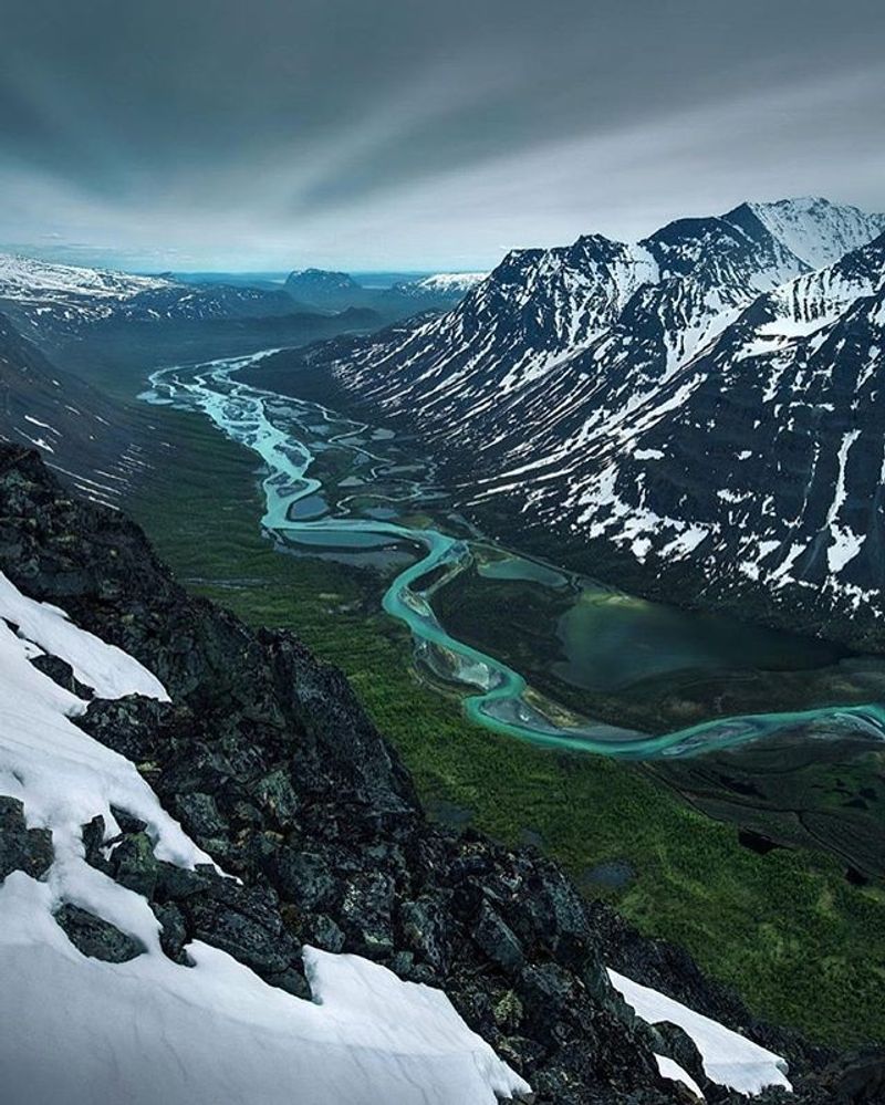
There are no roads into Sarek, no visitor centers, and no marked hiking trails. That is either a dealbreaker or the entire point, depending on the kind of traveler you are. This remote Swedish wilderness covers around 1,970 square kilometers of glacially carved terrain in Swedish Lapland, making it one of the most genuinely wild places left in Europe.
Ancient glaciers carved the park’s broad U-shaped valleys with characteristic precision, leaving behind flat valley floors flanked by steep mountain walls that rise to over 2,000 meters. Around 100 glaciers still exist within the park, though most are small remnants of far larger ice masses that once dominated the landscape during the last Ice Age.
Access requires either a helicopter or a long trek from the nearest road, typically taking several days. The Rapa Valley is considered the park’s most spectacular area, a broad glacial valley with a braided river system that spreads across the flat valley floor in constantly shifting channels. Experienced hikers with solid navigation skills and proper wilderness gear make up virtually the entire visitor population here.
13. Lake District National Park, Cumbria, England, United Kingdom
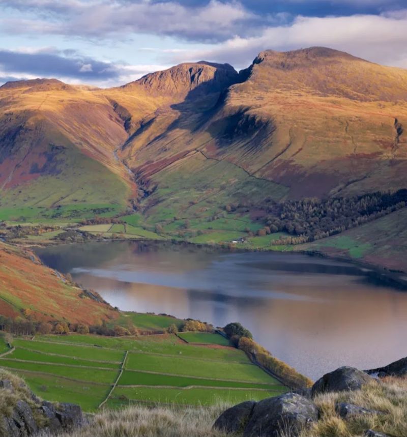
England’s most visited national park owes its entire layout to ice. During the last Ice Age, glaciers spread out from a central highland area and carved the radial pattern of valleys and lakes that makes the Lake District so distinctive on any map. The lakes themselves formed when glacial debris dammed valley floors as the ice retreated around 10,000 years ago.
Windermere, England’s largest natural lake at nearly 18 kilometers long, sits in a classic glacially carved valley with steep sides and a flat, deep basin that holds water fed by surrounding fells. Nearby Wastwater, the country’s deepest lake at 79 meters, occupies a valley carved even more deeply by a powerful glacier that once flowed toward the coast.
The fells surrounding the lakes are rounded rather than jagged because glaciers smoothed their upper surfaces as the ice moved across them. Villages like Grasmere, Ambleside, and Hawkshead are built from local stone and sit within the glacial landscape in a way that feels completely organic and unhurried, making the region as appealing for a quiet weekend as for a serious walking trip.
Share this story