One waterfall on this list pours straight out of the middle of a cliff, and a dam built about a century ago is the reason. The river found a path through underground caverns and simply popped out halfway down the rock.
I love that kind of surprise. Tennessee hides plenty of them.
One cascade spills off a ledge into a gorge after a string of smaller drops, and another plunges 256 feet off the Cumberland Plateau.
A few of these falls still hold traces of the old mills that once ran on their power. A couple ask you to wade right up a creek bed to reach them, so your sneakers will get soaked.
The best part might be the drive itself. Two-lane roads, little country churches, and quiet pastures point the way.
Cummins Falls State Park
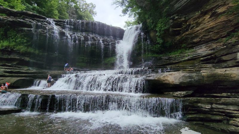
Few swimming holes make you earn them quite like this one. The reward is a 75-foot waterfall that stair-steps into a wide pool at the bottom of a rocky gorge.
By water volume, it ranks as the eighth-largest waterfall in Tennessee. That means plenty of roar for your effort, especially after a rainy stretch.
Getting to the base takes a Gorge Access Permit, and those are limited. Book yours ahead of time, or you may end up admiring the view from the rim instead.
The hike down runs about two to three miles round trip. Expect slippery boulders, water crossings, and a route that follows the river bed itself.
Keep your eyes on the rocks as you go. Fossils show up in the stone, which makes the slog feel like a nature lesson with a splash zone.
Not up for the scramble? The Waterfall Overlook Trail gives you a look from above without dropping into the gorge.
Safety matters here because the gorge can flash flood. Check the park’s social media for closure alerts before you leave the house.
Kids 12 and under must wear life jackets in the plunge pool. Picnic tables, grills, and restrooms make it easy to turn the trip into a full day.
History runs deep too. John Cummins bought the land around 1825 and ran a mill until a 1928 flood swept it away.
The site became a state park in 2012. Gates open from 8 a.m. to 6 p.m., so plan your drive with that window in mind.
Address: 390 Cummins Falls Ln, Cookeville, TN 38501
Burgess Falls State Park
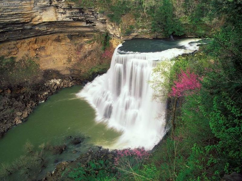
Four waterfalls in one short hike sounds like a sales pitch, but the Falling Water River actually delivers. The river drops more than 250 feet as it tumbles through this park.
The grand finale is the main Burgess Falls. It plunges more than 100 feet into a dramatic limestone gorge and steals the show from its smaller siblings.
The River Trail follows the water past rapids and cascades. A sturdy fence lines much of the route, which helps when the drop-offs get serious.
Want fewer elbows on the trail? The Ridgetop Trail is the quieter option, winding through the woods above the river.
Watch for the remains of an old log flume along the way. It’s a clue that this river has been working for people for a long time.
Tom Burgess, a Revolutionary War veteran, settled here in the 1810s. His family used the river to run a gristmill and a sawmill.
Later, the City of Cookeville built a dam in 1924 for hydroelectric power. After a 1928 flood, it was rebuilt and ran until 1944.
The land became a State Natural Area in 1971 and a state park in 1975. Not a bad retirement for a hard-working river.
Families will like the playground, swings, and picnic tables near the trailhead. Fishing is allowed too, with a valid Tennessee license.
The park sits about 15 miles south of Cookeville. That makes it an easy pairing with other falls in the area.
Address: 4000 Burgess Falls Dr, Sparta, TN 38583
Rock Island State Park
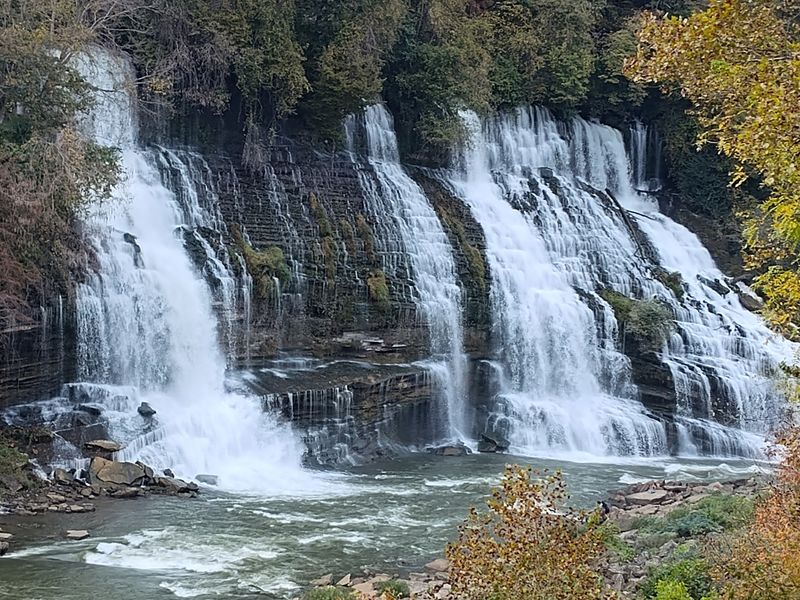
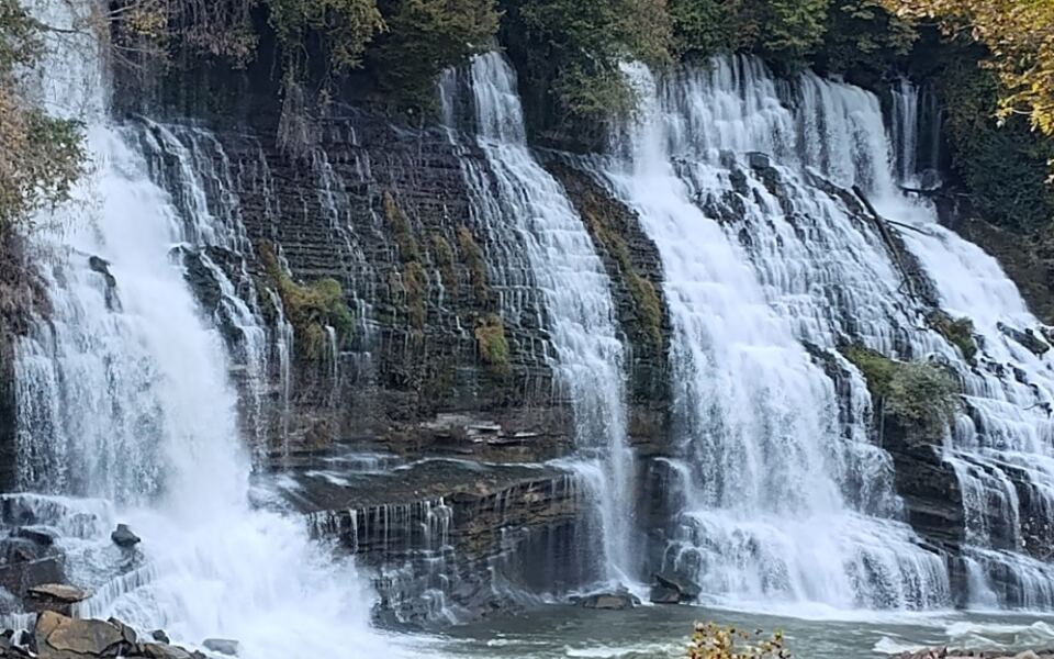
Water isn’t supposed to shoot out of the side of a cliff, yet here it does. Twin Falls spills about 80 feet from limestone walls in a way that looks totally wild.
The twist is that people caused it. After the Great Falls Dam went up, river water seeped through underground caverns and burst out mid-cliff.
You can see Twin Falls from an overlook near a parking area. A short trail with stairs brings you closer for a better look.
Great Falls is the park’s other star. It’s a 30-foot horseshoe-shaped cascade that once powered a cotton mill built in 1892.
An easy overlook near the Old Mill picnic area gives you a view of it just steps from your car. The steep Old Mill Gorge Trail drops to the gorge floor if your legs feel brave.
Now the serious part. Swimming and wading downstream of the TVA Powerhouse aren’t allowed, since dam releases can change currents fast.
Check the TVA water release schedule or the park’s Facebook page before heading into the gorge. Want a swim?
The sand bar area is the spot.
The park sits where three rivers meet, so the scenery shifts at nearly each overlook. The Great Falls Hydroelectric Plant from 1917 is on the National Register of Historic Places.
Rock Island opened as a state park in 1969. Year-round cabins, a playground, and a tennis court make it easy to stay longer than planned.
Address: 82 Beach Rd, Rock Island, TN 38581
Fall Creek Falls State Park
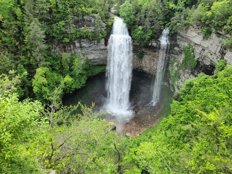
At 256 feet, the main waterfall here is a neck-craner. It ranks among the tallest waterfalls in the eastern United States.
You don’t need to hike far to see it. An accessible overlook gives you the full drop, top to bottom.
For the close-up, a strenuous trail of about a third of a mile leads to the base. The climb back up will remind you exactly how tall 256 feet is.
The park has more water to show off too. Cane Creek Falls drops 85 feet and is often called the biggest in the park by volume.
A suspension bridge over Cane Creek Gorge adds a fun wobble to the views. If you want the base of Cane Creek Falls, the steep Cable Trail gets you there.
This park is huge, with nearly 30,000 acres and more than 56 miles of trails. There’s also a 345-acre lake for fishing and boating.
Need a break from waterfalls? An 18-hole golf course, a nature center, and playgrounds are all part of the package.
Staying overnight is easy with an 85-room lodge, cabins, and more than 200 campsites. Some trails were damaged by an August 2023 tornado, so check trail status first.
The story started in 1937 when the federal government bought the land. Workers from the WPA and the Civilian Conservation Corps built early facilities.
Tennessee took over the park in 1944. Not bad for a place that began as a rescue project.
Address: 2009 Village Camp Rd, Spencer, TN 38585
Bald River Falls
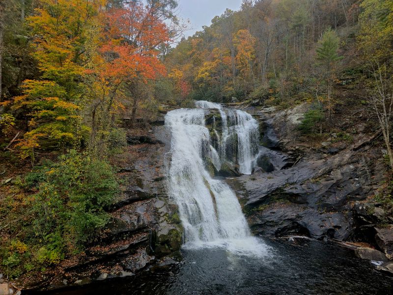
Here’s a 90-foot waterfall you can admire without unbuckling your seat belt. Bald River Falls sits right beside the road in the Cherokee National Forest.
The drive alone is worth it. Tellico River Road follows an old logging railroad bed, winding along the river into the mountains.
That logging past is real history. The Babcock Lumber Company heavily logged these forests in the early 1900s.
The falls reopened in May 2025 after nearly two years of bridge and road work. The new two-lane bridge includes an observation deck for safer viewing.
That deck makes the view easier for folks using wheelchairs too. No scrambling over rocks needed to get a great photo.
Want a little more effort? A short trail leads to the top of the falls for a different angle.
Serious hikers can take the 5.6-mile Bald River Falls Trail upstream. It heads into the Bald River Gorge Wilderness and passes smaller waterfalls along the way.
The river isn’t controlled by a dam. That means the flow stays natural and can get powerful after rain.
Swimming right at the falls isn’t a smart move because of the strong currents. Calmer spots downstream are better for cooling off.
Much of the watershed upstream is protected as the Upper Bald River Wilderness, designated in 2018. Nature lovers and photographers flock here for good reason.
Address: River Rd, Tellico Plains, TN 37385
Ozone Falls State Natural Area
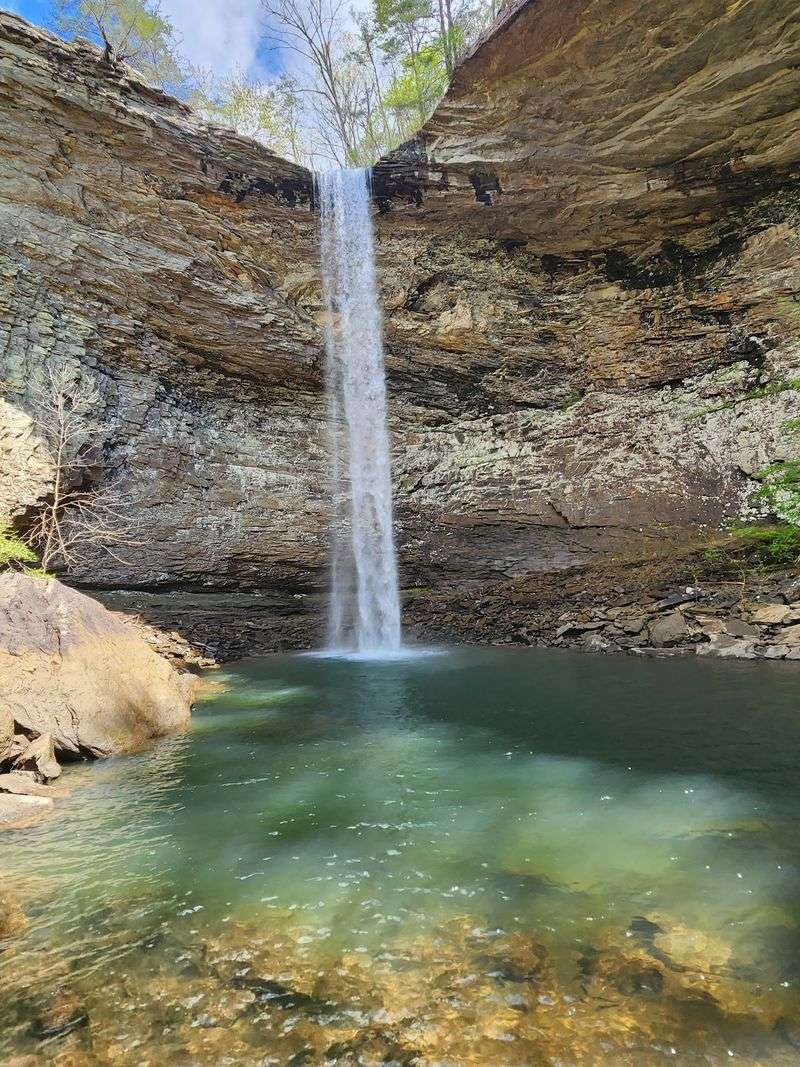
Hollywood came calling at this waterfall. Scenes from Disney’s 1994 live-action The Jungle Book were filmed here.
It’s easy to see why. Fall Creek drops about 110 feet into a plunge pool backed by a weather-carved rock amphitheater.
The name has a fun backstory too. The spot was once called McNair Falls after a local miller.
In 1896, the community and the falls were renamed Ozone. The story goes it was for the refreshing quality of the air from the mist.
A short, flat path from the parking area leads to the top of the falls. You’ll look straight down into the pool, so keep your footing.
The trail to the base is a different animal. It’s rugged and steep, running about three-quarters of a mile into the gorge.
Along the way, you may pass a small rock house called Gamblers Den. At the bottom, a cold, deep swimming hole waits.
Here’s another oddity. After its big drop, Fall Creek slips underground and disappears from view.
The natural area covers 43 acres and was designated in 1973. Sandstone cliffs, mixed forest, and pockets of prairie plants fill the small space.
The roadside pull-off fits only about five or six vehicles. Arrive early, and pack out your trash to keep the place clean.
Address: 14563 TN-1, Ozone, TN 37854
Foster Falls Recreation Area
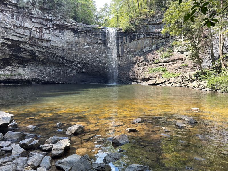
Rock climbers and waterfall chasers share the same address at Foster Falls. The sandstone bluffs here hold more than 150 climbing routes.
Climbers need a free permit before roping up. Everyone else can stick to the views and the water.
The falls drop about 60 feet into a deep swimming hole. That pool runs cold, so a quick dip will wake you up fast.
An accessible boardwalk and viewing platform lead to an overlook of the falls. It’s an easy win for folks who don’t want a steep trail.
For the swimming hole, a moderately steep trail heads down to the base. A suspension bridge along the way adds a little bounce to your step.
Big hikers, take note. Foster Falls marks the southern end of the 12.5-mile Fiery Gizzard Trail, a well-known backpacking route.
The area was once managed by TVA as a natural area starting in 1973. In October 2025, it became part of the newly named Fiery Gizzard State Park.
Camping is an easy add-on here. There are 26 rustic, drive-in campsites open year-round, plus flush toilets and hot showers.
Picnic tables and grills sit near the parking area for a lunch with a view. The trails are well marked too, which helps on unfamiliar ground.
Gates run from 8 a.m. to 4:30 p.m. Plan your swim and hike around that schedule.
Address: 498 Foster Falls Rd, Sequatchie, TN 37374
Greeter Falls Waterfall
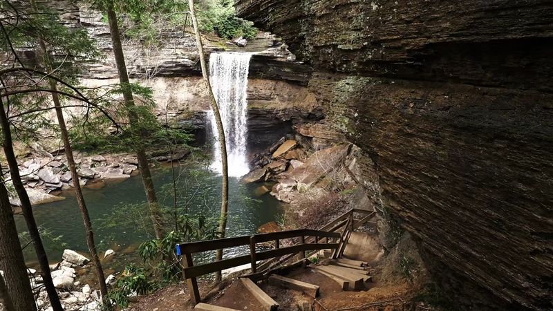
How many waterfall hikes come with a spiral staircase? Greeter Falls does, and it makes the final descent feel like part of the adventure.
The hike is about half a mile. It’s short, but the trail has some challenging stretches, so wear shoes with good grip.
Along the way, you’ll pass interesting rock formations. The scenery keeps changing, which keeps tired legs distracted.
The area features more than one waterfall too. That gives you a few chances to stop, snap photos, and catch your breath.
The main attraction is the falls and the swimming hole below. On a hot afternoon, that pool is hard to resist.
After a rainy week, the water volume really picks up. The pounding falls can feel a lot like a free massage if you get close.
Of course, more water also means stronger flow. Use good judgment before you wade in after heavy rain.
The falls sit on the west end of one of the state’s prettiest parks. That makes it a good stop to pair with other Cumberland Plateau trails.
Picnic tables near the trailhead give you a spot to refuel. Dogs are welcome here too, so your four-legged hiking buddy can tag along.
Hours run from 8 a.m. to 5 p.m. Weekend afternoons tend to get busy, so a weekday morning might give you more elbow room.
Address: 550 Greeter Falls Road, Altamont, TN 37301
Machine Falls
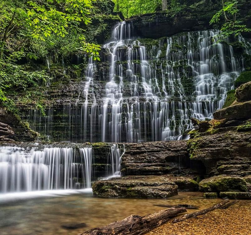
Wide and tall at the same time, Machine Falls looks like a giant rock staircase with water running down it. It stands about 60 feet high and almost as broad.
The falls sit inside the Short Springs Natural Area outside Tullahoma. The 420-acre area is known for wooded ravines and interesting geology.
Spring is a great time to visit. Wildflowers fill the woods, adding color to an already pretty walk.
The Machine Falls Trail is a moderately difficult loop of about 1.6 miles. It includes a steep descent down to the base.
Expect to get your feet wet. Hikers often wade through shallow water along the streambed to reach the best view.
The clear pool at the bottom is a nice spot to cool your toes. Kids of different ages tend to love this part of the trip.
Got extra energy? Busby Falls and Adams Falls are also in the natural area, and longer loops can link them up.
Three groups manage the land together. They include the state environment department, the City of Tullahoma, and TVA.
Parking is on Powell Road near a large water tower. That tower makes a handy landmark when your GPS starts acting confused.
Tullahoma itself dates to 1852. Grab a snack in town before or after your hike.
Address: Powell Road, Tullahoma, TN 37388
Rutledge Falls
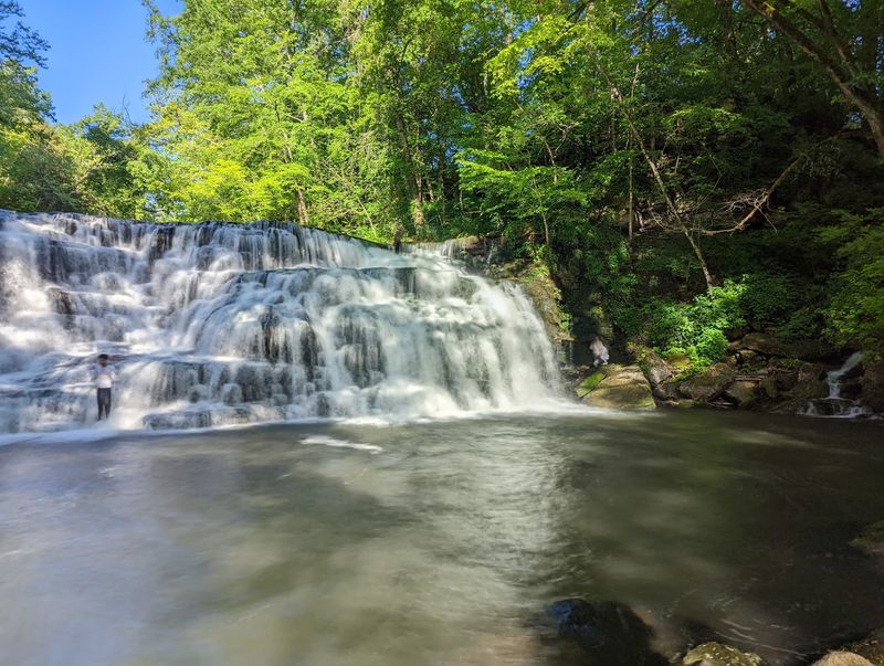
Some of the best waterfalls ask for a long hike, but this one barely asks for a stroll. Rutledge Falls sits about 100 yards from a small roadside parking area.
Look for it across from a church parking lot on a quiet country road. The short gravel path gets you to the water in a few minutes.
Keep in mind that the falls are on private property. Be respectful, follow posted rules, and leave the place cleaner than you found it.
The falls come in multiple sections. That gives the water a layered look as it spills over the rocks.
Swimmers have options here. There are deeper spots for a real swim and shallower areas for wading.
That mix makes it a nice pick for families. Little ones can splash in the shallows while bigger kids head for deeper water.
Hours run from 8 a.m. to 6 p.m. Weekend afternoons draw the biggest crowds, so plan around that if you want quiet.
Tuesday evenings and Thursday mornings tend to be calmer. A weekday visit could give you the pool nearly to yourself.
This stop pairs well with Machine Falls, which is also near Tullahoma. You could knock out two waterfalls in one easy day.
Bring a towel, water shoes, and a snack. You won’t need much else for this short and splashy detour.
Address: 1276 Rutledge Falls Rd, Tullahoma, TN 37388
Abrams Falls
Reaching this waterfall starts with one of the most famous drives in the Smokies. The trailhead sits along the one-way Cades Cove loop road.
That loop moves slowly, so give yourself extra time. Pastures, mountains, and old homesteads make the crawl easy to enjoy.
Once you park, the hike runs about 2.5 miles each way. That adds up to a five-mile round trip.
The trail is rated moderate. Tree roots, rocks, and uneven ground keep you watching your step.
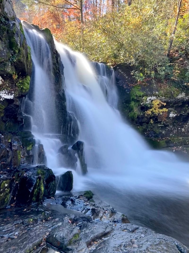
At the end, Abrams Falls pours into a wide pool. The water and rocks make a great backdrop for a trail snack.
Here’s a word of caution. The pool can look calm, but strong currents and slick rocks make it risky.
Many hikers simply enjoy the view from the rocks. Snap your photos, rest your legs, and save the swimming for safer spots.
This waterfall sits on the Tennessee side of Great Smoky Mountains National Park. Townsend is the nearest town and a handy base.
There’s no restaurant at the trailhead, so pack food and plenty of water. You’ll want both for the return trip.
Parking in the national park requires a parking tag. Sort that out before you arrive so the cove can be the only thing slowing you down.
Address: Townsend, TN 37882
Stillhouse Hollow Falls State Natural Area
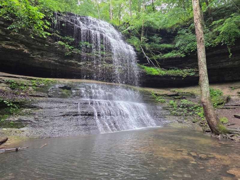
Small but mighty is the best way to describe this spot. The whole natural area covers just 90 acres in Maury County.
It’s named for its main attraction, Stillhouse Hollow Falls. You’ll reach it by walking about two-thirds of a mile on the trail.
That short distance makes it a solid pick for families. Kids can handle the walk without too much complaining.
Finding it is part of the fun. The area sits about 21 miles southwest of Columbia, off U.S.
Highway 43.
It’s also about three miles northeast of Summertown. That puts it in a quiet stretch of rolling Middle Tennessee hills.
The trail winds through the woods before the hollow opens up. Then the falls appear, tucked away from the highway noise.
Bring a picnic and stay a while. The peaceful setting is perfect for slowing down after a long drive.
Hours run from 8 a.m. to 5 p.m. Plan to arrive with enough daylight to enjoy the walk without rushing.
Weekend afternoons see the most visitors. Early weekday visits usually mean more quiet time with the water.
Since this is a state natural area, treat it gently. Stay on the trail and pack out what you bring in.
Address: 8716 Lawrenceburg Hwy, Mt Pleasant, TN 38474
Fall Hollow Falls
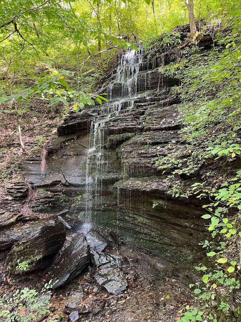
The Natchez Trace Parkway is built for slow driving, and this stop rewards anyone who takes it easy. Fall Hollow sits right off the parkway near Highway 412.
You don’t need a big hike to see water. A short paved trail leads to one of the falls in just a few minutes.
The stream above the drop is fun to watch on its own. Water slides over the rocks before tipping over the edge.
Want more? A rougher, more technical trail heads farther down to bigger falls below.
That lower route takes careful footing. Wear shoes with grip, especially if the rocks are wet.
There are several views of smaller falls along the way. You’ll also find multiple spots to see the main falls and play in the water.
Winter brings its own show. When temperatures drop, the falls can freeze, and they’re still easy to walk to.
A free parking lot makes the stop simple. You can pull in, stretch your legs, and be back on the road quickly.
Hohenwald is the closest town. It makes a handy spot to grab supplies before or after your visit.
Fall Hollow is a fine way to end a Tennessee waterfall road trip. It’s easy, pretty, and proof that the slow road pays off.
Address: Fall Hollow Trail, Hohenwald, TN 38462
Share this story