Some places on Earth are so enormous that even millions of people can barely make a dent in the empty space. Extreme deserts, frozen tundra, thick rainforests, and brutal winters all push people into tight corners of otherwise massive countries.
The result is a fascinating map of human settlement where cities buzz with life while the land stretching beyond them stays almost untouched. These 13 countries show just how unevenly people are spread across our planet.
Mongolia
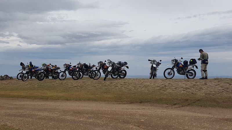
Mongolia holds a record that sounds almost unbelievable: roughly 1.56 million square kilometers of land shared by only about 3.5 million people. That works out to around 2.2 people per square kilometer, making it the least densely populated country on Earth by a wide margin.
The sheer emptiness is hard to picture until you look at a satellite image.
Much of the country is covered by steppe grasslands, rugged mountains, and the famous Gobi Desert. Winters are brutal, regularly plunging to temperatures that would shut down most cities in other parts of the world.
These harsh conditions have historically encouraged nomadic herding rather than fixed, large-scale settlements.
Ulaanbaatar is the beating heart of the country, holding nearly half the national population within its city limits. Outside the capital, towns can be separated by hundreds of kilometers of open land.
This wild contrast between a crowded capital and a nearly empty countryside makes Mongolia one of the most geographically fascinating countries anywhere on the planet.
Australia
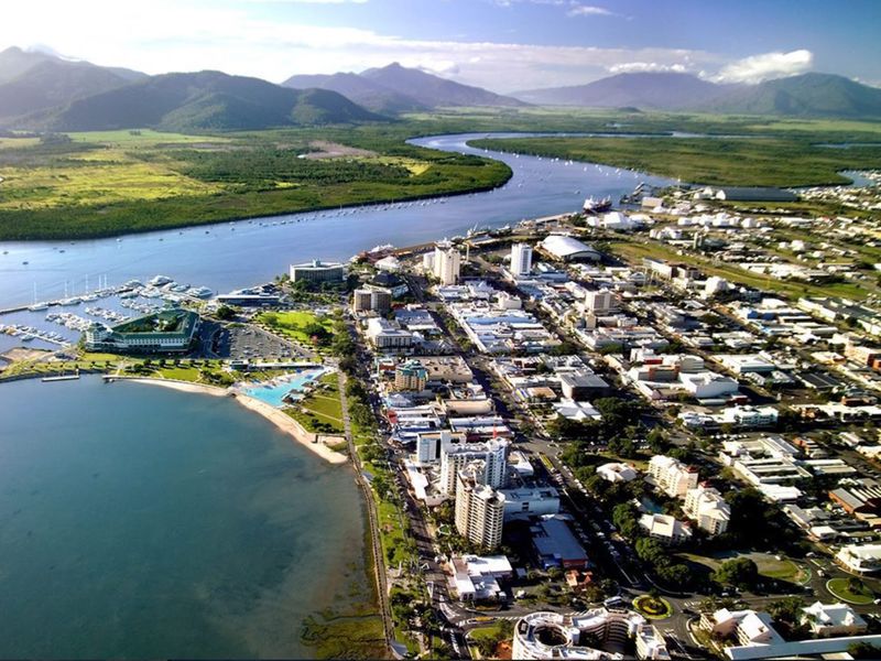
Australia is practically a continent pretending to be a country. It covers about 7.7 million square kilometers, yet most of its 26 million residents cling to a narrow coastal fringe, leaving the enormous interior almost completely empty.
The national average sits at roughly 3.5 people per square kilometer, which is misleadingly generous given how concentrated the population actually is.
Head inland and the reason becomes obvious fast. The Outback is a sun-scorched, water-scarce expanse where temperatures regularly exceed 40 degrees Celsius and the nearest town might be a three-hour drive away.
Large portions of central and western Australia receive so little rainfall that permanent large-scale agriculture is simply not practical.
Sydney, Melbourne, Brisbane, Perth, and Adelaide are genuinely world-class cities with millions of residents each. Yet combined, they occupy a tiny fraction of Australia’s landmass.
The country essentially packs its entire modern economy and lifestyle into a thin coastal ribbon while leaving a territory the size of Western Europe almost untouched. That contrast is one of the most striking geographical quirks on the planet.
Namibia
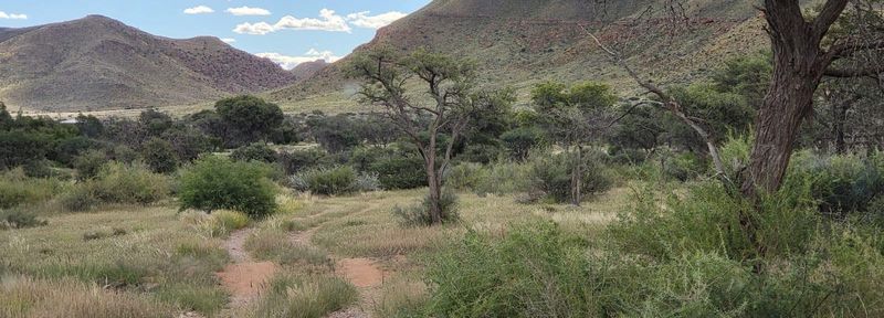
Walking along Namibia’s Skeleton Coast feels like stepping onto a different planet. The Atlantic surf crashes against ancient desert dunes, and the nearest city might as well be on the moon.
With a population density of roughly four people per square kilometer across 825,000 square kilometers, Namibia ranks among the sparsest nations in Africa.
The Namib Desert hugs the entire Atlantic coastline, while the Kalahari spreads across the east. Between them lies a patchwork of dry savanna, rocky escarpments, and vast rangelands that can support wildlife far more comfortably than dense human populations.
Water scarcity is the defining challenge that shapes where settlements can exist at all.
Population clusters heavily in the north, particularly in regions near the Angolan border, where rainfall is slightly higher and agriculture becomes more viable. Windhoek serves as the modern, well-organized capital, but it stands somewhat alone in a landscape that is otherwise dominated by open space.
Namibia’s emptiness is not neglect; it is geography doing exactly what geography does best, setting the terms of human life.
Iceland
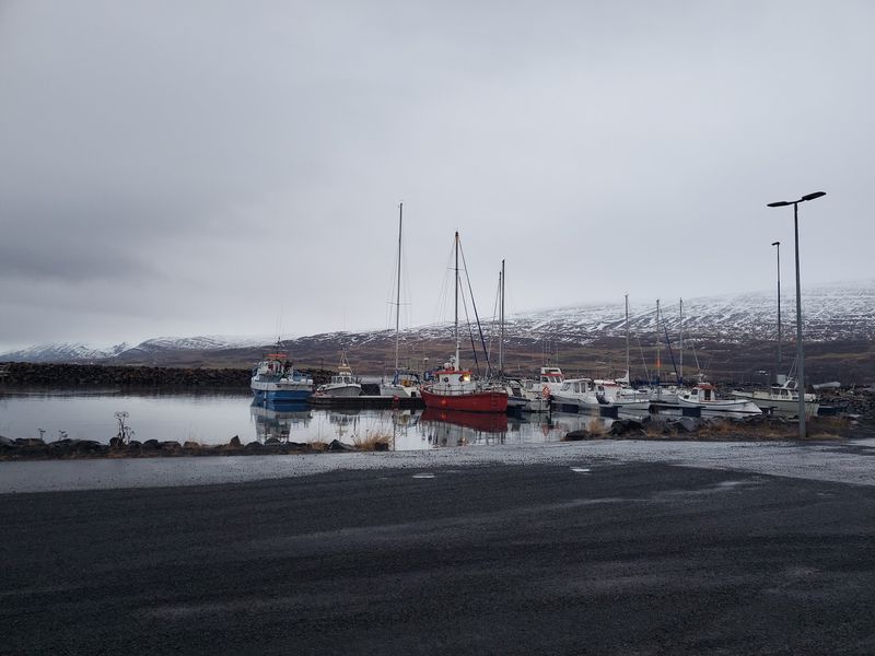
Iceland is a country where the interior is essentially off-limits for living. Glaciers, lava fields, active volcanoes, and highlands cover enormous portions of the island, leaving only the coastal edges suitable for permanent settlement.
At roughly 3.8 people per square kilometer, Iceland is one of Europe’s most sparsely populated nations despite being a wealthy, modern society.
The total population hovered just under 400,000 in 2025, spread across about 103,000 square kilometers. A large share of those residents live in Reykjavik and the surrounding southwestern corner of the island, creating a lopsided distribution that makes the rest of the country feel remarkably quiet.
Drive an hour east from the capital and the roads thin out considerably.
What makes Iceland’s emptiness particularly striking is how recent much of its landscape is. Volcanic eruptions regularly reshape the terrain, and some areas are geologically too young and unstable for development.
The upside is that Iceland preserves some of the most dramatic, untouched scenery in the Northern Hemisphere. Waterfalls, geysers, and lava plains stretch for miles without a single rooftop in sight.
Guyana
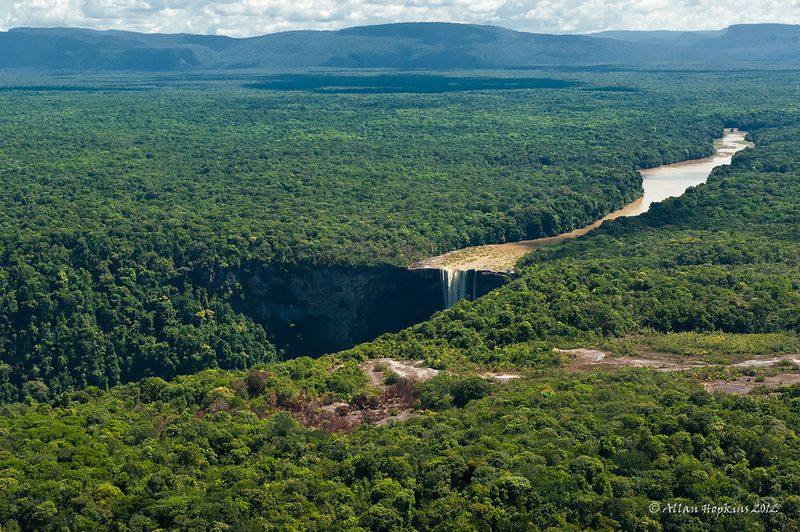
Guyana is South America’s best-kept geographical secret. It covers about 215,000 square kilometers, yet fewer than one million people call it home, producing a population density of roughly four per square kilometer.
Those numbers alone make it one of the least populated countries in the Western Hemisphere.
The coastal plain along the Atlantic is where almost everyone actually lives. Georgetown, the capital, sits below sea level and relies on a Dutch-designed drainage system to stay dry.
Rice fields and sugar plantations stretch along the coast while, just a short distance inland, the land rises into dense tropical forest that covers the overwhelming majority of the country.
Rivers serve as highways in much of the interior because roads are scarce and often impassable during the rainy season. Indigenous communities maintain traditional ways of life across vast forested territories that few outsiders ever visit.
Recent offshore oil discoveries have brought new economic attention to Guyana, but for now its interior remains one of the most biodiverse and least disturbed landscapes in all of South America. The emptiness is part of what makes it extraordinary.
Suriname
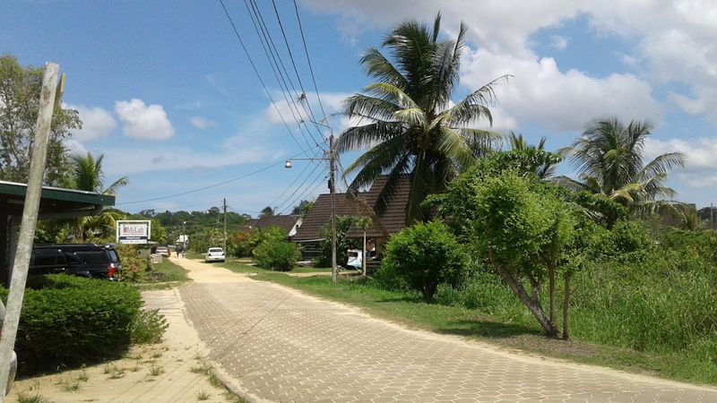
Suriname might be the smallest country in South America by area, but it punches well above its weight in terms of sheer emptiness. Covering about 164,000 square kilometers with a population of only around 600,000, it averages roughly four people per square kilometer.
Most of those residents are packed into Paramaribo and the narrow northern coastal zone.
South of that populated strip, the country transforms dramatically. Thick tropical rainforest blankets around 90 percent of the national territory, making Suriname one of the most forested countries on Earth by percentage.
Interior settlements are scattered and small, often connected to the outside world more easily by river canoe or small aircraft than by road.
Suriname’s cultural diversity is genuinely remarkable for such a small population. Communities of South Asian, African, Javanese, Indigenous, and mixed descent all contribute to a rich social fabric concentrated almost entirely in the north.
Meanwhile, the southern forest quietly absorbs carbon, shelters jaguars and tapirs, and remains one of the last truly wild spaces in the Americas. That combination of cultural richness and natural vastness makes Suriname quietly unforgettable.
Libya
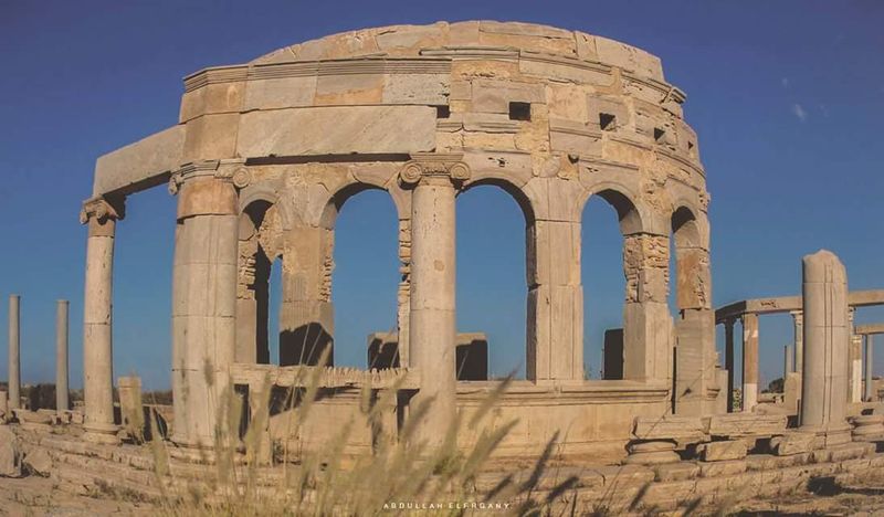
Libya’s statistics look almost comedic on paper. The country covers roughly 1.76 million square kilometers, making it one of Africa’s largest nations, yet it holds only about 7.3 million people.
That averages out to around 4.2 per square kilometer, but the real story is far more extreme than the average suggests.
The Sahara Desert dominates approximately 90 percent of Libya’s territory. In those vast inland regions, entire districts can pass without a single permanent settlement.
Water sources are limited to ancient underground aquifers and scattered oases, which simply cannot support large or dense populations across such a huge area.
Nearly everyone lives within a relatively narrow Mediterranean coastal band. Tripoli, Benghazi, and Misrata concentrate the bulk of the population, functioning almost like independent islands of urban life surrounded by an ocean of sand.
The contrast between a busy coastal city and the silent desert just hours away is one of Libya’s most defining characteristics. Historically, trans-Saharan trade routes once animated the interior, but modern borders and changing economics have left those ancient corridors quieter than ever before.
Canada
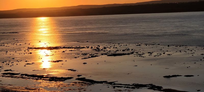
Canada is the second-largest country in the world, and it wears that title with a certain quiet pride. Stretching across nearly 10 million square kilometers from the Pacific to the Atlantic and deep into the Arctic, it somehow manages to hold fewer than 45 million people.
The result is a national density of only a few people per square kilometer, despite having genuinely massive cities.
Toronto, Montreal, and Vancouver are cosmopolitan, fast-moving places that feel nothing like the frozen tundra hundreds of kilometers to their north. Yet those cities sit on a tiny fraction of Canada’s total land.
The Yukon, Northwest Territories, and Nunavut together cover millions of square kilometers but hold a combined population smaller than many mid-sized Canadian cities.
Permafrost, brutal winters, limited road access, and the sheer cost of building and maintaining infrastructure in remote northern regions all conspire to keep the far north sparsely settled. Indigenous communities have lived across these territories for thousands of years, but large-scale permanent settlement remains a challenge that even modern technology has not fully solved.
Canada’s north is magnificent, vast, and stubbornly, beautifully empty.
Botswana
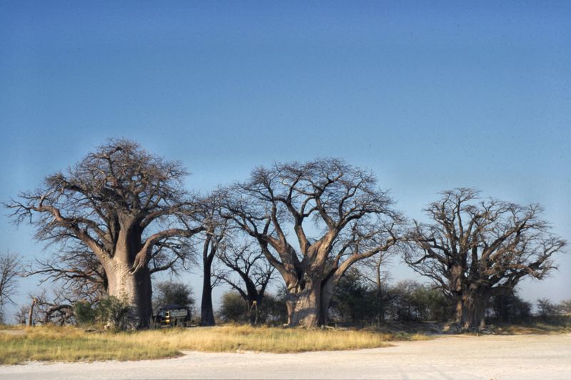
Botswana is bigger than France, yet it holds only a few million people. With a density hovering just above four per square kilometer, it is one of southern Africa’s most sparsely populated countries.
The numbers alone do not fully capture how much of the country is genuinely, magnificently empty.
The Kalahari Desert and semi-arid scrubland cover enormous portions of the territory. The Central Kalahari Game Reserve, one of the world’s largest protected areas, takes up a chunk of the country roughly the size of Switzerland.
It was originally set aside partly to protect the traditional lifestyle of the San people, one of the world’s oldest indigenous cultures.
Population concentrates in the eastern corridor, where Gaborone, Francistown, and the main railway line are located. Botswana’s economic success, built significantly on diamond mining, has funded impressive urban development and a growing middle class.
Yet step outside the eastern towns and the land opens up into wildlife-rich wilderness that attracts safari visitors from around the world. Botswana has managed something rare: genuine prosperity alongside preserved wildness, and that balance is worth celebrating.
Mauritania
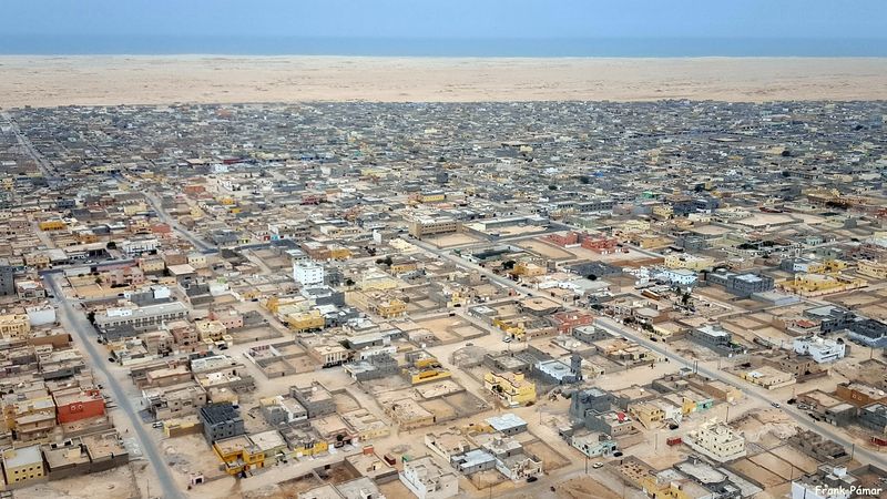
Mauritania occupies more than one million square kilometers of northwestern Africa, yet only around 5.5 million people live there. The World Bank estimates a national density of about five per square kilometer, but that figure hides an even starker reality: roughly 90 percent of the population lives in the southern tenth of the country, close to the Senegal River and the Atlantic coast.
The Sahara Desert blankets the north with a thoroughness that leaves almost no room for permanent habitation. Ancient caravan routes once linked Mauritanian trading cities to markets across North and West Africa, and cities like Chinguetti were once considered among the most important Islamic scholarly centers in the world.
Today, encroaching sand threatens several of those historic settlements.
Nouakchott is a fascinating case study in rapid urban growth. Founded as a small administrative post at independence in 1960, it has grown into a city of over one million people, attracting rural migrants and nomadic families increasingly settling permanently.
The capital sits on the Atlantic coast, surrounded by desert on three sides, a modern city literally holding back the sand. That image says everything about how Mauritania balances ancient geography with modern ambition.
Kazakhstan
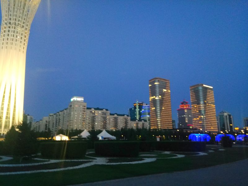
Kazakhstan is the world’s largest landlocked country, covering roughly 2.7 million square kilometers of steppe, desert, and mountain terrain. Despite having around 20 million residents, the sheer scale of the territory keeps average density at roughly seven per square kilometer.
Crossing Kazakhstan by train takes multiple days, a journey that gives a visceral sense of just how much space exists between settlements.
The steppe is Kazakhstan’s defining landscape. Flat, wind-swept, and extraordinarily vast, it stretches from the Caspian Sea in the west toward the Chinese border in the east.
Winters are harsh across much of the country, and summers can be scorching, creating a continental climate that has historically favored nomadic herding over dense agricultural settlement.
Almaty in the south, nestled against the Tian Shan mountains, and Astana in the north, a purpose-built capital rising from the steppe, are Kazakhstan’s two showpiece cities. Both are modern and growing rapidly.
But travel a few hours outside either city and the population thins quickly, replaced by enormous, quiet landscapes that have barely changed in centuries. Kazakhstan’s combination of modern ambition and ancient emptiness makes it one of Central Asia’s most compelling stories.
Russia
Russia is so large that describing it feels almost absurd. At over 17 million square kilometers, it spans eleven time zones and covers more than one-eighth of Earth’s total land area.
Yet even with roughly 145 million residents, the average population density comes out to only about 8.8 people per square kilometer. Siberia is mostly responsible for that remarkably low figure.
European Russia, the western slice of the country, contains Moscow, St. Petersburg, and the majority of the population. Cross the Ural Mountains heading east and the density drops sharply.
Siberia is home to some of the world’s largest reserves of oil, gas, coal, and timber, but its permafrost, extreme cold, and remoteness make permanent large-scale settlement enormously expensive and logistically challenging.
Some Siberian cities, like Novosibirsk and Omsk, are genuinely substantial. But between them lie hundreds of kilometers of taiga forest, frozen rivers, and tundra that see very little human activity.
The Russian Far East is even more extreme, with regions larger than Western Europe holding populations numbering only in the hundreds of thousands. Russia’s geography is a reminder that land and people do not always go hand in hand.
Chad
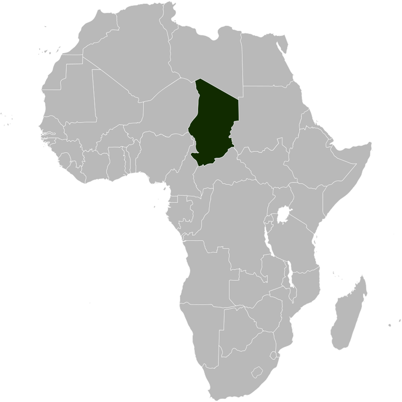
Chad covers about 1.28 million square kilometers of north-central Africa, a territory larger than South Africa, yet much of it is profoundly empty. The World Bank pegged its 2023 population density at approximately 15.3 people per square kilometer, higher than Mongolia or Australia but still remarkably sparse by global standards.
The country’s population is growing fast, crossing 21 million by 2025.
Northern Chad extends deep into the Sahara, where the Tibesti Mountains rise dramatically from the desert floor and temperatures can be extreme enough to challenge survival. These northern regions are among the least visited and least populated areas of the entire African continent.
The contrast with the south is enormous.
Southern Chad receives more rainfall and supports agriculture, fishing along Lake Chad’s shrinking shores, and the majority of the country’s population. N’Djamena, the capital, sits at the country’s southwestern edge near the Cameroon border, far from the northern desert that dominates the map.
Chad’s challenge going forward is managing a rapidly growing population alongside serious environmental pressures, including Lake Chad’s dramatic shrinkage due to climate change and agricultural demand. The empty north and the busy south tell two very different stories about the same country.
Share this story