The West Coast of the United States is built for road trips. California, Oregon, and Washington offer an almost overwhelming mix of ocean cliffs, ancient forests, volcanic peaks, and alpine lakes, all connected by roads that are worth the drive on their own.
Whether you have a weekend or two weeks, these 13 adventures prove that getting there really is half the fun. Pack snacks, charge your camera, and get ready to pull over a lot.
Olympic Peninsula Loop, Washington
Imagine squeezing a rainforest, a mountain range, a wild Pacific coastline, and a serene canal into one road trip loop. That is exactly what Washington’s Olympic Peninsula delivers, and it does so without any fuss.
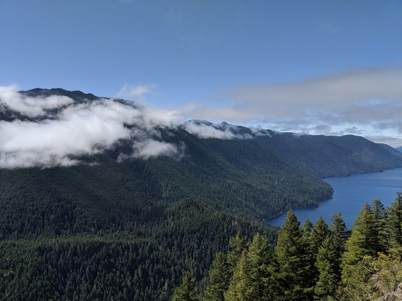
Highway 101 circles much of the peninsula, connecting dramatically different environments in a single journey. Lake Crescent offers glassy blue water framed by forest.
The Hoh Rain Forest feels like another planet, green and dripping and ancient. Rialto Beach and Kalaloch put you face to face with a raw, stormy Pacific shoreline that no postcard fully captures.
Towns around the peninsula make multi-day stays easy, and the Pacific Coast Scenic Byway stays open year-round, though individual park roads can close in winter. Most travelers find three to five days works well for a proper loop.
Rushing it is technically possible, but you would spend the whole drive home regretting every stop you skipped.
North Cascades Scenic Highway, Washington
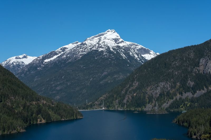
Diablo Lake looks like someone accidentally spilled neon paint into the mountains. The color comes from glacial rock flour suspended in the water, and it is one of the most unexpected sights you will encounter on State Route 20, Washington’s North Cascades Scenic Highway.
The route links the wetter, greener western Cascades with the sunnier Methow Valley, passing alpine lakes, jagged peaks, and trailheads along the way. Washington Pass is another highlight, where a short walk to an overlook rewards you with a jaw-dropping panorama of rocky spires and deep valleys.
Because the high mountain section closes in winter, this is a late-spring-through-fall adventure. Late September and early October bring fall color that makes the drive feel almost theatrical.
If you are heading east toward the Methow Valley, consider spending a night in the western-themed town of Winthrop, which earns its quirky cowboy aesthetic with excellent restaurants and a genuinely charming main street.
Mount Rainier’s Paradise and Sunrise Roads, Washington
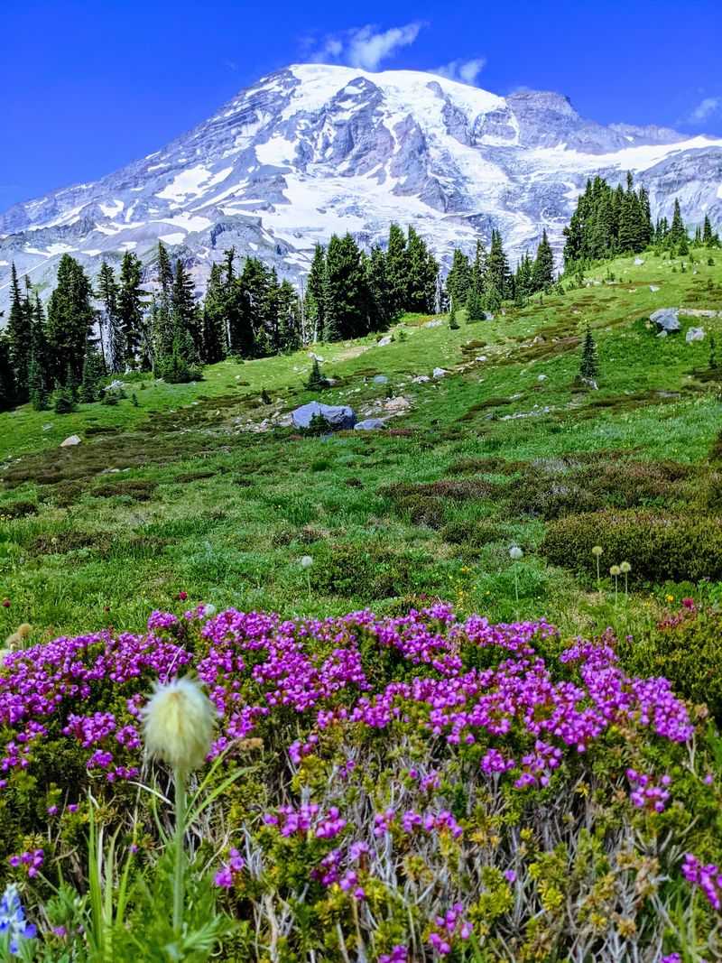
Mount Rainier has a habit of making people stop their cars in the middle of the road. At 14,411 feet, the volcano dominates the horizon for miles before you even reach the park entrance, and it only gets more dramatic as you climb closer.
The road to Paradise is the most popular route inside the park. Old-growth forest gives way to waterfalls, then to subalpine meadows packed with wildflowers in summer, and finally to sweeping views of glaciers that hang off the mountain’s flanks.
Sunrise Road offers a different angle, climbing into the subalpine zone from the White River entrance with views that stretch toward the Cascades.
Sunrise sits at around 6,400 feet and is typically only accessible in summer, so checking current road conditions before heading out saves a wasted trip. The grades on both roads are winding enough to make the drive itself feel like part of the adventure.
Wildlife sightings, including marmots and deer, add a nice bonus to the journey.
Highway 1 Through Big Sur, California
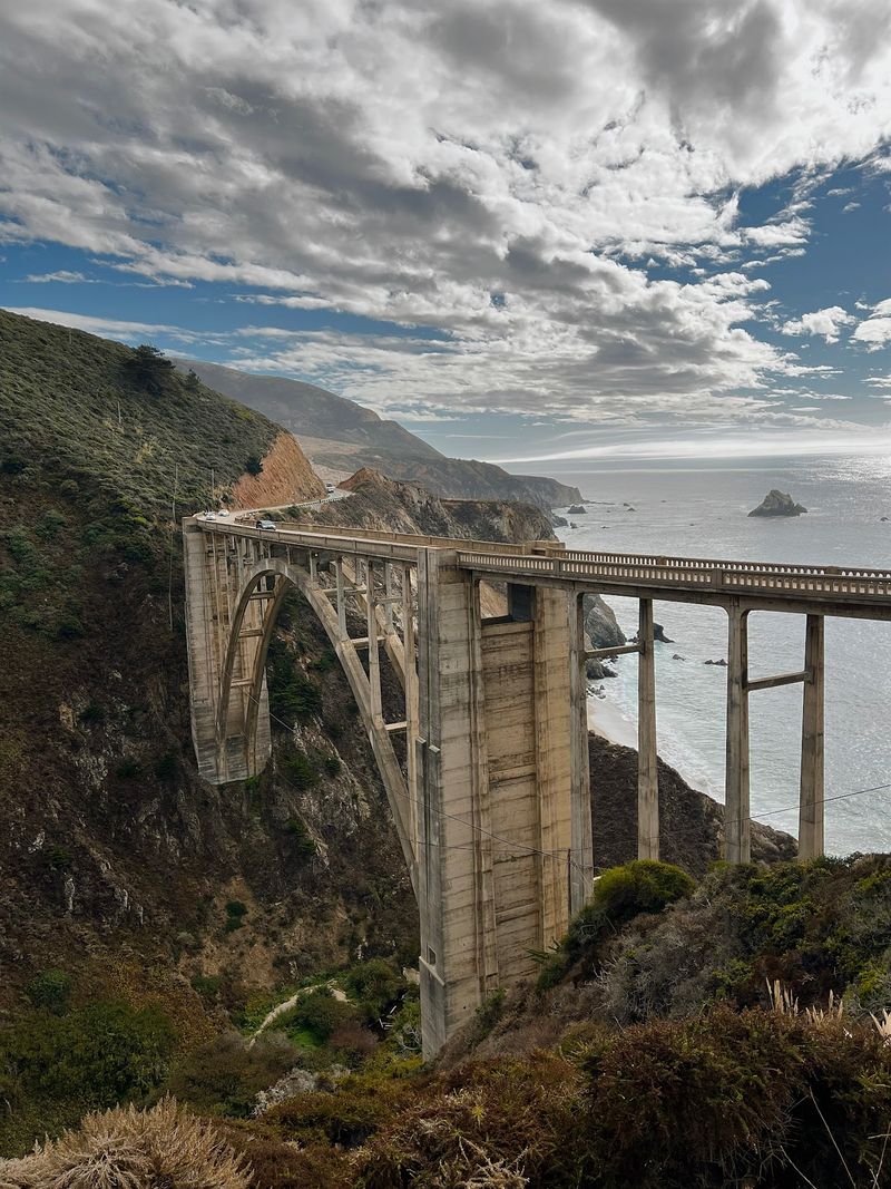
Few roads on Earth have the nerve to be this beautiful. California’s Highway 1 through Big Sur stretches roughly 90 miles between Carmel and the Hearst Castle area, threading between redwood-covered slopes and cliffs that plunge straight into the Pacific Ocean.
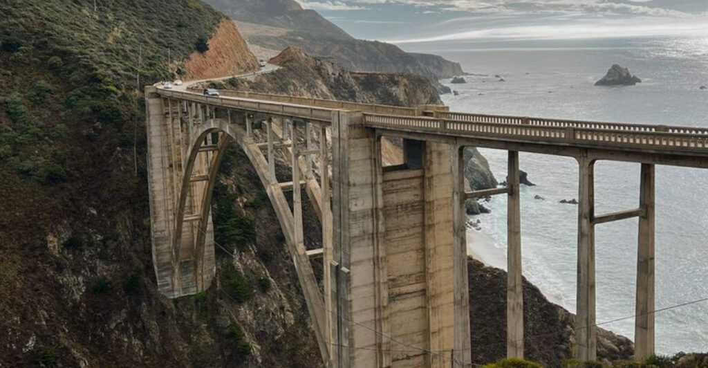
Bixby Bridge is the obvious photo stop, but the magic keeps coming. McWay Falls drops onto a sandy cove you can only view from above, coastal overlooks appear around nearly every bend, and short trails lead to beaches worth every step.
The light here in the late afternoon turns the ocean a shade of silver-gold that feels almost unfair.
As of 2026, Visit California confirmed that repairs along the legendary route were complete and the road was fully open again. Go slow, stop often, and plan for the drive to take twice as long as your map app suggests.
That is not a problem. That is the whole point of Big Sur.
The Cascade Loop, Washington
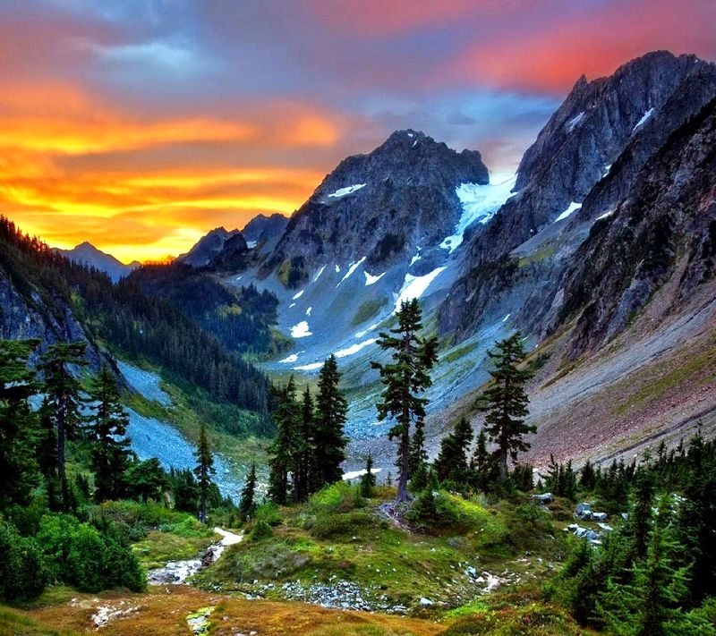
At 440 miles, Washington’s Cascade Loop is less a road trip and more a full-blown expedition, and it earns every mile. The official tourism authority recommends roughly five days rather than trying to squeeze its nine-plus hours of driving into one heroic push.
The loop connects Puget Sound, Whidbey Island, the dramatic North Cascades, the apple orchards and vineyards of North Central Washington, and mountain towns along U.S. 2. Winthrop channels old-west energy with boardwalks and craft beer.
Leavenworth goes full Bavarian village, complete with lederhosen and pretzels that are actually worth eating.
Alpine passes, farm stands, lakeside campgrounds, and ferry rides break up the driving in the best possible way. The variety is what makes the Cascade Loop stand out from other big-picture road trips.
You can be watching waves crash on a beach in the morning and eating schnitzel in a fake Bavarian village by evening. Washington is a strange and wonderful state.
Whidbey Scenic Isle Way, Washington
Not every great road trip needs a mountain pass or a cliffside drop. Whidbey Island proves that water views, historic towns, farmland, and a well-timed ferry ride can be just as satisfying as anything the Cascades throw at you.
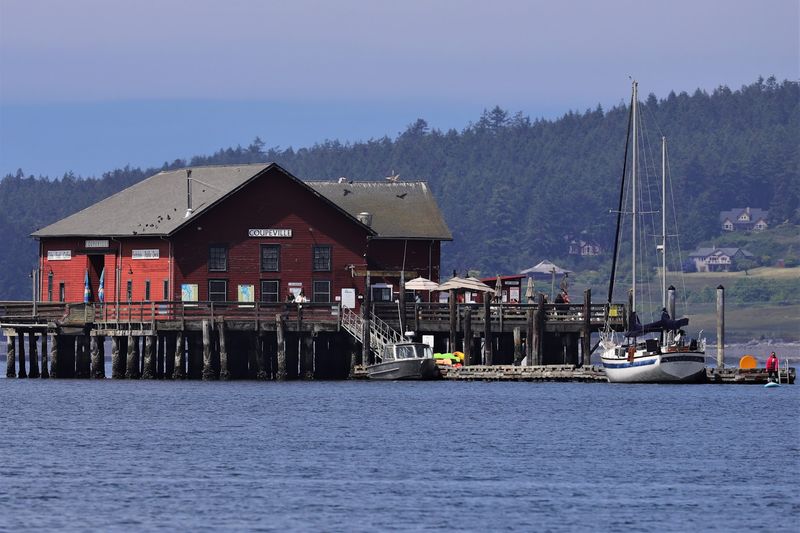
The Whidbey Scenic Isle Way runs the length of the island, connecting communities including Coupeville, Oak Harbor, Greenbank, and the charming village of Langley. Coupeville is particularly worth a slow wander, with Victorian-era buildings, a working wharf, and a chowder scene that locals take very seriously.
Deception Pass at the northern end delivers the most dramatic scenery on the island. The bridge spans a churning channel between two rocky headlands, and the views from the walkway are genuinely thrilling.
Unlike Washington’s high mountain routes, this byway is accessible year-round, making it a solid choice for fall and winter travelers who still want something scenic. The Clinton ferry creates an easy loop back toward the Seattle region when you are ready to head home.
Pacific Coast Scenic Byway, Oregon
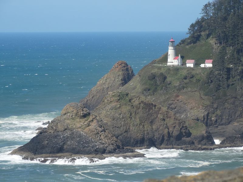
Oregon’s coastline operates by its own rules. Sea stacks rise out of the ocean like forgotten monuments, lighthouses perch on headlands that jut dramatically into the Pacific, and small coastal towns serve chowder so good it feels like cheating.
Highway 101 runs the entire length of the Oregon coast, delivering an almost continuous sequence of beaches, capes, forests, and viewpoints along the Pacific Coast Scenic Byway. Cannon Beach anchors the northern stretch with its iconic Haystack Rock.
Cape Kiwanda in the middle offers a sandstone headland you can actually scramble up. Bandon and the rugged southern coast feel wilder and less crowded.
Treating this as a multi-day journey rather than a single push is strongly recommended. State parks and pullouts appear so frequently that you will naturally slow down anyway.
Short detours lead toward tide pools, sand dunes, fishing harbors, and hiking trails that most people driving through never find. Oregon makes the coast feel like a secret even when Highway 101 is busy, which is a neat trick worth experiencing firsthand.
Samuel H. Boardman State Scenic Corridor, Oregon
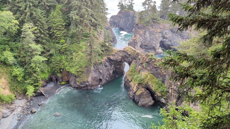
Oregon keeps one of its best-kept coastal secrets tucked near the California border. The Samuel H.
Boardman State Scenic Corridor covers roughly 12 miles of Highway 101 near Brookings, but those 12 miles pack in more dramatic coastline than most roads manage in a hundred.
Natural Bridges, Arch Rock, Secret Beach, and House Rock are the headline stops, but the corridor rewards anyone willing to leave the car. Short trails drop through dense coastal forest to viewpoints and beaches that feel genuinely remote despite being a short walk from the road.
Secret Beach lives up to its name with a hidden cove framed by sea stacks that stops people in their tracks.
Drivers who blow through the corridor in 20 minutes see the views. Travelers who give it half a day or more experience something closer to the real thing.
Bring layers, because the wind off the Pacific here means business. The southern Oregon coast is far less visited than the northern stretch, which makes Boardman feel like a reward for anyone who made the full drive down.
Historic Columbia River Highway, Oregon
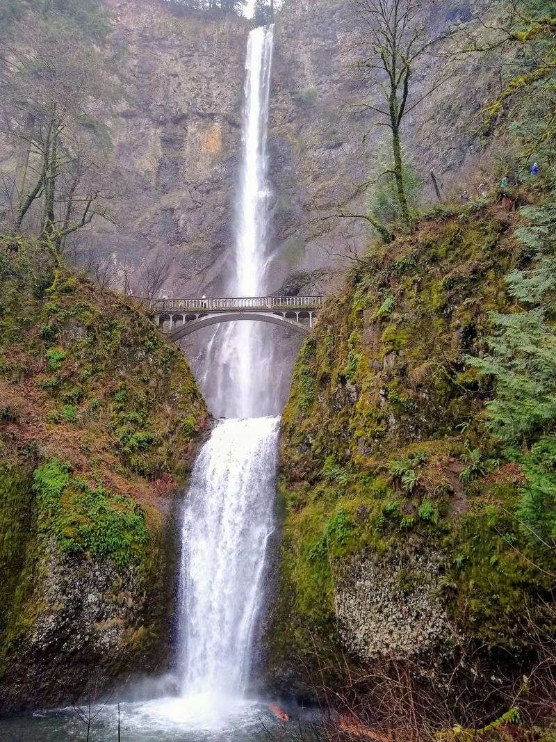
Built in 1916 and designed to be as beautiful as the landscape it crossed, the Historic Columbia River Highway was America’s first scenic highway. Over a century later, it still earns that title without breaking a sweat.
The route stretches about 70 miles through the Columbia River Gorge, pairing one of North America’s great rivers with towering basalt cliffs and a remarkable concentration of waterfalls. Crown Point and Vista House provide the first dramatic overlook.
Multnomah Falls, at 620 feet, is the showstopper, but Latourell, Wahkeena, and Bridal Veil falls all deserve a stop and a short hike.
Many of the gorge’s waterfalls sit within about 40 miles of Portland, making this one of the easiest spectacular drives to attach to a city visit. The biggest challenge on this route is deciding how often to pull over, and the honest answer is: more than you planned.
Fall brings color that makes the basalt cliffs look even more cinematic. Spring brings rushing water and wildflowers lining the trails above the gorge.
Cascade Lakes Scenic Byway, Oregon
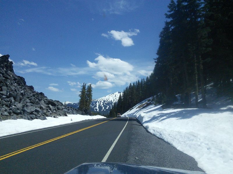
Central Oregon’s high desert meets volcanic peaks and alpine lakes on the Cascade Lakes Scenic Byway, and the combination hits harder than you might expect. Starting near Bend, the route climbs roughly 66 miles through a landscape shaped by ancient eruptions and cooled by clear mountain water.
Sparks Lake offers one of the most photographed reflections in Oregon, with South Sister mirrored in calm water at sunrise. Devils Lake is a vivid turquoise gem popular with swimmers.
Elk Lake draws kayakers and anglers. Trailheads appear frequently, and the access they provide ranges from easy lakeside strolls to longer alpine hikes.
Snow closes the upper portions of the byway in winter, so this is primarily a late-spring-through-fall adventure. Bend serves as an excellent base, with craft breweries and restaurants that make a post-drive evening genuinely enjoyable.
The town has grown quickly over the past decade, but it has held onto the outdoor-focused energy that made it popular in the first place. Pair the byway with a sunrise start and you will have the lakes largely to yourself.
Crater Lake and the Volcanic Legacy Scenic Byway, Oregon
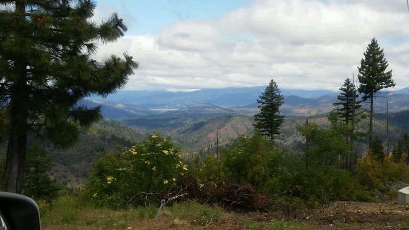
Crater Lake is one of those places that makes first-time visitors go completely silent. The water is so deeply, impossibly blue that it looks digitally enhanced.
It is not. That color comes from the lake’s extraordinary depth and purity, and no photograph fully prepares you for it.
The Volcanic Legacy Scenic Byway approaches the park through terrain shaped by eruptions and lava flows, giving the drive a moody, otherworldly quality before you even reach the caldera rim. Inside the park, the 33-mile Rim Drive circles the lake and connects viewpoints that look down into the water from different angles and elevations.
Snow determines when the complete Rim Drive is accessible. Sections reopen progressively beginning in late spring, with the full loop typically open by midsummer.
Wizard Island, a cinder cone rising from the lake’s surface, can be reached by boat tour during the summer season. The combination of the volcanic approach road and the caldera rim drive makes this one of the most geologically fascinating road trips on the entire West Coast.
Redwood Highway and Newton B. Drury Scenic Parkway, California
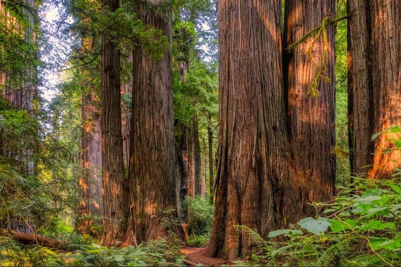
Driving through a redwood forest resets something in your brain. The trees are so tall and so old that the usual sense of scale stops working, and for a few miles you feel genuinely small in the best possible way.
U.S. 101 through Northern California’s redwood country connects coastal scenery with groves containing some of the tallest trees on Earth. The Newton B.
Drury Scenic Parkway is the standout detour. Its 10-mile route through Prairie Creek Redwoods State Park passes through old-growth forest so dense and cathedral-like that it earns its own category.
Trailheads along the parkway lead to Fern Canyon, where vertical walls draped in green ferns have been used as a film location multiple times. Roosevelt elk frequently graze in the meadows near the park, and spotting a herd from the road is a surprisingly common thrill.
The Redwood Highway makes a natural addition to any California road trip heading north toward Oregon, and the parkway itself is one of those detours that travelers remember for years after the trip ends.
Highway 395 Through California’s Eastern Sierra
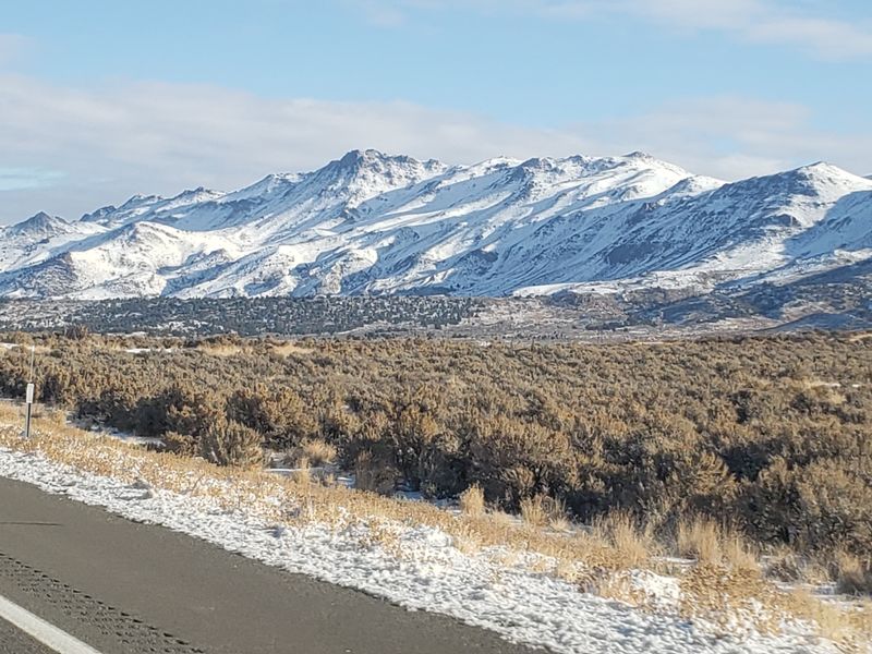
Highway 395 through California’s Eastern Sierra is the road trip that people who have already done Highway 1 talk about with a slightly smug expression. It trades ocean cliffs for something equally dramatic: a massive mountain wall rising thousands of feet above a high desert valley.
The route connects Lone Pine, Bishop, Mammoth Lakes, June Lake, and Mono Lake while running along the base of the Sierra Nevada. Mono Lake’s tufa towers are genuinely strange and worth a stop.
The Alabama Hills near Lone Pine have appeared in so many Western films that the rock formations feel oddly familiar. Mammoth Lakes offers hiking, fishing, and a volcanic landscape that reminds you the Sierra is not as calm as it looks.
Side trips push this route from great to exceptional. The June Lake Loop passes glacial lakes and mountain scenery on a 16-mile detour.
When Tioga Road is open, it connects Highway 395 to Yosemite through 47 miles of forests, meadows, lakes, and granite domes. The pass closes in winter, so timing matters, but when it is open the combination of 395 and Tioga Road is hard to beat on the entire West Coast.
Share this story