Latin America is one of the most varied regions on Earth, stretching from steamy Caribbean beaches to frozen Patagonian glaciers, with everything from ancient ruins to volcanic islands in between. The sheer range of landscapes, cultures, and histories packed into this part of the world is genuinely hard to believe until you start exploring it.
From the stone temples of the Maya to the shifting sand dunes of Brazil, every corner tells a different story. The 15 destinations below were chosen to show just how wide that range really is, and why no two stops on a Latin American journey ever feel quite the same.
Mexico City, Mexico
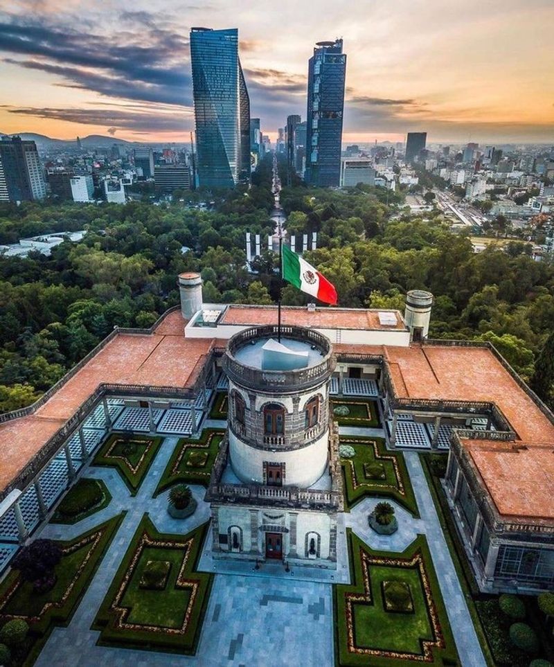
Built on the ruins of a sunken empire, Mexico City is the kind of place that rewards anyone willing to look down at the ground beneath their feet. The Spanish colonial capital was constructed directly over Tenochtitlan, the Aztec island city, after the 16th-century conquest.
Remains of the Templo Mayor now sit just steps from the Metropolitan Cathedral, creating one of the most layered archaeological and architectural zones in the world.
Twenty-eight kilometers south, the canals and floating gardens of Xochimilco survive from a pre-Hispanic farming tradition that once fed an entire civilization. UNESCO recognizes the historic center and Xochimilco together as a single World Heritage property, because both pieces are needed to understand the city’s full story.
Visiting both feels like reading two chapters of a very long book.
Beyond history, Mexico City buzzes with world-class museums, neighborhood markets, and a food scene that ranges from street tacos to internationally recognized restaurants. The city’s sheer energy can be overwhelming at first, but most visitors find that overwhelming feeling turns into fascination pretty quickly.
Few capitals on Earth pack this much history, culture, and flavor into one place.
Oaxaca, Mexico
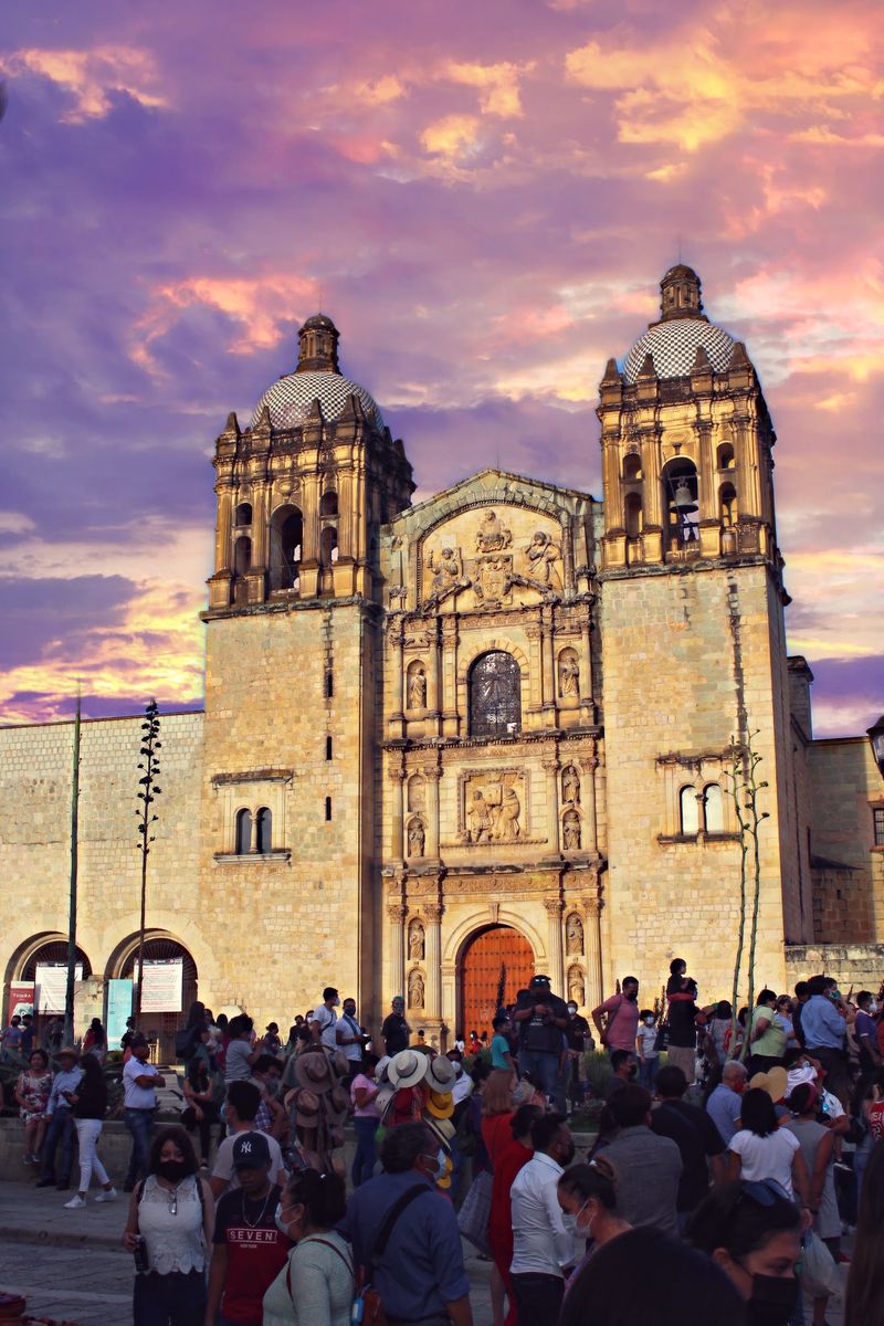
Oaxaca smells like chocolate, toasted chili, and wood smoke, and that combination alone tells you something important about how deeply Indigenous traditions run through this city. While the colonial grid of low buildings and thick earthquake-resistant walls reflects 16th-century Spanish planning, the culture inside those walls is heavily Zapotec and Mixtec.
Markets overflow with handwoven textiles, black clay pottery, and mole pastes that have been perfected over generations.
Just outside the city, Monte Alban rises on a flattened mountaintop where Zapotec builders constructed temples, ball courts, and hieroglyphic monuments starting around 500 B.C. The site flourished for over a thousand years and remains one of Mesoamerica’s most impressive archaeological complexes.
Standing on that mountaintop at sunrise, looking out over the valley, is one of those travel moments that sticks with people for years.
Oaxaca’s historic center contains roughly 1,200 listed civil and religious monuments spread across 247 blocks, according to UNESCO. That density means almost every walk turns up something interesting, whether it is a painted church facade, a courtyard market, or a festival procession.
Oaxaca rewards slow travel more than almost anywhere else in Mexico.
Tikal National Park, Guatemala
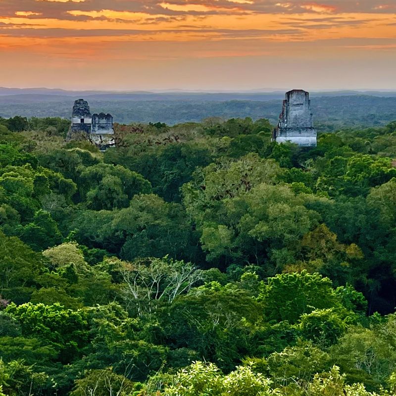
Somewhere deep in the Guatemalan jungle, a pyramid taller than a 20-story building pokes through the forest canopy, and spider monkeys watch from the treetops as tourists crane their necks to look up. Tikal was one of the most powerful Maya cities of the Classic period, inhabited from roughly the 6th century B.C. through the 10th century A.D.
Its ceremonial core includes plazas, palaces, royal tombs, and temples whose steep staircases once hosted religious ceremonies visible from miles away.
What makes Tikal genuinely unusual among ancient sites is its dual status as both a cultural and natural World Heritage property. UNESCO recognized it under both criteria, because the ruins sit within a biologically significant section of the Maya Forest.
The park forms part of the much larger Maya Biosphere Reserve, which covers more than two million hectares and stretches across protected land toward Mexico and Belize.
Early morning visits before tour groups arrive offer a different experience entirely. Fog drifts between the trees, toucans call overhead, and the silence between those sounds feels ancient.
Tikal is not just an archaeological site you visit; it is an environment you absorb, and the forest itself is as much a reason to come as the ruins.
Monteverde, Costa Rica
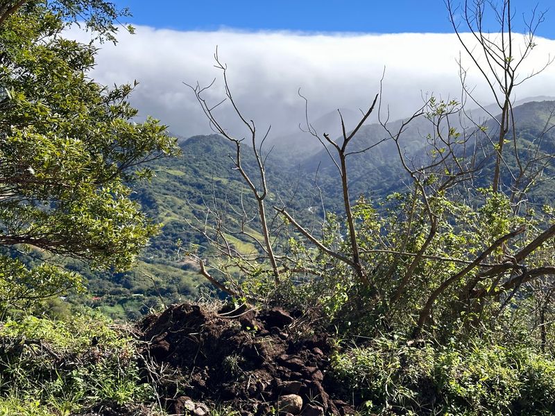
Most people picture Costa Rica as beaches and lowland rainforest, which makes Monteverde something of a pleasant shock. Perched around 5,250 feet above sea level, the Monteverde Cloud Forest Biological Reserve exists in a permanently misty world where moisture-laden air condenses around the canopy almost every day.
The result is a forest so damp that mosses, ferns, orchids, and bromeliads carpet not just the ground but every branch and trunk in sight.
The biodiversity packed into that cool, foggy environment is extraordinary. Resplendent quetzals, three-wattled bellbirds, and over 400 other bird species have been recorded in the reserve.
Jaguars, tapirs, and pumas also live here, though spotting them requires patience and a good guide who knows where to look.
Hiking trails wind through the reserve at various difficulty levels, making it accessible for families with kids as well as serious trekkers. Suspension bridges over the canopy offer a bird’s-eye view of the forest that ground-level trails simply cannot match.
Costa Rica’s tourism organization specifically highlights Monteverde for its cool temperatures and persistent fog, which feel dramatically different from the Pacific beaches just a few hours away. That contrast, within a country smaller than West Virginia, is part of what makes Costa Rica ecologically fascinating.
Cartagena, Colombia
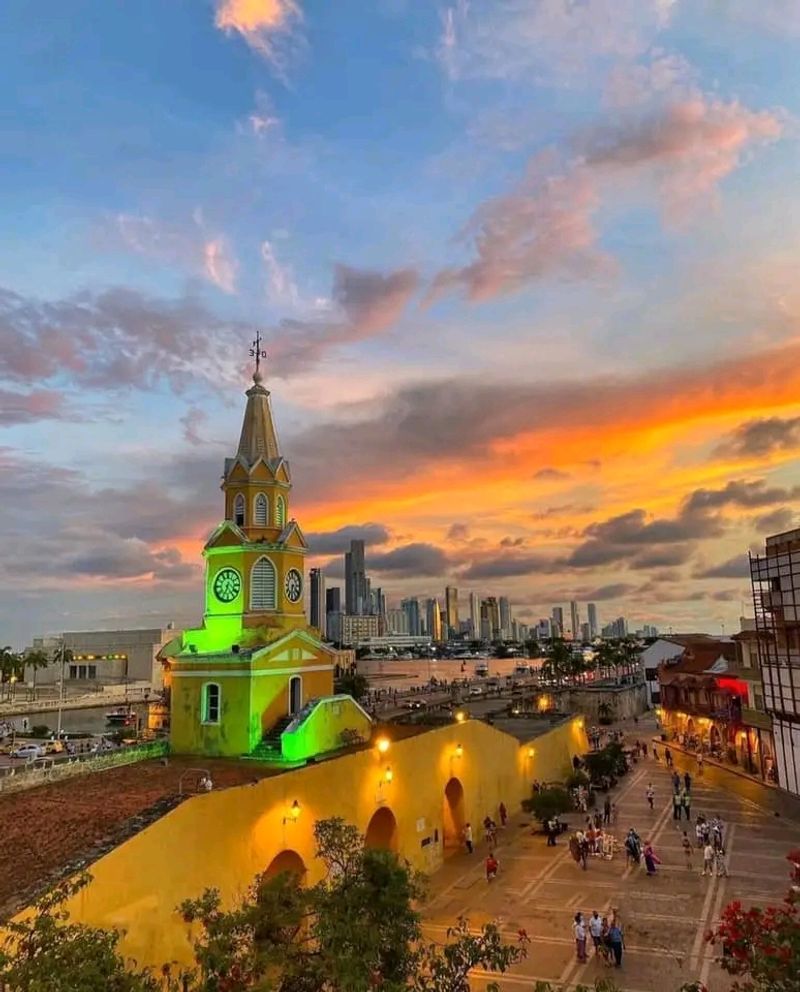
Cartagena’s old city looks like someone turned the volume up on every color available and then forgot to turn it back down. Bougainvillea spills over balconies painted yellow, turquoise, and coral, all enclosed within defensive walls that took two centuries to complete.
Those walls were not decorative; Cartagena was one of Spain’s most strategically vital Caribbean ports, and protecting it required what UNESCO now calls the most extensive fortification system in South America.
The city’s history is layered with the realities of colonial-era trade, including the Atlantic slave trade, which shaped Cartagena’s culture, food, music, and population in profound ways. Getsemani, the neighborhood historically associated with artisans and enslaved people, has become one of the most vibrant and artistic corners of the city.
Its street murals and community life tell stories that the polished tourist zones sometimes gloss over.
Castillo San Felipe de Barajas still looms over the eastern approach to the city, a fortress so well designed that it was never successfully stormed. Walking its tunnels and ramparts gives a real sense of the military engineering involved.
Beyond the walls, the Caribbean coast stretches toward islands and mangroves that offer a completely different pace from the busy historic center.
Galapagos Islands, Ecuador
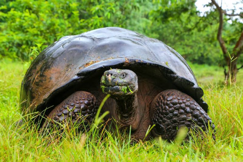
Nowhere else on Earth will a sea lion flop onto the bench beside you at a dock and simply go to sleep, completely unbothered by your presence. The Galapagos Islands sit about 620 miles west of mainland Ecuador, where three major ocean currents converge and create conditions that encouraged species to evolve in ways found nowhere else.
Giant tortoises the size of coffee tables, marine iguanas that sneeze salt, and finches with beaks shaped by millions of years of island life all call this place home.
Charles Darwin visited in 1835, and his observations here helped him develop the theory of natural selection. UNESCO describes the islands as a living museum and showcase of evolution, and the World Heritage property covers both the terrestrial archipelago and the surrounding marine environment.
That marine zone is one of the most biologically productive in the Pacific, supporting whale sharks, hammerheads, dolphins, and penguins that have no business being this close to the equator.
The landscape itself shifts dramatically between islands. Barren lava fields, humid highland forests, and wildlife-packed beaches can all appear within a short boat ride of each other.
Visitor access is carefully managed to protect ecosystems, which means the experience feels intimate rather than crowded, even during peak season.
Machu Picchu, Peru
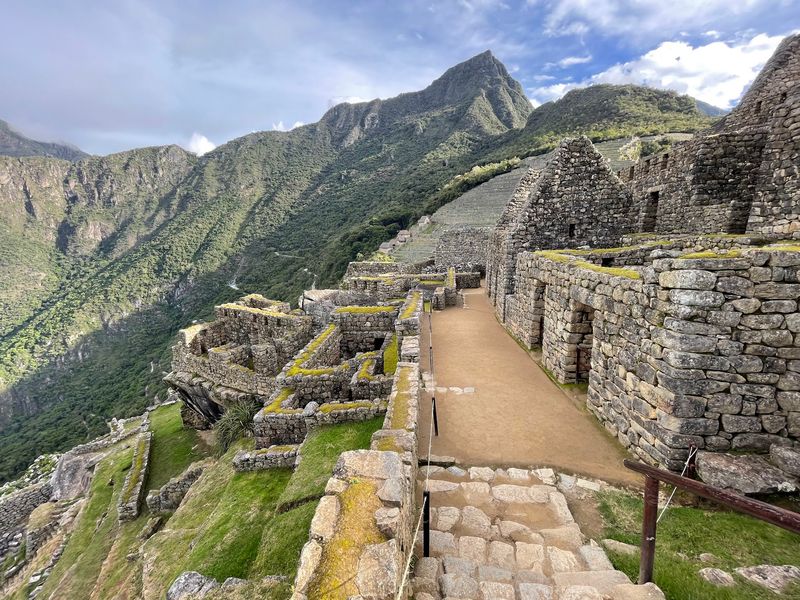
There is a reason Machu Picchu appears on more travel bucket lists than almost any other site in the world, and it has everything to do with location. Inca builders chose a narrow ridge at roughly 7,970 feet above sea level, where the Andes begin dropping toward the Amazon basin, and then constructed an entire city of fitted stone without using mortar or metal tools.
The precision is still baffling to engineers today.
UNESCO recognizes Machu Picchu as a mixed cultural and natural World Heritage property covering 32,592 hectares. That boundary includes far more than the famous citadel; it encompasses forested valleys, mountain peaks, and one of the most biodiverse transition zones on the continent.
The protected area connects high Andean grasslands with cloud forest, creating habitat for spectacled bears, cock-of-the-rock birds, and hundreds of orchid species.
Getting there requires either a multi-day trek along the Inca Trail or a train ride through the Sacred Valley followed by a bus up the switchbacks. Both options are worth planning carefully because visitor numbers are managed through timed entry tickets.
Arriving at the Sun Gate on foot after days of hiking, with the citadel appearing below through morning mist, is reportedly one of those experiences that travelers describe for the rest of their lives.
San Pedro de Atacama, Chile
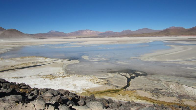
The Atacama Desert is often called the driest place on Earth, but calling San Pedro de Atacama just a desert town is like calling the ocean just a big puddle. The landscape surrounding this small adobe village includes salt flats where flamingos wade through shallow brine, volcanic peaks rising above 19,000 feet, and the El Tatio geyser field that erupts in spectacular steam columns at dawn.
Excursions regularly climb above 13,000 feet into the Andean Altiplano, where the air is thin and the silence is total.
Valle de la Luna, a short drive from town, looks like a film set for a science fiction movie. Wind and water have carved the salt and clay into ridges and craters that glow orange and purple at sunset.
The Chilean tourism board lists archaeology, Indigenous culture, hot springs, and stargazing alongside the more obvious landscape attractions, and all of them are legitimate reasons to stay longer than planned.
Northern Chile’s skies are among the clearest on Earth, which is why so many international observatories have been built in the region. Several operators offer guided nighttime stargazing sessions that use professional equipment and take full advantage of the altitude and dry air.
Seeing the Milky Way from the Atacama is an experience that no photograph does justice to.
Rapa Nui (Easter Island), Chile
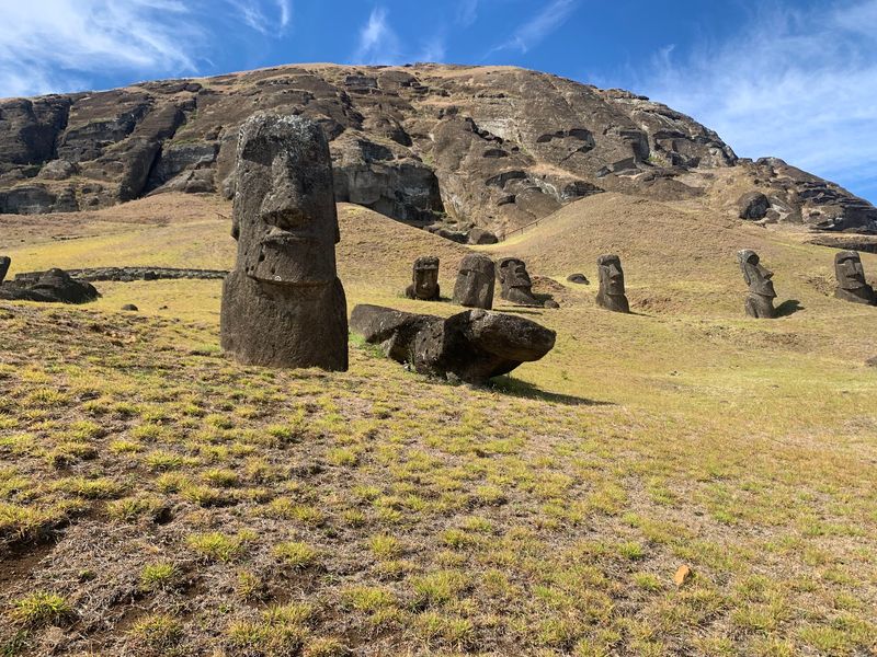
About 2,300 miles from the Chilean coast, a Polynesian island sits alone in the South Pacific with nearly 1,000 carved stone figures staring across its landscape. Rapa Nui, known internationally as Easter Island, is one of the most isolated inhabited places on Earth, and that isolation shaped one of the most distinctive cultures anywhere in the Pacific.
The moai, enormous carved figures representing ancestral chiefs, were erected on ceremonial platforms called ahu, sometimes using stones transported miles from a single volcanic quarry.
UNESCO dates the major period of moai construction primarily from the 10th through 16th centuries. Rapa Nui National Park now protects about 7,000 hectares of cultural and archaeological landscape, including the quarry at Rano Raraku where hundreds of unfinished figures still stand half-carved in the hillside.
Walking among them feels genuinely eerie in the best possible way.
What makes Rapa Nui especially interesting in the context of Latin America is how completely different it is from everything else in the region. The language, traditions, and artistic heritage are Polynesian, not Spanish colonial.
Chile administers the island, but Rapa Nui connects the South American political world with the Pacific cultural world in a way that challenges any simple definition of what Latin America actually is.
Los Glaciares National Park, Argentina
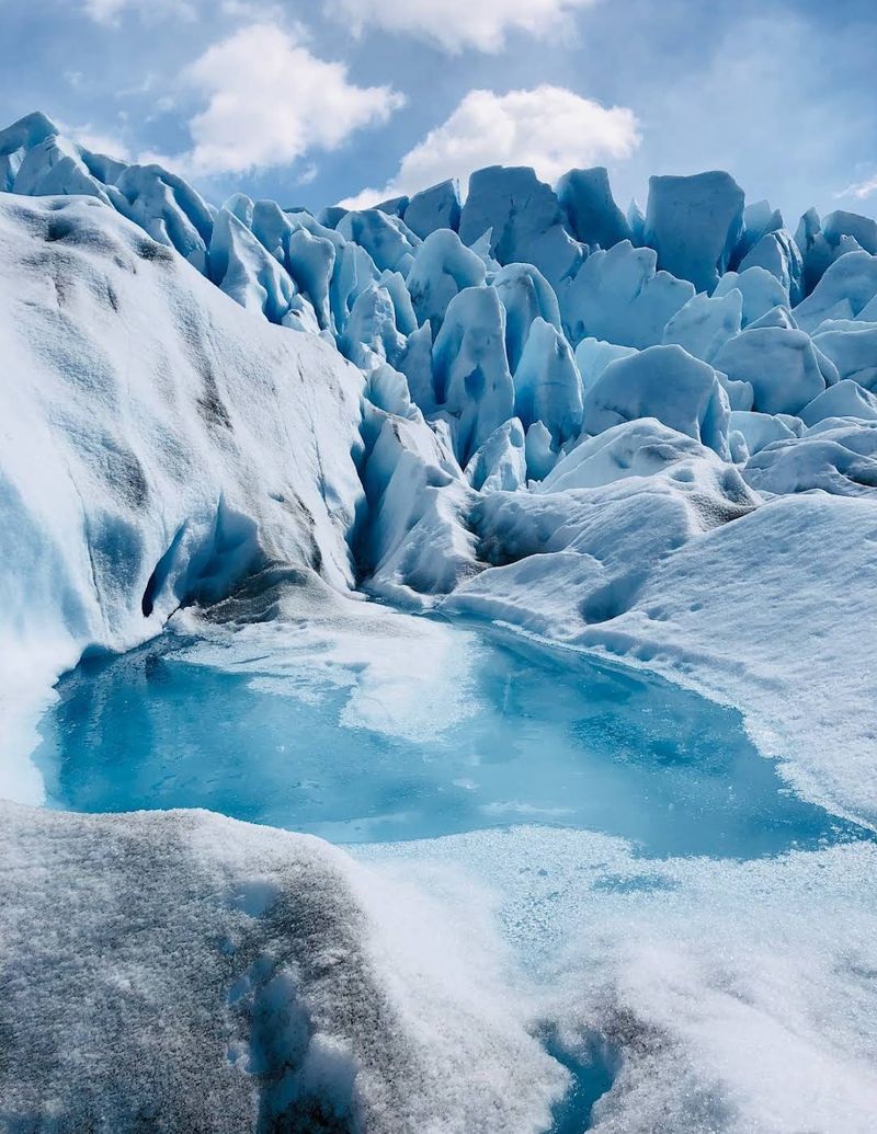
Standing in front of the Perito Moreno Glacier and watching a chunk of ice the size of a house crash into the lake below is the kind of thing that reminds you how small humans actually are. Los Glaciares National Park in Argentina’s Santa Cruz Province protects more than 726,000 hectares of Patagonian landscape, including part of one of the largest continental ice fields outside the polar regions.
The park was established in 1937 and became a UNESCO World Heritage Site in 1981.
Perito Moreno is the park’s most visited glacier, accessible via a network of walkways stretching more than 2.5 miles along the viewing area. Unlike most glaciers worldwide, Perito Moreno is considered stable, meaning it advances roughly as fast as it calves, making it one of the few places where you can reliably witness glacial ice falling into water.
Boat routes reach other massive glaciers including Upsala and Spegazzini, which are even larger but require more effort to access.
Away from the ice, the park shifts into Andean-Patagonian forest and open steppe where condors circle overhead and guanacos graze on windswept grassland. Pumas and endangered huemul deer also live within the park boundaries, and patient wildlife watchers have a real chance of encountering both.
The combination of ice, mountains, forest, and wildlife within one protected area is genuinely hard to match anywhere in South America.
Pantanal, Brazil
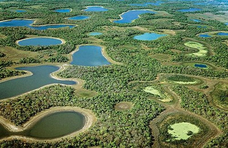
Jaguars are notoriously difficult to spot in the Amazon, but in the Pantanal they sometimes stroll along riverbanks in plain sight of tourist boats, which tells you something about just how wildlife-rich this ecosystem is. The Pantanal is the world’s largest tropical wetland, spreading across central South America with its biggest share in Brazil.
Every year, seasonal floods reshape the landscape, turning grasslands into shallow lakes and pushing animals into concentrated areas where they become easier to observe.
Brazil’s tourism authority lists roughly 124 mammal species, 463 bird species, and 325 fish species living in or passing through the Pantanal. Giant anteaters shuffle through the grass, capybaras lounge in groups near the water, caimans line every riverbank, and hyacinth macaws, the world’s largest parrot species by length, nest in palms throughout the region.
Portions of the Pantanal form a UNESCO Natural World Heritage property.
Getting around requires a combination of boats, horses, and trucks, depending on the season and water level. Fazendas, traditional cattle ranches that have adapted to ecotourism, provide the most common base for exploration.
The best wildlife viewing typically happens from July through October, when water levels drop and animals cluster around remaining water sources. Few places in the world offer wildlife encounters this accessible and this spectacular.
Rio de Janeiro, Brazil
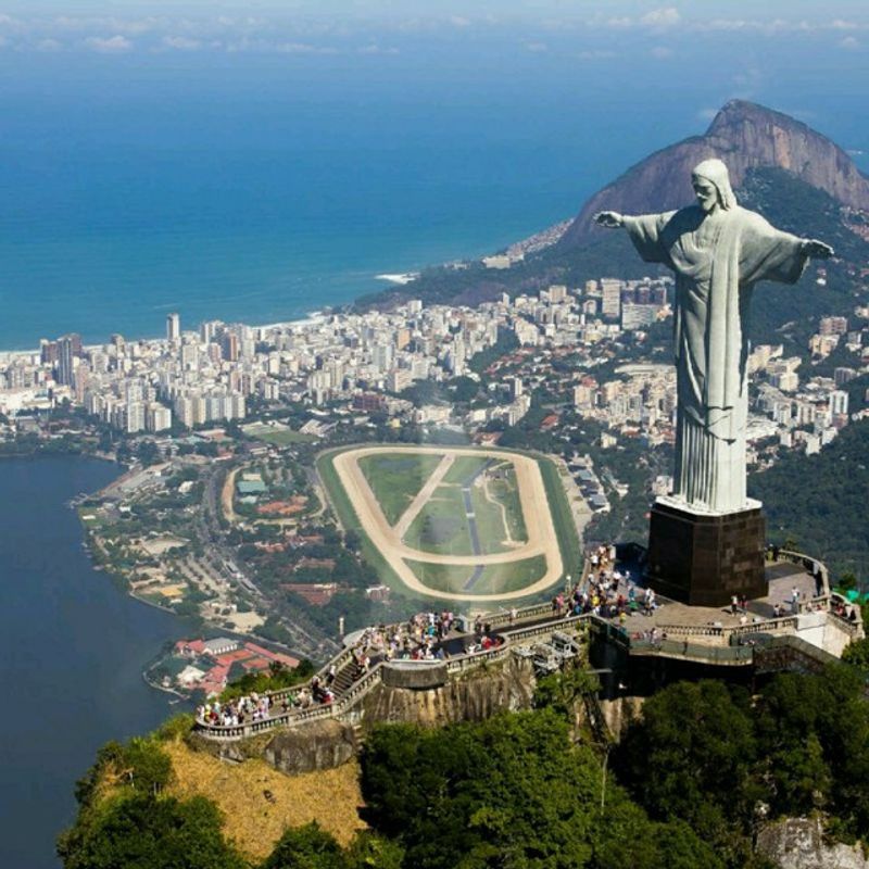
Rio de Janeiro is the only major city in the world where a national rainforest park sits within the city limits, which says everything about how unusually Rio was built. Mountains, ocean, bay, and dense urban neighborhoods exist so close together that the city’s geography is inseparable from its identity.
UNESCO recognized this by designating Rio’s cultural landscape, stretching from Tijuca National Park down through Corcovado and the Botanical Garden to the Copacabana coastline, as a World Heritage property.
Tijuca National Park’s peaks rise above 3,300 feet and contain one of the largest urban forests in the world. Trails wind through the trees to waterfalls and viewpoints, while the famous Christ the Redeemer statue at Corcovado watches over the city from above.
The Botanical Garden, established in 1808, holds over 6,500 plant species and remains one of the most important research gardens in South America.
At sea level, Roberto Burle Marx’s geometric black-and-white wave mosaic along the Copacabana promenade has become one of the most photographed sidewalks on Earth. Neighborhoods like Santa Teresa cling to hillsides with narrow tram lines and colonial houses, while Lapa’s arched aqueduct hosts weekend samba sessions that go until well past midnight.
Rio rewards exploration in every direction, vertically as much as horizontally.
Lencois Maranhenses National Park, Brazil
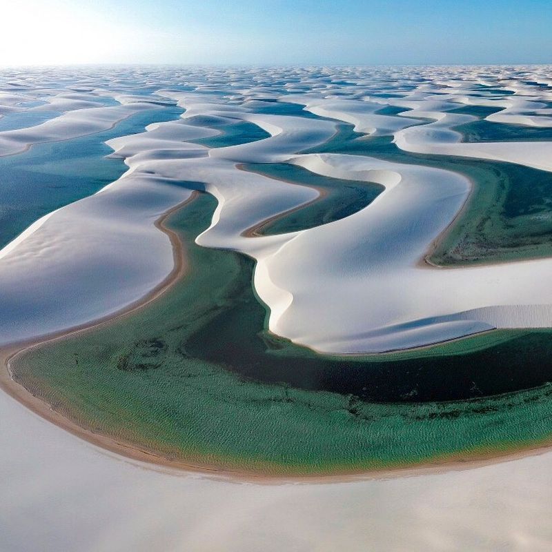
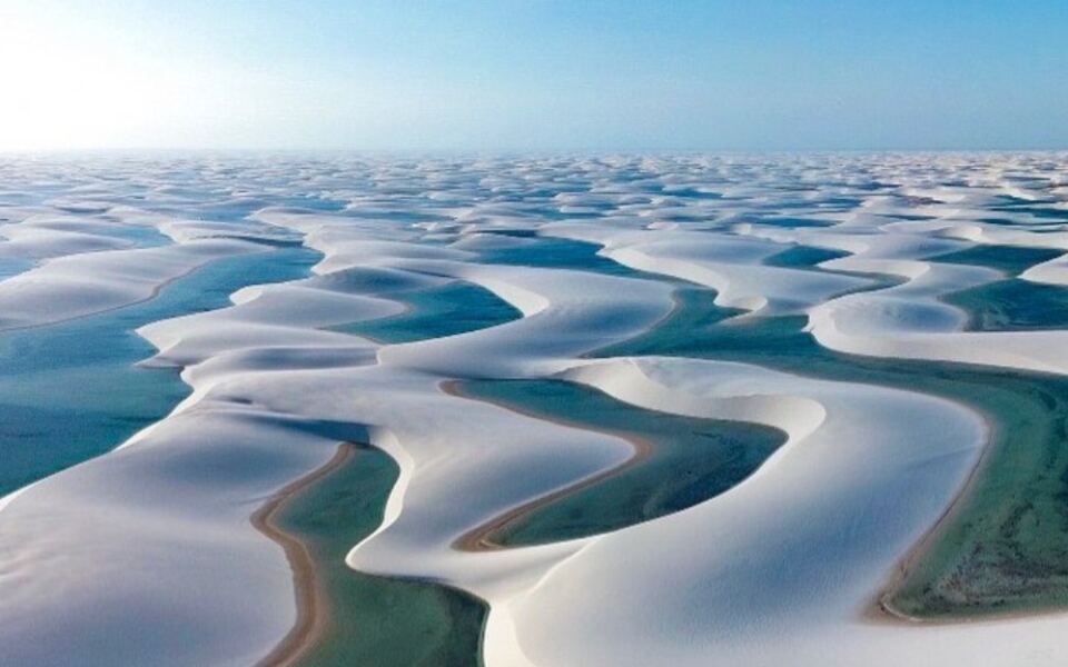
Picture an enormous white desert full of crystal-clear blue lagoons, and you have something close to what Lencois Maranhenses looks like from above. Located along Brazil’s northeastern coast, this national park contains massive fields of white barchan dunes separated by seasonal freshwater lagoons that appear every rainy season and then slowly disappear as the dry months return.
The lagoons are not fed by rivers; they form purely from rainwater collecting in the low points between dunes.
The dunes themselves are enormous, reaching roughly 100 feet high in places and extending more than 12 miles inland. They are also moving, migrating as much as 25 meters per year under persistent coastal winds.
UNESCO notes that approximately 90,000 of the park’s 156,562 hectares consist of dune fields, making this South America’s largest expanse of shifting dunes. The park was added to the World Heritage List in 2024, recognizing both its visual drama and its geological significance.
The best time to visit is between July and September, when the lagoons are at their fullest and the water is warm enough for swimming. Getting there requires traveling to the town of Barreirinhas and then heading into the park by 4×4 vehicle or boat along the Preguicas River.
The journey is part of the experience, passing through small fishing communities that feel refreshingly far from the tourist trail.
Santo Domingo, Dominican Republic
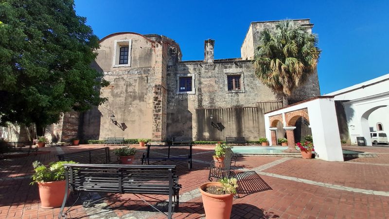
Santo Domingo holds a record that most travelers have never heard of: it is home to the first cathedral, the first hospital, the first customs house, and the first university established by Europeans anywhere in the Americas. Founded at the end of the 15th century and rebuilt on the west bank of the Ozama River in 1502, the city served as the launching pad for Spanish colonization across the entire continent.
Every Spanish colonial city that came after it, from Havana to Lima, borrowed from the urban grid laid out here first.
The protected historic district, known as the Zona Colonial, covers 106 hectares and retains its original grid plan, defensive walls, stone forts, and early stone buildings. Walking through it feels different from other colonial cities because the architecture here is genuinely old, predating most of what survives elsewhere in Spanish America.
The Cathedral of Santa Maria la Menor, completed in the 16th century, is the oldest cathedral in the Americas still standing.
Santo Domingo’s history also reflects the violent collision of Indigenous, European, and African societies that defined the early Caribbean. The city’s museums and public spaces engage honestly with that history in ways that add real depth to what might otherwise feel like a straightforward sightseeing experience.
The food, music, and street life of the modern city layer on top of all that history with tremendous energy.
Colonia del Sacramento, Uruguay
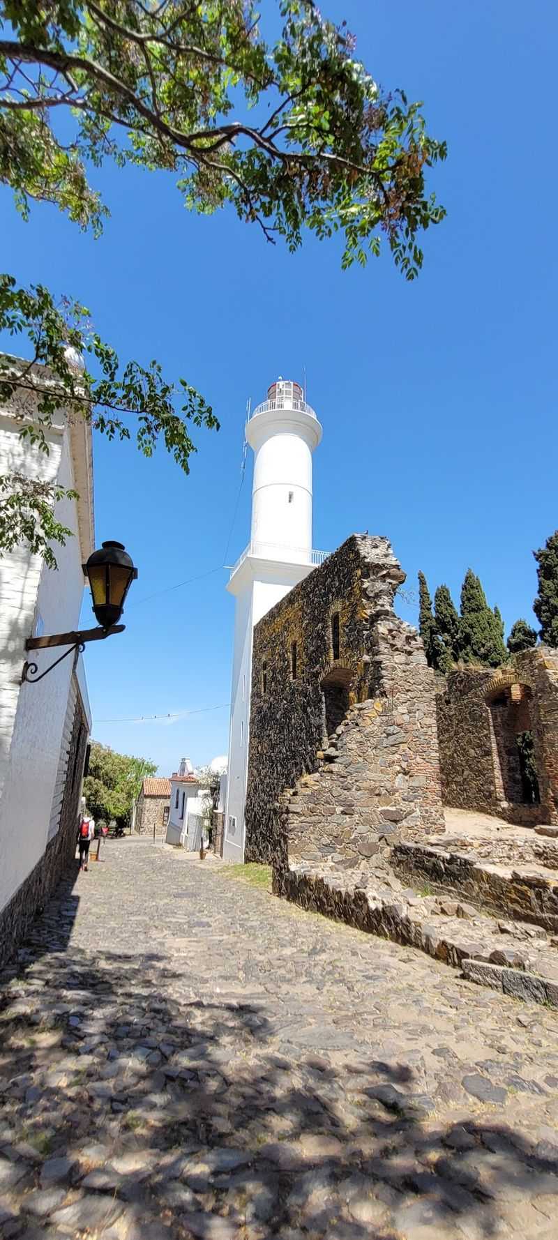
Colonia del Sacramento is the kind of place where you arrive planning to spend an afternoon and end up staying for two days because the pace of life makes rushing feel genuinely rude. Founded by Portugal in 1680 on a small peninsula jutting into the Rio de la Plata, the town was a strategic thorn in Spain’s side for nearly a century, changing hands multiple times as the two empires argued over who actually owned this stretch of river.
That back-and-forth rivalry left behind something unusual: a colonial town with a mixed Portuguese, Spanish, and post-colonial architectural character found nowhere else in South America.
Unlike the standardized checkerboard grids imposed on most Spanish colonial cities, Colonia’s streets follow a more relaxed pattern shaped by the peninsula and its defensive needs. Cobblestone lanes wind between low whitewashed houses, fragments of old walls, and a lighthouse that still works.
UNESCO recognized the historic quarter as a World Heritage property for this rare architectural mixture.
The town sits directly across the Rio de la Plata from Buenos Aires, just a short ferry ride away, which makes it an easy day trip that most visitors quickly wish they had budgeted more time for. The waterfront at sunset, with the wide brown river stretching toward Argentina, is one of those quietly beautiful scenes that stays with you long after you have gone home.
Share this story