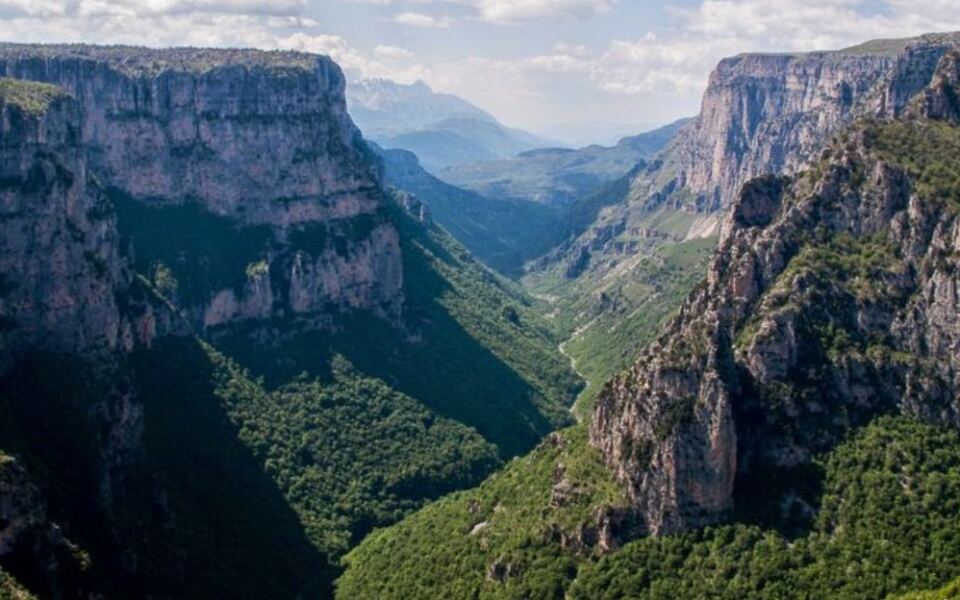
Europe is home to some of the most jaw-dropping natural landscapes on the planet, and many of them are protected inside national parks. From icy volcanic giants in Iceland to turquoise canyon lakes in Croatia, the variety is almost hard to believe.
These parks span the entire continent, reaching from the Arctic edges of Scandinavia all the way to the sunny volcanic slopes of the Canary Islands. If you love wild scenery, dramatic geology, and unforgettable views, this list is your starting point.
Jotunheimen National Park, Norway
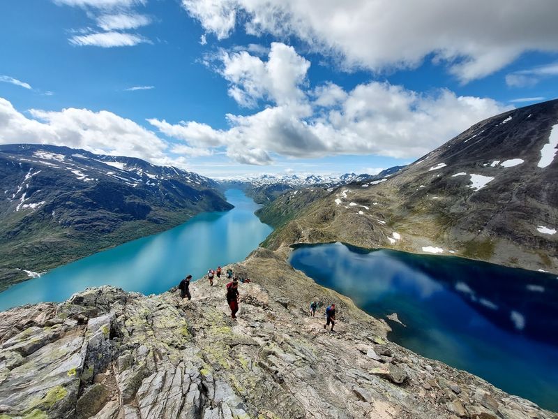
Standing on the Besseggen ridge with two completely different colored lakes on either side of you is not something most people forget quickly. Jotunheimen, which translates to “home of the giants,” earns that name with over 200 peaks rising above 2,000 meters.
Galdhopiggen tops the list at 2,469 meters, making it the highest point in all of Norway.
Lake Gjende glows an almost unnatural turquoise-green, while Bessvatnet beside it is so clear that visibility can reach 30 meters beneath the surface. Glaciers sit between sharp ridges, and waterfalls drop into valleys that feel completely untouched.
The scale of everything here is genuinely hard to take in.
Hikers come from across Europe to tackle these trails, and the park rewards every level of effort. Even a short walk from Gjendesheim puts you face to face with views that would look perfectly at home on a movie screen.
Norway’s mountain scenery is legendary, and Jotunheimen is the reason why.
Plitvice Lakes National Park, Croatia
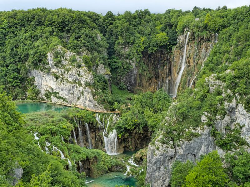
Most lakes sit still and look pretty. Plitvice Lakes are actively being built right now, which makes them one of Europe’s most quietly dramatic places.
Water moving through limestone dissolves calcium carbonate and deposits it as tufa, slowly forming the barriers that divide the system into 16 terraced lakes connected by hundreds of waterfalls.
The upper lakes spread through forested terrain with wider, calmer pools, while the lower lakes squeeze into a narrower limestone canyon with steeper walls and more intense color contrasts. Water shades shift from deep navy to electric turquoise depending on depth, minerals, and the angle of the light.
No filter is needed here.
Brown bears, wolves, and lynx live in the 30,000 hectares of protected forest surrounding the lakes. UNESCO has recognized the park since 1979, partly because the geological process reshaping it is still ongoing.
Wooden boardwalks and boat crossings let visitors move through the landscape without disturbing it, keeping the whole experience surprisingly peaceful even during busy seasons.
Vatnajokull National Park, Iceland
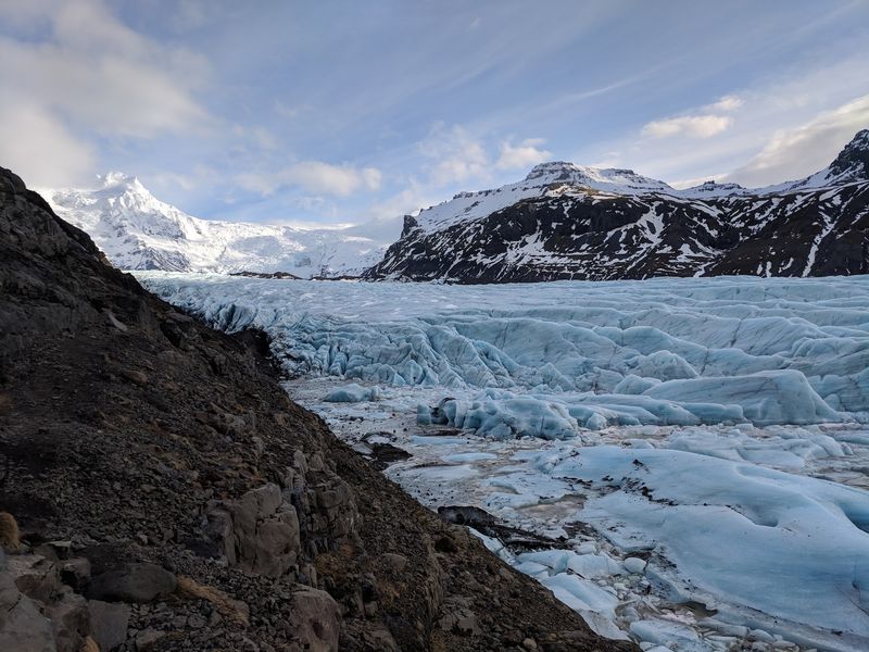
Nowhere else in Europe can you watch a volcano erupt beneath a glacier and then see the floodwaters reshape a black sand plain in real time. Vatnajokull National Park covers over 1.4 million hectares, which is roughly 14 percent of Iceland’s entire surface.
That number alone tells you this place operates on a completely different scale.
The Vatnajokull ice cap sits over ten central volcanoes, eight of them still buried under ice. When subglacial eruptions trigger glacial floods called jokulhlaups, the surrounding plains get rearranged almost overnight.
Lava formations, geothermal fields, canyon systems, and outlet glaciers all exist within the same protected boundary.
UNESCO classifies around 85 percent of the World Heritage property as true wilderness, which is rare even by Icelandic standards. Skaftafell and Jokulsarlon glacier lagoon sit within the park’s edges, giving visitors accessible entry points into a landscape that otherwise feels entirely prehistoric.
Fire and ice coexist here not as a clever marketing phrase but as a daily geological reality.
Durmitor National Park, Montenegro
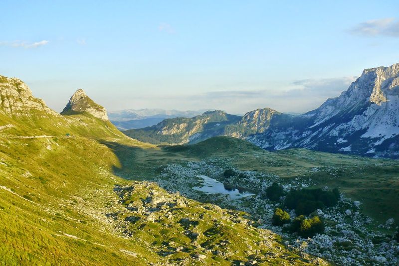
Carved by rivers, shaped by glaciers, and framed by 50 peaks above 2,000 meters, Durmitor packs more geological drama per square kilometer than almost anywhere else in the Balkans. Bobotov Kuk reaches 2,525 meters and looks the part, rising above alpine meadows and forests of ancient black pine that have stood here for centuries.
The real showstopper is the Tara River Gorge, recognized by UNESCO as the deepest gorge in Europe. It cuts more than 60 kilometers through the protected landscape, dropping to depths that make the canyon walls feel almost vertical when viewed from the rim.
The river at the bottom is strikingly clear and runs cold even in summer.
Glacial lakes called “mountain eyes” sit quietly between limestone ridges, reflecting the peaks above them. The park’s extreme elevation range allows Mediterranean plants and alpine species to coexist within the same protected area.
Montenegro does not always appear on lists of Europe’s great mountain destinations, but Durmitor makes a very strong argument for its inclusion.
Picos de Europa National Park, Spain
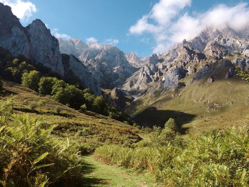
Driving north through Spain’s green coastal strip and suddenly seeing a wall of bare limestone peaks rise out of the forest is a moment that stops most first-time visitors cold. Picos de Europa stretches across three regions: Asturias, Cantabria, and Leon, covering more than 67,000 hectares of some of the most geologically striking terrain on the Iberian Peninsula.
The contrast between the lush Atlantic lowlands and the raw mountain interior is one of the park’s defining features. Oak and beech forests give way to high ridges, deep gorges, and rocky pastures where cattle and horses still graze.
The Cares Gorge trail cuts through the heart of the massif along a path originally built to maintain a water channel.
Brown bears and wolves survive in the park’s more remote sections, while chamois pick their way across the rocky upper terrain. The Lakes of Covadonga and the Naranjo de Bulnes rock tower are among the most photographed spots.
Traditional mountain villages remain active within the boundaries, giving the park a lived-in character that many purely wild reserves lack.
Triglav National Park, Slovenia
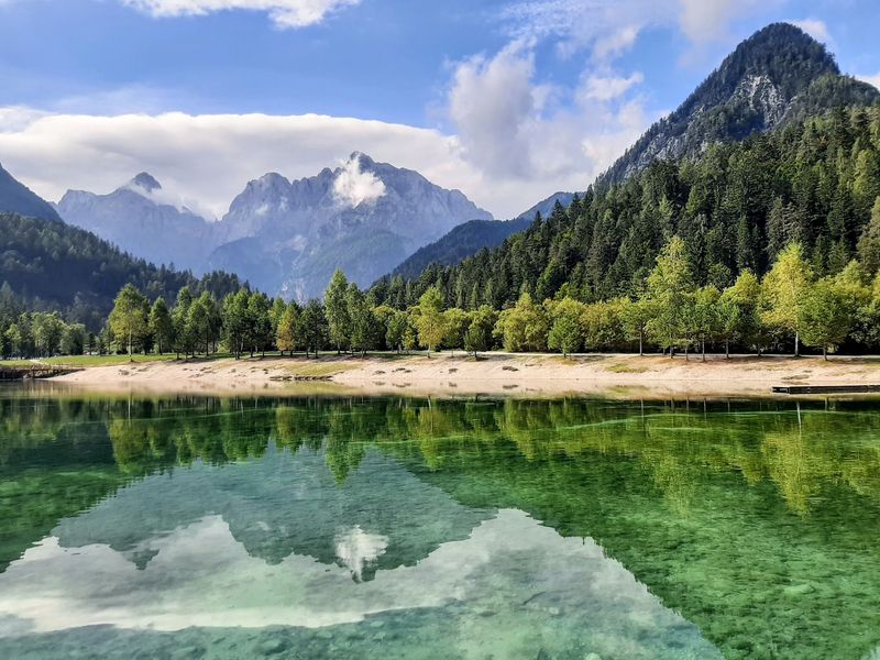
Slovenia’s national identity is so closely tied to Mount Triglav that the mountain appears on the country’s flag, its currency, and just about every piece of tourism material the country has ever produced. The peak reaches 2,864 meters and sits at the center of Slovenia’s only national park, which protects a large section of the Julian Alps along the Italian border.
The landscape around Triglav is a full alpine package: sharp limestone ridges, glacial valleys, crystal-clear rivers, mountain meadows, and forests that shift in color with every season. The Triglav Lakes Valley is one of the most scenic high-altitude routes in the eastern Alps, with a chain of small lakes sitting below dramatic rock faces.
What separates this park from purely wilderness reserves is the long-established cultural layer beneath the scenery. Mountain pastures have been used for centuries, traditional settlements dot the valleys, and historic routes cross the high terrain.
The Bohinj region, sitting just outside the park’s core, adds a lake and a valley landscape that complement the alpine interior beautifully. Slovenia may be small, but Triglav proves it punches well above its weight scenically.
Teide National Park, Spain
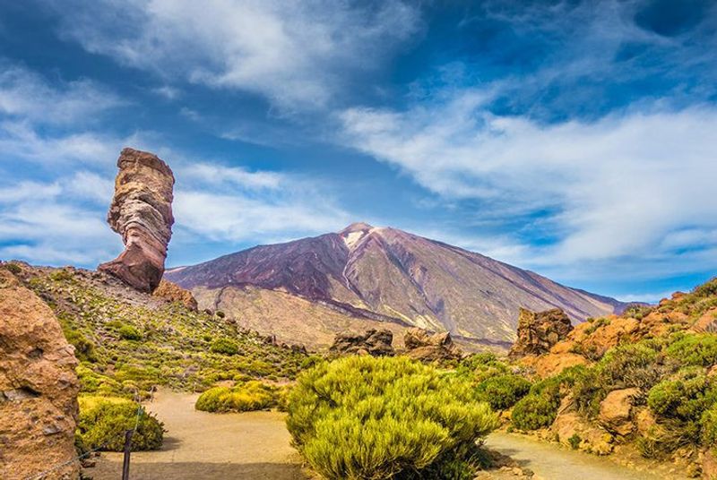
Visitors arriving at Teide’s high-altitude landscape for the first time often describe the experience as stepping off the planet entirely. At 3,715 meters, Mount Teide is not only Spain’s tallest peak but also the highest point in the entire Atlantic Ocean.
The volcanic cone dominates a surreal plateau of hardened lava, pumice fields, and mineral deposits stained in reds, yellows, and blacks.
The park covers about 18,990 hectares in central Tenerife and contains 41 marked walking routes ranging from short crater-rim strolls to serious summit climbs. Despite the apparently lifeless look of the upper terrain, over 200 plant species manage to survive here.
The Teide violet and the spectacular red tajinaste bugloss bloom at elevations where most plants simply give up.
Lava flows from different eruption periods sit side by side, each with its own texture, color, and age. UNESCO recognized Teide in 2007, citing both its geological importance and its exceptional natural beauty.
The cable car makes the upper zone accessible to people who are not climbers, and the views from the top stretch across several other Canary Islands on clear days.
Pirin National Park, Bulgaria
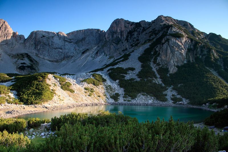
Bulgaria does not always appear at the top of European mountain travel lists, but anyone who has stood at the edge of one of Pirin’s 70-plus glacial lakes surrounded by limestone crags tends to rethink that oversight quickly. The UNESCO World Heritage property covers roughly 40,000 hectares, with much of it sitting above 2,000 meters where the terrain turns genuinely wild.
Elevation climbs to 2,914 meters at Vihren Peak, producing a dramatic vertical shift from dense conifer forest on the lower slopes to open scree, rock, and alpine meadow near the summits. The contrast between the rugged upper terrain and the calm lake surfaces below it is one of the park’s most striking visual qualities.
Waterfalls, caves, and rivers add further variety to the landscape.
UNESCO specifically called out the exceptional scenic quality when listing the park, noting the meeting of Mediterranean and continental climate influences that creates unusual biodiversity alongside the dramatic landforms. For travelers who have spent time in the Alps but not yet explored the Balkans, Pirin offers a compelling and less crowded alternative with scenery that stands up confidently to the comparison.
Vikos-Aoos National Park, Greece
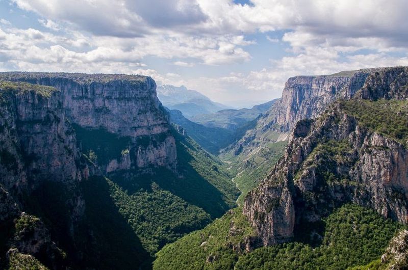
Greece’s mainland hides a mountain world that most visitors flying into Athens or the islands never discover. Vikos-Aoos National Park sits in the Pindus range of northwestern Greece, and its defining feature is the Vikos Gorge, one of the deepest canyons relative to its width anywhere on Earth.
The walls drop hundreds of meters from rim to river with almost no slope in between.
The Voidomatis River runs along the gorge floor and is consistently praised for its exceptional clarity. Viewpoints above the village of Vradeto offer wide perspectives across the canyon that reward the effort of getting there.
Traditional stone-arched bridges crossing the river below add an architectural layer to the geological drama.
The surrounding Zagori region contains dozens of well-preserved stone villages connected by old mule paths and footbridges that have been here for centuries. Wolves, bears, and otters still live in the park’s wilder sections, while rare alpine plants grow on the high Pindus ridges above the gorge.
The combination of dramatic canyon scenery, clear rivers, and intact village culture makes this corner of Greece feel like a destination entirely separate from the rest of the country.
Eryri National Park, Wales
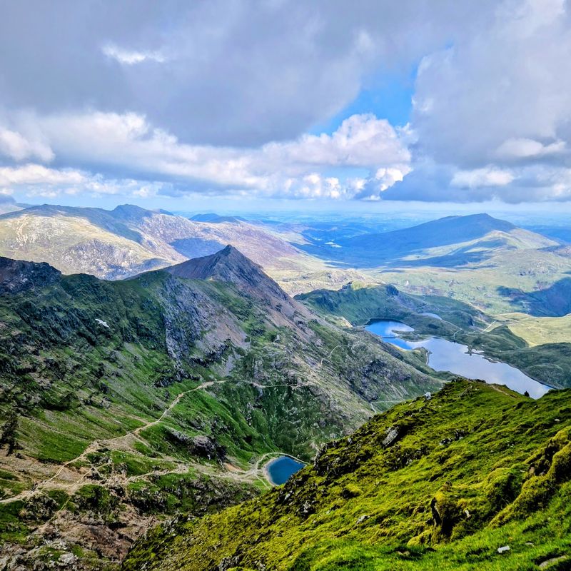
Rain and clouds are part of the deal in Eryri, and honestly, they make the scenery better. Low mist drifting across the ridges, sudden shafts of light over dark lake surfaces, and the way the mountains shift from grey to green to purple depending on the weather all contribute to an atmosphere that feels genuinely ancient.
This is Wales at its most elemental.
The park protects nine mountain ranges and 15 peaks above 900 meters, with Yr Wyddfa topping out at 1,085 meters as the highest point in England and Wales. Glacial erosion carved the cirques, ridges, and lake basins that define the landscape today.
Cwm Idwal, a rocky glacial hollow enclosed by dramatic cliffs, was one of the first places in Britain where glaciation was formally recognized as a landscape-forming process.
The reflections of the Glyderau range across Llynnau Mymbyr are among the most photographed mountain views in the UK. Sharp ridges like Crib Goch demand full attention from experienced hikers, while gentler valley routes give families access to the same landscapes.
Eryri’s mix of Atlantic weather, Celtic character, and dramatic mountain terrain makes it unlike any other park in Britain.
Peneda-Geres National Park, Portugal
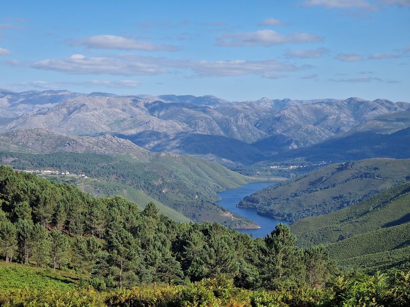
Portugal has dozens of protected natural areas, but only one that carries the full national park designation, and Peneda-Geres has earned it. Located in the far north near the Spanish border, the park covers about 70,290 hectares of granite mountains, river valleys, reservoirs, and forest that feels refreshingly free of crowds for most of the year.
Elevation ranges from around 140 meters near the valleys to 1,545 meters on the higher ridges, creating a wide variety of terrain within a single protected area. Fast rivers cut through the granite before widening into large reservoirs such as Caniçada and Vilarinho das Furnas.
Wild garrano ponies, one of Europe’s oldest horse breeds, still roam the hills freely and are a genuinely surprising sight on mountain trails.
Iberian wolves and roe deer survive in the more remote sections, while ancient Roman roads, megalithic monuments, and centuries-old village communities add a historical richness to the landscape. The park is not just scenic wilderness; it is a living cultural landscape where farming traditions, stone architecture, and natural beauty exist side by side.
For anyone exploring northern Portugal, skipping Peneda-Geres would be a genuine mistake.
Lake District National Park, England
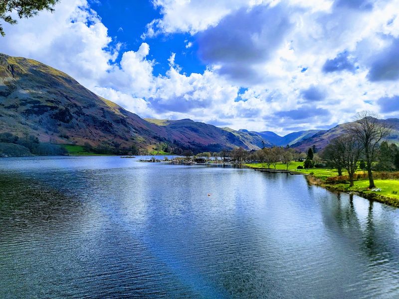
There is a reason the Lake District has inspired poets, painters, and novelists for over two centuries. The combination of dark glacial lakes, steep fells, stone-walled fields, and ancient woodland creates a landscape that feels deeply composed, as if nature spent extra time getting the proportions right.
Covering 2,362 square kilometers, it is England’s largest national park.
The park holds more than 350 named fells and 16 major lakes, including Windermere, Ullswater, Derwentwater, and Wastwater. Scafell Pike, at 978 meters, is England’s highest summit and sits above one of the most rugged valley systems in the country.
Centuries of sheep farming shaped the open upland landscape visible today, particularly the patchwork of dry-stone walls climbing the hillsides.
UNESCO added the Lake District to its World Heritage list in 2017, recognizing both the exceptional natural beauty and the cultural landscape created by generations of farmers. Boat trips on Windermere, hikes over Helvellyn, and quiet evenings beside Grasmere all offer different versions of the same core appeal: a landscape that rewards slowing down.
England’s mountain scenery may be modest by Alpine standards, but the Lake District’s character is entirely its own.
Paklenica National Park, Croatia
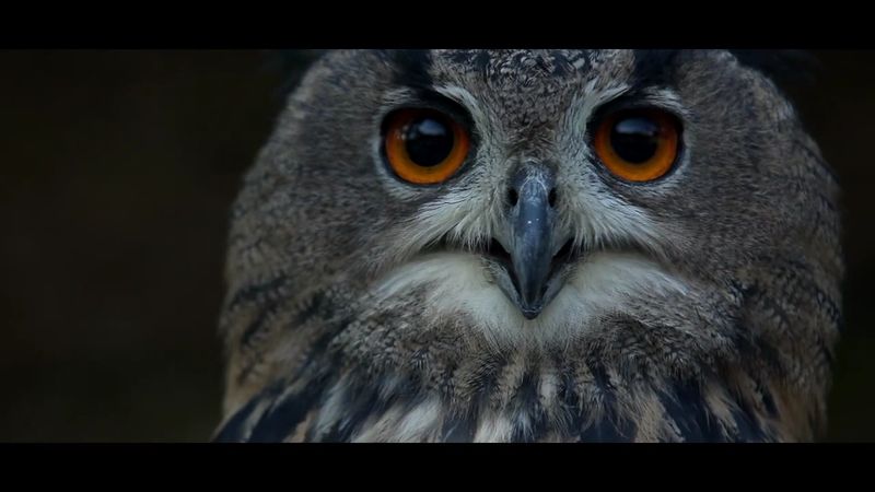
Paklenica has a reputation among rock climbers that spreads far beyond Croatia’s borders, and one look at the canyon walls explains why. Velika Paklenica and Mala Paklenica are two deep gorges cut through the Velebit Mountains’ southern face, exposing vertical limestone cliffs that drop hundreds of meters with barely an interruption.
The rock is good, the routes are varied, and the setting is spectacular.
The scenery changes quickly as trails climb inland from near the Adriatic coast. Within a few kilometers, the coastal scrub gives way to dense black-pine and beech forest, then to exposed ridges with wide views back toward the sea.
That rapid shift from Mediterranean to high mountain terrain is part of what makes Paklenica feel more dramatic than its modest size might suggest.
Manita Pec cave adds an underground dimension to the park’s scenery, with impressive stalactite formations accessible on guided tours. The canyon floors follow rivers through the gorges, and the trail network allows hikers to explore deep into the Velebit interior without needing technical climbing skills.
Croatia’s coastline gets most of the international attention, but Paklenica shows that the country’s mountains are equally worth the journey.
Oulanka National Park, Finland
Finland’s most celebrated national park has no mountains, no glaciers, and no dramatic coastal cliffs, yet it consistently ranks among Europe’s most spectacular natural reserves. The secret is water.
Rivers in Oulanka move fast, drop over waterfalls, squeeze through rocky gorges, and then spread wide across sandy riverbanks before narrowing again, creating a constantly changing landscape built entirely around the rhythm of flowing water.
The Kiutakongas rapids are among Finland’s most powerful, and the suspension bridges crossing the Oulankajoki River give visitors front-row views without getting soaked. Rare plants including the Lapland rhododendron grow in the nutrient-rich river valleys, adding unexpected color to the forest floor.
Wetlands, cliffs, sandy beaches, and dense boreal woodland all appear within the same protected area.
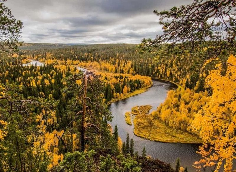
Autumn is when Oulanka reaches its visual peak. The forest transforms into deep yellows, oranges, and reds in a display that Finns call “ruska,” and the contrast with dark river water and white rapids creates scenes that photographers return for year after year.
Winter brings frozen waterfalls and deep snow, turning the same landscape into something completely different. Oulanka proves that impressive European scenery comes in more forms than just high-altitude drama.
Lahemaa National Park, Estonia
Lahemaa makes a quietly confident case that dramatic scenery does not always need altitude. Estonia’s only national park sits along the Gulf of Finland coast and covers 725 square kilometers of rocky capes, sandy beaches, ancient boulders, dense forest, traditional fishing villages, and some of the most expansive bog landscapes in northern Europe.
The scale is horizontal rather than vertical, and it works.
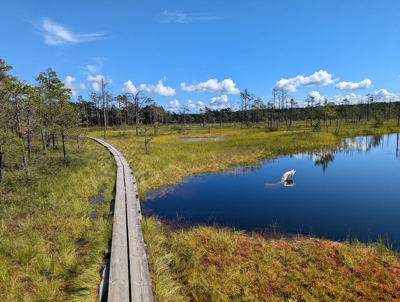
The Viru Bog boardwalk is one of the park’s most accessible highlights, carrying visitors across an open wetland that feels almost limitless in every direction. Early morning mist rising off the bog surface, with pine trees appearing as dark silhouettes against a pale sky, is one of those images that stays with you.
The coastline alternates between granite boulder fields, sheltered beaches, and long views across the Baltic.
Historic manor houses, stone-walled fishing villages, and ancient coastal landscapes give Lahemaa a cultural depth that purely wilderness parks often lack. The park’s appeal shifts with the seasons: spring brings wildflowers to the forest floor, summer opens up the coastline, autumn colors the woodland, and winter turns the bogs into frozen silence.
Lahemaa shows that Europe’s most impressive scenery sometimes whispers rather than shouts.
Share this story