Our planet is home to places so jaw-dropping, so bizarre, and so breathtaking that photos barely do them justice. From islands where evolution ran wild to deserts that fill with lagoons overnight, Earth has been quietly building wonders for millions of years.
UNESCO’s World Heritage List exists to protect these places, recognizing them for their outstanding natural beauty, cultural importance, or scientific value. The 15 sites below are as different from each other as possible, and every single one will make you want to pack a bag.
Galapagos Islands, Ecuador
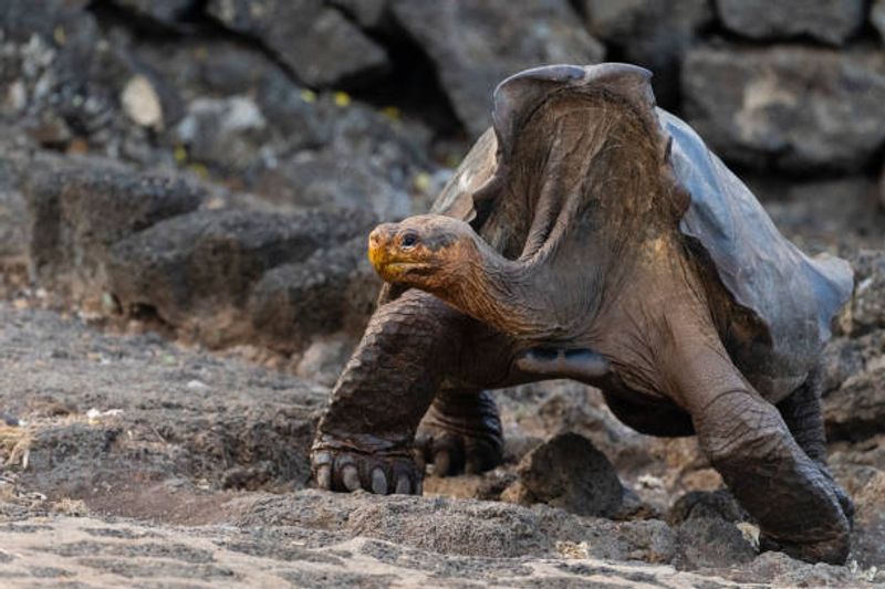
Roughly 1,000 kilometers off Ecuador’s coast, a chain of volcanic islands sits at the crossroads of three major ocean currents, and evolution basically went rogue there. Animals found nowhere else on Earth developed in isolation over millions of years, producing species that look like nature was experimenting without supervision.
Giant tortoises lumber across lava fields. Marine iguanas sneeze salt from their nostrils.
Penguins swim alongside tropical fish.
Charles Darwin visited in 1835, and what he observed eventually shaped his theory of natural selection. The Galapagos became one of UNESCO’s first World Heritage Sites in 1978 for good reason.
Its wildlife shows zero fear of humans, which means you can stand one meter from a sea lion and it will simply yawn at you.
The underwater world rivals anything above the surface. The Galapagos Marine Reserve shelters whale sharks, hammerheads, manta rays, and colorful reef fish in extraordinary numbers.
Ecuador proposed a further extension incorporating the Hermandad Marine Reserve in 2026. Few places on the planet make the concept of biodiversity feel so vivid, so immediate, and honestly so entertaining to witness firsthand.
Great Barrier Reef, Australia
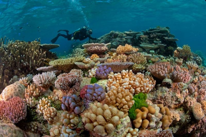
Calling the Great Barrier Reef simply a reef is like calling the Amazon simply a river. UNESCO describes it as the world’s most extensive coral reef ecosystem, covering around 348,000 square kilometers along Australia’s northeastern coast.
That is roughly the size of Japan, and it is entirely alive.
The numbers inside this ecosystem are almost absurd. Around 400 coral species, more than 1,500 fish species, six of the world’s seven marine turtle species, and significant populations of dugongs, dolphins, and whales all share this one connected system.
From above, the reefs and islands create vast turquoise patterns that look painted onto the ocean surface.
Underwater, every square meter pulses with color and movement. Schools of parrotfish crunch coral.
Reef sharks cruise calmly past. Clownfish disappear into anemones.
UNESCO highlights the reef’s extraordinary scientific value as one of Earth’s most complex natural systems, not just its beauty. The Great Barrier Reef is a reminder that the ocean can build cities of its own, far more intricate than anything constructed on land, and that protecting them is one of the more urgent tasks humans currently face.
Historic Sanctuary of Machu Picchu, Peru
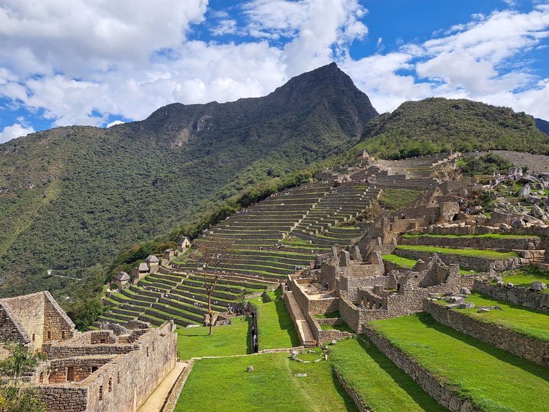
At 2,430 meters above sea level, where the Andes meet the upper Amazon basin, an entire 15th-century city appears to have grown directly from the mountain ridge. Machu Picchu is extraordinary partly because you cannot easily tell where the rock ends and the architecture begins.
The Inca builders did not flatten the landscape. They worked with it, terrace by terrace, stone by stone.
Around 200 structures occupy the steep ridge, including temples, ceremonial spaces, residences, and a sophisticated water system that still functions. Agricultural terraces cascade down the slopes in a way that looks simultaneously practical and artistic.
UNESCO recognizes Machu Picchu for both cultural and natural values, because the sanctuary extends far beyond the famous citadel into cloud forest habitat containing significant biodiversity.
Millions of photographs have made the view feel familiar before you arrive. Standing there is genuinely different.
Clouds move through the valleys below. Mountains rise on every side.
The air is cool and thin. Visitors who expected to feel underwhelmed by a place they had already seen a thousand times online routinely report the opposite.
Some places simply have to be experienced to be properly understood.
Serengeti National Park, Tanzania
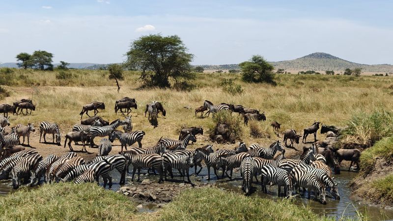
Two million wildebeest moving across open grassland is not something a photograph can fully prepare you for. The Serengeti’s Great Migration is the largest remaining unaltered animal movement on Earth, according to UNESCO, and it operates entirely on its own schedule: rain falls, grass grows, animals move, predators follow.
Hundreds of thousands of zebras and gazelles join the wildebeest on this circular journey through the larger Serengeti ecosystem. Lions, cheetahs, leopards, hyenas, and African wild dogs follow the herds, producing one of the planet’s most dramatic predator-prey relationships playing out across roughly 1.5 million hectares of savanna.
Nobody is directing the show.
The Serengeti is spectacular for exactly that reason. Humans are observers here, not organizers.
Animals fill the horizon in numbers that feel almost prehistoric. Crocodiles wait at river crossings.
Cheetahs sprint across open plains. Lion prides nap in the shade of acacia trees while wildebeest stream past.
UNESCO designated the Serengeti a World Heritage Site in 1981, recognizing an ecosystem that still functions at the kind of scale that most of the natural world lost long ago.
Wulingyuan Scenic Area, China
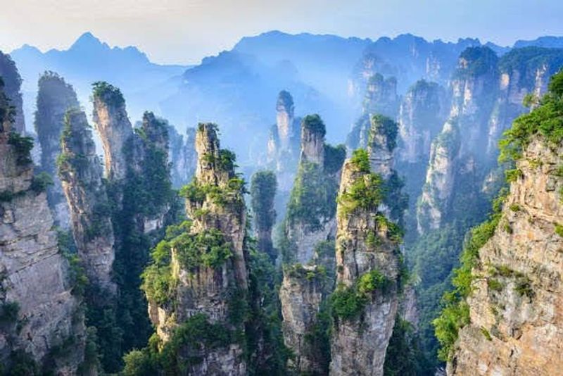
More than 3,000 sandstone pillars rise through forest in China’s Hunan Province, many exceeding 200 meters in height, and the whole scene looks like a landscape a fantasy novelist invented. Mist drifts between the towers regularly, creating the impression that enormous stone columns are floating above the valley.
Photographs of Wulingyuan routinely get accused of being digitally enhanced. They are not.
Millions of years of erosion carved this landscape from ancient quartz sandstone, producing the pillars, peaks, ravines, pools, waterfalls, and caves that now occupy roughly 26,400 hectares of protected land. UNESCO records approximately 40 caves and two enormous natural bridges within the area.
One of those bridges rises hundreds of meters above the valley floor.
The wildlife matters too. Wulingyuan provides habitat for several threatened species, and its dense forests support biodiversity that the dramatic geology sometimes overshadows.
UNESCO inscribed the site in 1992. Wulingyuan reportedly inspired the floating mountains in the film Avatar, which is either a fun piece of trivia or a sign that even Hollywood needed to borrow from reality to make something look believably extraordinary.
Nature got there first, as usual.
Lencois Maranhenses National Park, Brazil
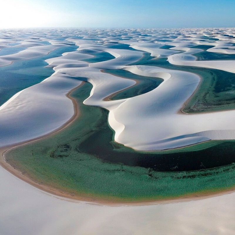
White sand dunes stretching to the horizon are already a striking sight. Add thousands of blue and green freshwater lagoons sitting between those dunes and you have a landscape that looks like it operates by its own private set of physical laws.
Lencois Maranhenses in northeastern Brazil became a UNESCO World Heritage Site in 2024, and the timing feels long overdue.
The park’s unusual character comes from an equally unusual combination of factors. Strong coastal winds sculpt enormous dune chains, while a rainy season fills the depressions between them with freshwater.
The result is temporary lagoons of varying shapes, colors, and depths that appear and disappear with the seasons. UNESCO notes the site reaches its visual peak when those lagoons are at maximum fullness, typically between July and September.
The dune field stretches along roughly 80 kilometers of coastline, making it the largest coastal dune system in South America. Some lagoons are shallow enough to wade through.
Others are deep enough to swim in comfortably. Fish actually colonize the temporary lagoons during the wet season, arriving via seasonal flooding from nearby rivers.
The whole system is a reminder that contradictions can sometimes produce the most beautiful outcomes imaginable.
Yellowstone National Park, United States
Yellowstone sits on top of one of Earth’s largest volcanic systems, and the landscape makes absolutely no attempt to hide that fact. More than 10,000 geothermal features are packed into this Wyoming park, including over half of the world’s active geysers according to UNESCO.
Old Faithful is the famous one, but it has thousands of equally dramatic neighbors that most visitors never reach.
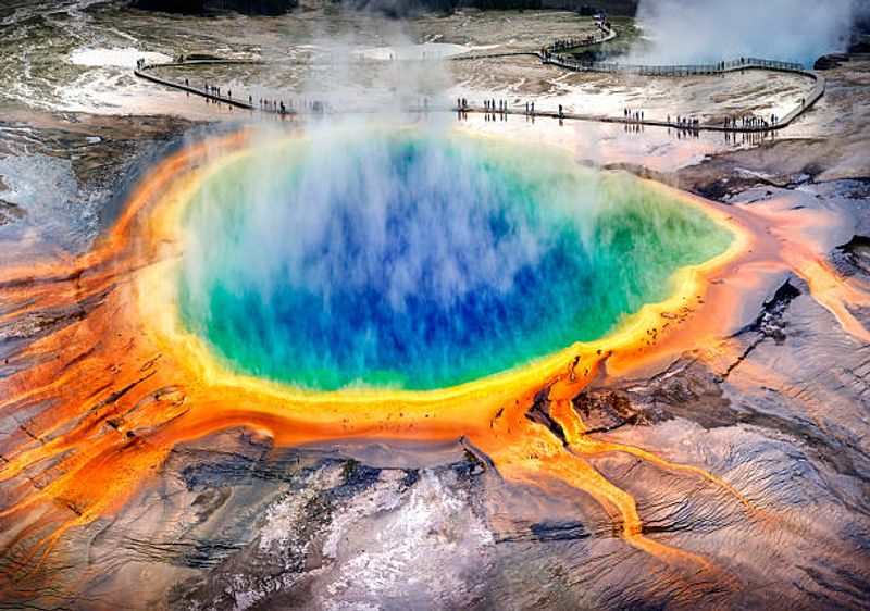
The Grand Prismatic Spring produces vivid rings of orange, yellow, and green from heat-loving microorganisms living at different temperatures around the pool’s edge. Mud pots bubble and pop.
Steam pours from hillsides. Entire valleys smell faintly of sulfur.
Beneath it all sits a volcanic caldera roughly 45 by 75 kilometers across, which puts the park’s geological personality into perspective.
Yellowstone is also a serious wildlife sanctuary. Grizzly bears, wolves, bison, and elk inhabit one of the few remaining large, relatively intact temperate ecosystems in North America.
Wolves were reintroduced in 1995, and their return reshaped the entire ecosystem in ways scientists are still studying. Yellowstone is simultaneously a geological laboratory and a wildlife refuge, which makes it one of the most scientifically valuable pieces of protected land anywhere on the planet.
Ha Long Bay – Cat Ba Archipelago, Vietnam
Imagine a mountain range that got flooded until only the peaks were left above water. That is essentially what happened at Ha Long Bay.
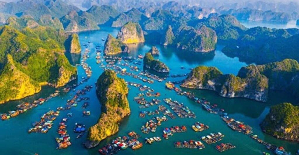
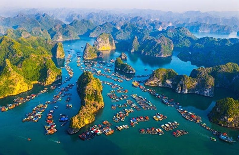
Limestone was dissolved and sculpted by erosion over millions of years into towers, cones, caves, and arches. Then rising sea levels moved in, filling the valleys and leaving 1,133 islands and islets jutting from green-blue water in northeastern Vietnam.
UNESCO describes Ha Long Bay and Cat Ba as the world’s most extensive example of marine-invaded tower karst, which is the technical term for this specific type of landscape. The expanded property covers 65,650 hectares and includes caves, hidden lakes, sheer cliffs, and isolated coves that can only be reached by boat.
A 2023 boundary extension added Cat Ba Island, whose forested interior supports the critically endangered Cat Ba langur.
Traveling through the bay by boat is genuinely disorienting in the best way. Limestone towers appear around every corner, each one slightly different in shape and height.
Fishermen live on floating villages among the islands. Kayaking into caves reveals hidden lagoons completely enclosed by rock.
The experience feels less like tourism and more like accidentally sailing into a geography textbook that turned out to be spectacular.
Los Glaciares National Park, Argentina
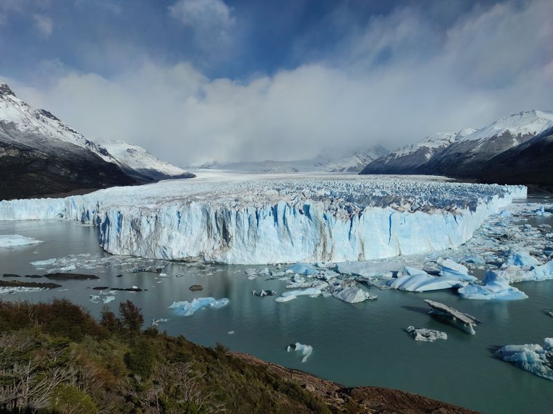
Perito Moreno Glacier does not behave like something frozen is supposed to behave. Its enormous ice wall advances into Lake Argentino at a measurable pace, periodically calving massive blocks of blue-white ice that crash into the water with thunderous booms audible from the viewing platforms hundreds of meters away.
UNESCO records the glacier face reaching around 60 meters above the lake surface. Standing across from it feels genuinely humbling.
But Los Glaciares National Park is far larger than one glacier. The UNESCO property covers more than 726,000 hectares of southern Patagonia, incorporating towering Andean peaks, enormous glacial lakes, and numerous glaciers fed partly by the South Patagonian Ice Field, the largest major remnant of Quaternary glaciation in South America.
Glaciers cover roughly half the entire property.
The landscape here is actively changing. Ice is still carving the mountains.
Lakes are still being shaped by glacial forces. Wildlife including guanacos, Andean condors, and pumas inhabit this dramatic environment.
The park also contains the Fitzroy massif, a collection of granite peaks so sharp and photogenic that they became the logo for a well-known outdoor clothing brand. Patagonia earns its reputation for scale repeatedly and without effort.
Petra, Jordan
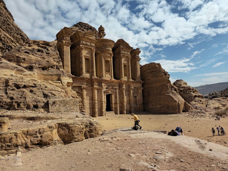
Walking through the narrow Siq canyon toward Petra and seeing the Treasury appear at the end of that slot in the rock is one of travel’s genuinely theatrical moments. The rose-red sandstone facade, carved directly into the cliff face, is intricate enough to look built by hand and natural enough to look grown from the rock itself.
That combination is exactly what makes Petra so extraordinary.
The ancient Nabataean city is half-built and half-carved, according to UNESCO. The Treasury is simply the most photographed structure in a much larger landscape containing elaborate tombs, temples, high places, channels, cisterns, tunnels, and dams.
The full site covers an enormous area that most visitors explore only partially. Petra’s hydraulic engineering deserves particular attention.
Its water-management system collected and controlled seasonal rainfall, making large-scale settlement possible in an arid mountain environment.
UNESCO inscribed Petra in 1985 as a World Heritage Site of outstanding cultural value. The Nabataeans built their city here between the 4th century BC and the 2nd century AD.
What they left behind is not just impressive architecture. It is evidence that understanding a difficult landscape can be more powerful than simply overpowering it, which feels like a lesson worth remembering.
Okavango Delta, Botswana
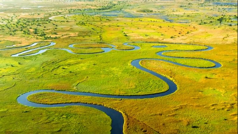
Most rivers travel toward the ocean. The Okavango River has other ideas.
Instead of reaching the sea, its waters fan out across the sands of Botswana’s Kalahari Basin, creating one of the world’s largest and most intact inland deltas. UNESCO designated the Okavango Delta a World Heritage Site in 2014, recognizing it as one of the few major interior delta systems on Earth that remains relatively undisturbed.
What makes the timing of this system almost miraculous is that floodwaters arrive during Botswana’s dry winter season. While surrounding landscapes turn brown and arid, the delta floods into wetlands, channels, and flooded grasslands precisely when wildlife needs water most.
Elephants, buffalo, zebras, lions, African wild dogs, and rhinos all converge on this seasonal pulse. The World Heritage property covers more than two million hectares.
From a small aircraft, the delta looks like an intricate blue network of veins spread across golden grassland. At water level, mokoro canoes glide silently through reed-lined channels while hippos surface nearby and fish eagles call overhead.
The Okavango proves that a river does not need a coastline to create an entire functioning world. Sometimes the most remarkable destination is the one the water never actually leaves.
Komodo National Park, Indonesia
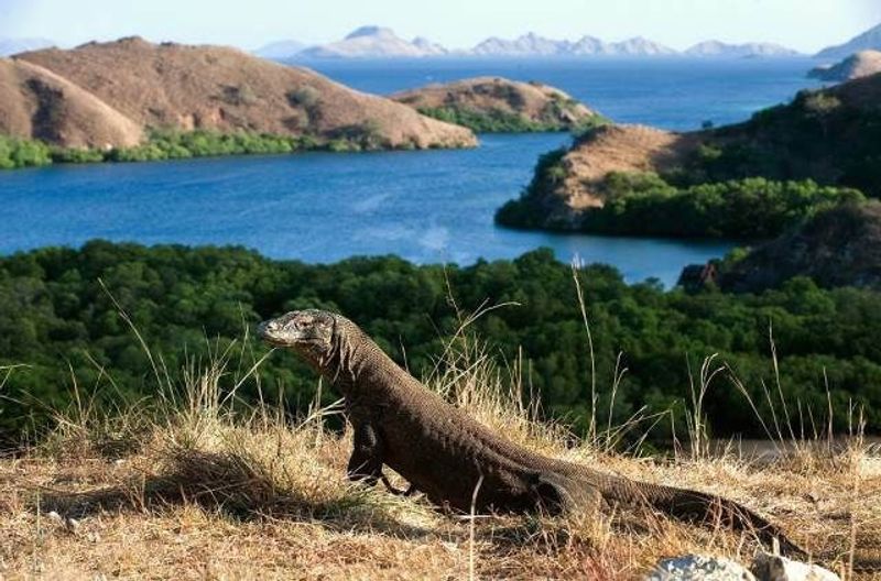
Komodo National Park would be worth visiting purely for its scenery. Volcanic islands rise dramatically from intensely blue water.
Dry savanna covers rugged hillsides. White sand beaches border coral reefs teeming with marine life.
Then a three-meter lizard ambles out of the scrub and the whole experience shifts into a different category entirely.
The Komodo dragon is the world’s largest living lizard species, and most of its surviving wild population lives within this Indonesian World Heritage property and on nearby Flores. UNESCO inscribed the park in 1991, recognizing both its remarkable terrestrial wildlife and its exceptional marine environment.
Strong currents flowing through the islands support rich coral ecosystems visited by turtles, manta rays, dugongs, dolphins, and whales.
The park covers the major islands of Komodo, Rinca, and Padar, along with smaller islands and extensive marine habitat. The contrast between the dry, almost prehistoric-looking hills above water and the vivid coral gardens below creates a destination that feels like multiple ecosystems stitched together into one protected area.
Komodo dragons can grow to 70 kilograms, run faster than most people expect, and have saliva containing dangerous bacteria. Visiting with a ranger is strongly recommended and frankly just common sense.
Wadi Rum Protected Area, Jordan
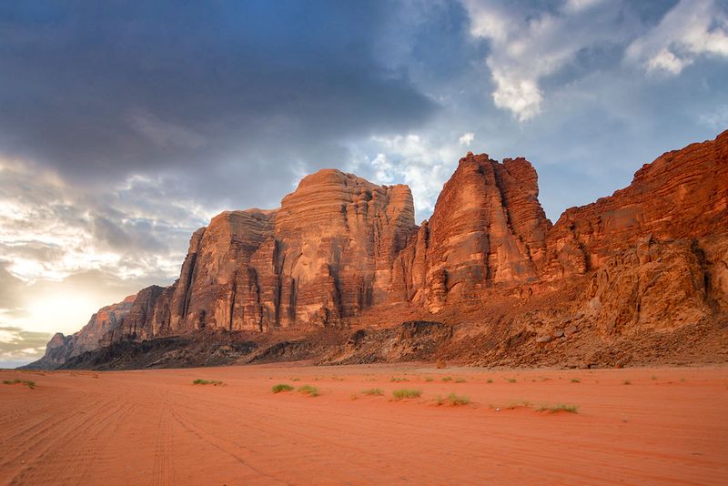
Wadi Rum has been used as a film location for Mars so many times that it is easy to understand why. The landscape in southern Jordan features enormous sandstone and granite formations, narrow gorges, natural arches, and open desert valleys under a sky that seems disproportionately large relative to everything below it.
The colors shift from pale gold to deep red depending on the time of day.
UNESCO designated Wadi Rum a mixed natural and cultural World Heritage Site in 2011, recognizing both its dramatic geology and an extraordinary record of human presence. The protected area contains approximately 25,000 rock carvings and 20,000 inscriptions documenting roughly 12,000 years of human interaction with this environment.
Those inscriptions help trace the development of early writing systems and the societies that passed through or settled in the region.
Bedouin communities have lived in Wadi Rum for generations and continue to do so today. Visitors can stay in traditional camps, travel by camel, and watch stars from a location with almost zero light pollution.
The desert that initially looks empty and timeless reveals layers of human history the longer you look at its walls. Few landscapes manage to feel simultaneously ancient, alien, and deeply inhabited all at once.
Meteora, Greece
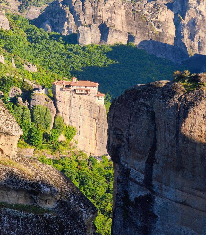
Somewhere around the 11th century, hermits looked at a collection of near-vertical sandstone pillars rising from a valley in central Greece and concluded those inaccessible towers were the perfect places to build monasteries. That decision produced one of the most visually astonishing religious landscapes anywhere on Earth.
The name Meteora is commonly interpreted as meaning suspended in the air, and when valley mist rises around the rock formations, the description feels uncomfortably accurate.
UNESCO inscribed Meteora in 1988 for both its natural and cultural values. The sandstone formations were shaped by millions of years of erosion, producing towers and pinnacles that reach up to 400 meters above the valley.
Eventually 24 monasteries were constructed on these nearly inaccessible summits, accessed originally by rope ladders and baskets. A handful of active religious communities still live there today.
The surviving buildings contain Byzantine chapels, vivid frescoes, courtyards, and libraries that have preserved manuscripts through centuries of political upheaval. Getting supplies up to some of the monasteries remained a rope-and-pulley operation until roads were eventually cut into the rock.
Meteora demonstrates that human determination, when combined with genuine faith and an extraordinary landscape, can produce results that feel completely impossible until you are standing in front of them.
Socotra Archipelago, Yemen
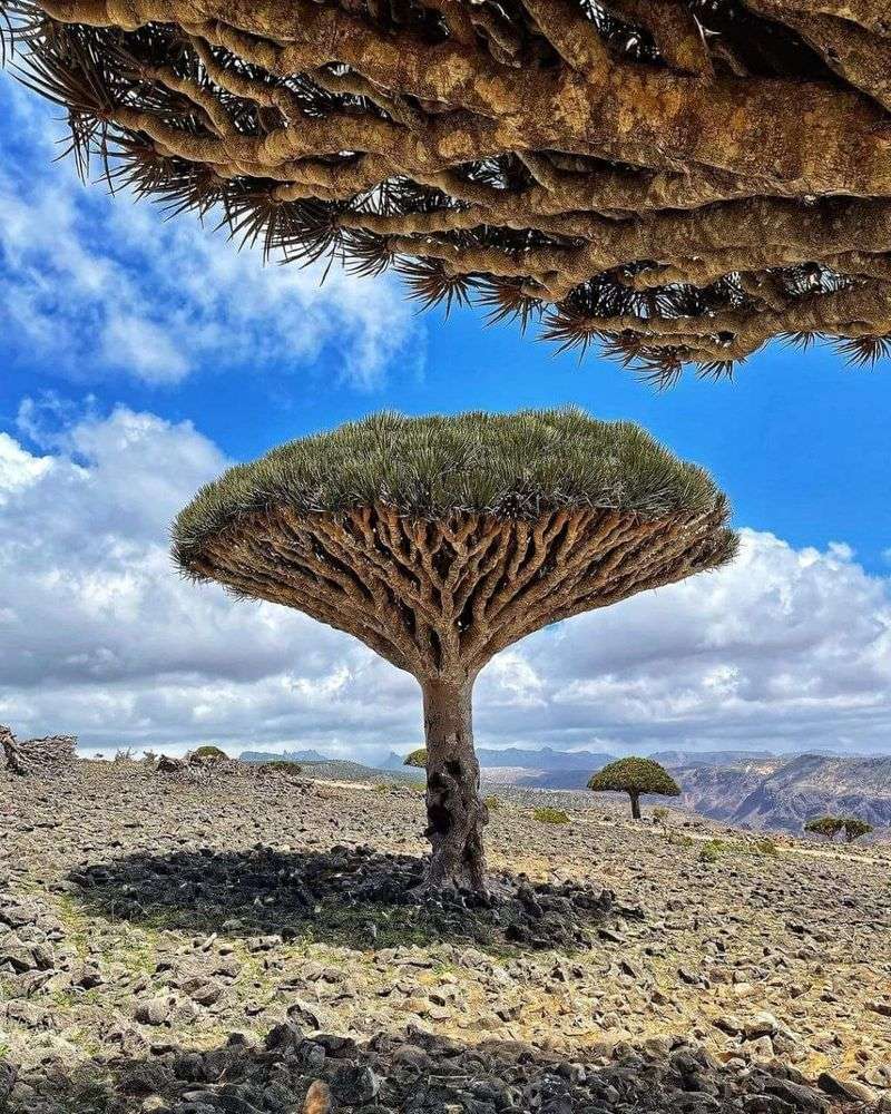
The dragon’s blood tree looks like someone turned an umbrella inside out, planted it in rocky soil, and called it a day. Its dense, flat canopy sits atop a pale trunk in a shape found nowhere else in the plant kingdom.
Socotra is full of plants like this: species that evolved in isolation for so long that they stopped resembling anything familiar.
UNESCO inscribed the Socotra Archipelago in 2008, noting that 37 percent of its 825 plant species are endemic, meaning they grow naturally nowhere else on Earth. Around 90 percent of its reptile species and 95 percent of its land-snail species are equally unique to the islands.
That level of endemism has earned Socotra the informal title of the Galapagos of the Indian Ocean, and the comparison holds up scientifically.
The marine environment around the archipelago is equally impressive, with hundreds of reef-building coral species and coastal fish recorded in surrounding waters. Socotra belongs to Yemen, and current security and travel conditions require careful attention to official government advisories before any visit is considered.
As a subject of scientific study and ecological importance, however, the archipelago stands among the most remarkable island systems on the planet. Evolution clearly saved some of its most creative work for this corner of the Indian Ocean.
Share this story