Some roads were built simply to get people from one place to another, but others look as if engineers went to war with the mountains themselves. Across the world, highways cling to cliffs, climb above the clouds, squeeze through hand-carved tunnels, and negotiate switchbacks so tight that the road seems to fold back on itself.
Many of these routes serve as perfectly legitimate transportation corridors, yet steep grades, extreme elevations, remote terrain, and dramatic drop-offs make the experience truly unforgettable. From Bolivia’s infamous Yungas route to the high passes of the Alps and Karakoram, these remarkable roads prove that getting there can sometimes be the most memorable part of the trip.
North Yungas Road, Bolivia
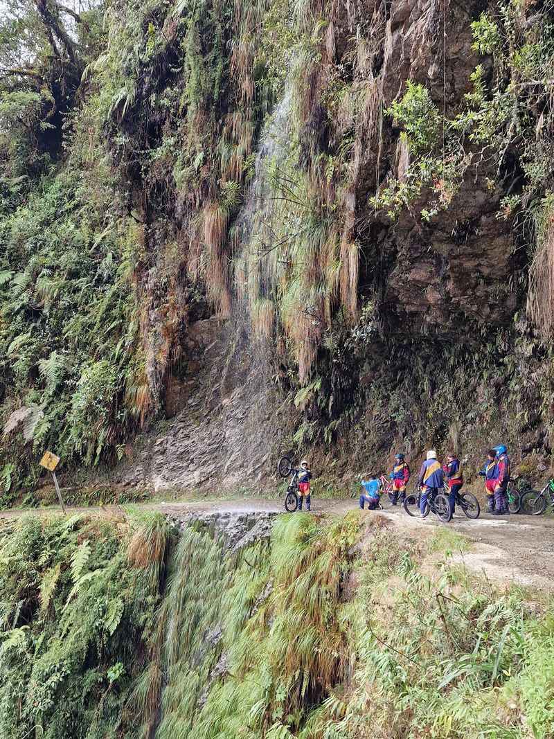
Nicknamed the “Death Road,” Bolivia’s North Yungas route carries one of the most intimidating reputations of any road on Earth. Carved northeast of La Paz, this historic corridor once served as the main connection between the capital city and the lush tropical Yungas region far below.
At its narrowest, sections measure roughly three meters wide, with sheer mountainside drops waiting just beyond the edge.
Bolivia’s government eventually built the newer Cotapata-Santa Barbara route to handle regular interprovincial traffic, which transformed the old road into an adventure-tourism hotspot. Mountain bikers now descend in droves, weaving through rapidly changing landscapes of high-altitude peaks, dense jungle vegetation, roaring waterfalls, and thick morning mist.
The terrain shifts so dramatically that riders move through multiple climate zones in a single descent.
Despite its fearsome nickname, thousands of travelers tackle the route every year on guided cycling trips with safety equipment and experienced guides. The sheer variety of scenery makes every kilometer feel like a reward.
Bolivia’s Death Road is proof that a road’s history and its natural setting can combine into something genuinely extraordinary, far beyond just the danger itself.
Stelvio Pass, Italy
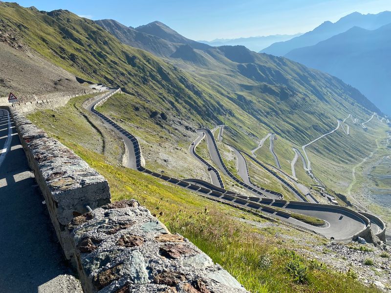
Seen from above, the road climbing Stelvio Pass looks almost impossibly tangled, like someone scribbled a line across the mountain face and then decided to loop it 88 times. Sitting at 2,758 meters in Italy’s Rhaetian Alps, it ranks among Europe’s highest paved mountain crossings and has been drawing drivers, cyclists, and motorcyclists for generations.
The pass historically connected the Habsburg cities of Milan and Vienna during an era when crossing the Alps was a genuine logistical challenge.
Those 88 hairpin bends are the real attraction here. Each one delivers a fresh angle on the surrounding Alpine scenery, and the views from the upper switchbacks stretch across multiple countries on a clear day.
Cyclists who grind their way to the summit earn bragging rights that last a lifetime, while motorcycle riders treat the descent like a moving celebration.
Snow dictates the season firmly. The pass is generally accessible only during the warmer months, and even midsummer can bring cold snaps at that altitude.
Stelvio rewards patience and preparation with some of the most jaw-dropping mountain road scenery anywhere in Europe, making every sharp corner feel absolutely worth it.
Trollstigen, Norway
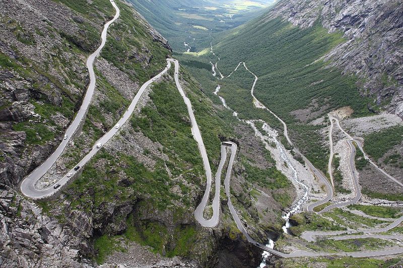
Norway seems purpose-built for dramatic roads, but Trollstigen still manages to stop people cold the first time they see it. The name translates roughly to “Troll’s Ladder,” and one look at the road explains why.
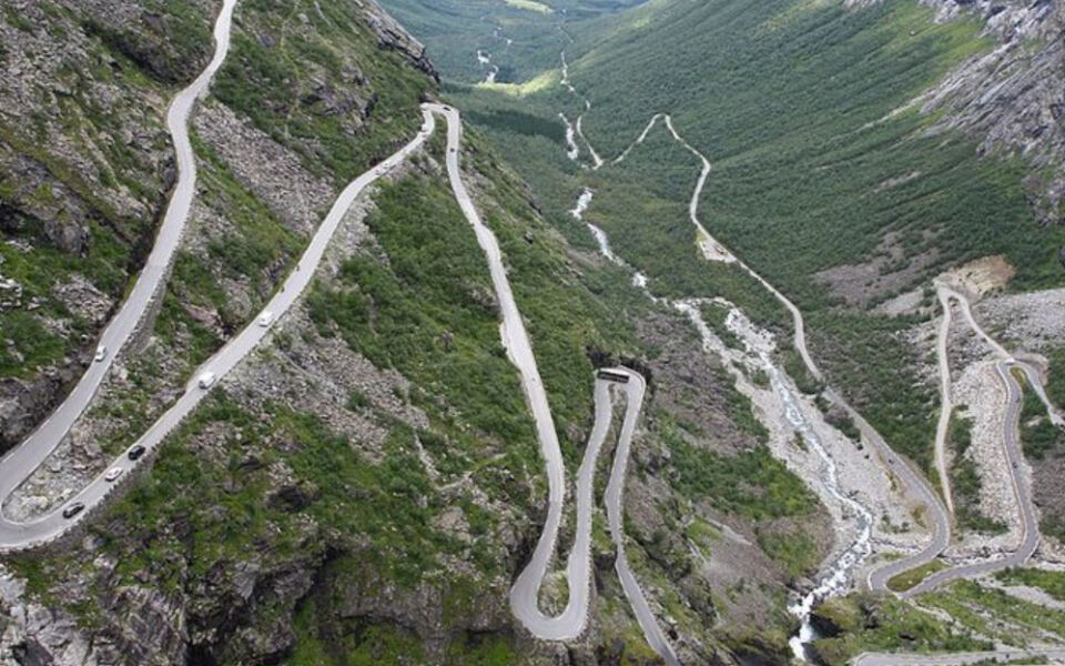
Eleven hairpin bends climb a sheer, waterfall-streaked mountainside before reaching the broad Trollstigen plateau at the top.
Opened in 1936 after eight years of construction, the road was an enormous engineering achievement for its time. Workers built the route largely by hand across incredibly unforgiving terrain, and the result is a serpentine masterpiece that has since become one of Norway’s most photographed landmarks.
An architectural viewing platform now projects dramatically over the landscape, perched roughly 200 meters above the road below for a perspective that genuinely makes your palms sweat.
The mountain section is seasonal, closing during winter and sometimes temporarily during heavy rain or rockfall risk. Visiting in the right window means experiencing waterfalls, sheer peaks, and sweeping fjord-country views all at once.
Trollstigen also sits along the famous Geiranger-Trollstigen Scenic Route, so travelers can extend the experience across one of Norway’s most celebrated drives. Few roads anywhere offer this combination of engineering drama and raw natural beauty.
Skippers Canyon Road, New Zealand
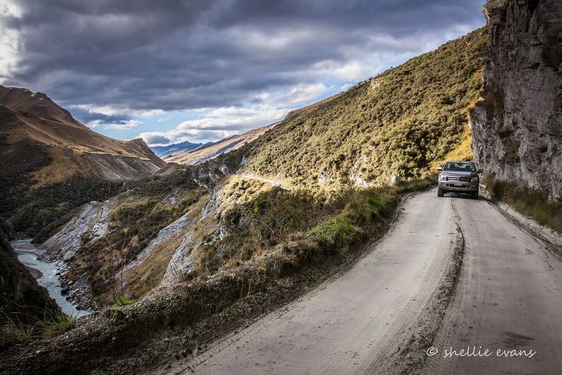
Gold fever drove people to do extraordinary things during the 1880s, and Skippers Canyon Road near Queenstown is one of the most enduring results. Workers hand-drilled and blasted a three-kilometer section of solid schist rock while suspended on ropes approximately 183 meters above the Shotover River below.
That kind of construction detail tends to stick in the memory long after the drive is over.
The unsealed road threads through rugged canyon walls, offering raw, exposed views that no amount of guardrail could fully tame. The route was created between 1883 and 1890 to serve gold-rush miners, and it has changed surprisingly little since then.
The rough surface and narrow width mean that some rental-car agreements specifically exclude Skippers Canyon, making it one of the few roads in New Zealand where your insurance policy becomes a topic of genuine conversation.
Guided four-wheel-drive tours have become the most popular way to experience the route safely, pairing the dramatic landscape with historical storytelling about the gold-rush era. The canyon itself is stunning, cutting deep into the surrounding hills with the Shotover River glinting far below.
Skippers Canyon Road rewards adventurous travelers with scenery and history that feel completely unlike anything else near Queenstown.
Dalton Highway and Atigun Pass, Alaska
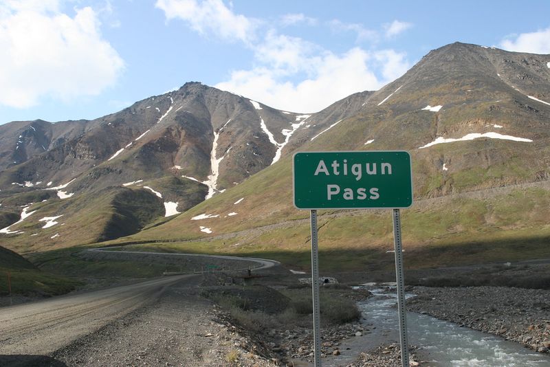
Driving the Dalton Highway feels less like a road trip and more like a genuine expedition into one of North America’s last truly wild places. Stretching roughly 414 miles from near Livengood toward Deadhorse on the Arctic coast, the highway crosses boreal forest, the dramatic Brooks Range, and vast Arctic tundra in a single continuous journey.
Cell coverage is essentially nonexistent for most of the route, and fuel stops are separated by enormous distances.
Atigun Pass, the highway’s highest point at approximately 4,800 feet, cuts through the Brooks Range in a corridor where avalanches are a documented seasonal hazard. Alaska transportation officials actively warn travelers about avalanche risk around the pass, and the surrounding peaks make the threat entirely believable.
Commercial trucks serving North Slope oil operations dominate the traffic, adding another layer of intensity to the driving experience.
Most of the highway surface is gravel or packed dirt, meaning flat tires are an expected part of the journey rather than a surprise. Travelers who prepare properly are rewarded with wildlife encounters, Arctic light, and a sense of genuine remoteness that is increasingly hard to find anywhere.
The Dalton is not a casual Sunday drive, but for the right traveler, it is absolutely unforgettable.
Million Dollar Highway and Red Mountain Pass, Colorado
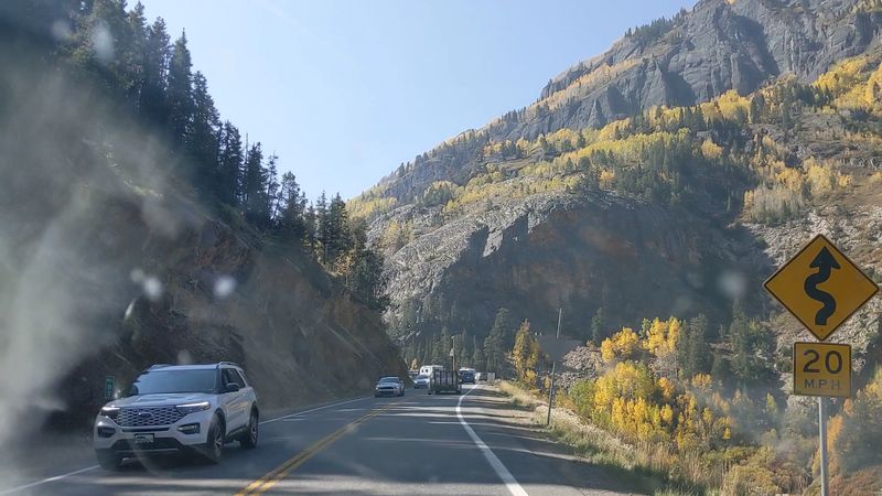
Red Mountain Pass earns its reputation the moment the road tilts upward and the San Juan Mountains close in on both sides. Sitting at roughly 11,018 feet along U.S. 550, this stretch of the celebrated Million Dollar Highway connects the historic mining towns of Silverton and Ouray through terrain that looks almost vertical from the roadside.
Grades exceeding seven percent keep drivers fully focused, and the scenery makes it genuinely difficult to keep your eyes on the pavement.
The road’s colorful name has several competing origin stories, including claims about the gold content of the original gravel fill and the enormous cost of early construction. What is certain is that the route transformed what had previously been a narrow mountain trail into a legitimate highway through some of Colorado’s most dramatic high-country scenery.
The surrounding mountains display brilliant rust-red and orange tones from iron-oxide minerals, creating a color palette that looks almost unreal in afternoon light.
Winter brings a completely different challenge, with heavy snowfall and avalanche risk making the route genuinely dangerous for unprepared travelers. Summer visitors enjoy wide-open views, wildflowers, and the unmistakable feeling of driving through mining history.
Red Mountain Pass is Colorado mountain driving at its most theatrical and most memorable.
Going-to-the-Sun Road, Montana
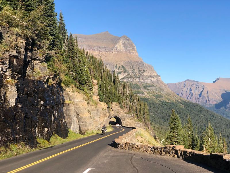
There is a moment on Going-to-the-Sun Road when the road seems to disappear into the mountain wall ahead, and then suddenly reappears clinging to the cliff face above. Glacier National Park’s signature drive packs an astonishing amount of mountain drama into roughly 50 miles, crossing the Continental Divide at Logan Pass more than 6,600 feet above sea level.
Construction crews worked primarily through the late 1920s and early 1930s to carve the route across terrain that resisted every effort.
Glacier-carved valleys, alpine lakes, dense cedar forests, and long stretches where the roadway appears to float against the cliff face all appear in quick succession. The National Park Service restricts vehicle dimensions on the narrowest sections, which reflects just how tightly the historic design fits the available space.
Oversized vehicles must use a shuttle system or approach from lower elevations, adding a layer of planning that rewards careful preparation.
Snow is a defining part of the road’s personality. The high alpine section closes seasonally, and crews undertake a massive plowing operation each spring before the road reopens.
Watching the snowplow footage alone is enough to understand the scale of the landscape. Going-to-the-Sun Road is one of those rare drives where the road itself is the destination, not just the route to one.
Beartooth Highway, Montana and Wyoming
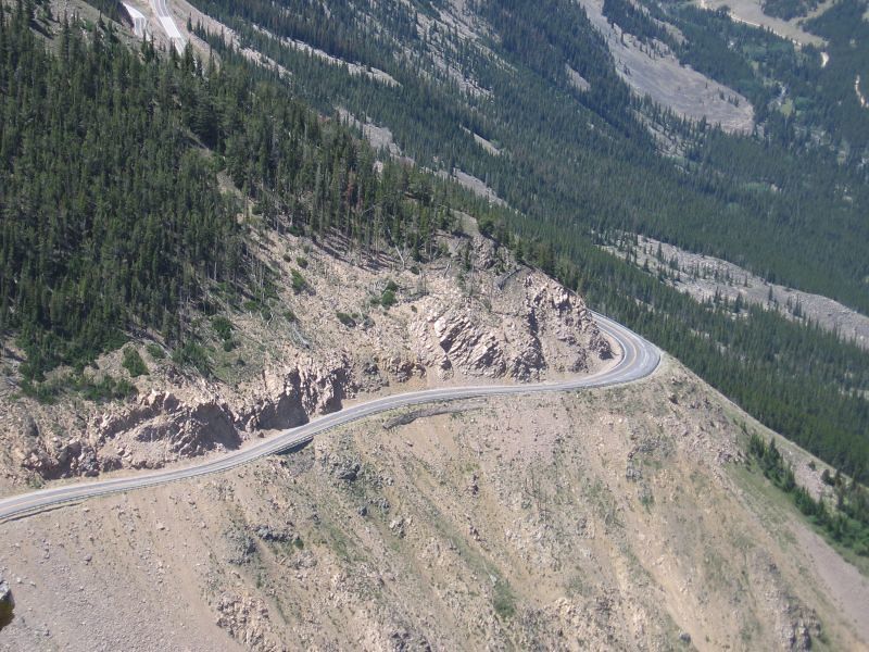
At the top of Beartooth Pass, summer and winter exist simultaneously. Drivers emerge from the switchbacks onto a high alpine plateau at 10,947 feet to find snowfields sitting peacefully beside wildflower meadows, while valleys thousands of feet below bask in warm sunshine.
This disorienting combination is one of the great pleasures of the 68-mile Beartooth Highway, which opened in 1936 and has been thrilling travelers ever since.
The highway climbs through a succession of tight switchbacks before opening onto glacially carved cirques, exposed plateaus, and a string of alpine lakes that reflect the sky in shades of deep blue and green. The surrounding Beartooth Mountains feel ancient and enormous in a way that is difficult to describe from sea level.
Wildlife, including grizzly bears, mountain goats, and bighorn sheep, can appear near the road at almost any point.
Heavy snow generally closes the highway through winter, and spring reopening depends entirely on weather and clearing conditions. For travelers approaching Yellowstone National Park from the northeast, the Beartooth route transforms the approach journey into one of the region’s most celebrated experiences.
Legendary journalist Charles Kuralt once called it the most beautiful drive in America, and it is genuinely hard to argue with that assessment.
Transfagarasan, Romania
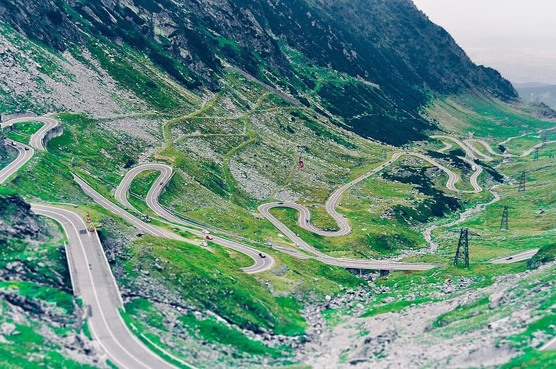
Romania’s Transfagarasan looks from above like someone attempted to write cursive across an entire mountain range and then gave up halfway through. The road twists across the Southern Carpathians in a relentless sequence of curves, steep climbs, tunnels, and viaducts, reaching roughly 2,145 meters at its highest point.
Built under Nicolae Ceausescu between 1970 and 1974 using military labor, the road was constructed with a strategic purpose, not a scenic one, though the scenery turned out to be spectacular anyway.
Approaching the summit, the highway repeatedly doubles back on itself in the tight serpentine pattern that appears in countless aerial photographs and travel magazine covers. The surrounding Fagaras Mountains are the highest range in Romania, and the peaks above the road carry snow well into summer.
Lake Balea sits near the top, adding a striking glacial element to an already dramatic landscape.
The highest sections close during winter, and even in summer, high-altitude weather can shift rapidly from sunshine to thick cloud within minutes. Drivers who time the trip well are rewarded with views that stretch across multiple mountain ridges.
The Transfagarasan is one of those roads that genuinely earns its reputation every single kilometer of the way up.
Karakoram Highway and Khunjerab Pass, Pakistan
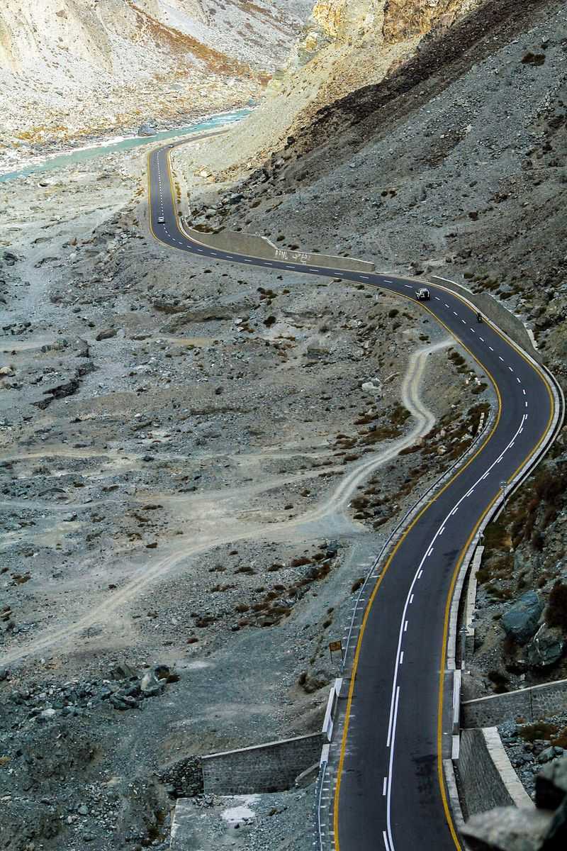
The Karakoram Highway climbs into a world that operates on a completely different scale from most mountain roads. Linking Pakistan with China across some of the planet’s most extreme terrain, the highway passes through the legendary Hunza Valley before ascending toward Khunjerab Pass at approximately 4,693 meters, or 15,397 feet above sea level.
Pakistan’s tourism authorities describe Khunjerab as one of the world’s highest paved international border crossings, and the landscape around it fully matches that claim.
Getting there means driving past towering peaks, massive glaciers, deep river gorges, and ancient Silk Road settlements that have survived in these valleys for centuries. The road itself was a joint Pakistan-China construction project completed in 1979 after roughly two decades of work that claimed hundreds of lives.
Plaques along the route acknowledge the workers who built it through conditions that would defeat most modern machinery.
Altitude sickness becomes a real concern as the highway climbs toward the pass, and travelers are advised to acclimatize gradually rather than rushing the ascent. Snow and severe winter conditions close the border crossing seasonally.
The combination of engineering achievement, cultural history, and raw Himalayan scenery makes the Karakoram Highway one of the world’s great road journeys, full stop.
Zoji La, India
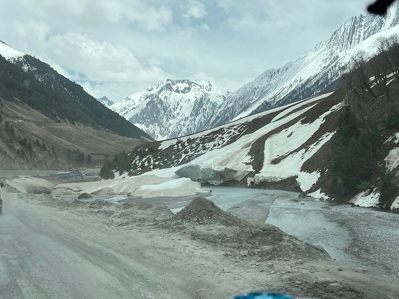
Zoji La is the kind of mountain pass that nations take seriously. Rising to roughly 11,600 feet along the Srinagar-Kargil-Leh corridor in the Indian Himalayas, it serves as the primary gateway between Kashmir and the remote region of Ladakh.
Snow, subzero temperatures, and avalanche-prone slopes have historically made winter travel across the pass extremely dangerous, and sometimes outright impossible for months at a time.
India’s Border Roads Organisation has repeatedly undertaken massive snow-clearing operations to restore connectivity across the pass, often working under brutal conditions at high altitude. The road climbs through a stark, raw Himalayan environment where the landscape changes completely from one side of the crossing to the other.
The green, forested Kashmir side gives way almost immediately to the bare, lunar-like terrain of Ladakh.
Zoji La carries far more than tourist traffic. Passengers, essential food and medical supplies, commercial goods, and military transport all depend on the route for reliable access to Ladakh.
A tunnel project is underway to eventually provide year-round connectivity, which would transform life for communities that currently face months of isolation each winter. Until that tunnel opens, Zoji La remains one of India’s most strategically important and dramatically challenging mountain crossings.
Icefields Parkway, Canada
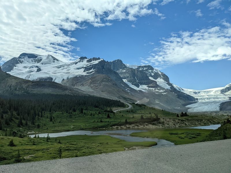
Some roads intimidate through sheer narrowness. The Icefields Parkway in Alberta intimidates through sheer scale.
Stretching 232 kilometers between Lake Louise and Jasper along Highway 93 North, the route crosses some of the Canadian Rockies’ most imposing terrain, where the mountains feel so large that the road seems almost accidental by comparison. On a cloudy day, the peaks disappear entirely into the weather above, leaving drivers in a strange, muffled world of grey and green.
Sunwapta Pass, at 2,035 meters, is the parkway’s high point, and the Big Bend hairpin below it gives drivers a memorable taste of what serious mountain road design looks like. The surrounding landscape includes glaciers, icefield viewpoints, turquoise glacial lakes, and wildlife corridors where elk, bears, and mountain goats appear regularly near the road.
Parks Canada is direct about the remoteness: cell coverage is essentially absent, and services are limited to a handful of points along the entire route.
Winter transforms the parkway into a genuinely serious undertaking, with avalanche-control closures, ice, and rapidly changing conditions making preparation essential. The summer and fall seasons reward travelers with some of the most consistently spectacular mountain scenery in North America.
The Icefields Parkway earns its reputation quietly, one breathtaking kilometer at a time.
Moki Dugway, Utah
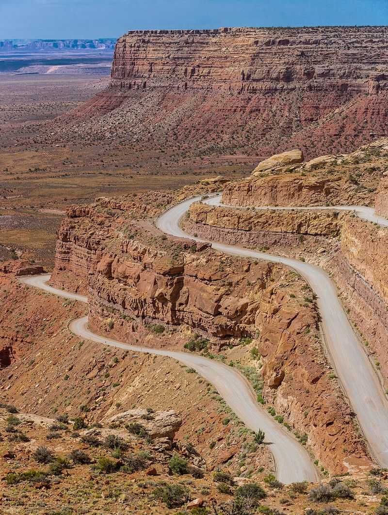
Moki Dugway looks like a road that someone drew as a joke and then accidentally built. Part of State Route 261 in southern Utah, this unpaved section uses a series of tight switchbacks to climb the sheer edge of Cedar Mesa, gaining roughly 1,100 feet of elevation in just three miles of exposed, narrow dirt road.
There are no guardrails to speak of, and the views from the climb are the kind that make your stomach briefly forget its usual job.
Utah’s tourism office specifically discourages large RVs and trailers from attempting the section, and one look at the sharp corners explains why. The road was originally built in the 1950s to haul uranium ore from the mesa above, which adds an interesting industrial footnote to what is now primarily a scenic attraction.
From the switchbacks, the view opens across the Valley of the Gods and surrounding red-rock desert country in a panorama that stretches for dozens of miles.
Unlike an Alpine pass shaped by glaciers and snow, the Moki Dugway delivers its drama through exposed sandstone, open desert air, and an abrupt change in elevation that arrives with almost no warning. The road is passable in dry conditions with a standard vehicle, but rain turns the surface slick quickly.
It is one of the American Southwest’s most underrated and genuinely thrilling short drives.
Grossglockner High Alpine Road, Austria
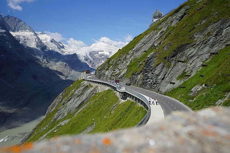
Austria built the Grossglockner High Alpine Road in the 1930s with a clear purpose: make the high mountains accessible to ordinary people, and do it in style. The result is a 48-kilometer purpose-built panoramic route that negotiates 36 bends while climbing through Hohe Tauern National Park to a main crossing at Hochtor, 2,504 meters above sea level.
A side road climbs even higher to the 2,571-meter Edelweiss Spitze viewpoint, where the horizon fills with peaks in every direction.
Austria’s highest mountain, the 3,798-meter Grossglockner, towers over the route and is visible from multiple points along the drive. The Pasterze Glacier, Austria’s largest, spreads across the valley below the summit area, though it has retreated significantly over recent decades.
Interpretive stops along the road explain both the geology and the history of the crossing, making the drive feel educational without being dull.
Winter snow closes the high route for a substantial portion of each year, concentrating all the traffic into the warmer months and making summer weekends genuinely busy. Tolls apply for the road, which funds its ongoing maintenance.
The Grossglockner High Alpine Road is not a white-knuckle experience in the traditional sense, but its scale, scenery, and engineering ambition place it comfortably among Europe’s most impressive mountain drives.
Furka Pass, Switzerland
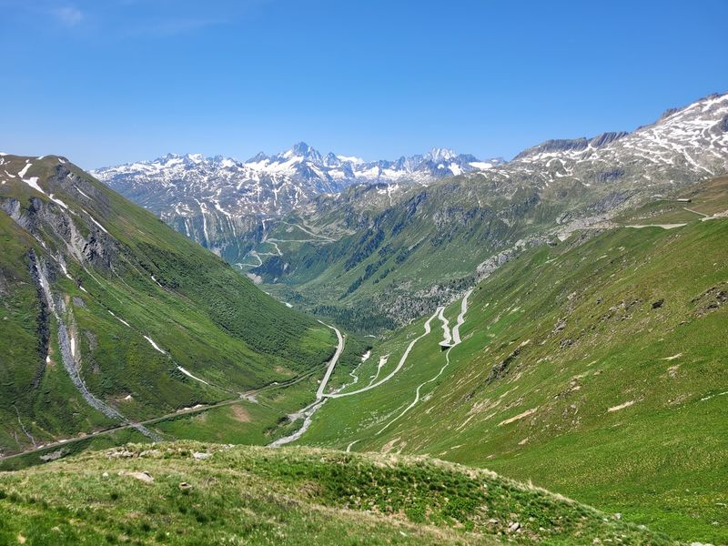
James Bond once drove these curves at high speed while being chased by a woman in a white Aston Martin, and honestly, that feels about right for the Furka Pass. The 1964 film Goldfinger used the Swiss pass as its opening chase location, cementing the road’s cinematic reputation for a generation of movie fans.
Rising to 2,429 meters and connecting Realp in Uri with Oberwald in Valais, Furka offers tight Alpine curves, glaciated peaks exceeding 4,000 meters, and scenery that needs no Hollywood assistance to look dramatic.
The historic Hotel Belvedere sits inside one of the road’s sweeping bends, positioned dramatically near the Rhone Glacier. The glacier has retreated considerably since the hotel was built, which adds a sobering environmental layer to an otherwise exhilarating landscape.
Visitors can still walk up to the glacier’s edge from the road, making a brief stop feel genuinely worthwhile rather than just a photo opportunity.
Furka is firmly a seasonal crossing, with heavy Alpine snow keeping the pass closed through winter and access returning during the warmer months. The Furka Steam Railway, which once crossed the pass and was later restored by enthusiasts, offers an alternative way to experience the landscape.
Whether by road or rail, Furka delivers an Alpine experience that feels both timeless and slightly cinematic, even without a car chase involved.
Share this story