Patagonia is one of those rare places that looks almost too dramatic to be real, stretching across the southern tips of Argentina and Chile in a wild tangle of glaciers, granite towers, turquoise lakes, and windswept coastlines. Covering six Argentine provinces and a huge swath of southern Chile, it rewards travelers who are willing to go the extra mile, sometimes literally.
Whether you are chasing world-class hikes, ancient rock art, breaching whales, or simply a road that seems to go on forever, Patagonia delivers in spectacular fashion. Here are 15 places that prove why this remote corner of the world belongs on every serious traveler’s list.
Torres del Paine National Park, Chile
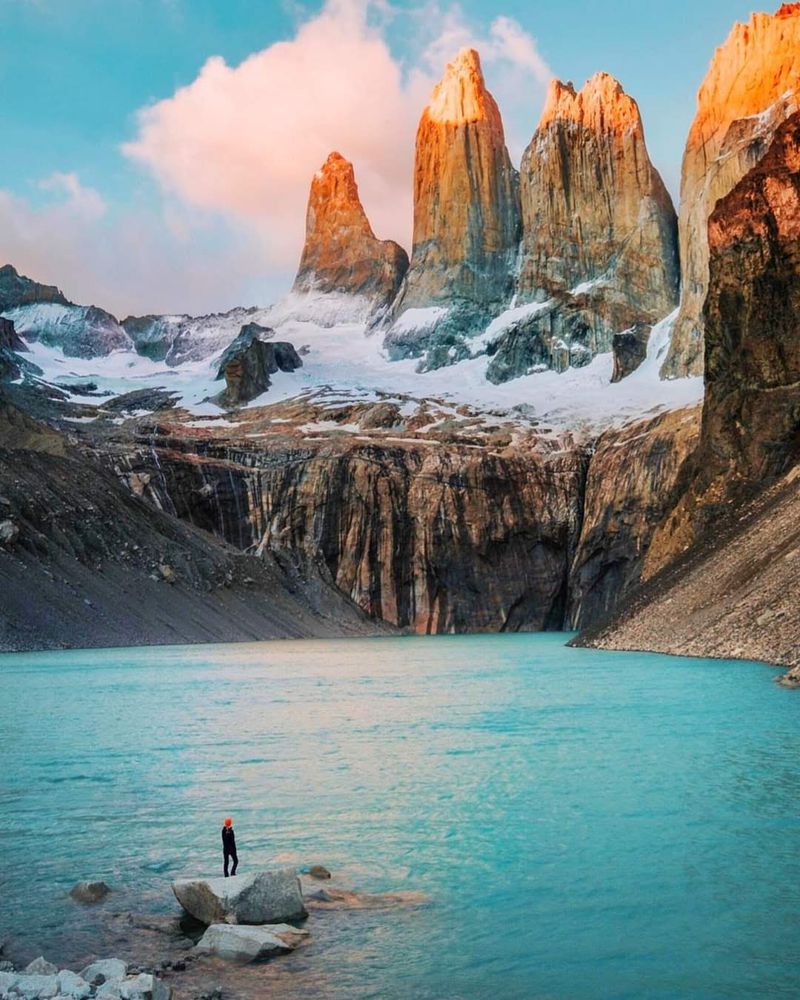
Few places on Earth announce themselves quite like Torres del Paine. Those three jagged granite spires shoot straight up from the steppe like nature’s own skyscrapers, and they look absolutely unreal on a clear Patagonian morning.
The park covers roughly 227,000 hectares and packs in an almost unfair amount of scenery. Lake Pehoé glows turquoise, Grey Glacier groans and cracks at the edge of the Southern Patagonian Ice Field, and guanacos wander across the golden grasslands without a care in the world.
Hikers can take on the famous W or O circuits, which are multi-day routes that pass through the park’s greatest highlights. Shorter day hikes to Mirador Base Torres are also popular and genuinely rewarding.
Even a scenic drive combined with a boat excursion toward Grey Glacier gives visitors a solid taste of what makes this park so legendary. Pack wind-resistant layers because the Patagonian gusts here are no joke, and weather can shift from sunshine to sleet within the same hour.
Book accommodation well in advance, especially for summer visits between December and February, when spots fill up fast.
Perito Moreno Glacier, Argentina
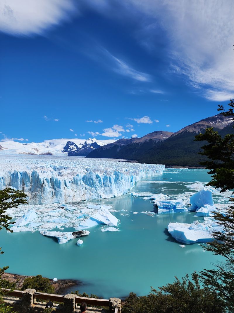
Perito Moreno is the kind of glacier that makes you forget you were ever tired from traveling. Standing on the viewing walkways near El Calafate, you hear it before you fully see it: deep groans, sharp cracks, and then a thunderous splash as a chunk of ice the size of a building breaks off and crashes into Lake Argentino.
Unlike most glaciers around the world, Perito Moreno is considered stable and is not retreating at an alarming rate, which makes it one of the more accessible and dramatic ice experiences on the planet. UNESCO has recognized Los Glaciares National Park as a World Heritage site, noting that glaciers cover roughly half the park’s area.
The ice front stands about 60 meters above the lake’s surface, and its vivid blue crevasses are genuinely mesmerizing up close. Guided ice-trekking excursions let visitors strap on crampons and walk across the glacier’s surface, which is a wildly memorable experience.
The nearby town of El Calafate serves as a comfortable base with good restaurants and accommodation options for every budget. Arriving early in the morning means fewer crowds and better light for photography.
El Chaltén and Mount Fitz Roy, Argentina
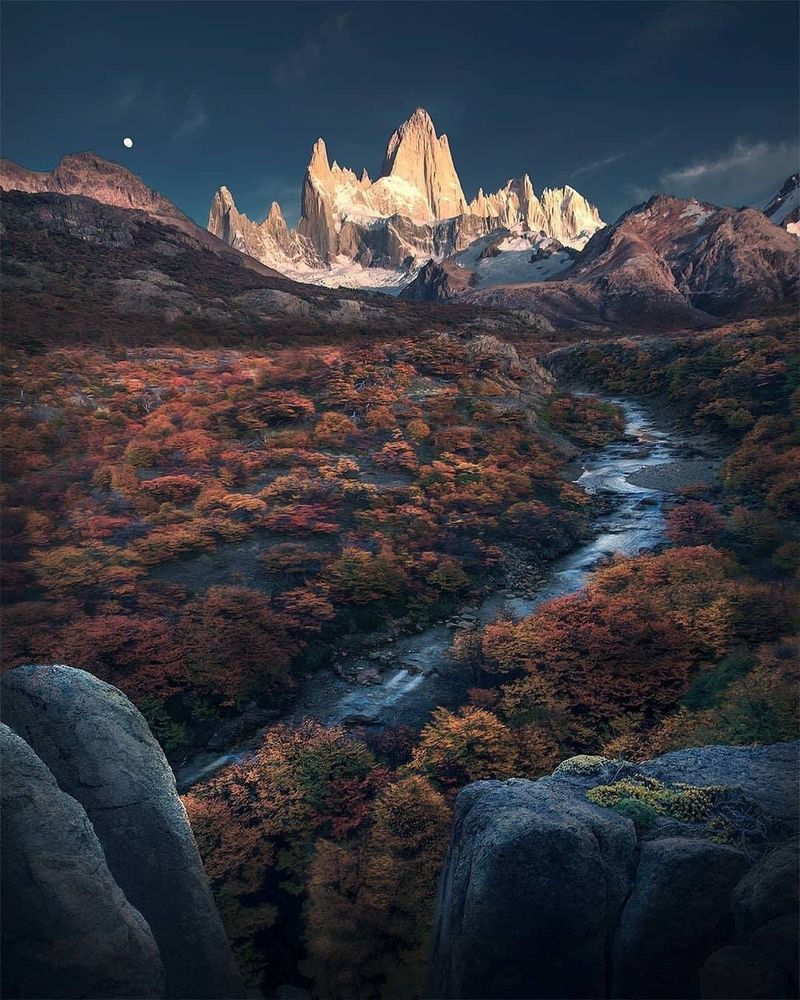
Argentina officially declared El Chaltén its national trekking capital, and once you arrive, the title makes complete sense. Trails branch out from the edge of town in multiple directions, all heading toward some of the most dramatic granite scenery anywhere on the continent.
Mount Fitz Roy is the centerpiece, a serrated tower of rock that catches the sunrise in shades of orange and pink during good weather. The hike to Laguna de los Tres is the classic route, a demanding full-day effort that ends at a glacial lake with the Fitz Roy massif reflected in the water.
Laguna Torre offers a slightly different skyline, with Cerro Torre’s needle-like peak rising above a floating iceberg lake.
What makes El Chaltén particularly welcoming is that you do not need to be an expert mountaineer to enjoy it. Shorter walks to Piedras Blancas Glacier and Chorrillo del Salto waterfall suit families and casual hikers perfectly well.
The village itself has a friendly, outdoorsy vibe with craft beer bars, cozy restaurants, and gear shops. Patagonian wind and fast-changing weather are constants here, so dressing in layers is not optional but absolutely necessary for a safe and comfortable outing.
Carretera Austral, Chile
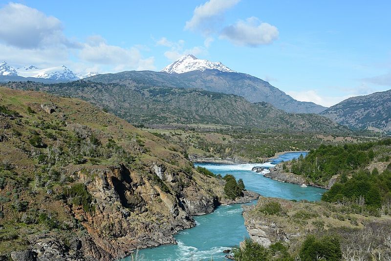
Stretching more than 1,200 kilometers through some of the least-touched wilderness in South America, the Carretera Austral is a road trip that redefines what a road trip can be. Chile’s Route 7 connects Puerto Montt in the north to Villa O’Higgins in the south, threading through fjords, rainforests, glaciers, and tiny communities that seem to exist outside of time.
Long gravel sections, river crossings, and mandatory ferry legs keep things interesting and occasionally nerve-wracking. That unpredictability is genuinely part of the charm.
Highlights along the route include Queulat National Park, the Marble Caves at Lake General Carrera, Patagonia National Park near Cochrane, and the wooden-boardwalk village of Caleta Tortel.
Driving the full length can take one to three weeks depending on how many stops you make, and most travelers agree that rushing it is a mistake. Cyclists and motorcyclists tackle it too, though the distances between fuel and food stops require careful planning.
Renting a 4×4 or campervan is the most flexible option, and building extra days into your schedule for weather delays or unexpected detours is genuinely smart advice rather than just a suggestion. The road rewards patience generously.
Marble Caves and Lake General Carrera, Chile
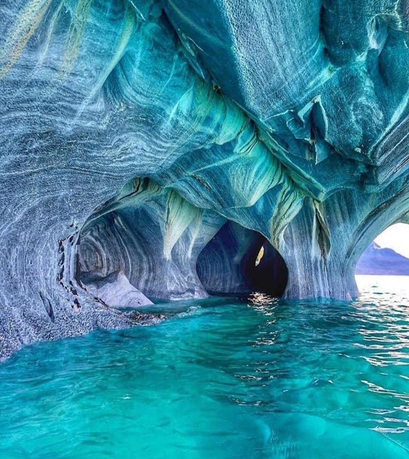
Lake General Carrera holds the kind of color that makes photographers question whether they accidentally left a filter on. Chile’s largest lake glows in shades of turquoise so vivid and electric that they look digitally enhanced, even in person.
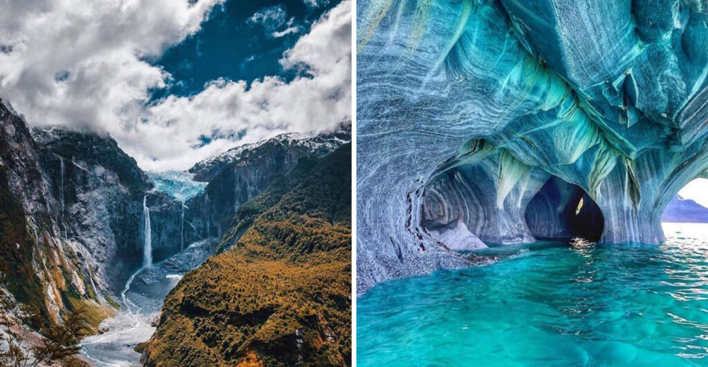
Along the lake’s shore near Puerto Rio Tranquilo, thousands of years of wave erosion have sculpted marble bedrock into a series of caves, arches, and cathedral-like chambers. Known collectively as the Marble Caves or Marble Chapels, these formations are best visited by boat or kayak so you can glide directly through the sculpted interiors.
Light bouncing off the turquoise water onto the marble walls creates shifting patterns of blue and white that change throughout the day depending on the sun’s angle.
Weather and water conditions directly affect visibility inside the caves, so calm mornings typically offer the clearest and most colorful experience. Tours depart from Puerto Rio Tranquilo and usually last around an hour, though kayak trips allow for more time and closer exploration.
The small town itself sits right on the Carretera Austral and is an easy stop for road-trippers passing through. Combining a cave visit with a lakeside lunch makes for a memorable afternoon on this remarkable stretch of southern Chile.
Queulat National Park, Chile
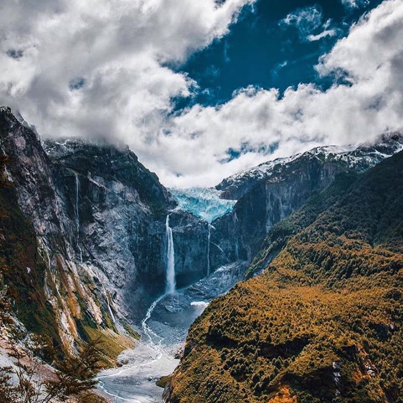
Queulat National Park is the kind of place that makes you feel small in the best possible way. Thick temperate rainforest carpets every surface, rivers run cold and fast, and somewhere above the treeline, a glacier hangs suspended between two cliff faces like it forgot to fall.
That glacier is the Ventisquero Colgante, or Hanging Glacier, and it is one of the most striking natural sights along the entire Carretera Austral. Meltwater pours off its edges in twin waterfalls that crash into a lagoon below, and a well-maintained trail through the forest leads to a viewing platform where the full spectacle comes into focus.
Rain is genuinely common here, so waterproof gear is not just recommended but essential.
Chile’s tourism authority specifically calls out Queulat as a must-visit on the northern Carretera Austral, and it is easy to see why. The park also offers suspension bridges, river walks, and camping areas for those who want to slow down and spend a night or two among the trees.
Birdwatching is excellent, with Magellanic woodpeckers and other Patagonian forest species active throughout the park. Arriving with flexible timing helps, since morning mist often clears by midday to reveal the glacier in full dramatic glory.
Patagonia National Park, Chile
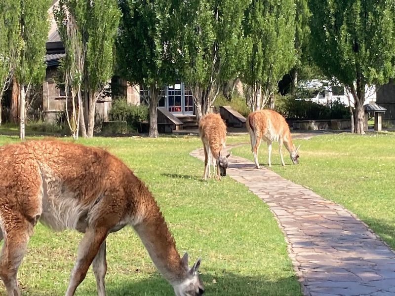
Patagonia National Park does not ease you into it. The Valle Chacabuco opens up and suddenly you are looking at one of the most expansive, uncluttered landscapes in all of South America, with mountains rising on every side and guanacos dotting the golden grasslands like living punctuation marks.
Located in Chile’s Aysén Region between Cochrane and Chile Chico, the park sits many hours south of Coyhaique on the Carretera Austral, which means reaching it requires real commitment. That commitment pays off.
Trails wind through open steppe, cloud forests, and river valleys with very few other hikers in sight, creating a sense of solitude that is increasingly hard to find in Patagonia’s more famous parks.
The park was developed in part through a major private conservation effort and is now managed by Chile’s national park service. Wildlife is abundant, including pumas, Andean condors, flamingos, and several species of deer.
Camping and lodge accommodation are both available within park boundaries. Day hikes range from easy valley strolls to longer ridge climbs with sweeping views.
Visiting here alongside Torres del Paine gives travelers a genuinely contrasting Patagonian experience, swapping crowded trails for wide-open landscapes that feel refreshingly uncrowded and wonderfully raw.
Bariloche and Nahuel Huapi National Park, Argentina
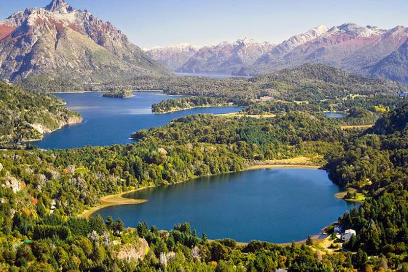
Bariloche surprises people who expect all of Patagonia to look like windswept steppe and crumbling ice. Here in the north, the landscape swaps that harsh drama for something almost impossibly pretty: dense Andean forests, chocolate-box mountain peaks, and enormous blue lakes that stretch to the horizon.
Nahuel Huapi National Park wraps around the city and covers more than 717,000 hectares across Río Negro and Neuquén provinces. It protects a layered mix of Patagonian forest, high-Andean ecosystems, and open steppe, offering a range of experiences that few single parks can match.
Cerro Tronador, an extinct stratovolcano draped in glaciers, is one of the park’s most iconic day trips.
Boat excursions to Victoria Island and Puerto Blest are popular and genuinely scenic, threading through forested channels and stopping at waterfalls. Bariloche itself has a well-developed tourism infrastructure with ski resorts, chocolate shops, and excellent restaurants, making it one of the more comfortable bases in all of Patagonia.
Visiting in autumn, between March and May, brings fiery foliage colors to the forests that rival anything in the northern hemisphere. The city also serves as the northern entry point for the legendary Route of the Seven Lakes road trip heading south toward Villa La Angostura.
Route of the Seven Lakes, Argentina
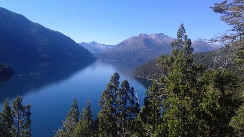
Some roads exist purely to get you somewhere. The Route of the Seven Lakes exists to remind you that the journey can be the whole point.
This roughly 110-kilometer stretch of Route 40 between San Martín de los Andes and Villa La Angostura passes through a string of mountain lakes so beautiful it almost feels unfair to drive it in a single day.
The lakes on the route include Lácar, Machónico, Falkner, Villarino, Escondido, Correntoso, and Espejo, each with its own personality and shade of blue or green. Forested picnic spots, rocky beaches, and mountain viewpoints appear around almost every bend, making spontaneous stops both easy and deeply satisfying.
The road also passes through sections of Lanín and Nahuel Huapi national parks, so the scenery never dips below spectacular.
Autumn is particularly magical here, with beech trees turning gold and copper between March and May. The route is paved in most sections but has some gravel stretches, so checking road conditions beforehand is worthwhile.
Cyclists tackle it too, though the distances require good fitness and a loaded touring setup. Whether you drive, cycle, or join an organized day tour from Bariloche or San Martín, the Route of the Seven Lakes is one of Argentina’s most rewarding and unhurried road experiences.
Los Alerces National Park, Argentina
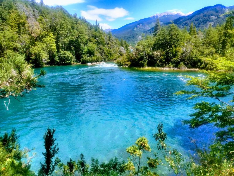
There is a tree in Los Alerces National Park that was already more than 600 years old when the Roman Empire fell. The Fitzroya cupressoides, known locally as alerce or lahuán, is one of the longest-lived tree species on Earth, and Los Alerces is one of the last places where significant ancient forests of this species still stand.
UNESCO recognized the park as a World Heritage site, describing a landscape shaped by successive glaciations and filled with clear-water lakes, glacial cirques, and remarkably intact Patagonian forest. The star of the show is a single tree in the Millennial Alerce Forest estimated at approximately 2,600 years old and nearly 60 meters tall.
Reaching it involves a boat trip across turquoise Lake Menéndez followed by a short forest walk.
Beyond the ancient trees, the park offers waterfall hikes, river trails, and camping among some of the most serene forest scenery in all of Patagonia. Lake Futaleufú and Lake Rivadavia add brilliant color to the landscape, and fly-fishing is popular in the park’s clear rivers.
Los Alerces sits near the town of Esquel in Chubut Province, making it an accessible yet surprisingly uncrowded destination. Visitors who make the effort consistently describe it as one of Patagonia’s most emotionally affecting places.
Península Valdés, Argentina
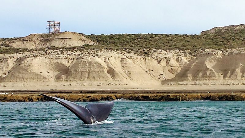
Patagonia’s coast has been quietly upstaging its mountains for years, and Península Valdés is the proof. UNESCO recognized this remote Atlantic peninsula as a site of global importance for marine-mammal conservation, and a single day spent here watching wildlife tends to convert even the most mountain-focused traveler into a devoted coast enthusiast.
Southern right whales arrive in the sheltered Golfo Nuevo and Golfo San José between June and December to breed and raise their calves, making whale-watching boat trips from Puerto Pirámide one of Argentina’s most extraordinary wildlife experiences. Elephant seals haul themselves onto beaches at Punta Delgada and Caleta Valdés, while Magellanic penguins nest in large colonies nearby.
Punta Norte is famous for orca hunting behavior, where killer whales intentionally beach themselves to grab sea lion pups in shallow water.
Because the wildlife calendar shifts dramatically through the year, timing your visit according to what you most want to see is genuinely important. A good naturalist guide makes a significant difference in spotting animals and understanding their behavior.
The peninsula is a roughly four-hour drive from the city of Trelew, and the nearby town of Puerto Madryn offers solid accommodation and restaurant options. Combining Valdés with a visit to the Punta Tombo penguin colony nearby creates an exceptional wildlife-focused Patagonia itinerary.
Cueva de las Manos, Argentina
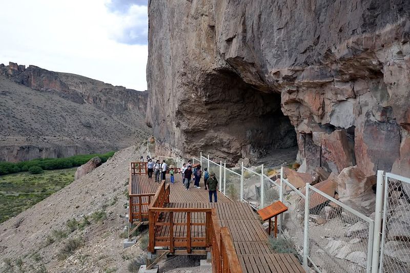
Patagonia keeps surprising people who assume it is only about mountains and glaciers. Hidden inside a canyon carved by the Río Pinturas in Santa Cruz Province, Cueva de las Manos holds one of the most extraordinary collections of prehistoric rock art anywhere in the Americas.
The name translates to Cave of the Hands, and the walls are covered with hundreds of stenciled human handprints in shades of red, black, white, and ochre. They were created by blowing pigment through bone tubes onto hands pressed against the rock, a technique that produced remarkably crisp outlines that have survived for thousands of years.
UNESCO dates the wider artistic sequence to between roughly 9,300 and 1,300 years ago, placing the oldest images firmly in the hunter-gatherer era.
Alongside the hands are paintings of guanacos, rheas, and hunting scenes that give a vivid window into how the region’s earliest inhabitants lived. Guided tours are required and add real depth to the experience, explaining the techniques, pigments, and cultural context behind the art.
The canyon itself is beautiful, with dramatic red rock walls and sweeping steppe views. Reaching the site involves a drive along gravel roads from the town of Perito Moreno or Bajo Caracoles, making it a genuine off-the-beaten-track Patagonian discovery.
Ushuaia and Tierra del Fuego National Park, Argentina
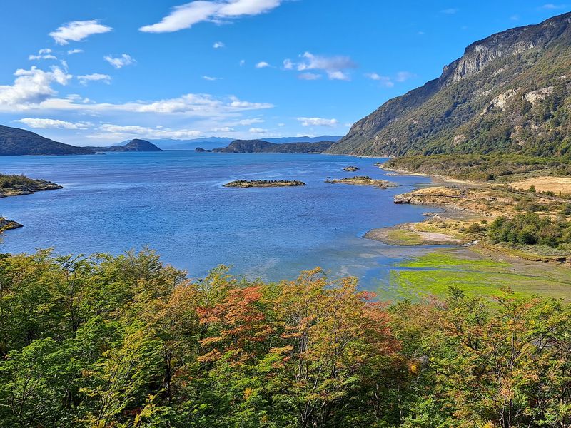
Ushuaia likes to remind visitors that they have reached the end of the world, and it is not entirely wrong about that. Wedged between the Martial Mountains and the Beagle Channel on the island of Tierra del Fuego, it is the southernmost city in Argentina and a genuine frontier town with real mountains, real forests, and a real sense of being delightfully far from everything.
Tierra del Fuego National Park begins just 10 kilometers from the city center along National Route 3, the same road that starts in Buenos Aires thousands of kilometers north. Inside the park, trails wind through lenga beech forest, along glacial lakes, and down to the rocky shores of the Beagle Channel.
The autumn color display between March and May turns the forests into something genuinely spectacular.
Navigation trips on the Beagle Channel pass sea bird colonies, sea lion haul-outs, and the forested islands that so captivated Charles Darwin during his 1830s voyage. Ushuaia’s maritime museum and the historic Estancia Harberton nearby add cultural depth to what can otherwise become a purely outdoor-focused visit.
The city itself has grown into a well-supplied tourist hub with good restaurants, gear shops, and accommodation at multiple price points. It also serves as the departure point for Antarctic expedition cruises heading further south across the Drake Passage.
Caleta Tortel and Villa O’Higgins, Chile
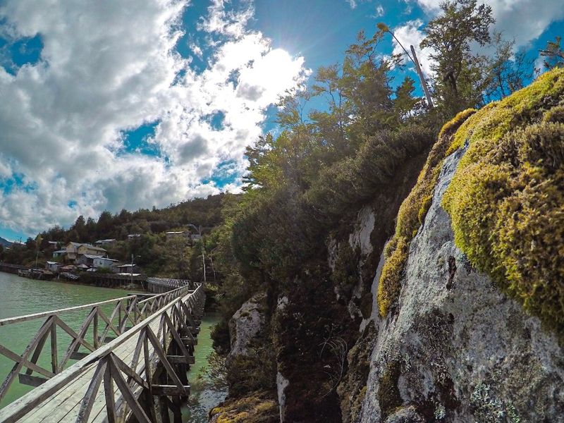
Caleta Tortel has no streets. The entire village is connected by a network of wooden boardwalks and staircases that cling to a steep forested hillside above a fjord, and the effect is genuinely unlike anything else in Patagonia.
It looks like someone tried to build a town and ran out of flat ground about halfway through.
Reaching Tortel from Coyhaique involves roughly 575 kilometers of Carretera Austral driving, much of it on gravel. Continuing south to Villa O’Higgins, the road’s remote endpoint, adds more gravel and a mandatory ferry crossing across Baker and O’Higgins lakes.
That difficult logistics chain is precisely what keeps both places feeling raw and unhurried. Villa O’Higgins marks the southern terminus of the Carretera Austral and sits at the edge of the Northern Patagonian Ice Field.
Adventurous travelers can continue from Villa O’Higgins into Chilean or Argentine Patagonia via a famous multi-day trekking and boat route that eventually connects to El Chaltén in Argentina. Kayaking around the fjord channels near Tortel is a popular local activity, and the surrounding forests and rivers offer excellent hiking.
Both settlements have basic but comfortable accommodation, and the local seafood, particularly centolla king crab, is a genuine highlight worth planning a meal around. Slow travel suits this corner of Patagonia perfectly.
Puerto Williams and Navarino Island, Chile
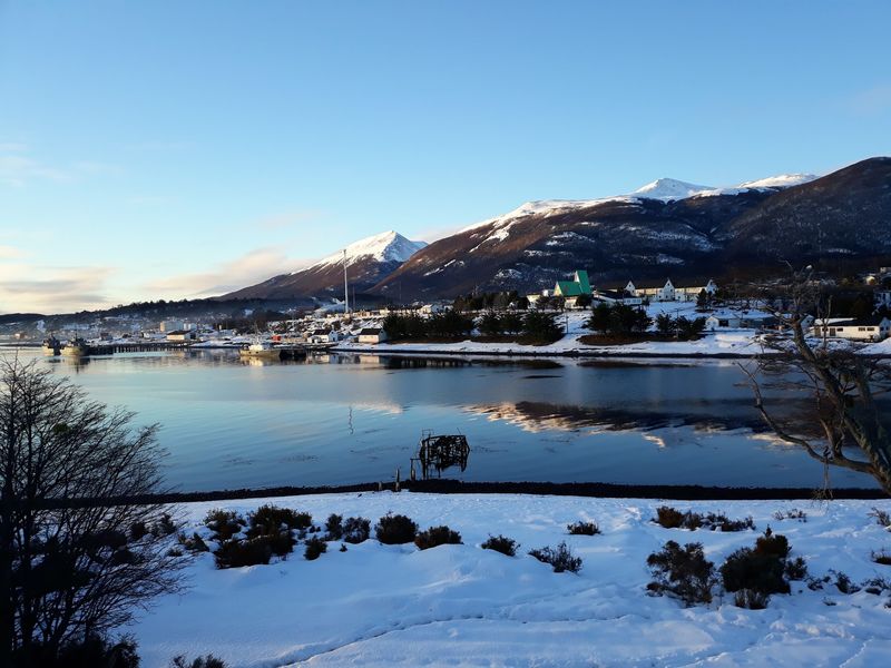
Pushing further south than almost anywhere else on Earth that has a proper town, Puerto Williams sits on Navarino Island beside the Beagle Channel and wears its extreme geography like a badge of honor. Chile Travel promotes it as the southernmost city in the world, a claim that generates friendly debate with Ushuaia across the channel but adds to the end-of-the-world atmosphere either way.
Getting there is genuinely part of the experience. A weekly ferry from Punta Arenas winds through the Strait of Magellan and along the Beagle Channel on a journey lasting around 30 to 33 hours.
The scenery along the way, all fjords, forested islands, and dramatic skies, makes the crossing feel worthwhile rather than merely necessary. A faster flight option from Punta Arenas also exists for those short on time.
On the island itself, the Dientes de Navarino trekking circuit is one of the southernmost multi-day hikes in the world, crossing rugged terrain above the treeline with views across channels and mountains that feel genuinely untouched. Yagán cultural history is preserved in the local museum, offering important context about the indigenous people who navigated these waters for thousands of years.
Puerto Williams suits travelers who want Patagonia at its most remote, most honest, and most beautifully inconvenient.
Share this story