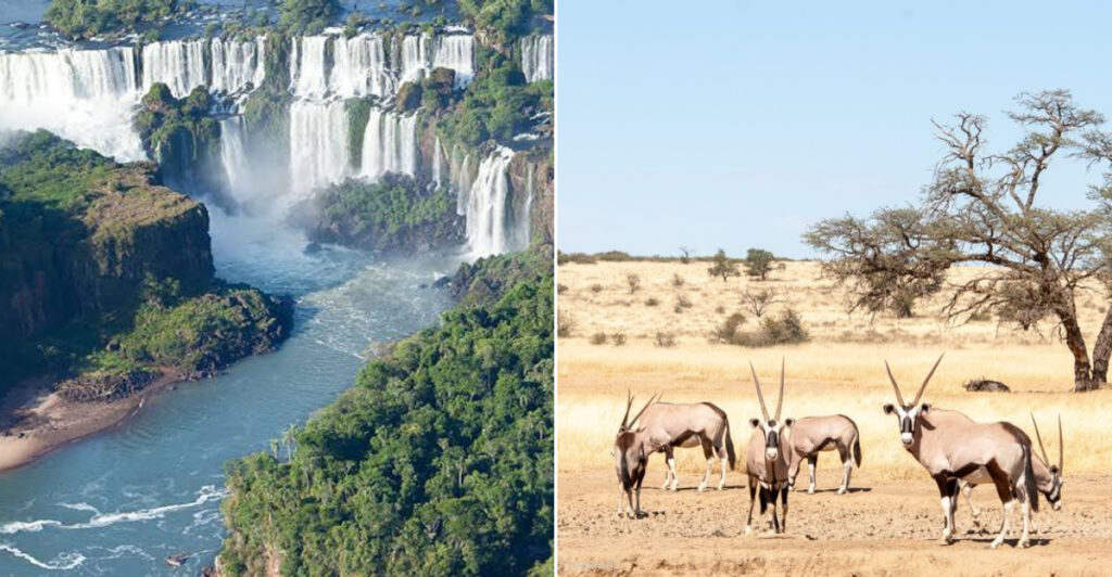
Some of the most breathtaking places on Earth do not belong to just one country. They stretch across borders, connecting nations through shared rivers, mountain ranges, wetlands, and forests.
These natural wonders remind us that nature does not follow political lines drawn on a map. From the thundering spray of Victoria Falls to the ancient glaciers of Patagonia, the world’s greatest landscapes often belong to everyone at once, and that makes them even more worth exploring.
Niagara Falls, Canada and the United States
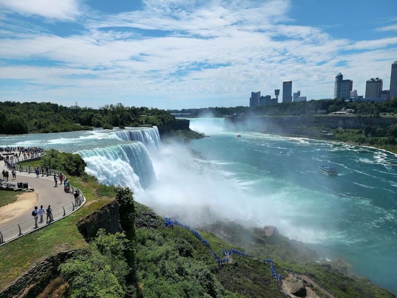
Few natural borders in the world are as dramatic or as well-known as Niagara Falls. Straddling the line between Ontario, Canada and New York, USA, the falls split into two major sections along the Niagara River.
Horseshoe Falls on the Canadian side carries the largest volume of water, while the American Falls and Bridal Veil Falls sit on the US side.
The Canadian side offers tunnel experiences behind the waterfall, scenic parkland, and broad views of Horseshoe Falls. Niagara Falls State Park in New York provides boat trips, observation platforms, and well-maintained trails that get visitors surprisingly close to the American Falls.
Both parks operate year-round, though winter visits come with a different kind of spectacle when ice forms along the gorge edges. Crossing between the two countries requires valid travel documents.
Either side gives you a genuinely powerful look at one of the most visited waterfalls on the planet.
Iguazu Falls, Argentina and Brazil
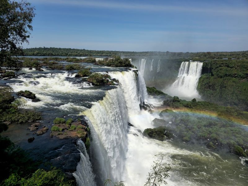
Stretching nearly 2,700 meters across a basalt landscape blanketed by subtropical forest, Iguazu Falls is one of the most expansive waterfall systems anywhere on Earth. The falls sit on the border between Argentina and Brazil, divided between two national parks that each offer a completely different experience of the same natural wonder.
Argentina’s side features an extensive network of walkways that bring visitors right up to individual cascades, including the thundering U-shaped section known as the Devil’s Throat. Brazil’s side is better known for sweeping panoramic views across the full width of the system, giving you the kind of perspective that photographs struggle to capture.
Both parks are accessible throughout the year, though heavy rainfall can raise water levels dramatically and occasionally affect walkway access. Visiting both sides over two days is the most rewarding approach.
The contrast between up-close immersion on the Argentine walkways and Brazil’s wide-open vistas makes the full trip genuinely worthwhile.
Victoria Falls, Zambia and Zimbabwe
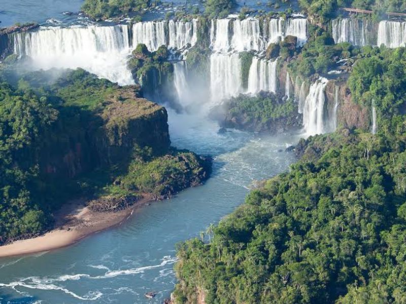
The local name says it best. Mosi-oa-Tunya, meaning the smoke that thunders, describes exactly what happens when the Zambezi River reaches the border between Zambia and Zimbabwe and drops into a series of basalt gorges.
The mist produced by the falls can be visible from miles away and soaks visitors on nearby viewing paths even during dry conditions.
UNESCO protects the site through Zambia’s Mosi-oa-Tunya National Park and Zimbabwe’s Victoria Falls and Zambezi national parks. Both countries provide viewpoints, but the experience changes considerably depending on the season.
High-water months typically bring the most dramatic spray, while lower water levels in the dry season reveal more of the rock face and allow better views into the gorge.
Zimbabwe’s rainforest path along the gorge rim offers some of the closest views, while Zambia’s side tends to attract fewer crowds. Planning around the season is genuinely important here, because the falls look and feel like an entirely different place depending on when you arrive.
Mount Everest, Nepal and China
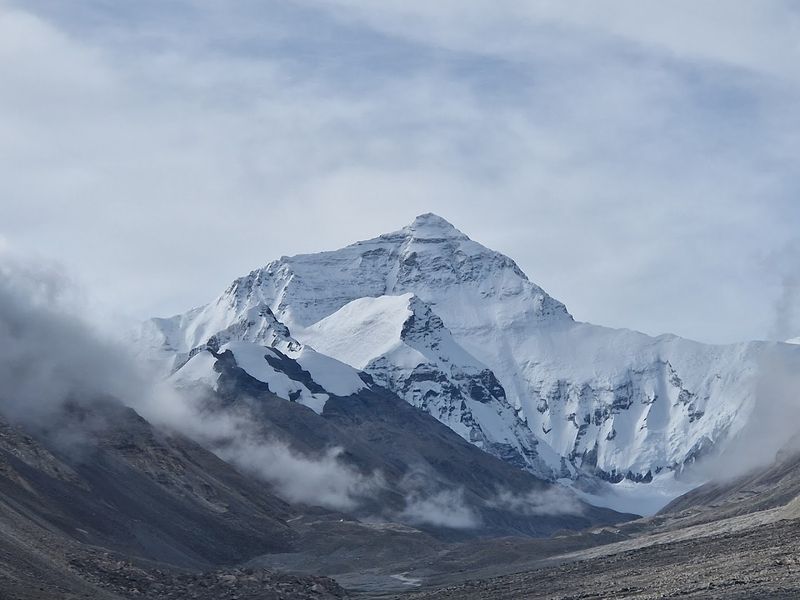
The highest point on Earth sits precisely on the border between Nepal and China’s Tibet Autonomous Region. Nepal calls the mountain Sagarmatha, the Tibetan name is Chomolungma, and most of the world simply calls it Everest.
Whatever name you use, the scale of the place is difficult to process until you are standing somewhere near it.
Most trekking visitors approach through Nepal’s Sagarmatha National Park, following established routes that pass through forests, Sherpa villages, high suspension bridges, and alpine valleys before reaching the viewpoints below the summit zone. Everest Base Camp on the Nepal side sits at roughly 5,364 meters, making the trek itself a serious physical undertaking that requires preparation, acclimatization time, and the right permits.
Spring and autumn are the preferred seasons for trekking, with spring also being the main climbing window. China’s Tibet side offers a different approach, but access regulations there change more frequently.
Either route demands respect for altitude and weather.
Lake Titicaca, Peru and Bolivia
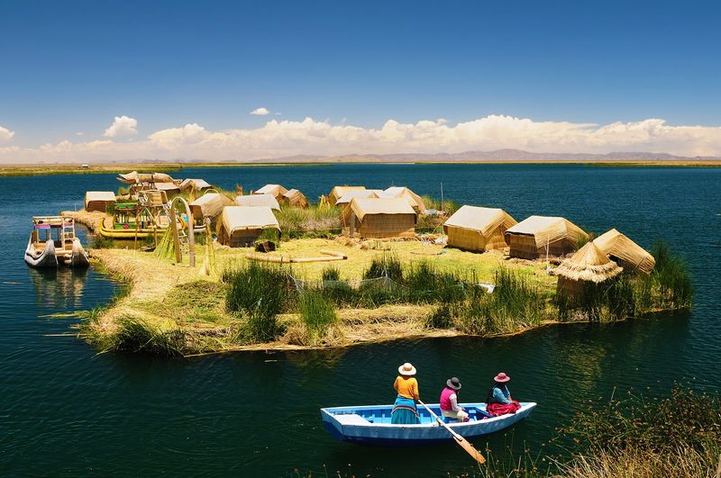
Sitting at roughly 3,810 meters above sea level, Lake Titicaca is one of the highest navigable lakes in the world and one of the most culturally significant bodies of water in South America. The lake straddles the border between Peru and Bolivia, and both sides offer genuinely different experiences worth exploring.
Peru’s main gateway is the city of Puno, where boat services take visitors to the famous floating islands built entirely from totora reeds. The Titicaca National Reserve protects important wetland habitat on the Peruvian side.
Bolivia’s entry point is the town of Copacabana, from which travelers can reach Isla del Sol, an island with pre-Columbian ruins and sweeping views of the Cordillera Real mountain range.
Accommodations, guided tours, and community-based visitor programs operate on both sides of the lake. The altitude affects many visitors, so spending a day or two acclimatizing in a lower-elevation city before arriving at the lake is a practical step worth taking seriously.
The Wadden Sea, Denmark, Germany and the Netherlands
Twice a day, the North Sea pulls back to reveal one of the most productive intertidal ecosystems on the planet. The Wadden Sea stretches along the coasts of the Netherlands, Germany, and Denmark, covering an area of tidal sand and mud flats that UNESCO recognizes as the world’s largest unbroken system of its kind.
The exposed seabed during low tide becomes a feeding ground for millions of migratory birds moving between Arctic breeding grounds and wintering areas in Africa. Seals, harbor porpoises, and a wide range of fish species rely on the system throughout the year.
Visitors can explore different sections through national parks and coastal islands in each country, and guided mudflat walks are available in multiple locations.
Walking onto the tidal flats independently is genuinely risky because incoming tides move faster than expected and can cut off the return path. Booking a guided excursion with a certified local guide is the standard recommendation.
The experience of walking on the exposed seabed is unlike anything most travelers have done before.
Waterton-Glacier International Peace Park, Canada and the United States
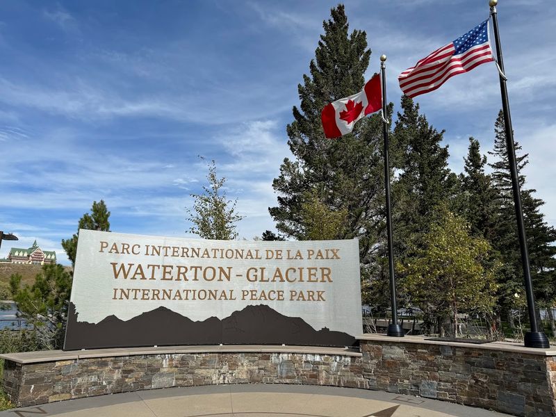
In 1932, Waterton Lakes National Park in Alberta and Glacier National Park in Montana were formally joined to create the world’s first International Peace Park. The designation recognized both the shared mountain ecosystem and the cooperative relationship between Canada and the United States.
It was a forward-thinking move that still shapes how both parks are managed today.
The landscape spans glacially carved valleys, pristine lakes, dense forests, high alpine passes, and meadows filled with seasonal wildflowers. Black bears and grizzly bears both live within the combined park area, along with mountain goats, bighorn sheep, and a wide range of bird species.
Scenic drives, boat tours, and backcountry trails give visitors multiple ways to experience the terrain on either side of the border.
Seasonal road and trail access depends heavily on snowpack, so some higher-elevation routes open later than others. Crossing the international boundary within the park area requires current, valid travel documents.
Checking both parks’ official websites before planning is the most reliable way to confirm current conditions.
Kgalagadi Transfrontier Park, Botswana and South Africa
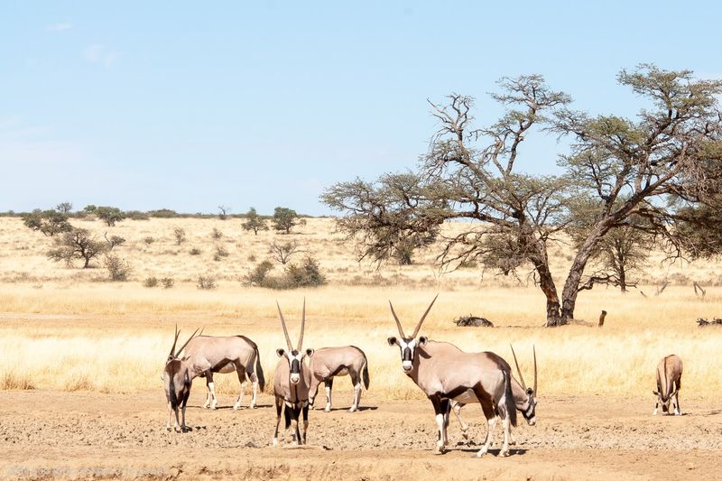
Red dunes, dry riverbeds, and open skies define the Kgalagadi Transfrontier Park, a vast protected wilderness shared by Botswana and South Africa. The park combines Botswana’s Gemsbok National Park with South Africa’s former Kalahari Gemsbok National Park, creating a single conservation area covering more than 3.6 million hectares.
The landscape supports gemsbok, springbok, wildebeest, leopards, cheetahs, and a remarkable range of raptors. The area is especially well known for its black-maned lions, which have become one of the park’s most recognized wildlife features.
Sparse camel-thorn woodland lines the dry riverbeds, providing shade and a focal point for animal activity.
Visitors can enter from either country, but the remoteness of the park demands careful preparation. Long distances between facilities, limited fuel availability, rough roads, and border crossing procedures all require advance planning.
SANParks manages accommodation bookings and availability for the South African section, and reservations fill up well ahead of peak periods.
Serengeti-Mara Ecosystem, Tanzania and Kenya
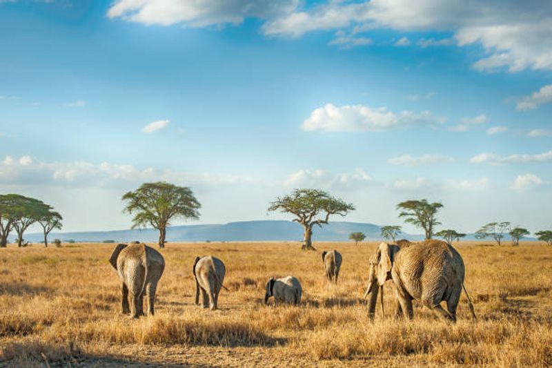
No political boundary interrupts the movement of wildebeest, zebras, and gazelles as they travel through the Serengeti-Mara ecosystem each year. The ecosystem connects Tanzania’s Serengeti National Park with Kenya’s Maasai Mara National Reserve and the surrounding private conservancies, forming one of the most significant wildlife landscapes in the world.
Animal movement through the region follows rainfall patterns and grazing conditions rather than any fixed schedule, which means the timing and location of large herds can shift from year to year. River crossings, where animals navigate crocodile-filled water in large groups, draw considerable attention from wildlife photographers and safari travelers.
Safari vehicles cannot simply drive across the international border, so travelers wanting to experience both the Serengeti and the Mara need to cross through official entry points and complete immigration procedures separately for each country. Most tour operators offer combined itineraries that handle the logistics smoothly.
Visiting both sides gives a more complete picture of how the broader ecosystem actually functions across the landscape.
The Alps, Eight European Countries
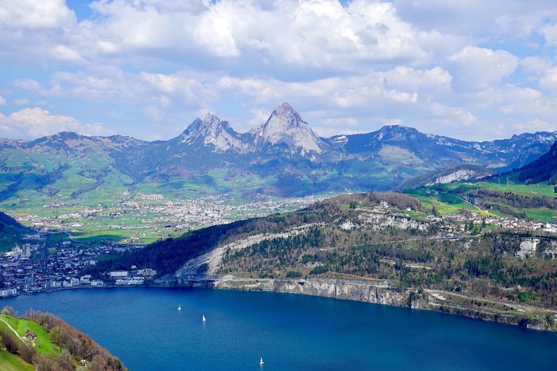
The Alps arc across eight countries, covering Austria, France, Germany, Italy, Liechtenstein, Monaco, Slovenia, and Switzerland in a mountain range so large that no single nation could manage it alone. The International Alpine Convention was established specifically because environmental protection, climate challenges, and cross-border transportation within the range require coordinated effort across all member countries.
The range includes glaciers, dramatic limestone peaks, alpine meadows, waterfalls, and thousands of lakes. Each country contributes its own national parks, mountain villages, cable car systems, long-distance hiking routes, and ski areas to what is one of the most visited mountain regions on Earth.
Access is extensive throughout the year, though high-altitude routes and some passes close during winter months due to snow. Summer brings the most reliable access to hiking trails, while winter draws visitors to ski areas spread across multiple countries.
Traveling through multiple Alpine countries on a single trip is entirely practical, with well-connected rail and road networks making cross-border movement straightforward for most visitors.
The Pyrenees, France and Spain
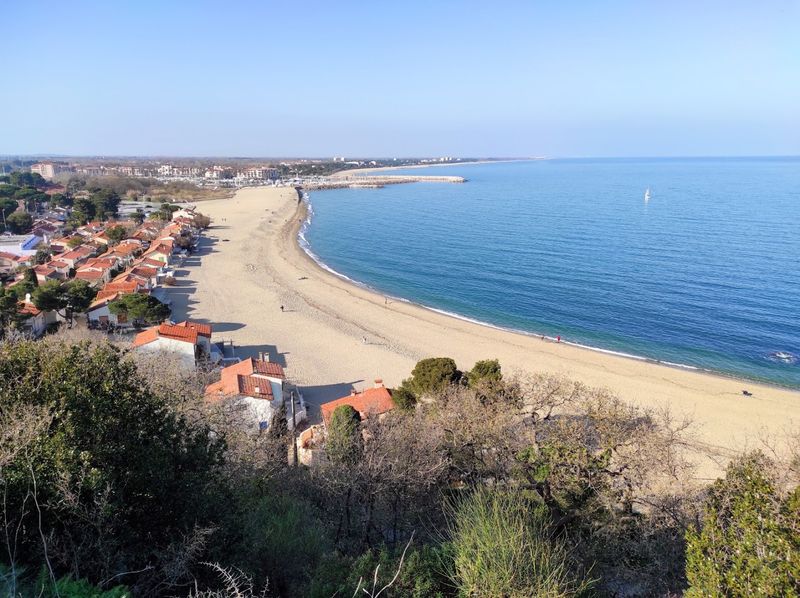
Running roughly 430 kilometers from the Atlantic coast to the Mediterranean, the Pyrenees form one of Europe’s most clearly defined natural borders between France and Spain, with the small nation of Andorra tucked within the wider mountain region. The range is less crowded than the Alps in many sections, which makes it appealing for travelers who prefer more space on the trail.
The landscape includes glacial cirques, high mountain lakes, waterfalls, dense forests, and dramatic limestone formations. Bearded vultures, a species that was reintroduced to the range, can be spotted soaring above the higher ridges.
France’s Pyrenees National Park and Spain’s Ordesa y Monte Perdido National Park both protect significant portions of the core mountain area.
Roads, ski resorts, and mountain communities make the range accessible from both sides. Weather in the higher elevations changes rapidly, and snow can arrive well before or linger well after the main winter season.
Checking trail and road conditions before heading into the higher terrain is always the sensible approach.
The Amazon Rainforest, Eight South American Countries
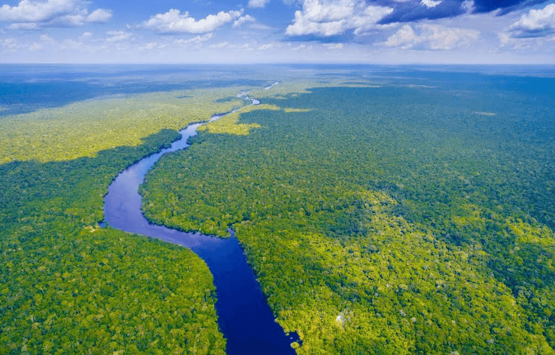
The Amazon is not one destination with a single entrance. It is an enormous living system of forests, rivers, wetlands, Indigenous territories, national parks, and biological reserves spread across Bolivia, Brazil, Colombia, Ecuador, Guyana, Peru, Suriname, and Venezuela, with additional rainforest in French Guiana.
Collectively, it represents the largest tropical rainforest on Earth.
Travelers typically access the Amazon through established regional gateways that offer guided river journeys, wildlife excursions, forest lodges, and visits to protected areas. The experience varies significantly depending on which country and which part of the basin you enter.
River levels, wildlife activity, and trail conditions all shift between wet and dry seasons.
Responsible travel within the Amazon requires checking local safety advisories, understanding park regulations, and respecting community access rules in areas where Indigenous communities manage their own territories. Going with an experienced, locally based guide is not just a recommendation here, it is genuinely the most effective way to understand what you are looking at and to do so without causing harm.
The Pantanal, Brazil, Bolivia and Paraguay
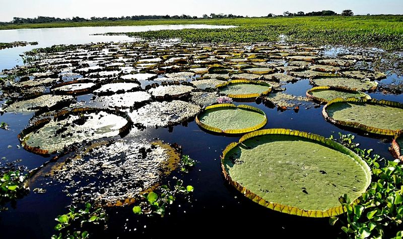
When seasonal rains arrive, the Pantanal transforms into a shifting mosaic of rivers, shallow lagoons, flooded grasslands, and forested islands across parts of Brazil, Bolivia, and Paraguay. UNESCO recognizes the Brazilian section as one of the world’s largest freshwater wetland ecosystems, and the broader trinational region holds significant ecological value across all three countries.
Wildlife viewing is most developed on the Brazilian side, where established routes and river-based tours give visitors access to jaguars, giant river otters, caimans, capybaras, tapirs, and an extraordinary number of bird species. The dry season generally offers easier wildlife spotting because animals concentrate around remaining water sources, while the wet season brings lush flooding that changes the entire character of the landscape.
Access conditions can shift significantly depending on the time of year, and wildfires have periodically affected parts of the region during dry periods. Checking current conditions before booking any Pantanal trip is a practical step, especially for travelers planning visits to the less-developed Bolivian or Paraguayan sections.
Patagonia, Argentina and Chile
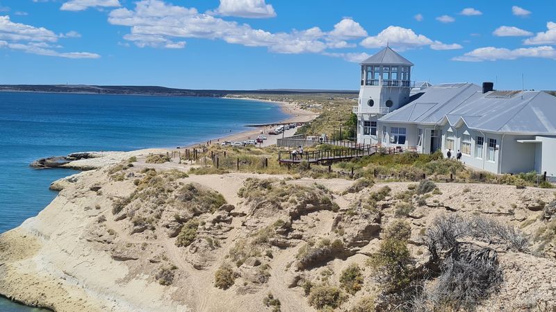
Patagonia is not a country, a park, or a single address. It is an entire southern region shared by Argentina and Chile, spanning the Andes, open steppe, temperate forests, glaciers, fjords, and windswept Atlantic and Pacific coastlines.
The scale of it takes some adjustment, especially for first-time visitors who expect it to feel like a single manageable destination.
Argentina’s standout landscapes include Los Glaciares National Park, home to the Perito Moreno Glacier, and the trekking hub of El Chaltén near the striking peaks of Mount Fitz Roy. Chile’s section includes Torres del Paine National Park, the remote Carretera Austral highway, and Patagonia National Park, which opened to visitors in recent years after years of land conservation work.
Both countries actively promote trails, wildlife watching, glacier excursions, and scenic road trips through their official tourism channels. Some remote routes are seasonal, and glacier-related activities may close temporarily for safety assessments.
Planning well ahead, especially for peak summer months, gives travelers the most options.
The Great Lakes, Canada and the United States
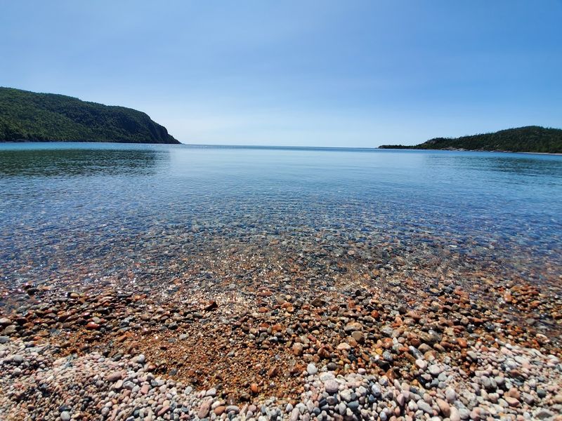
Together, the Great Lakes hold roughly 21 percent of the world’s surface fresh water, making them one of the most important freshwater systems on the planet. Lake Superior, Lake Huron, Lake Erie, and Lake Ontario all touch both Canada and the United States, while Lake Michigan lies entirely within US borders.
The broader region includes islands, sand dunes, limestone cliffs, forests, wetlands, and river connections that link the lakes together.
Visitors can explore the system through dozens of national, provincial, and state parks spread across both countries. Pictured Rocks National Lakeshore in Michigan, Sleeping Bear Dunes National Lakeshore in Michigan, and Ontario’s Bruce Peninsula National Park are among the most visited sections.
Each lake has its own character, from Superior’s cold, clear depths to Erie’s warmer, shallower waters.
Canada and the United States coordinate management of the lakes through the International Joint Commission, which addresses water levels, water quality, and ecosystem health across the shared system. The Great Lakes region is genuinely one of North America’s most underappreciated travel destinations for people who have not yet spent time along its shorelines.
Share this story