Most travelers passing through the Eastern Balkans stick to the well-worn path of famous capitals, busy beaches, and resort towns. But the real magic of this region hides in quieter corners, where ancient rocks, forgotten villages, and layered histories wait to be discovered.
From Bulgaria’s sandstone towers to Kosovo’s riverside old towns, these places tell stories that rarely make it into the highlight reels. Pack your curiosity, because the Eastern Balkans have far more to offer than most people realize.
Belogradchik, Bulgaria
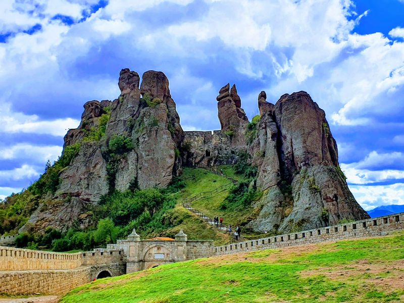
Imagine a town where the walls of a fortress and the walls of nature are practically the same thing. Belogradchik sits tucked among a sprawling field of reddish sandstone and conglomerate towers that stretch for roughly 30 kilometers across northwestern Bulgaria.
Erosion shaped these formations over more than 200 million years, carving them into shapes locals named the Madonna, the Horseman, and the Castle.
The fortress built between the rocks is what truly sets Belogradchik apart from any ordinary small town. Its earliest defenses date to Roman times, and both medieval Bulgarian rulers and Ottoman commanders expanded it over the centuries.
The result is a structure where stone walls and natural rock columns are nearly impossible to tell apart.
Visiting feels less like touring a historical site and more like exploring a geological maze with a history lesson built right in. The formations glow warmly at sunset, turning the whole area into something that looks almost unreal.
Belogradchik rarely crowds with international tourists, so you get to enjoy that remarkable landscape at your own pace without fighting for the best viewpoint.
Leshten, Bulgaria
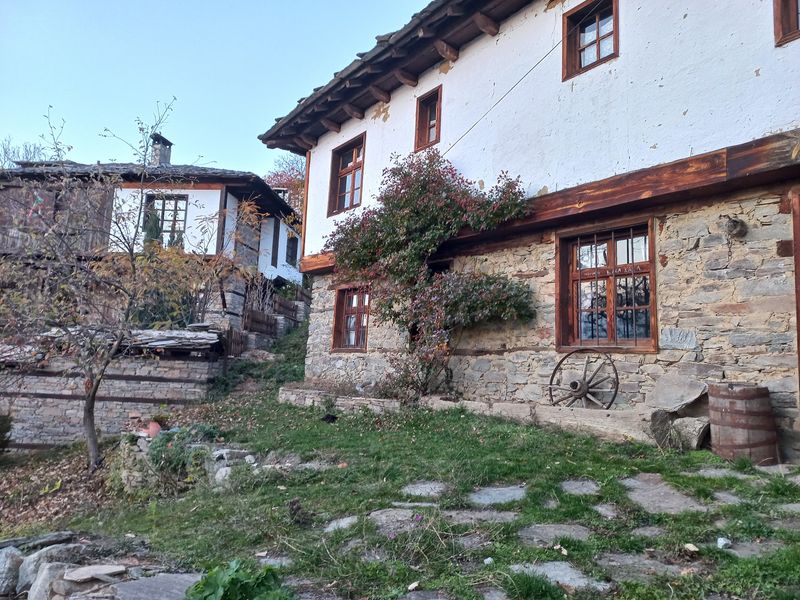
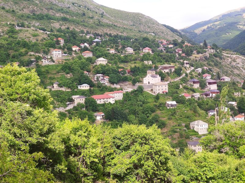
Tucked into Bulgaria’s western Rhodope Mountains, Leshten looks like someone pressed pause on the 18th century and never pressed play again. Stone-and-timber houses from the Bulgarian National Revival period line the narrow cobblestone lanes, many of them carefully restored and now welcoming guests as charming guesthouses.
Around 15 historic homes have been brought back to life, giving the village a lived-in warmth rather than a museum-like stillness.
The views from Leshten add another layer to its appeal. Pirin Mountain peaks rise in the distance beyond the old rooftops, creating a backdrop that photographers absolutely love.
Nearby villages Kovachevitsa and Dolen preserve similar architecture, so combining all three into a single day trip makes perfect sense if you have the time.
What makes this corner of southwestern Bulgaria special is how quietly rewarding it feels. There are no massive monuments or flashy attractions pulling crowds here.
Instead, Leshten offers something rarer: a genuine sense of stepping into a traditional Bulgarian rural world that survived not in a museum, but in actual stone and wood. Slow travelers who appreciate texture and history over ticking boxes will feel right at home.
Melnik, Bulgaria
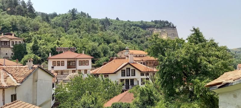
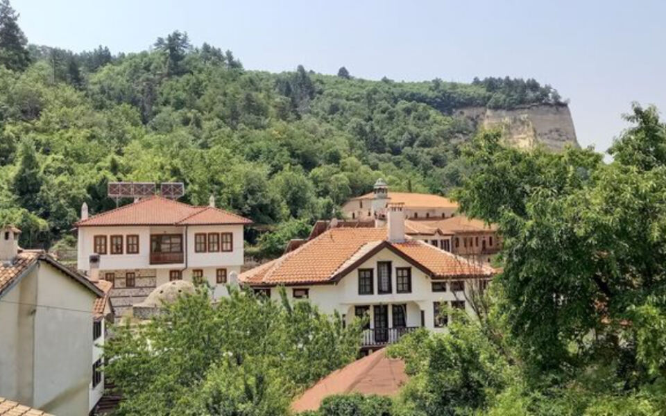
Officially a town, Melnik has a population so small it feels more like a secret kept between a handful of locals and the sandstone cliffs surrounding it. Bulgaria’s tourism authorities recognize it as the country’s smallest town, and one look at the Melnik Pyramids rising around it explains why this place is hard to forget.
These naturally eroded formations reach about 100 meters high, shaped into obelisks, ridges, and towers by centuries of wind and rain.
Beyond the geology, Melnik has real depth. Historic houses, churches, and archaeological remains fill its compact center, and wine production has been part of the local culture for a very long time.
The Damyanitsa winery nearby continues that tradition, producing the bold Melnik grape variety that wine lovers specifically seek out.
Walking through Melnik’s streets feels slightly surreal because the pale, sharply eroded hills press in from every direction. The town seems squeezed into existence by the landscape around it rather than built on flat, convenient ground.
That combination of unusual geology, wine culture, and old architecture gives Melnik a personality entirely its own, making it one of Bulgaria’s most genuinely distinctive stops for curious travelers.
Perperikon, Bulgaria
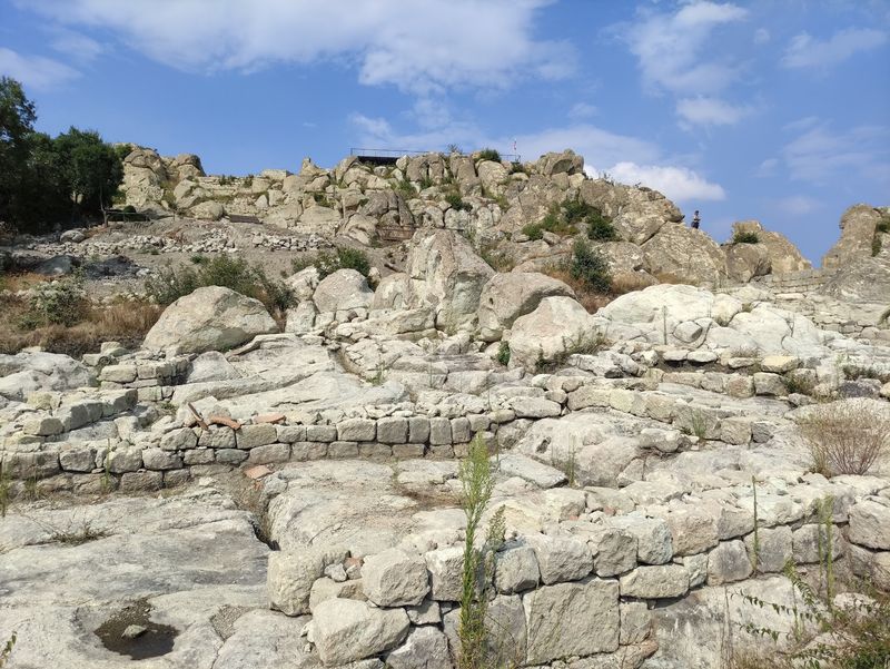
Some archaeological sites are built on the land. Perperikon was carved out of it.
Sitting roughly 470 meters above sea level in Bulgaria’s Eastern Rhodopes, about 20 kilometers from Kardzhali, this extraordinary complex was cut directly into the rock of a hilltop rather than assembled from separate materials. Stairways, rooms, channels, walls, and ceremonial spaces are all part of the same continuous stone mass.
Human activity here stretches deep into prehistory, and the site accumulated layer after layer of occupation through Thracian, Roman, Byzantine, and medieval periods. That sequence of cultures makes Perperikon feel less like a single-era ruin and more like a geological timeline of human ambition.
Archaeologists continue working here, and new discoveries keep updating what we know about the site’s long story.
Getting to Perperikon involves a walk uphill through the surrounding landscape, which is part of the experience. The views from the summit extend across the rolling Rhodope terrain, giving visitors a sense of why communities kept returning to this elevated spot for thousands of years.
For anyone traveling through the Eastern Rhodopes, skipping Perperikon would mean missing one of the most compelling historical landscapes in the entire Balkan region.
Kratovo, North Macedonia
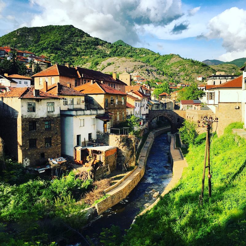
Not many towns can claim they were built inside a volcano, but Kratovo pulls it off with style. This small North Macedonian settlement sits within the remains of an ancient volcanic crater, giving its streets an unusually dramatic, steep character that no urban planner could have invented.
Old stone bridges cross the narrow valley floor, while medieval and Ottoman-era towers rise above red-roofed houses clinging to the crater’s slopes.
North Macedonia’s tourism portal sums it up neatly, calling Kratovo the “town of bridges, towers and underground tunnels.” Mining shaped the town’s economy for centuries, and its streets still follow the natural contours of the landscape rather than any logical grid. That organic layout gives Kratovo a wandering, exploratory quality that rewards visitors who enjoy getting slightly lost.
Compared to Ohrid or Skopje, Kratovo barely registers on international itineraries, which means you can explore it without crowds. The combination of geology, medieval architecture, traditional stone bridges, and fortified towers creates an atmosphere that feels genuinely atmospheric rather than staged for tourism.
If you enjoy places where history and landscape are inseparable from each other, Kratovo belongs near the top of your North Macedonia list.
Kokino, North Macedonia
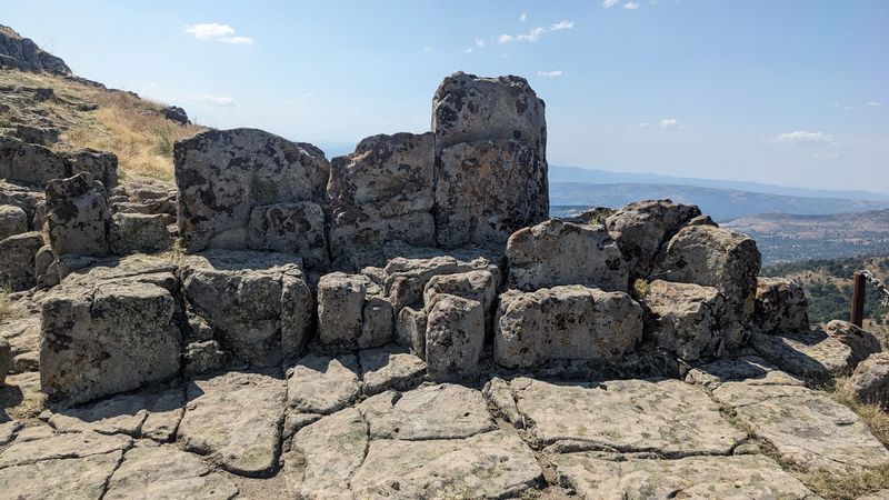
Forget the columns and reconstructed walls. Kokino works differently.
This Bronze Age hilltop in North Macedonia holds its significance not in grand architecture but in carefully positioned rocks, ritual pits, and the sweeping sky above them. Archaeologists have uncovered ceramics, axes, stone structures, and objects dating primarily from the early and late Bronze Age, suggesting the site served both ceremonial and observational purposes for communities living here thousands of years ago.
The elevated position was clearly no accident. Extensive visibility over the surrounding countryside seems to have been central to whatever rituals and sky-watching activities took place at Kokino.
North Macedonia’s tourism authorities highlight the site’s connection to both archaeology and prehistoric astronomy, making it one of the more intellectually fascinating stops in the entire region.
Visiting Kokino asks something of you that most tourist sites do not: imagination. There are no reconstructed buildings or dramatic ruins to frame the experience.
Instead, you stand on a windswept hilltop and try to picture the people who gathered here, read the seasons in the sky, and shaped their world around what they observed. That quiet, open-air quality makes Kokino feel like a genuinely rare kind of encounter with deep human history.
Mavrovo and Galichnik, North Macedonia
A church slowly disappearing into a lake sounds like something from a folktale, but at Mavrovo it is simply Tuesday. The partially submerged Church of St. Nicholas sits in Mavrovo Lake, an artificial reservoir whose water levels rise and fall with the seasons.
When water is high, only the upper walls and dome remain visible. When levels drop, more of the stone structure emerges, drawing photographers from across the region.
Mavrovo National Park surrounds this striking scene with some of North Macedonia’s wildest mountain terrain, covering the Korab, Bistra, and Deshat ranges. Within the park, the village of Galichnik preserves traditional pastoral architecture and hosts the famous annual Galichnik Wedding festival, a celebration of local customs that draws visitors every July.
The combination of mountain scenery, living village culture, and submerged church gives this area a layered richness that is hard to find elsewhere.
Travelers who make it to Mavrovo often say it feels like discovering a completely different country from the one they expected in North Macedonia. The national park’s forests, peaks, and remote villages offer outdoor adventure alongside cultural depth.
Whether you come for hiking, photography, or the festival, Mavrovo rewards the effort of getting there with scenery that genuinely sticks with you.
Devil’s Town, Serbia
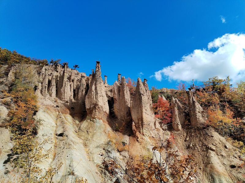
Southern Serbia is not exactly famous for its supernatural landscapes, which makes Devil’s Town all the more surprising when you actually see it. Known locally as Djavolja Varos, this cluster of tall earth pillars rises from heavily eroded slopes on Mount Radan, near the village of Djake, about 27 kilometers southeast of Kursumlija.
Harder stone caps sit on top of each column, slowing their erosion while the softer earth around them keeps wearing away.
Local legends leaned into the strangeness of the landscape, giving it a name that suggests the devil himself had a hand in the construction. The geological reality is equally dramatic: acidic groundwater and centuries of erosion worked together to produce formations that look like they belong in a science fiction film set rather than a European countryside.
A marked walking trail leads visitors through the protected area and past the strangest columns.
The contrast with the surrounding forested mountains and agricultural valleys makes Devil’s Town even more striking. You are walking through a perfectly normal Serbian landscape one moment, and then suddenly you are surrounded by dozens of stone-capped earth pillars pointing skyward.
It is the kind of place that makes you stop mid-sentence and just stare, which is honestly the best possible reaction to a place called Devil’s Town.
Negotin Wine Country, Serbia
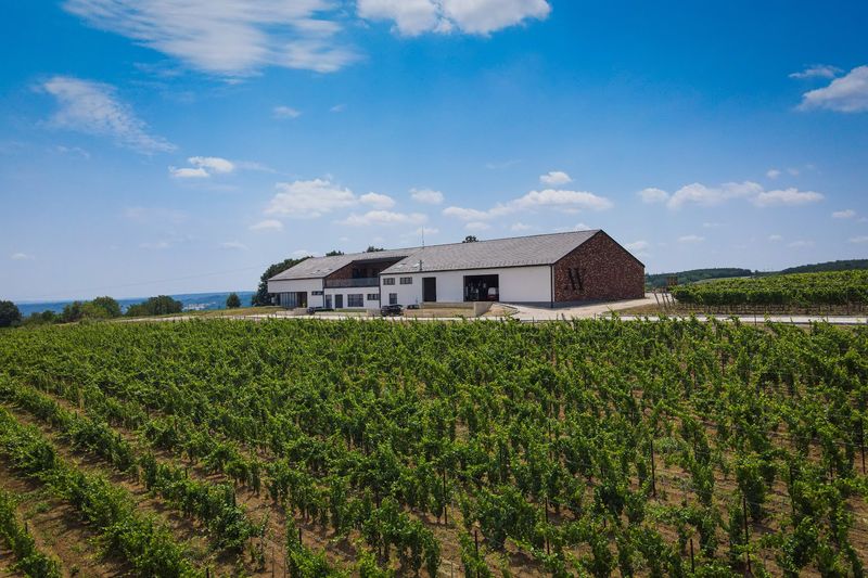
Wine has been produced around Negotin for more than seven centuries, and the villages here have the architecture to prove it. Near the point where Serbia, Romania, and Bulgaria meet, clusters of stone wine cellars called pivnice fill settlements like Rajac, Rogljevo, Stubik, and Smedovac.
Some remain active and welcome visitors for tastings, offering a relaxed, unpretentious wine experience very different from polished commercial wine trails.
The Negotin region is not just about wine, though. The Vratna Gates, three enormous natural rock openings carved by the Vratna River, sit nearby and draw visitors for their dramatic scale.
Monasteries and forested mountain terrain add further variety to the area, making Negotin a destination with more layers than its modest international profile suggests.
What gives this corner of eastern Serbia its particular charm is the way winemaking and rural life remain genuinely intertwined. The pivnice villages were not designed for tourism; they developed organically over generations as places where families stored and celebrated their harvests.
Visiting today still feels like stepping into a functioning agricultural tradition rather than a staged heritage experience. For travelers who appreciate authenticity over polish, Negotin delivers the kind of honest, grounded travel experience that is increasingly hard to find.
Deliblato Sands, Serbia
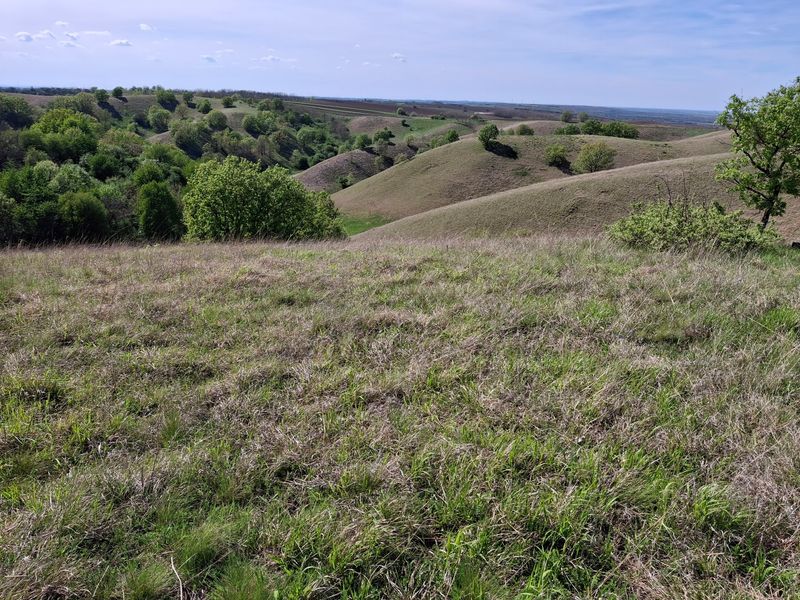
Serbia hides a secret that most of its own visitors never discover: a genuine sand dune landscape sitting quietly southeast of Belgrade. Deliblato Sands developed from wind-blown sand deposits and today forms a protected mosaic of dunes, grassland, forest patches, and wetland areas.
The highest dunes rise to around 200 meters above sea level, a number that surprises most people who assume the Balkans means only mountains and coastlines.
Systematic forestation efforts began centuries ago to stabilize the moving sands, and those planted forests now form part of the reserve’s character alongside the open dune areas. The result is a patchwork landscape where steppe plants and animals adapted to dry, sandy conditions thrive alongside species from the wetter habitats near the Danube at the reserve’s southern edge.
Hikers and cyclists find marked routes threading through this varied terrain.
The sheer unexpectedness of Deliblato Sands is its greatest selling point. Arriving from the flat agricultural plains of Vojvodina and suddenly encountering rolling dunes covered in steppe grasses and sand-loving wildflowers feels genuinely disorienting in the best way.
It is the kind of landscape that makes you question whether you have accidentally wandered into a completely different country, which is a sensation worth traveling for.
Sulina, Romania
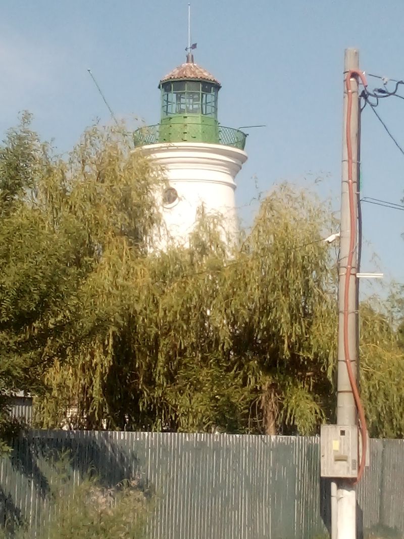
Sulina is the kind of place that feels like it exists slightly outside of normal time. Sitting at the eastern edge of the Danube Delta, where one of the river’s main branches finally meets the Black Sea, this small Romanian town is accessible primarily by boat rather than road.
That simple fact shapes everything about it, from its quiet pace to its sense of being slightly set apart from the rest of the country.
During the 19th and early 20th centuries, Sulina operated as a busy international port, attracting Greek, Italian, British, Turkish, and Jewish communities among others. Their presence left behind a remarkably cosmopolitan cemetery, where gravestones in multiple languages and scripts sit side by side, telling a story of surprising cultural overlap in this remote corner of Romania.
Historic lighthouses add to the atmosphere of a place shaped by maritime trade.
Today, Sulina combines that layered history with the natural beauty of the surrounding delta wetlands and an undeveloped Black Sea beach that stretches quietly nearby. The absence of crowds and commercial development gives it a peaceful, slightly melancholy beauty.
For travelers willing to arrive by water and slow down for a day or two, Sulina offers a genuinely rare glimpse of Romania’s forgotten maritime past.
Sarmizegetusa Regia, Romania
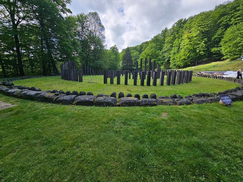
Long before Rome arrived, the Dacians had already built something remarkable in the mountains of what is now Romania. Sarmizegetusa Regia served as the political and religious heart of the Dacian kingdom, sitting high in the Orastie Mountains at an elevation that made it both defensible and dramatic.
Today it forms part of the UNESCO-listed Dacian Fortresses of the Orastie Mountains, a group of strongholds constructed between the first centuries BCE and CE.
The ruins are particularly memorable for their setting and for the circular ceremonial structures that survive on the mountain terraces. Stone-lined sanctuaries, defensive walls, and evidence of sophisticated urban planning reveal a civilization that developed independently and impressively before the Roman Empire absorbed Dacia in the early second century CE.
The site challenges any assumption that pre-Roman Europe was uniformly simple or underdeveloped.
Reaching Sarmizegetusa Regia requires leaving Romania’s famous medieval towns behind and heading into heavily forested highlands on roads that test both vehicles and patience. That effort is very much part of the reward.
Arriving at the ruins after winding through dense mountain forest creates a sense of genuine discovery that more accessible sites simply cannot replicate. History feels earned here, and that makes it stick much more firmly in the memory.
Berat, Albania
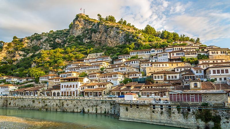
Berat wears its history visibly, stacking it up a hillside above the Osum River in layers of white Ottoman-era houses that seem to lean in toward each other as they climb. UNESCO recognized Berat for its exceptionally preserved architecture and for something rarer: the centuries-long coexistence of different religious communities within a single Albanian city.
Byzantine churches share the hilltop Kala district with mosques from the Ottoman period below, all within easy walking distance of each other.
What sets Berat apart from many European castle sites is that its fortified Kala district never became a purely archaeological monument. People continued living inside it, turning it into a neighborhood where history and daily life overlap in an unusually genuine way.
Wandering through the Kala today means passing active households, small cafes, and ancient churches within a few steps of each other.
Albania’s beaches have been pulling international attention recently, and Berat sometimes gets treated as a quick stop between coastal destinations. That is a mistake worth avoiding.
Spending a full day or two in Berat reveals how Byzantine, Ottoman, Christian, and Islamic traditions shaped each other within this one compact city in ways that feel specific, layered, and genuinely absorbing rather than generic or tourist-facing.
Gjirokastra, Albania
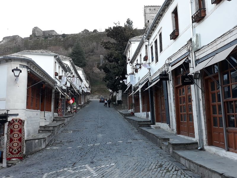
Gray stone roofs spreading up a steep hillside under a dominating castle, Gjirokastra looks like a town that decided centuries ago to make architecture its defining statement. UNESCO highlights the traditional houses here, developed mainly from the 17th century onward, for their unusual combination of massive stone lower sections and projecting upper floors.
That design reflected both the need for defense and the practical realities of housing extended families across multiple generations.
The town’s bazaar, mosque, churches, and castle fill out a historic center that feels genuinely complete rather than partially preserved. Gjirokastra’s gray rooftops and mountainous southern Albanian backdrop create a visual character quite unlike anything on the country’s Mediterranean coast, making it feel like a separate chapter in the Albanian story rather than a variation on a familiar theme.
Tourism has grown quickly here in recent years, and Gjirokastra is no longer entirely off the radar. But the architecture still delivers.
Walking through the old residential neighborhoods, past houses that look almost like small fortresses in their own right, gives a remarkably clear picture of how an Ottoman-era Balkan town adapted itself to difficult terrain and local building traditions over several centuries. Few places in the region make that story so legible just by existing.
Prizren, Kosovo
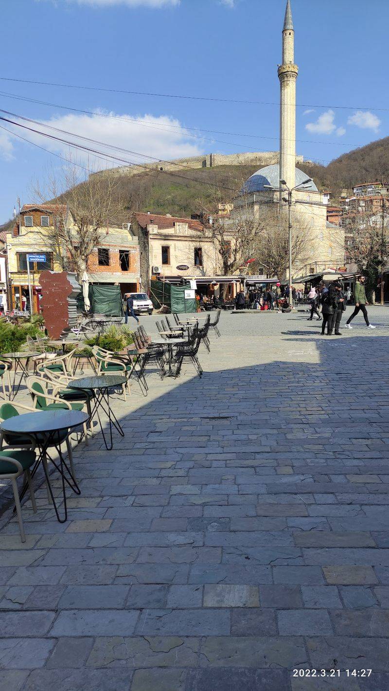
Few cities in the Balkans pack as much history into as small a space as Prizren manages with apparent effortlessness. The Lumbardhi River runs through the old center beneath the reconstructed Stone Bridge, while the Sinan Pasha Mosque, built in 1615, anchors the historic core with a confident, well-preserved presence.
Above everything, Prizren Fortress watches over the city from a hilltop where archaeological evidence traces occupation back through late antiquity and earlier periods.
Churches, Ottoman baths, mosques, traditional houses, and the remains of older defensive structures are all within comfortable walking distance of each other. That density of different historical layers reflects the many communities that shaped Prizren across the centuries, from Byzantine and Serbian medieval rulers to Ottoman administrators and the diverse populations who lived under each.
Kosovo’s local tourism authority identifies Prizren as a longstanding meeting point of cultures, and the built environment makes that claim easy to believe.
The views of Shar Mountain rising behind the city add a cinematic quality to the whole experience. Prizren’s riverfront streets are genuinely pleasant to walk, combining good food options, active local life, and historical monuments in a mix that feels organic rather than arranged for visitors.
It is the kind of old town that rewards slow, aimless wandering far more than any structured tour ever could.
Share this story