The most rewarding trips do not always begin with a famous landmark. Sometimes they start with a narrow mountain road, a ferry to an island with fewer than 150 residents, or a trail leading toward a village that seems forgotten by time.
The world still holds places where tourism feels secondary to geography and local life. These sixteen destinations share one useful quality: they remain far enough outside the usual circuit to reward curiosity, patience, and the willingness to take the longer road.
Iya Valley, Japan
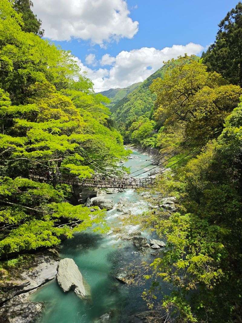
Japan may have one of the world’s most efficient transportation systems, but Iya Valley feels like it was deliberately left off the map. Hidden deep in the mountains of Shikoku, this secluded gorge is described by Japan’s national tourism organization as one of the country’s most spectacular and remote landscapes.
Steep hillside settlements, old thatched farmhouses, hot springs, and dense forest fill the valley floor and ridgelines.
Only three of the area’s original 13 vine bridges survive. Modern versions are reinforced for safety, but walking across still involves wooden slats, visible water rushing far below, and enough swaying to make the crossing genuinely memorable.
The Ochiai settlement adds another remarkable layer, with centuries-old farmhouses and stone walls spread across a slope with roughly 390 meters of elevation difference.
Iya is not difficult because nothing exists there. It is challenging because everything takes longer.
Roads curve sharply, villages are scattered across ridges, and that slower pace may be exactly what makes the valley feel so unlike the Japan most visitors ever see.
Tusheti, Georgia
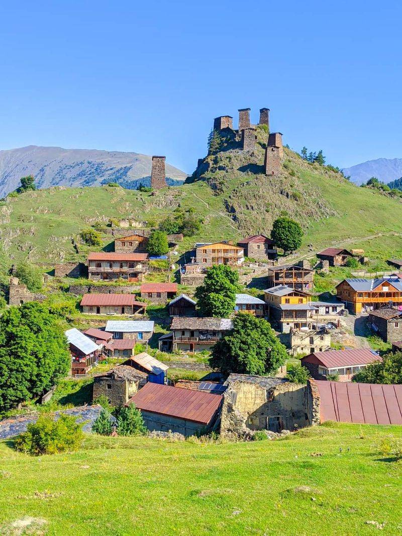
Tusheti makes visitors earn their arrival, and the region has absolutely no apologies about that. This remote corner of Georgia sits high in the Caucasus at elevations ranging from roughly 1,900 to 4,490 meters, where alpine meadows, pine forests, glacial lakes, stone villages, and medieval defensive towers create one of the country’s most extraordinary mountain landscapes.
Getting there is genuinely part of the experience. The road crosses Abano Pass at around 3,000 meters and is typically open only from late May through September.
Georgia Travel notes the 72-kilometer mountain section can take at least four hours by 4WD because of the difficult terrain. Outside that season, access becomes dramatically more limited and adventurous.
Omalo provides the usual introduction to the region, while Dartlo looks almost like an open-air museum of slate houses and ancient towers. Shenako and Diklo preserve even more traditional architecture.
Travel by horse or on foot and the landscape becomes something else entirely. Modern Georgia disappears quickly behind you, replaced by a silence that feels earned.
Flores Island, Azores, Portugal
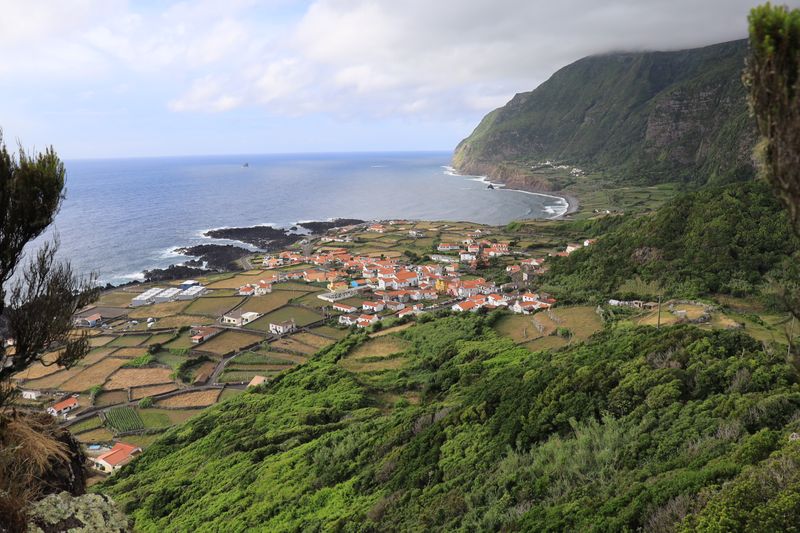
Flores is the island travelers imagine when someone first mentions that the Azores are volcanic. Fitting an extraordinary amount of scenery into just 141.4 square kilometers, the island’s interior is dominated by volcanic highlands where old craters have become still, reflective lakes.
Countless streams and waterfalls descend through intensely green vegetation toward the open Atlantic below.
The geography here is also historically extreme. Together with neighboring Corvo, Flores forms the western group of the Azores, and hiking authorities describe it as Europe’s westernmost point.
That detail alone gives every sunset a slightly dramatic quality. Fajã Grande delivers some of the island’s signature scenery: steep green walls, natural pools, cascading waterfalls, and an Atlantic horizon that stretches endlessly.
Elsewhere, Rocha dos Bordões reveals tall basalt columns rising from the hillside like nature’s own organ pipes, while crater lakes occupy the island’s high interior with an almost unreal calm. Flores does not feel hidden because there is nothing to see.
It feels hidden because an island this beautiful somehow remains several flights and a lot of open ocean away from mainstream European tourism.
Ittoqqortoormiit, Greenland
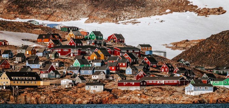
There are remote towns, and then there is Ittoqqortoormiit. Visit Greenland calls it the most isolated town in Greenland, positioned between the world’s largest national park to the north and the world’s largest fjord system to the south.
That geographic context alone makes the place feel genuinely extraordinary before you even step off the helicopter.
Travel typically involves flying from Iceland to Nerlerit Inaat and then continuing roughly 40 kilometers by helicopter, boat, or snowmobile depending on the season. Expedition cruises also stop here during summer months.
The reward is a landscape of enormous icebergs, jagged mountains, Arctic wildlife, seabirds, and colorful houses standing beneath some of the most sparsely populated terrain on the planet.
Traditional hunting culture remains part of daily local life here. So do polar bears, which is not a small detail.
Visit Greenland explicitly warns visitors leaving town independently to carry appropriate emergency communications and understand polar-bear safety. Camping outside town without proper protection is not recommended.
Ittoqqortoormiit is not casual sightseeing, and that is precisely why curious travelers keep dreaming about it.
The Westfjords, Iceland
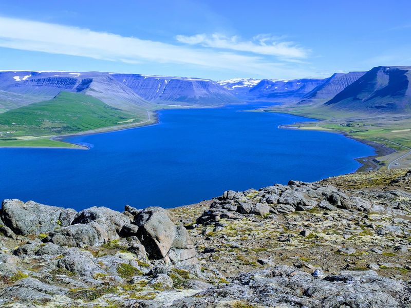
Iceland’s Ring Road has become one of the world’s great road-trip routes. The Westfjords reward travelers who are willing to leave it behind entirely.
Visit Iceland calls this northwestern peninsula one of the country’s best-kept secrets, noting that isolation and sparse population have helped preserve both its natural landscape and a local folklore culture that feels genuinely alive.
The geography here is wonderfully inconvenient in the best possible way. Long fjords cut deeply into the peninsula, meaning a village clearly visible across the water may still require a substantial drive around mountains and rugged coastline.
That inconvenience protects the sense of space that makes the region so compelling. Waterfalls spill from high plateaus, cliffs rise dramatically above the Atlantic, and tiny settlements occupy narrow coastal strips beneath towering mountains.
Even by Icelandic standards, the Westfjords can feel almost empty. Travel here requires more planning than the heavily visited south coast.
It also delivers a version of Iceland that feels much closer to the country travelers first imagined before everyone else booked the same road trip. That version is worth the extra planning.
Chiloé, Chile
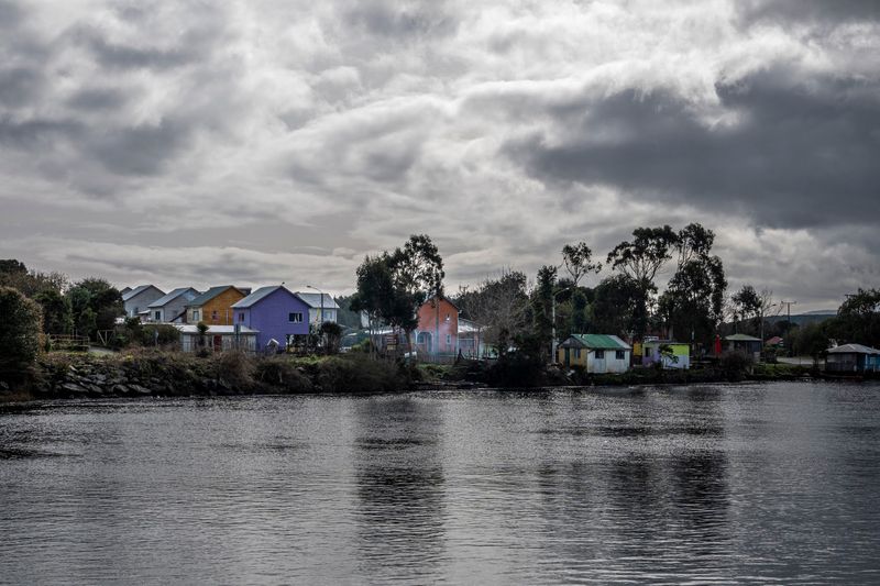
Chiloé feels slightly detached from mainland Chile in both geography and imagination, and that quality is exactly what makes it special. Chile Travel describes this southern archipelago as a place of mysticism, legends, distinctive food, dense forests, scattered islands, and traditional communities shaped by centuries of geographic separation from the rest of the country.
Castro provides the famous image of palafitos, colorful houses built on stilts above tidal water, which look best in the soft light of an overcast afternoon. Beyond the towns, the atmosphere shifts quickly.
Chiloé National Park and Tantauco protect dense evergreen forest, peatland, wild beaches, wetlands, and a rugged Pacific coastline that rewards patient exploration on foot.
The islands are also celebrated for historic wooden churches, a rich local mythology, fishing traditions, and curanto, a communal meal traditionally cooked using heated stones buried in the earth. Chiloé rarely delivers the massive granite drama associated with Patagonia farther south.
Its appeal is moodier and quieter. Fog moves across green hills, wooden houses weather beside the sea, and old stories about supernatural creatures remain genuinely woven into daily culture here.
Zagori, Greece
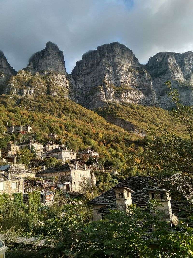
Mention Greece and most travelers immediately picture islands and whitewashed walls. Zagori makes a quietly confident case for turning inland instead.
The region lies among the Pindus Mountains of Epirus, where traditional settlements sit above 1,000 meters among forests, rivers, and steep valleys. Their architecture is defined almost entirely by stone: stone houses, stone lanes, and graceful arched bridges built across streams and ravines over centuries.
Then there is Vikos Gorge, which slices dramatically through the surrounding mountain landscape. The Voidomatis River flows for around 15 kilometers through Vikos-Aoos National Park beneath old plane trees and historic bridges, offering some of the clearest mountain water in the entire country.
Walking paths that once connected isolated villages now form some of the area’s best and most rewarding hiking routes.
The old Vradeto stone staircase provides another memorable example, climbing through rough mountain terrain toward enormous views over the gorge below. Zagori feels like an entirely different Greece, one that rewards hikers, photographers, and anyone who assumed the country had nothing to offer beyond sand and sea.
No beach required, and somehow that feels like a relief.
Kalsoy, Faroe Islands
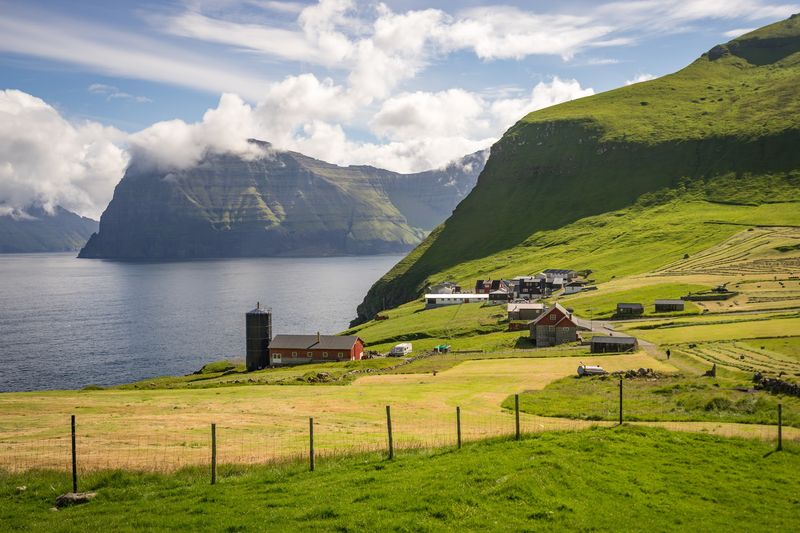
Kalsoy looks like a narrow green mountain that someone dropped sideways into the North Atlantic and forgot about. The island is so thin and tunnel-filled that locals nicknamed it ‘the flute.’ Visit Faroe Islands notes it contains 13 peaks, 11 valleys, and four villages whose combined population sits below 150 people.
That ratio of dramatic geography to actual residents is genuinely impressive.
The famous destination is Kallur, where a small lighthouse stands near the northern tip above extraordinary cliffs. Reaching it requires hiking from the village of Trøllanes, with the return trip normally taking around 90 minutes to two hours depending on your pace and how long you spend staring at the view.
The hike itself is not technically difficult, but the scenery makes it feel significant.
The road to the trailhead also contributes to the adventure. A roughly 17-kilometer route passes through four narrow tunnels between the ferry landing and Trøllanes, and local tourism authorities recommend using public transport because parking and road space are extremely limited.
Kalsoy has grown in popularity among Faroe Islands visitors. Stand above the cliffs with several islands lined across the horizon, though, and it still feels satisfyingly close to the edge of everything.
Outer Hebrides, Scotland
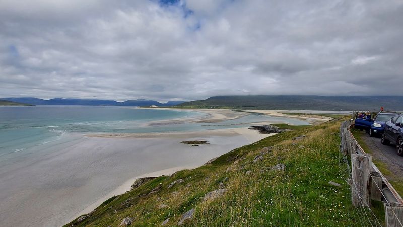
Scotland’s Outer Hebrides look almost tropical in photographs. The water genuinely can be turquoise, the beaches genuinely can be brilliant white, and the Atlantic wind usually corrects any remaining misunderstanding within about thirty seconds of stepping outside.
More than 70 islands form the archipelago, though only 15 are inhabited, giving the chain a wonderfully wild quality that photographs struggle to fully capture.
VisitScotland highlights wild Atlantic waves, diverse wildlife, living Gaelic culture, beaches, hills, machair grasslands, and isolated communities among the region’s defining attractions. Lewis and Harris combine mountain terrain with broad beaches and strong Gaelic traditions that feel organic rather than performed for visitors.
Berneray adds seals and remote sand, while Barra compresses beaches, hills, moorland, and island character into a remarkably small and lovable area.
Beyond the main islands lies St Kilda, which VisitScotland describes as far-flung, untamed, and weather-dependent to reach. The Outer Hebrides reward a specific kind of traveler: someone who does not consider unpredictable ferries and rapidly changing weather to be inconveniences, but treats them as part of the story itself.
That traveler will leave with something genuinely hard to explain to people who stayed home.
Prokletije National Park, Montenegro
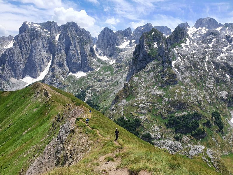
Montenegro’s Adriatic coastline receives most of the country’s international attention, and its northeastern mountains have been quietly waiting for their turn. Prokletije National Park protects one of the most dramatic portions of the Dinaric mountain system.
Montenegro Tourism describes it as the ‘Alps of the South of Europe,’ with jagged summits, technical climbing routes, canyoning, diverse wildlife, and Montenegro’s highest peak, Zla Kolata, reaching 2,534 meters.
The name ‘Prokletije’ roughly evokes the idea of cursed mountains, and the landscape does its best to justify that dramatic title. Sharp limestone ridges rise above glacial valleys and cold mountain lakes, while villages around Plav and Gusinje serve as gateways into terrain that spills across borders shared with Albania and Kosovo.
That cross-border geography gives the entire area an adventurous, frontier-like quality that few European parks can match.
Compared with the Swiss or Austrian Alps, infrastructure here is lighter and trails can feel significantly less polished. For adventurous travelers, that is not a flaw in the experience.
That is the entire point of coming here rather than somewhere with better signage and a cable car waiting at the top. Prokletije rewards effort with genuine solitude.
Koli National Park, Finland
Not every hidden corner needs to look extreme to be worth the journey. Koli National Park works through stillness rather than spectacle, and that quality is rarer than most travelers realize.
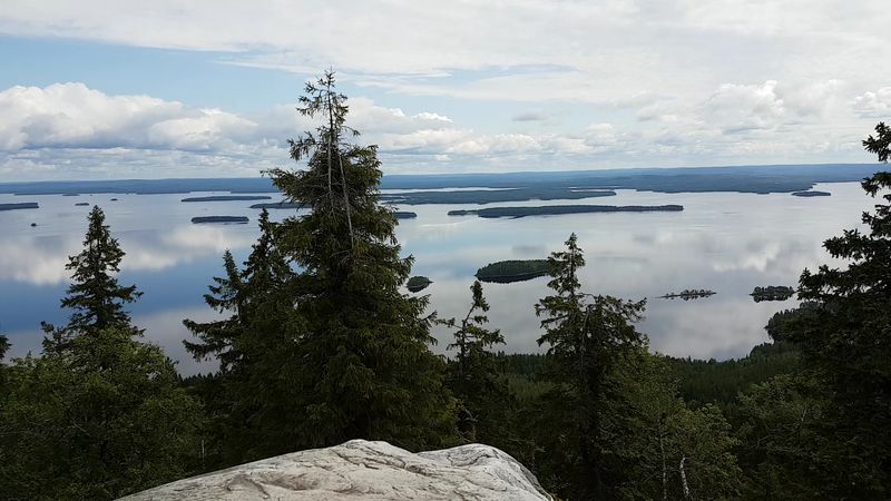
The park overlooks Lake Pielinen in Finland’s Lakeland region, and Visit Finland describes the view from Ukko-Koli as one of the country’s most beloved national landscapes, a scene that has moved Finnish artists, composers, and nature lovers for well over a century.
Forest-covered hills descend toward an enormous patchwork of water and islands that seems to stretch without any clear end in any direction. Autumn turns the landscape into gold and red so saturated it looks slightly unreal.
Winter simplifies everything into snow, frozen lake surface, and pale northern light that arrives at a low angle and stays that way all afternoon.
Koli also carries a useful reminder about what discovery actually means. Finding a hidden experience does not always require reaching somewhere no one has heard of.
Sometimes the hidden part is simply finding enough silence to appreciate a place properly, without a crowd between you and the view. Koli offers exactly that kind of quiet, and it turns out that quiet is surprisingly hard to find.
Chachapoyas Country, Peru
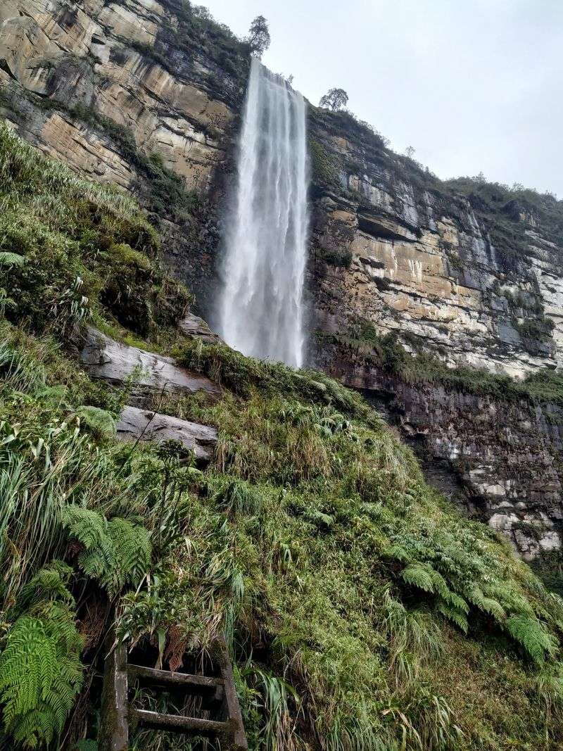
Machu Picchu dominates Peru’s archaeological imagination so completely that the north of the country barely gets mentioned in the same conversation. The Chachapoyas civilization developed between roughly the sixth and 16th centuries in the humid mountains where the Andes meet the Amazon basin.
UNESCO’s tentative listing for the Utcubamba Valley includes Kuélap, Revash, Karajía, Laguna de los Cóndores, and numerous other sites scattered through cloud forest and steep terrain.
Kuélap is the headline site, a monumental fortified settlement positioned dramatically high above the valley on a narrow ridge. The scale of the stonework surprises most visitors who had no idea anything this large existed in northern Peru.
Curiosity pays off even farther from the main site, though. Revash contains funerary structures built directly against cliff faces.
Karajía is famous for tall sarcophagi placed high in inaccessible rock faces, staring out over the valley below.
Other remains lie amid forests that UNESCO describes as shaped by persistent humidity and complex tropical mountain ecosystems. Travelers who assume Peruvian archaeology begins and ends with the Incas can easily lose several days in Chachapoyas country correcting that assumption with great enthusiasm and very sore hiking legs.
Takayna/Tarkine, Tasmania, Australia
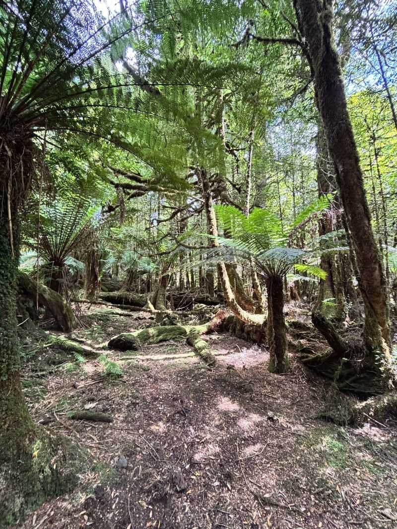
Tasmania’s northwestern wilderness feels prehistoric for reasons that are entirely legitimate. Discover Tasmania describes Takayna/Tarkine as Australia’s largest expanse of cool-temperate rainforest, covering an area roughly half the size of Lebanon.
That scale is difficult to picture until you are standing inside it and realize the canopy above you has been continuous for a very long time.
The landscape is not one continuous forest type. Myrtle beech and blackwood woodland merge with buttongrass moorland, dark tannin-stained rivers, coastal dunes, and a rough Southern Ocean shoreline where waves arrive having crossed enormous distances.
Huon pines line the waterways, and visitors can explore by kayak, river cruise, hiking trail, or slow backroad. The old mining settlement of Corinna now functions as a remote base on the Pieman River, providing a comfortable enough starting point for genuine wilderness.
Even getting there from Tasmania’s south involves crossing the Pieman River on a small vehicle ferry, which sets the tone perfectly. Takayna is not filled with famous individual landmarks or viewpoints with car parks.
Its attraction is the feeling that the landscape is simply bigger than any single stop you could make within it. That feeling is increasingly rare and worth traveling a long way to find.
Senja, Norway
Lofoten gets the postcards, the magazine covers, and the Instagram hashtags. Senja quietly deserves a much larger share of the road-trip traffic heading north.
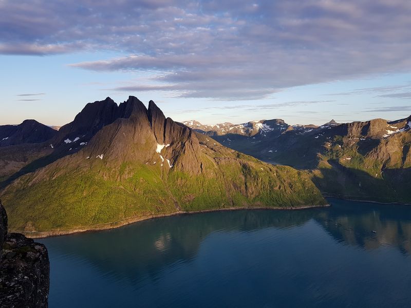
Norway’s second-largest island combines gentle inland valleys with a dramatically exposed outer coast where steep mountains drop toward narrow fjords and vivid turquoise bays. The contrast between the island’s two sides is striking enough to feel like visiting two different places in one trip.
Visit Norway highlights hiking, cycling, fishing, skiing, wildlife trips, midnight sun, and northern lights among the area’s many attractions. Traditional fishing cabins provide an atmospheric way to stay close to the water, and the surrounding scenery makes even a simple morning coffee feel unreasonably cinematic.
Summer ferries connect Senja with Vesterålen, while another route runs toward the Tromsø area for travelers combining destinations.
The island’s greatest advantage might simply be comparison with its famous neighbor. Senja delivers many of the ingredients that make northern Norway celebrated worldwide: knife-edged peaks, deep fjords, fishing villages, and extraordinary Arctic light.
It delivers all of that without quite carrying the same level of international fame as Lofoten yet. For curious travelers who prefer arriving somewhere slightly ahead of the crowd, that timing is a genuine gift.
Saaremaa, Estonia
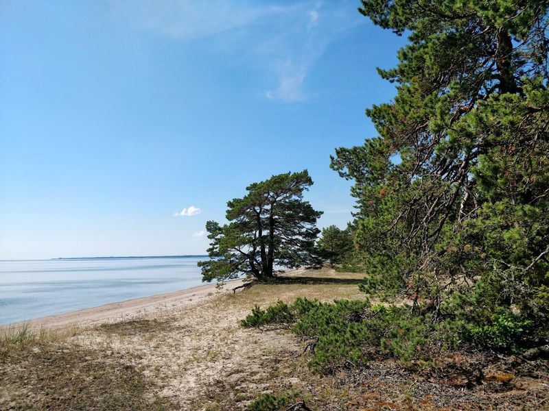
Saaremaa is Estonia’s largest island, but it carries itself with the quiet confidence of a place that has never felt the need to advertise. The island sits in the Baltic Sea and feels meaningfully removed from the mainland’s rhythm and pace.
Visit Estonia highlights forests, marshes, juniper-covered coastline, diverse wildlife, thermal spas, nature reserves, and a cultural landscape shaped by centuries of distinct island traditions that developed in productive isolation.
The strangest landmark on the island is Kaali, a group of meteorite craters that interrupt the otherwise gentle, forested terrain. The main crater holds a small lake and provides one of the most quietly surreal natural-historical attractions in the entire Baltic region.
Elsewhere, Panga Cliff offers dramatic views over the open Baltic, Vilsandi National Park protects rare birds and orchids, and the town of Kuressaare provides a compact historic base anchored by its well-preserved medieval castle.
Saaremaa does not arrive with grand gestures or overwhelming spectacle. Instead it works gradually, convincing visitors to add another day and then another, through a combination of peaceful scenery, good food, and the particular satisfaction of an island that rewards slow travel.
That quiet persuasion may actually be the more interesting kind of discovery available to travelers today.
Raja Ampat, Indonesia
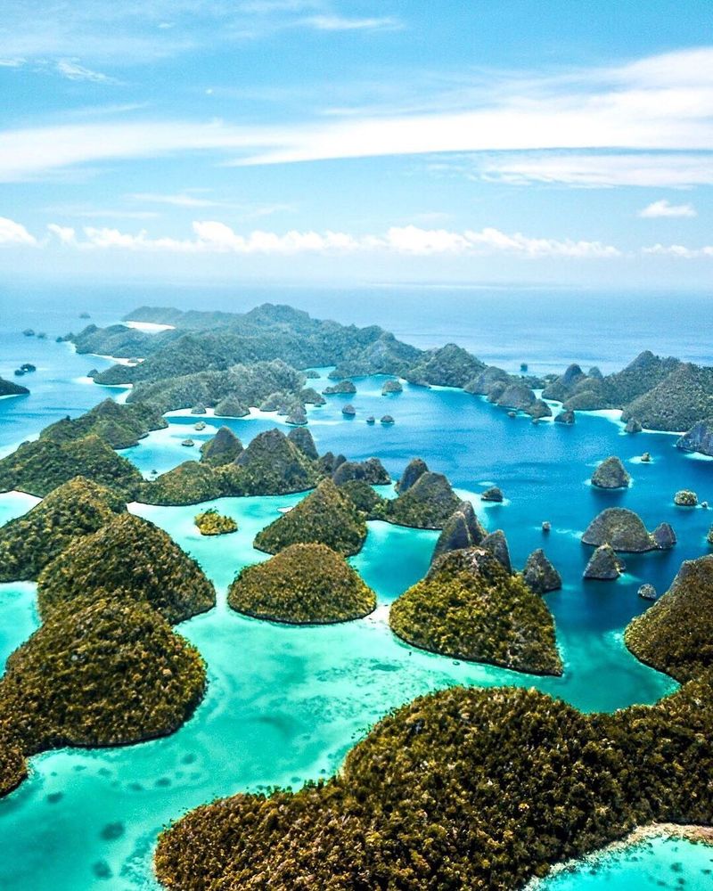
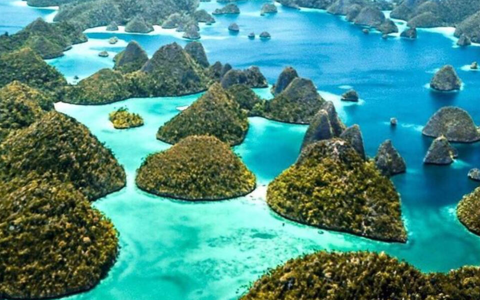
Raja Ampat is no longer a secret among serious divers, but it still manages to feel like another world entirely on arrival. The archipelago in eastern Indonesia is celebrated for clear tropical water, steep limestone islands rising from the sea, hidden lagoons, extensive coral reefs, and marine life so abundant it regularly surprises even experienced underwater travelers.
Indonesia’s official tourism portal highlights more than 1,500 species of fish and coral living in these waters.
The classic image comes from elevated viewpoints where dozens of forest-covered limestone islands appear scattered across brilliant blue water in every direction, looking like a geography lesson that someone illustrated too enthusiastically. Below the surface, the experience becomes richer still.
Reef systems here contain a density of marine life that researchers consistently rank among the highest recorded anywhere on the planet.
Reaching Raja Ampat typically requires more effort than reaching Bali or Java. Boats become central to transportation, islands are scattered across a large area, schedules matter, and flexibility helps.
That logistical friction has helped preserve at least some of the sensation that travelers are genuinely moving through an archipelago rather than simply arriving at a polished resort. The extra effort is part of why the destination still feels worth protecting.
Share this story